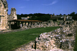
Fig.1 Remains of St. Augustine's Abbey, Canterbury, with the remains of the Church of Saints Peter and Paul (left, under the roof) and the Church of St. Pancras (right rear).
Description:
Civitas capital; early Christian site
Dating Evidence:
1 coin of Honorius (393-423)
200 coins, "House of Theodosius" issue (388-402)
Christian silver hoard (c.407-11)
1 Gallic tremissis, of either Severus III or Zeno (c.480)
"Anglo-Frisian" pottery (fifth century)
Sources:
Fig.1 Remains of St. Augustine's Abbey, Canterbury, with the remains of the Church of Saints Peter and Paul (left, under the roof) and the Church of St. Pancras (right rear).
Archaeological fieldwork is revealing many important clues about late Roman Canterbury. While decay and demolition were certainly in evidence in many of Canterbury's public buildings, what is interesting is the re-use of these areas for continued economic activity in the tumultuous fifth century.
The fourth century saw the demolition of the public baths and the portico of the local temple. But the temple courtyard was still being used in the fifth century, perhaps as a market, and new timber structures were built over the baths complex. FN3 Although the southern carriageway at Riding Gate was stopped up at this time, its space was maintained for use as a metalworker's workshop.FN4 Other fifth-century structures were built over Roman roads, indicating that urban standards may have been declining in Canterbury, but its sub-Roman occupants were choosing adaptation over desertion.
There is other evidence that at least some of these fifth-century occupants were quite wealthy and Christian. An impressive silver hoard was found outside of the London Gate, and is dated from coin evidence to c.407-11 or later.FN5 The hoard included silver ingots (late fourth/early fifth century), a gold ring (late fourth), and numerous silver spoons (late fourth) decorated with the Chi-Rho monogram. The spoons in particular offer indisputable evidence of a wealthy Christian community in sub-Roman Canterbury that may have provided the precedent for the Augustinian mission of 597.FN6 Bede claims that when St Augustine arrived in Kent in 597 he was given permission by King Ethelbert to restore Roman churches in the Canterbury vicinity.FN6a It is worth noting that St Peter's Church respects the Roman rather than the medieval street pattern of Canterbury, while excavations at St Martin's (a half-mile east of the city, where Queen Bertha and her chaplain had been worshipping) revealed a small rectangular building built of Roman materials and with a floor of opus signinum incorporated into the channel of the present church.FN6b Nicholas Brooks believes that this Roman structure may have been a mausoleum or martyrium.FN6c Other evidence of a British Christian community lingering until the seventh century includes the place-name Eccles in the parish of Aylesford, where a timber building and Christian cemetery (with some seventh-century burials) have been found in the ruins of a Roman villa.FN6d
Other evidence allows us to extend the sub-Roman occupation at least to the end of the fifth century. In the temple precinct archaeologists uncovered a multiple burial, seemingly a family and their pet dog, with associated jewelry dating stylistically to the mid fifth century.FN7 Esmonde Cleary points out that this inhumation is in clear violation of the Roman law preventing burial of the dead within town walls.FN8 In the Marlowe area, in south-eastern Canterbury, excavation revealed timber structures inserted into the shell of an earlier stone building; deposits indicated up to four phases of fifth-century occupation on the site.FN9 Nearby, in soil covering a late Roman courtyard, excavators found a Visigothic coin and a firesteel, a metal "match" used to strike flint FN10 The coin, a gold tremissis of either Severus III or Zeno, is most likely a Visigothic copy originating in southern Gaul c.480.FN11 Its fragmented condition indicates that it was probably part of a goldsmith's collection, as was the firesteel, which is similar to one found at Portchester and dates by affinity to the mid to late fifth century.
Nearly 30 Grubenhäuser have been excavated in Canterbury, seven of which have been assigned to the fifth century due to their association with "Anglo-Frisian" pottery.FN11a But the four pagan Saxon graves thus far identified in Canterbury all come from the Roman cemeteries of the city, lending credence to Frere's theory that the huts and graves were those of fifth-century Saxon federates. "The absence of any substantial pagan Saxon cemetery in the vicinity of Canterbury," writes Brooks, "suggests that English settlement in the town was always very slight." FN11b
Caesaromagus, "Caesar's Plain," suffered badly from the Boudiccan revolt and could never compete economically with the markets at nearby London and Colchester. The Romans lost interest in developing the small town after the second century, and native Trinovantian influence remained strong in the area.
But in the fourth century, Chelmsford may have taken on a significant
religious role. A Romano-Celtic temple was built just outside the city
walls c.320 in which, states Drury, "we can see the complete change
from the Celtic tradition of worshipping in the open air, to the classical
concept of anthropomorphic gods who need houses."FN12 The building consists of two concentric octagons, the inner one opening to a semicircular apse
on its western wall. "The site," writes Drury, "produced
90 coins more or less equally spread between 310 and 402 ending with issues
of Arcadius."FN13 Sometime after 402, ritual discontinued at the temple and a small three-room house was erected against its eastern wall. A subsequent
fifth-century phase saw the careful demolition of the temple and the removal
of its stones, perhaps, as Drury suggests, to build Chelmsford's first
Christian church.FN14 The small house remained standing, however, and there is evidence that domestic activity continued at the temple site for some
time, probably until the late fifth century.FN15
Less is known about Chelmsford's timber structures, traces of which
have been found both inside and outside the city walls. One large timber
building, destroyed by fire, has been dated to the fifth century because
it contained continental pottery identified stylistically as "Jutish."
Locally made sub-Roman pottery has also been recorded both at Chelmsford
and nearby Great Dunmow. "Presumably," writes Dunnet, "the
bulk of the population continued living in their established homes."
FN16
Chichester shows signs of continued settlement in the fifth century. Its public baths were still functioning in the 370s, and two houses in Chapel Street show signs of occupation into the next centuryFN17 Fifth-century numismatic evidence includes a bronze coin of Arcadius.FN18 and a Visigothic copy of a gold solidus of Valentinian III.FN19 There is also numismatic and ceramic evidence of occupation in the late fourth and early fifth century at some of the neighboring villas and settlements, including Bignor, Rookery Hill, Thundersbarrow, and Bow Hill.FN20 Down has speculated that the strongholds of the sub-Roman tyranni may have included "the old civitas capitals" like Chichester "with their strong walls, the forts of the Saxon shore and, in some instances, the large estates where the owners were sufficiently wealthy to maintain armed forces."FN21
Description:
Colonia; early Christian site
Dating Evidence:
12 coins dating 388-402 (uncatalogued)
Bronze buckle (late fourth century)
Two cruciform brooches
Sources:
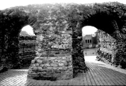
Fig.2 The Balkerne Gate, Colchester.
Colchester, Roman Britain's first capital and colonia, was on its way to becoming the model provincial city before its destruction by Boudicca in AD61. Though rebuilt, Colchester was once again vulnerable to the attacks of seaborne raiders in the fourth and fifth centuries. Excavations at Duncan's Gate and Balkerne Lane have revealed evidence of fire-destruction and external attacks in the fourth century.FN22
Coin finds and graves testify to continuous occupation into the early years of the fifth century.FN23 Other fifth-century evidence includes one sunken-floored hut, two cruciform brooches, and parts of military belt-buckles.FN24 The military buckles could have belonged to any late Roman soldier, but the fact that the hut and graves were found within Colchester's walls suggests that these occupants were present at a time when the Roman restriction against intra-mural burials no longer existed.FN25 The area around the Balkerne Gate, which remains to this day largely intact, may yet yield clues about sub-Roman defense and transportation.
Recent excavations at one Roman cemetery near the present-day Police Station revealed startling evidence of a substantial Christian community in late Roman Colchester.FN26 A small pagan cemetery was apparently succeeded by a larger Christian cemetery in the early fourth century. Most of the bodies were in nailed wooden coffins, though some were in lead coffins, hollowed tree trunks, timber vaults, or no coffins at all. To one side of this cemetery excavators found the circuit of a long rectangular stone building, with timber inner partitions, oriented east-west. It seems to have been constructed between 320-40, with later alterations including a rounded apse added at the eastern end. The structural design strongly suggests that this building was a Christian church, though no Christian artifacts have yet been found. The interior did yield, however, hundreds of fourth-century coins, five complete oil lamps, an iron frying pan, and bird and pig bones. The excavator suggests that the latter may have been part of a funerary or other ritual meal. FN27
Description:
Provincial/diocesan capital; seaport
Dating Evidence:
2 "chip-carved" bronze buckles
200+ Theodosian bronze coins (c.388-402)
Gold and silver issues of Arcadius and Honorius
One silver ingot (c.405)
Imported pottery (Biv, Bv, and Bvi)
Sources:
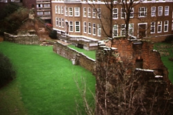
Fig.3 Medieval bastion and late Roman wall, London.
Settlement continued in London into the fifth and sixth centuries, but its character changed dramatically from its once-lofty status as an administrative center of the province. The great basilica was carefully demolished at the start of the fourth century; its apse was left standing and became part of some new structure standing alone on the now-vacant forum.FN28
The London waterfront, on the other hand, showed signs of revival in the late fourth century.FN29 Urban occupation continued there until the sixth century, and there is some evidence - a brooch and amphoras - of continued trade with the Continent.FN30 A section of the riverside wall was rebuilt at this time, while towers were added (c.350) to the landward wall.FN31 These defensive measures fit in with late fourth-century imperial policy and are paralleled at other walled cities in Britain.
The Notitia Dignitatum states that London housed the imperial treasury (and its overseer, the praepositus Thesaurorum Augustensium) in the last decade of the fourth century. A silver ingot, of the type presented to the army on an imperial accession or anniversary, was found within the Tower of London in a hoard that also contained a silver coin of Arcadius and two gold coins, one of Honorius and one of Arcadius.FN32 Scattered around the Tower as well were several coins running down to 388-402, leading Perring to postulate that a late Roman salient was built on the Tower site in the last decades of the fourth century, perhaps associated with the campaigns of Stilicho.FN33
The site which gives the clearest evidence of fifth-century occupation is a masonry building uncovered in Lower Thames Street near Billingsgate.FN34. This large house had under-floor heating and a private bath-suite, all of which continued to be used well into the fifth century. A hoard of over two hundred copper coins issued between 388 and 402 were found scattered on the furnace room floorFN35 and under the furnace ashes was found a piece of fifth-century amphora imported from the eastern Mediterranean, probably Gaza. The terminus of this occupation is marked by broken glass and roof debris, on which was found a circular brooch identical to one found in an early (pagan) Saxon grave at Mitcham, Surrey.
There is little evidence of "Germanic" pottery or Grubenhäuser in the city itselfFN36 though a "Saxon" cemetery has been identified in the London suburb of Orpington.FN37 Anglo-Saxon London (Lundenwic) grew up to the west of the city and did not become a significant burg until quite late. In fact, the Anglo-Saxon Chronicle describes London as a place to which the Britons fled after defeat in Kent in the 450s.FN38 Perring sees London as the center of a minor sub-Roman kingdom surrounded by banked ditches, constructed to mark the boundaries between it and the sub-Roman communities of Verulamium and Canterbury.FN39 The Roman fort at Cripplegate may have passed from the control of these sub-Roman Britons to become an Anglo-Saxon royal palace.FN40 But the archaeological evidence is not yet able to clear up all of the questions posed by London. Ironically, Roman Britain's largest city appears not to have been a significant settlement in the immediate post-Roman years, though finds definitely show sporadic activity in the fifth century.
Description:
Saxon Shore fort
Sources:
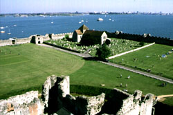
Fig.4 The medieval castle and church within the walls of the Portchester Saxon Shore fort.
A civilian population grew alongside the military presence in the Saxon Shore fort of Portchester. Occupation within the walls was intensive in the fourth century and continued at least into the early fifth century.FN41 It is not yet clear whether this fifth-century occupation was the continuation of the military community or a new settlement.FN42 Cunliffe's excavations in the 1960s and 70s revealed what he considered a strong "Germanic" presence at Portchester. Continental pottery, Frankish jewelry, and Grubenhäuser were found alongside the Roman finds inside the walls of the fort.FN43 Cunliffe interpreted these as clear signs of a settled Germanic detachment (laeti?) who maintained some contacts with the Continent and shared space inside the fort with the sub-Roman Britons.FN44
Description:
Saxon Shore fort; early Christian site
Dating Evidence:
13000 bronze coins ("uncertain Theodosian")
4200 bronze coins of Arcadius
1000 bronze coins of Honorius
1 gold tremissis of Leo I (Italian mint, c.461-74)
Sources:

Fig.5 View of the interior and walls (facing north) of Richborough fort.
Rutupiae, "muddy waters," was once one of Roman Britain's main south coast ports, welcoming such visitors as Claudius and Count Theodosius. Though it once guarded the southern approach to the Wantsum Channel, which separated the Isle of Thanet from the rest of Kent, changing water levels have now left it some 4km from the sea. Excavations in the early part of this century uncovered an exceptionally numerous quantity of Roman coins of the House of Theodosius, which account for 45% of all coinage found within the fort.FN45 The coins, along with other late Roman military metalwork recovered, indicate that Richborough was one of the last places in Roman Britain to have been held in full military strength.FN46
By the early fifth century a Christian community was established within the (abandoned?) fort of Richborough. The foundations of a hexagonal masonry structure identified as a baptismal font were uncovered inside the fort, in the north-west corner, along with artifacts bearing the Chi-Rho monogram.FN47
Johnson sees the Richborough evidence as fitting in with the pattern repeated in other parts of the late Empire, "where bishops were glad to establish their congregations within the safety of the now abandoned fort walls."FN48
Description:
Municipia; early Christian site
Dating Evidence:
14 (?) bronze coins of Arcadius
3 (?) bronze coins of Eugenius (392-4)
1 silver coin of Honorius, from Milan (397-404)
2 bronze coins of Honorius
36 (?) "House of Theodosius" issue coins
252 sherds of Romano-British pottery (late fifth century)
Imported pottery (1 sherd from a Mediterranean amphora)
Silver hand-pin (sixth or seventh century)
Sources:
Verulamium is one of the strongest cases for the survival of a major Roman town into the fifth and sixth centuries. Frere's excavations in the 1970s and 80s of Verulamium Insula XXVII reveal a diversity of both public and private activity during the sub-Roman period. One townhouse alone in Insula XXVII reveals the complexity of this activity.FN49 Built c.380 on a vacant site, the house included 22 ground-floor rooms and a colonnade surrounding a garden or courtyard. After a period of use, two extensions were added to the house, complete with a series of high-quality mosaic floors whose replacement was necessitated by constant wear. The kitchen floor alone was re-paved four times between about 400 and 430 when a hole was cut through it for the placement of a corn-drying oven or small hypocaust. The oven was used so much that it too needed repairs before the house was demolished c.460. At this stage a large rectangular structure, interpreted as a stone barn or hall, was constructed on the site. After another undetermined period of use, one of the stone buttresses of this building was damaged by the laying of a wooden water pipe, constructed--in the Roman style--with hollowed-out trunks joined by iron collars. Dating is based on associated coins and pottery (of the first decade of the fifth century) and on the continuing stratigraphic sequence which, the excavator estimates, ran down to 475+.
Branigan notes that the construction of the sub-Roman water main indicates that 1) Roman hydraulic engineering skills were still alive in Britain; 2) the Roman aqueduct which served Verulamium was still functioning; and 3) municipal authorities were still working for the maintenance of the city c.450-70.FN50 The quality mosaic pavements, found in several houses, would seem to indicate that the skills of the mosaicist were also still alive in fifth-century Britain.
There are further reasons to be as optimistic about the agrarian economy of Verulamium and its environs. The forum, with its well-worn floor, survived into the fifth century. Branigan takes this as an indicator of the continued occupation of the surrounding villa estates, which needed such markets for their goods.FN51 Two cottages in Gadebridge Park were occupied at least into the early fifth century, when animal pens were built as additions.FN52 There is also slight evidence that Verulamium benefited from Mediterranean trade in the sub-Roman period. The floor of a timber building in Insula XIX was terraced into a previously open cobbled area at some time after 388, and lying on its surface was a quantity of late Roman material, including a pin, brooches, and sherd of an amphora imported from the eastern Mediterranean.FN53 "The current picture of late Roman Verulamium is one of widespread occupation," comments Rosalind Niblett, "increasingly in timber buildings, amidst areas of open cultivated land; . . . but the standard of living was not necessarily low, witness the new water pipe and the imported amphora."FN54
This survival of a Verulamium community in the fifth century has also been inferred from Constantius's Life of St Germanus, which describes Germanus's visit to the shrine of St Alban in 429. Many scholars have argued for the survival of a "British" population into the sixth century in what has been described as a Saxon-free "Chiltern Zone."FN55 According to the Anglo-Saxon Chronicle, the area remained in the hands of the Britons until their defeat at the Battle of Bedcanford in 571.FN56 When King Offa of Mercia founded St Albans Abbey in 793 it is likely that he chose a site with previous Christian activity. Excavations at the Abbey, which lies just outside of Verulamium, have revealed evidence of near-continuous activity from the late Roman period to the Dissolution of the Monasteries in the sixteenth century. The earliest level, below the Norman cellarium and Anglo-Saxon church, contained several pits, iron nails, charcoal and cremated bones, a silver hand-pin, Roman tile and glass, 32 Roman coins (all but one or two of fourth-century date), and 252 sherds of Romano-British pottery.FN57
Although there is no conclusive evidence for an early Christian cemetery which might have contained the martyred Alban's remains, the finds suggest "intensive use of the site during the growth of [Alban's] cult in the fourth and fifth centuries."FN58 The silver pin is of "Celtic" type and dates by affinity to the sixth or seventh century, while the pottery -"grass- or chaff-tempered" - is of late fifth- or sixth-century date.FN59 Seventh-century "Saxon" material, together with a reference to St Alban's shrine in Bede, would suggest that there was some continuity of occupation, perhaps a mixture of pagan and ChristianFN60 from the fifth century to the foundation of the Anglo-Saxon Abbey by Offa.
Description:
Temporary dune settlement
Dating Evidence:
Roman fine wares
Imported pottery (Bi, Bii, and E ware)
One enamelled disc brooch (Roman)
Two penannular brooches (sub-Roman)
Six iron knife blades
Sources:
Bantham Ham at the mouth of the River Avon has, since the eighteenth century, been known to locals as a repository of ancient garbage. Several middens were uncovered by farmers in the nineteenth century, and many of the objects found were collected in 1902 by H.L. Jenkins.FN61 In 1953 Aileen Fox identified some of the ceramic finds as sherds of imported pottery dating to the fifth to seventh centuries.FN62 A sub-Roman date was then ascribed to this Devon dunes settlement.
Small-scale excavations at the dunes in April 1978 revealed more midden material overlying hearths and adjacent hollows, defined by the excavator as Areas A, B, C, and D.FN63 Area A contained a hearth, stake-holes (thought to represent tent-supports), a shallow gully, charcoal pipes, shells, slate slabs, animal bones, a knife blade and other iron fragments, part of an enamelled brooch, and several sherds of pottery (two of which had been pierced to make whorls). Area B was similarly rich, producing several pits, limpet shells, slate slabs, bone frag ments, two hearths, charcoal, 70 stake-holes, whetstones, several iron objects, and a single sherd of imported pottery (E ware). Area C yielded only bone and shell fragments, charcoal, and mussel shells, while Area D contained charcoal deposits, several slate slabs, a group of five stake-holes, mussel and limpet shells, and a decorated bone comb.
Analysis of the pottery (21 sherds were found in the most recent excavation) by the excavator identified Roman fine wares and more examples of the imported pottery identified by Fox, the latter representing Mediterranean amphoras (Bi and Bii) and Gaulish kitchenware (E ware).FN64 Sixty-one iron objects and fragments were uncovered, including a nail, chisel, clamps, and six knife blades (probably once adorned with wooden shafts). Finely crafted objects found at the site included fragments of a decorated bone comb, two penannular brooches (one bronze and one iron), and a leaded bronze enamelled disc brooch. The penannular brooches have been identified as sub- or post-Roman, while the disc brooch is likely of Roman provincial manufacture (second or third century).FN65 Finally, a great quantity of marine shells and animal bones were uncovered, the latter representing (in decreasing order) cattle, sheep, goat, pig, dog, horse, deer, hare, vole, birds, and fish.
The large number of artifacts and slight evidence of structures has led observers to conclude that Bantham was a temporarily, perhaps seasonally, occupied settlement.FN66 A sub-Roman trading post, with occasional but intense use, seems likely because of the location and the Mediterranean imports. The iron fragments, along with a single find of iron slag and eleven whorls, suggest that manufacturing may have occurred alongside, or in relationship to, the long-distance trade.
After a defensive wall was built around the religious precinct of Bath in the early fourth century, more and more people began abandoning their extra-mural settlements and moving inside the walled "city." At least 11 major buildings, some quite large and several with underfloor heating and mosaics, make Bath the most thriving of the small towns in late Roman Britain.FN67 A recently found hoard of silver coins shows that the wealth spread to the surrounding communities as well.FN68
The flourishing baths complex underwent dramatic changes at the end of the fourth century. The increasing problem of flooding shut down the underfloor heating for long periods, though the numbers of people visiting the springs did not decrease. The precinct of the Temple of Sulis Minerva saw the most drastic changes, perhaps as the result of the rising influence of Christianity in the area.FN69 The Temple altar was dismantled and sculpted blocks were torn from the "Gorgon" pediment, then overturned and used to pave the floors. The colonnade in the outer precinct was demolished and new secular buildings were constructed in its place.
The most complex and significant sequence occurred in the temple's inner paved precinct.FN70 The paved floor had been swept regularly until the middle of the fourth century, when an accumulation of earth began to cover it (and a coin of Constans, c.347-48). A new cobbled floor was then laid on top of the dirt, and again dirt began to accumulate over the worn stones. This pattern was repeated six times until the final collapse of the buildings sealed the sequence with a blanket of masonry rubble. The third level of cobbling sealed a "House of Theodosius" coin (388-402) and related pottery (Oxford color-coated ware and shell-tempered ware), but that leaves three layers of pavement, each of them worn by the passage of feet, extending to a time beyond the last coin issues and datable pottery.
The excavators believe that the chronology of this sequence extends occupation of the temple precinct at least to 470 and very likely into the sixth century and beyond.FN71 While the pottery experts would like to compress the entire chronology into the late fourth century (squeezing the last three layers into the 390s), most archaeologists agree with Cunliffe (and the coin evidence from here and the sacred spring) that settlement must extend well into the fifth century.FN72
Evidence: elsewhere supports the theory that Bath remained populated through the sub-Roman period. Throughout the baths complex the floor slabs, especially beneath the doorways, showed considerable wear in the last (fifth-century) phase, indicating that "even though the buildings were now being demolished, the spring continued to be frequented on an impressive scale."FN73 While there was much stone-robbing in the post-Roman years, not all the buildings were demolished. The reservoir enclosure survived into the early medieval period and became known as the King's Bath.FN74 "Elsewhere within the walled area" of Bath, writes Cunliffe, "there are hints of domestic buildings being used well into the fifth and possibly the sixth centuries."FN75 Such "hints" include the Abbeygate Street site, where a Roman building that had collapsed in the late fourth century was replaced, after an interval, by a new structure erected on a different alignment, the associated stratigraphy arguing for survival well beyond 410. Excavation has thus lent some credence to the assertion of the Anglo-Saxon Chronicle that, at the time of the Battle of Dyrham (c.577), Bath was a major civitas and (perhaps) the residence of a British king.FN76
Excavation has revealed what has been identified as a sub-Roman cemetery at Brean Down. Three skeletons yielded calibrated radiocarbon dates of 415-600, 560-660, and 654-786. The skeletons were aligned east-west but were not buried with grave-goods. Nearby stones suggest a return to the pre-Roman trait of slab-lined and cist burials.FN77 The east-west alignment and lack of grave-goods have been interpreted as Christian burials. A Romano-Celtic temple was built on the Down c340 and demolished c.390.FN78 This was replaced by a small, rectangular, stone-built structure. One interpretation is that the pagan temple was demolished by the Christian community, who replaced it with a small shrine.FN79 But the rectangular structure could have been a subsequent pagan shrine, abandoned sometime after the coming of the Christians.FN80
Cadbury-Congresbury (Cadcong) is an Iron Age hillfort that was reoccupied in the late or post-Roman period. Around AD 400 new earthworks were constructed, including a bank dividing the hillfort into two parts and a linking entrance way.FN81 These earthworks included both late Romano-British pottery and fifth- and sixth-century pottery imported from the Mediterranean, putting the reoccupation of Cadcong within the timeframe 400-700. FN82
According to its excavators, Cadcong's defensive rampart "is not a major military work, with extensive use of timber-framing or revetment (as at South Cadbury); but rather a flat platform on which turf or a light superstructure was piled."FN83 However, traces of other defensive structures found at Cadcong, including bastions and watchtowers, argue for a more intensive fortified use. Burrow estimates the manpower needed to defend Cadcong and its inhabitants as between 400 and 650 men.FN84
But Cadcong's defenses are only part of the story. Several domestic buildings were discerned from excavation, as well as a gatehouse and a roundhouse identified by the excavators as a possible shrine or temple.FN85 Evidence of metalworking is abundant at Cadcong, which is also one of the sites which has yielded the largest amount of imported Mediterranean amphoras.FN86 By the sixth century, the residents of Cadcong had attained, in the opinion of the excavators, "high status, patronising craft-workers and having access to glass and ceramics from the Anglo-Saxon areas to the East, and from the Eastern Mediterannean."FN87
Still, there is much debate over the exact function of this hilltop settlement. Some of the possibilities are:
There is no conclusive evidence for any of these possiblities. Until we have a better understanding of the reoccupation of hillforts in general, Cadcong is best left as a "high-status" site.FN91
There may be other contextual clues, however, if we look at sub-Roman Somerset. Fowler believes that the inhabitants of Cadcong came from nearby Gatcombe, a walled villa and late Roman community.FN92 This would parallel what Alcock has suggested for South Cadbury hillfort, that its sub-Roman inhabitants had migrated from nearby Ilchester (Lindinis).FN93 Cadcong lies at the junction of three tribal kingdoms: the Dobunni, the Durotriges, and the Dumnonii. Given the intensive sub-Roman occupation of hillforts and other settlements in this area, these Britons may have been responsible for the construction of Wansdyke as a defensive border between their civitates and the encroaching Saxons.FN94 The inhabitants of Cadcong seem to have enjoyed undisturbed peace until the late sixth or early seventh century, when the settlement declined and was abandoned.FN95
Cannington, in Somerset, is the site of one of the largest Roman cemeteries excavated in Britain. The cemetery originally consisted of some 2000-5000 graves (only 500 of which survived to be excavated) and was in use from the second century to the seventh or eighth. The earlier graves were aligned roughly north-south and contained grave-goods, while the latter were aligned east-west and lacked grave-goods, suggesting an initially pagan and subsequently Christianized community.
Two explanations have been offered for the size and location of the cemetery. One scenario is that the local Romano-British population migrated to the nearby hillfort and used Cannington as their burial-ground.FN96 This is likely to have happened in the sub-Roman period, but does not explain the second-century graves, for the hillfort reoccupation is unlikely to have been that early. (Though a late Roman temple, found on the hilltop, could account for some of the early pagan graves.FN97) Another explanation is that Cannington served as a communal burial ground for several communities in Somerset, as was probably the case for Poundbury near Dorchester.FN98
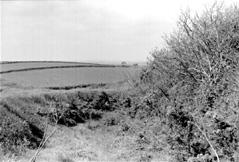
Fig.6 Ditch and ramparts of Castle Dore, Cornwall.
Castle Dore is an artificial earthwork created in the pre-Roman Iron Age. It consists of a circular plateau surrounded by two concentric banks, about eight feet high, and two deep ditches. Radford's excavations in the 1930s identified Castle Dore as a hillfort reoccupied and refortified at the end of the Roman period, in use through the fifth, sixth, and seventh centuries.
Few traces of the fortifications were discovered. A dry stone revetment
was added to the old earthen banks to make a fighting platform, and a small
oval hut just inside the gateway was likely used as a guardhouse.FN99 From
the gateway a rough cobbled road, about six feet wide, led to the interior
plateau and past several wooden structures. From posthole patterns, Radford
identified these structures as two large halls (90ft x 40ft and 65ft x 35ft) and two granaries (7ft x 5ft). Though some archaeologists
have questioned Radford's interpretation of these features,FN100 Rahtz maintains
that "the post-Roman complex at Castle Dore remains . . . the most
impressive 'palace' in the west."FN101
Dating evidence is scarce at Castle Dore. Those structures labelled sub-Roman
clearly overlay Iron Age features, but only a few beads and pottery sherds
were found in the sub-Roman layer. The sherds are from one vessel of imported
pottery, of unidentifiable type but similar to a grey vessel (sixth century)
found at Gwithian.FN102 D.F. Williams, however, believes the sherds to be
from amphoras of the pre-Conquest period.FN103 Castle Dore's proximity
to the "Tristan stone" (DRUSTANUS HIC IACIT/CUNOMORI FILIUS)
has led to the belief that this fort was the residence of Cunomorus (King
Mark), a sixth-century prince named in a Dumnonian genealogy.
Chun Castle is a bivallate walled enclosure occupied in both the Roman and sub-Roman periods. Excavations revealed dry stone structures, a hearth associated with grass-marked pottery, fragments from one vessel of Aegean origin (mid sixth century), a crude furnace, and a block of smelted tin.FN104
Late Roman Dorchester produced one of Britain's most distinctive schools for mosaicists and was the home of a flourishing Christian community. Over a thousand graves have been examined at nearby Poundbury, one of three major Christian cemeteries identified in Roman Britain.FN105 The majority of the graves were aligned east-west and were in simple wooden coffins without grave goods, though others were in more elaborate stone or lead coffins and included few grave goods. Within some of the coffins at the "main cemetery," bodies were partially preserved by a packing of gypsum plaster.FN106 A coin pendant with the Chi-Rho, along with the east-west alignments (which carefully avoid earlier north-south inhumations), strongly suggest that many of these were Christian graves.
The Dorchester area has yielded other evidence of early Christians. The villas at Frampton and Hinton St Mary both contained mosaics bearing such Christian symbols as the Chi-Rho, and presumably these mosaics were part of private chapels. These and stone mausolea found in the Christian section at Poundbury suggest that Christianity was spreading among the upper classes in the fourth century. By c.420 however, the cemetery went out of use, and a substantial agricultural community grew up on the site (the enclosed area equals that of South Cadbury). Features of this post-Roman settlement include fifteen buildings (post-built, beam-slot, combined post-and -beam, and sunken-featured structures), seven groups of pits, six grain driers and a threshing floor, four small ditched enclosures, and a substantial ditched enclosure.FN107 Additionally, six mausolea belonging to the late Roman cemetery were either robbed or re-used in the post-Roman period, one yielding a Theodosian bronze coin sealed in its wall plaster.FN108 This settlement seems to have had two phases, spanning (on radiocarbon estimates) from the late fourth to early seventh centuries. Sherds of imported amphoras, quality iron knives, and bone pins tell us something of Poundbury's economic and industrial activities, while the large number of grain driers might suggest on-site mass processing of grain.FN109 The end of sub-Roman Poundbury was sudden, marked by the destruction of drystone and timber structures and the possible slaughter of animals, with radiocrabon estimates suggesting a date in the middle of the seventh century. FN110This would be contemporary with the cemetery evidence for the first Saxons arriving in the area.
The forum basilica at Exeter underwent extensive remodelling in the latter part of the fourth century, and the new floor laid in the basilica contained a coin of Valens (c.367-75).FN111 Though grass and weeds were apparently growing in the palaestra of the bathsFN112 at least one Roman townhouse was built after the middle of the fourth century, with the insertion of a water trough overlaying a coin of c.363-67. Adjacent to this large house was a dump of oyster shells and a well-worn coin of Maximus (c.387-88), indicating probable activity at the site at the beginning of the fifth century.FN113
In the middle of the fifth century, the southern end of the forum and basilica was carefully demolished, and the stones were removed from the site in an orderly manner calling for some organization of manpower.FN114 First a large quarry-pit, together with several smaller pits, were dug into the curia floor to extract clay for bronze-working.FN115 Then the site was used as a cemetery, as excavators uncovered six inhumation graves which followed the alignment of the Roman buildings. Two of the graves yielded radiocarbon dates placing them in the fifth or sixth centuries, while the rest appeared to belong to the later Saxon minster church.FN116
Bidwell believes that these graves are part of a larger (yet to be fully excavated) Christian cemetery, indicating a fifth-century Christian community at Exeter which he describes as a "proto-monastery."FN117 If these Christian graves were succeeded directly by the Saxon church and graveyard, it may signal continuity of occupation at Exeter.FN118
There is an intriguing reference to Exeter in the Life of St John the Almsgiver, written in the early seventh century. A captain sailing from Alexandria with a cargo of corn is blown off course and lands in Britain, where he trades his cargo for Cornish tin (and some bronze numisma) and relieves a local famine. This reference has been taken to mean Exeter (or its port at Topsham), the first major Roman port reached by ships rounding the Iberian peninsula.FN119 But it could also refer to some other Dumnonian port which had succeeded Exeter in the sub-Roman period. Castle Dore, near Fowey, may have become a new focal point for the post-Roman inhabitants of Dumnonia. The wide spread occurrence of Christian memorial stones with their Ogham script in West Devon and Cornwall suggests Welsh or Irish missionary activity in this area,FN120 which was quickly solidifying into a westward-looking "Celtic" kingdom.

Fig.7 Glastonbury Tor, Somerset.
Glastonbury has long been the focal point of Arthurian and early Christian tradition in Somerset. The two features that have received the most attention are Glastonbury Abbey, one of Britain's most magnificent pre-Reformation religious houses, and Glastonbury Tor, an enigmatic terraced hill which rises over 500 feet above the Somerset plains. The Tor has yielded the strongest evidence for sub-Roman occupation, but neither area has been fully excavated and little archaeological work has been done since the 1960s.
Ralegh Radford's excavations at Glastonbury Abbey were aimed at discovering the earliest religious activity on the site. An ancient cemetery of slab-lined graves was found near the remains of a timber structure thought to be the original church of St Mary. Along with this small wattled building were found post-holes interpreted as the remains of wattled oratories, and the entire area was bounded on the east by a great bank and ditch thought to be a monastic vallum. Though no dating evidence was found at the Abbey, these features lay beneath later Saxon structures, leading Radford to interpret the site as a "Celtic" monastery based on Irish parallels.FN121 More recent excavation on the precinct ditch uncovered wooden stakes which yielded radiocarbon determinations centering on the late sixth and seventh centuries.FN122 Also found in this area was an eastern Mediterranean copper censer, of late sixth- or seventh-century date, which suggests that Glastonbury maintained Byzantine ecclesiastical contacts.FN123
Philip Rahtz's excavations on Glastonbury Tor have yielded much more evidence of sub-Roman occupation. Structures were found both on the summit of the Tor and on the terrace platforms, which were reached in medieval times by a series of steps cut into the bedrock approaching from the west.FN124 Slight remains of wooden buildings were found associated with hundreds of animal bones (representing prepared joints of ham, beef, and mutton seemingly butchered elsewhere and brought to the site), charcoal, and burnt stones. A fenced-in eastern hollow yielded Roman tileFN125 a bone needle, an iron lamp-holder, and a mysterious stone cairn. The most important area was the south platform, where traces of a large timber building were found along with two hearths, crucibles and other evidence of metal working, a dozen pieces of imported Mediterranean amphoras, and a carved bronze head (stylistically "Celtic").
Though the finds from the Tor are rich, their interpretation is rather difficult. Rahtz came up with four possibilities:
Two north-south aligned graves (containing the leg bones of two individuals well under 20 years old) found on the Tor might support the first explanation, but there is no evidence of a late Roman temple at Glastonbury.FN126 Though the early Christian associations with Glastonbury are many, Rahtz at first ruled out a Celtic monastery or hermitage because the quantity of meat bones seemed contrary to the ascetic lifestyle of "Celtic" monks. Because of the metalworking and Mediterranean imports, Rahtz favored the third interpretation, that the Tor was the fortress of a British chieftain, comparable to the craggy palaces of Dumbarton Rock and Dunadd.FN127 However, others have persisted in prefering the monastic interpretation for the Tor occupation.FN128 Evidence: of meat-eating (i.e. animal bones) has since been found at such monastic sites as Iona and Whithorn, and now Rahtz himself is reconsidering the monastic model.FN129 The Tor may then be the earliest attested eremitic monastic site in Britain, with the hermitage later brought under the control of the more accessible Abbey.FN130 When the new rulers of Wessex began to patronize the Abbey in the seventh century, Glastonbury had long been venerated as a Christian holy site.FN131
Ham Hill is one of the largest contour hillforts in Britain, with an oblong plateau enclosed by a circuit of defenses 5km in length. However, imprecise and poorly recorded excavations from 1907 to 1930 have only given slight illumination to probable late Iron Age, Roman, and sub-Roman occupation. More recent casual finds have yielded an abundance of Roman material, including pottery and several coin hoards.FN132 A 12-room Roman villa, associated with a coin series running from Carausius (287-293) to Valentinian II (375-392), has been partially excavated and seems to be part of an even larger complex of at least two phases.FN133 No sub-Roman structures have been identified.
Description:
Hillfort
Dating Evidence:
Imported pottery (Bi, Bii, and Bmisc)
Source:
The coastal hillfort at the top of High Peak in Devon has yielded evidence of Neolithic and sub-Roman occupations during excavations in 1871, 1929, and 1961-64. The only structures identified from the sub-Roman fort were a large single ditch, a rampart which formed the crest of the hill, and a small outer rampart on the eastern side of the site.FN134 These may represent either a univallate or a bivallate contour hillfort, possibly overlooking a harbor. All three excavations turned up sherds of imported amphoras (dating to c.475-650 and representing several vessels), found at the crest of the hill, in the large ditch, and in the small rampart outside the ditch.FN135 Along with the pottery were found animal bones (mostly ox and pig), a small bronze strap, a shale spindle whorl, and a whetstone. The large amounts of charcoal found in all the ditch fills and in the debris on the inner rampart suggest, to its most recent excavator, that the hillfort met a violent end at the hands of advancing Saxons.FN136

Fig.8 The ramparts of Maiden Castle, near Dorchester.
Maiden Castle, Britain's largest Celtic hillfort, was a political center for the Durotriges tribe before the Roman invasion. It was captured by Vespasian after a bloody massacre of its defenders, and consequently the Durotriges were encouraged to settle in nearby Durnovaria (Dorchester). In the late fourth century, sometime after 367 a Romano-Celtic temple was constructed on the hillfort's plateau.FN141 Maiden Castle, with its large ramparts, may then have become an enclosed shrine similar to the temple at Lydney, possibly associated with a sub-Roman cemetery.FN142 According to its first excavator, the temple at Maiden Castle had its floor replaced, suggesting "an existence prolonged well into the fifth century."FN143 Thereafter, a nearby circular shrine may have replaced the Romano-Celtic temple.FN144 The latest numismatic finds were from a hoard of four gold coins dating to about the first decade of the fifth century found near the temple.FN145
Excavations at the shrine of Apollo at Nettleton have revealed much and varied activity in the fourth and fifth centuries. Although the temple had become derelict in the second half of the fourth century, sometime after 370 it was adapted for habitation and used as a farmstead until 392 or possibly later.FN146 From knife or sword wounds found on skeletons at the site, the excavator believes that the homestead occupants were massacred as a result of a raid on the settlement sometime after 392.FN147 Some 500 Roman coins, ranging in date from 333 to 402 were found along with other objects on the floor of the "West Lodge" (Building XVIII), and all had apparently been subjected to fire. One object associated with the coins was a plumbata or martiobarbulus, a lead-weighted feathered javelin head comparable to those found at Wroxeter (which date to the early fifth century).FN148 Glass from this building has been assigned to the late fourth and early fifth centuries, and some of the beads found have been typed "Saxon." Reece, examining the coin evidence, sees occupation at the site continuing well into the fifth century.FN149
Limited excavation at Phillack in west Cornwall has revealed a cemetery dated artifactually to the sub-Roman period.FN150 The cemetery is enclosed and consists of inhumations in cist-graves oriented east-west, which suggests Christian use.FN151 Dating evidence includes one sherd from a Phocean Red Slip Ware bowl and a nearby inscribed stone of c.600.FN152 The evidence from Phillack compares to similar burial sites in the Scillies.FN153
These islets were once connected by the now submerged sea-bed to Cornwall. There is both literary and archaeological evidence that the Scillies were inhabited throughout the Roman period. The Emperor Maximus exiled two Priscillianist heretics to Scilly in the fourth century. A Romano-Celtic pagan shrine found on Nor'nour yielded a late Roman treasure trove (including Roman coins of the late fourth century, glass, bronze finger-rings, pots, domestic pottery, bronze brooches, and clay goddess-figurines from Gaul), suggesting a lingering paganism to the beginning of the fifth century.FN154 An early Christian wooden church was replaced by a stone chapel on St Helen's, and the few graves excavated point to Christian cemeteries in the Scillies.FN155 Scattered finds of imported pottery, found at Mary's Hill and Tean, and a Merovingian buckle and girdle hanger found at Tean, indicate commercial activity from the mid fifth to seventh centuries.FN156
Fig.9 View from the plateau of Cadbury Castle, Somerset.
The hill at South Cadbury, sometimes called "South Cadbury
Castle" and "Cadbury-Camelot," was the site of
one of the most publicized (and published) British excavations
of the 1960s. The association with the fabled court of King Arthur
was made by two prominent Tudor antiquarians, John Leland and
William Camden, disregarding other sites traditionally associated
with Arthur (e.g. Celliwic, Caerleon, Winchester) and the fact
that "Camelot" was invented by Chrétien de Troyes
or his successors in the twelfth and thirteenth centuries.FN161
However, when ploughing on the hill in the 1950s turned up sherds
of late Roman Mediterranean pottery, large-scale excavations soon
commenced under the direction of Leslie Alcock, who had recently
excavated the precedent-setting hillfort of Dinas Powys.
South Cadbury and Dinas Powys are both heavily fortified hill-top
settlements which yielded strong evidence of sixth-century activity.
There are other factors, however, which set South Cadbury apart
from the Dinas Powys model. Most obvious is the sheer size of
the hill: over 500 feet high, with steep sides defended by five
massive ramparts, enclosing a plateau of about 18 acres. Burrow
has estimated that it would have taken a force of about 870 men
to defend and maintain the ramparts alone, compared to about 400-650
for the comparably sized Cadbury-Congresbury.FN162 Also of significance
is the extended sequence of activity at South Cadbury, noted by
Alcock as one of the longest stratified sequences in western Europe.FN163
Neolithic activity (beginning about 4500 BC) is indicated by pottery,
flints, and both human and animal bones. A native farmstead occupied
in the late Bronze Age (eighth century BC) fell to Iron Age invaders
in the sixth or seventh century BC, when the first artificial
ramparts were constructed. The Iron Age occupation was brought
to a violent end shortly after the Roman invasion of AD43 presumably
during the campaigns of Vespasian, when the defenses were partly
dismantled. Roman occupation (dated by coins, pottery, and military
equipment) was slight until the third century, when a Romano-Celtic
temple was constructed (out of timber) and frequently visited
(coins range from 222-35 to 393-402). The defenses were repaired
on a massive scale in the later fifth century and timber structures
were constructed in the interior, all associated with Mediterranean
imports. After a long period of abandonment, the fort was the
site of a late Saxon burg and royal mint during the reign
of Ethelred (beginning of the eleventh century), whence the gateways were rebuilt in stone. Finally, after Cnut's accession in
1017 the burg was abandoned and the hilltop given up to
cultivation.
What Alcock terms the "Arthurian" period of occupation
or Cadbury 11 - the fifth and sixth centuries AD - is dated by the
abundant finds of imported pottery, including fine red bowls,
Mediterranean amphoras, and grey bowls and mortaria from
the Bordeaux region. The quantity of sherds suggests a minimum
vessel number comparable to that of Cadbury-Congresbury, and second
only to Tintagel.FN164 Sealed and scattered pottery were found in
the post-holes and wall-trench of a rectangular structure on the
summit of the hill. This building, about 19m long by 10m wide,
was interpreted by Alcock as the principal building of the fort,
probably a feasting hall.FN165 Other post-holes suggest interior
divisions and an antechamber. Such halls feature prominently in
the poetry of the British Heroic Age, but only a few examples--notably
Yeavering and Doon Hill--have been excavated and published.FN166
Alcock, however, suggests that the model for the Cadbury hall
was not the Germanic feasting hall but rather the aisled houses
of villa complexes in later Roman Britain.FN167 Though these were
occasionally rebuilt in timber, a better model might be the massive
timber building complexes constructed at the baths basilica in
sub-Roman Wroxeter.FN168 Only one other pottery-dated structure
was excavated at Cadbury 11, that of a small (4m x 2m) rectangular
building near the northern door of the hall which has been interpreted
as a kitchen.FN169 Finally, some of the smaller round houses previously
attributed to the Iron Age may belong instead to Cadbury 11 with
parallels at Cadbury-Congresbury and Buiston.FN170
Much of the imported pottery was found in association with the
rebuilt defenses and the south-west gate. "The hill-top had
been re-fortified with a timber fighting platform," writes
Alcock, "faced with dressed stone and anchored down with
rubble."FN171 Stone for the ramparts had been quarried from
derelict Roman buildings and was re-used unmortared in the non-Roman
fashion of dry masonry. The absence of nails suggests wooden pegged
joints were used, a somewhat sophisticated carpentry technique.FN172
The timber gate-tower constructed at the south-west gate was seemingly
based on the simple Roman auxiliary fort gate model, and showed
signs of repair in the later sixth century.FN173 It likely contained
two double-leaved doors, an interior bridge, and possibly a light
tower.FN174 In all, the defensive circuit spans nearly 1200m, the same as the perimeter of the Iron Age fort. The size
of the Cadbury defenses is without parallel among contemporary
hillforts in Britain.
The size of South Cadbury's fortifications and the large quantity
of imported pottery discovered there make it and Tintagel the
two most significant sub-Roman occupation sites in the south-west.
It should be noted that only six percent of the hillfort's summit
was excavated by Alcock's team, and future excavation is likely
to turn up a greater variety of structural and artifactual evidence.
Description:
Promontory hillfort; early Christian site
Dating Evidence:
Two inscribed milestones (third and fourth centuries)
Sherds of Oxford Red Color-Coated ware (fourth century)
10 bronze coins ranging from Tetricus I to Constantius II
Radiocarbon estimate from charcoal (calibrated: c.AD 403)
Archaeomagnetic date (AD 450-500)
Imported pottery (PRSW Form 3, ARSW, Bi, Bii, Biv, Bv, Bmisc,
and D ware)
Glass fragments from drinking vessels
Slight traces of metalworking
Merovingian (?) ring-ornament
Sources:
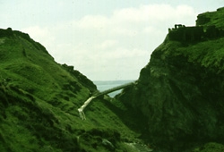
Fig.10 Modern passageway to "Tintagel Island."
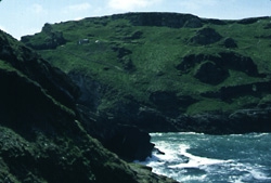
Fig.11 Terraces and Iron Gate on "Tintagel Island."
The picturesque ruins of the Norman castle at Tintagel have inspired
writers from Geoffrey of Monmouth to Tennyson who have helped
add "King Arthur's Castle" to the tourist's map. More
recently, archaeologists and historians have begun to unravel
the complex history of the site, whose "Dark Age" phase
is showing signs of activity on a grander scale than the legends
themselves.
Beyond the inner ward of the Norman castle, on the high protruding
headland called "Tintagel Island," lay the remains of
several small rectangular structures made of stone and slate.
Radford's excavation of these structures in the 1930s revealed
thousands of sherds of imported pottery, then known as "Tintagel
ware." Because this pottery dated to the fifth to seventh
centuries and was used primarily for the transportation of wine
and oil, Radford interpreted the headland settlement as a remote
Celtic monastery.
The monastic model for Tintagel was commonly accepted until the
1970s, when Ian Burrow and others began casting doubts on Radford's
interpretation of the stone huts, whose number has now grown from
30 to over 100.FN175 Because Tintagel does not appear as a monastery
in Cornish hagiography, and because no early Christian church
or cemetery have been found at the castle site, archaeologists
now doubt that the stone huts are monastic "cells."
Some are likely barracks belonging to the Norman castle, while
others - on both the plateau of the headland and on its terraces - are
multi-period, including drystone buildings contemporary with the
imported pottery.FN176
The monastic model is now being replaced by a secular interpretation
of the Tintagel settlement. The new models proposed are 1) a fortress
or royal seat, and 2) an international port of trade. The first
model is supported more by linguistic and literary evidence than
archaeology. The name "Tintagel" is thought to derive
from the Cornish tin/din, "fort," and
tagell, "neck or constriction."FN177 Thomas believes
that Tintagel's original identity as a castle or fortress was
perpetuated by the Romans, making it the coastal Durocornovium
("fort of the Cornovii") listed in the Ravenna Cosmography.FN178
Two inscribed Roman milestones have been found in Tintagel, as
well as Roman coins and both commercial and locally made pottery
of the third and fourth centuries.FN179 Whatever role it played
during the Roman occupation, later tradition made Tintagel the
fortified seat of the rulers of Dumnonia, including Mark and Tristan.
This tradition, in turn, may have had something to do with the
location here of the twelfth- or thirteenth-century Norman castle
which Geoffrey of Monmouth linked with Arthur.FN180
The second model holds that Tintagel was a major late and sub-Roman
port of trade, perhaps occupied only seasonally. This theory is
based primarily on the enormous amount of imported pottery which
has been (and still is being) uncovered on the headland. More
fine pottery and amphoras - over 300 vessels in all - have been
found at Tintagel than at any other site in Britain and Ireland.FN181
Slight traces of metalworking found at Tintagel support the widely-held
view that Cornish tin was traded for the imports,FN182 which Dark
suggests passed first through Frankish middle-men (hence the possibly
Merovingian ring-ornament) before arriving in Britain.FN183 Minor
excavation on the headland in the 1980s began to uncover evidence
of associated structures, including a possible sub-Roman wharf
below the Iron Gate and a court beneath the Norman hall of the
Inner Ward.FN184 In the Lower Ward, on the mainland, excavation
revealed two hearths, a well-built oven, a multitude of butchered
and cooked bones, and imported glass, pottery, and metalwork,
suggesting intensive food preparation and cooking at the site.FN185
One of the clay hearths yielded an archaeomagnetic date of AD
450-500 (at a 68% confidence level).FN186
Charles Thomas has recently re-evaluated the evidence at Tintagel
for English Heritage.FN187 He argues that there are too many geographic
problems at Tintagel headland (a restricted location, vulnerability
to gales and salt-laden spray, meagre and shallow soil cover,
a limited water supply) to have made it suitable for year-round
habitation, so that during the period of its imports (about 450
to 650) it is more likely to have been inhabited only periodically,
perhaps solely during the summer months.FN188 However, the construction
of a ditch-and-rampart line across its only point of landward
access, along with the metal-working and ostentatious signs of
wealth, make it an ideal candidate for a fortress. Thomas sees
Tintagel Island as a stronghold of the post-Roman kings of Dumnonia,
but one used only periodically as part of an irregular sequence
of dynastic visitations, where food as well as goods required
for overseas trade were brought to the king under a system of
enforced obligations.FN189 Such itinerant kings are well-attested
in the early medieval world, the theory being that it was easier
to take the larger royal households to the food than it was to
maintain them in one permanent location.FN190
Even if the settlement on the headland turns out to be thoroughly
secular, there is still strong evidence for early Christianity
at Tintagel. Thomas led two seasons of excavation at the Tintagel
Parish Churchyard, which is on the mainland not far from the castle.
His team uncovered two slate-lined graves, two rock-covered burial
mounds, and one memorial pillar; associated imported pottery and
a cross on one of the slates identify the site as early Christian
(400-600).FN191 Near the graves were found traces of open-air fires,
the remains of which yielded a (calibrated) radiocarbon date centering
on AD 403.FN192 Thomas suggests that the fire and pottery are the
remains of a funeral meal held at the Christian cemetery, a custom
common at this time on the continent.FN193 Remains of a low bank
of earth and stones surrounding the yard yielded a sherd of ARSW,
suggesting that an enclosure was added to the cemetery in the
later sixth century.FN194 Its excavators see Tintagel Churchyard
as an important burial ground "contemporary and associated
with the post-Roman use of the Island."FN195
Description:
Circular fortification (a "round")
Dating Evidence:
Grass-marked pottery
Imported pottery (PRSW, Bi, Bii, Biv, Bmisc, and E ware)
Imported glass
Source:
Trethurgy is a univallate hill-slope enclosure, one of many circular
walled and ditched fortifications common in south-western Britain
referred to as Cornish "rounds." Trethurgy has produced
locally-made pottery and some 50 sherds from imported amphoras,
representing four different styles of vessels, along with sherds
of Phocean Red Slip Ware and E ware from Gaul.FN196 The pottery
range suggests a period of occupation throughout the fifth and
sixth centuries.FN197 Also found was a tin ingot, which lends support
to the theory that Cornish tin was exchanged for the Mediterranean
and Gaulish imports.FN198
Recent excavation at Wells Cathedral has revealed a late or sub-Roman stone building standing beside the first Anglo-Saxon church. The building has been tentatively identified as a mausoleum.FN199
A major rescue excavation in 1977 uncovered a temple complex on
West Hill in Uley. Coinage indicates a series of religious structures
built on the site beginning in the LPRIA and continuing in the
Roman and post-Roman periods. The major feature was a small Romano-Celtic
temple consisting of stone-walled concentric rectangles with associated
bronze coinage and other votive objects. Coin evidence suggests
that the temple was built in the second quarter of the fourth
century and demolished c.400. This occurred with a systematic
dismantling of the buildings and the careful removal of the stonework.FN200
Excavation further disclosed at least three phases of post-temple
structures, associated with Theodosian coinage and various types
of Romano-British pottery. The first of these structures, represented
by large post pits and beam slots cut through the demolished remains
of the stone temple, has been interpreted as a double-aisled timber
basilica (11m x 9.2m), probably a church, constructed sometime
after the last coins were deposited (c.402).FN201 No apse was identified,
but an attached polygonal structure may have served as a baptistry
(with a conjectured altar).FN202 In the late fifth or sixth century,
a perimeter bank was built around the complex, with two foundations
of dry stone footings and postholes at the north end possibly
representing gate towers with stair-turrets.FN203
In the late sixth or early seventh century, the timber basilica
was dismantled and a smaller stone structure was erected over
the north-eastern corner of the basilica.FN204 This rectangular masonry
building was later given an apse, and has been interpreted as
a two-cell chapel. Associated with the chapel were ten fragments
of blue-green window glass, some containing dark red streaks,
which have parallels with Anglo-Saxon churches and are thus most
likely post-Roman.FN205 Also possibly connected with the stone church
is a polygonal open-sided structure south of the church with mortared
stone footings, interpreted as an open "screen" roofed
with re-used Roman tiles.FN206 The incorporation of the pagan altar
and a statue of Mercury into the sub-Roman structures' walls lends
support to the excavators' explanation of Uley as a Christian
takeover of a pagan shrine.FN207
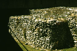
Fig.12 The remains of the late Roman buttress at Winchester's Westgate.
A late Roman cemetery at Lankhills, just outside of Winchester's north gate, has yielded an abundance of graves dating to the late fourth or early fifth century.FN208 Some of these graves were cut into by sub-Roman structures, labelled by the excavators Features 24, 25 and 26. Features 25 and 26 appear to have been bedding-trenches for plants forming the boundary of a garden.FN209 While there was some decay in street and drain maintenance, there were also metallings (of inferior quality) and new timber structures which encroached on the carriageways.FN210 Wacher believes the citizenry began building their houses on top of the paved city streets because they provided a firm, well-drained foundation.FN211 "These metallings and structures," comments Esmonde Cleary, "however much they represent a decline in standards, also represent a continuation of population."FN212
Description:
Auxiliary fort (?); princely stronghold
Dating Evidence:
Roman pottery
Sources:
Excavation at Aberffraw, on Anglesey, revealed what appeared to
be--because of associated pottery--a late Roman auxiliary fort.
Its stone rampart was rebuilt, according to the excavator, possibly
as a ballista platform, "in the fifth or sixth centuries
by the founders of what was to be one of Gwynedd's most successful
dynasties."FN213 Edwards does not believe that Aberffraw was
a Roman fort, but rather that its construction was wholly the
work of the kings of Gwynedd in the fifth century.FN214 An inscribed
lead coffin, bearing the Alpha and Omega (and possibly
the Chi-Rho) symbols, suggests a wealthy Christian community
in early post-Roman Anglesey.FN215
Description:
Hillfort
Dating Evidence:
Late or post-Roman glass bead
Fragment from a glass beaker (fifth/sixth century)
Source:
The Breiddin is one of the largest hillforts in Britain, its inner rampart enclosing 28ha. A probably late or post-Roman glass bead was found on the enclosure. The globular bead is of crackled turquoise glass.FN216 Excavations in the 1930s at nearby New Pieces, a small bivallate enclosure, yielded one--perhaps two--pieces of glass dated to the fifth or sixth century. The more distinctive piece is from a colorless or pale green glass vessel, probably a tall beaker.FN217
Description:
Legionary fortress
Dating Evidence:
Imported pottery (Bv)
Radiocarbon date of burial (c.660-940)
Sources:
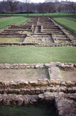
Fig.13 Remains of the legionary barracks at Caerleon.
The fortress of Isca was systematically dismantled after its legion was removed c.260. Thereafter civilian occupation continued in Caerleon until at least 375 and an early Christian tradition in the city is suggested by the literary sources.FN218 Some time after 354 two round-ended buildings (K and L) were constructed over the via vicinaria and the verandah of barrack block A.FN219 Building K, which has left the most traces, was originally 7.2m x 4.5m with "two post-holes flanking a tegula which had been reused as part of a threshold," stone walls (one of which concealed a late military bronze belt fitting) and partitions, and a floor of well-laid rubble paving.FN220 Inserted under the paved floor was a single female inhumation burial, the skeletal remains yielding a radiocarbon date of c.660-940.FN221 "The need for extra buildings in a vernacular style may imply," according to the excavators, "a considerable population for Caerleon during the earlier part of the [medieval] period." FN222 Giraldus Cambrensis, writing in the twelfth century, described baths, temples, water conduits, hypocausts, and an amphitheatre which were still standing at Caerleon in his day.FN223
Description:
Roman fort
Dating Evidence:
One clipped siliqua, probably of Theodosius (379-95)
Four penannular brooches (fifth century)
Metalworking debris
Sources:
The Roman fort of Segontium, which underwent extensive internal
modifications in the fourth century, appears to have been manned
up to about 410 (or that time when payment failed to reach the
frontier).FN224 Sub-Roman activity is indicated by a new sentry-box
built in the SE guardroom of the SW gateway, and two penannular
brooches dating stylistically to the fifth century.FN225 An early
medieval church was founded just outside of Segontium, at Llanbeblig,
and ordered government in this area is indicated by terms like
civis and magistratus inscribed on the sixth-century
Penmachno stone.FN226
Description:
Civitas capital
Dating Evidence:
Seven Theodosian coin hoards (coin range 388-402)
Seven late Roman buckles
Two lead-weighted javelin heads (martiobarbuli )
One fine zoomorphic penannular brooch
Radiocarbon dating of graves (fifth to eighth centuries)
Class G penannular brooch
Two spiral pins (seventh century)
Sources:
Caerwent began as a fort and developed into a large town and civitas
center. In the middle of the fourth century, the town defenses
were strengthened with the addition of at least eleven external
towers, heptagonal in shape and irregularly spaced.FN227 Also at
this time both the south and north gates at Caerwent were blocked,
seemingly in answer to some external threat.FN228 Several Theodosian
coin hoards were found at Caerwent, deposited after buildings
had collapsed and possibly, as has been suggested by Reece, as
late as the second or third quarter of the fifth century.FN229
Graffiti scratched on the walls of the curia in the basilica have
been assigned to the fifth century, and the forum remained in
use some time after that.FN230 Drains were built running through
the blocked-up gates, suggesting that the baths were still operating
for some time until they collapsed and were replaced by another
structure, possibly a church.FN231 Though this interpretation has
been questioned, four other stone buildings have been identified
recently as early medieval and may have belonged to the sixth-century
monastery founded by the Irish Saint Tathan.FN232 Stylistic analysis
of jewelry found in the town confirms occupation and activity
during this period.FN233
The excavation of a cemetery just outside the walls of Caerwent
revealed further evidence of sub-Roman occupation. Radiocarbon
dates taken from the graves show that the people of Caerwent continued
to be buried in this cemetery in the fifth and sixth centuries;
in fact, the continuity extends to the eighth or ninth century
when the settlement was clearly monastic.FN234 One interesting
burial contained a Roman coin (c.335-48) and a late Roman bracelet,
yet radiocarbon analysis indicated a date of c.540-770. "If
this is correct," comment Knight and Lane, "it implies
the continuing use of Roman objects well into the early medieval
period."FN235
Description:
Early Christian site (?)
Dating Evidence:
Imported pottery (PRSW and E ware)
Early Christian inscribed stone (fifth or sixth century)
Sources:
Two long-cist burials were found in early excavations on Caldey
Island, near St David's Church and the medieval priory respectively.FN236
An early Christian ogam inscribed stone (ECMW No. 301)
found near the priory could support the later hagiographic evidence
of a sixth-century monastery founded on the site of the later
priory by Abbot Pyro.FN237
More recently, Ewan Campbell has identified two sherds of imported
pottery found in the vicinity of St David's Church.FN238 One is
a sherd of Phocaean Red Slip Ware imported from Asia Minor in
the mid fifth or sixth century; the other is a sherd of E ware,
probably from a Merovingian jar imported in the seventh century.
Campbell believes that these imports belonged to a secular settlement
at St David's associated with the nearby landing place and perhaps
the cist burials, and contemporary with the sixth-century monastic(?) foundation at the priory.FN239
Description:
Ditch enclosure; early Christian site?
Dating Evidence:
Late Romano-British pottery (third and fourth centuries)
Radiocarbon dates from charcoal (calibrated: AD 410-560; AD 576-658;
AD 429-599; AD 427-596; AD 543-645; AD 392-538.
Sources:
The medieval church of Capel Maelog lies on a low hill in the
outskirts of the modern town of Llandridod Wells. The site was
extensively escavated between 1984 and 1987, revealing substantial
activity beginning in the late Roman period. Excavators uncovered
a sub-rectangular enclosure underlying the eatern end of the medieval
church. The enclosure was approximately 18m across internally,
with a single ditch 2m wide and 1m deep.FN240
Two charcoal samples
from the primary filling yielded calibrated radiocarbon dates
centered in the sub-Roman period. Several sherds of late Romano-British
pottery (including two sherds from an Oxford color-coated ware
bowl, four sherds of Black Burnished Ware, and several sherds
from a Severn Valley Ware jar) were also found in the ditch filling
along with scattered fragments of Roman glass. Within the western
side of the early enclosure was a curving ditch (7.4m x 1.6m x
1m) which also yielded radiocarbon dates centering in the fifth
and sixth centuries. Four widely scattered post-holes were also
found, but remain undated.
Interpretation of these features is difficult. The early enclosure
beneath the medieval church appears to have originated in the
fourth or early fifth centuries, with its ditch receiving silting
in the sixth and seventh centuries, but its function remains obscure.FN240a
An extensive early cemetery, with coffins and other inhumations
around a focal grave, is established inside the enclosure shortly after
the seventh century, and a stone church is built there by the tenth century.
Coygan Camp is an Iron Age promontory fort which has shown signs
of occupation in the Roman and early medieval periods. The fort
was defended on its north and west sides by a stone-built rampart
with revetments on both sides. Four structures ("huts")
have been identified, of both stone and timber construction, but
no finds were associated with them to allow for dating.FN241
There is an abundance of finds, however, from other areas of the
site. Coins and pottery show that the Roman period occupation
extends from at least the second to the fourth century.FN242 Sixth-century
occupation is attested by the presence of imported pottery (one
sherd of a Bi amphora and five sherds of Phocaean Red Slip Ware)
which came from complete vessels and pre-date the rampart tumble.FN243
Other finds of possible early medieval date include two crucibles,
a bronze ingot, a dagger, and three spear-heads of non-Roman type.
Campbell believes that the range of finds suggests continuity
of occupation from the Roman to early medieval periods, while
"the imported pottery indicates that there must have been
a high-status site at Coygan in the sixth century."FN244
Fig.14 The twin peaks of Degannwy Castle, near Conwy, Wales.
The medieval fortifications of Degannwy Castle straddle two craggy
hilltops overlooking Conwy Bay. Leslie Alcock's excavations between
1961 and 1966 revealed traces of early medieval structures beneath
the thirteenth century castle, especially on the western hill.
A drystone wall and two trenches were uncovered on the eastern
side of the hill, though this may have enclosed the entire summit.
The drystone wall is not closely datable, though datable glass
and pottery were found (unstratified) very near it.FN245
Artifactual evidence suggests occupation in the Roman period and
a long sequence throughout the medieval period. Late Roman finds
include a coin sequence extending from Gallienus (260-68) to Valens
(364-78) and pottery "calcite-gritted material and a 'Dinorben'
bowl"of similar date.FN246 Early medieval objects include one
sherd from a Bi amphora, datable to the late fifth to mid sixth
century, and about a dozen fragments from "B miscellaneous"
amphoras.FN247 These were found associated with a fragment of possibly
post-Roman glass.
Though there is an absence of coins of the period 330-48, Roman
occupation at Degannwy is likely to extend from the 260s to the
370s.FN248 The imported pottery argues for early sixth-century occupation,
while there is an absence of material to argue for continuity.
Later tradition associates Degannwy Castle with Maelgwn of Gwynedd,
one of the tyranni denounced by Gildas. Though the tradition
is a strong one, it may be rather late.FN249 Likewise, an entry
in the Annales Cambriae for the year 812 states that "The
citadel of the Canti ( Decantorum arx) is struck by lightning
and burnt," and this is usually identified with Degannwy.FN250
The craggy hillfort of Dinas Emrys lies on one of the principal
routes through Snowdonia. Excavations in 1910 and in the 1950s
revealed several stone walls and revetted platforms surrounding
a small summit. On the summit were found the stone foundations
of an oval structure, a square pool or cistern, several post-holes
(possibly belonging to a palisade), and other structures of indeterminate
date and function.
The artifactual evidence ranges from the early Roman to the medieval
period. Roman period finds include pottery, glass, an iron brooch,
and three "Donside" terrets (rein-rings from a chariot).
Late Roman and early medieval finds include gilt-bronze studs,
mortaria (late third or fourth century), color-coated wares and
calcite-gritted vessels (late fourth century), at least seven
glass vessels, a two-handled Biv amphora (fifth or sixth century),
and a roundel cut from a pottery sherd with a Chi-Rho pattern
on it (sixth century).
Dating the periods of occupation at Dinas Emrys has proven to
be difficult and controversial. The early material, thought to
belong to Iron Age or early Roman occupation, may have been brought
to the site at a later date.FN251 Late Roman occupation seems certain--because
of the abundance of pottery and glass--and probably spans the
fourth century. Early medieval occupation is indicated by the
imported pottery (fifth to sixth centuries), and both the middle
and main ramparts rest on late Roman material.FN252
More questions surround the nature of the pool, discovered in
Savory's excavations. The 1910 excavation sought the legendary
sinking tower of Vortigern, but uncovered the remains of a Norman
castle instead. When Savory uncovered the pool and found it contained
fifth- or sixth-century imported pottery, it was hard not to see
it as the pool where Vortigern is confronted by the prophetic
boy as described in the Historia Brittonum. Radiocarbon dating and a
sherd of medieval pottery seem to contradict this, though this
material may be intrusive.FN253 Even more perplexing is the presence
of some 33 posts erected within the pool, which must have seen
a long and complex sequence of activity.
Dinas Powys, near Cardiff in Glamorganshire, is a small hilltop
settlement surrounded by crude defensive earthworks. Leslie Alcock's
excavations in the 1950s, extensively documented, made Dinas Powys
the classic site of post-Roman Celtic archaeology. In the thirty
years since the excavations were first published, Alcock and others
have reassessed and reinterpreted the nature of the sub-Roman
settlement at Dinas Powys in the light of new discoveries at similarly
occupied hillforts.
The post-Roman occupation of Dinas Powys does not represent the
re-use or refortification of an Iron Age hillfort. Though some
Iron Age pottery was discovered at the site, no Iron Age structures
were recognized.FN254 Excavation did reveal an abundance of Roman-period
material, including colored glass and window-glass (first to second
century), Samian ware (second century), a Roman brick, a La Tène
brooch (first century), and tools for the manufacture of shale
armlets.FN255 Because these objects were not associated with Roman-period
structures, Alcock believes that they were brought to the site
as "mementos" in the fifth and sixth centuries. Others
have questioned Alcock's "mementos theory." Rahtz has
suggested that the Roman fine table- and glass-wares were hoarded
heirlooms that came into use again when pottery and glass became
extremely scarce in late fifth-century Britain.FN256 The Laings
believe that the Romano-British material, because it falls mostly
into the first and second centuries, must represent contemporary
occupation of some sort. FN257 They would even date one of the earthen
banks to the early Roman period, which could disrupt the chronology
of the sub-Roman phases.
Alcock's sub-Roman phase which he labels "Phase 4/Early Christian" has
three further divisions (A, B, and C) and spans the fifth through
seventh centuries. Phase 4A (fifth century) is represented by
three industrial hearths (with associated metal working debris),
fence holes, one defensive bank and ditch, an incomplete timber
structure, a child's grave, and the earliest imported pottery
(PRSW). Phase 4B (fifth to seventh centuries) showed continued
industrial activity, the construction of two stone houses (inferred
from two rectangular gullies), and the latest pottery imports
(E ware). Phase 4C (seventh to eighth centuries) began with the
construction of a second defensive bank and ditch and ended with
the abandonment of the site.
Though Dinas Powys yielded no impressive structures, the quality
and quantity of imported pottery and other early Christian material
from Alcock's excavations have made it possible to answer broader
questions about economic and industrial aspects of British society.
Dinas Powys ranks just below Tintagel and Cadbury-Congresbury
in the amount of imported pottery it has yielded, which runs from
the earliest imports in sub-Roman Britain to the latest. But most
remarkable is the wide variety of objects that relate to industrial
activity: bronze and iron metalwork, tools for jewelry-making,
whetstones and querns, glass beads and other raw materials. Accompanying
these were objects of likely domestic use, such as the Samian
tableware, Roman and Germanic glass vessels, carved bone pins,
and fine antler combs.
What has perhaps caused the most discussion is the enormous quantity
of animal bones discovered at Dinas Powys. Some 12,000 bones (representing
sheep, cattle, and pigs) were uncovered by the excavators, though
only a fraction have been studied in detail. FN258 Analyses indicate
that whole animals were entering the settlement at Dinas Powys
and being butchered there.FN259 It is not clear, however, whether
the inhabitants favored cattle or pig.
Alcock relied heavily on this information about farming economy
and industry to formulate his first interpretation of Dinas Powys.
He concluded that the early Christian occupation was that of a
princely court (llys) or stronghold which received tribute
in the form of food renders and whose economy depended on animal
byproducts supplemented by craft industries. Although some have
questioned Alcock's use of later Welsh and medieval literary sources
to formulate the "llys model," no other interpretation
of Dinas Powys has gained acceptance. On the contrary, Alcock's
model may be gaining more support as other hillfort occupation
comes to light. The question, then, is how does Dinas Powys compare
with other fortified sites in Wales and Dumnonia receiving imported
goods in the sub-Roman period?FN260 Esmonde Cleary, expressing support
for Alcock's model, points out the problems presented by Dinas
Powys:
These [hillforts] . . . were presumably the residences of local rulers. At Dinas Powys the artefactual assemblage included ARSW [pottery] and glass from the Rhineland, which indicates extensive contacts. The site itself was defended and therefore could presumably call upon the labour and resources of a large area round about. Yet the buildings were small and simple. Status must have been proclaimed largely by means which leave us little or no trace.FN261
The means of displaying status, if we are to judge by the evidence of Gildas and the Llandaff Charters, was likely that of clients/retainers and agricultural lands. These leave no archaeological trace, yet are arguably more valuable than lavish buildings and treasure.
More than fifty years of excavation at the multivallate hillfort of Dinorben in Denbighshire revealed several periods of discontinuous occupation spanning the early Iron Age to the sub-Roman period. Around 260 a large roundhouse was built at the northern end of the site, followed by the construction of small curvilinear huts at the southern end.FN262 Associated items include a large number of Roman coins, the latest being two very worn "House of Valentinian" bronzes from Arles.FN263 By the fourth century, Dinorben appears to have become a rural estate, akin to a southern villa, with the roundhouse possibly representing the residence of a Romano-Celtic noble.FN264 The roundhouse was succeeded, probably in the early fifth century, by a roughly constructed aisled timber dwelling (identified from a system of post-holes) at the northern end associated with fragments of late Roman flanged bowls of fine pink ware.FN265 A sub-Roman reoccupation thus seems likely, though it is not yet possible to trace the continuity between this early fifth-century community and the latest objects from the site, which include several "Anglo-Saxon" ornamental bronze items, a bronze stud (similar to those found at Dinas Powys), and a polychrome (dark blue with white zig-sag lines and yellow and green circular patches) glass bead fragment.FN266
Gateholm is a small tidal island in the Broad Sound which was
perhaps once a promontory attached to the mainland. Its eroding
cliffs lead up to a flat plateau which is covered with rows of
turf-grown walls. These are seemingly the remains of several sub-rectangular
buildings, organized in a more or less homogeneous plan, perhaps
protected by a drystone bank. Excavations and occasional finds
indicate a long span of occupation.
Activity in the Roman period is indicated by several fragments
(31 sherds from 12-18 vessels) of mortaria and samian wares, spanning
c.250-350, and one coin each of Carausius and Tetricius I.FN267
Oxford color-coated ware suggests that activity continued to the
late fourth century at least, while signs of early medieval occupation
include a bronze ringed pin (of sixth- to ninth-century date)
and a bronze stag (now lost), the only close parallel that has
been found for the stag on the Sutton Hoo whetstone.FN268
Interpretations of the hut settlement at Gateholm have varied.
Davies sees it as a homogeneous but unusual "Roman"
settlement which began around 250-300 with perhaps intermittent
occupation into the post-Roman period.FN269 One sherd of the Oxford
ware was incorporated into the cobbling of a building (seen by
excavators to be one of the earlier structures) which suggests
that it, at least, was not constructed until the very end of the
fourth century (and possibly later).FN270 Gateholm has also been
compared with Tintagel and considered an isolated monastery; but
reconsiderations of the nature of Tintagel have weakened this
interpretation.FN271
Excavation at Glan-y-Mor, on the Bristol Channel, revealed "an
unusual Roman building complex consisting of 22 rooms and cellars
divided into four ranges built around a central court yard."FN272
Signs of occupation during the Roman period include pottery, iron,
glass, and bronze items. These artifacts date activity from the
late first or early second century to the mid or late fourth century.
The building itself probably dates to the late third century and
has been identified as "a short-lived mansio."FN273
Subsequent to the partial demolition of this complex, a layer
of rubble (containing crushed tile, charcoal, and animal bones)
indicates reoccupation in possibly five of the rooms. In addition
to this reoccupation, the remains of a round-cornered rectangular
building (4.7m x 5.2m) were found in the south-east corner of the
central courtyard. The building had a paved floor and two drains
running along its walls.FN274
No definitely post-Roman artifacts were found associated with
the reoccupations. However, a great quantity of food debris including
cattle, sheep, pig and dog bones; deer antlers; and limpet and
periwinkle shells were recognized "in post-Roman contexts."FN275
Animal bone from one of the reoccupied rooms gave a radiocarbon
date of 600-860, while other reoccupied rooms yielded a whetstone
and a shale bracelet which are possibly early medieval.FN276
Graenog is the site of three structures which are part of a round-hut group. Sherds of plain samian pottery and Roman coarse wares have been found over most of the site, dating activity to the second through fourth centuries. After this Roman-period occupation, the structures were re-used and a corn-drying kiln was constructed.FN277 A remanent magnetic date from the hearth in one of the huts yielded a date of 500-550.FN278
Recent excavation by P. Wilkinson at Hen Gastell focused on the summit of the hill and the defenses.FN278a The summit, which measures some 21m x 28m, appears to have been deliberately levelled. At least 15 post-holes were found during excavation, but no clear structural plan has been determined. The summit was defended on its south and west sides by a rock-cut ditch with a bank along its outer rim. The ditch was filled with rubble. The excavator identified three periods of occupation, the earliest belonging to the fifth and sixth centuries. Datable artifacts include both D and E wares, parts of conical glass beakers, and a Fowler type G penannular brooch.
Longbury Bank rests on a flat-topped limestone ridge in Pembrokeshire.
Several excavations have been carried out on a small cave (Little
Hoyle) which runs under the Bank, and an enigmatic vertical shaft
rises to the summit of the ridge. There are no visible structures
or earthworks on the summit, but a slight break in the slope running
across the promontory suggests a boundary or defense.
Roman pottery was discovered in trenches cut (by modern excavators)
into the Bank, and two fourth-century Roman coins were found at
the nearby manor house of Trefloyne.FN279 Excavations in this century and the last have produced a large quantity of sherds of imported
pottery (1 PRSW dish; 1 Bi, 1 or 2 Bii, 1 Biv, and 1 or 2 Bmisc
amphoras; a mortarium and a plate of D ware; and 5 E ware
vessels), as well as a silver trapezoidal plate of possible Byzantine
import, and 63 fragments from at least 15 Merovingian glass drinking
vessels.FN280 Items of local provenance include a Type G bronze penannular brooch, an annular loom-weight, shells from various
molluscs, and animal bones (mostly cattle).FN281 Two samples of charcoal, which yielded radiocarbon dates centering in the fifth
or sixth centuries, confirm late Roman activity and occupation
in the late fifth through seventh centuries.FN282
Due to the absence of identifiable structures, it has been difficult
to interpret the early medieval settlement at Longbury Bank. Some
have suggested occupation within the cave, which was possibly
the retreat of a hermit from one of the nearby monasteries (Penally
or Caldey).FN283 A simple chisel-cut cross was found above the floor of the shaft, but its date remains problematic.FN284 Most of the imported pottery was found on the summit of the bank, and the
site could just as well have been a secular--possibly royal--settlement.FN285 "The association with exotic food and drink is clear," write Campbell and Lane, "and the status of those people
able to afford such luxuries can be assumed to be high.".FN286
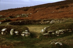
Fig.15 Remains of hut at Ty Mawr on Holyhead Mountain.
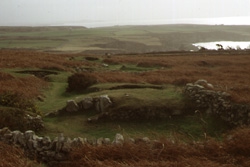
Fig.16 Remains of hut at Ty Mawr on Holyhead Mountain.
Ty Mawr is a large group of mostly circular stone huts situated
on the southern slopes of Holyhead Mountain. The huts lay below
an ancient hillfort and are associated with fields which were
enclosed and cultivated by the inhabitants. Much attention has
been paid to the prehistoric phase of the hut settlement. Late
Roman use of the mountain, perhaps as a naval lookout station,
is suggested by traces of a signal tower and by a hoard of 22
Theodosian coins, including a clipped siliqua of either
Arcadius or Honorius.FN287 Roman pottery and third- and fourth-century coins associated with the huts were discovered by early excavators,
though more recently the identification of the group as a Romano-British
village has been questioned.FN288
Excavations by Christopher Smith in 1978 to 1982 strongly indicated
sub-Roman occupation in the eastern part of the Ty Mawr group.
Radiocarbon determinations placed two of the huts (T3 and T4)
in the sixth century AD, and indicated the re-use of an older
structure (T1) in this period as well as an episode of cultivation
in the ancient fields.FN289 Determinations from the site were taken from a large midden of shellfish (mainly limpet) and the charred
remains of naked barley and spelt found in "hearths"
in the sixth-century huts.FN290 Though the original roundhouse may have been reoccupied, Smith noted that the two sub-Roman huts
were smaller and more rectangular than the much earlier hut-circles.FN291 Known locally as Cytian'r Gwyddelod, "the cottages (or huts) of the Goidels (or Irish)," Ty Mawr may have hosted
Irish immigrants in the late or sub-Roman periods, though the
name could alternatively refer to indigenous occupants.FN292
Bourton was a thriving Roman settlement which developed near the native hillfort of Salmonsbury.FN293 One excavated Roman structure yielded a coin of Valentinian sealed beneath a pavement, and a coin of Honorius was also found on the site.FN294 The coins, along with a sherd of fine wheel-turned grey-ware pottery, possibly Merovingian, suggests continued activity through the fifth century.
The Roman legionary fortress at Chester was altered dramatically
at the end of the third century, when its barracks were completely
demolished. The Chester legion, legio XX Valeria Victrix,
does not appear in the Notitia Dignitatum, and coinage
inside the fortress seems to have run out about 373.FN295 Recent excavation has shown, however, that the administrative buildings
at the center of the fortress remained in use after the barracks
were demolished and were even refurbished in the fourth century.FN296 Strickland sees fourth-century Chester as "purely an administrative centre, surrounded by acres of [paved] open space, where a field
army, when it did eventually come to base, could occasionally bivouac."FN297
It is possible that this administrative role was continued by
Chester even after the troop withdrawals of the early fifth century.
When buildings were destroyed in the third and fourth centuries,
their stone was often used for street-paving, and excavation has
shown that these subsequent road surfaces (late fourth/early fifth
century) were worn smooth.FN298 At the Abbey Green site, excavators
uncovered a large (11m x 5m) timber-framed building constructed
on drystone sleeper walls with a gravel and flagged floor.FN299
This building, aligned along the Roman street, apparently underwent
several modifications in the fifth and sixth centuries datable
by the presence of amphoras and red color-coated vessels
imported from the Mediterranean. Higham sees the imported pottery
as a sign that Chester's port was still in operation, with a flourishing
church in the city causing a demand for wine and oil.FN300
The Laings interpret this as evidence that Chester was the sub-Roman
civil administrative center of the kingdom of Powys.FN301 The remains of metalworking (both iron and bronze) found at the Abbey Green
site could support the theory of high-satus occupation continuing
in the city.FN302 Although, as yet, the archaeological evidence of sub-Roman occupation in Chester is sparse,FN303 the literary evidence amply testifies to a continuing British presence. Bede
records two notable events occurring in or near the city at the
turn of the seventh century. The first is a council of Welsh church
leaders c.601 called in response to Augustine's demands for British
obeisance.FN304 After the Britons reject the new archbishop of Canterbury, Bede records (gleefully) the destruction of a British army, along
with 1200 British monks, at the Battle of Chester (ad civitatem
Legionum) in 615.FN305 Nennius, a century later, lists Chester (in urbe Legionis) as the site of Arthur's ninth battle
against the Saxons in the sixth century.FN306 Chester has also been suggested as the base from which St Germanus set out to win the
Alleluia Victory in 429.FN307 According to the Anglo-Saxon Chronicle, Chester's Roman defenses were in such good shape in the year 894
that they were used by a band of Danes to withstand a two-day
siege by English levies.FN308
Cirencester was Roman Britain's "Second City," after
London, and contained flourishing mosaic and sculpture workshops.
But the evidence for late Roman Cirencester produces a mixed picture
of continued occupation and decay. The floor of the forum was
quite worn down, but it was also kept clean and apparently the
market flourished here after the cessation of coins.FN309 The Verulamium Gate underwent the refacing of its tower, the rebuilding of the
front face of the wall, and the provision of a sluice gate and
other flood-prevention work which has been dated on ceramic evidence
to the beginning of the fifth century.FN310 A roadside ditch beside Ermine Street yielded evidence that the road also remained well-used
(and often repaired), until grass began to grow on it and two
unburied bodies were left to rot in the ditch.FN311
There is good evidence for an early Christian presence in Cirencester.
As the administrative capital of the province Britannia Prima,
Cirencester was likely the see of a bishop, and it has been suggested
that the British bishop missing (but represented by a deacon)
at the Council of Arles was from Cirencester.FN312 A Christian palindrome, whose letters can be rearranged to form a cross from the words
PATER NOSTER, was found carefully scratched into the wall plaster
of a house on Victoria Road. It clearly dates from a time when
open references to Christianity would have invited persecution.FN313 Excavations at Cirencester's urban cemeteries have yet to
yield any clues about this Christian presence. Of the over 400
skeletons exhumed, most were of fourth- or early fifth-century
date.FN314
An accumulation of silt and debris in roadside ditches signals
that Cirencester began to decline in the middle of the fifth century.
At that time, the city population seems to have abandoned their
old dwellings and resettled inside the town amphitheatre. In the
amphitheatre, which lies just outside the city walls on the Fosse
Way, there is abundant evidence of timber buildings and road and
wall repairs dated, from associated coins and (grass-tempered)
pottery, to the late fifth century.FN315 This has been interpreted as a shrinking city population moving into a smaller and more
easily defended area, perhaps to flee disease and epidemic. There
is ample evidence of this process from Gaul and Dacia, where Roman amphitheatres
were converted into miniature fortified towns.FN316 The ceaster of Chesterton, the modern district wherein the amphitheatre lies,
may refer to this fortified settlement.FN317
Was it, then, the amphitheatre of Cirencester rather than the
city itself that fell to the Saxons in the Battle of Dyrham in
577? Excavation has revealed no signs of violent destruction in
the city. "It may be that the population of fifth century
Corinium was no more than a collection of farming families,"
write Reece and Catling.FN318
Droitwich began as a Roman fort established to supervise salt mining at the local brine springs.FN319 One late Roman aisled house contained a paving which sealed a coin of Honorius.FN320 Traces of timber frame buildings also support the view of post-Roman activity continuing at the town, while mining activity certainly continued into the Anglo-Saxon period. At the Upwich Pit, a series of ten brine-boiling hearths and several stake alignments were constructed, the hearths still containing ash and charcoal residue from the processing of salt through this brine-boiling method.FN321 Radiocarbon determinations from the char coal residues provided dates of between cal AD 435±95 and cal AD 630±30. Sub-Roman to Anglo-Saxon continuity seems likely from the presence of an assemblage of grass-tempered wares, pagan "Anglo-Saxon" stamp-decorated pottery, and fragments of "Anglo-Saxon" fabrics. References to Saltwic are found throughout middle and late Saxon charters.
Two Roman villas at Frocester have produced fifth-century burials, with one of these--Frocester Court villa--producing evidence of sub-Roman timber structures.FN322 The stone buildings at Frocester Court were inhabited until the end of the fourth century, though one room had been converted into a stable. In the early fifth century, the villa residents abandoned the stone house and erected at least two timber structures in the courtyard. One building, 14m x 3m, appears to have been a hall built on sill beams laid flat (no post-holes were found) on a floor of stone and gravel. Around this building and in and under its floor were dozens of sherds of grass-tempered pottery. A second structure, 12m x 9m, was erected across part of the courtyard hall and defined by a timber beam-slot and internal post-holes. Four graves found in the courtyard have also been identified as fifth-century burials. Heighway sees Frocester as a significant fifth-century center in Gloucestershire, "perhaps a rural market." FN323
The military presence in Gloucester in the years leading up to
400 seems to have been very high. The late Roman walling of the
city was likely part of a scheme to fortify all the major settlements
along the tributaries of the Severn River, to control Irish or
Saxon raids up the Bristol Channel.FN324 Gloucester's forum area was in continuous use after the forum itself had been dismantled
in the late fourth century, with timber structures replacing stone
and evidence of re-planning in the town center in the early fifth
century.FN325
Coin evidence associated with the last phase of metalling indicates
that the whole forum may have been resurfaced after 390.FN326 A
colonnaded stone stucture near the forum was demolished c.370
only to be replaced by a timber building which yielded a radiocarbon
date of AD 430±80.FN327 The new timber structure may
have been a sub-Roman market booth, for it contained a quantity
of bones believed to represent butchery waste. Elswhere, a coin hoard, with several coins
of Honorius and Arcadius, seems to have fallen from the rafters
of one building and lay on top of debris.FN328 Two or three subsequent occupations overlay the deposition of Fel. Temp. Reparatio
imitation coins on Berkeley Street.FN329 A coin of Valens (364-78) was found beneath a mosaic on Southgate Street, while a
Roman building in the Blackfriars district was modified late and
continued to be used throughout the Saxon period.FN330 Ornamental metalwork, shell-tempered and Oxfordshire wares, and imported
pottery (fragments of North African amphoras) testify to
occupation continuing into at least the late fifth century.FN331
A late or post-Roman cemetery at Kingsholm may tell us more about
this community.FN332 That there were Christians in this community is indicated by a sub-Roman timber mausoleum, containing the skeleton
of a male with silver belt-fittings, found overlying a Roman building
and beneath the Saxon chapel of St Mary de Lode.FN333 According to the Anglo-Saxon Chronicle, Gloucester fell to the Saxons
at the Battle of Dyrham in 577. If this entry is accurate, the
city was then under the control of a king named Conmail. The late
Roman earthwork defenses which surrounded the city would have
made it an attractive residence for a sub-Roman king.FN334
In the Milton Keynes area, both the rural site of Bancroft and the vicus at Dropshort (Magiovinium) have produced coins of Arcadius.FN335 At Bancroft, late Roman and early Saxon pottery overlap each other in the same assemblage.FN336
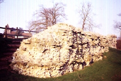
Fig.17 Remains of the Roman wall circuit at Silchester.
Silchester is one of the few former Roman cities in Britain that
did not evolve into a medieval and modern town. Thus, the circuit
of its Roman walls survives almost completely intact, and excavation
of the now-vacant interior has revealed the most complete plan
of any Roman town in Britain. The undisturbed nature of Calleva's
remains gives hope, as well, that we may learn more about the
nature and survival of such towns in the fifth and sixth centuries.
There are numerous signs of new structures and activity in fourth-century
Silchester, though the character of occupation was perhaps changing.
By 300 the basilica ceased to be used as a public building, being
divided by partitions and reorganized as a metal workshop.FN337
As late as 320 large-scale renovations were taking place at the
baths, while numerous Theodosian coins (including a bronze coin
of Arcadius, c.395-402) attest to activity at the forum.FN338 Sometime during the fourth century the walls of the amphitheatre were torn
down, while the inn and one of the temples contained coins of
Valens (364-78).FN339 Some of Silchester's townhouses were given fourth-century mosaics (associated coins run down to Honorius),
while the south-east gate "was deliberately blocked in the
Roman or sub-Roman period" to control traffic
moving in and out of the city more easily.FN340 An unusually large number of very worn late Roman coins (including a siliqua of Constantine
III, c.407-11), a North African ceramic lamp (c.395-420), fragments
from late Roman glass vessels, and bronze accessories (pins, buckles,
a bracelet) signify economic activity continuing at Silchester
for much of the fifth century.FN341
The most interesting fourth-century structure at Silchester is
the "basilican church" discovered near the forum in
1892.FN342 This very small building (13m x 9m) has been the focus of much attention, not least because it was the first Roman structure
in Britain to be convincingly identified as a Christian church.
The identification is based on the building's plan, which is similar
to Old St Peter's in Rome, and the discovery of a "baptismal
font" (a square foundation of brick and an associated pit)
near the main entrance.FN343 No significant dating evidence (apart from some third-century pottery sealed beneath the floor) was
found during the 1892 and 1961 excavations, though the plan suggests
a late fourth-century erection and some later reconstruction.FN344 Only a few Christian objects have been found at Silchester,
and none in direct association with the basilica. The Christian
community, such as it was, must have been small, though the proximity
of the church to the Forum suggests that they were not without
influence.
If we look at the material evidence for the fifth and sixth centuries
in Silchester, apart from the Roman structures, we see a noticeably
"Celtic" element asserting itself. In addition to Roman
metalwork of late fourth- or early fifth-century date, there is
a relative abundance of evidence of pins and penannular brooches
whose affinities are Irish and Scottish. Along with this evidence
there was found, in a Roman well, a tombstone inscribed with Ogom
characters commemorating one EBICATOS in Irish text.FN345 This
figure has been seen as an Irish pilgrim or mercenary, and his
tombstone has been assigned various dates from c.450 to 700.FN346
It is by far the most easterly find of an Ogom inscription in
Britain, and contrasts with the early Saxon material found at
nearby towns like Winchester and Dorchester-on-Thames. The few
Saxon finds from Silchester belong to the seventh century and
later.FN347
Fitting into the notion that Silchester was a "Saxon-free
zone" during the fifth and sixth centuries is a series of
dykes which surround the town, the most substantial of the earthworks
known as Grim's Bank. It was first proposed that Grim's Bank was
constructed after the battle of Badon Hill (c.500) as a boundary
between Briton and Saxon lands. This view has now been altered
a bit, some now preferring a date of c.450 and seeing the dykes
as the boundary of a British kingdom or sub-Roman civitas
of sorts centered around Silchester.FN348 This "civitas"
likely survived as a center of British power up to the seventh
century, when there begins to appear an abundance of Saxon finds
in the area. There are, it should be noted, no signs of widespread
destruction at Calleva itself.FN349 Silchester's transition from British to Saxon control appears to have been both late and
non-traumatic.
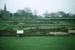
Fig.18 Excavated remains of the Roman settlement at Wall, Staffordshire.
The small fortified town at Wall, in Staffordshire, is one of five situated along Watling Street forming what was likely a chain of posting stations along the Welsh frontier.FN350 Coinage from stray finds and excavations runs down to the end of Roman occupation, and a single bronze bowl bearing a Chi-Rho monogram (which contained a now-lost Roman coin hoard) suggests Christian activity in the fourth century.FN351 Although no fifth-century artifacts have been found at Wall, there is some literary evidence for sub-Roman occupation. Gildas mentions that there were twenty-eight cities in sub-Roman Britain without listing them; Nennius does list them, and includes Wall (Cair Luitcoyt) among the likes of London and Dumbarton.FN352 Nennius (or the original compiler), thought to have been writing in Wales in the ninth century, is probably listing ancient settlements thought to have been important or whose names were still known in his day.FN353 This is verified by a mention of a raid on Wall (Caer Luydcoed) in an early Welsh poem called Marwnad Cynddylan ("The Lament of Cynddylan").FN354 Shown to date from the seventh century, the poem describes a raid in which neither the bishop nor "the book-holding monks" were spared, suggesting the presence of an organized Christian community in Wall at that date.FN355
Not much is know about the Roman small town of Worcester. The
only Roman structure identified at Worcester is a circular building
thought to be a temple or shrine, while traces of timber-framed
buildings have been excavated in nearby Sidbury. The only traces
of the town's fortifications are northern and eastern sections
of a ditch which originially formed a circuit. It seems likely
that some form of these defenses must have been standing when
the Saxons arrived for them to have named their settlement Weogornceaster,
"Roman walled town of the people called Weogora."FN356
Worcester has produced some fourth-century coins and pottery and
unbroken glass vessels. Under the refectory of the Norman cathedral
lay two burials probably belonging to the sub-Roman period.FN357
Grave one contained a skeleton of a man (age 25-30), fragments
of very fine spun gold (around the skeleton's neck), a few sherds
of Roman pottery, and a single post-hole was also identified. The bones yielded (uncalibrated)
radiocarbon dates of AD 536 (429-643) and AD 585 (483-687). The
gold thread was woven into a brocade, probably the border of a
cloth garment, perhaps a priest's hood or collar. Bassett has
shown (through charter evidence) that St Helen's parish church
also originated as a Roman or British church before it became
the property of Hwiccan rulers and, subsequently, an Anglo-Saxon
see (c.680).FN358 Hwiccan conversions before (and possibly leading
to) the creation of the see would then have been the work of British
Christians in and around Worcester.
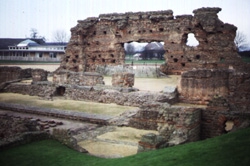
Fig.19 Remains of the "Old Work" (baths basilica) at Wroxeter, site of a sub-Roman timber complex.
Wroxeter is the Roman site that has yielded the most archaeological
evidence for occupation and activity during the sub-Roman period.
Philip Barker's meticulous excavations have revealed, in detail,
the phases of repair and reconstruction which made Wroxeter a
thriving city in the fifth century while its fellow cities were
in sharp decline.
After the Roman Conquest, the Cornovii seem to have given up their
local hillfort, the Wrekin, and moved in or near the town growing
around the former legionary base at Wroxeter. It was not until
after Hadrian's visit to Britain that funds were sufficient to
build a forum and basilica, but slowly Wroxeter grew into a prosperous
civitas capital. Though Wroxeter no longer quartered a
legion, the Cornovii continued to raise a militia on their own
(some of whom were absorbed into the regular army as Coh. I
Cornoviorum) showing an ability to protect themselves
and their town.FN359
Decline appears to have set in at the beginning of the fourth
century, when the forum was destroyed and the main baths
went out of use (though the frigidarium quite possibly
continued to be used).FN360 The forum was still used as an open market, but civil activity gradually moved to the basilica in
the baths complex. This building had been refloored in the late
third century, repaired, then refloored three more times up to
375.FN361 At this point it ceased to have a public function, and instead was turned into an industrial complex with ramshackle
buildings, pits, and a furnace constructed in the interior. Again
the floor showed wear, and associated coins date this activity
to c.388-92.
This complex did not last long, however, for it too seems
to have been cleared by about 402. At this time the basilica's
roof and clerestorey were carefully removed, along with all interior
walls and columns, leaving an empty shell. The pits in the floor
were filled and some of the tile was used to make a path, presumably
to give pedestrians safe passageway through the area.FN362 This phase appears to have lasted only a short while after the coin
series ends.FN363
For most cities of Roman Britain, this would have been the last
evidence of the final chapter of occupation. But at Wroxeter,
remarkably, we have evidence that construction resumed in this
period, in not one but two subsequent phases. The middle of the
fifth century witnessed a major redevelopment on this site, most
accurately described by the excavators themselves:
Much of the north wall of the basilica was demolished and dug out in places to well below floor level, and tons of rubble were laid down as building platforms. . . . It formed the foundation for a large timber-framed two-storied winged house, perhaps with towers, a verandah and central portico. . . . The building covered about half of the nave and stretched [to about125 feet long and 52 feet wide]. . . . On its western side, a long thin mortar and rubble platform marked a second building, [extending about 80 feet], which appears to have been something like a loggia solid-walled on the north side and columned on the south. To the east . . . a substantial smaller building was put up against the eastern wall of the basilica. Its structure was most unusual for this phase in that it was built of mortared stone. . . . On the western side [of the former south aisle], five regular platforms of rubble 8m x 2.5m . . . carried buildings leaning against the south wall of the basilica . . . but the rest of the aisle was clear of any buildings leaving the entrance to the frigidarium accessible. . . . One possible use [of the frigidarium] might have been as a small church or chapel or, since some charred grain was found in this room . . . it may have been used as a granary. . . .
On the western portico, a series of buildings was constructed around the main doorway. . . . Each of these buildings was reconstructed several times during the lifetime of [the timber hall]. A further building was constructed at the junction of the west and north porticos.
The east-west street now saw some remarkable, if not unique, modifications. . . . Both ends of this 'gravel street' were revetted and had ramps or steps to provide pedestrian access. . . . North of the gravel street, the southern frontage . . . was covered by a range of timber buildings which seem to have been either shops or residences. Some were placed long side onto the street, others had impressive porticoed facades. Nearly all were rebuilt at least once. . . . FN364
These impressive structures have been described as "the last
classically inspired buildings in Britain" until the eighteenth
century.FN365 But their interpretation is difficult. Though the complex has "the hallmarks of Roman public works, only constructed
with timber,"FN366 the excavators see it more as a villa than a public building, perhaps the residence of a tyrannus
like Vortigern.FN367 "Thus we have [at Wroxeter] a powerful character," agrees Webster, "building himself a kind
of country mansion in the middle of the city, surrounded with
small buildings, which are either stables or . . . houses for
his retainers."FN368 Philip Dixon, however, sees part of the complex as incorporating "a covered street, similar to a
shopping mall."FN369
After an unknown period of use, these elaborate structures were
deliberately dismantled and removed and two smaller buildings
were constructed at the western end of the basilica. The excavators
have suggested 550 for this construction, though no strictly datable
materials were found.FN370 Finally, an inhumation burial was dug into the now-abandoned area just south of one of the buildings.
Radiocarbon dating of the remains has yielded a date of 610±60.FN371
Associated coinage gives a terminus post quem of
c.375-402 for the early phases of construction, while the radiocarbon
determinations give a date of around 600 for the possible abandonment
of the site.FN372 Can we be more precise about the dating of
the extensive rebuilding in the middle phase? A single find of
imported pottery, an amphora (probably carrying wine) from Gaza,
links Wroxeter with similar finds at London and Cadbury-Congresbury,
but a late fifth- or early sixth-century date is the only one
yet being offered.FN373 Most intriguing of all is the memorial stone, whose inscription commemorates an Irishman named Cunorix,
found just outside the Wroxeter defenses.FN374 Kenneth Jackson
dated the inscription to the late fifth century, and many have
seen this Cunorix as an Irish mercenery hired to protect the city.FN375
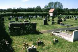
Fig.20 Site of the late Roman cemetery at Ancaster.
A vicus or small town developed alongside the Roman fort at Ancaster, but the character of that settlement is not clear. Outside of the defenses, to the west, excavators uncovered a late Roman cemetery containing over 300 inhumations. Most were stone-lined graves or wooden coffins aligned east-west, and few contained associated grave-goods, leading some to speculate that this was a Christian cemetery.FN376 Coins found in one grave date to the 360s, but it is possible that the burials continue into the fifth century.FN377 Though no artifacts of this period identified as "Anglo-Saxon" have been found within the town, a cemetery to the south-east has yielded 40 cremation urns, common in pagan Saxon cemeteries.FN378
Excavations at Ardwall Isle, off the Kircudbright coast, have revealed significant evidence of an early medieval Christian community. Thomas has assigned the early medieval activity to three phases.FN379 Phase I, which is thought to have begun in the late fifth century, describes an unenclosed cemetery with inhumations surrounding a small rock-cut hollow (identified by Thomas as the bottom of a "slab-shrine"). During Phase II, perhaps in the seventh century, this cemetery was succeeded by another, whose graves were aligned on the axis of a "corner-post" shrine, with post-holes perhaps representing a timber oratory or chapel. Grave-markers accompanying the Phase II burials included slabs with incised crosses and what appears to be a portable stone altar.FN380 Phase III saw further aligned burials and a stone chapel and hut. Thomas interprets much of this evidence as a sign of increasing Irish influence in the area.FN381
At Binchester, a fort just south of Hadrian's Wall, occupation continued after the introduction of the latest coins (of Magnentius, 350-53) and of pottery from the Crambeck kilns (conventionally dated post-370).FN382 The praetorium had an undisturbed rubbish deposit in its yard, suggesting that it decayed naturally and was possibly in use in the fifth century.FN383 But there was a change in the character of occupation during this period, as military buildings were put to non-military purposes. By the sixth century, "Anglo-Saxon" burials and artifacts begin to appear.FN384
This native dwelling showed signs of occupation in both the Roman and early medieval periods, with several alterations spanning that time. Radiocarbon samples taken from timber stakes yielded dates of 370±50 AD and 520±50 AD.FN385 Decorated wooden objects were preserved in a slumped hollow between the fifth-century house and its seventh-century framework.
Christianity may provide the evidence bridging the gap between the Roman and sub-Roman communities in Carlisle. Evidence: of an early Christian community consists only of a tombstone and a gold ring with an incised palm branch; but Thomas has argued that, as a civitas capital, Carlisle must have also been a bishopric, and perhaps the bishopric of the British saints Ninian and Patrick.FN393 When St Cuthbert visited Carlisle in the seventh century, he was greeted by a man described as praepositus civitatis, and was able to walk along the town walls and see a working fountain (implying that there was still a functioning aqueduct in the city).FN394 Burnham and Wacher point out that these are strong signs of continuity: "In this way the Church, as in many other parts of the western empire, would have formed the bridge by which a moderately civilized Romano-British community was maintained and eventually transformed into an English one."FN395
The vicus which grew up inside the Roman fortress at Catterick
shows strong signs of continued occupation in the fifth century.
One building was altered in the last decades of the fourth century,
when an apse was added to its west end. "This apsidal building
remained in use long enough for occupation material to collect
on its floors," write Burnham and Wacher, "after which
it fell into decay, with soil accumulating around its walls and
over its floor."FN396 Some time later a timber-framed house
was built on top of the earlier stone building, its walls on a
different alignment, which must (on stratigraphic grounds) be
attributed to the fifth century. Other timber structures share
similar structural features and would appear to be of the same
phase.FN397
It would appear that a substantial Romano-British settlement still
existed at Catterick," write Burnham and Wacher, "sheltered
by its massive walls, at least in the first part of the century...."FN398 But can we extend this "Romano-British"
occupation to the late sixth century and the Battle of Catraeth?
The poems of Taliesin seem to equate Catterick with Catraeth,
the seat of King Urien of Rheged and the destination of the warriors
in the Gododdin of Aneirin.FN399 Alcock has questioned this
identification, pointing out the early Saxon material (a Grubenhaus,
pottery, brooches, and assorted military items) found in and around
the vicus, which has produced no identifiable "British"
items of the sixth and later centuries.FN400 While both Alcock
and Wacher agree that Catterick is most likely the site of the
Battle of Catraeth, it is less clear when this settlement finally
came into Anglian hands.
Doon Hill is the site of the only completely excavated plan of
a northern British Hall. Within a polygonal palisaded enclosure
lies Hall A, a massive rectangular timber building (70ft x 32ft) with slightly tapering end bays, two central doors, and the
lateral division of a central hall with private apartments at
each end.FN401 It parallels both the large hall at South Cadbury
and another northern British hall at Balbridie.FN402 "Doon
Hill A was certainly an impressive building," writes Alcock,
"and taking account of the surrounding palisade, we should
see it, in British terms, as a princely neuadd [hall] set
within the appropriate llys [court]."FN403
"Doon Hill might be representative of an archetypal British
form," adds Hope-Taylor, "from which 'Yeavering-style'
building could directly have been developed, . . . a product of
the sixth or possibly the fifth century AD."FN404 But there
seems to be a bit of confusion concerning the date of Doon Hill
Hall A. It was superseded by a second hall (Hall B) which was
built according to a different plan, one which more closely resembles
the hall at Yeavering. The Yeavering hall has been dated c.640
so Doon Hill Hall A must have been built prior to this time, before
the Angles reached Din Eidyn (Edinburgh) in 638.FN405 It
appears that Doon Hill represents, like Yeavering, a British stronghold
taken over by Anglian expansion in the seventh century.FN406
Castle Rock, Dumbarton--Alt Clut in the British tongue--lies
on the north shore of the River Clyde in the heart of the British
kingdom of Strathclyde. Bede calls it both urbs and civitas
Brettonum munitissima, and Adomnan insists that King Roderc
of Strathclyde "ruled on Clyde Rock."FN407 With its twin
summits and picturesque castle, there has been much speculation
about this craggy citadel.
Leslie Alcock's excavations at Dumbarton in 1974 and 1975 revealed
no coherent defensive plan, but an area on the eastern spur revealed
exciting evidence of sub-Roman occupation. There were the remains
of "a dry-stone terrace or fighting platform, laced and revetted
with timber beams."FN408 Radiocarbon estimates from the oak
timbers of the terrace suggest either that it had been built in
the sixth century and repaired in the seventh, or that it was
a work entirely of the seventh century.FN409 Like the ramparts
at the Mote of Mark, this structure too was destroyed by fire,
probably as a result of a Viking siege in the ninth century..FN410
The artifactual evidence from Dumbarton, however, points to a
fifth- and sixth-century date for the occupation. Finds include
sherds of amphoras from the eastern Aegean and south-west
Asia Minor (probably containing wine), Gaulish kitchenware, Merovingian
glass, and jewelry-making debris.FN411 "This [evidence] points
clearly to Alt Clut as one of the dynastic centres of Strathclyde
by the time of Rhydderch [Roderc] if not earlier," writes
Alcock. "We must think of [Bede's] civitas . . . in
an organizational sense, as an administrative and social centre."FN412
The notion that the forts along Hadrian's Wall were abandoned following the troop withdrawals of Magnus Maximus and Constantine III was accepted for a long time. Now it is absolutely clear that the Wall was not abandoned, for excavation is revealing plentiful evidence of occupation continuing at the Wall forts after new coinage ceased to arrive in the early fifth century.FN413 In fact, archaeologists have recently discovered new timber structures being built inside some of the forts which indicate occupation into the sixth century and beyond.
Castlesteads is unique among the Wall forts in being built between the Vallum and the Wall. Radford identified a Class-I inscribed stone at Castlesteads which is thought to be of sixth-century date.FN414
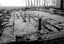
Fig.21 Remains of a granary at Birdoswald fort.
Birdoswald fort was built to guard the Irthing bridge crossing. Recent excavations here have revealed the re-use of Roman military buildings as domestic structures in the fifth century, associated with the latest Romano-British pottery found in northern BritainFN415 Two Roman granaries were, in their final stages, reconstructed and used for human occupation. One of these new structures. termed "halls" by the excavators, was a modification of the south granary, while the other was built after the north granary had collapsed, partly overlying the granary, and partly overlying the adjacent Roman road.FN416 Under the floor of the south granary was a fill of earth and rubbish containing Huntcliff and Crambeck Wares (late fourth to fifth centuries), and a hearth found at one end of the this "hall" contained a Roman gold and glass earring (later fourth century). Traces of fifth-century British metalwork were also uncovered, and on the other side of the fort an "Anglian" pin and brooch (eighth century) was found in the 1950s.FN417
Chesterholm is the site of several forts, the first timber fort being part of the old Stanegate frontier system. An earthen bank piled against the fort wall suggests the possibility of post-Roman fortifications. Evidence for internal occupation in the sub-Roman period includes an "Anglo-Saxon" style annular brooch (sixth century?) and a fifth- or sixth-century penannular brooch, both found within the fort.FN418 Outside the fort was found a Class-I inscribed tombstone (dated late fifth or early sixth century) which commemorates the death of one "Brigomaglos."FN419 Thus, at Chesterholm we have a curious mixture of Romano-British and Germanic elements within the same community, suggesting the possible presence of Germanic merceneries.
Housesteads fort is the best preserved site on Hadrian's Wall. A seemingly prosperous vicus, with numerous shops and temples, grew up to the south and east of the fort. A defensive earthen bank was built after the fort's stone walls, and evidence of internal occupation includes sixth-century "Anglo-Saxon" pottery and metalwork.FN420 It has also been suggested that some of the population of both Housesteads and Chesterholm relocated inside the Iron Age hillfort at Barcombe, which seems to preserve part of the name Vercovicium.FN421
Chesters was a bridgehead fort guarding the point where the Wall crosses the North Tyne river. Post-Roman occupation inside the fort is indicated by an "Anglo-Saxon" annular brooch of the sixth or seventh century.FN422
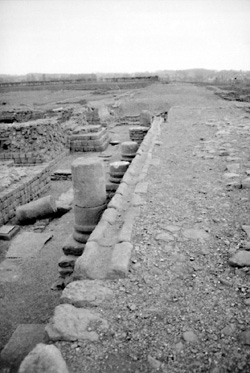
Fig.22 The main street at Roman Corbridge.
Corbridge is a fort two miles south of the Wall which dates back to the first century. Like Housesteads, a large and prosperous vicus grew up around the stone-walled fortress. The main street of the town received its last resurfacing in the latter half of the fourth century, and a hoard of 48 gold coins found in Corbridge dates to this period.FN423 Other coin finds (nine coins of Arcadius and Honorius) show that the town was occupied at least to the end of the fourth century.FN424 Fifth- and sixth-century finds withinthe fort include "Anglo-Saxon" pottery and brooches.FN425
Benwell fort was named by its Roman inhabitants "The Place with a Fine View." Sixth-century "Anglo-Saxon" glass and metalwork was found near the fort.FN426
South Shields fort is the easternmost settlement along the Wall, built to protect
supplies entering the mouth of the River Tyne. Around 400, the
south-west gate went out of use and a large ditch was dug in front
of it.FN427 Subsequent to this, the ditch was filled in and a newapproach road was laid, and the gate--by this time in ruins--was
replaced by a new gate passage contructed in timber. Associated
finds include a gold solidus of Magnus Maximus, which has
been dated to 388,FN428 and an "Anglo-Saxon" spearhead.FN429
Outside the fort was a small inhumation cemetery, possibly fifth-
or sixth-century.FN430
Other miscellaneous finds from the Wall include an "Anglo-Saxon"
spearhead from CARVORAN (Magnis) and a horde of late Roman
coins (including one of Honorius) thrown as a votive offering
into Coventina's Well at CARRAWBURGH (Brocolitia).FN431
If, as it appears, the Wall was not completely abandoned when
coin payments stopped arriving after 410 what became of the soldiers
stationed there? According to Breeze and Dobson, "we must
accept that the soldiers of the Wall returned to the soil from
which they had sprung"; i.e. back to the British communities
into which they had been born or into which they had married.FN432 Some undoubtedly remained as paid protectors of these northern
vici, while others would have gravitated toward the new
political and military powers of the north: Rheged, Strathclyde,
and Manau Gododdin.FN433
Kenneth Dark has recently surveyed the fifth- and sixth-century
evidence from the Wall and has developed an interesting scenario.
The timber halls, inscribed tombstones, and post-Roman defenses
are seen as secular high-status British re-use of the Wall forts,
perhaps as a continuation or revival of the command of the Dux
Britanniarum.FN434 The presence of early Anglo-Saxon weapons
within these Romano-British settlements is interpreted as a sign
that the Britons were hiring Germanic mercenaries, as indeed Gildas
says they were doing. "We may have, then," writes Dark,
"a pattern of probably secular high-status British reuse
of a series of Wall-forts, and possibly the installation of Anglo-Saxon
merceneries at them, and of the sub-Roman occupation of the nearby
Roman-period towns of Corbridge and Carlisle."FN435
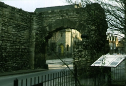
Fig.23 The still-standing North Gate of Roman Lincoln.
The Colonia Domitiana Lindensium, or Lindum, succeeded
an earlier legionary fortress at Lincoln. Little is known about
the streets and buildings of the colonia, which lies beneath
the medieval castle and cathedral in the heart of the modern city.
Thus, most conclusions about sub-Roman Lincoln have been drawn
from what has not been found rather than from what has.
Wacher points out that there are remarkably few zoomorphic buckles
and fittings of the late Roman army in all of Lincolnshire, and
only one in Lincoln itself.FN436 There are no early Anglo-Saxon
settlements attested in or near Lindum (the closest is
some two miles north of the modern city limit), while a sixth-century
king of Lindsey has an unmistakably British name Caedbaed.FN437
When an Anglian settlement finally does appear at Lincoln in the
late seventh century, Bede tells us that the ruler in the area
was a praefectus Lindocolinae civitatis, giving the British
form (Lindocolina) of the city's name.FN438
Excavations at Lincoln have revealed some positive evidence for
survival of occupation into the sub-Roman period. Street surfaces
within the city were repaired in the fifth century, and there
have been stray finds of imported Mediterranean pottery and a
pin of "Celtic" design which could prolong occupation
into the sixth century or later.FN439 Evidence: of a possible Christian
community at Lincoln comes from the courtyard area at the forum.
There, beneath the graveyard of a seventh-century Anglian church,
lay other burials which have yielded radiocarbon dates centering
in the fifth century.FN440 It has been suggested that a timber church,
destroyed by the construction of the Anglian stone church, was
built on this site c.400 with a sub-Roman cemetery laying close
to its walls.FN441
The Mote of Mark is set on a craggy hillock rising above a side
estuary of the Solway Firth. Its summit is enclosed by a timber-reinforced
stone wall, which was clearly destroyed by fire at some point
in the site's history. The enclosed area is approximately 75m
x 35m, but much of it is covered with rocky outcrops. Excavations
in 1913, 1973, and 1979 uncovered an enormous amount of jewelry
and metalworking debris, including what may be the first instance
of Celtic interlace.FN442
There has been much debate concerning the nature and date of this
fort. At first, excavators thought that they had uncovered an
Iron Age hillfort reoccupied in the eighth century. The subsequent
finds of imported Gaulish pottery and "Germanic" glass
indicate occupation in the fifth and sixth centuries, while radiocarbon
samples from the rampart show that it too was a post-Roman construction.FN443
There is no evidence of Iron Age occupation at the Mote.
More accurate dating thus depends upon the stylistic evidence
of the jewelry along with the imported pottery. Laing has argued
that the brooches and pins as well as the interlace-decorated
molds are purely "British" in style and are contemporary
with the pottery, giving a sixth-century date to the industrial
activity at the Mote.FN444 His opponents argue that the interlace
is zoomorphic and belongs to a later, seventh-century Anglian
phase.FN445 Alcock has pointed out that the fortification of hilltops
was quite unknown in Anglo-Saxon Northumbria, and thus the ramparts
at the Mote of Mark must pre-date Anglian settlement.FN446 He suggests
that the site was a British industrial foundation of the sixth
century, whose jewelry industry was taken over by the Angles in
the seventh.FN447 Laing, on the other hand, dates the initial British
occupation to the fifth century, with a defensive rampart built
in the sixth, and believes that the site was abandoned when the
Angles arrived in the seventh.FN448
There is also much debate on how to classify the site. The defensive
rampart would suggest that the Mote of Mark is one of the many
fortified hilltop settlements which appear throughout the "Celtic
fringe" in the sub-Roman period. Alcock, who has excavated
several of these, sees the Mote as "a princely llys
[court] with an attendant jeweller."FN449 But the profusion
of jewelry-making debris suggests that the Mote could have been
a purely industrial site, with its own defenses, which continued
functioning as such after its ramparts were destroyed by fire
and Angles controlled the territory.FN450 "They took over the
industrial activities of the Mote," writes Alcock, "and
no doubt its British craftsmen as well, and exploited them vigorously
for the production of elaborate jewelry in an early Anglo-Celtic
style." FN451
The Roman fort of Ravenglass has yielded an unusually large quantity of late fourth-century pottery, "probably several hundred vessels."FN452 Pottery and coinage bring the occupation at Ravenglass most likely to the early fifth century, whence it may have fitted into a "localized system of defense."FN453 Ravenglass has also been suggested as a candidate for the hometown of St Patrick, Glannoventa possibly being corrupted as Banna Venta.FN454

Fig.24 Excavations of the sub-Roman community near the medieval Priory at Whithorn.
Bede tells us that the first Christian missionary in Scotland
was a bishop named Ninian, a Briton who had studied in Rome. He
founded a church in southern Scotland, at a place the English
call Hwit-aern, and named it Candida Casa in honor
of St Martin of Tours. Bede, furthermore, describes this church
as made of stone rather than wood, "in a manner to which
the Britons were not accustomed."FN455
Although the historicity of St Ninian's mission has been in question
for some time, recently archaeology has thrown new light upon
the very real early Christian community at Whithorn. Peter Hill's
extensive excavations have uncovered both an early church and
a later monastery which pre-date the Viking settlement at Whithorn.
Phase 1/A (late fifth century) is dated by the presence of imported
pottery and is characterized by small buildings. At one structure,
isolated on the crown of a hill, diggers found the residue of
lime which had been imported for white-washing--as close as archaeology
will ever get to Ninian's "shining house" (candida casa)."FN456
Hill elaborates on these features:
The buildings [of Phase 1] were consistently small and were probably rectilinear with bowed sides and straight end walls. The curving ditches may reflect overhanging eaves. No substantial timbers were used and the walls and roof were probably constructed as a single entity of woven wattle.FN457
Phase 1/B (late fifth to mid sixth century) extended to the last
of the Mediterranean imports and saw the growth of the settlement,
including a possibly monastic garden.FN458 Phase 1/C (c.550-700) included
buildings which were part of a secular settlement which grew up
on the fringes of the ecclesiastical site; they yielded broken
"wine glasses."FN459
Phase 1 ended with a possible disaster (a fire) and ceased contact
with the outside world.FN460 The period which followed, Phase 2
(late sixth century), saw the foundation of a cemetery of lintel
graves closely linked with a circular shrine.FN461 This has been
identified as a ?monastic oratory, and may have been associated
with a small stone chapel.FN462
According to Hill, "The cumulative evidence of exotic technologies"
uncovered at Whithorn--which includes lime-washing, mouldboard
ploughs, and a mechanical mill"--suggests settlers with skills
acquired within the Roman empire."FN463 Charles Thomas, who
has also excavated in the area, agrees that there must have been
Romanized communities along the Galloway coast, perhaps with a
sizeable enough Christian element in the late fourth century to
warrant the provision of a bishop (from Carlisle?) such as Ninian.FN464
Further evidence that such communities did exist is the impressive
number of inscribed memorial stones from Galloway and Dumfrieshire.
One, from Whithorn, was erected by a Christian family (it bore
the formula Te Dominum Laudamus) to commemorate one Latinus.FN465
Two stones from nearby Kirkmadrine (across Luce Bay) bear Chi-Rho
crosses and have been dated c.500 One of these commemorates Viventius
and Mavorius as sancti et praecipui sacerdotes,
indisputable evidence of two priests bearing Latinized names in
remote Galloway.FN466
Brian Hope-Taylor's excavations at Yeavering revealed a remarkable,
though perhaps not unique, settlement type: a northern British
fortress taken over by Angles which becomes an Anglian villa
regia. The earliest structures at Yeavering--small timber
and wattle buildings--are identified as "British" type,
of fifth- or sixth-century date. Also thought to be British in
origin is the double-palisaded Great Enclosure, which later became
an elaborate structure associated with the Anglian Great Hall.
Its initial phase consisted of two widely spaced parallel fences
attached by two bulbous terminals, each enclosing a rectangular
building which may have served as a look-out tower or guard post.FN467
Both Hope-Taylor and Alcock believe that this enclosure was originally
a place for public gatherings and part of a pre-Anglian royal
center of the northern Britons, probably in the kingdom of the
Gododdin.FN468 "Yeavering's archaeological record clearly testifies
to the meeting of two major cultural groups," writes the
excavator, "each with diverse strains of influence already
within it, at a time probably nearer 550 than 600; and to the
vigorous hybrid culture which that produced."FN469
Other structures at Yeavering are more difficult to place, ethnically
and chronologically. The enigmatic Building E was identified by
the excavator as "unmistakably" a wooden theatre, focused
on a stage (which may have carried a throne!) and a (carved?)
ceremonial pole.FN470 "Yeavering-style building," writes
Hope-Taylor, "may well have been a response to the special
political needs and pretensions of a ruling class . . . [who]
would be found not to have been without various enrichments and
a certain crude pomp."FN471 Datable objects from Yeavering
include a silver-inlaid iron buckle of Frankish origin, which
likely dates between c.570-80 and c.630-40, and a gold-washed
copper alloy copy of a Merovingian gold tirens, minted
c.630-50.FN472
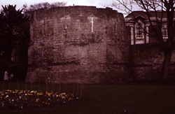
Fig.25 A late Roman multangular tower at York.
There is no doubt that York enjoyed a special status among Romano-British
cities in the third and fourth centuries. This former legionary
fortress was used as headquarters for the campaigning emperors
Septimius Severus and Constantius Chlorus, both of whom died in
the city. York also saw the elevation of Constantine I, and was
rewarded with impressive walls and fortifications.
Excavations in York have so far concentrated on the military and
defenses, and we know little about its public and domestic buildings.
The best evidence for fifth-century occupation comes from the
headquarters building (principia) and the legionary bath-house.FN473
The principia, in fact, remained intact and in use until
it was destroyed by fire in the early seventh century or later.FN474
A rise in the water level in the late fourth century caused severe
flooding in York, resulting in the destruction of much of the
wharves and harbor facilities.FN475 York probably did not survive
as a "center of population," writes Campbell, but it
did survive as a "center of authority."FN476 In 601
Pope Gregory the Great instructed Augustine to send a bishop to
York who would become the metropolitan of "that city and
province."FN477 When the bishop Paulinus arrived in York in
c.625 it was part of the Anglian kingdom of Edwin of Northumbria,
who is said to "have brought under his sway all the territories
inhabited by the Britons."FN478
© Internet Archaeology
http://intarch.ac.uk/journal/issue3/snyder/gaznew.html
Last updated: Wed Sep 3 1997