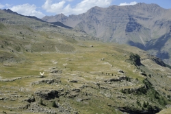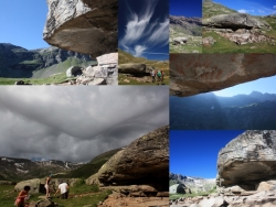

The Faravel plateau is a large, relatively flat zone, roughly 2km (north-south) by 1km (east-west) (Figure 3). Located at the western end of the Freissinières Valley, the average altitude across the plateau is c.2,200m. Today, the treeline is at about 2,000m, with some young fir trees now recolonising the high altitudes, including some scattered across the plateau. A number of streams cross the plateau in a west-east direction; some combine on the eastern edge to create a small waterfall that cascades down a cliff-face towards Fangeas, a lake and pasture area some 150m below. The plateau edge runs roughly north-south, and comprises outcropping sandstone bars that include the Faravel rock shelter. A sandstone overhang on the eastern edge of the plateau constitutes the rock shelter (Figure 4). The underside of the overhang provides a 'roof' protecting an area of c.8m²; however, the archaeological site centred on the shelter is more extensive, covering an area of c.15m² (Figure 5). A seasonal watercourse once ran in the front of the shelter, and appears to have run dry at c.1949-1751 cal BC.
