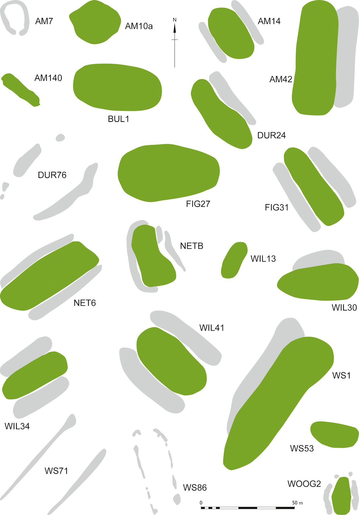
| Site name / number: | Figheldean 27 |
| Abbreviation: | FIG27 |
| Name: | Knighton Down |
| Parish / Grinsell number: | Figheldean 27 |
| Subform: | Long barrow |
| Hoare number: | - |
| Wiltshire HER Number: | SU 14 NW 102 |
| National Monument Record number: | SU 14 SW23 |
| Scheduled Monument number: | 10132 |
| Within the WHS?: | N |
| Length (m): | 55 |
| Width (m): | 21 |
| Height (m): | 3 |
| Ditch width (m): | 6.5 |
| Orientation: | W-E |
| Excavated?: | Y |
| Focus of mound features: | ? |
| Visible from Stonehenge?: | Y |
| Associated with round barrows?: | N |
| Ditch form: | Side ditches only, continuous. |
| Postholes in ditches: | - |
| Internal pits: | - |
| Internal postholes: | - |
| Internal cairn or stones: | - |
| OS Grid Reference: | SU 1279 4535 |
| British National Grid X coordinate: | 412790 |
| British National Grid Y coordinate: | 145350 |
| Latitude: | 50.9300819 |
| Longitude: | -1.8195200 |
| References: | Grinsell, L V (1957) 'Archaeological Gazetteer', in R B Pugh and E Crittall (eds) A History of Wiltshire. Volume 1, Part 1, 21–279. London, Oxford University Press |
| Plan reference: | McOmish et al. (2002), Fig 2.8, F |
| Radiocarbon date: |
Internet Archaeology is an open access journal based in the Department of Archaeology, University of York. Except where otherwise noted, content from this work may be used under the terms of the Creative Commons Attribution 3.0 (CC BY) Unported licence, which permits unrestricted use, distribution, and reproduction in any medium, provided that attribution to the author(s), the title of the work, the Internet Archaeology journal and the relevant URL/DOI are given.
Terms and Conditions | Legal Statements | Privacy Policy | Cookies Policy | Citing Internet Archaeology
Internet Archaeology content is preserved for the long term with the Archaeology Data Service (ROR). Help sustain and support open access publication by donating to our Open Access Archaeology Fund.