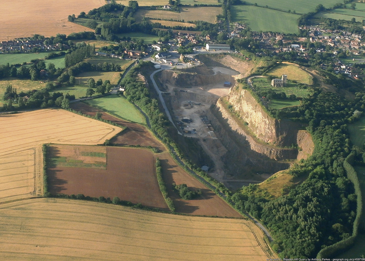
Breedon Hill (Figure 1) is the site of one of the few Iron Age hillforts in the East Midlands - and one which, in its original form, ranked among the largest monuments of its type in the region. Subsequently, the hillfort interior witnessed multiple periods of monastic occupation from the early medieval period, attesting to the site's complex history.
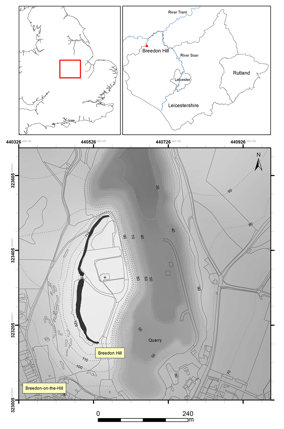
Situated in north-west Leicestershire (SK 40535 23223), the hill is formed from an outcrop of carboniferous limestone that rises steeply to a summit of 122m (AOD) above the village of Breedon-on-the-Hill, located around the base of the hill's southern slope (Figure 2). The hilltop commands a dominant position over the surrounding landscape, characterised by rolling lowlands of agriculturally suited clay soils, between the Trent valley some 4km to the north and the Soar valley about 9km eastward.
The single rampart and ditch earthworks originally enclosed an oval-form area of approximately 8.5ha (21 acres). Extensive quarrying of the eastern and northern parts of the outcrop has reduced the enclosed area to c.3.4ha (8.5 acres). The remains of the oval-form rampart stand at a height up to 3m. An in-turned entrance in the western rampart comprises the only confirmed original break in the earthworks. The extant earthworks and the two fields surrounding the parish church of St Mary and St Hardulph are protected by Scheduled Monument designation no. 1003606; this area and the western hillside are further designated as a Site of Special Scientific Interest (SSSI) for ecological significance.
In the last quarter of the 7th century AD, a minster church was founded within the hillfort enclosure. An important group of architectural sculpture from this monastery belonging to the late 8th and early 9th centuries later became incorporated into the fabric of the largely 13th-century parish church. From the early 12th century the church was established as a cell of the Augustinian Priory of St Oswald at Nostell, Yorkshire, and was retained as the parish church after the dissolution of the mother priory in 1539.
Rescue excavations undertaken in the mid-20th century – instigated in response to the encroaching quarry workings – focused their attention almost wholly on the eastern rampart, with the aim of dating the construction and sequence of the hillfort's earthworks (Figure 2; Kenyon 1950; Wacher 1964; 1976-7). Apart from the small-scale unpublished interventions into the ramparts and eastern interior, which have left behind a limited contextual record in an area of the hilltop since destroyed, very little investigation has taken place in the hillfort interior. Consequently, our understanding of the nature, form and spatial pattern of human occupation within the interior from later prehistory onwards remains very limited. As such, discussion on aspects regarding the site's settlement and activity character and potential role(s) in relation to known contemporary sites – for instance the univallate hillfort at Burrough Hill where a recent long-term research project has contributed a great deal to the study of the region's hillforts (Thomas and Taylor 2011; Taylor et al. 2012), and the emerging long-lived lowland 'agglomerated' settlements in the region (e.g. Humberstone and Beaumont Leys, Leicester) uncovered by development-led projects – has not been possible. Just as with other analogous sites in the region (Willis 2006, table 4), the limited chronological understanding of the site's origins and development – due in part to the lack of securely dated and contextualised finds and the long use period of the dominant pottery style in the region – has compounded this issue and limited the site's inclusion in broader discussions of the British Iron Age (e.g. Harding 2012; Elsdon 1992).
This article presents the results of a small-scale study initiated as an undergraduate dissertation designed to test how non-intrusive methods can be used to investigate an archaeologically and ecologically sensitive site. The research helps to address some broader questions relating to the study of the first millennium BC in the region. The related data are available to access via the Archaeology Data Service for the purposes of preservation and reuse (Whittaker 2019).
Cite this as: Whittaker, C. 2019 Breedon Hill, Leicestershire: new surveys and their implications, Internet Archaeology 52. https://doi.org/10.11141/ia.52.6
Internet Archaeology is an open access journal based in the Department of Archaeology, University of York. Except where otherwise noted, content from this work may be used under the terms of the Creative Commons Attribution 3.0 (CC BY) Unported licence, which permits unrestricted use, distribution, and reproduction in any medium, provided that attribution to the author(s), the title of the work, the Internet Archaeology journal and the relevant URL/DOI are given.
Terms and Conditions | Legal Statements | Privacy Policy | Cookies Policy | Citing Internet Archaeology
Internet Archaeology content is preserved for the long term with the Archaeology Data Service (ROR). Help sustain and support open access publication by donating to our Open Access Archaeology Fund.