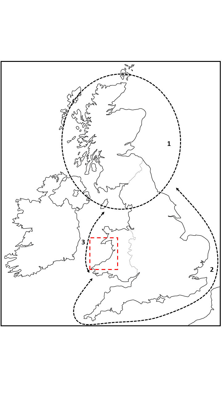
Figure 1: Map of study area showing three designated zones (1-3) and study area of Cardigan Bay (red dotted box)
Figure 2: Submerged Stories. Illustration by Erin Kavanagh
Figure 3: 'The Submerged Forest at Borth' by Ifor Christie, A Level Art student at Ysgol Penweddig. Submitted to Layers in the Landscape. Used with permission.
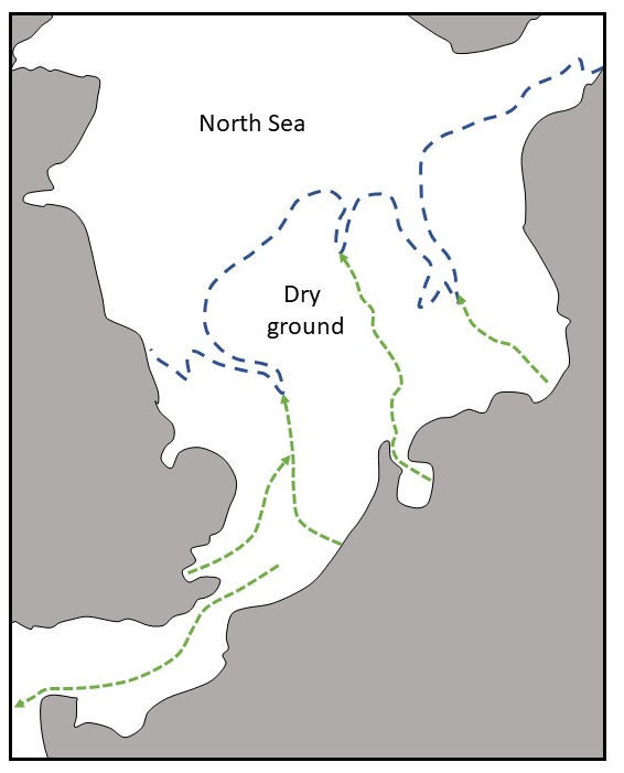
Figure 4: Landscape envisaged to have existed in the North Sea area by Clement Reid in 1913
Figure 5: Sea level curve (blue) showing rise in global sea levels, archaeological periods and key events during sea level rise in British waters. LUP — Late Upper Palaeolithic. M — Mesolithic. LP — Later Prehistory
Figure 6: Core taken from seabed in Bay of Firth, Orkney Islands. Image credit: authors
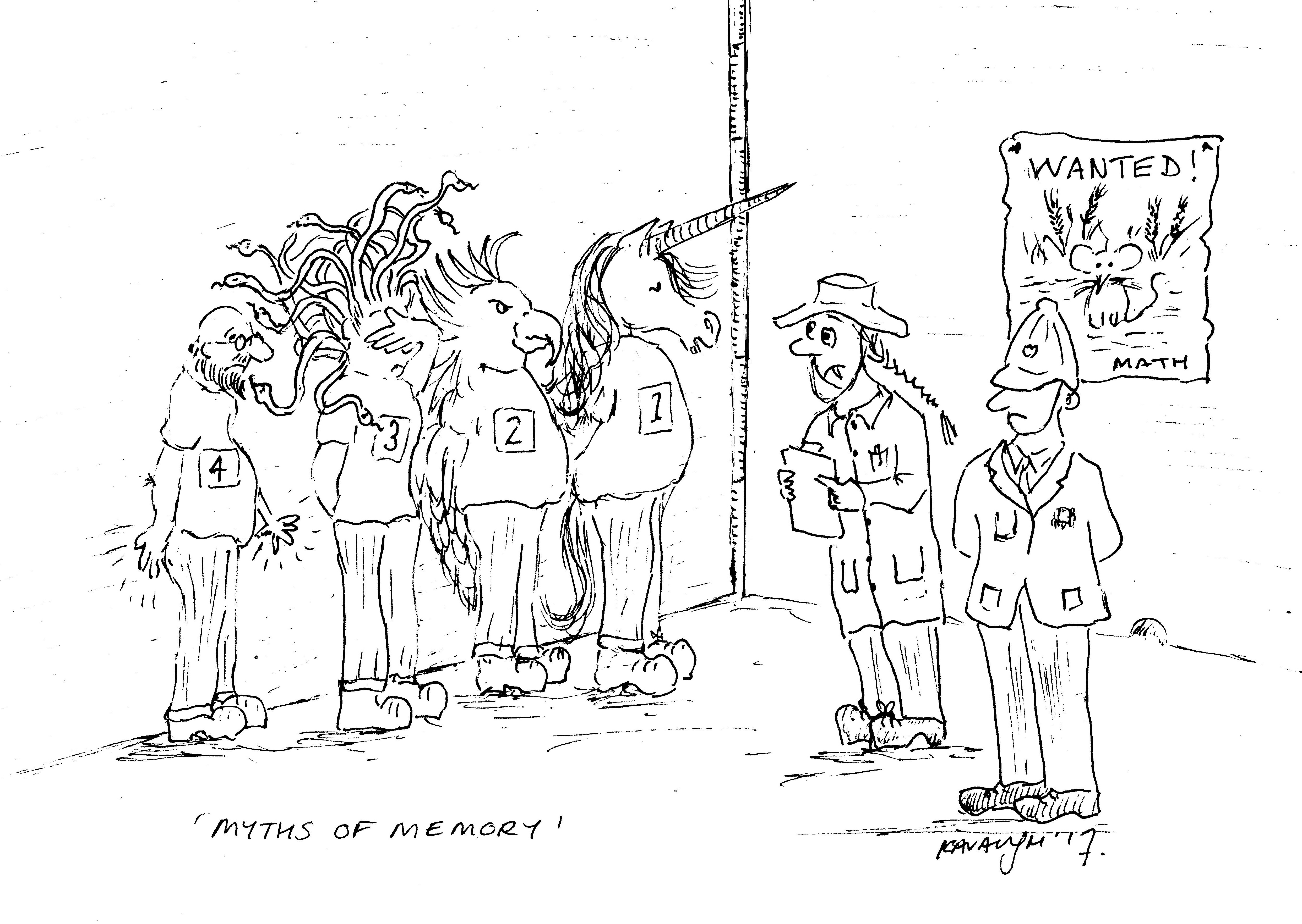
Figure 7: Myths of Memory. Illustration by Erin Kavanagh
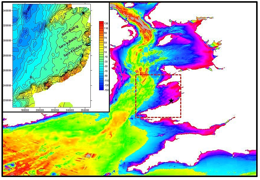
Figure 8: Bathymetric map showing topography of the seabed. Inset: detailed bathymetry from Cardigan Bay and the position of the three sarns
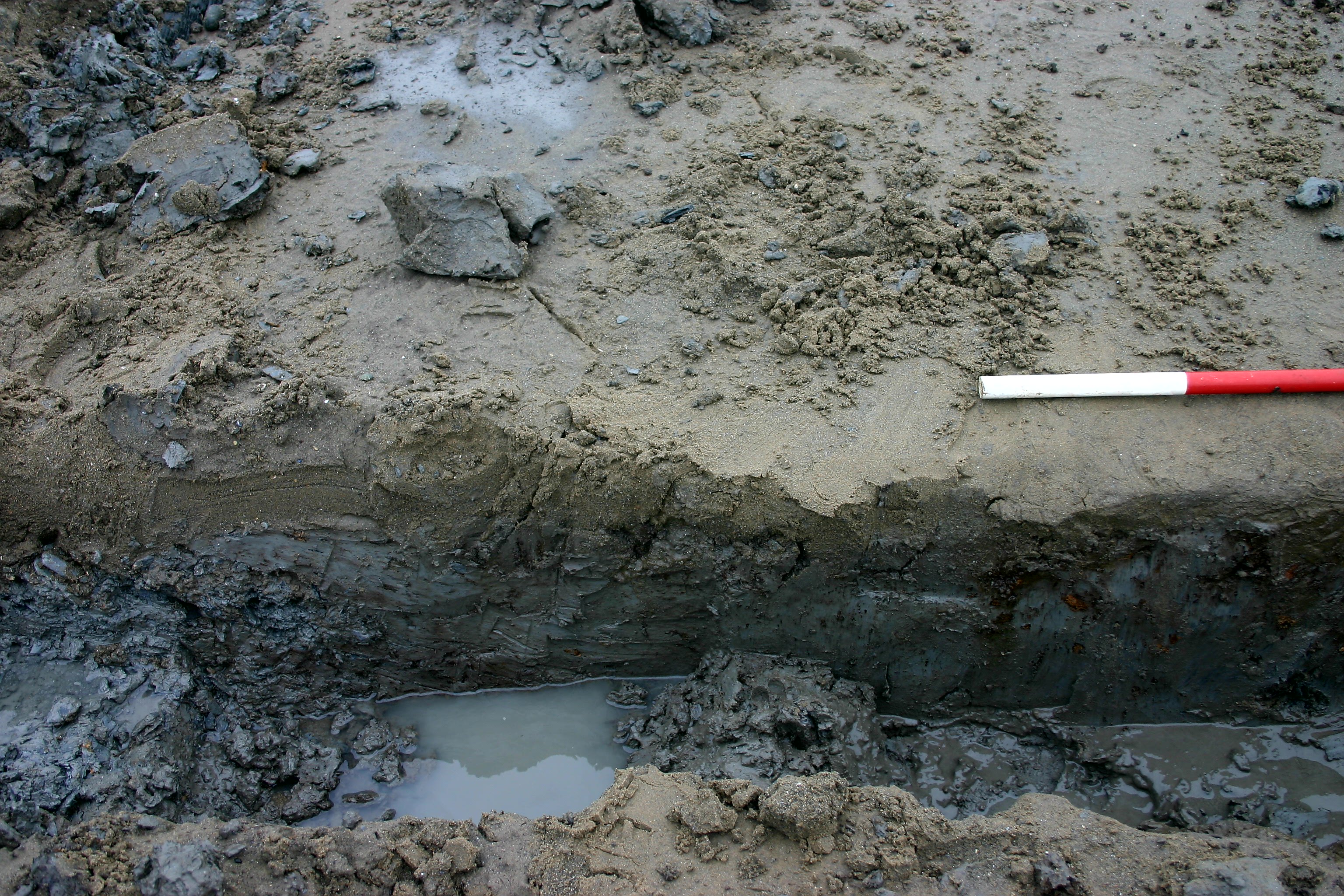
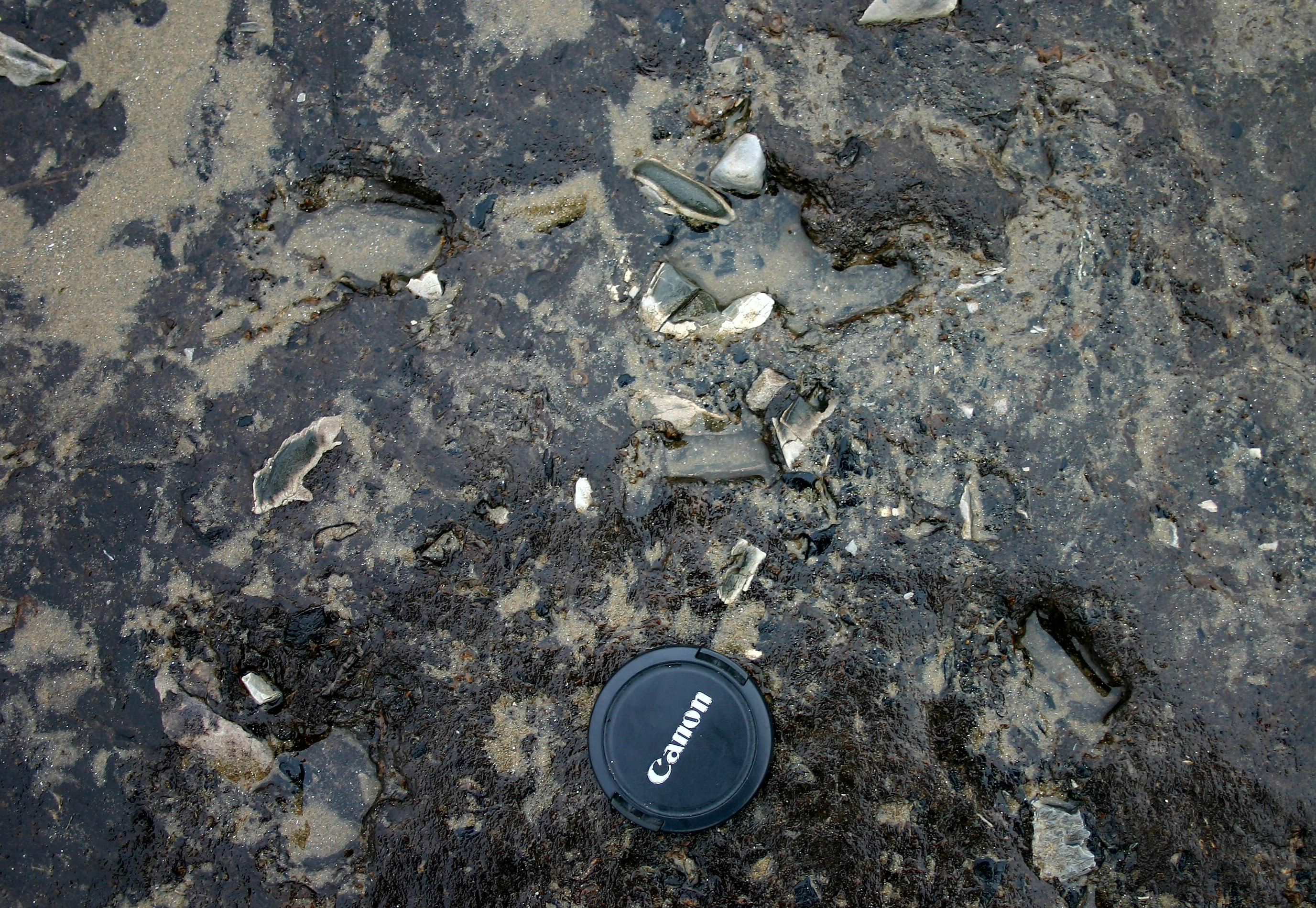
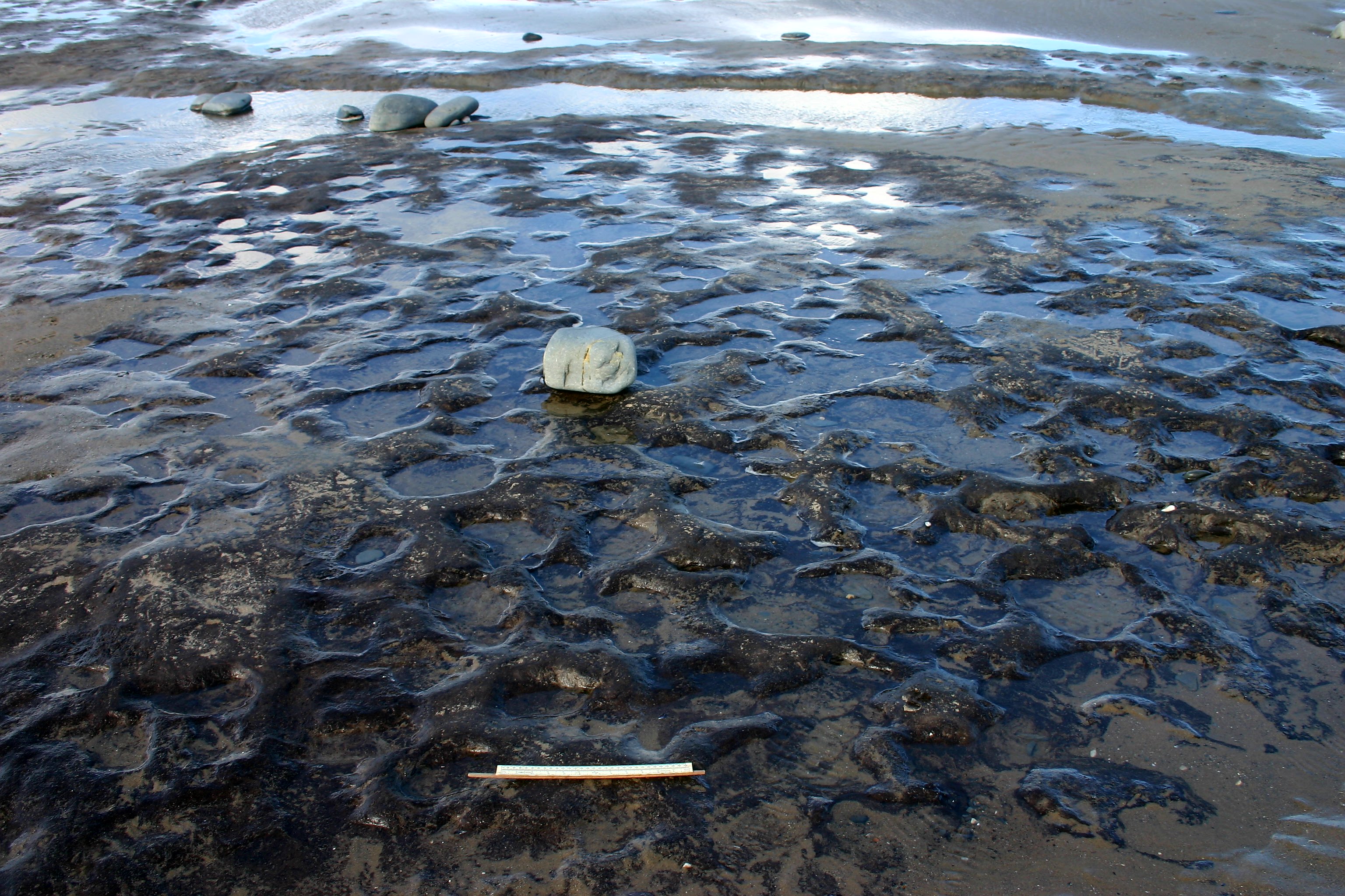
Figure 9: (a) Sarn Cynfelin gravels at low tide. Image credit: authors (b) Peat at Borth showing main peat body and intercalated clays and peats at top of sequence (indicated by red arrows). Image credit: authors (c) Burnt stone fragments lying in peat at south end of beach in Borth. Image credit: authors
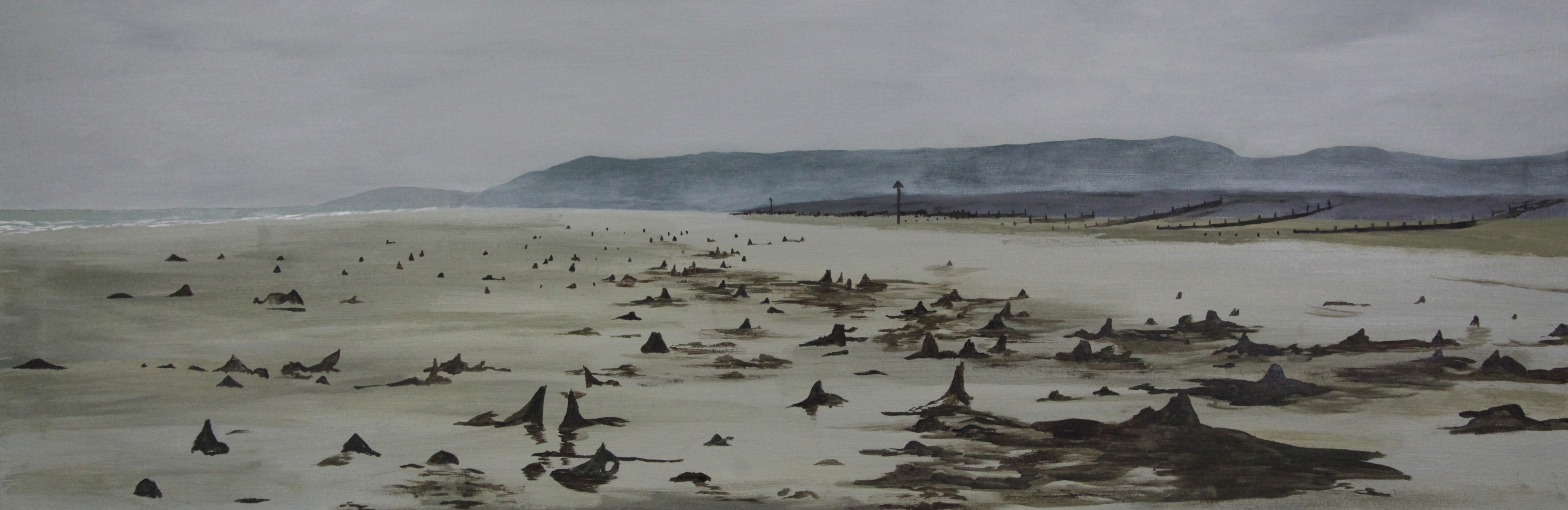
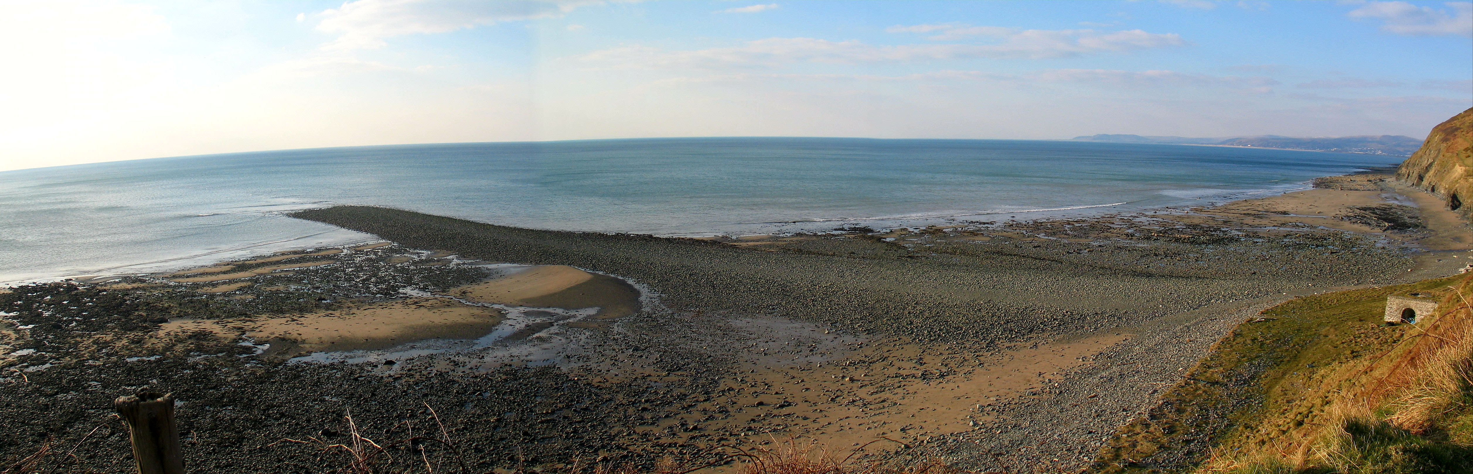
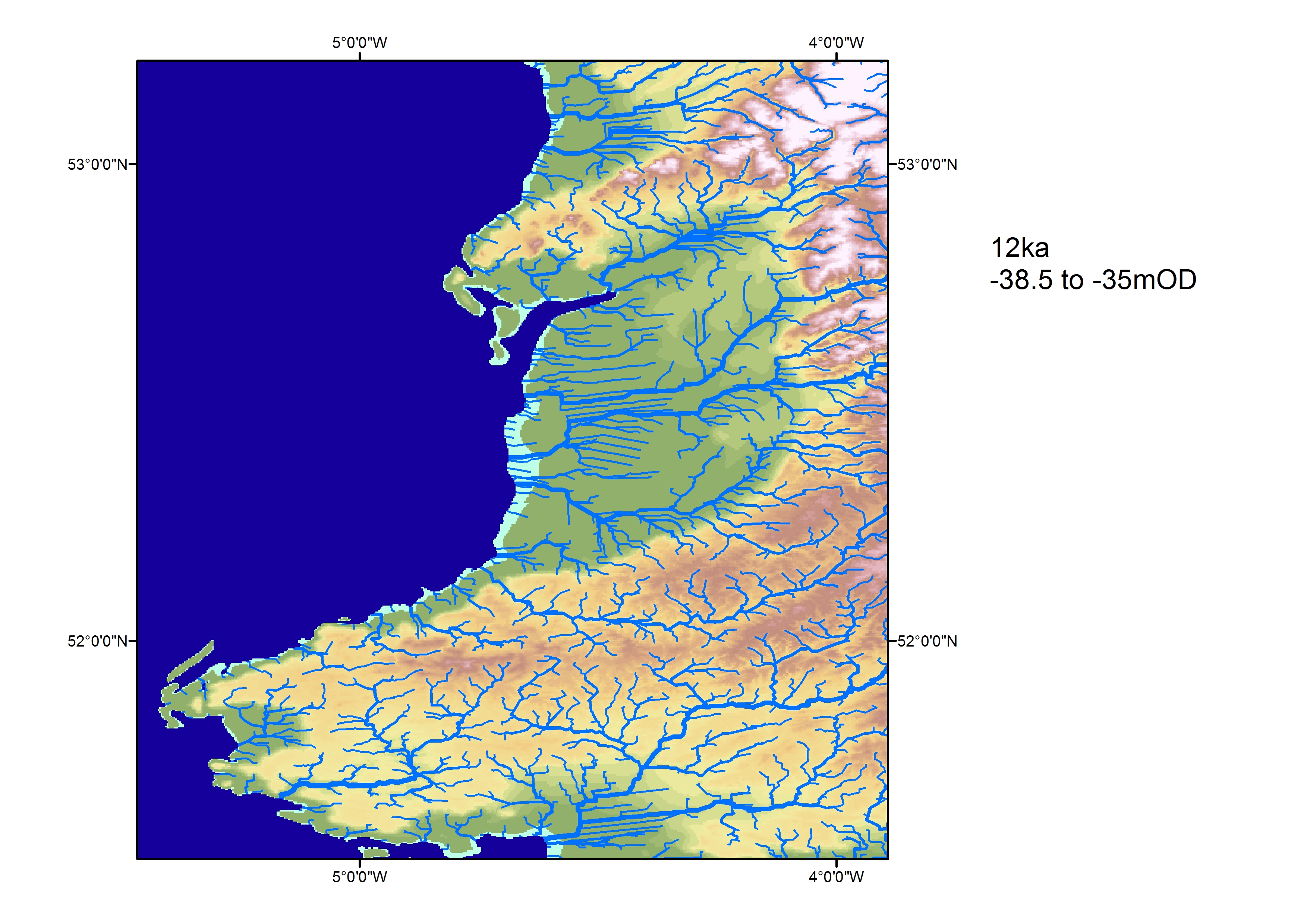
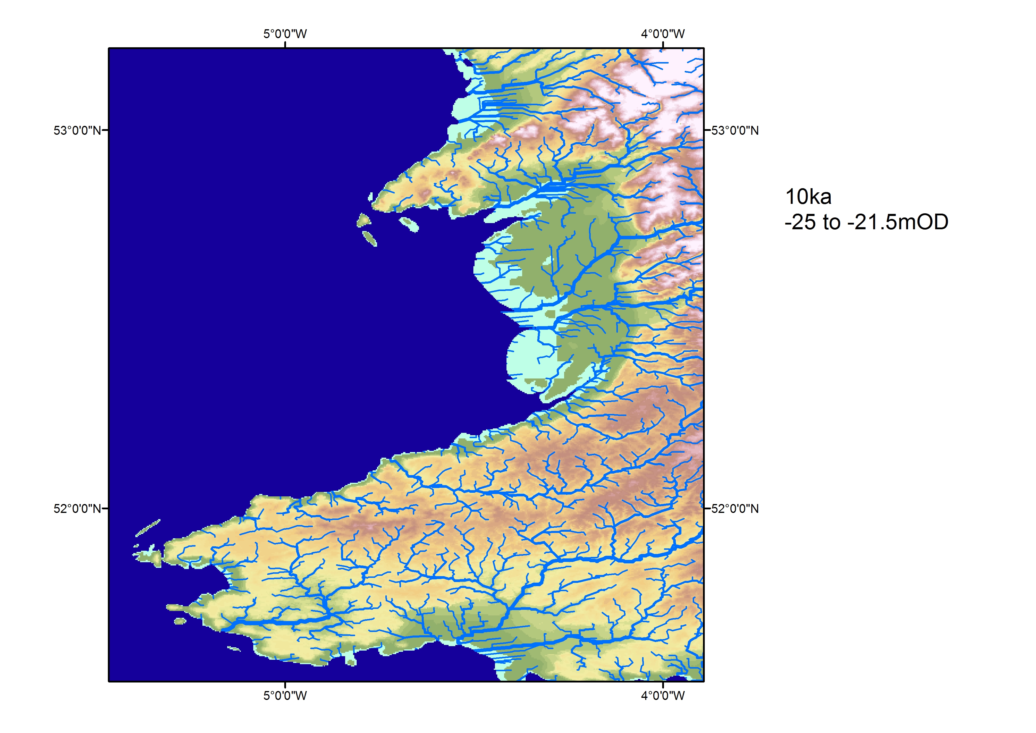
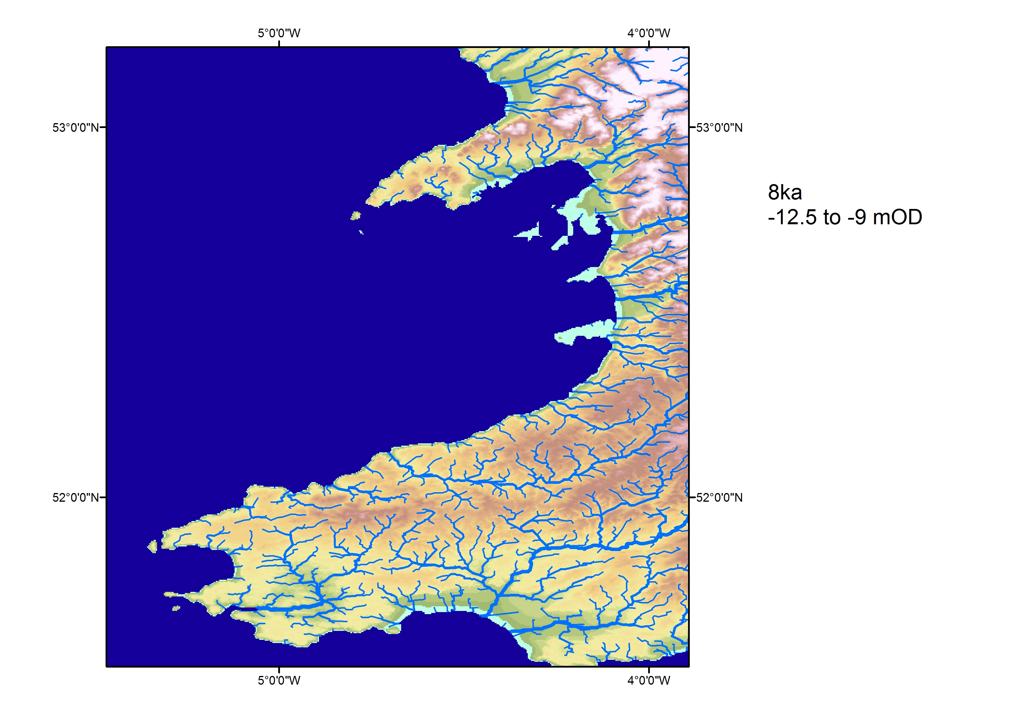
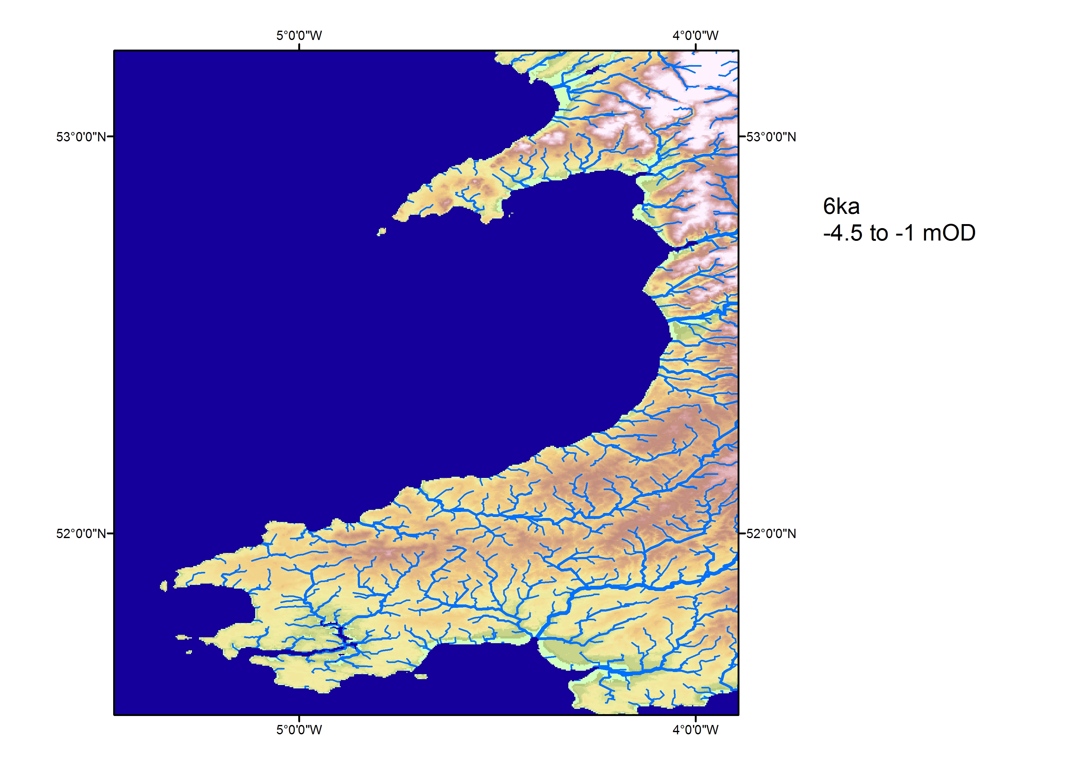
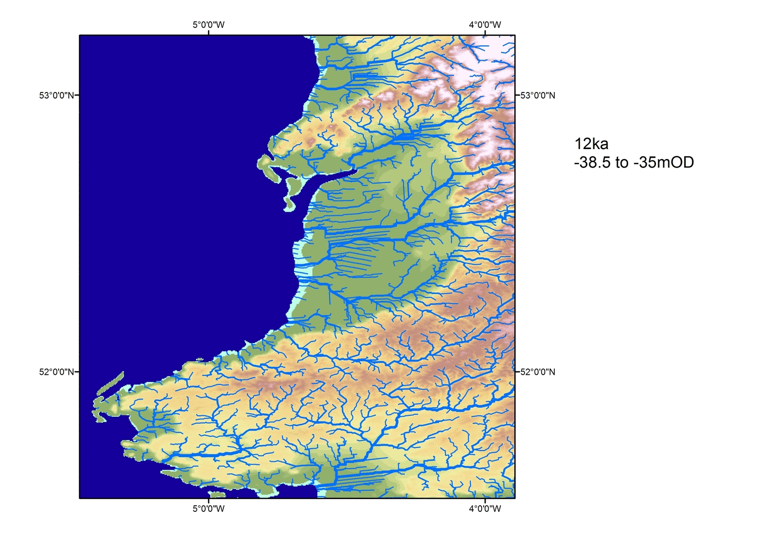
Figure 10: Reconstructed coastal positions at 12000 (a), 10000 (b), 8000 (c), and 6000 (d) years before present. Green colour indicates the intertidal zone (assuming a 5m tidal range similar to that of the bay today). View animation
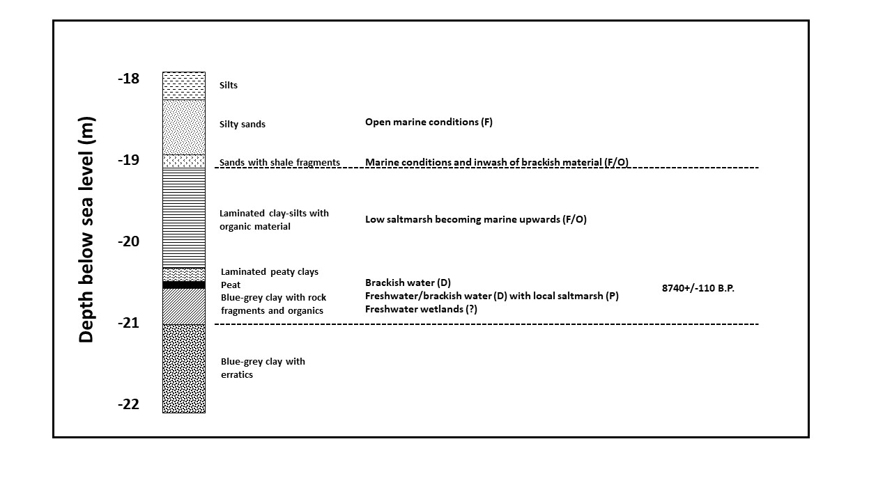
Figure 11: Interpretation of core ZZ 27 (offshore Aberaeron) (Haynes et al. 1977) showing lithology, inferred environmental changes and dating
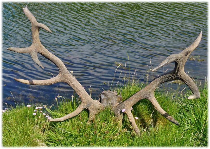
Figure 12: Red deer antlers from tidal channel sediments at Borth. Image credit: authors
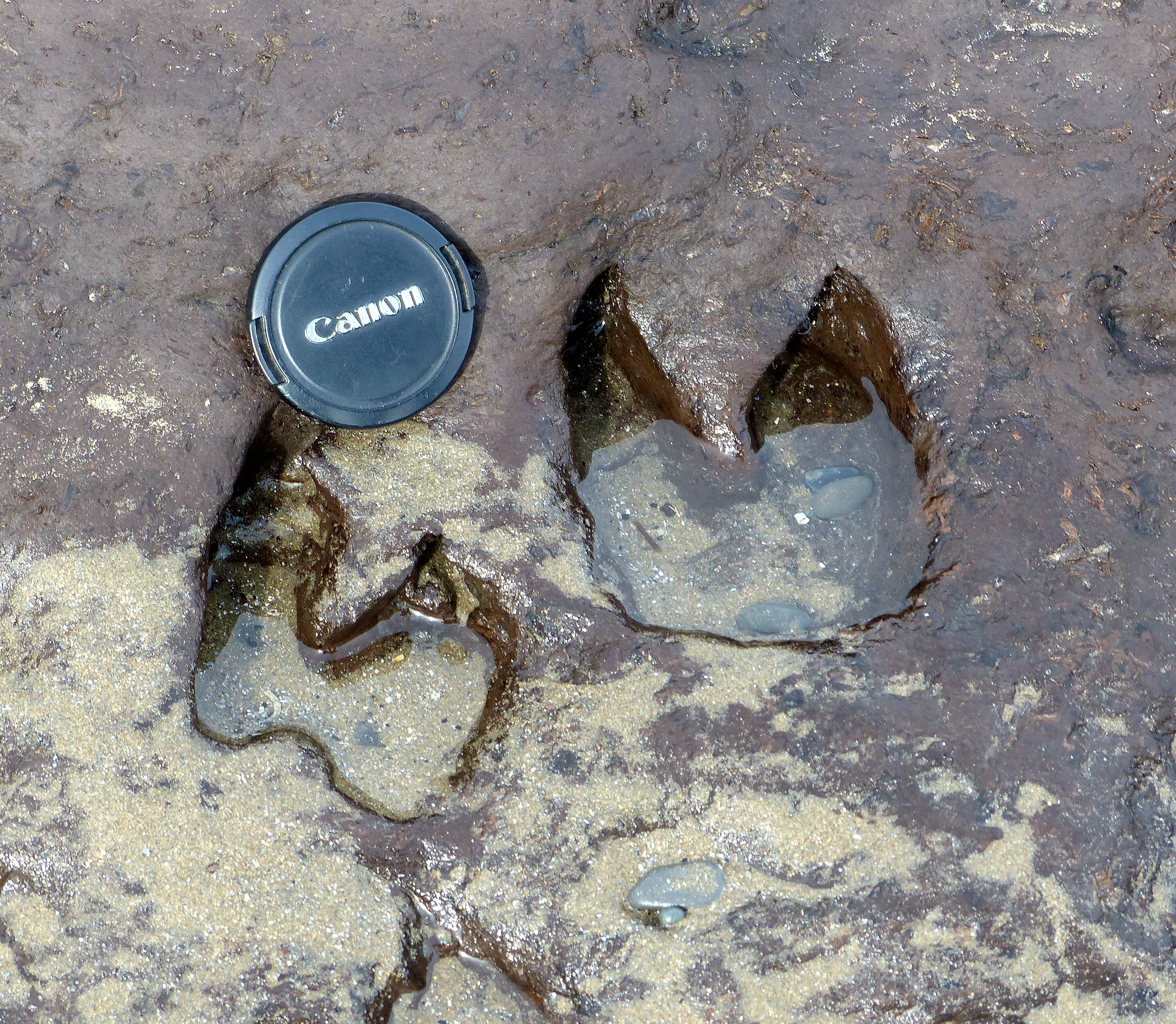
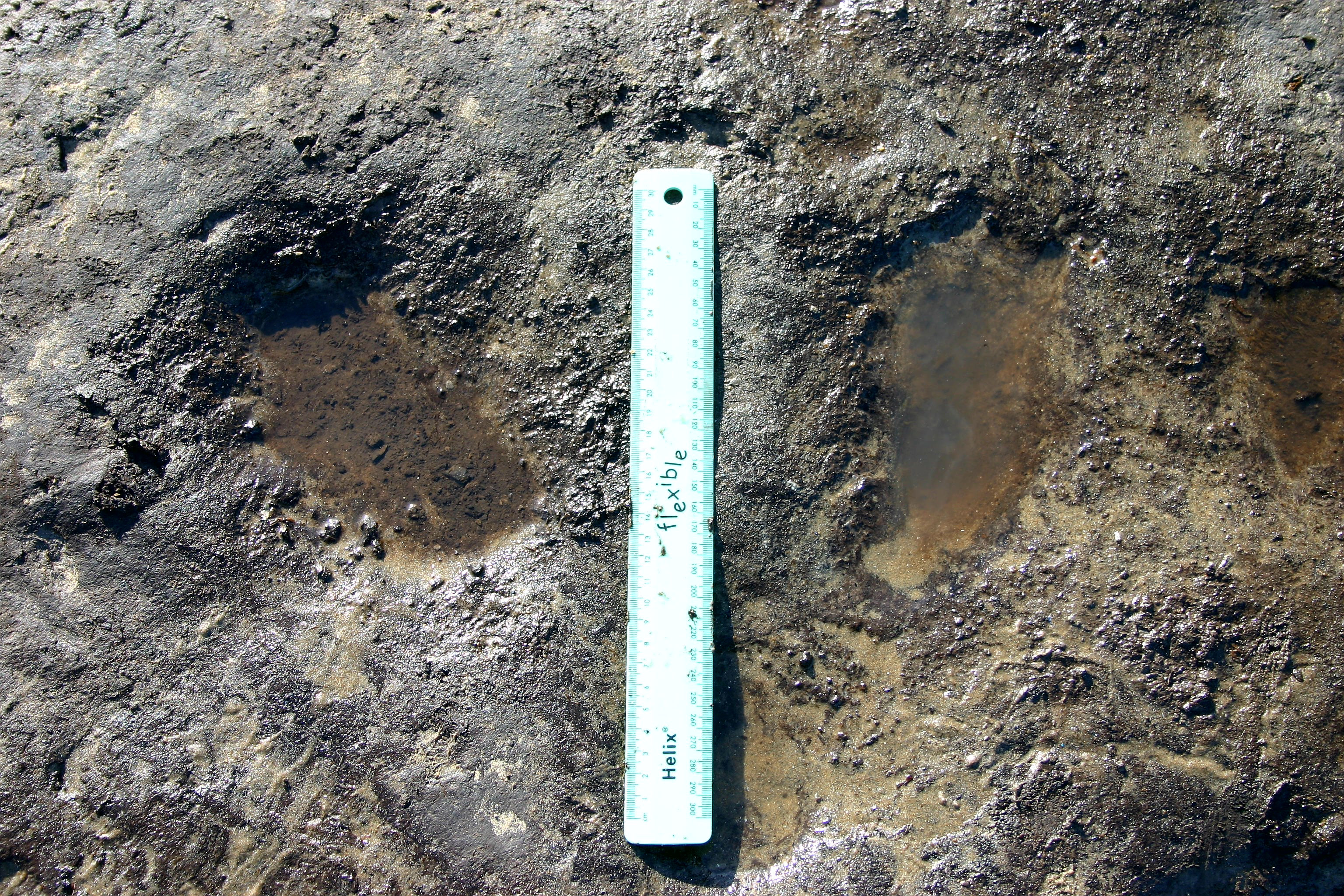
Figure 13: a) Footprints from a range of different animals preserved in peat at south end of the forest at Borth. Image credit: authors b) Split hoof print of a boar from Borth. Image credit: authors c) Left and right juvenile human feet from Borth. Image credit: authors
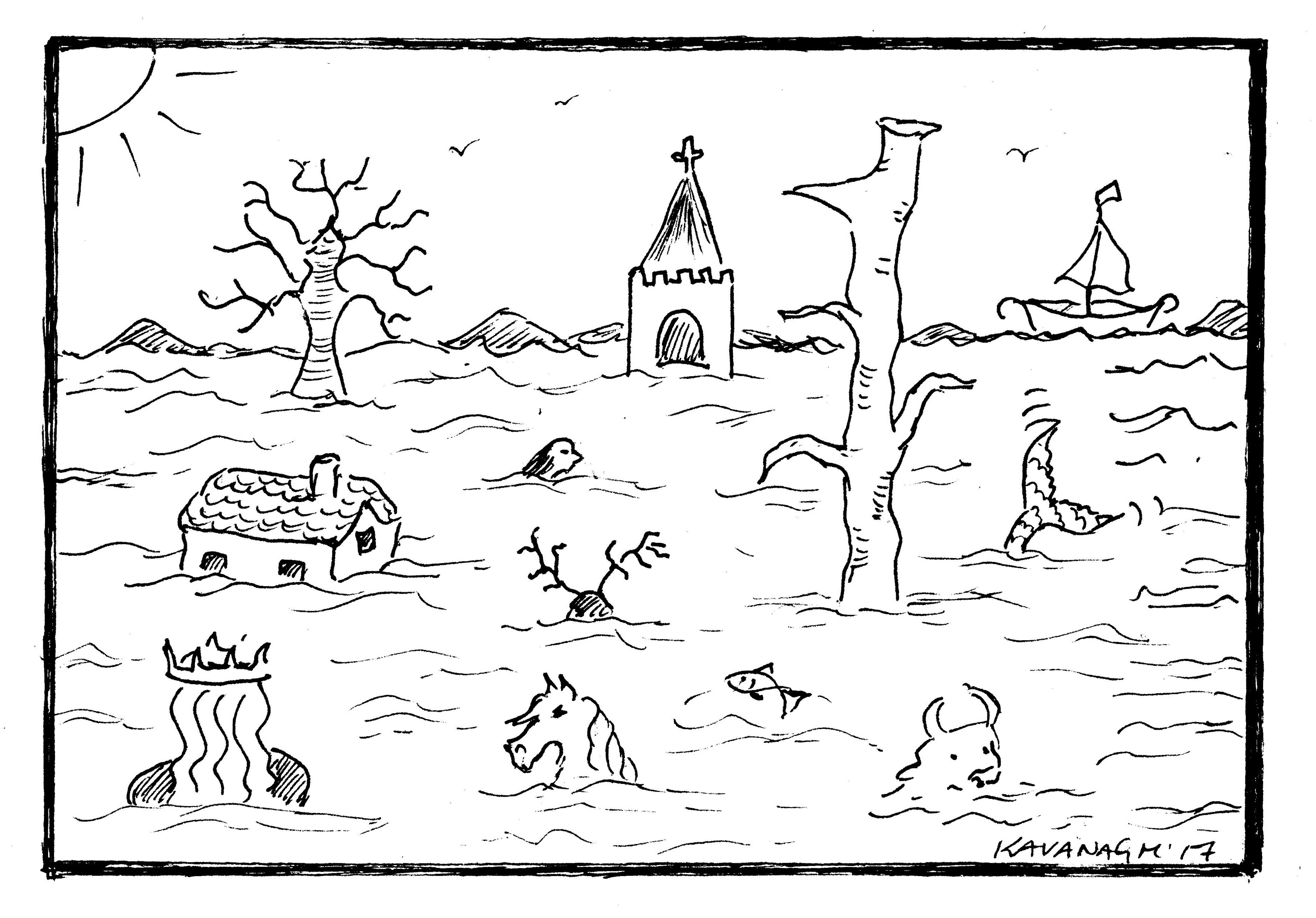
Figure 14: The flooding of Cardigan Bay. Illustration parodying a woodcut, by Erin Kavanagh
Cite this as: Kavanagh, K.E. and Bates, M.R. 2019 Semantics of the Sea — Stories and Science along the Celtic Seaboard, Internet Archaeology 53. https://doi.org/10.11141/ia.53.8
Internet Archaeology is an open access journal based in the Department of Archaeology, University of York. Except where otherwise noted, content from this work may be used under the terms of the Creative Commons Attribution 3.0 (CC BY) Unported licence, which permits unrestricted use, distribution, and reproduction in any medium, provided that attribution to the author(s), the title of the work, the Internet Archaeology journal and the relevant URL/DOI are given.
Terms and Conditions | Legal Statements | Privacy Policy | Cookies Policy | Citing Internet Archaeology
Internet Archaeology content is preserved for the long term with the Archaeology Data Service (ROR). Help sustain and support open access publication by donating to our Open Access Archaeology Fund.