Cite this as: Meara, H. 2020 Challenges Facing the State Management of Historic Shipwrecks in English Territorial Waters, Internet Archaeology 54. https://doi.org/10.11141/ia.54.3
The European Convention on the Protection of the Archaeological Heritage 1992, ratified by the UK in 2001, does not distinguish between archaeological sites located on land and those located on the seabed. The management of monuments in the care of the state is always a challenge. This is particularly the case when the monuments are located in the most inaccessible of places, at the bottom of the sea. The seas around England are full of shipwrecks. Historic England is responsible for the management of a select number of wrecks that have been afforded statutory protection. Funding challenges for maritime archaeology in the UK mean that Historic England has to seek creative solutions to the management of historic wrecks.
Historic England is responsible for maintaining a national record of historic shipwrecks located within territorial waters as part of the National Record of the Historic Environment. The database currently includes records for over 37,000 shipwrecks, including approximately 6000 wreck sites whose position on the seabed is known, and also a further 31,000 unlocated wrecks that are known only from documentary sources.
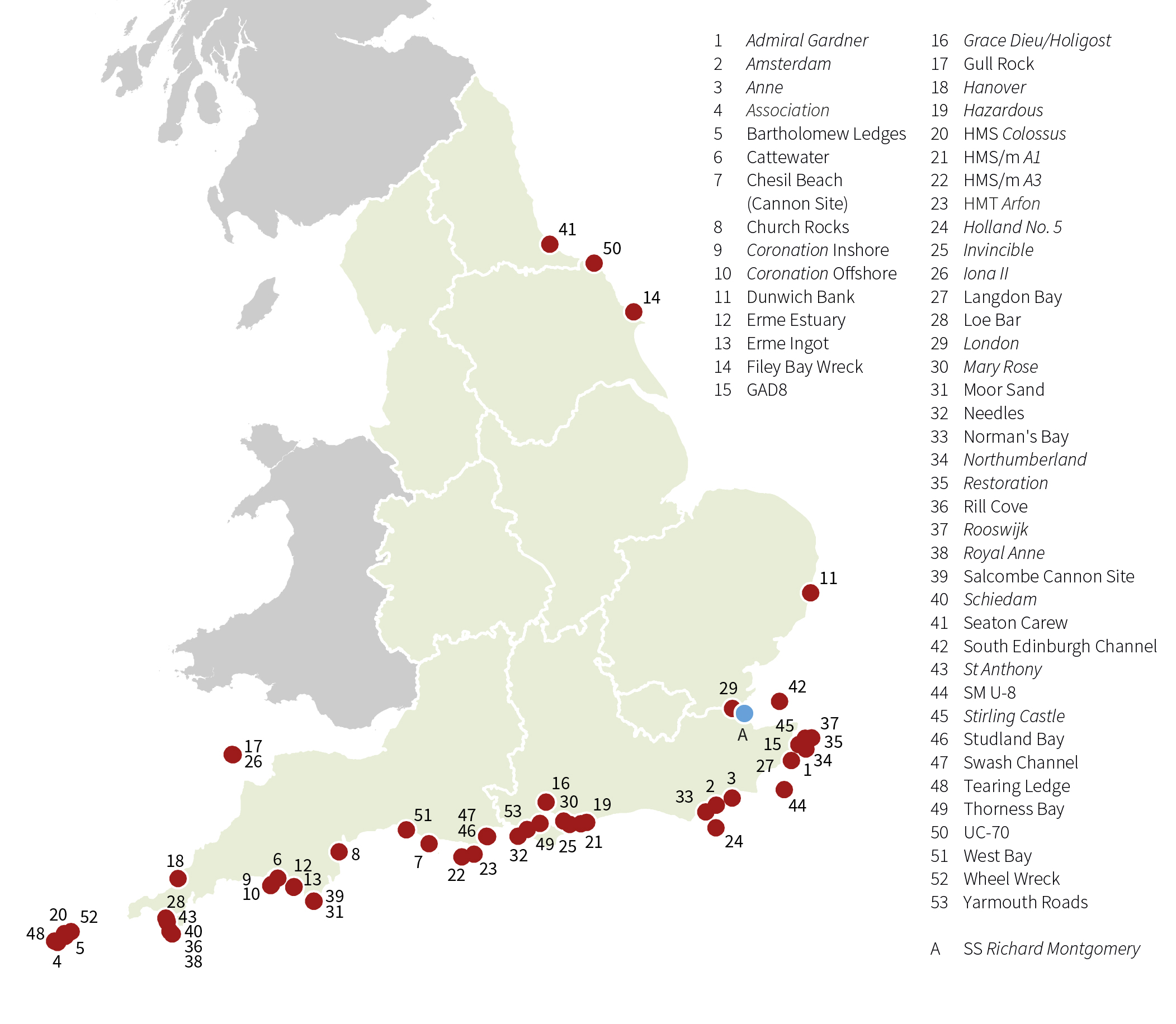
However, only a small fraction of these wrecks have been designated as protected wrecks under the Protection of Wrecks Act 1973 (Figure 1).
Historic England's responsibilities for archaeological sites under the sea are derived from the National Heritage Act 2002 (Roberts and Trow 2002). This Act tasked Historic England (formerly English Heritage) with 'securing the preservation of ancient monuments in, on or under the seabed, and promoting the public's enjoyment of, and advancing their knowledge of ancient monuments in, on or under the seabed' (Historic England 2015, 3). In addition, the act allowed Historic England to provide grant aid to projects working on protected wreck sites.
Shipwreck sites in English waters do not automatically receive legal protection. The Protection of Wrecks Act 1973 allows the Secretary of State to designate a restricted area around a wreck site, in order to prevent uncontrolled interference. The Act is divided into two sections. Section 1 of the Act allows for the protection of wreck sites that are considered to be of historical, artistic or archaeological importance. It is the management of wrecks protected under this section of the Act that is the responsibility of Historic England. Section 2 of the Act allows for the designation of a restricted area around a wreck considered to be dangerous. There is currently only one wreck in English waters that is designated under Section 2 of the act, the remains of the Richard Montgomery, a World War II era Liberty Ship, which stranded near Sheerness, Kent, in 1944 while carrying a cargo of bombs and other munitions, bound for Cherbourg to aid in the liberation of France.
Shipwreck sites are designated based on an assessment of their significance. As well as being able to reveal a great deal of information about how ships were constructed in the past, wrecks can also reveal much about international trade, the daily lives of the sailors on board, and can reveal detailed information about specific historic events. When considering whether or not a shipwreck should be given protection, factors including period, rarity, documentation, group value, survival, vulnerability, diversity, and potential will be taken into consideration when determining their national importance (Historic England 2016a; 2016b; 2017b).
There are currently 53 shipwrecks in English waters that have been designated under Section 1 of the Protection of Wrecks Act 1973 (Figure 2). These cover a very broad date range, with the earliest site being the remains of the scattered cargo of a late Bronze Age shipwreck, and the most recent being the remains of the UC-70, a UC II class German submarine sunk by bombs and depth-charges during World War I. Details of all of the wrecks protected under Section 1 of the Protection of Wrecks Act 1973 can be found online on the National Heritage List for England.
Although access to protected wrecks is restricted, the Protection of Wrecks Act doesn't prohibit all access to protected wreck sites. Instead, it encourages responsible access, in order to ensure that the activities undertaken do not put the archaeological remains at risk. Access to the wrecks is controlled by a licensing system administered by Historic England on behalf of the Department for Digital, Culture, Media and Sport (DCMS). Each licence will have a specific set of conditions attached, which control the type of activity that can take place. A licence will only be granted if the proposed activity will be beneficial to the long-term care of the wreck, or will aid in public appreciation of the site. A wide variety of activities can be undertaken on protected wreck sites, but they usually fall into one of these four categories:
The requirements for obtaining a licence vary depending on the nature of the proposed work on the site. In order to obtain a licence to visit a wreck, the applicant is required to complete an online application form, detailing the proposed activity, outlining any relevant experience they hold, and detailing the names of two people willing to provide references on their behalf. In order to obtain a licence to allow the recovery of material or to undertake excavation, a full Project Design is required detailing the research objectives and a method statement, including provision for conservation and a suitable repository for artefacts.
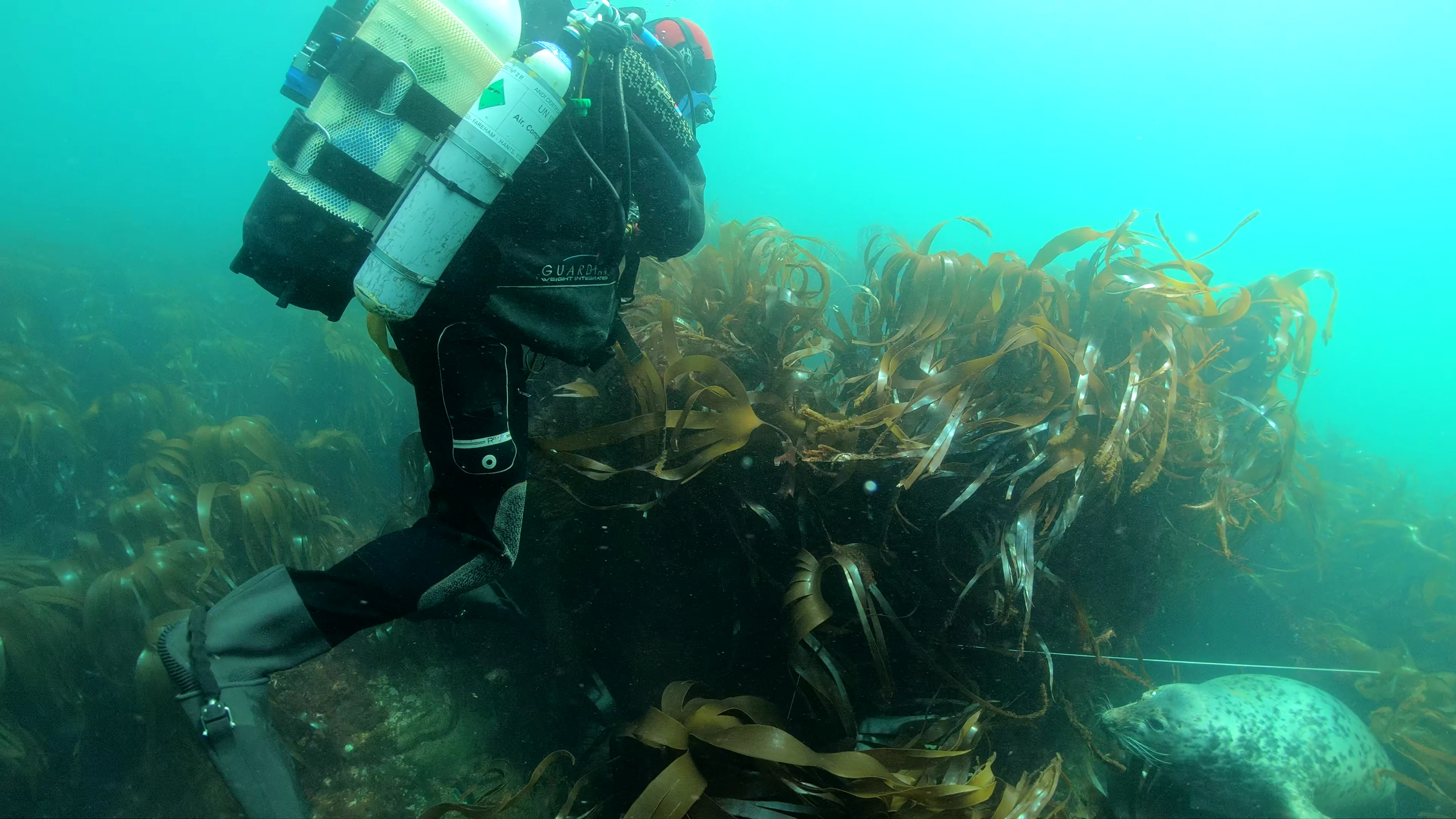
The Secretary of State provides funding for a commercial archaeological company to provide archaeological services relating to wreck sites in UK territorial waters. Historic England is responsible for the management of the English part of this service. Responsibility for wrecks in the rest of UK territorial waters lies with the devolved administrations in Wales, Scotland and Northern Ireland. The current provider of archaeological services in relation to historic wreck sites in English waters is Wessex Archaeology. The purpose of this service is to provide quality information to inform the protection and management of these heritage assets. Wessex Archaeology will undertake fieldwork to assess new sites being considered for designation. They will also undertake periodic monitoring of sites, in order to assess their condition and survival (Figure 3). A broad variety of work will be undertaken as part of this contract, including desk-based research, remote sensing, and also site investigation by divers. On occasion, site investigation will be undertaken by remote operated vehicle (ROV) on sites that are particularly deep or otherwise inaccessible to divers.
However, the budget for undertaking work by the commercial archaeological company is very limited. In addition, conducting archaeological work at sea is particularly at risk from the adverse effects of the weather, which can frustrate the best-laid plans. As a result, it is only possible for a small number of sites to be visited for assessment and study each year.
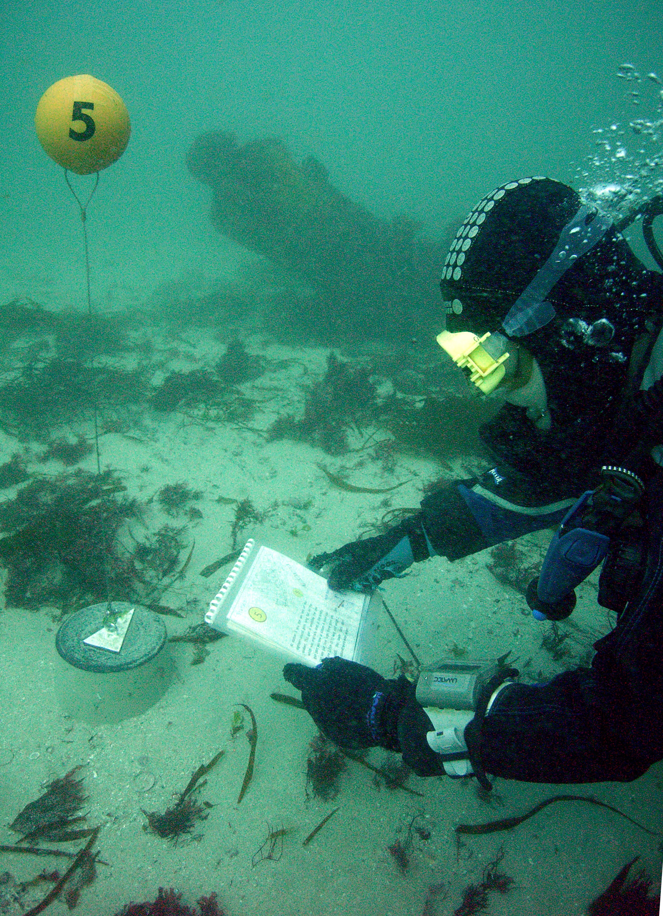
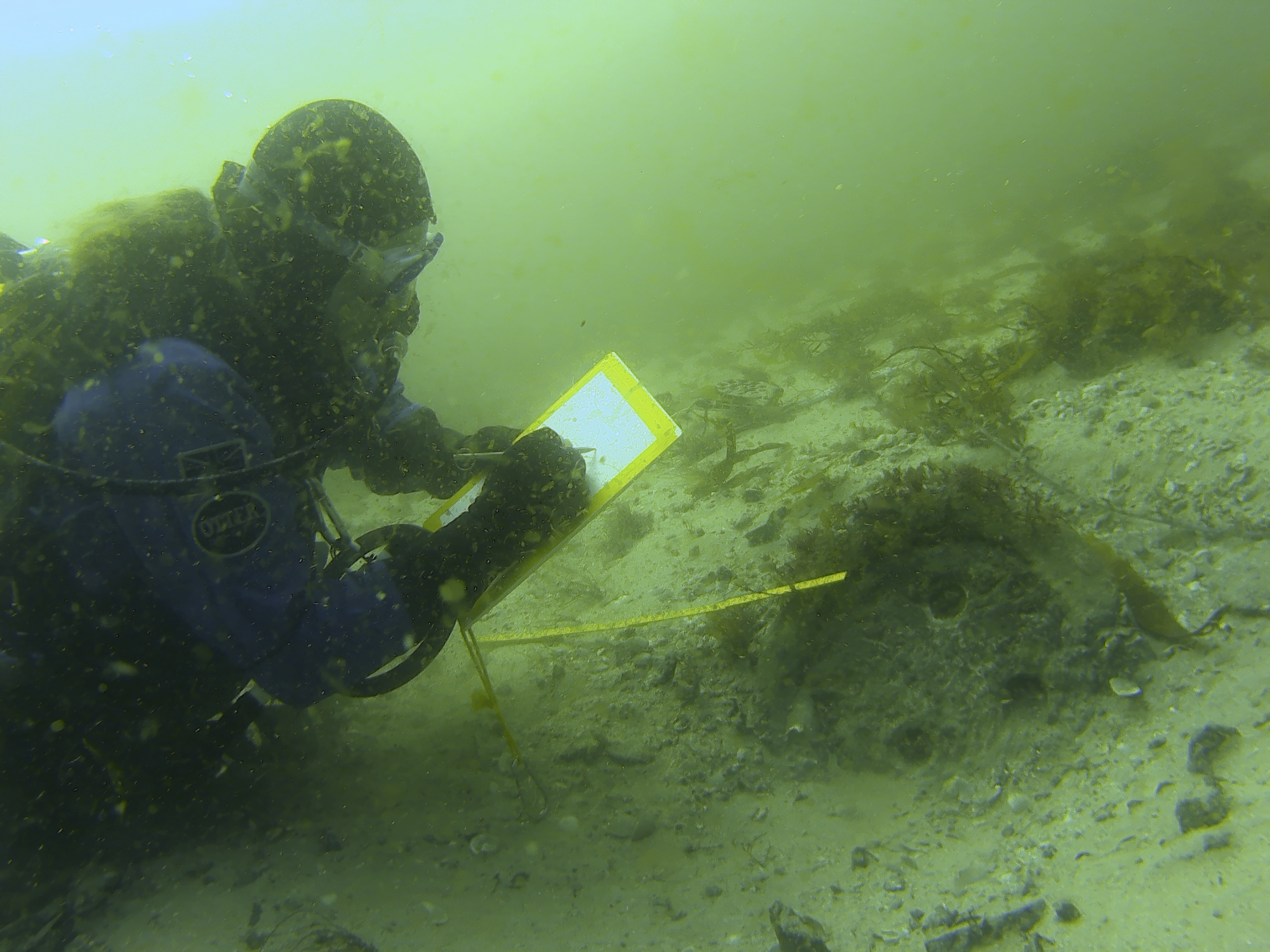
We need to monitor protected wreck sites in order to maintain an up-to-date understanding of their condition. The challenge of undertaking the greater part of the monitoring is met by volunteer divers, who hold licences to access the sites. These individuals are known as licensees (Figure 4). They are, in many ways, the voluntary custodians of the protected wreck sites. They play a vital role in the management of the sites. They undertake many hours of diving, often at their own expense, and provide information that enables stewardship and effective management. During 2018 there were over 200 licensees and team members undertaking study of England's protected wreck sites. Historic England has recognised the importance of the licensees by awarding them with Affiliated Volunteer status.

Each licensee is required to submit a report to Historic England at the end of the year. The reports detail any work undertaken over the course of the year, and provide valuable information on the current condition of the site. For example, has the wreck become more exposed over the course of the year, or, conversely, has the wreck become reburied by seabed sediments. In addition to the annual reporting, licensees maintain regular communication with Historic England throughout the year. In this way, the security of the sites is maintained. Reports of activity, such as unauthorised diving, illegal salvage, or fishing activity that could damage the archaeological remains, can be addressed. Through this mechanism new discoveries are reported quickly to Historic England, which allows us to target our funding and support to where it will be most beneficial.
The ability of licensees to mobilise quickly to take advantage of the best conditions is a key part of their success. A small group of locally based divers can mobilise at short notice, and are able to take advantage of the best weather and seabed conditions. In this way, they can undertake monitoring visits, create detailed photogrammetric surveys and, when necessary, at-risk material can be recovered for study, conservation and eventual display.
There is no requirement for licensees to be trained and qualified archaeologists, although they should be competent to undertake their activities on a protected wreck site. A licensee will undertake projects under the guidance of a Nominated Archaeologist, a voluntary role that provides advice and guidance to the licensees throughout the course of the project.
The licensees are a very dedicated group of volunteers. In many cases they have been involved with the sites over several decades. Statistics from a recent survey undertaken by Historic England indicated that over 43% have been involved with the sites for 10 years or more, and that 21% had been involved with sites for over 20 years. However, the ageing demographic of the licensees presents a major challenge, as many of the current licensees are approaching an age when they will no longer be diving. We have identified the need to actively encourage a younger generation of divers to become involved with protected wreck sites. We are currently in the early stages of a project designed to pair up new recruits with existing teams, so that the expert knowledge of these long-standing volunteers can be passed on to produce the next generation of skilled and highly motivated custodians. In addition, we are undertaking projects to train and increase the skills of local divers to fulfil the role on newly discovered and protected sites, where there are no pre-existing licensee teams in place. This increase in local capacity is vital for the future management of England's protected wreck sites.
In 2008 we began an annual programme of assessing risks to all protected sites, both terrestrial and marine, in order to better understand their condition and vulnerability. The sites are individually assessed, and are given a status of either low, medium or high risk, with the results published in the annual Heritage at Risk register (Historic England 2017a).
By undertaking this annual review of sites, we are able to identify the management needs of each site, and thereby prioritise the programme of work for the following year, ensuring that the limited budget available for work is targeted at the sites that are most in need. When the initial audit was undertaken in 2008, there were 11 protected wreck sites considered to be at high risk.
Over the last decade, there has been a reduction in the number of wreck sites considered to be at high risk, as a result of ongoing management, the work that the volunteer licensee teams are doing, and working in partnership with other organisations. There are currently four protected wreck sites on the Heritage at Risk register:
These sites are the main recipients for additional funding and targeted programmes of work to reduce the risk that they face.
Preservation in situ is usually considered to be the most suitable management approach. This is in line with the Annex to the 2001 UNESCO Convention on the Protection of Underwater Cultural Heritage, which has been adopted as best practice by the UK government. However, the risk to each of the protected wreck sites has been managed and reduced in a variety of ways, depending on the needs of the particular site. In many instances, a programme of ongoing monitoring to ensure that the wreck site remains safely buried beneath seabed sediments is the main requirement. On other sites, the security of the site has been increased by the promotion of public access via the installation of diver trails on the seabed. On sites where considerable erosion is taking place, programmes of finds recovery and also detailed excavation have been undertaken. Site-specific conservation statements and management plans have been produced, and these identify how the values and features of the protected wreck sites can be conserved, maintained and enhanced.
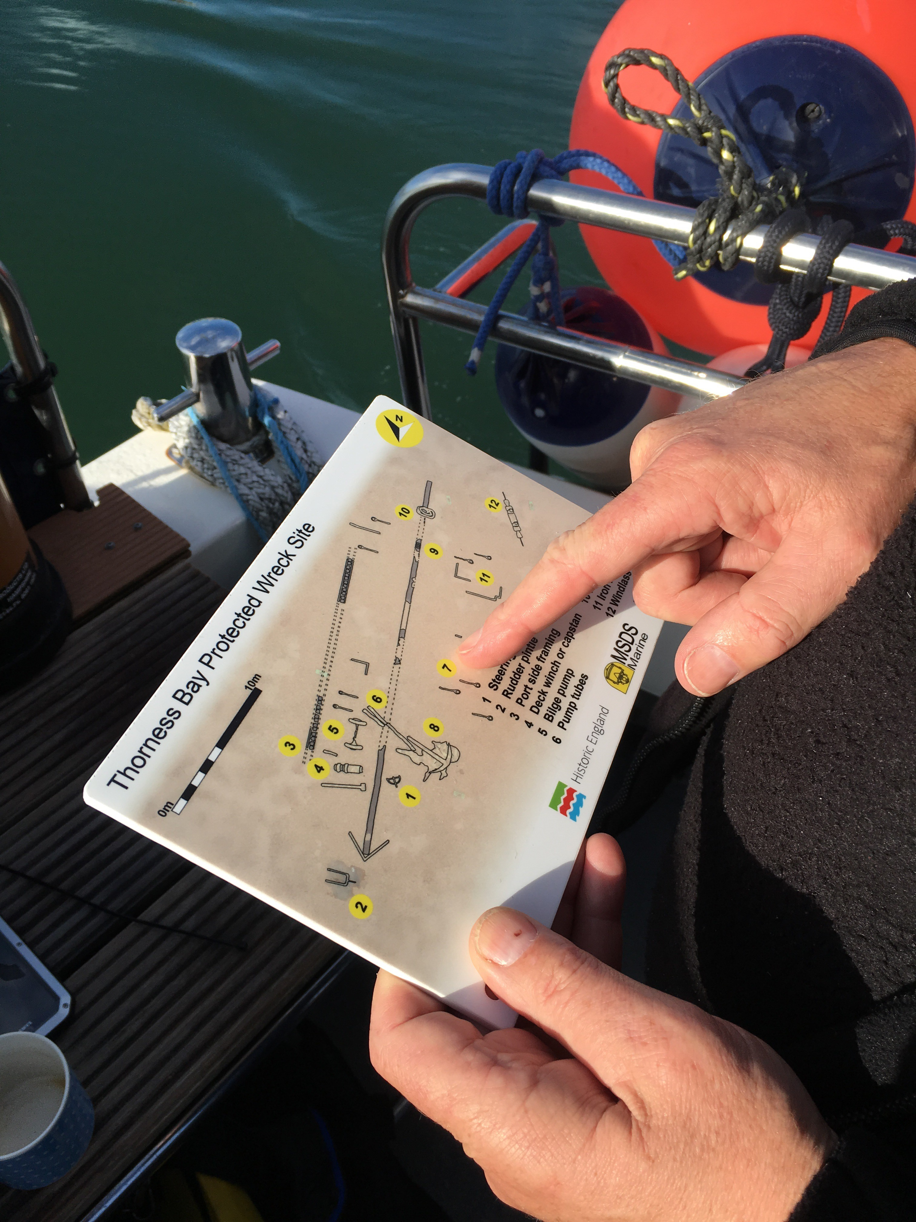
Shipwreck sites are by their very nature difficult to access. They are located at sea, and often in areas of particularly dangerous stretches of coastline, which have historically been the causes of other wrecks. It is a great challenge for us to find ways to encourage visitors to these sites, in order to ensure that they are experienced and enjoyed by as broad a section of the population as possible. One way in which we have gone about providing enhanced access to wreck sites is by facilitating the creation of diver trails.
These trails encourage responsible access. Each trail is accompanied by interpretation material in the form of guides for reading on the boat prior to the dive, or waterproof slates to be carried during the dive, which aid in orientating the diver on the seabed (Figure 5). The sites themselves are enhanced through the placing of weypoints on the seabed, connected by lines in order to guide divers in low visibility. These trails are managed locally by teams of volunteers, including charter boat operators, recreational diving groups, archaeological societies and other special interest groups.
There are significant benefits to increasing the number of visitors to the sites. Visiting divers are encouraged to share any photographs they may take. These photographs are included in the annual Licensee reports submitted at the end of the year. In addition, they can be submitted throughout the year, and shared via social media. These visitors assist with site monitoring, and provide up-to-date information throughout the year, which keeps us informed of any urgently required intervention. Increased numbers of legitimate visitors on a given site has an additional benefit of deterring anyone looking to access the site illegally.
There are currently dive trails in operation on six protected wreck sites. These trails are located on some of the more robust wreck sites, where visiting divers are unlikely to inadvertently cause damage to fragile archaeological remains. There are trails located on the following wrecks:
There was formerly a trail in operation on the wreck of the Hazardous, a 3rd rate ship of the line, lost in 1706 in Bracklesham Bay, West Sussex. However, when much of the wreck became buried by sediment, this trail went out of use. As part of a programme of work funded by Historic England, the dive trail will be reinstated on this site in the future, following the completion of an ongoing excavation.
The diver trail on the wreck of HMS Colossus, located off the Isles of Scilly has been in operation for over 10 years. The trail has proved immensely popular, with over 250 divers visiting the trail each year. In 2018, it was reported to Historic England by the licensed volunteers that the dive trail was beginning to show its age. Some of the markers had been lost and required replacing. In addition, abandoned fishing gear including lines and lobster pots had become ensnared in the trail, making it a hazard for visiting divers. As a result, we have funded a project for a local group, the Cornwall and Isles of Scilly Maritime Archaeology Society (CISMAS) to visit the wreck in order to remove the trapped fishing gear, and to renovate and repair the stations on the seabed. In addition, the project includes provision for developing new and improved interpretation material, in the form of a dive slate, for visitors to take with them to the seabed when visiting the wreck (Figure 6), based on lessons learned through the development of trails on other wreck sites since this trail was originally developed.
Divers visiting the protected wreck dive trails have provided very positive feedback. In addition, research indicates that diver trails have considerable economic benefits to the local economy. A study commissioned by Historic England, and undertaken by the Nautical Archaeology Society, indicated that the diver trail on the wreck of the Coronation protected wreck, located off Plymouth, was worth around £42,000 to the local economy during the course of a single year (Nautical Archaeology Society 2013). The protected wreck dive trails have been recognised as examples of best practice for audience engagement by UNESCO.
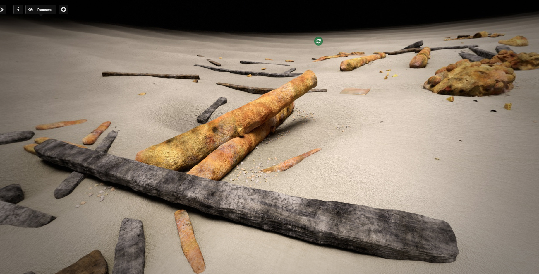
However, not everyone is lucky enough to be able to dive on a protected wreck site. In order to share these fascinating sites with everyone, we have been experimenting with innovative forms of display and interpretation, enabling the public to enjoy diving these sites from the comfort of their own armchairs. The virtual dive trails have been developed from a wide variety of sources, including information gleaned from research into documentary and archival evidence, underwater photographs and video footage captured by licensees and contractors, as well as cutting-edge computer-generated imagery derived from marine geophysical datasets. By combining these different sources of information together we are able to bring the sites to life, and share what it is like to dive a protected wreck site (Figure 7).
The public reaction to the virtual dive trails scheme has been very positive. Over 10,000 people have accessed the trails since they were launched. The dive trails have been accessed from all over the world, thereby bringing experience of England's protected wrecks to a geographically wide audience (James 2018).
From the beginning, the virtual dive trails have had accessibility built into them as a key driving factor, with the aim that the virtual trail would be accessible to everyone. All information is provided in both visual and audio formats. Videos are always subtitled when needed, and images are provided with suitable alt-text to enable the visually impaired to access the trails (Cant 2018). All of the dive trails commissioned by Historic England can be accessed online.
To date, we have commissioned virtual dive trails on 15 of England's protected wreck sites. The trails have been developed using a variety of both bespoke and pre-existing platforms, in order to allow their producers the freedom to explore the emerging technologies as much as possible. A consistent tone of voice and the use of Historic England branding have ensured a coherent look for the trails across the various platforms. There are several new trails in production. Each new trail builds on the lessons learned from the ones that came before and are, therefore, constantly improving.
HMS Colossus [NHLE]was a 74-gun warship wrecked on the Isles of Scilly in 1798, while en route from Naples to England, carrying wounded from the Battle of the Nile, as well as a cargo that included a large collection of Greek antiquities belonging to Sir William Hamilton. The wreck was discovered in 1972 and designated under the Protection of Wrecks Act in 1975. Over the following years the wreck was investigated and over 30,000 sherds of Greek pottery were recovered. The ceramics are now held at the British Museum. Following the end of the investigation, the site was de-designated in 1984. A further section of the remains of Colossus was discovered by a local diver in 1999, and this part of the wreck was subsequently designated in 2001. This area of wreckage consisted of a large section of the port side of the stern of the vessel, and included cannon, muskets, and rigging elements. Wooden elements of the ship have survived very well on this part of the wreck. For example, in 2001 a 3.3m-long carving of a neo-classical male figure, which formed part of the decoration on the stern of the vessel, was excavated and recovered by the Archaeological Diving Unit (Camidge 2016). This case study will look at a selection of the projects undertaken on the wreck of HMS Colossus by the Cornwall and Isles of Scilly Maritime Archaeology Society (CISMAS), a group formed in 2004 in order to promote maritime archaeology in Cornwall and the Isles of Scilly.
The first work undertaken on the Colossus by CISMAS was in 2005, when the group secured funding in the form of a Local Heritage Initiative grant to undertake a survey of the debris field surrounding the remains of the wreck. The aim of this survey was to characterise and map the surviving debris, and to establish the exact location in which the earlier discoveries had been made (Figure 8). During this survey, the positions of over 100 artefacts were plotted and recorded.
Since its discovery, the structural timbers of the stern section of the wreck had visibly deteriorated owing to erosion and attack from marine organisms. With funding from English Heritage, in 2005 CISMAS undertook a series of trials, in order to determine what would be the best method to stabilise the remains and slow down any further decay. It was decided that a section of the stern of the wreck should be covered with a geotextile mat, held in position with sandbags. In the intervening years, this mat has become covered with seaweed and a layer of sediment, protecting the timbers concealed underneath it.
The annual monitoring reports indicated that the wreck was becoming more exposed, and that small objects were being revealed by the falling sediment levels. In 2010, CISMAS were commissioned to undertake a survey of these artefacts on the seabed, and to record their position and condition. Areas of structural ship timbers, newly exposed by the falling sediment levels on the seabed, were also recorded. The recording confirmed that previously exposed timbers were being eroded and subjected to attack by marine organisms.
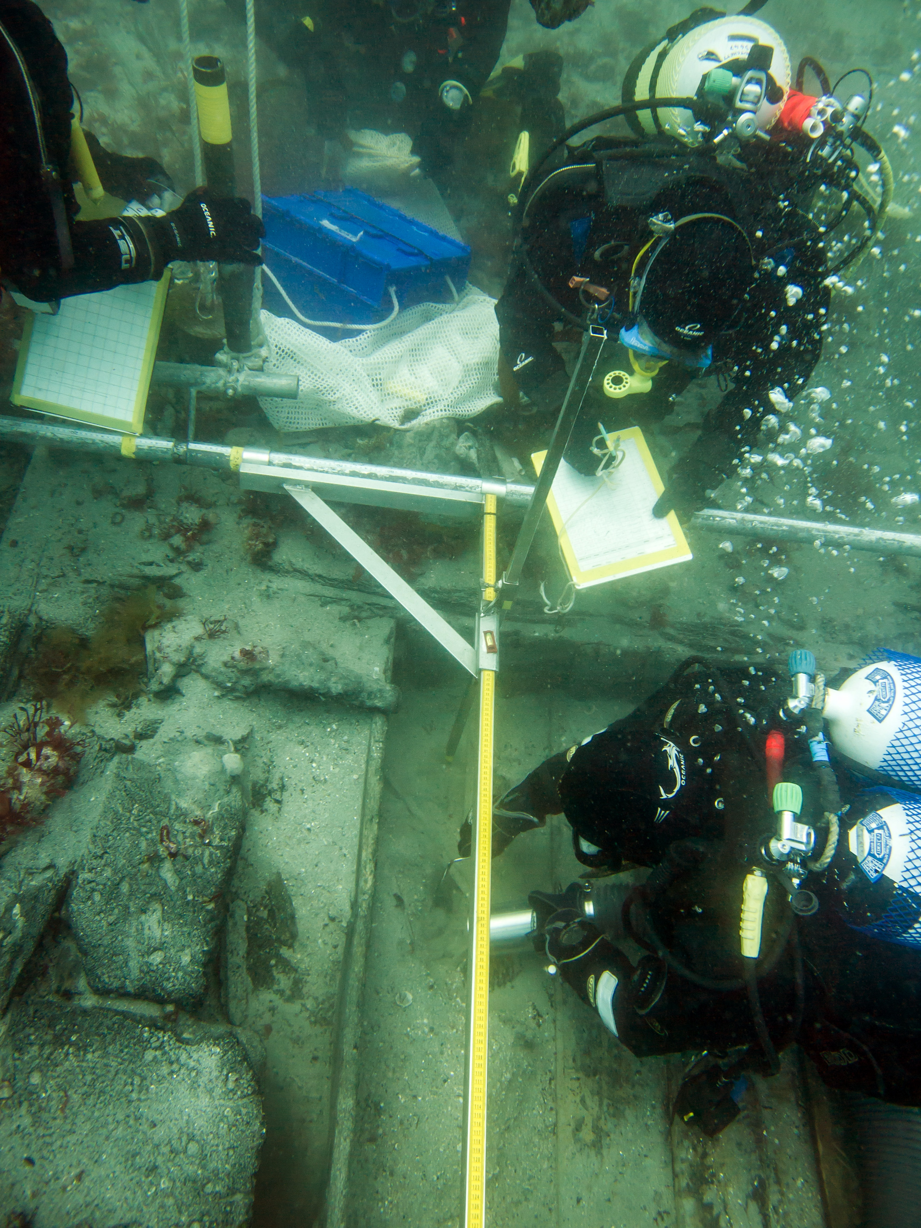
In 2012, CISMAS were commissioned to undertake the excavation of a section of the stern of the wreck, in order to investigate the surviving main gun-deck ordnance, record a gun-deck port, and to further record the stratigraphy within the wreck (Figure 9). In addition to these goals, the project included the first phase of a long-term reburial trial, in which artefacts recovered from the wreck during the course of the excavation were reburied on the site (following initial recording and conservation), in order to test reburial as a method of long-term storage of artefacts from wreck sites. The artefacts were buried in two separate collections. The first is to be recovered after 10 years, and the second after 25 years.
Following the discovery of newly exposed wreck material during 2014, a project to record and excavate was commissioned, in order to establish the nature and extent of the material, and to recover any objects at risk of loss. Three trenches were excavated during this season, and the project led to a reappraisal of how the Colossus was wrecked. The following year, CISMAS again returned to the wreck site in order to seek evidence that would confirm the new wrecking theory.
This case study demonstrates the breadth of work, including monitoring, survey, excavation, the development of new theories, and the testing of ground-breaking methodologies that can be undertaken by a group consisting largely of volunteers donating their free time and expertise, working under the guidance of a nominated archaeologist, with a limited quantity of funding from both the state, via Historic England and its predecessors, and from other funding bodies.
The London [NHLE] was a 2nd rate 'Large Ship' built at Chatham in 1656, which served in both the Cromwellian and Restoration navies. The London was present at the siege of Dunkirk in 1658, and was part of the fleet that transported Charles II back to England during the restoration of the monarchy in 1660. In 1665, at the outset of the Second Anglo-Dutch War, the London was destroyed by a large explosion in the Thames estuary. The loss of the London was seen by Samuel Pepys, who recorded the event in his diary:
'This morning is brought me to the office the sad newes of The London, in which Sir J. Lawson's men were all bringing her from Chatham to the Hope, and thence he was to go to sea in her; but a little a'this side the buoy of the Nower, she suddenly blew up. About 24 [men] and a woman that were in the round-house and coach saved; the rest, being above 300, drowned: the ship breaking all in pieces, with 80 pieces of brass ordnance. She lies sunk, with her round-house above water. Sir J. Lawson hath a great loss in this of so many good chosen men, and many relations among them.'
The wreck of the London was discovered in 2005 during work in advance of a large-scale port development. Following assessment, the site was designated under the Protection of Wrecks Act 1973 in 2008 (Evans 2017).
Since 2010, a group of local divers have undertaken monitoring of the site, lead by Licensee Steve Ellis, under the guidance of a nominated archaeologist, currently Mark Beattie-Edwards of the Nautical Archaeology Society. As the site was suffering from erosion, and artefacts were at risk of being lost, a licence for the recovery of finds found on the surface of the seabed was granted in 2012. The wreck of the London lies in the Thames estuary, and represents a very difficult working environment. It is located on the edge of a very busy shipping lane, in two separate areas, and large cargo vessels regularly pass close to the site. It is also a highly tidal environment, with visibility on the site often virtually zero, and work on the site undertaken almost by touch alone.
In 2014, Historic England commissioned a project to evaluate the site. This project was undertaken by Cotswold Archaeology, and incorporated both the volunteer licensee and a team of professional archaeologists. The aim of the project was to improve our understanding of the surviving vessel structure and associated seabed deposits, and to undertake the recovery of artefacts that were at risk of loss as a result of the ongoing erosion of the site.
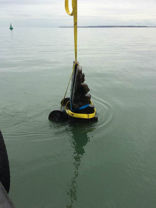
During the course of this project, a gun carriage was discovered by the licensee and team, after being partly exposed following movement of seabed material. It was in excellent condition, having been preserved by the clay of the Thames Estuary. Over the following months, parts of the gun carriage became more exposed and at risk of breaking up owing to the strong currents and exposure to marine organisms. The waterlogged wooden gun carriage, which weighed approximately one ton, was lifted in the summer of 2015 (Figure 10). It is currently undergoing conservation by York Archaeological Trust. When the conservation process is completed, it is intended that the carriage will go on display at Southend Museum.
In 2019, Historic England commissioned the Nautical Archaeology Society to undertake a feasibility study into a programme of recovery, recording and reburial on artefacts and structural timbers from the London wreck. This project will explore a possible method of avoiding the permanent loss of objects and information, but without the prohibitive costs associated with conservation.
The London Shipwreck Trust was established in order to raise funds for the continued study of the shipwreck site. In July 2019, the trust, working in partnership with the Nautical Archaeology Society, and Southend Museum, launched the 'Save the London' campaign. The aim of this campaign is to seek public and corporate sponsorship, in order to raise funds to pay for the recovery, conservation and display of artefacts from the London. Historic England is supportive of this independent initiative as it develops cultural partnerships and collaboration, as well as increasing local community capacity and skills.
We have also commissioned MSDS Marine to undertake a programme of geophysical survey of the wreck site in the summer of 2019. This project consists of a desk-based review of extant datasets relating to the wreck, and a survey that will comprise sub-bottom profiling of the wreck, in order to provide further understanding of the nature and extent of buried deposits associated with the protected wreck site. The results of this project will inform the on-going management of the wreck.
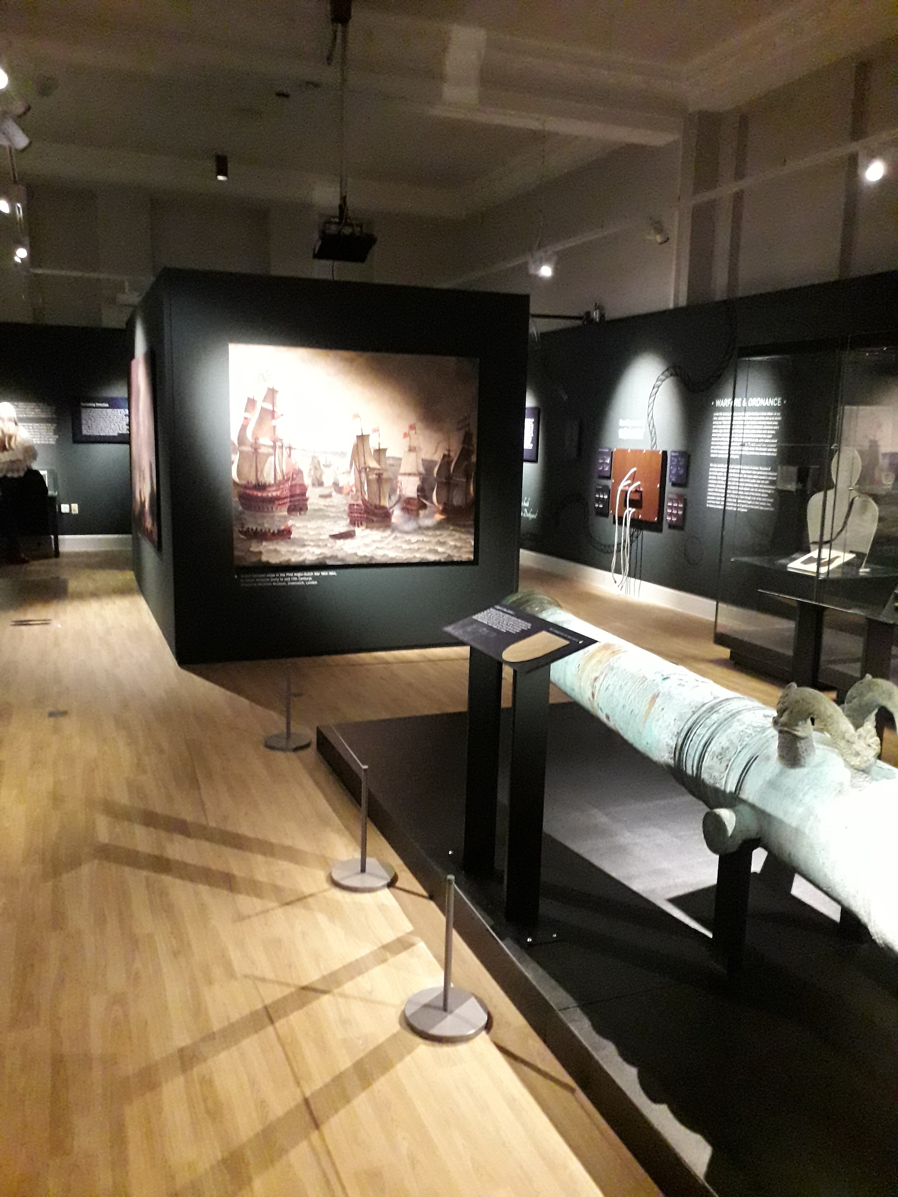
This site continues to be classified as high risk. However, the work being undertaken by the site licensee and nominated archaeologist, alongside research projects commissioned by Historic England and fundraising activities undertaken by the London Shipwreck Trust and its partner organisations is helping to ensure a better understanding of the London, and to ensure the future conservation and management of the wreck. An exhibition at Southend Museum called 'The London Shipwreck: A Sunken Story' opened in 2018 (Figure 11). The exhibition features displays of artefacts recovered from the seabed by the Licensee Steve Ellis, and conserved at the Historic England facility at Fort Cumberland. The exhibition is an excellent example of what can be achieved through close co-operation between Historic England as representatives of the state, the local authority museum, professional archaeologists and a dedicated team of volunteer divers.
Not all of the wrecks protected under the Protection of Wrecks Act 1973 are of wooden sailing vessels. This case study concerns a shipwreck of a much more recent era. The wreck of HMT Arfon [NHLE] was discovered in 2014 by two divers who run a dive charter boat business. The wreck is located off the Dorset coast.
The Arfon was a steam trawler, requisitioned by the navy in 1914 for use as a mine-sweeper, and fitted with a 6 pounder gun. The trawler worked out of Portland Harbour, sweeping mines laid by German submarines along the shipping lanes of the Dorset coast. The Arfon spent three years successfully sweeping mines before it detonated a mine on 30 April 1917, and sank in less than two minutes, with the loss of 10 members of the crew of 13.
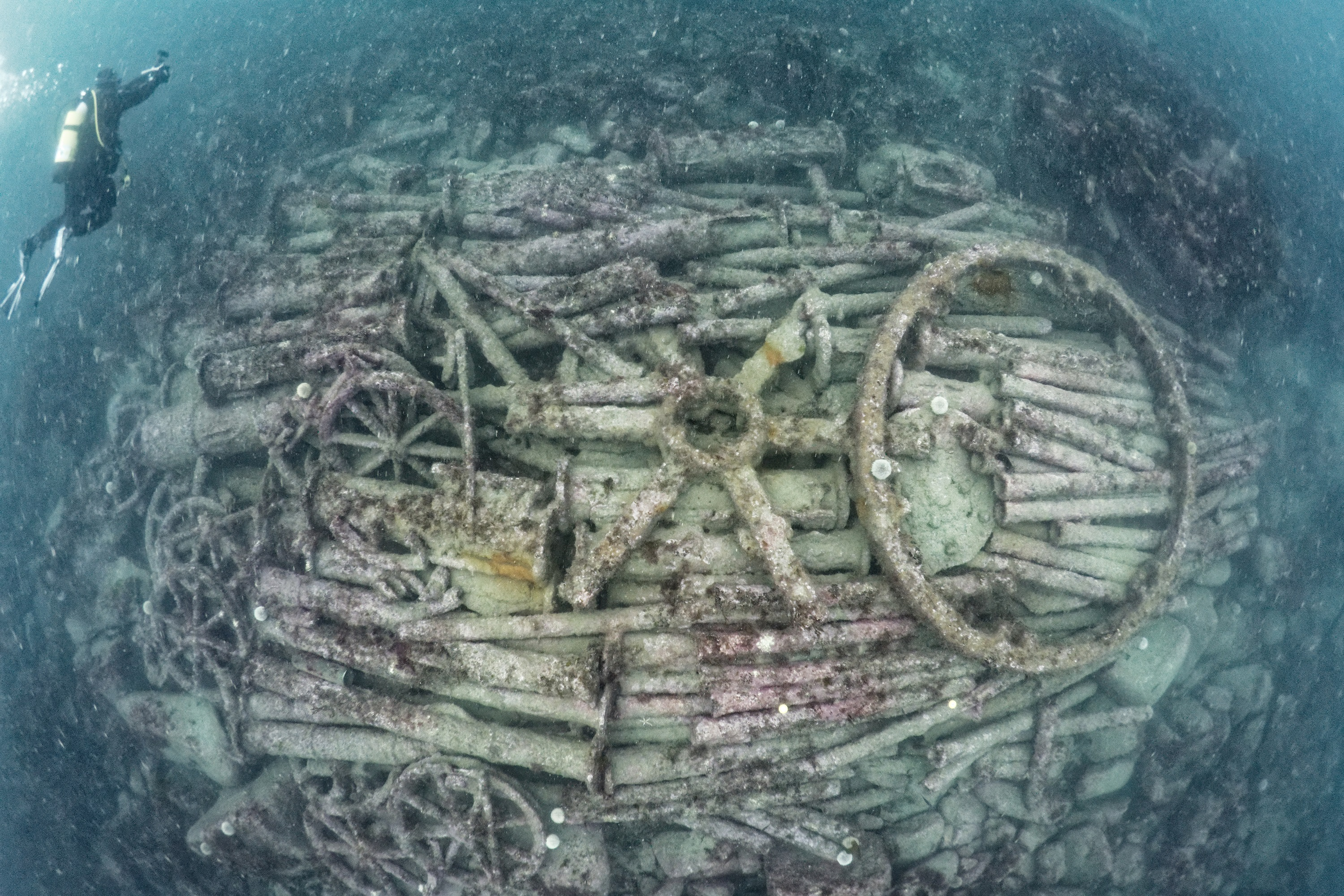
The wreck is exceptionally well preserved. The trawler's key features, such as its mine-sweeping gear, deck gun, portholes, and engine room are still intact on the seabed. The vast majority of wrecks of this period around the English coast have been heavily salvaged, with their fixtures and fittings taken as trophies and souvenirs by visiting divers. The Arfon is unique, as it has been untouched for almost 100 years, before it was first discovered in 2014. The wreck was considered to be vulnerable to souvenir hunters and uncontrolled salvage, and was therefore designated under the Protection of Wrecks Act 1973.
Since the site became protected, the finders have been undertaking further archival research in order to further knowledge and understanding of the wreck. They have discovered previously unknown documentation, which supported the positive identification of the wreck. In addition, the licensees have taken an active role in maintaining site-security, developing a good relationship with the National Coastwatch Institution, a voluntary organisation whose aim is to keep a visual watch along UK shores in order to protect life at sea. As a result of this relationship, it is now a condition of all licences that anyone diving the Arfon must radio St Aldhem's Head NCI in order to announce their intention to dive. Unauthorised divers will be monitored and reported to the Coastguard. This ensures that only legitimate visitors access the protected wreck.
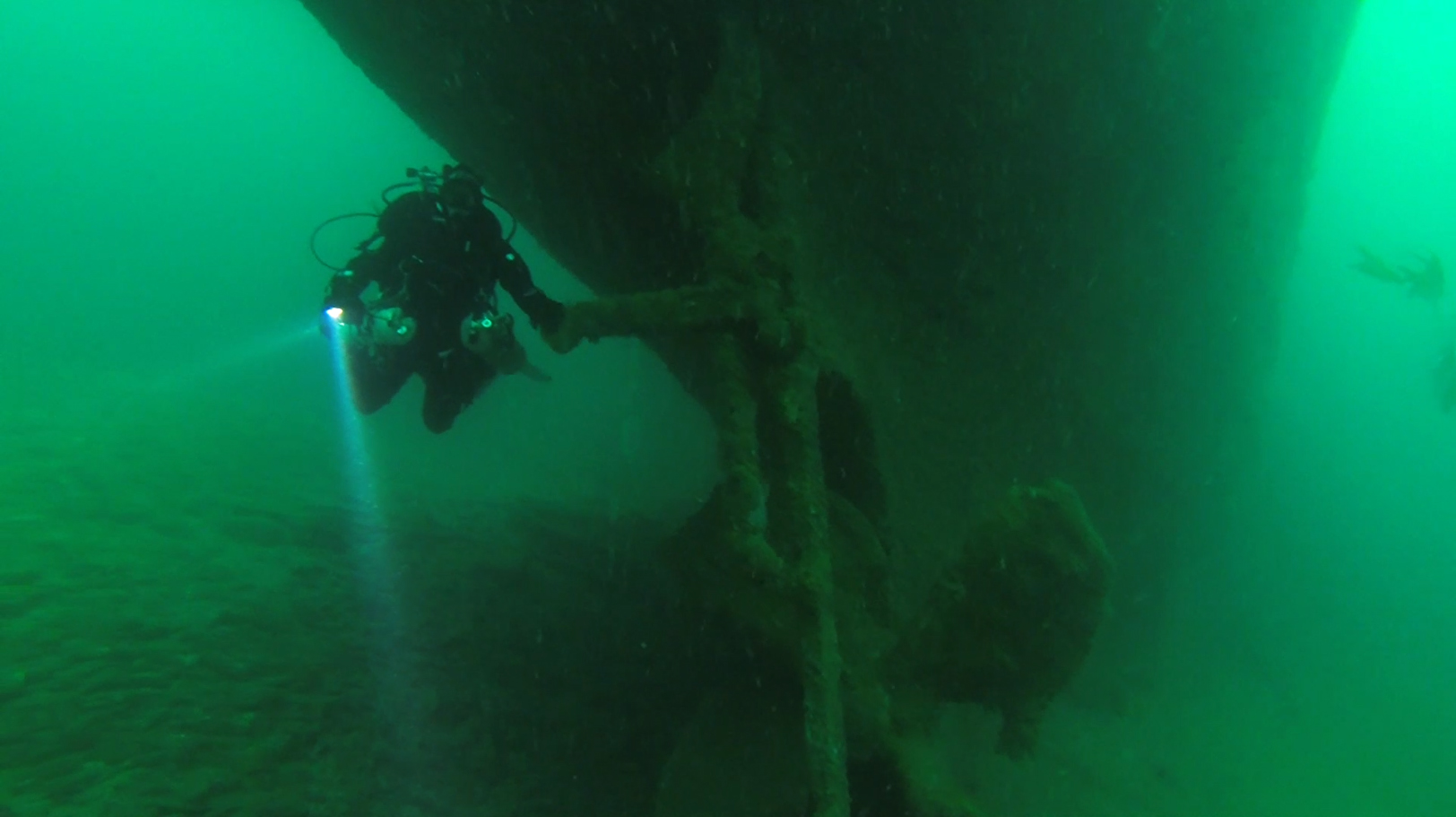
The wreck has proved popular with visiting recreational divers (Figure 12). Six local charter boat companies now hold licences for the wreck, and regularly take groups of divers to visit the site. HMT Arfon is an excellent example of how developing an increase in awareness, a sense of community pride, and the encouraging of local vigilance, can assist in overcoming the risk to a wreck from souvenir hunting and illegal salvage.
The Protection of Wrecks Act 1973 provides an effective means to protect and manage nationally important historic shipwrecks. The licensing system allows for the effective management of the wrecks through engagement with the diving community, who act as volunteer custodians of the sites.
The case studies described above have shown the broad range of sites that are protected under the Act. The variety of sites means that there is no simple approach that is suitable for all the sites. They each have their own particular needs and requirements. In a climate of limited resources and reduced budgets, Historic England works closely with dedicated teams of volunteers, to train and to enthuse individuals, and increase the skills of local groups and societies to help preserve these important sites for the future.
In addition, we are committed to increasing public access to the wreck sites, with enhanced visitor experiences being provided by dive trails where appropriate, and, with public access being enabled by virtual trails as well, to ensure that as broad a section of the population as possible are able to access and experience these fascinating sites.
The contribution of the volunteer licensees to the protection of these sites is invaluable. Our current projects to recruit new volunteers to existing dive teams will ensure that the decades of experience held by many of these groups is handed-on to the next generation of protected wreck licensee divers, and that England's historic wreck sites continue to be protected, managed and conserved on behalf of the nation.
Internet Archaeology is an open access journal based in the Department of Archaeology, University of York. Except where otherwise noted, content from this work may be used under the terms of the Creative Commons Attribution 3.0 (CC BY) Unported licence, which permits unrestricted use, distribution, and reproduction in any medium, provided that attribution to the author(s), the title of the work, the Internet Archaeology journal and the relevant URL/DOI are given.
Terms and Conditions | Legal Statements | Privacy Policy | Cookies Policy | Citing Internet Archaeology
Internet Archaeology content is preserved for the long term with the Archaeology Data Service (ROR). Help sustain and support open access publication by donating to our Open Access Archaeology Fund.
 Home
Home