Cite this as: Schopper, F. 2020 Seddin, Freyenstein and Wittstock. Research, presentation and sustainable site management in Northern Brandenburg, Internet Archaeology 54. https://doi.org/10.11141/ia.54.5

The State of Brandenburg covers an area of around 30,000 sq. km, surrounding Berlin City. However, this article focuses on the more remote areas in the north-western parts of our state (Figure 1). The Prignitz is a historic region halfway between Berlin and Hamburg. Its name still survives in the names of County Prignitz and County Ostprignitz-Ruppin. For approximately 15 years, the Brandenburg State Authorities for Heritage Management and State Museum of Archaeology (BLDAM), together with the local authorities, have been working on a tourist route to discover archaeology. It is based on remarkable sites and monuments with important archaeological or historical information. The Prignitz Archaeological Route (Figure 2) includes the Slavonic-German stronghold at Lenzen, a megalithic tomb at Mellen, the Bronze Age King's Grave at Seddin, the Bronze Age features of the so called 'Teufelsberg' near Wolfshagen, a medieval castle in Meyenburg, an abandoned town in Freyenstein and the 17th-century battlefield near Wittstock. The pace of development and research possibilities differ from site to site. Therefore, this article concentrates on the three, thus far, most developed sites of Seddin, Freyenstein and Wittstock.

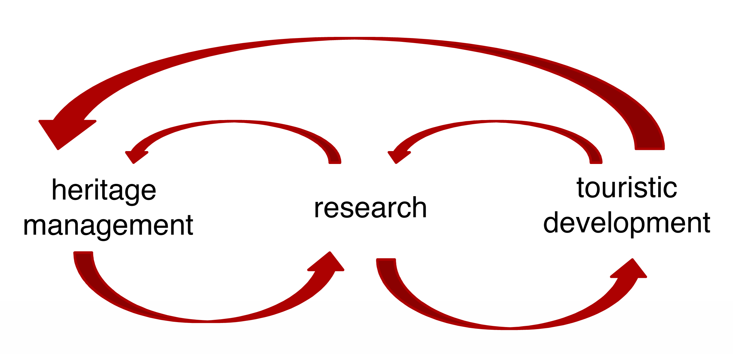
Each place had to apply three main approaches (Figure 3). Firstly, there was the heritage management and administration work, which involved laying out the track and handling budgets regarding protection, admissions and funding. Second came the research phase, including a lot of effort to qualify older information on the sites and to add new insights. Thirdly was the tourist development, which involved the erection of signposts and the construction of cycle tracks, as well as creating commercial products, branding and advertising efforts. Museum work had to bring the stories to the people. Of course, all three approaches are very much linked together. The ropes of the framework went back and forth. This article can only reflect a small part of the workload; nevertheless it will hopefully give an insight into the structures of the archaeological monuments and a short outline of the complex projects.
An important step was the so-called 'Prignitzer Erklärung' (Prignitz declaration), signed on 28 May 2009. It is a letter of intent signed by the county authorities, the mayors, the tourist board, NGOs and the State Authorities for Heritage Management and the State Museum of Archaeology to declare their commitment to the project.
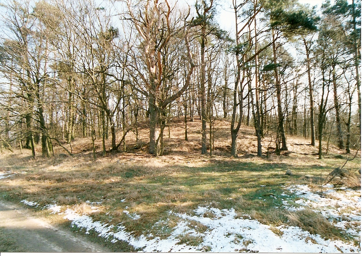
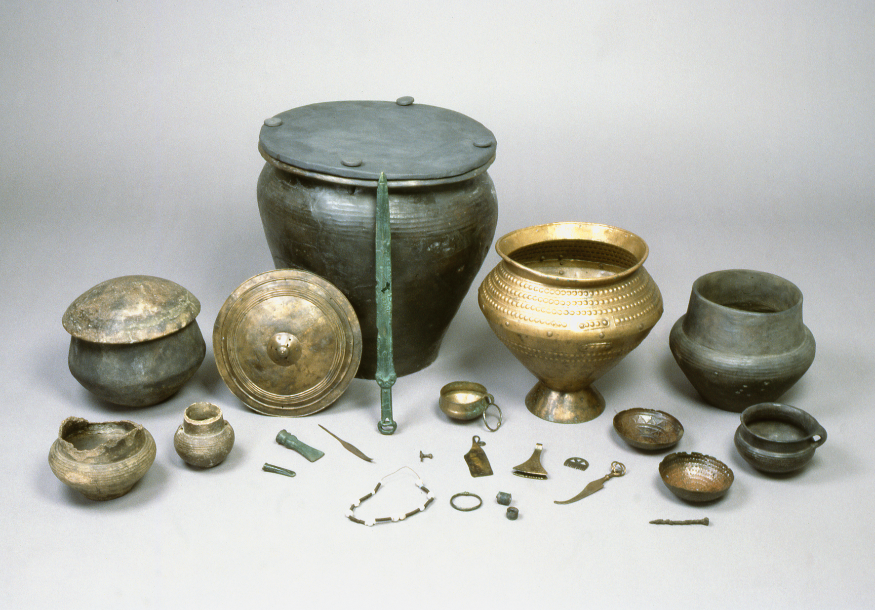
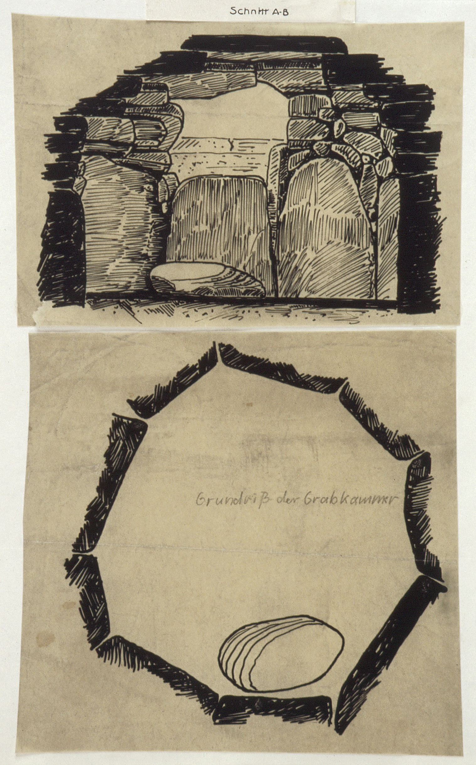
Close to the village of Seddin is an impressive late Bronze Age burial mound, known as the King's Grave. The dimensions of the mound, with a diameter of 63m and a height of approximately 10m, are quite unique for that period (Figure 4). As far as we know, it contains only a single grave chamber. Even new geophysical methods gave no suggestion of further graves. Grave goods and radiocarbon analysis date the mound shortly before 800 BCE (Figure 5). Compared to the dimensions of the mound, the collection of ceramics is astonishingly limited, but compared with other graves of the Nordic Bronze Age (usually only one or two vessels), the collection is of considerable size. Quite remarkable is the outer urn, which was covered with a ceramic cap and fixed with ceramic nails. Within this was the inner urn, a bronze amphora, containing burnt bones. Its cap was a bronze phallera. Axe heads, a knife, rings, pearls, a razorblade, a bronze comb, a sword, a lancet, small bronze vessels and iron pins demonstrate the importance of the deceased. The stone chamber was constructed using glacial erratics, and had a corbelled roof. The walls were plastered with clay and painted (Figure 6). New analysis of the plaster material caused a dispute about its deliberate mixture with chalk to enhance its appearance (Knoll et al. 2014; Schlütter and May 2018). There was no entrance to the chamber, which was sealed and covered by the earth and stone mound.
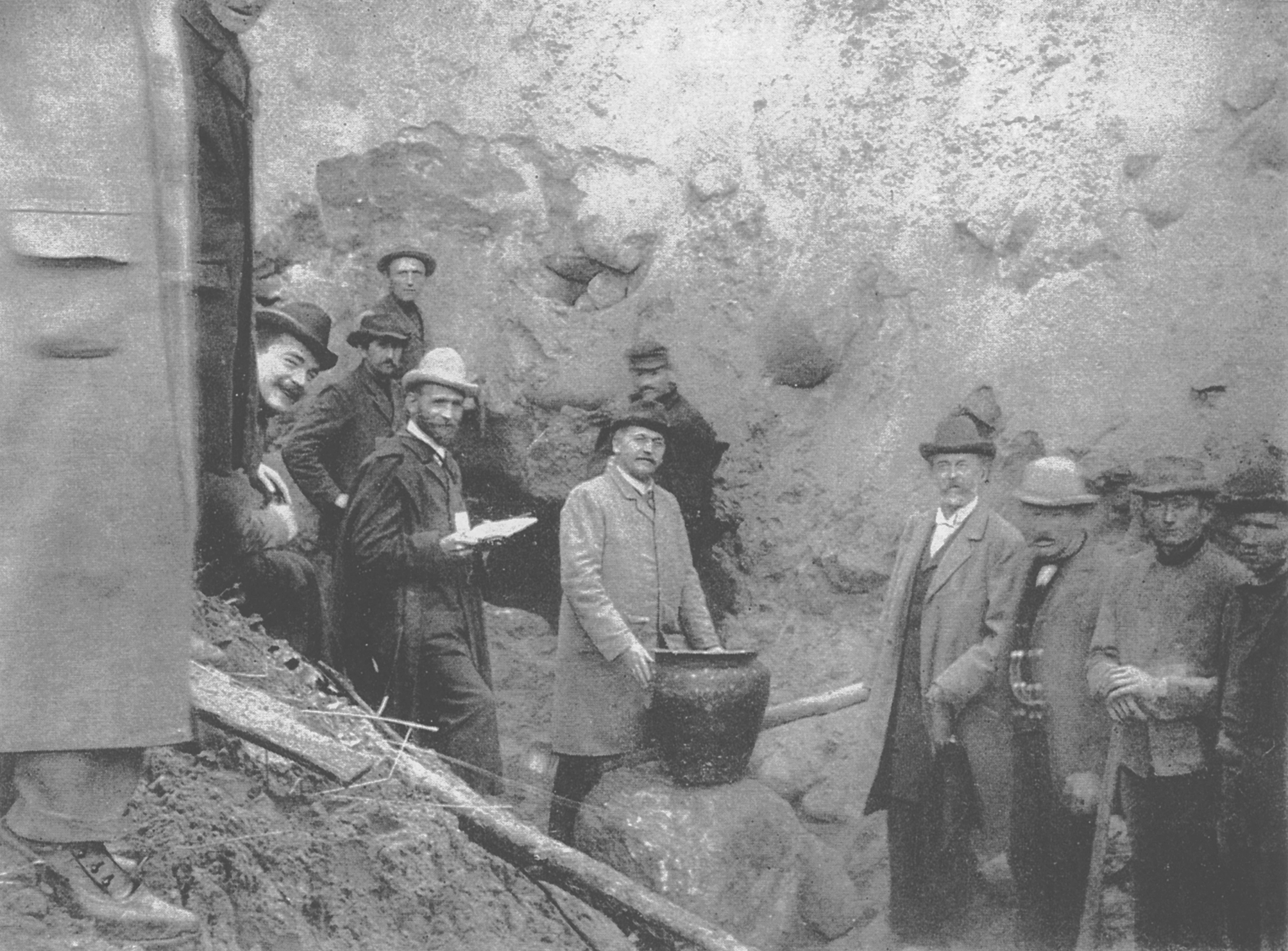
The stones made the mound a promising site for economic exploitation in the late 19th century. The then privately owned mound was used as a stone quarry for street paving. After the unexpected discovery of the grave chamber and its remarkable contents in 1899, the museum in Berlin was informed and subsequently several eminent archaeologists inspected the site (Figure 7). In an unprecedented undertaking, the area was bought as an archaeological monument by the Brandenburg Province of the Prussian state to stop the quarry activities and preserve the site for the future. Today it is the property of the Community of Groß Pankow.
When the grave was discovered, the mound was almost bare of trees and its surface had been damaged by quarrying activities. Having bought the mound, the province authorities proceeded to smooth the surface. Following the conventions of the time, they even planted trees on top of it to make it look better. With 19th century Mediterranean discoveries in mind, they built a modern, dromos-shaped entrance to the originally sealed grave chamber. After that, the site itself was left practically untouched for almost 100 years.
Subsequent research work concentrated almost entirely on the finds. Alfred Kiekebusch was engaged to publish the finds and parts of the documentation, which eventually took place almost 30 years after their discovery (Kiekebusch 1928). The grave was well known to the general public (Pastenaci 1935; Kitzler 1936) as well as to scholars, who frequently referred to the finds and the elaborate architecture of the grave by quoting Kiekebusch. In the mid-1970s, the East German archaeologist, Harry Wüstemann, published a paper on the social structure of the Bronze Age societies in the Seddin region (Wüstemann 1974).
To commemorate the discovery and evaluate its impact on Bronze Age research in Germany, the BLDAM organised an anniversary conference in 1999. The papers presented and the discussions made it very clear that it was due time to revive research on the material and the original documentation, as well as to apply new methods to reveal further information (Schopper 2000; Kunow 2003). The condition and appearance of the site was quite inadequate for the importance of the King's Grave and its enormous mound.
In the aftermath of the conference, Jens May, an archaeologist within the BLDAM, made an elaborate plan of necessary steps to preserve and investigate the mound, as well as to enhance its importance in terms of cultural tourism (May 2003). Furthermore, he re-assessed older information (May and Hauptmann 2005). From the beginning of the new approach to Seddin, there was significant interest among the Prignitz county council, in particular Ortrud Effenberger (Head of the Counties Heritage unit) and Edelgard Schimko (Head of Economy and Development Department of Prignitz County). Likewise the mayor of Groß Pankow, Thomas Brandt, and his community administration made a major effort to enhance the project. In addition to these three main partners (County of Prignitz, Community of Groß Pankow, Brandenburg State Authorities for Heritage Management and State Museum of Archaeology), further partners became involved and provided varying amounts of support (short-list: Brandenburg State Ministry of Culture, Research and Science; Freie Univeristät Berlin; Hochschule für Technik und Wirtschaft, Berlin; Beuth Hochschule für Technik, Berlin; Georg-August-Universität Göttingen; Eurasien Abteilung des Deutschen des Archäologischen Instituts, DFG (German Research Fund), EU 'Leader' Development Fund; students and local volunteers).
A significant problem was the fact that the King´s Grave was nearly invisible beneath the trees that had been planted in the late 19th century and the undergrowth that had taken hold of the site since then. Under German laws, a forest has to stay a forest and the area of the mound was defined as forest. Negotiations with forest wardens and environmental authorities resulted in the felling of 70% of the trees, while it was agreed that 30% of the trees would be retained. This was also important because a group of locals was very fond of the mound with the trees and started an international petition against tree cutting. The compromise resulted in a visible mound with a few trees, which provide a park-like appearance.
To understand the site and its surroundings in greater detail, a programme of surveying was carried out using modern methods, such as airborne laser scanning, drone-based photography, and geophysics. The mound is on a shallow ridge between little rivulets. The stone quarry of the 19th century had destroyed quite a lot. Adjacent to the mound a line of pits with burnt stone was excavated.
In addition to the county-led excavations, Svend Hansen from the German Archaeological Institute and the present writer were lucky to include the research work on Seddin in the Berlin Excellence Cluster of the German Research Fund 'TOPOI', which allowed us to intensify the research work for six years (Hansen and Schoppere 2018). This resulted in several articles and books being published (May 2018, footnote 17).
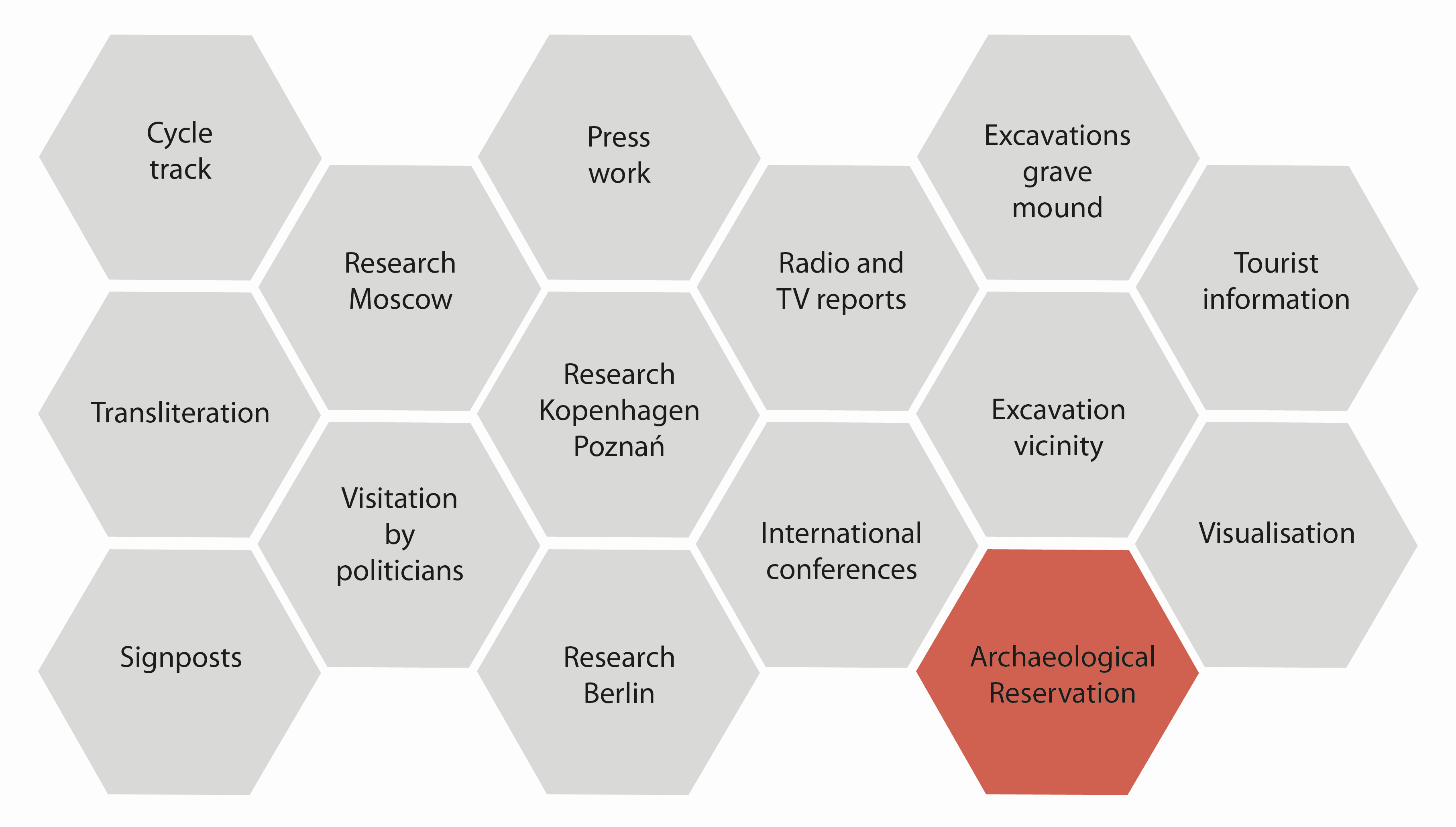
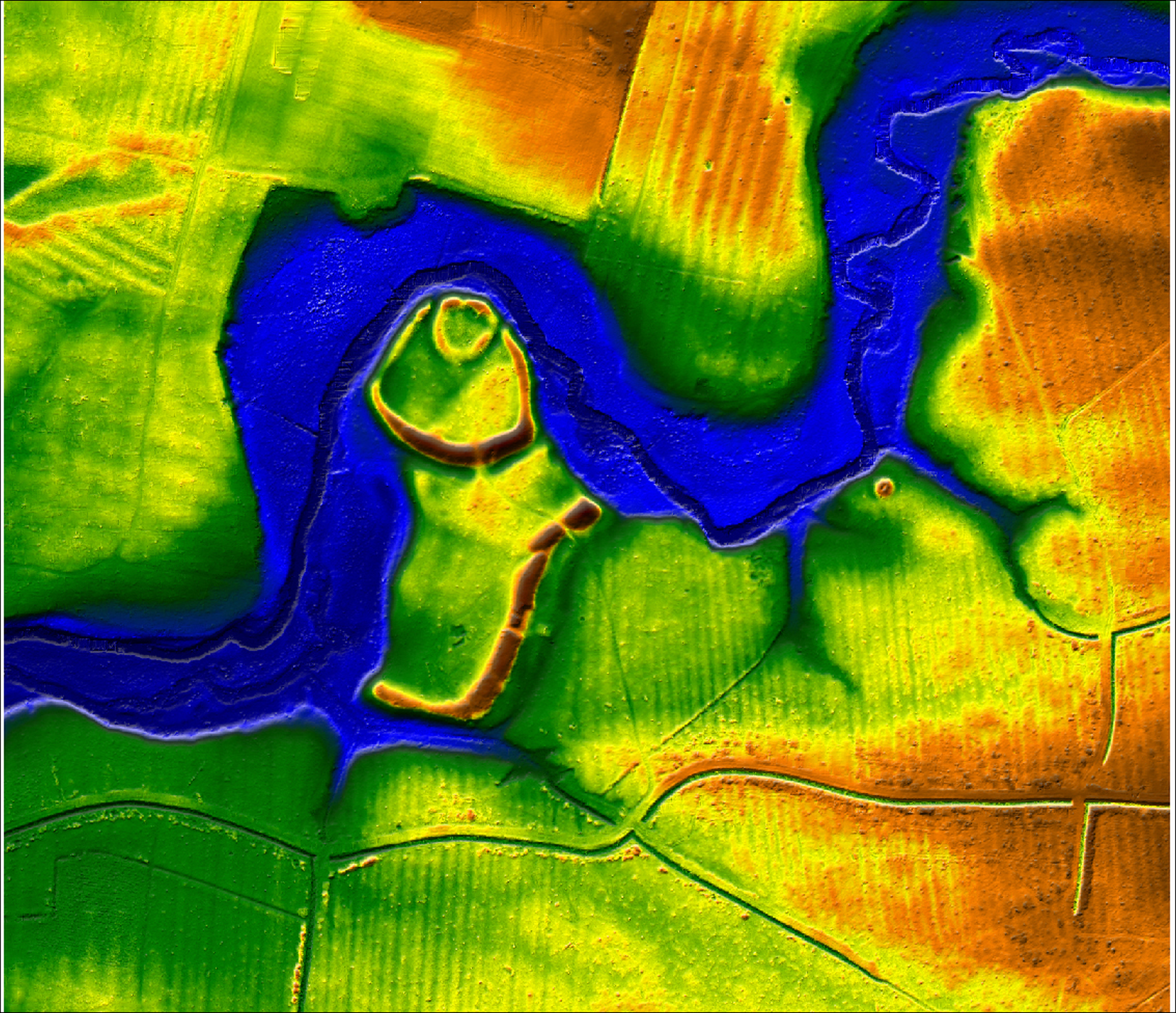
To develop Seddin within the tourist route, a lot of different steps were necessary. They ranged from international conferences to visits by politicians, and provision of information panels to the construction of cycle tracks (Figure 8). One of the most important steps was the declaration of an archaeological reserve by Brandenburg State Cabinet. The Ministry, following the proposal of the Brandenburg State Authorities for Heritage Management and State Museum of Archaeology, suggested a wider area for the reserve in order to understand the King's Grave within the context of the regional Bronze Age. Not far from Seddin are other older Bronze Age graves with swords and traces of large grave mounds. A few kilometres away is a fortification, which was previously not well dated (Figure 9). Following a programme of survey and excavation, we are now able to date the ramparts of the so called 'Schwedenschanze' to the Bronze Age.
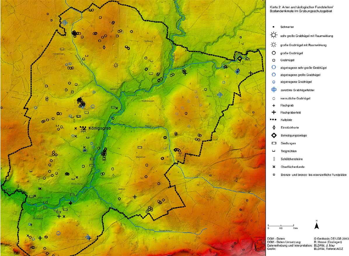
In the environs of Seddin, we mapped and classified all the Bronze Age remains, especially grave mounds. Of course, most of them are not precisely dated, but in this area grave mounds were only built during the Bronze Age period. To preserve the landscape and its Bronze Age remains around Seddin, the State Cabinet of Brandenburg established an archaeological reserve named 'Siedlungs- und Ritualraum Königsgrab Seddin' ('Settlement area and ritual landscape of the King's grave of Seddin'). Comprising 5661 hectares, or 17,000 acres, it is nearly 60 square kilometres and is one of the largest archaeological reserves in Germany (Figure 10).
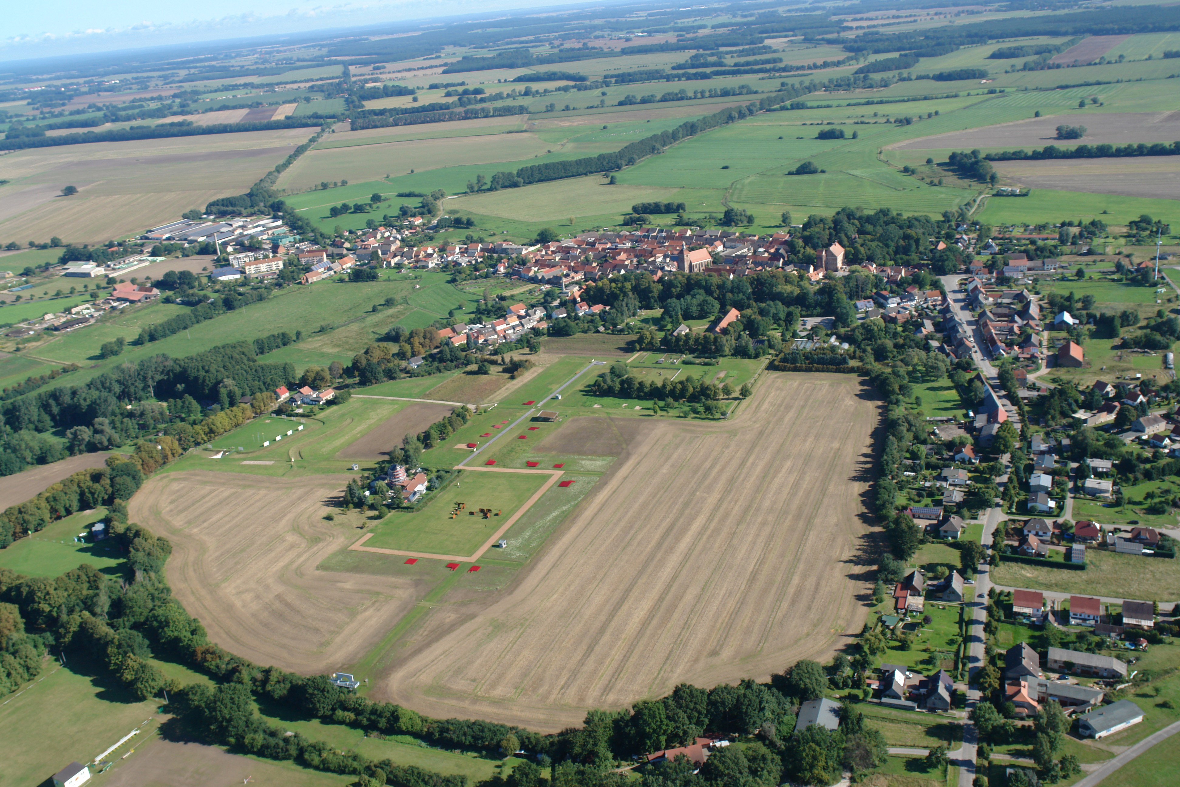
About 40km north-east of Seddin is the small, picturesque town of Freyenstein, with a market place, a church and even two palaces. It looks quite old, but it is, in fact, the new town of Freyenstein, founded in 1287. The old town of Freyenstein, which existed between 1100 and 1280, was double the size and up the hill from the new town, and was invisible and almost forgotten. Limited information about the old town was preserved only by inscriptions on older maps and parchment documents. The vulnerable position of Freyenstein, on the border between Brandenburg and Mecklenburg, resulted in abandonment of the old town, and its subsequent replacement by a smaller town on a new site. In contrast to virtually all other central European towns, the area of the old town was used almost exclusively for agricultural purposes. This has resulted in an unusual degree of preservation of subsurface archaeology and a unique treasure for modern archaeologists. Hardly any part of the old town, which lays in an open area surrounded by a band of green where the old town wall ran (Figure 11), was impacted by subsequent building activity or infrastructural projects. All subsurface structures of the old town, including stone cellars and paved roads, remained intact on the site.

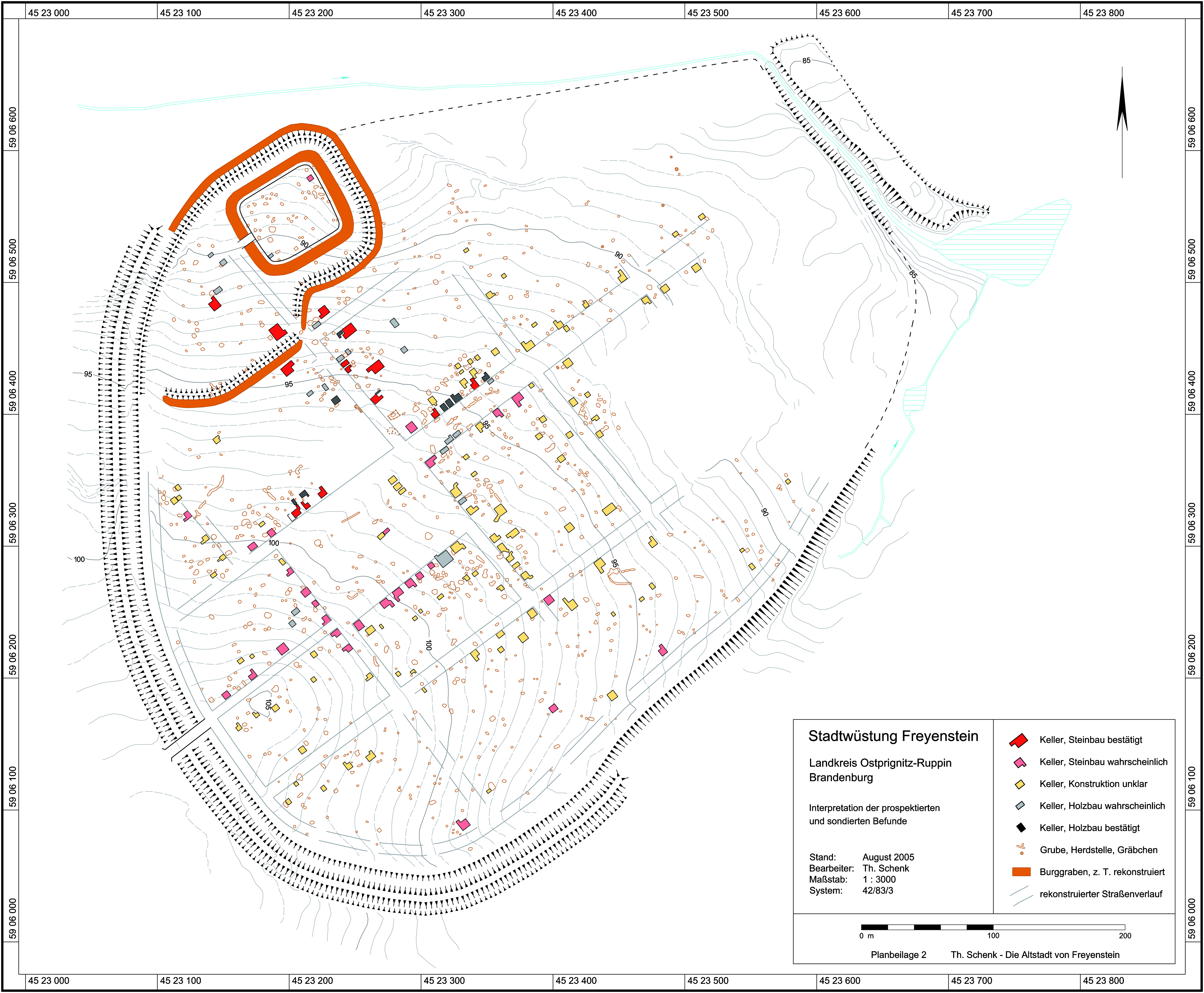
Archaeological research started in the 1980s, when Christa and Fritz Plate excavated some stone cellars. One cellar contained a great deal of ceramics, including drinking vessels, jugs and jars, giving the impression that it once belonged to an inn (Figure 12). While these excavations were limited, in the early 21st century Thomas Schenk used geophysical survey to reveal the general outline of the town, with its rows of houses, the market place and the wide main road (Schenk 2009). He was even able to find an old castle, which was completely unknown from the written sources (Figure 13). This new town map showed the archaeological potential of the site for preservation and research, as well as for cultural- and heritage-based tourism.
Fortunately, the community of Wittstock, which Freyenstein is a part of, was really interested in developing the site. In particular the mayor, Jörg Germann, was a great supporter and local champion of the project.
In order to develop such a site, it is necessary to have long-term access to the land or, ideally, to own it outright. The area of the old town, about 25 hectares, was privately owned by various landowners, who frequently leased it to others for use. Following a lot of discussions and repeated efforts, the community of Wittstock managed to buy most of the land. In parts of the site where this proved to be impossible, long-term leasing contracts were signed. Agriculture continues in small areas of the site, but is carefully managed and avoids deep ploughing. As a result, destruction of archaeological features is prevented or, at least, minimalised.
In one corner of the old town there is a public school building, dating from the 1950s. Given the fact that it was closed a few years ago, but still retained facilities such as toilets, a car park with enough space for buses and former class rooms that could be adapted as exhibition spaces, it was readily and cost-effectively adapted as a temporary entrance to the site.

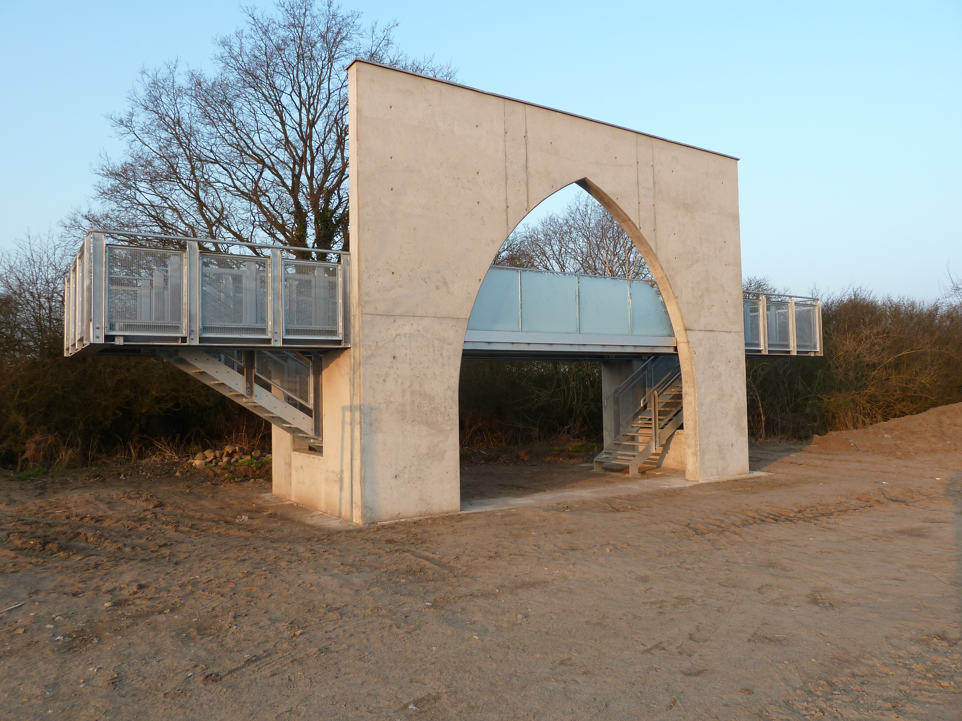
Step by step, an archaeological park was developed with funding from the European Union and the state of Brandenburg, as well as from the community of Wittstock itself. To present Thomas Schenk's important research to the public, an archaeological park was established and information about the site, as well as living conditions in the 12th and 13th centuries, is scattered around the overwhelmingly empty space. 'Steel children' play (Figure 14), a merchant appears and you can walk around the marketplace between stalls. Here and there, shelters for excavated stone cellars are built. Information about medieval architecture explain the structure of the town. The highest point of the site is marked by a new town gate (Figure 15). The platform provides a wonderful viewpoint to look over the old town and also the adjoining medieval 'new town' that continues to be inhabited.
Not far from Freyenstein, within the same community, is the battlefield of Wittstock. In the autumn of 1636, during the throes of the Thirty Years War, the Swedes fought against the armies of the German empire. The Swedes won this significant battle, though the war lasted 12 more years.
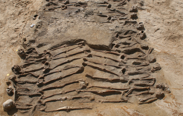
Of course, the battle of Wittstock was well known and historians had a good idea of where the battlefield was located, but there was nothing recognisable in the field and no archaeological finds had been recorded here. This changed when, during sand quarry activities, at the foot of a hill called 'Scharfenberg' south of Wittstock, for the first time ever in Central Europe a mass grave of soldiers dating from the 17th century was discovered. The remains of 120 soldiers were found packed in a grave-pit. Hardly any traces of clothes were found. Friend and foe lay side by side, naked as they were (Figure 16).
The newly discovered grave represented a substantial archaeological trace of this important battle and was an inspiring focal point to commemorate it. Fortunately, the local administration and the mayor already had such a positive experience with Freyenstein they urged us to do more with the site. Therefore, we decided to include the battlefield within the Prignitz Archaeological Route.
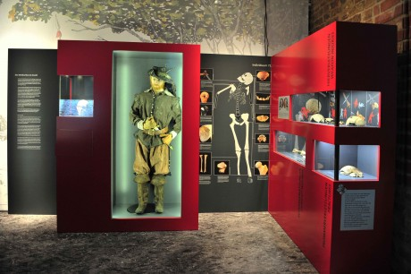
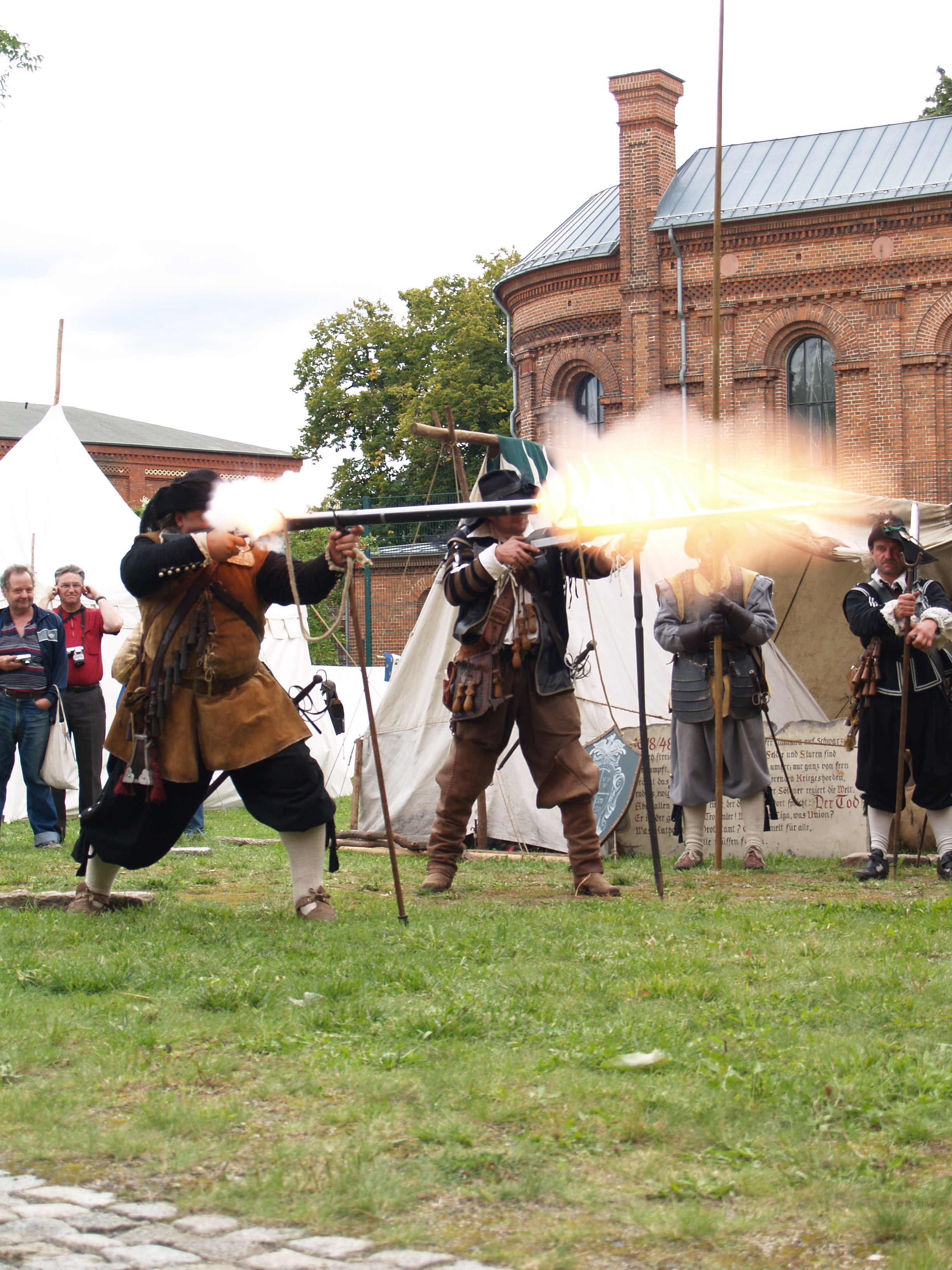
From the outset, it was clear that there are no original features, such as ditches or ramparts, to mark the battlefield. So we decided to tell the story of the soldiers from Sweden, Finland, Scotland, Spain, Austria, Saxonia, Bavaria and Croatia in a large exhibition. In the State Museum of Archaeology in Brandenburg City we showed the living conditions and warfare of the 17th century (Figure 17). The exhibition, which was accompanied by a catalogue (Eickhoff et al. 2013), conferences (Eickhoff and Schopper 2014) and re-enactments (Figure 18), was a great success in Brandenburg, and subsequently travelled throughout major German museums (Dresden, Munich, Stade, Trier). Overall, we had more than 150,000 visitors.
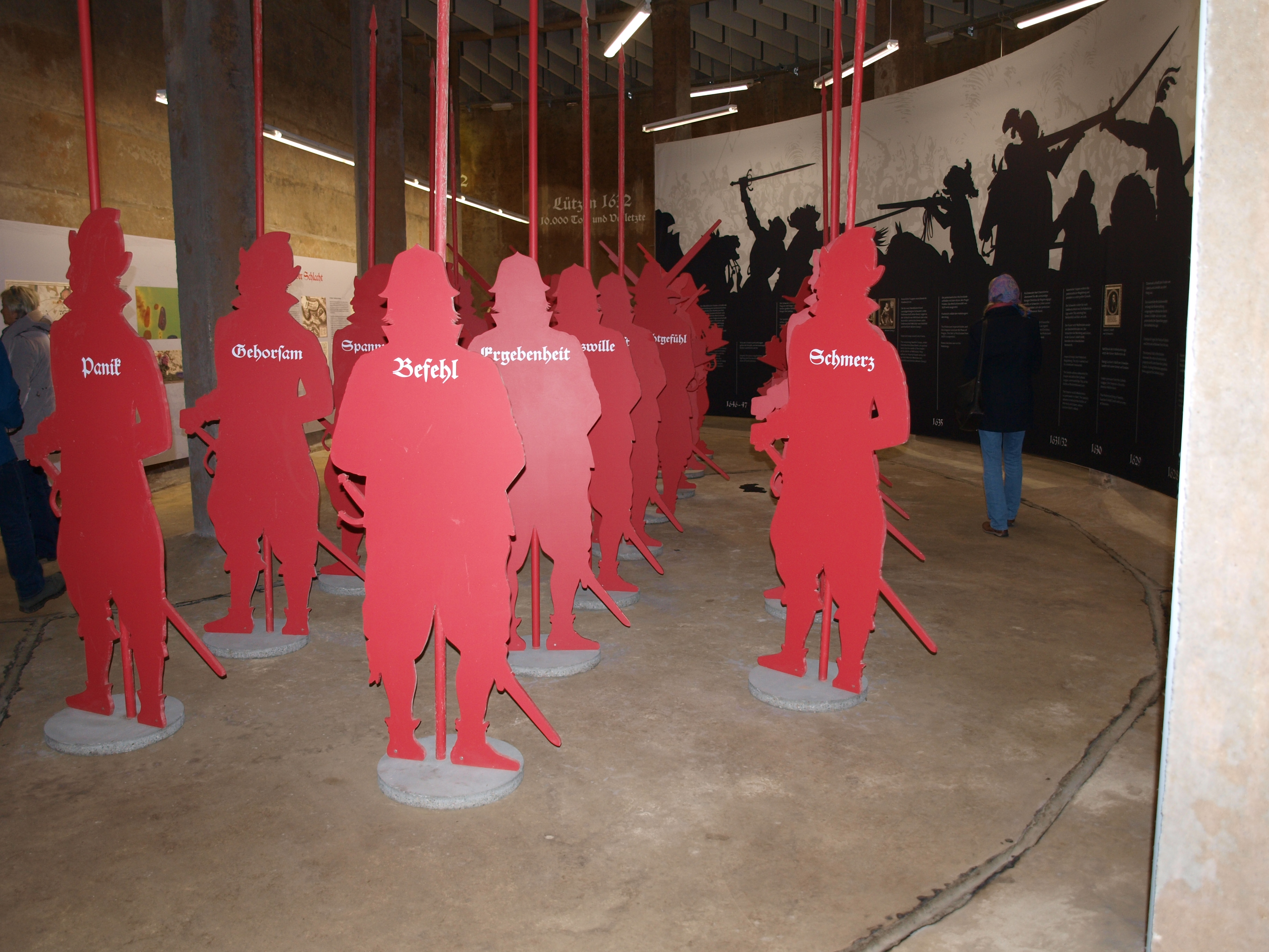
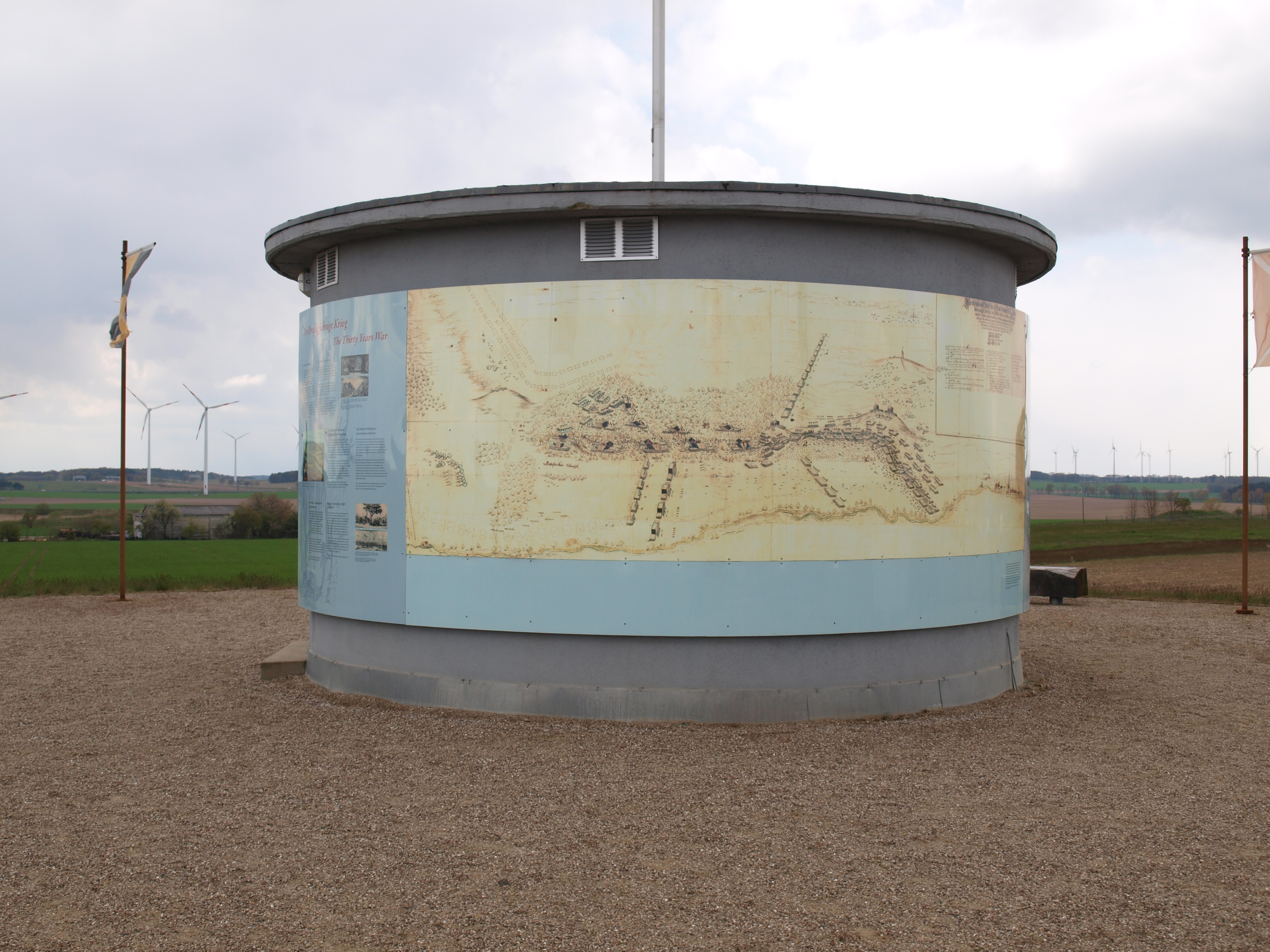
This very much illustrated the importance of the archaeological site to the state administration and the broader public, a fact that made funding a lot easier. Additionally, it was possible to use many of the presentation ideas and real-life experience of the big exhibition to establish a spin-off exhibition (Figure 19) right on the battle site. Today, an old water reservoir from the 1970s on the highest point of the battlefield displays various information panels about the battle and the archaeological approach to the site. The above-ground parts of the reservoir serve as a viewing platform (Figure 20).
This article has given an outline of our heritage management approaches to these three major sites. Some aspects are similar while some methods were adjusted, with different results. If you want to have a closer look, come and visit and see our treasures of time.
Internet Archaeology is an open access journal based in the Department of Archaeology, University of York. Except where otherwise noted, content from this work may be used under the terms of the Creative Commons Attribution 3.0 (CC BY) Unported licence, which permits unrestricted use, distribution, and reproduction in any medium, provided that attribution to the author(s), the title of the work, the Internet Archaeology journal and the relevant URL/DOI are given.
Terms and Conditions | Legal Statements | Privacy Policy | Cookies Policy | Citing Internet Archaeology
Internet Archaeology content is preserved for the long term with the Archaeology Data Service (ROR). Help sustain and support open access publication by donating to our Open Access Archaeology Fund.
 Home
Home