Cite this as: Preshlenov, H. 2022 Postglacial Black Sea Level Rising, Urban Development and Adaptation of Historic Places. The case-study of the city-peninsula of Nesebar (Bulgaria), Internet Archaeology 60. https://doi.org/10.11141/ia.60.5
A city, if it is to reflect and develop social living conditions, necessarily requires the construction of buildings, infrastructure and facilities that can provide the conditions for it to function effectively and give a unique character and monumentality to the urban environment. They are necessary conditions for the development of a sophisticated way of life and communication - exemplary qualities determined by Cicero as urbanitas (Cic. Brut. 167; Cic. Epist. 3.7.5; Cic. De orat. 1.17; Kunow 1992, 146-47).
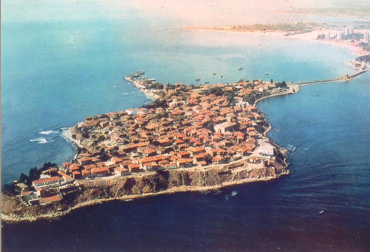
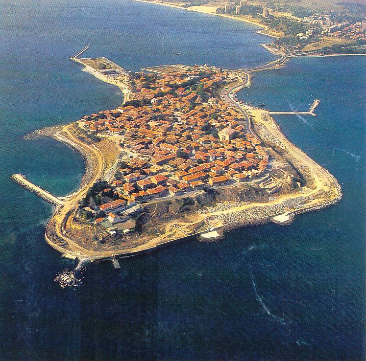
The Doric polis Mesambria Pontica (now Nesebar) was founded by settlers from Megara, Byzantium and Calhedon (IGB I2 1970, 255) during the second stage of the Great Hellenic colonisation. Its city centre is built on the Nesebar Peninsula, jutting into Burgas Bay on the west coast of the Black Sea (Фол 1995, 39-40; Preshlenov 2003a, 523-25; Гюзелев 2009, 76-92; Preshlenov 2009, 127-32; Hristov 2020, 70-77, 155-62) (Figure 1).

The spatial urban development on Nesebar peninsula is dependent on the dynamics of negative geodynamic processes of endogenous (modern movements of the earth's crust, earthquakes) and exogenous (abrasion, erosion, collapses) nature, all accelerated by eustatic fluctuations in sea level. Therefore, the highlighting of these geological benchmarks, and their relationship with postglacial climate change, their correlation with the archaeological database (fortifications, infrastructure (port waters and territory, communication approaches), sacred and secular constructions in the coastal zone), their impact on the spatial development of the urban structures of the peninsula and the modern coastal protection of the city-peninsula of Nesebar (a UNESCO World Heritage Site since 1983), is relevant even today, two-and-a-half millennia after the foundation of the Mesambrian polis.
Clarifying the dynamics of the regional relief-forming factors that have influenced construction in the contact zone between sea and land on the Nesebar peninsula, and highlighting the historical changes in the spatial development of its coastal urban structures, will be of help in predicting the pace of litho- and hydrodynamic processes. This in turn will help to optimise the protection of the modern coastline, the hydrotechnical morphosculpture in the coastal zone of the peninsula and the maintenance of the port territorial waters.
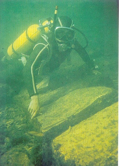
The study of development and construction activities in the coastal area of Nesebar fall within the scope of marine archaeology and also include other material traces of human activity along the coast (Marriner and Morhange 2007, 137). As part of this study, data on the paleogeographic development and urban transformations on the coast of Nesebar peninsula were analysed, mapped, and compared to similar monuments. This included reports by the following:
Based on this data, the paleo- and modern relief of the peninsula was reconstructed, as well as a basic 'morphological skeleton' (cf. Lilley 2000, 11-15; Davie 1987, 141-64) of the modern built-up urban area and the adjacent area of the peninsula. This includes:
Fluctuations in the Black Sea level are some of the determinants of the morphodynamics of Nesebar peninsula. The spatiotemporal changes in water level result from river inflow, evaporation, precipitation and water exchange with the World Ocean through the Bosphorus.
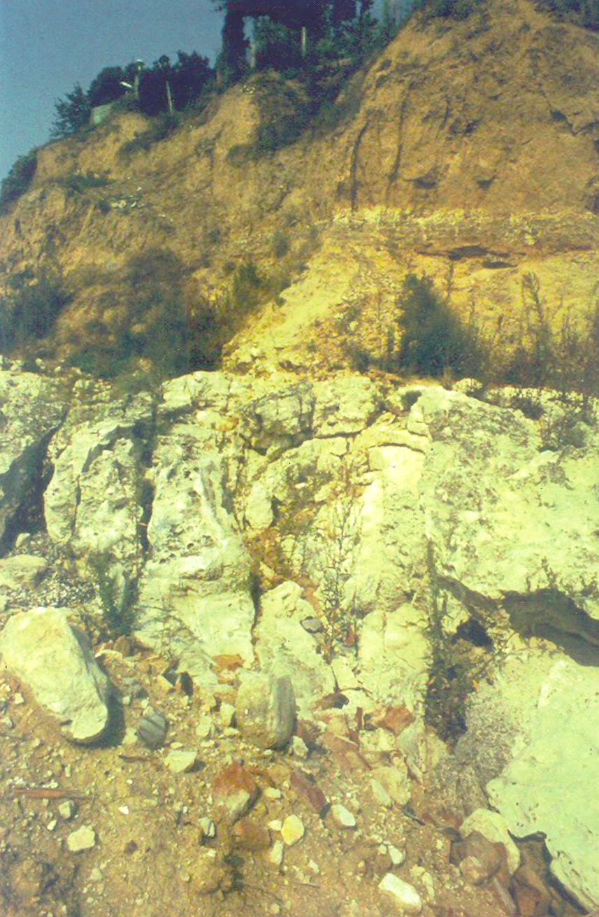
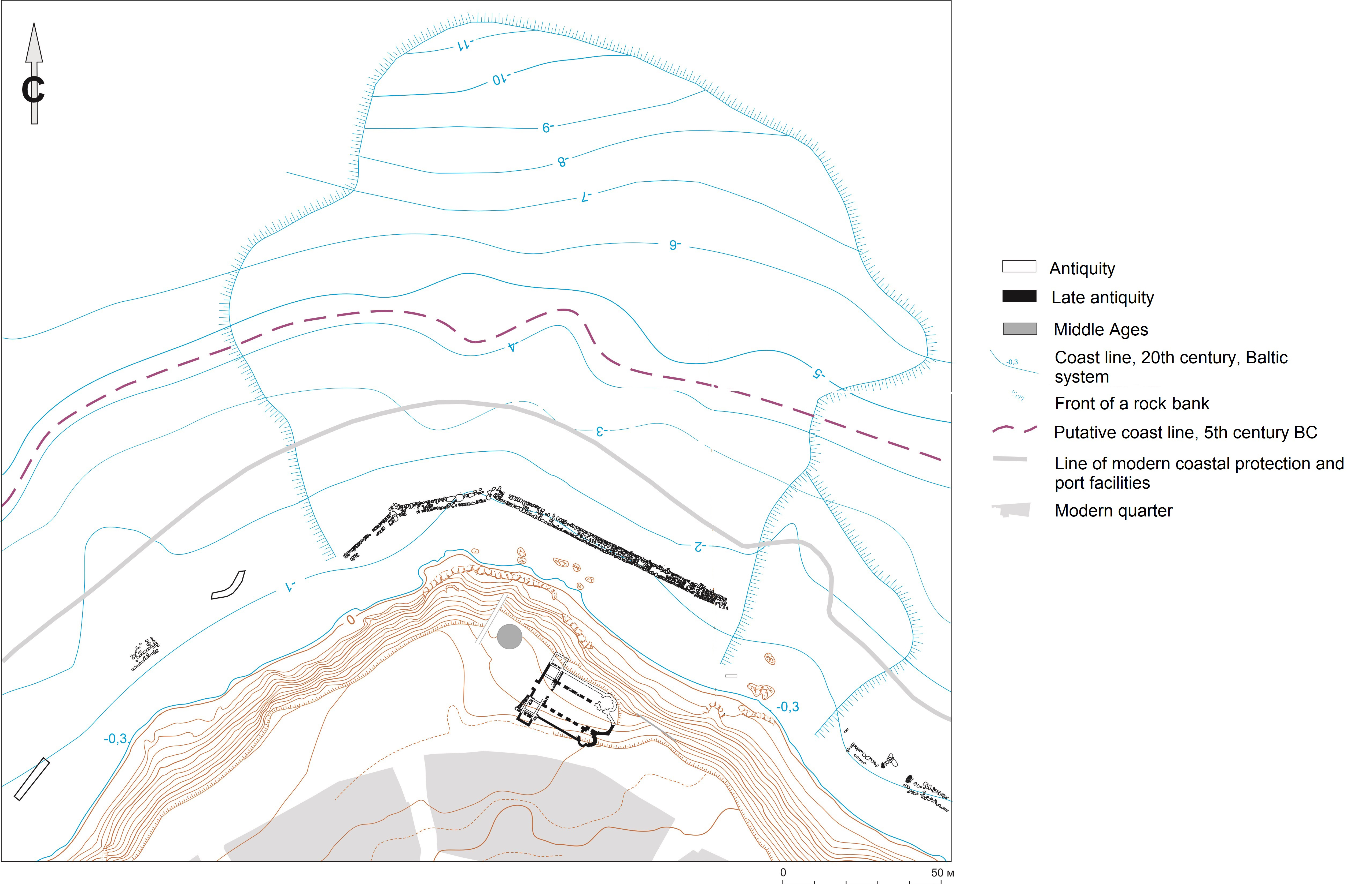
The formation of the sea terrace, on which most of the urban structures of the ancient, medieval and present-day Nesebar are built, is associated with a transgressive phase in the development of the Black Sea basin, and traditionally placed in the Upper Pleistocene (Крыстев et al. 1990, 345; Попов and Мишев 1974, 29-30, 45, 47, 76; Димитров and Димитров 2003, 20-21). The Nesebar paleo-peninsula has a narrow and strongly elongated shape, formed by sedimentary Neogene strata (Крыстев and Григориев 1990, 301) (Figure 3). Geomorphologically, the sea level maximum, 1.5-2m above its modern value, through the second postglacial Black Sea transgressive phase is related to the so-called 'Novochernomorian' (old sea (Орачев 2019, 36)) terrace, developed at 3-4/4-5m a.s.l..
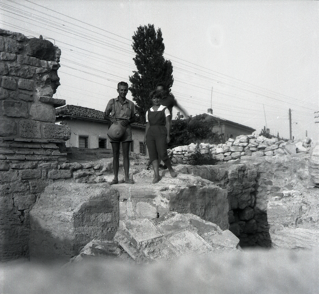
In Burgas, on lowland west of the tourist complex 'Sunny Beach', the terrace is mainly formed from accumulation and abrasion-accumulation (Крыстев et al. 1990, 346-47; Федоров 1963, 9; Попов and Мишев 1974, 77, 226, 227; Орачев 1990, 33, 40, 41, 46). An abrasion slope with niches up to about 5m a.s.l. cut into the bedrock was discovered in early 2000s on the north-eastern coast of the Nesebar Peninsula, where burials had been placed from the second half of the 14th century until the beginning of the 15th century (Божкова et al. 2007).
From the middle of the second millennium BC and for most of the first millennium BC, there is a regressive phase of the contemporary postglacial transgression with a character of ingression, known as 'Phanagorian'. During its peak, the formation of the 4-5m b.s.l. Black Sea shelf terrace probably ends (Орачев 1990, 44). Based on the results of underwater archaeological studies in the second half of the 20th century, its amplitude probably peaks at depths of 2/3-4/5m, 4/5-7m and 7-9m b.s.l. , corresponding with other coastlines (Шилик 1975a, 70-73; Щеглов 1978, 15-17, рис. 3; Крыстев et al. 1990, табл. 1; Fouache et al. 2012, 169, fig. 6). Different values of synchronous sea levels are explained by different rate and vertical direction of the tectonic movement and the rate of sediment deposition, as recently argued for the Strandzha Black Sea (Орачев 2019, 35-40) and the Azov coast (Fouache et al. 2012, 162-74).
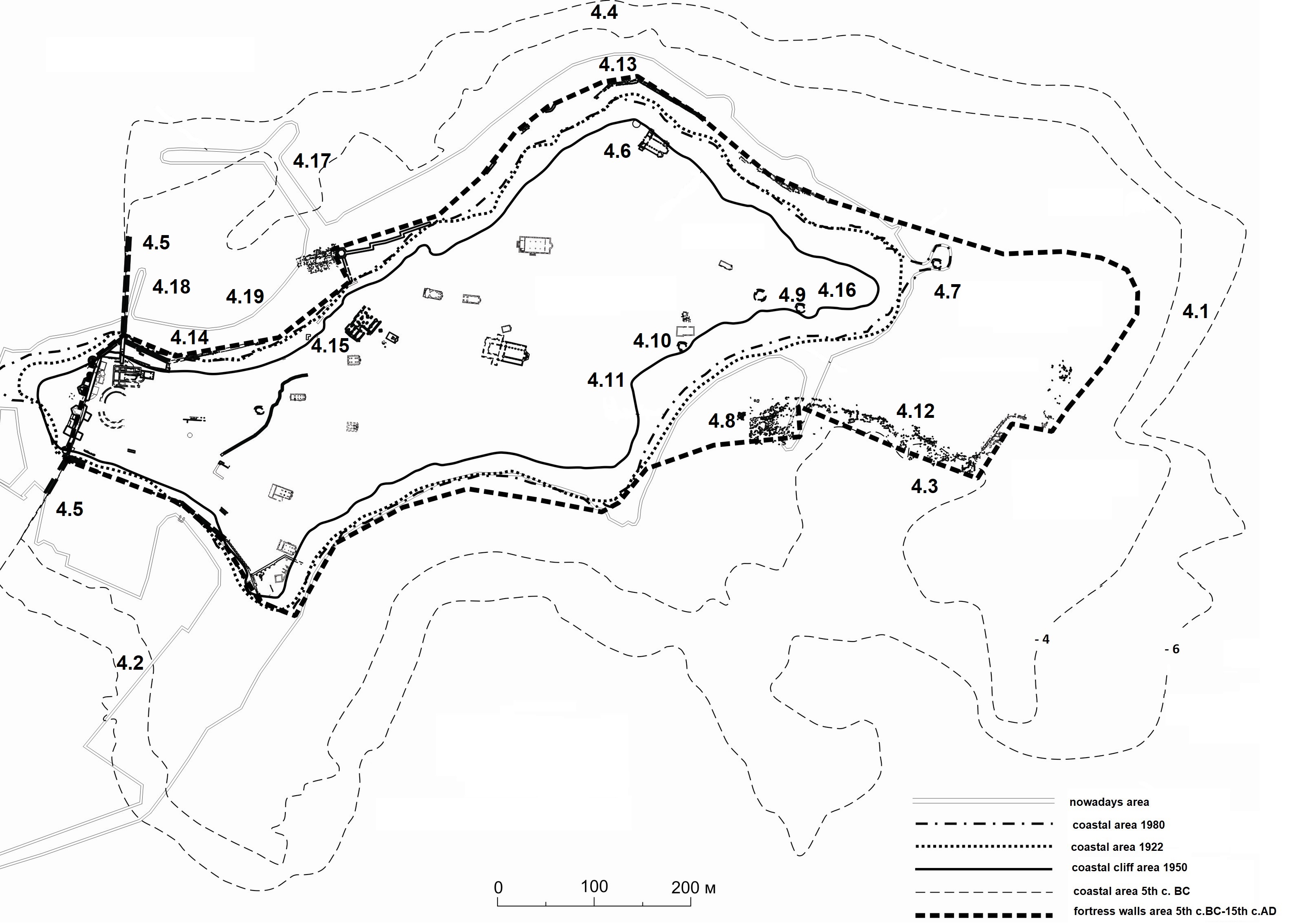
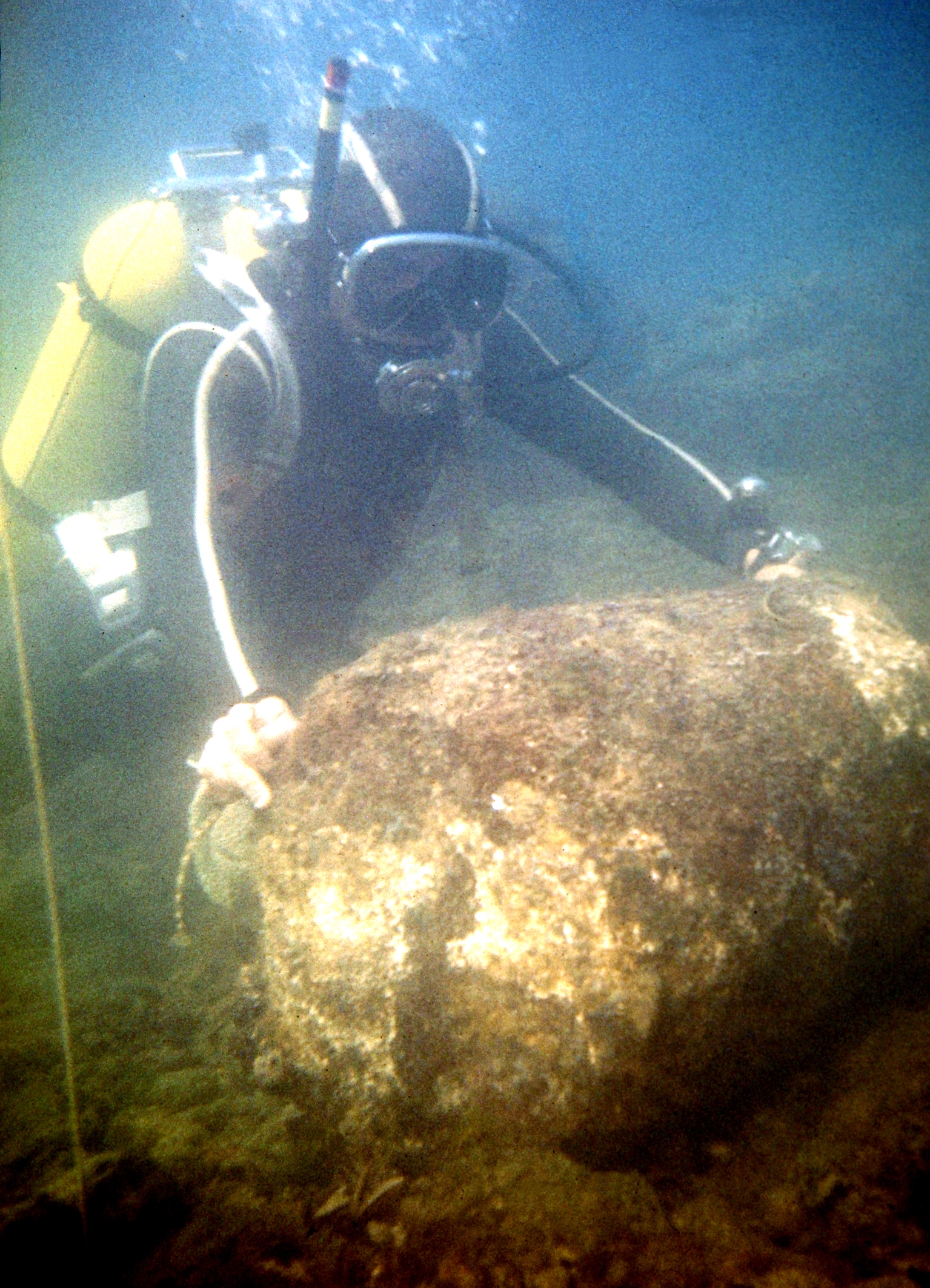
During this regression phase of the postglacial stage transgression, the peak of which happens after the 7th-6th century BC, the coastline, marked by the coastal terraced complex at about 4m b.s.l., is today at least 300m east of the foothills of the Nesebar peninsula slope (Прешленов forthcoming a) (Figure 4.1). Surf niches carved during the 'Phanagorian' long-standing sea level at the rocky base of the cliff slope of the Nesebar Peninsula are preserved in the dynamic harbour bottom of the southern port at a depth of 5-6m b.s.l. (Figure 4.2). This geomorphological situation is consistent with the evidence on the steep (45°) cliff between the 5th-6th isobaths, and the destruction from a crescent-shaped fortress wall in the south-eastern bay on the peninsula (Figure 4.3; Figure 5). Underwater reconnaissance of a sloping rocky bank in 1977, north-east of the peninsula (Figure 4.4), also showed established passages of walls between the 4th-5th isobaths (НА-НАИМ, К 80/1977; НА-НАИМ, К 80/1984; Прешленов forthcoming a), and the course of the north and south walls - diateichismata - of the ancient fortification system (Figure 4.5), which protect the craft quarters to the east and the associated shipyards and other marine business facilities (Прешленов 2011, 295-96).
The phases of the Holocene transgression reflects not only the shelf terraces but also the rhythm of the estuary deposits of Hadjiyska River. The depth of the highest peat layer in the alluvium of the sand strip is similar to that of the underwater coastal shelf terraces at 4-5m b.s.l. (Попов and Мишев 1974, 152, 158, 162, 225, фиг. 63).
During the so-called 'Nymphaean' transgressive phase (second half/end of the first millennium BC-first half/third quarter of the first millennium AD) the eustatic 'Black Sea' curve of Fedorov 'allows' maximum sea level rise to 0.5-1m compared to that at the end of the 20th century, while in Olbia the ingression seems to reach about 0.7m below modern water levels (Крыстев et al. 1990, табл. 1; Шилик 1975b, 6, 12, рис. 15). In the coastal estuaries connected with the Burgas Bay, the rise is traced to 1.5-2.0m a.s.l. (Синьовски et al. 2018, 116). After the subsequent so-called 'Korsunian' regression (end of the first to first half of the second millennium AD), the 13th–14th centuries continued to see a rise in sea level (Шилик 1975b, 7, 13, рис. 15). This so-called 'Lazica' modern transgression slows down towards the middle of the 19th century, and until the beginning of a more noticeable rise in sea level in 1923-1925 is characterised by slight fluctuations (Михова 1998, 67, 68). Аlong the Bulgarian Black Sea coast (measurements near Varna, Nesebar and Burgas) between 1924 and 1991, this increase in sea level rise reaches 2.786mm/yr (Веселинов and Мънгов 1998, 70, 71, 76). See Table 1.
| Phase | Date | Cultural/Historical Period |
|---|---|---|
| Transgression | up to middle of the 2nd millennium BC | Late Bronze Age (c. 1500 BC) |
| Regression | in the middle of the 1st millennium BC | Antique period (c. 500 BC) |
| Transgression | up to 3rd quarter of 1st millennium AD | Antique period (c. 500 BC-500 AD) |
| Regression | middle of the 2nd millennium AD | Medieval period (c. 1500) |
| Transgression | second half of the 2nd millennium AD | Present-day (c. 1800-2000) |
Tectonic movements are also relevant to these changes. The relief of the Burgas lowland is associated with different directions of neotectonic movements. To the north-west they appear with a certain rise, but to the south-east show a sinking (Орачев 2002, 242-43). Oscillations of the continental plate near Orizare village, municipality Nesebar, according to the velocity profile of the contemporary movements of the Earth's crust along the Bulgarian Black Sea coast, is very close to zero with a very low sinking rate of about 0.1mm/yr (Попов and Мишев 1974, 51, 52-53, фиг. 15).
Seismic activity, for which data are available for the middle of the 3rd century BC, the middle of the 1st century BC, the 3rd-5th century AD, the 10th-11th century AD, and until 1855, is also a factor that determines the formation of the contemporary relief of the coastal zone of Nesebar peninsula (see Preshlenov 2003b, 160; Прешленов 2018, 270, 273, 276-277; Орачев 2011, 129-30; 2012, 67, 85, 86, 89; Прешленов 2010, 294; Ognenova-Marinova 1992, 244-45; Κωνσταντινίδης 1945, 149-50).
The destructive action of the sea is one of the most powerful exogenous factors that affect the shores. In the 20th century, and most probably in previous centuries as well, prominent cliff slopes characterise Nesebar peninsula, forming the profile of the modern coast of the peninsula and its south-eastern shelf terrace (Прешленов forthcoming a; Марински 1998, 121-22; НА-НАИМ К 80/1978) (Figure 6). Even in rocky foundations, the waves carve out surf niches similar to those found in the north-eastern slope and in the waters of the contemporary south port. When fortifications, public and private buildings are built on the sloping landslide, they collapse with the landslide e.g. the north aisle of the church 'The Holy Mother of God Eleusa' (Figure 4.6), the church 'St Protomartyr Stephen' (Figure 4.7), the south-eastern part of the late antique fortress wall (Figure 4.8), the temple of Zeus and Hera (Figure 4.9), the early Christian basilica whose sacred space is incorporated in the church 'St George the Old' (Figure 4.10), and the theatre of the antique polis (Figure 4.11) (Preshlenov 2008b, 55).
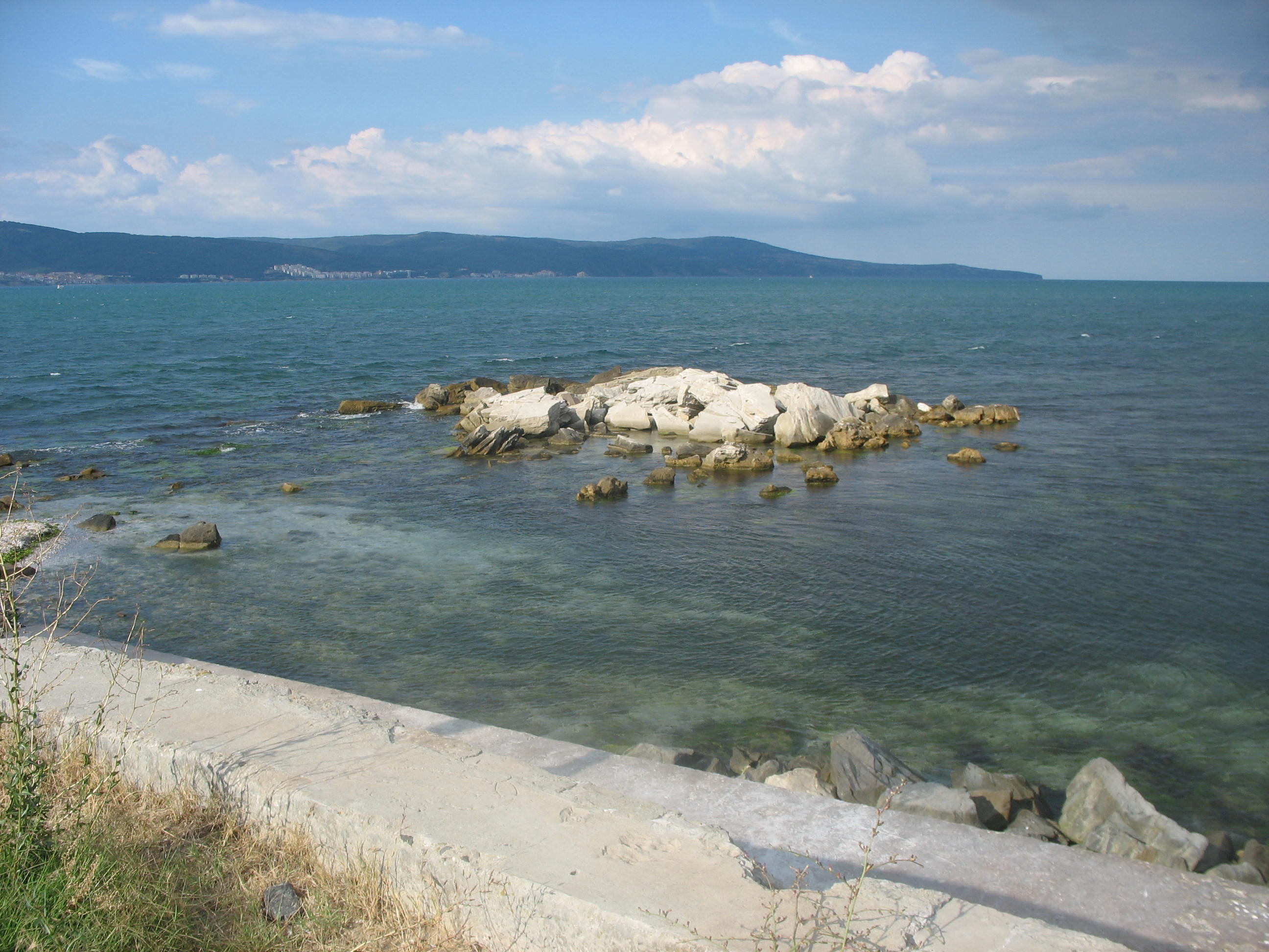
The final formation of Nesebar peninsula occured during the recent transgression phase that has emerged over the last five to six centuries (Попов and Мишев 1974, 76, фиг. 23). As a result of the combined negative impact, the coastal slope of the peninsula has been redeveloped and all older coastlines have been obscured and stripped away. At the beginning of the coastal strengthening activities around the peninsula at the end of the 20th century, it possesses the specific appearance of the indented bay ingressive shores – narrow and long bays and similar prominent capes (Прешленов forthcoming a) (Figure 7).
The destruction of ancient and early Byzantine fortifications are situated between the 13th isohypse along the north-western slope of the peninsula and the seabed to the 4th isobath on its south-eastern coast. This coastal strip, with submerged, modern and ancient higher coastlines, is also located geomorphologically between the 'Phanagorian' shelf terrace (4-6m b.s.l.) and the 'Young Karangatian' (12-15m a.s.l.) sea terrace. The last one remains the core of the fortified urban area, except for the early Thracian settlement and the Classical polis, and also late Antique, medieval and the present-day town on the Nesebar peninsula (Preshlenov 2018, figs 4 and 16).
The localisation of the early Thracian fortification in the area of the 5th-6th isobaths (Figure 4.3; Figure 5) and of the Classical fortification of the Doric polis in the area of the 4th(-5th) isobaths in the south-eastern (Figure 4.12; Figure 8) and in the north-eastern (Figure 4.4) sector of the peninsula gives reason to assume a predictable limit of fluctuations of sea levels in the 12th-5th centuries BC to 5-7m b.s.l. (Preshlenov 2012, 511-12, figs 16-18). The displacement of the north-eastern line of the curtain wall (Figure 4. 13) in the shallow water south of the 5th to 4th isobaths could be the result both of changed eustatics in the second half of the first millennium BC and other negative geodynamic processes (Прешленов forthcoming a).
Correlation of the historic and archaeological data with the main processes of terrace and estuary formation on the south-western Black Sea coast (Орачев 1990, 44-45; 2002, 244, 247) and the eustatic scheme for fluctuations at the level of the Black Sea basin by Fedorov, seen also by Mihova (Михова 1998, фиг. 2) and Orachev (Орачев 1990, обр. 1), suggest a gradual water rise until the end of the first millennium BC without exclusion of periods of prolonged stagnation at sea level (see Шилик 1975b, рис. 15).
Such a paleogeographic situation would not create complications for the inhabitants of the supposed proasteion, traces of which are seen in underwater exploration in the northern Nesebar Bay (Figure 4.14). The more intensive habitation of the terrain in front of the north-western sector of the Mesambrian fortifications can also be explained by the presence of three gates located at the hexagonal tower, at the eastern end of the northern retaining wall and in the fortification wall, which can be defined as diateichisma (Figure 4.5), protecting this suburban space from the west (Preshlenov 2008b, 54; Прешленов 2011, 295-97, 299-302, 304, 308). From the Classical period, suburban areas with a northern exposure have traditionally housed artisanal quarters and associated shipyards and other seafaring facilities (Kolb 1984, 129; Витрувий 1936, 110-11).
The changing paleo-ecological environment associated with the phases of sea level rise during the peak of the 'Nymphean' transgressive phase in the first half/third quarter of the first millennium AD, a process that necessitated, in previous centuries, a search for stable higher ground to site fortress facilities and neighbourhoods in other western Black Sea settlements (Орачев 2002, 247), limits the possibilities for expanding the perimeter of the fortified urban area. Passages from the 5th century AD Mesembrian curtain wall in opus mixtum are discovered in the south-eastern bay of the peninsula between the 2nd and 3rd isobaths (Figure 4.8) at about 110m in front of the 20th century church 'St George the Old' (Figure 4.9), destroyed in the 1950s, which preserved the sacred space of an early Christian basilica that had fallen into the sea (Preshlenov 2018, 398, 402-4, fig. 16).
The route chosen by the early Byzantine builders confirms the rate of rise of the Black Sea level in the first millennium AD with simultaneous extremes, established by Fedorov and Shilik (Шилик 1975a, 72, рис. 11; 1975b, 4, 10) and shows that by this second period of more significant urban redevelopment of the peninsula, some sections of the Hellenic wall had not yet been flooded by seawater. At even higher sites along the edge and the slope of the cliff, other sections of early and/or middle Byzantine fortifications, were seen by Shkorpil over the north-western bay south-west of the hexagonal tower and detected during construction in the 1990s (НА-БАН ф. 165, а.е. 457, л. 9, 17, 18; Прешленов 2011, 304-8) (Figure 4.15).
The 'Nymphean' transgression that established the sea starts before the end of the first millennium AD along the northern Black Sea coast close to its present value, the 'Korsunian' regression and the subsequent relatively intense first stages of the 'Lazica' transgression in the 13th-15th century (Шилик 1975a, 6-7), as well as the seismic activity in the 11th century AD recorded by the Byzantine authors, appear to be manifested to some extent in the Nesebar Peninsula as well and is a prerequisite for the activation of abrasion and other destructive geodynamic processes such as landslides and collapses (Попов and Мишев 1974, табл. 12; Михова 1998, 67; Орачев 2002, 249, 250; Ognenova-Marinova 1992, 244). The destabilisation of the cliff slope and the head of the peninsula terrace forces the abandonment of the northern aisle and the naves, and probably the second renovation of the monastery basilica 'The Holy Mother of God Eleusa', which is reported in a donation inscription on the silver obverse of the icon of 'The Holy Mother of God Eleusa' from 1341-1342 (Прешленов forthcoming b) (Figure 4.6). The rise in sea level gradually compromises the wind and wave protection functions of the tongue-shaped sector of the sea bottom in front of the basilica, slightly decreasing to the north and covered with broken and worked stone blocks. This rocky area, about 165m in length, is a natural barrier, which, until its flattening by the sea abrasion manifested at different Black Sea levels, proved capable of providing relatively calm waters in the northern bay of the Nesebаr Peninsula, at least until the end of antiquity (Прешленов 2011, 309-10, Обр. 11) (Figure 9).
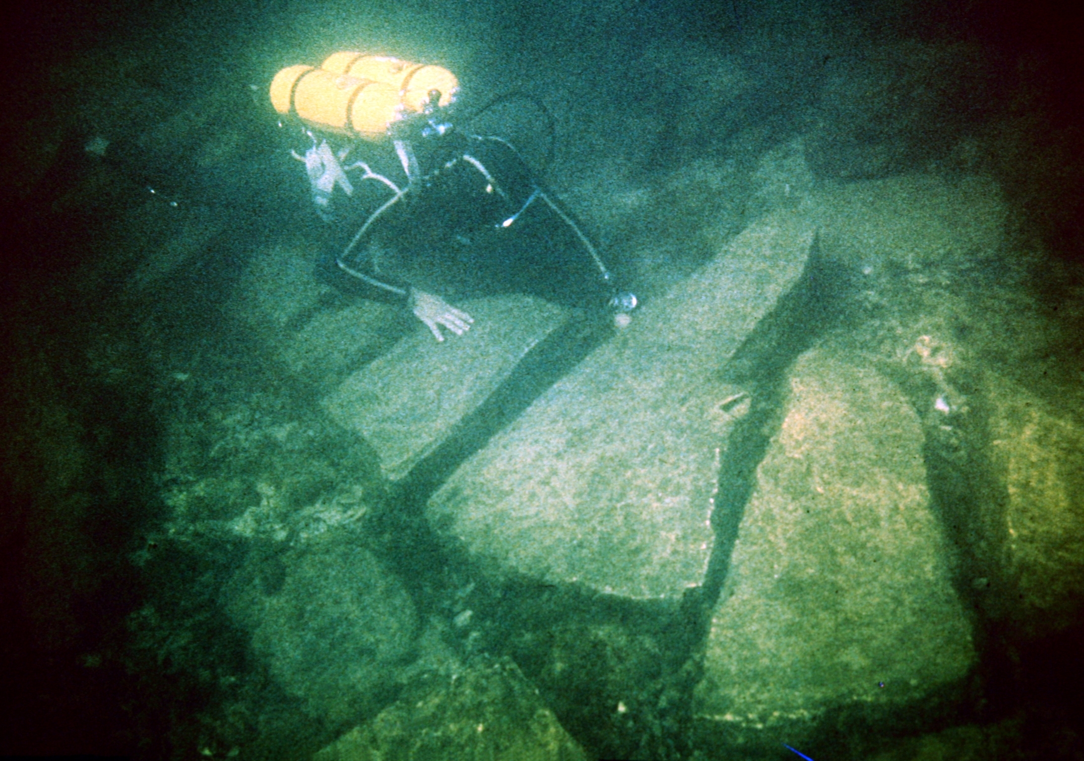
By the beginning of the 18th century, the south-eastern slope of the peninsula erodes and land to the Doric temenos of Zeus and Hera (Figure 4.9), the early Christian basilica (later occupied (in 1704) by the medieval church 'St George the Old' (Figure 4.10)) and the medieval monastery (Figure 4.16) is all lost to the sea. The destroyed buildings have been carried to the bottom of the south-eastern bay of the peninsula, where parts of square pillars, smooth and channelled columns, stepped blocks, rectangular polished slabs and squares with grooves for horizontal connection have been found up to 250m south-east (Preshlenov 2008b, 55) (Figure 10).
Earthquakes, recorded in the years 1352, 1688, 1778 and 1855, sometimes accompanied by collapses and displacement of large quantities of land to the sea, have an impact on the formation of the present coastal outline of the Nesebar peninsula (Ognenova-Marinova 1992, 244-45). The last of these resulted in the collapse of the church 'St Protomartyr Stephen', whose location, according to local place name evidence, is on the eastern coast near the rocky outcrop known as 'St Stefan' (Κωνσταντινίδης 1945, 149) (Figure 4.7).
In the second half of the 20th century, when draining of the coastal areas begins, the average gradient of rise at the Bulgarian Black Sea level is c.2.8mm/yr (Веселинов and Мънгов 1998, 71, 76), the average speed of the abrasion process between Cape Emine and Nesebar is c.80mm/yr, and the area lost is c.1000m2/yr (Пейчев 1998, 141, табл. 1, табл. 2). Most intense is the abrasion of the south-eastern slope of the Nesebar peninsula, where repeated surf action causes the cliff limiting the 'Young Karangatian' sea terrace to be cut back to the land. In the north-eastern coastal area between the trapezoidal-line Greek curtain wall and the monastery church 'The Holy Mother of God Eleusa', a strip between 15 and 25m wide is abraded by the end of the 20th century (Figure 4.6, 13; Figure 9). Along the south-eastern coast between 'St George the Old' and the late Antique curtain wall at least 70m is abraded (Figs 4.8, 10). In the last 150 years alone, the area of shallow waters has increased by 40-45m east of the National Border Police Service department to the rocky outcrop 'St Stefan' (Preshlenov 2008b, 55-56) (Figure 4.7, Figure 11).
As a result of the impact of the destructive geodynamic processes, the coastal slope of the peninsula has changed – narrow and elongated bays and protruding capes have been formed and the older ledges have been obscured and have lost their previous features, from a peninsula originally 850m long by 300m wide with a surface area of about 24 hectares. In comparison with the situation in the middle of the first millennium BC, when the Doric polis of Mesambria was established on its territory, the peninsula has lost no less than two-fifths of its surface (Preshlenov 2018, figs 4, 1 and 16) (Figure 4).
The continued strengthening of the coastal zone of Nesebar peninsula takes into account a complex of hydrodynamic factors (waves, currents, wind and the materials they carry), climate, rock stability, sedimentation and eustatic fluctuations at sea level. The sea terrace on which the urban structures of Nesebar are located is formed on almost horizontal Miocene limestone sandstones, marl limestones and clays (Figure 3). It is limited by the steep abrasion type of the coast, subjected until the end of the 20th century to the destructive energy of the sea surf (Попов and Мишев 1974, 76, фиг. 23) (Figure 4; Figure 6).
The upper boundary of the northern coast of the peninsula, which until its strengthening was determined by the limit of the wave influence, is a narrow abrasion terrace up to 5m wide, and is included within the boundaries of the National Archaeological and Architectural and Urban Reserve of Nesebar. The waters around the peninsula, part of which is intended for land reclamation, falls within the contact zone of the reserve, where a significant part of 3000 years of cultural and historical heritage of the city-museum is preserved (МК-НИНКН 2012, 7-14).
The northern bay of the peninsula is vulnerable to the surges and storms, sometimes at speed, exceeding 15m/s (Попов and Мишев 1974, 105, 124, фиг. 38, фиг. 50). During Antiquity, the calm waters in the bay provided a natural geographical barrier – the tongue-shaped rocky coastline of the peninsula, plunged to the north, where the edge of the 8-12m b.s.l. terrace runs (Figure 9). During the early Byzantine period in the transgressive rise of the sea level, the wave guard functions are carried by its surface though reduced to the 2nd-3rd isobaths (at that time a.s.l.). The natural advantages of this coastal sector are also evaluated, when along the western edge of the underwater peninsular slope a 'beam'-breakwater was designed (in the final project for coastal protection its construction is abandoned). Its straight section, providing protection against northern and eastern wind waves, is identical to that of the ancient natural barrier. The part of the coast flooded during late Antiquity has the capacity to serve as an underwater 'beam'-breakwater against the north-eastern wind waves at least up to the 6th-7th isobaths – the depth to which the north-western project bend of the 'beam'-breakwater reaches. At the end of the 20th century, the functions of the north-eastern natural wave barrier, levelled in the second half of the second millennium AD, is taken over by a 'beam'-breakwater, built to the west in the bay opposite the hexagonal tower of the Classical fortress wall (Прешленов 2011, 309-10, Обр. 11 and 12; Ангелова et al. 2016, Обр. 3.1) (Figure 4.17, Figure 12).
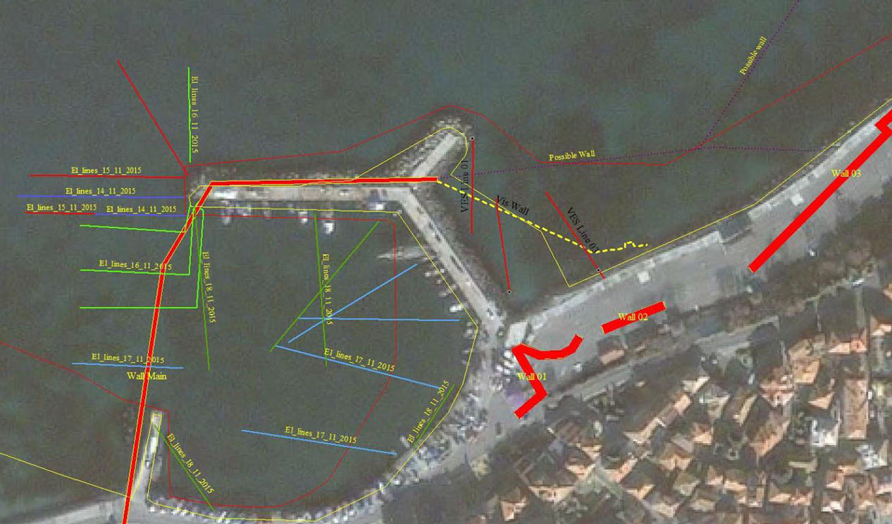
The construction of another 'beam'-breakwater in the north-western waters of the peninsula is being planned (Figure 4.18, Figure 12). It follows the tongue-shaped elevation of the seabed, which goes down to the north to the three-metre isobath about 70m from the shore – a route also chosen by the ancient builders in the construction of the northern diateikhisma of the Classical polis and the early Byzantine city (Прешленов 2011, 295-96, Обр. 1; Ангелова et al. 2016, Обр. 3.1; Прешленов forthcoming a) . The present coastal protection wall east of the 'beam'-breakwater, following the line between the 2nd and 3rd isobaths, pass about 25-30m north in front of the rectangular fortress tower and bastion-widening of the Classical wall (Figure 4.19). Between the 'beam'-breakwaters ending at the 3rd-5th isobaths and the shore multifunctional structures for coastal protection, the contemporary northern port has inherited the water area of the ancient port.
During the Classical and Hellenistic period, the coastline, fortification, religious and secular spaces of coastal Mesambria, the provincial Roman pilgrim city, and the (early) Byzantine bipolar municipality were limited by the steep abrasion of the coast, and subjected to the destructive energy of the sea surf right up to the end of the last century. The strengthening of the coastal zone has taken the complex hydrodynamic factors, climate, rock stability, sedimentation and eustatic fluctuations at sea level into account. With the successful completion of the coastal restoration works along the coast and in the contact zone of the National Archaeological and Architectural and Urban Planning Reserve at Nesebar, a significant part of the memory of the three-thousand-year-old cultural heritage of the museum city is being preserved for the future.
Internet Archaeology is an open access journal based in the Department of Archaeology, University of York. Except where otherwise noted, content from this work may be used under the terms of the Creative Commons Attribution 3.0 (CC BY) Unported licence, which permits unrestricted use, distribution, and reproduction in any medium, provided that attribution to the author(s), the title of the work, the Internet Archaeology journal and the relevant URL/DOI are given.
Terms and Conditions | Legal Statements | Privacy Policy | Cookies Policy | Citing Internet Archaeology
Internet Archaeology content is preserved for the long term with the Archaeology Data Service (ROR). Help sustain and support open access publication by donating to our Open Access Archaeology Fund.
 Home
Home