Cite this as: Vreenegoor, E. and Kosian, M. 2022 Using Cultural Heritage and Historical Analyses for Current and Future Problems With Too Much or Too Little Water, Internet Archaeology 60. https://doi.org/10.11141/ia.60.6
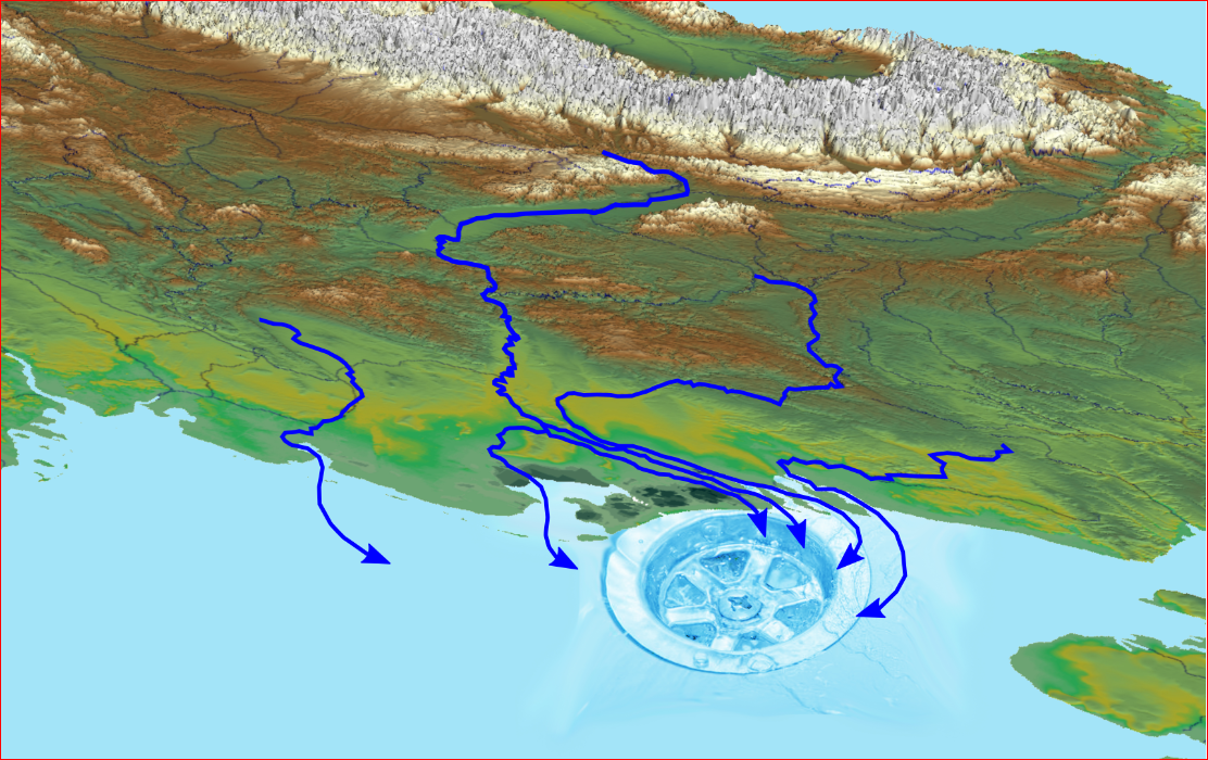
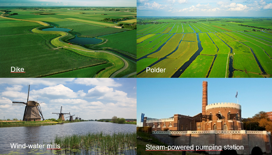
The Netherlands in the north-west of Europe consists of a flat river delta, moulded by broad rivers like the Rhine, Meuse and Scheldt, which flow into the North Sea (Figure 1). More than half of the land area of the Netherlands lies beneath sea level. As a result, throughout history its inhabitants have had to live with the threat of flooding, both from the sea and the hinterland. Numerous dikes, dams, sluices, culverts, canals, and pumping stations still bear witness to this history of dealing with water (Figure 2). Many toponyms, like Amsterdam, Rotterdam, Zaandam, Sluiskil, Delfzijl, Kinderdijk, and surnames, like Van Dijk, Van Dam, Van der Sluis, have a reference to water and evidence of water management and the organisation of water management can be found as early as the 13th century. We could say that dealing with water is part of our DNA.
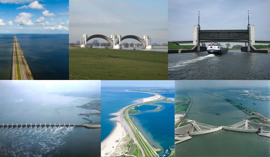
Great disasters like the 'Zuiderzee' flood in 1916 led to the construction of the Afsluitdijk, after which the former inland sea Zuiderzee was partially reclaimed. This created a large residual lake, the IJsselmeer. After another flood disaster in the south-western part of the Netherlands in 1953, flooding large parts of the province of Zeeland, a Delta commission was established. In the period between 1953 and 1988, the so-called Delta works were built to control the whole delta, such as the Haringvlietdam and sluices and the Callandtkering on the Meuse/Rhine river system and the Brouwersdam and Eastern Scheldt barrier on the River Scheldt. The Delta works are nowadays seen as iconic waterworks (Figure 3).
In order to address future problems with water and climate change, a new Delta commission was established in 2007 resulting in the appointment of a Delta commissioner (2010), an independent government commissioner for national issues on water and climate, followed by the Delta-legislation (2011).
The advantage for archaeologists and historical geographers of living in a delta is that organic archaeological remains such as bones, seeds, pollen, wood, leather and textiles are often well preserved. This is especially true for the Western Netherlands, which is low lying and covered with sediment layers, but also applies to humid conditions such as that found in stream valleys and dead river arms. This makes it possible to reconstruct past landscapes, land use, food patterns, and funeral rituals, but also contributes to knowledge about breeding methods, plant cultivation, dating and climate and climate change.
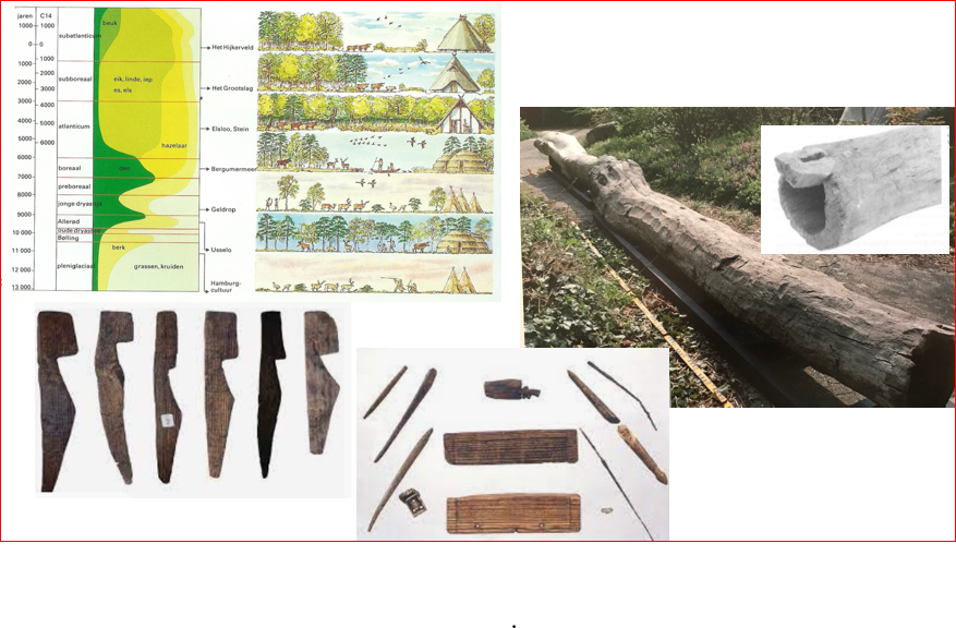
Some examples of well-preserved organic material found during excavations are set out below (Figure 4).
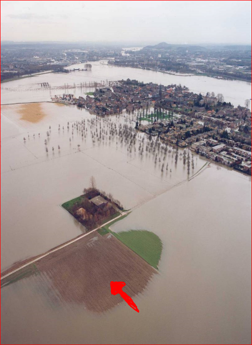
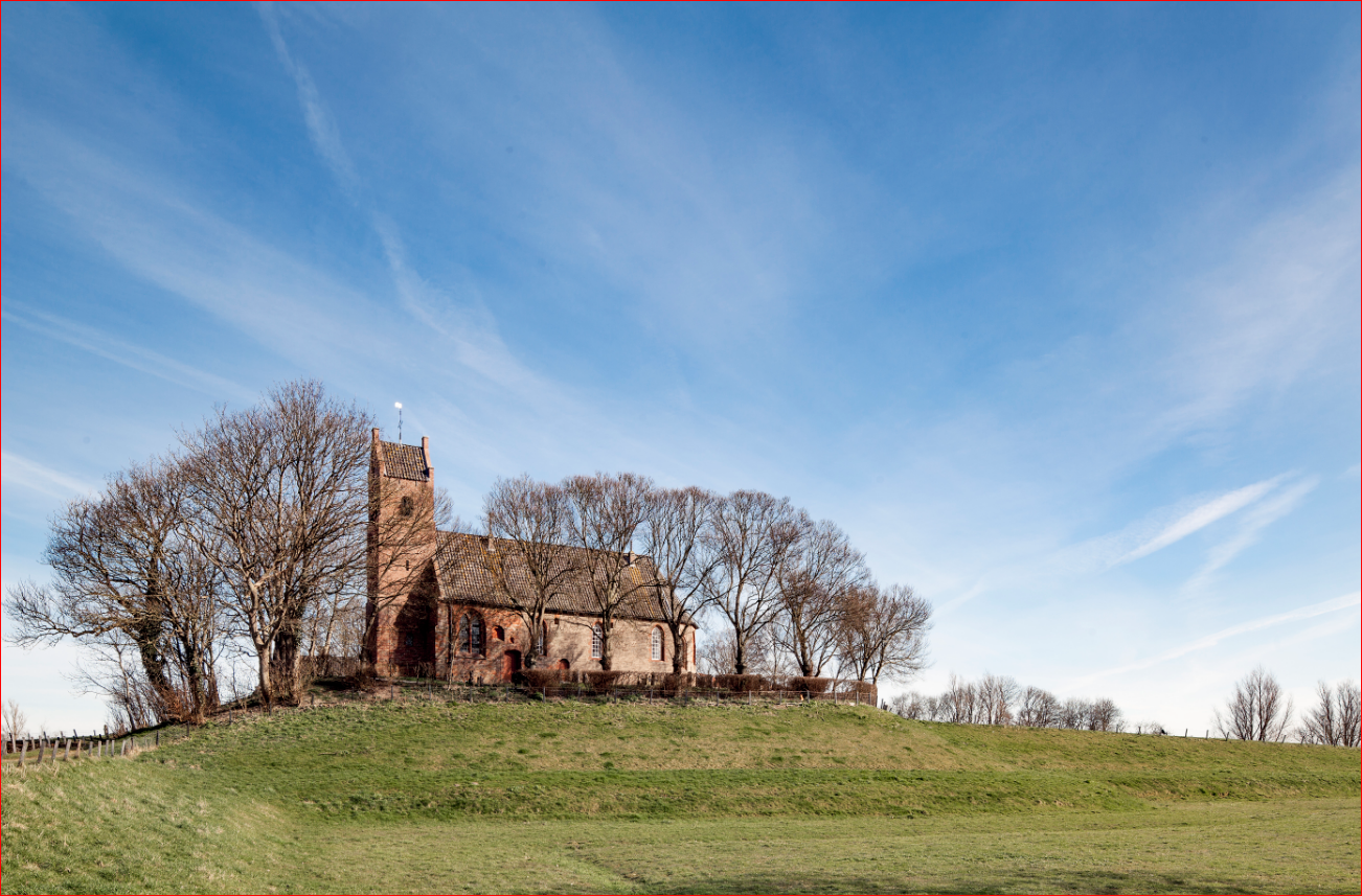
In prehistoric and Roman times in the Netherlands, people chose the highest and driest locations to live on, but always remained close to water. Figure 5 shows the location of a Roman villa at Borgharen (in the south of the Netherlands), which also remained the only high and dry spot when the River Meuse flooded in 1993 and 1995. Dwelling mounds erected since prehistoric times in tidal areas are still visible in the landscape (Figure 6).
Over the centuries, the Dutch have introduced a lot of measures to allow them to live with all this water such as dikes, dams, draining ditches and wind-driven-watermills. This type of mill, the so-called polder mills, made it possible to reclaim wet areas. This created the characteristic Dutch polder landscape, always in close relationship with the environmental possibilities.
After about 1850, with the advent of steam and later electric engines and other technical progress, it seemed like anything was possible and thus the so called 'makeable society' was born. Since then, everything was increasingly determined by humans, and habitation was less adaptive to the environment. People built houses and roads, developed agricultural lands and managed rivers and streams without sufficiently including the historical dimension in their analysis of soil and water (Figure 7a and Figure 7b).

The consequences of this way of construction without recognising the natural (and historical) conditions was to increase the risk of flooding, drought and soil subsidence.
Cultural heritage and historical analyses can be useful in understanding the landscape and can help to find solutions for problems, both with not enough or too much water.
Desk research should always make use of historical maps dating back to the 16th and 17th century, such as the military topographic maps and water- and river-management maps, because these provide useful information. Examples include locations of vanished water systems, water mills, drowned villages, castles, dikes and old water systems that had a crucial function for water management. An example of the use of this information are the locations of so called 'kwelkaden' marked on the maps. These are small dike systems built to reinforce the main river dike in places where water was seeping from under the dike, the so-called piping. These locations mark weak spots in the dike owing to sandy channel belts and, because of that, have a risk of piping. These sites are still a safety risk when building new dikes at that location.
Several more examples of ways in which to use the knowledge of cultural heritage and archaeology for water management issues are presented briefly below.
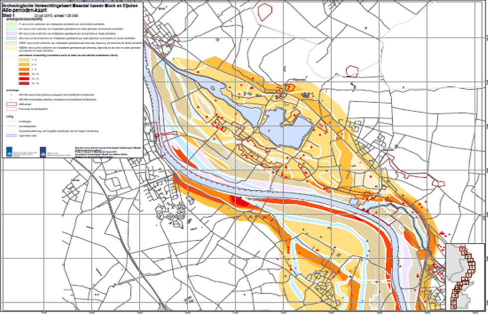
For the Rivers Meuse, Rhine and IJssel, archaeological research linked to river management has yielded new knowledge about the past and the buried landscape. The research results are converted into geo-archaeological maps of rivers and riverbanks and predictive archaeological maps (Figure 8). The aim of this research is to gain knowledge of the geomorphological, hydrological, archaeological and historical situation in order to formulate preconditions for sand, clay and gravel extraction, to look for possibilities for water storage and water safety, to know how to act in the context of the European Water Framework Directive (KRW) and to provide information for future archaeological research. It resulted in information about location choices and it can help to decide which water management solution is most suitable for an area.
Research on historical floods makes it possible to map risks for future floods. Additionally, it can suggest where to take water safety measures and where this is not necessary (Figure 9).
Studies of old dike systems provide useful information about the location, the subsoil and the water management in the past. Historical dikes in the Wadden Sea area have a so-called foreland to break waves and capture sludge. The reuse of the historical custom of sowing dikes with flower and herb mixtures helps to strengthen the dike in a natural way.
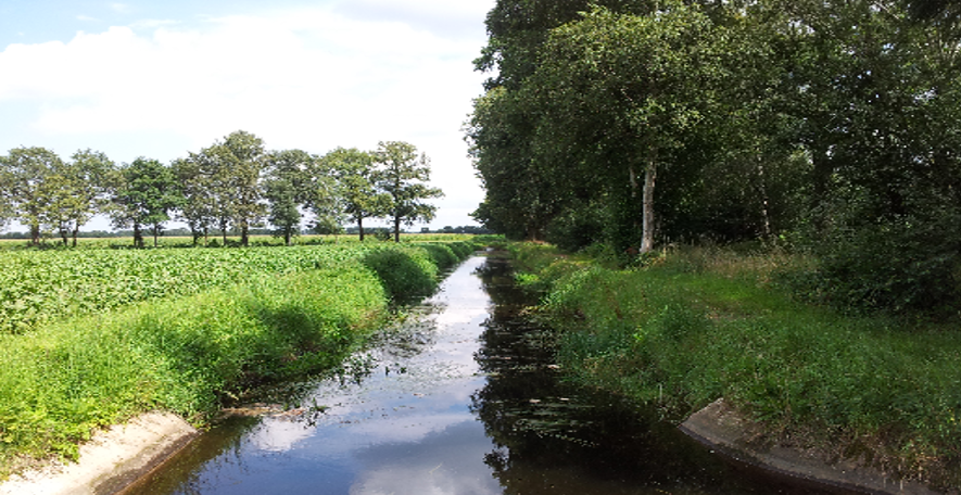
A thorough study of water mill landscapes reveals that, in medieval times, people already had the necessary knowledge of the water management of both the stream sections and the entire stream valley. This knowledge can be used for (climate) adaptation strategies to store water upstream.
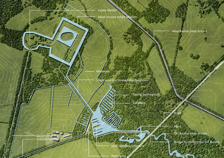
Historic estates with their canals, ponds and other water features also offer new possibilities for water storage within their own system (Figure 10). Studying these estates in their surrounding landscape and in combination with agreements about the water level with the Water Board1 can offer a solution for longer periods of drought while at the same time recovering special landscapes like old peat bogs or spring forests.
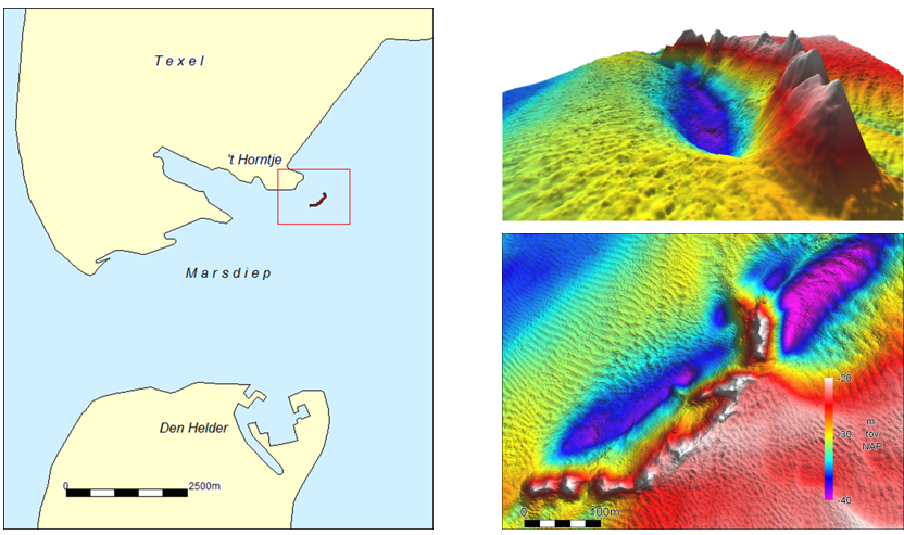
Another example is the study on drowned historic dikes, discovered by underwater archaeological research. These lay about 3–5m below the water surface and can possibly serve both as a hard substrate for plants and animals under water and as a boulder dam, breaking waves (Figure 11).
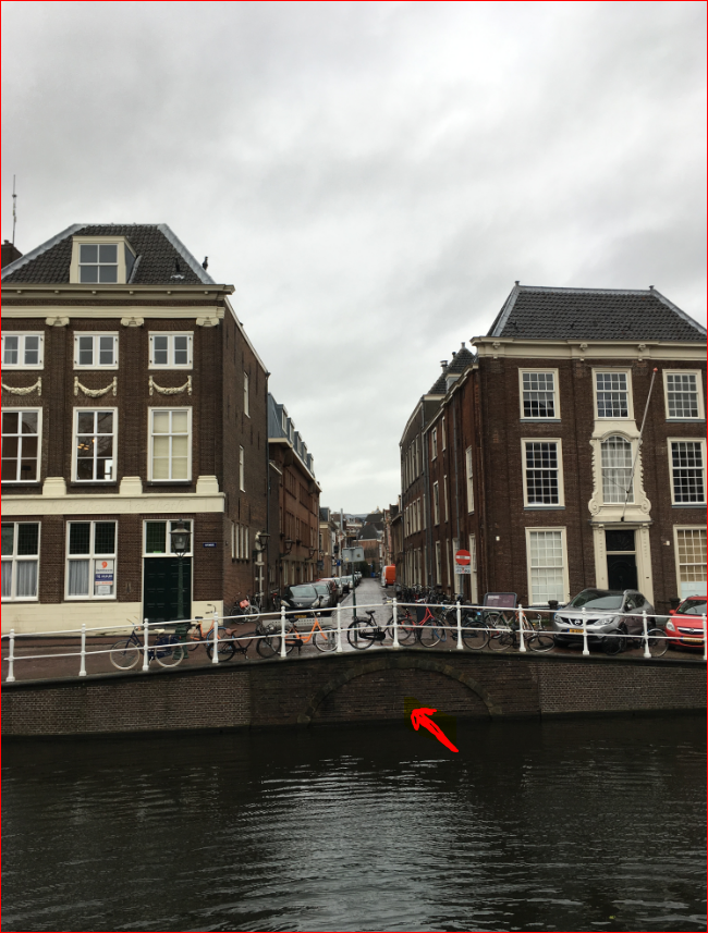
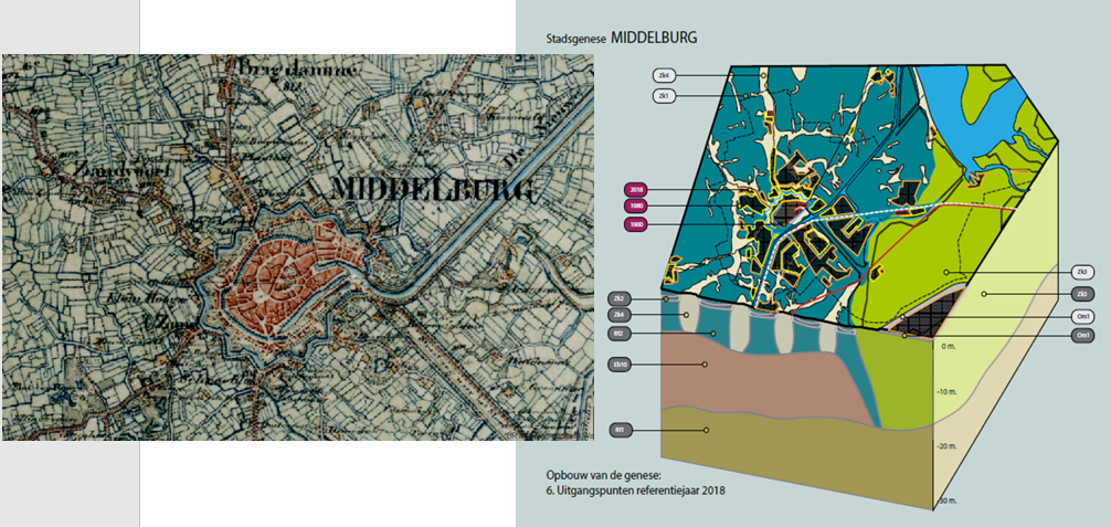
A final example is a method developed for the urban environment. We analysed the development of eight cities using historical maps in combination with soil and geomorphological maps. These maps and studies inform us about land and water use in the past and locations where watercourses have been completely obscured, covered or diverted (Figure 12). The resulting 3-D models would appear to be a useful tool to measure and offer solutions for climate adaptation and urban planning (Figure 13).
All the research projects presented here reveal that knowledge of the past can help to find solutions for current problems with too much and too little water. By using this knowledge and reusing old structures, it is possible to preserve and regain meaning of objects and their surrounding landscape and at the same time offer inspiration for modern water management. Moreover, drawing on knowledge of the past really helps in understanding the soil and water systems, their use and their alterations through time. It may prevent ad hoc technical solutions being devised and implemented which are not suitable for the place and not sustainable, only working temporarily and mitigating the problem instead of solving it.
The knowledge of these historic dimensions is often not used, or is insufficiently used by local and regional authorities and Water Boards when it comes to water, soil and climate challenges and spatial planning processes. The problem is in fact that most of the water and soil managers and urban planners have no direct contact with archaeologists and other cultural heritage managers. There is hardly any cooperation. The challenge therefore is to bring these worlds together, because it will provide added value for both in solving future challenges of managing water.
1. A Water Board, water council or water authority is a regional governing body solely charged with the management of surface water in the environment, acting independently of administrative governing bodies like provinces and municipalities. In general they are responsible for managing rivers, canals, flowing watercourses and drainage issues, water collection, etc. More specifically they manage polder systems, water levels, water barriers and locks, enforcements, water quality and sewage treatment in their respective regions. ←
Internet Archaeology is an open access journal based in the Department of Archaeology, University of York. Except where otherwise noted, content from this work may be used under the terms of the Creative Commons Attribution 3.0 (CC BY) Unported licence, which permits unrestricted use, distribution, and reproduction in any medium, provided that attribution to the author(s), the title of the work, the Internet Archaeology journal and the relevant URL/DOI are given.
Terms and Conditions | Legal Statements | Privacy Policy | Cookies Policy | Citing Internet Archaeology
Internet Archaeology content is preserved for the long term with the Archaeology Data Service (ROR). Help sustain and support open access publication by donating to our Open Access Archaeology Fund.
 Home
Home