Cite this as: Kadakas, U. 2022 Archaeological Heritage as a Sustainer of Biodiversity, Internet Archaeology 60. https://doi.org/10.11141/ia.60.9
As organisers of heritage protection and management we have discussed the role of archaeological heritage in society during the EAC symposiums and working groups. We have highlighted the importance of archaeological heritage as a source of history for communities and for building their identity, as well as involving different social groups in archaeological field studies in order to give additional value and meaning to people's lives. Also, we have discussed how to demonstrate that during development projects the mandatory costs of research can be balanced with the additional value that emerges from research for the development project (see different articles in Watson 2021).
In this article, based on the example of Estonian archaeological heritage, I would like to discuss archaeological sites as elements of cultural landscape, not only as indicators of the multi-layered nature of cultural landscapes, but as places that help to fulfil goals to maintain biodiversity. This way, elements of archaeological heritage could also be seen as habitats, as natural parts of (supporting) ecosystem services (MEA 2005).
The forces of nature have shaped the post-glacial landscape, but in densely populated Europe, even at its northern periphery, humans have been the main factors. For a longer period elsewhere, but in Estonia during the last 3000 years, the landscape has been changed significantly as a result of agricultural practices, including forestry (Table 1). Farms and villages are surrounded by intensively farmed fields, but meadows and pastures, forests and bogs, lie between them or further away. Although the latter are apparently more natural areas, there has been some human impact everywhere – wetlands have been turned into arable land with ditching, the natural communities of forests have been altered, peat has been cut from bogs, movement of surface water has been altered by building roads and railroads, resulting in parts of wetlands drying or arable lands turning into wetlands.
| Land parcel | area, km² | % |
|---|---|---|
| forest land (incl. commercial forests); shrub/brush | 23,811 | 52,52 |
| bogs and swamps, mossland; water body | 4795 | 10,58 |
| natural grassland | 2494 | 5,5 |
| arable land | 10,383 | 22,9 |
| residential, production and commercial land; roads, utility lines, quarries, other lands | 3853 | 8,5 |
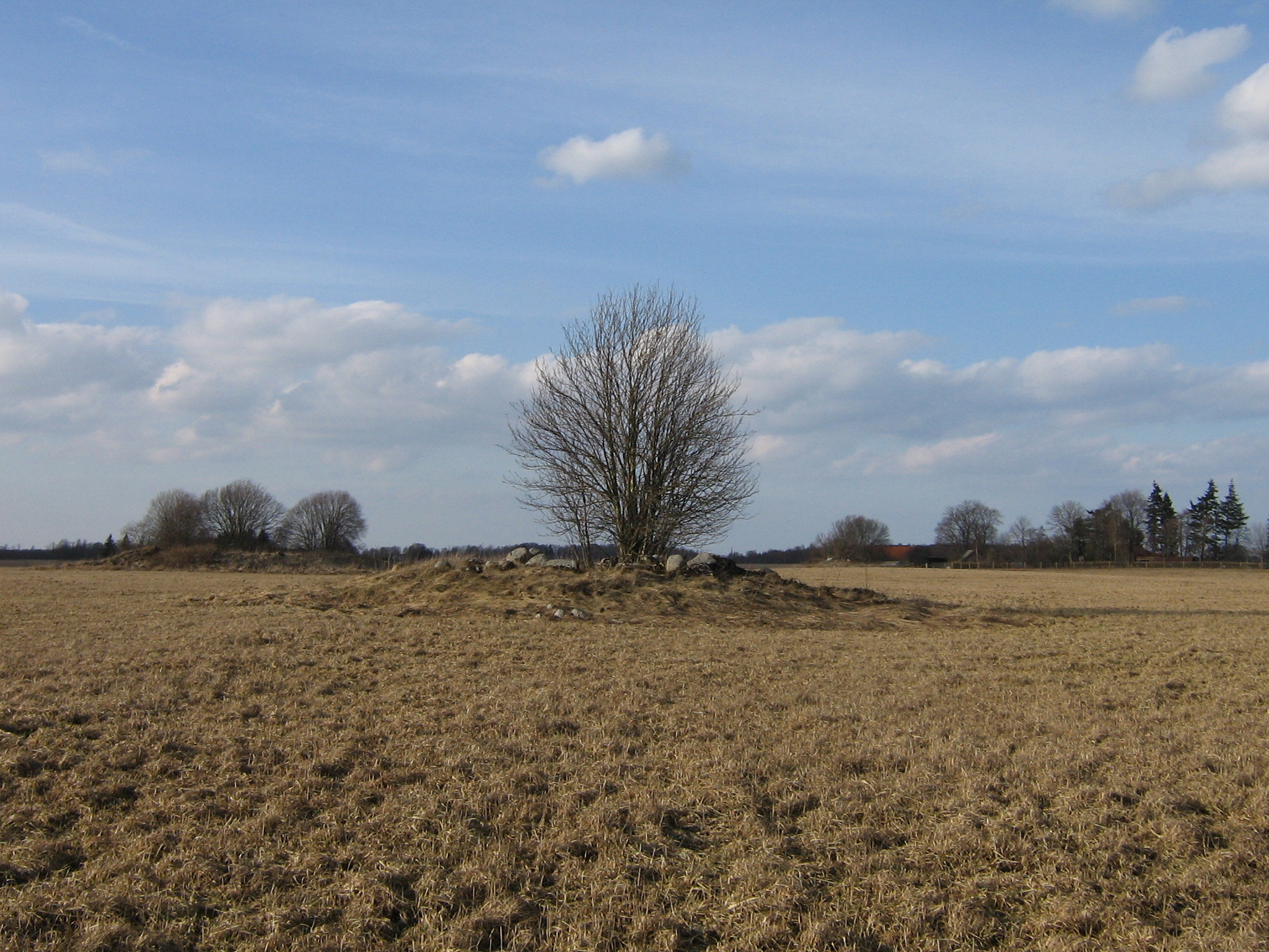
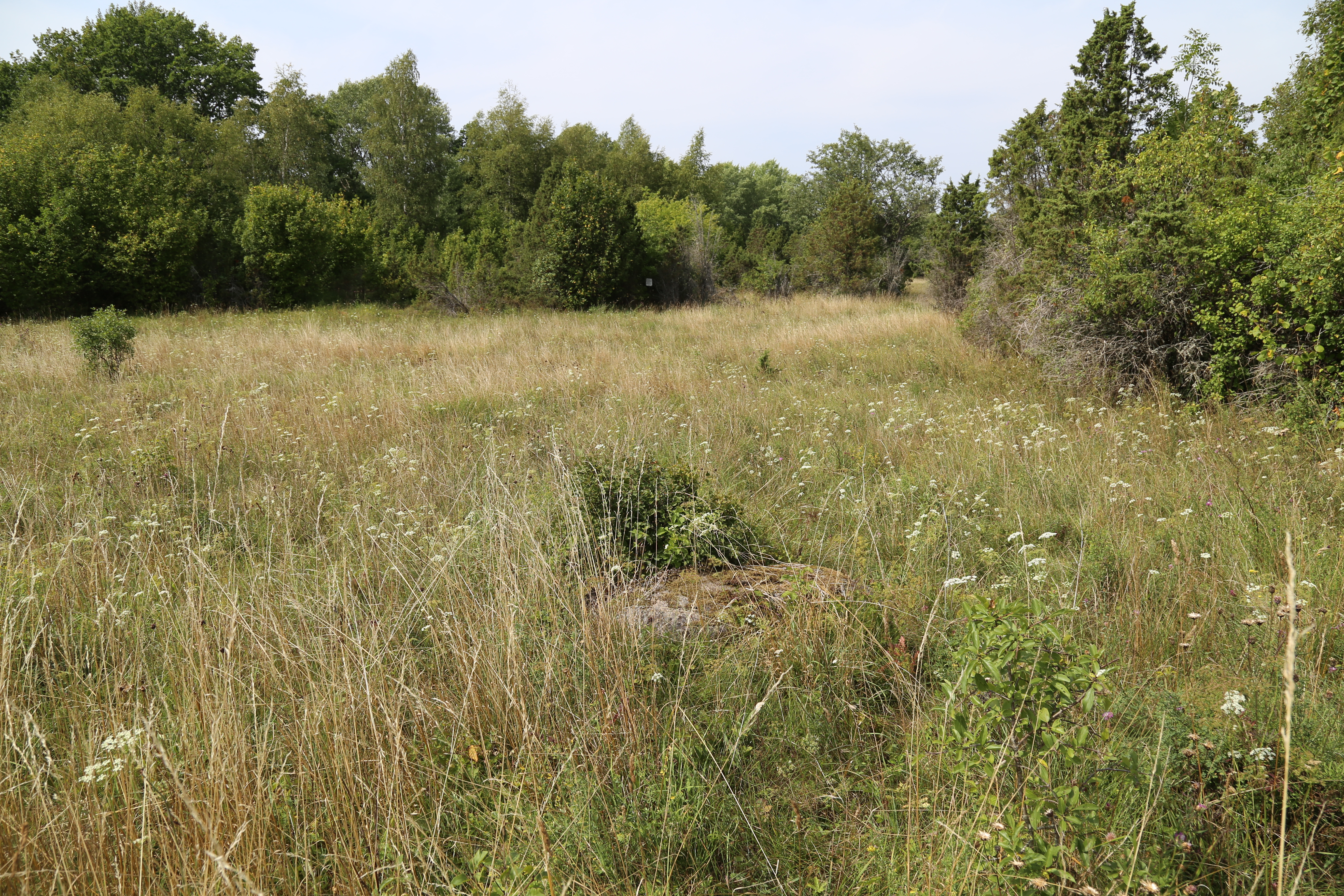
Over centuries, changes and shifts have steadily taken place on arable lands through settlement and land usage. In the early days of agriculture, areas with light soil were ploughed but also quickly exhausted. Landscapes with single farmsteads were turned into hamlets with large field systems, communal pastures, meadows and forests. Hierarchical land usage developed from the Iron Age and through the Middle Ages and culminated in large manorial estates with extensive field systems in the 17th-19th centuries, so that the peasants were forced to found new farmsteads and start tilling marginal areas, often wetland islands (see EA I, II, III). Such agricultural heritage landscapes include ancient field systems (stone piles and fences), stone graves Figure 1), inhumation and cremation cemeteries, enclosures and fortresses. Often these are situated within today's grasslands, pastures and forests and have probably maintained rich biodiversity for thousands of years owing to continuous cattle grazing. Among these, the wooded meadows and alvars – the juniper shrublands – of western and northern Estonia are especially rich in biological species (Helm 2019, 8; Figure 2).
The industrial emphasis of the 20th century meant not only the development of industry, the intensification of mining etc., but also the transformation of agriculture and forestry into large-scale production. The small field areas that were surrounded with stone walls and ploughed with horses or oxen were in the second half of the 20th century, within the Soviet state-managed extensive collective-farm policy, turned into extensive fields, tilled with huge farming machines Figure 3). Many former meadows, pastures and wetland were systematically turned into extensive field-systems (EA VI). While the creation of large monocultural field systems belongs largely to the Soviet period, the process of turning former mixed forests into monocultural tree-fields of spruce and pine is a process that continues extensively at present. As a result of the expansion of large-scale monocultural fields and forests (tree fields), for example, meadow flora and fauna have significantly decreased in Estonia during the last century (Marja and Nellis 2018; see also Greenmeter).

By the 21st century such a cultural landscape has evolved where the role and responsibility of humans for preserving and maintaining the ecosystems is remarkably important. Humans are responsible for whether bees can fly and pollinate, frogs have suitable habitats, forest and field birds can nest and raise their young. For instance, in Estonia during recent years there has been an intense public discussion about implementing a seasonal forest logging ban every spring and about the date when it is appropriate to start cutting hay. Those species that are accustomed to very specific environmental conditions, or populations in marginal habitats are obviously most endangered by human impact, but even the most common species are affected (CCADP 2030, 15). Three main aspects of agricultural activities contradict the biodiversity and wellbeing of the environment: (1) intensification of production (plant protection products, fertilizers, genetic engineering of plant breeds) diminishes genetic diversity and consequently also the survival capability within a changing environment; (2) neglect of species-rich semi-natural communities and (3) the increase in scale of agricultural activities (Kaasik et al. 2012, 17).
In 2019 there was 10,492.3km² of tillable land and 2406.41km² of natural grasslands in Estonia. The communal agricultural policy (CAP) of the European Union sees greening, a sustainable land use, as one of the measures for maintaining biodiversity (EU 2013 (37)). Farmers with more than 15 hectares of arable land must dedicate at least 5% of that land to ecological focus areas beneficial for biodiversity in order to get financial support. Hedges, fallow land, buffer strips, field margins, wooded strips, trees in line, small forest patches, ditches, etc. can be used as landscape elements in order to create mosaic agricultural landscapes (Oja et al. 2016, 5, and the references cited therein).
Most of the arable land units in Estonia (over 90,000) are smaller than 5 hectares. This means that such arable land units do not need extra ecological focus areas, because these border with such anyway. There are about 16,500 arable land units that are larger than 15 hectares. These border with or contain within themselves a lot of registered landscape elements (in 2016 about 28,000), which in 2016 made up 0.9% of all the land units with more than 15 hectares. In different regions the proportion of fields within the landscape varies a lot. For example, more fertile arable lands with larger fields are in Central Estonia. There are regions in Estonia where landscape structure supports the functioning of different ecosystems, but there are many areas where the proportion of ecological focus areas should be increased (Oja et al. 2016, 11–13).
In addition to agricultural landscapes, commercial forests should be estimated in a similar manner. Forest economy has intensified during the last ten or fifteen years in Estonia – pressure to intensify logging is high not only in private but also in state forests. The discussion about the choices of forestry policies in Estonia is very intense at present, and it is difficult to find a balance between economy and ecology Figure 4).
Estonian natural scientists have conducted a lot of research into biodiversity (e-Elurikkus). The result of one of such project is a publicly available map application – Greenmeter – where everyone can measure the rate of biodiversity on their plot of land and get suggestions on what to do to improve it. With this application, one can measure the biodiversity of the landscape ecosystem in a particular place within a 500m radius. The Greenmeter also gives advice on maintenance and how to increase the biodiversity in an area. One of the objectives was to create a tool to make decisions and choices while planning the public space so that the environment would remain suitable for both humans and other species around us. The average value of every unit of analysis, a 100mx100m map square, has been computed with parameters of many layers of data. All in all the application uses over 70 different layers of data from both recent and older field research episodes of plants throughout the 20th century. In Greenmeter, lower values (red and orange colours) indicate that the landscape structure and the changes in landscape of that particular area do not favour biodiversity. High values (green colours) indicate that the landscape of the particular area is in good shape and has high qualities regarding biodiversity (Figures 5 and 6).


How does archaeological heritage fit into the discussion about climate policies, biodiversity and land economy? Can archaeological values help to support and create favourable conditions for sustaining ecosystems? If yes, then how or how much?
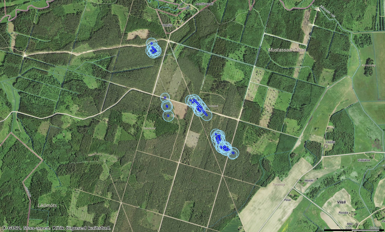
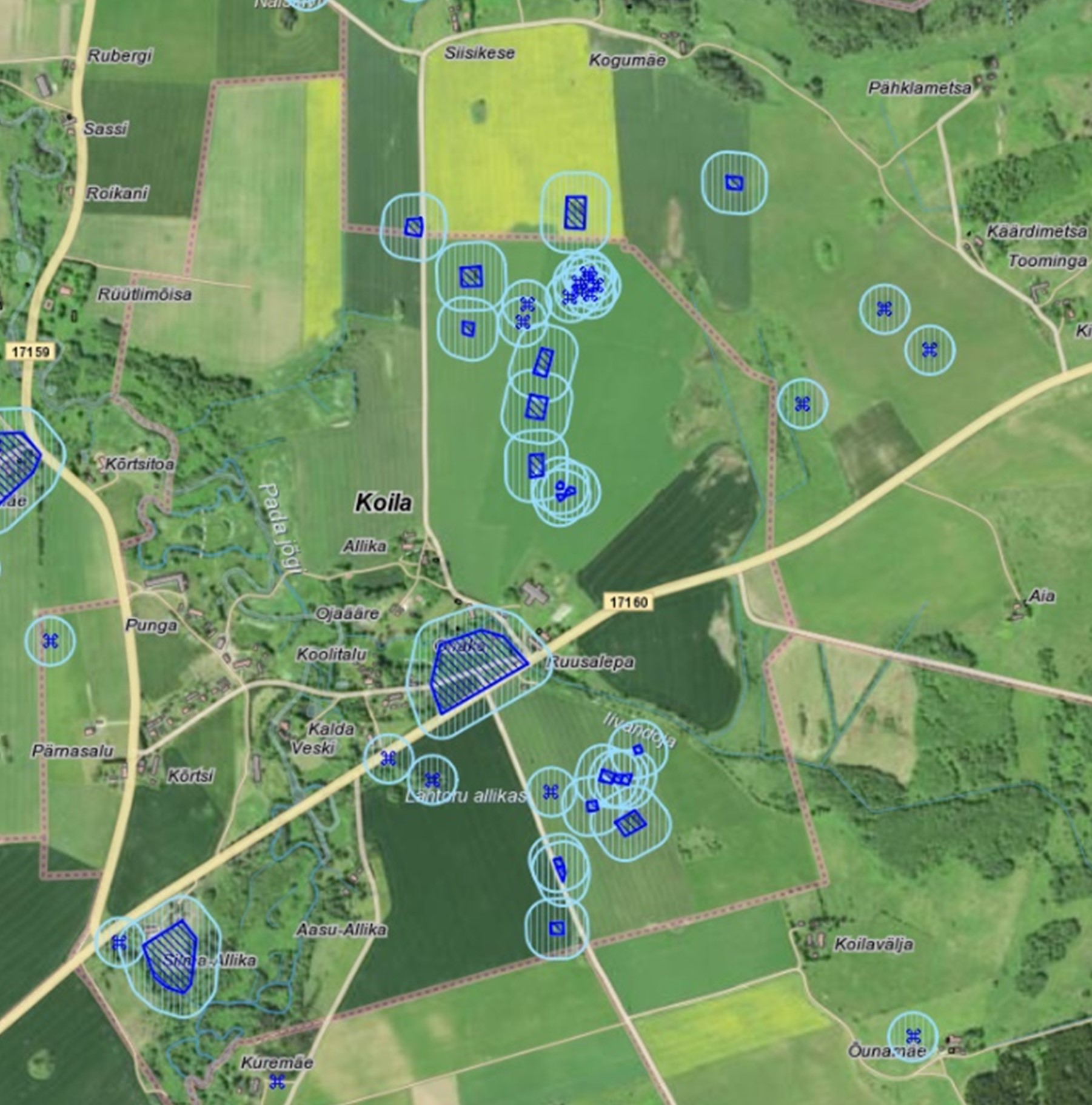
The listed archaeological heritage of Estonia covers in total about 48,8km², which makes up 0.11% of the territory of Estonia. In addition to that about 1500 newly discovered elements of archaeological heritage are waiting to be listed, with 50–100 new sites being added every year (Kadakas 2017; Kadakas and Lillak 2019). During the last ten years, the discovery of new sites is usually connected with the use of metal detectors. Most such finds are discovered in fields, pastures and meadows, with far fewer found in forests and wetlands. Mostly these are burial sites of various types, but settlement sites and iron production sites have also been found. In addition to this, historical field structures, defensive buildings and remains of other above-ground structures have been found, thanks to the rapidly developing field of LIDAR technology. Based on LIDAR mapping, archaeological heritage can be observed on large areas extending to one hectare, with a diameter of up to 50m. Areas of historical field systems, marked by stone walls and stone heaps, are obviously larger (Kadakas et al. 2021, 43).

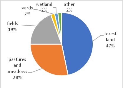
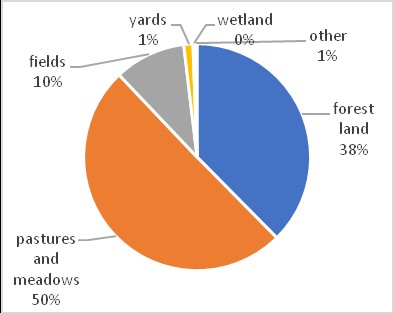
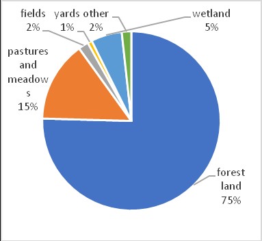
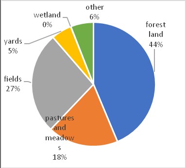
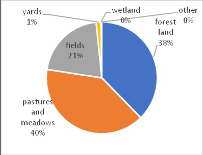
Settlement sites from the Stone Age to the 17th century (Kadakas 2021) cover about 56% of the total territory of archaeological heritage of Estonia (Figure 7). There are no particular restrictions to everyday (agricultural) use of the settlement site areas except the obligation to carry out archaeological research if there is a need to dig deeper than 20-30cm. Other monument types – mostly stone and sand burial mounds, cup-marked stones – also require restrictions on agricultural activities regarding ploughing and forest cutting, but cover a rather small part of the total area of archaeological heritage, only 3-4%. However, only 73 historical field structure areas are listed right now, but these make up 12% of the total area of archaeological heritage. If we were to exclude settlement sites, which have little effect on the everyday agricultural use of land, 47% of the other monuments and sites Figure 8) are located in forest areas, 28% on pastures and meadows and 19% on intensively cultivated fields:


Archaeological monuments have not been mentioned among the landscape elements during the compilation of the Greenmeter map or official documents and studies relating to the greening of agricultural lands in Estonia. However, the areas of ancient field systems, stone burial mounds or other elements of archaeological heritage situated in the middle of intensely farmed fields, or in forests, are clearly highlighted as places of biodiversity. For all of them, the most favourable conservation environment is permanent grassland or pasture or continuous forest cover. Like all other ecological focus areas, archaeological sites also provide valuable habitats for insects, birds, and open-landscape flora within modern monoculture agricultural lands. In the case of archaeological monuments situated within commercial forests, it is important not to manage the forest with methods of regeneration felling, but rather with methods of continuous cover forestry, which sustains both heritage and old biomes.
In the article I hope I have shown that archaeological heritage can provide more than a sense of identity and humanitarian knowledge about people's activities in the landscape and should not be taken only as a burden for the farmers. Thus, in addition to providing temporal depth to the cultural landscape around us, rural archaeological heritage can also be consciously used for sustaining natural diversity, which within monocultural landscapes is gradually becoming a kind of heritage of its own – the bioheritage.
This article was written with support of the research project of Estonian Ministry of Education and Research (PRG908). Translated by Villu Kadakas.
Internet Archaeology is an open access journal based in the Department of Archaeology, University of York. Except where otherwise noted, content from this work may be used under the terms of the Creative Commons Attribution 3.0 (CC BY) Unported licence, which permits unrestricted use, distribution, and reproduction in any medium, provided that attribution to the author(s), the title of the work, the Internet Archaeology journal and the relevant URL/DOI are given.
Terms and Conditions | Legal Statements | Privacy Policy | Cookies Policy | Citing Internet Archaeology
Internet Archaeology content is preserved for the long term with the Archaeology Data Service (ROR). Help sustain and support open access publication by donating to our Open Access Archaeology Fund.
 Home
Home