Cite this as: Wohlfarth, C. 2023 Reconciling the Protection of Nature and Monuments. A large-scale nature conservation project between the Siebengebirge and the Sieg, Internet Archaeology 62. https://doi.org/10.11141/ia.62.13
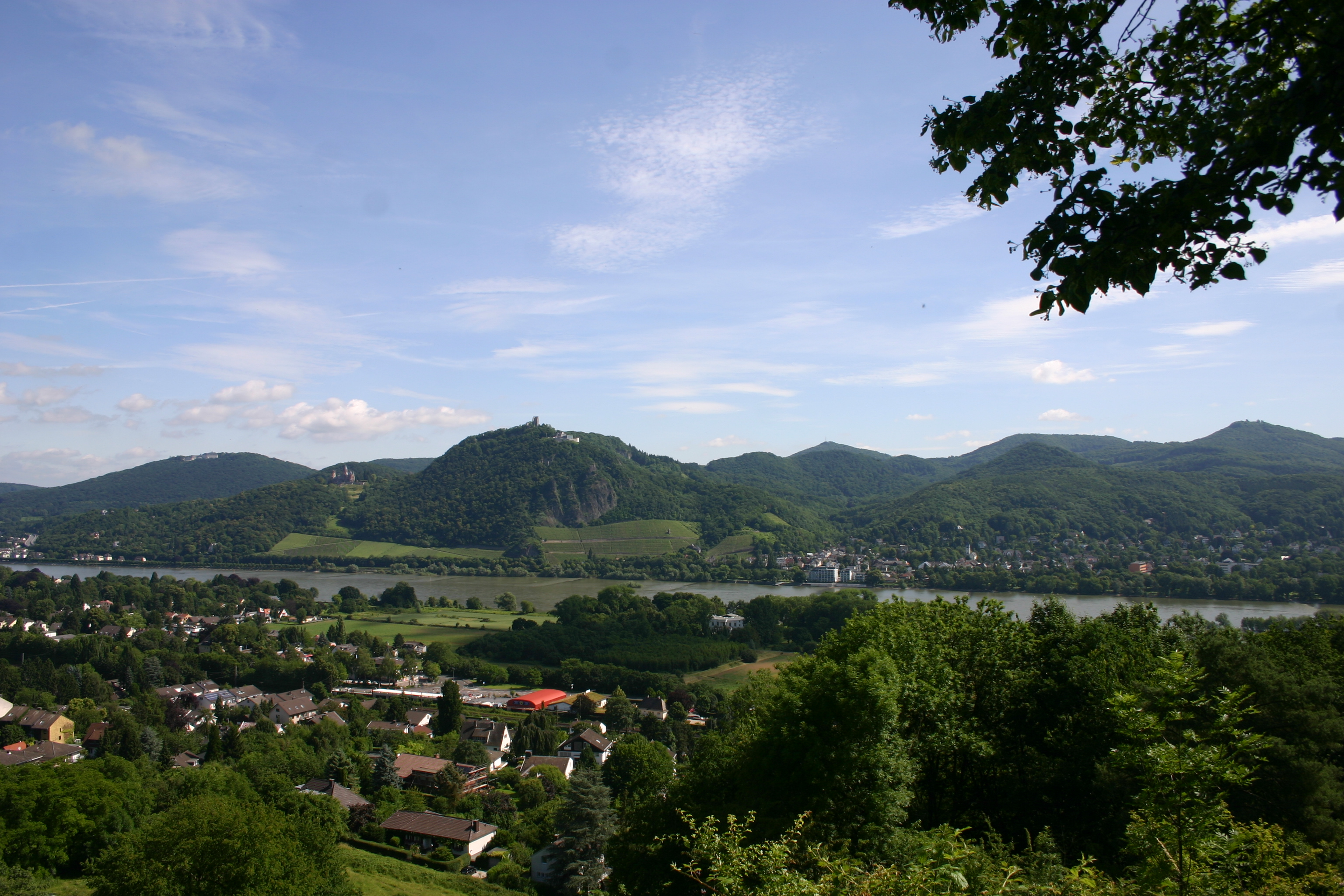
The Federal Environment Ministry has declared the landscape between the Rhine and the Westerwald to be a large-scale nature conservation project, unique in Germany, in order to protect it permanently. With the support of the state of North-Rhine-Westphalia (NRW), the federal government is promoting the project 'Natural and cultural landscape between the Siebengebirge in the west, the Pleiser Hills, Leuscheid Forest and the Sieg Valley in the east' (Fig. 1).
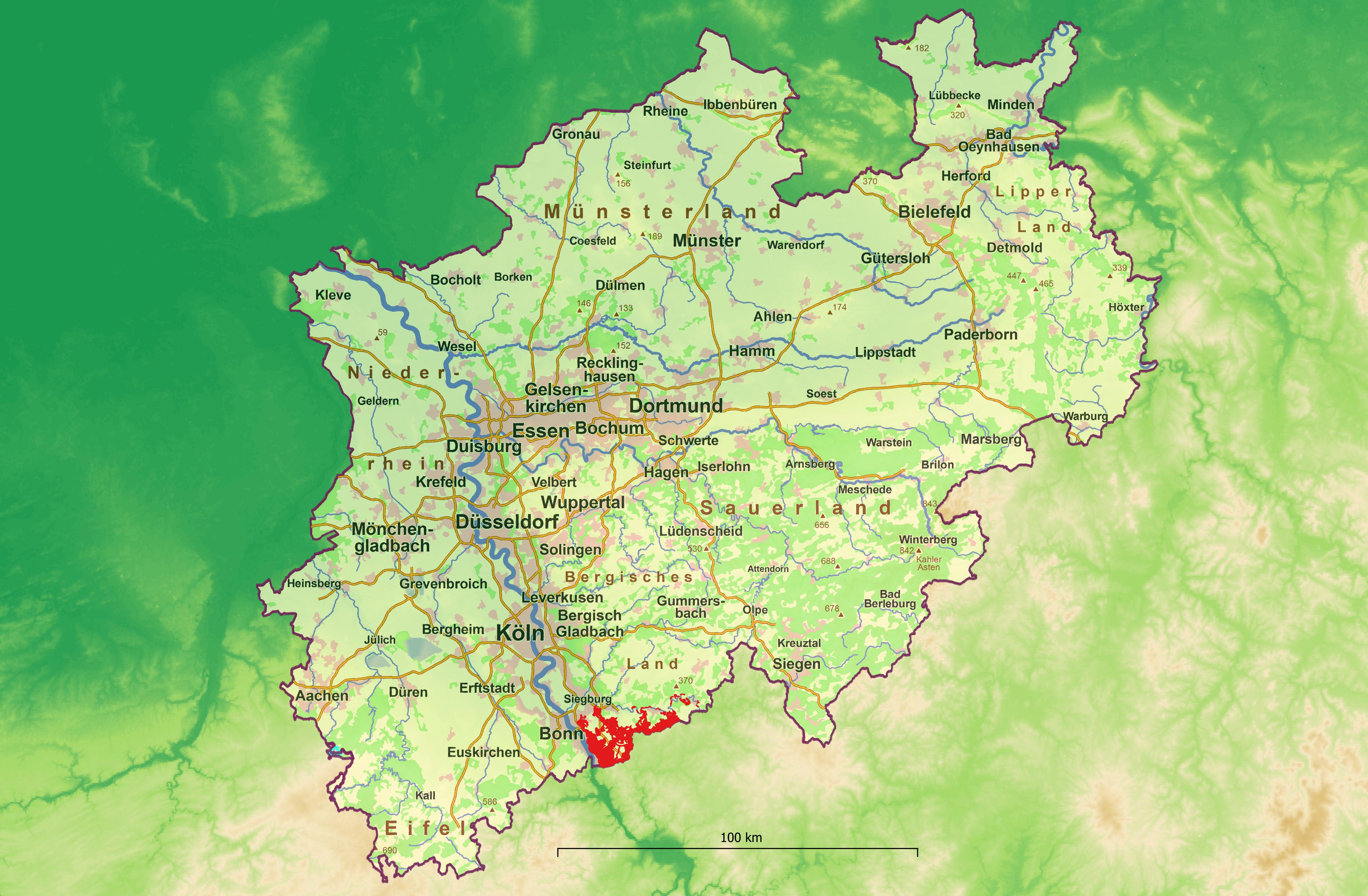
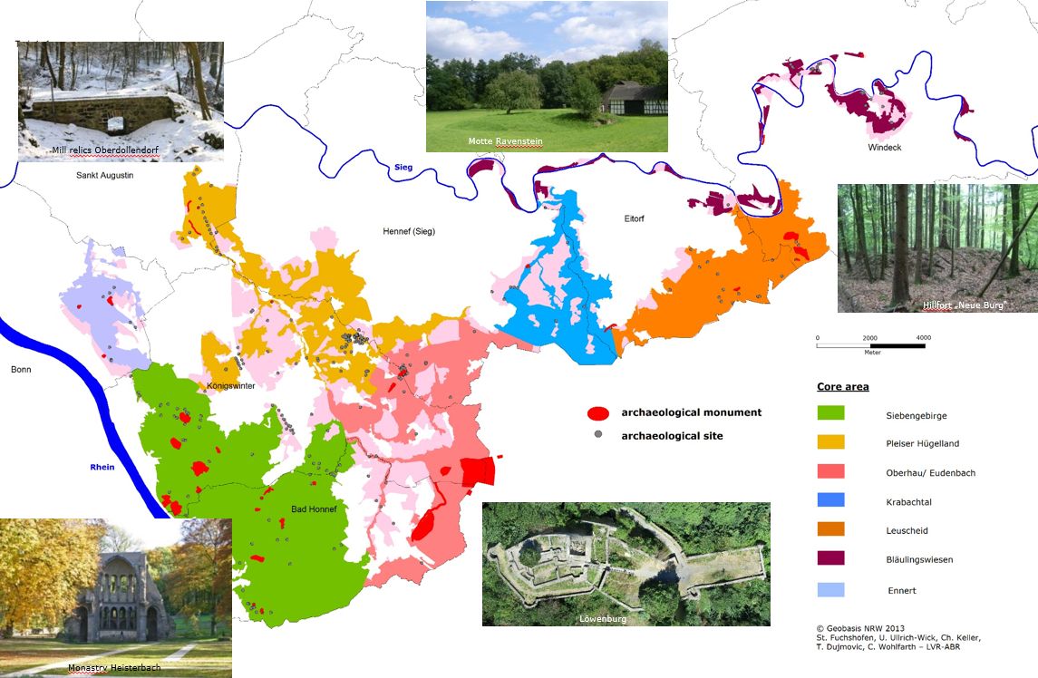
The main tasks of the 'chance.natur' funding programme are to preserve important natural and cultural landscapes in the long term and to develop them sustainably. Since December 2010, the Rhine-Sieg district has benefited from this funding programme for a large-scale nature conservation project. The project area of more than 10,000 hectares in south North-Rhine and the south-eastern Rhine-Sieg district affects six municipalities (Figure 2).
As a first step, the nature conservation project 'chance7' aimed to draw up a maintenance and development plan by mid-2013. This plan of measures was to determine in detail what exactly was to be implemented in the supervised area over the following ten years as step two and meant setting the course for future cultural landscape development of this region in the coming decades.
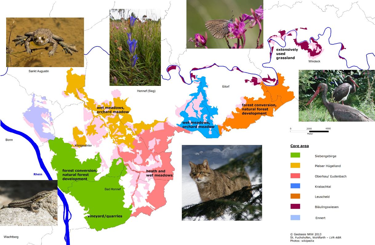
Large parts of the area were contiguous and thus met the overarching goal of biotope networking (Figure 3). In addition to the networking and maintenance of these habitats, the aim was also to achieve the spread of site-appropriate plants and animals.
Concrete measures were planned especially for former vineyards, quarries, orchards, extensively used grassland, heath and wet meadows in the valleys, as well as for the promotion of forest conversion and natural forest development. Different approaches for the implementation of the measures coud all be funded, such as land consolidation, land acquisition or conversion measures of those areas still under protection such as the state forest in the Siebengebirge, one of the oldest nature conservation areas of Germany. The participation was on a voluntary basis for regional stakeholders, nature conservation associations active in the six towns and municipalities of the project area, and representatives of agriculture and forestry.
Primarily, the focus has been on environmental protection. It was the task of the LVR-State Service for Archaeological Heritage in the Rhineland to take the topic of archaeology according to the EIA (Environmental Impact Assessment) into account. The LVR office supports the district and municipalities with the archaeological heritage project to implement the interests of the protection of cultural assets within the framework of large-scale nature conservation and was funded for two years by the DBU, the German Federal Environmental Foundation, starting in December 2011.
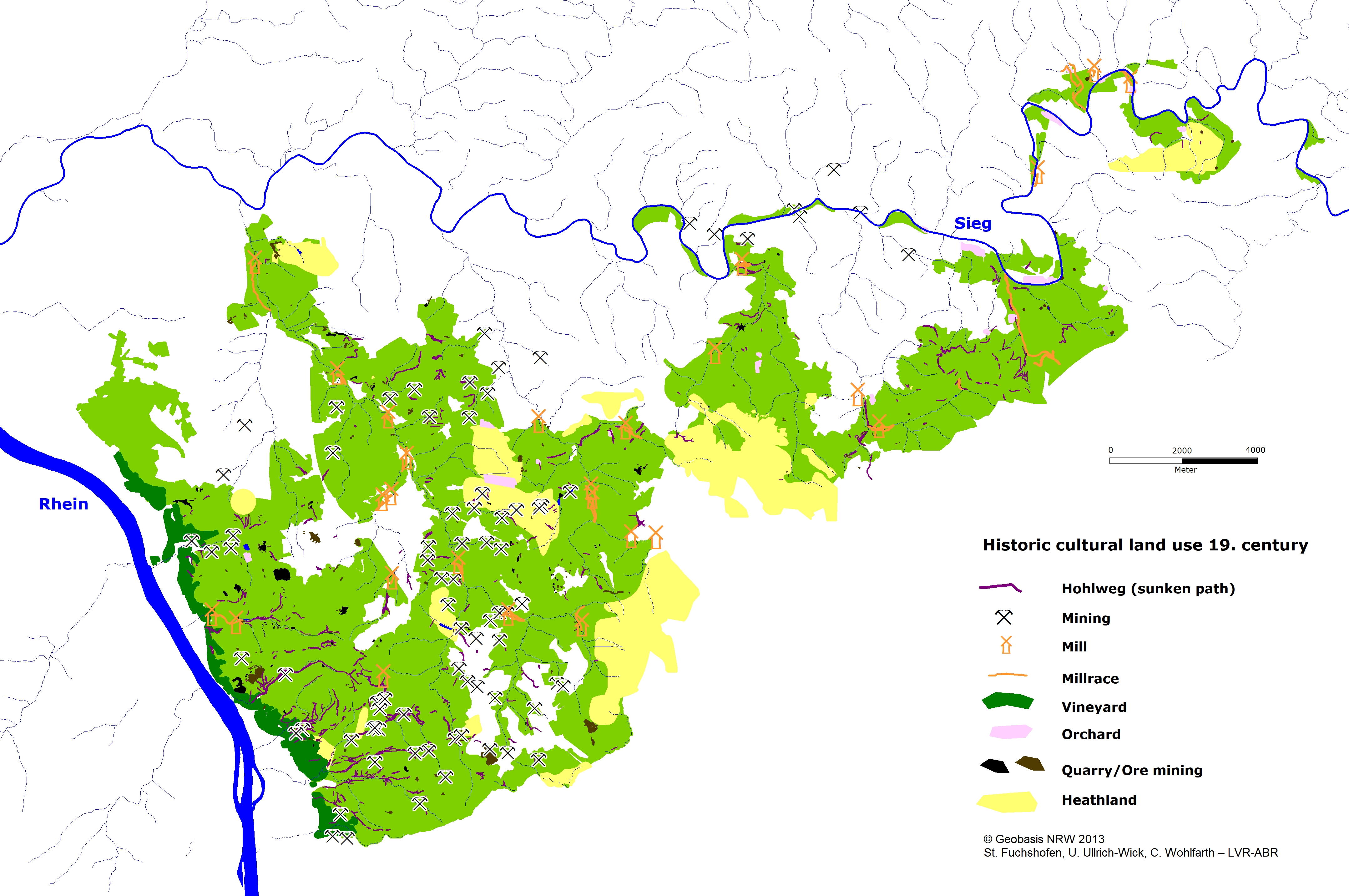
The goal of this project (Wohlfarth 2012) is to encourage close cooperation between those resonsible for preserving nature as well as of cultural heritage to integrate the cultural landscape, and especially the cultural assets, into the overall process to ensure that its value is recognised and is compatible with nature and monuments, as well as to protect them from environmental influences. With methods such as the large-scale evaluation of LiDAR maps of the forest areas, the detailed evaluation of erosion and aerial maps, as well as historical and modern sources such as archive data, literature, images and maps, the cultural landscape – a landscape shaped by mining and metalworking (Figure 4) as well as by agricultural use – is analysed in the run-up to the fieldwork.
Many of today's well-preserved monuments in the forest, mainly in the Siebengebirge and Leuscheid, should be included in the planning of measures. They include prehistoric hilltop fortifications, medieval and modern hilltop and lowland castles, the Heisterbach Monastery, and also mills and hammermills, as well as cultural landscape relics such as country weirs, Hohlwege (sunken roads), abandoned quarries, mines, vineyard terraces, pits, charcoal-burning sites, slag heaps and trenches (Figure 5).
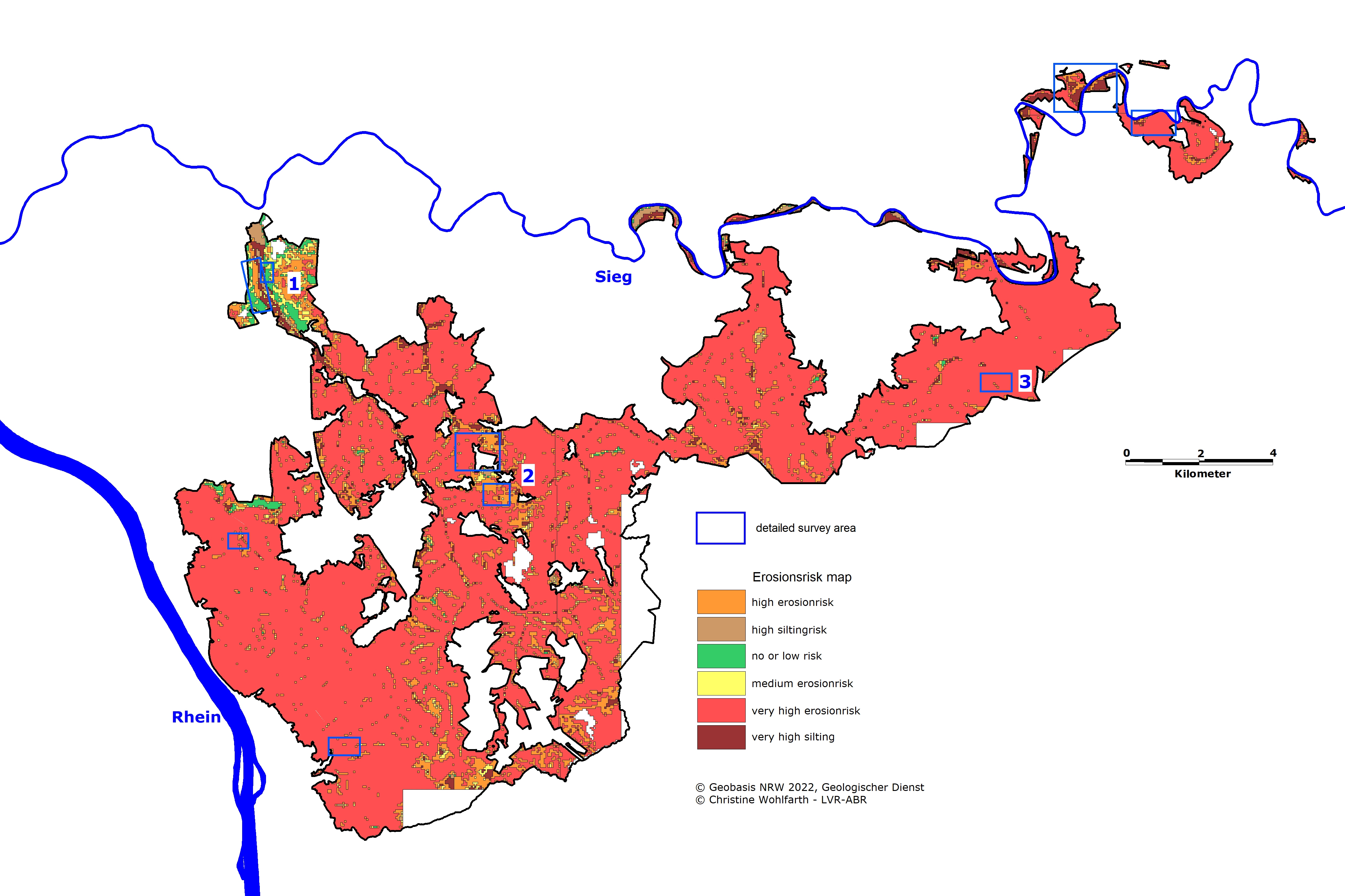
These cultural assets are increasingly endangered by climate change, extreme weather events such as damage caused by wind during storms or heavy rain events, but also, with insufficiently known impact, by recreational sports activities and the use of modern timber-harvesting equipment. According to erosion mapping by the Geological Survey, the majority of the project area is at very high risk of erosion (Figure 6) and silting up of the stream valleys. These factors are largely the result of anthropogenic impact.
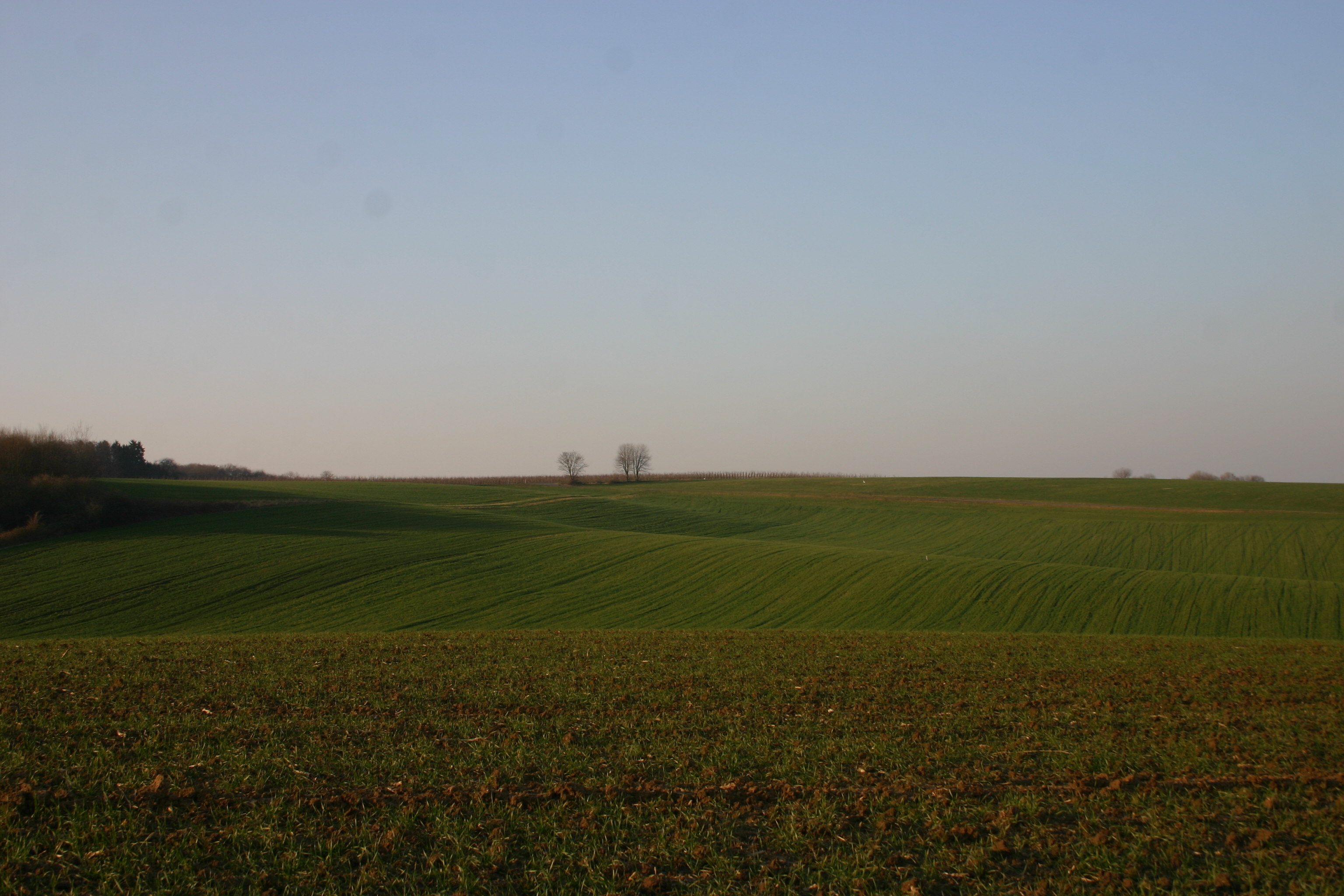
In addition to the preserved monuments in the forest, countless other archaeological sites, which are buried and therefore no longer visible, have been severely impaired and endangered by a wide variety of influences. Most of these are located in the fertile areas of the Pleiser Hills (Figure 7) and Windecker Land, where arable land has been intensively farmed since the Metal Ages from around 1000 BC onwards.
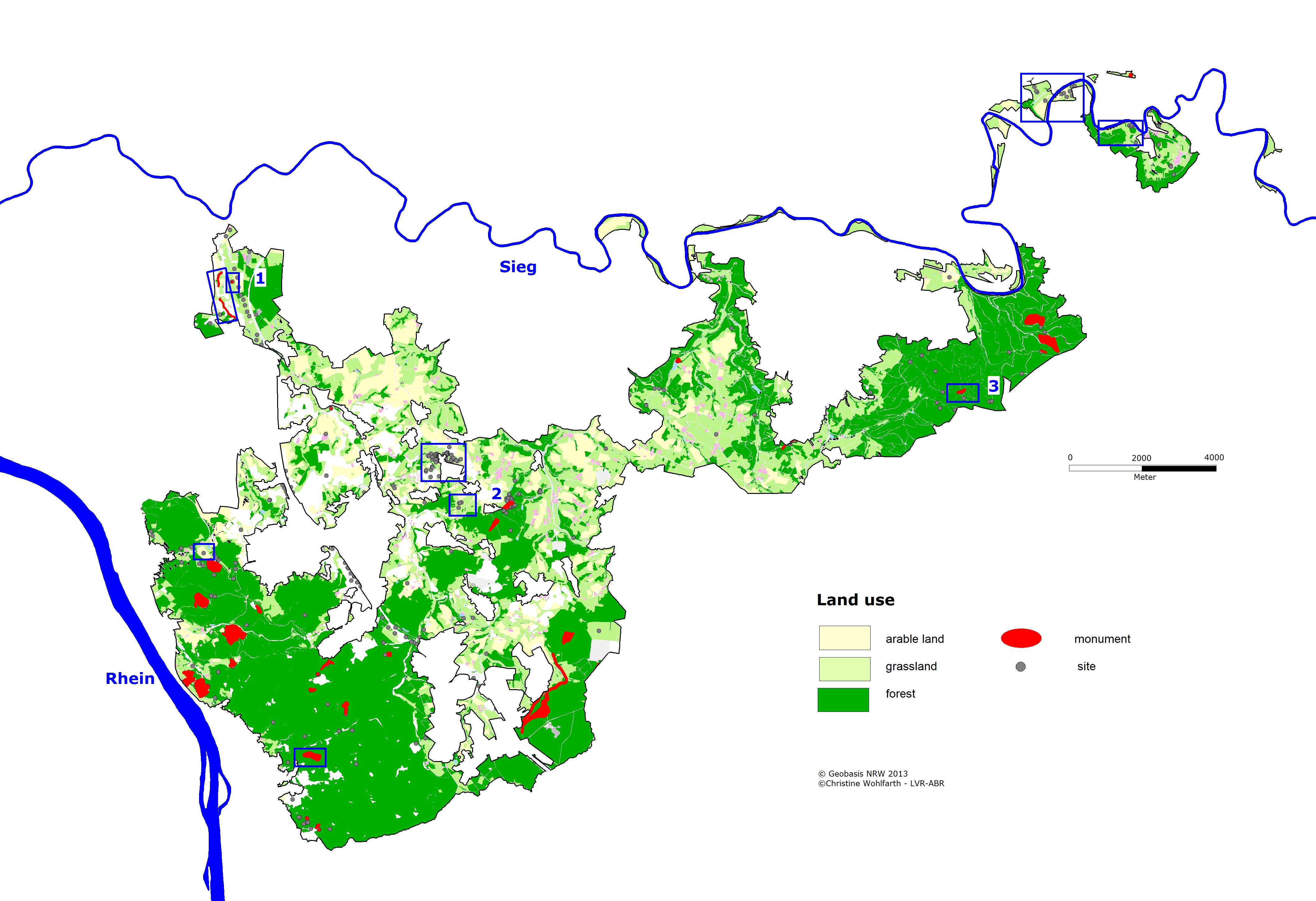
Using two sample objects from each of the different management areas (forest, arable land and grassland), various prospection methods are used to investigate the increasing risk of erosion to the cultural assets. Supplementary evaluations and surveys of cultural landscape relics in the forest and grassland, as well as archaeological surveys, soil research, geophysical investigations and trial trenches, have been used to specifically determine the risk of erosion and the state of preservation of monument remains in the various landscape areas with their different forms of use and cultivation (Figure 8). The detailed investigations are coordinated with the farmers and foresters on a voluntary basis. These investigations were supported by volunteers, collectors and archaeology students from the University of Bonn.
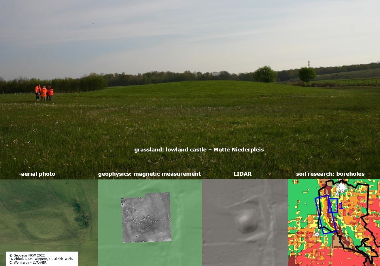
Grassland: aerial photo – LiDAR – magnetics – boreholes
The scientific investigations confirmed good preservation for the lowland castle in Niederpleis (Figure 9). The evaluation of the aerial map and LiDAR clearly show a motte hill and a moat. The castle mound is constructed from the excavated material of the ditch and the surrounding material. More high-flood loam was added from the west with sandier materials added from the Cologne layers from the east. The line of the location of this lowland castle directly corresponds to the boundary of these two geological units. On the slope to the east of the monument, water emerges from a spring horizon.
The analysis of the boreholes indicates that the current use as grassland poses no risk of erosion. The magnetics show some features, maybe pits or relics of the castle foundation and the moat. Using the motte as grassland without grazing is ideal for the protection and preservation of the archaeological monument. Considering the moisture in the vicinity of the ditch, mowing is limited to twice a year, at most.
Arable land: accurate/extensive fieldwalking – geoarchaeological investigation – trial trenches
The result of extensive fieldwalking in the Pleiser Hills, where high erosion is mapped, shows prehistoric and medieval finds spread on the hilltop in the east and on the slope to an old ditch (Figure 10).
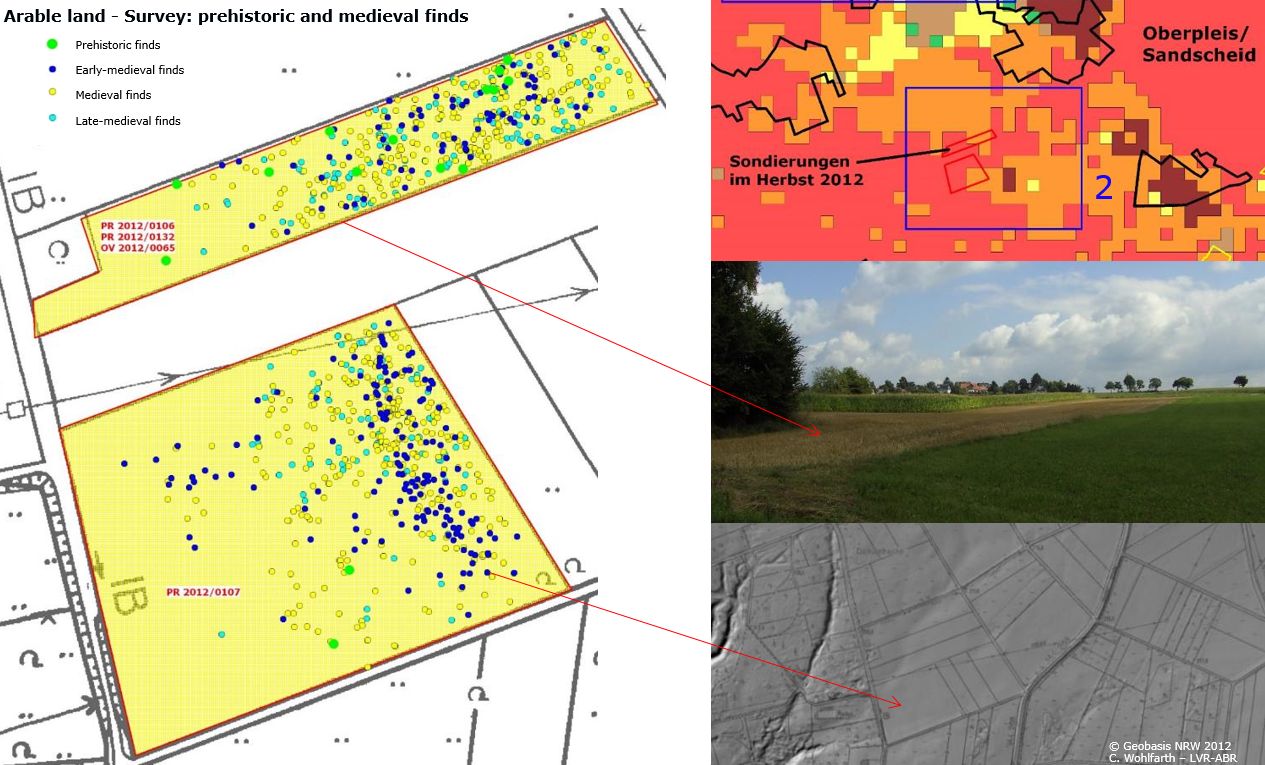
The analysis of the finds from the investigated areas reveals a dense scattering of early to late medieval pottery on the hilltop and the slope. In contrast, the ditch to the west is nearly devoid of finds. This indicates a medieval and Early Modern settlement on the spot, perhaps even dating further back into prehistory. The approximately 30 prehistoric finds are dated to the Neolithic period, as well as to the Iron Age. Most of the collected material is from the Middle Ages.
The trial trenches – three geological and two archaeological – were meant to clarify the degree of erosion and how much of the suspected settlements was preserved. In the trial trenches, no archaeological features were found. The long-lasting cultivation of this arable land, which reaches back to the Iron Age, has caused small-scale erosion processes. The soil on the hilltop is truncated, and material is deposited at the foot of the hill and in the ditch. The soil profile confirmed the erosion on the hilltop and a colluvium downslope to the ditch. Perhaps, therefore, the finds are the last signs of the former prehistoric settlement on the hilltop.
Forest: historic maps – LiDAR – trial trench
In the Leuscheid Forest, some parts of the Medieval–Early Modern Landwehr (territorial boundary between the duchy of Berg, the county of Sayn-Altenkirchen and Kurköln) are preserved. The structures of the wall ditch system (rampart) were identified in the laser scan and on the coloured historic map from 1593 (Figure 11). In this case, the boundary line is drawn and described, thus the monument was found in the field and cultural protection followed.
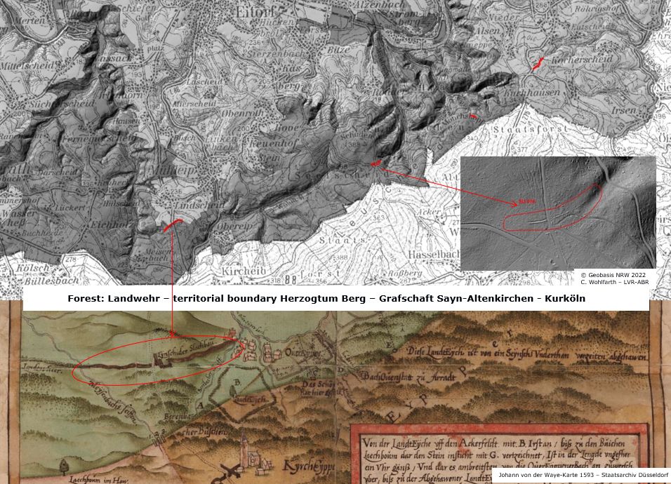
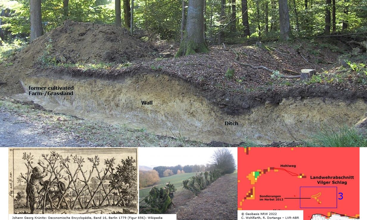
In another part of the boundary, a 15m long archaeological section was cut through the wall and the ditch in the vicinity of a path. It confirms that the territorial boundaries were maintained for a long time and the U-shaped ditch was kept clear up to the present day. The rampart consists of material excavated while constructing the ditch, and planting took place shortly after its filling, which prevented greater erosion. Immediately south of the rampart, an old ploughing horizon was detected (Figure 12), indicating an agriculturally used, forest-free zone adjacent to the borders. This enabled the early detection of attacking enemies.
The earth monument showed good conservation conditions owing to its position in the lightly sloping terrain and the small catchment area owing to the proximity to the local watershed.
The results of the specialist data are processed in a geographical information system and interesting cultural assets (Wohlfarth 2014) are accessible to the public via KuLaDig (culture, landscape, digital – an internet-based information system).
Concrete implementation recommendations for the integration of cultural assets into the maintenance and development plan of the nature conservation project, as well as the digital data, are continuously exchanged between the stakeholders (the planning company Grontmij, the project office chance7, and the foresters) in the interests of environmental communication and to reduce obstacles to cooperation.
One example of the implementation of concrete recommendations into the maintenance and development plan of the nature conservation project is the monument of silver- and lead mining relics from Iron Age to Modern times with an Early Roman ring-ditch, located outside the Roman Empire in the Germanic region. Initially, this was a flagship project planned for the conversion of forest into heathland with grazing. However, over the course of centuries of mining activities, the present-day heath vegetation had continually developed on the mining relics, such as slag heaps and mine shafts used to extract lead and silver ore since the Iron Age, as well as the production of iron ore as far as modern times. As a result of the archaeological and scientific investigations, which proved heavy metal pollution, the plan was abandoned. Now this monument is a montane archaeological research area by the LVR office in cooperation with the University of Bonn.
A project report, a catalogue of measures for each preserved monument with recommendations as well as a comprehensive appendix with scientific reports and public relations work were produced (Wohlfarth 2013). In addition, the LVR-office presented an exhibition at two locations and a guided tour to five archaeological monuments in the Siebengebirge.
On the basis of criteria that correspond to utilisation and protection requirements, holistic sustainable guidelines for the conservation of cultural assets are being developed that reconcile the interests of farmers and foresters working in the project area in particular, as well as those of nature conservation and cultural asset protection.
The holistic sustainable guidelines are as follows:
Large-scale nature conservation projects
Agriculture
Forestry
Running waters/ponds/mill ditches
Protection and maintenance measures
Adding value/communication
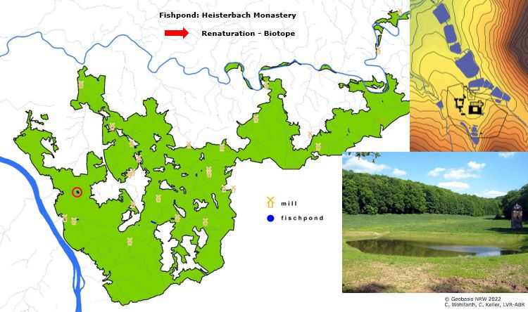
Since 2015, the measures of the maintenance and development plan have been implemented and the process of human-made transformation and redesign of the cultural landscape has begun. Historic or modern artificial water bodies such as fishponds or mill ditches are 'renaturalised' into biotopes or amphibian water bodies, e.g. at the Heisterbach monastery (Figure 13).
In addition, in some present-day forest areas, intensive interventions in the current cultivated landscape of former heathland sites are taking place. After deforestation, leaching of the soil occurs to create a heath landscape spread of site-appropriate plants and animals. On the other hand, former heathland, which was drained in the 20th century for grassland use, will not be retransformed back into heathland, according to the guidelines.
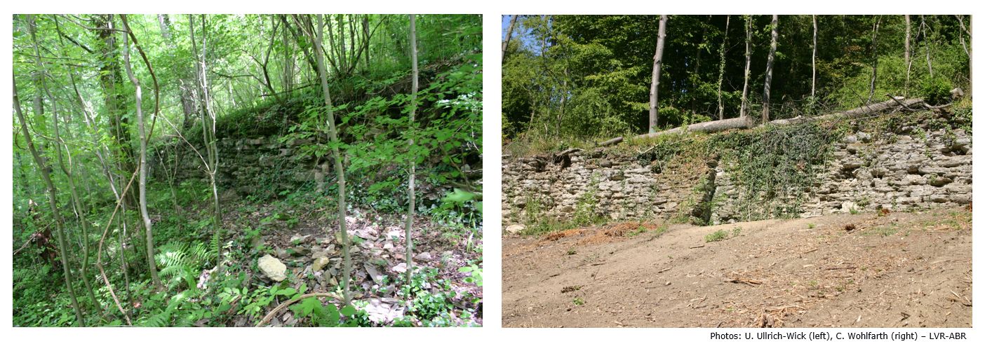
A further example for the cooperative work between nature conservation measurements and cultural asset protection is, according to the recommendation, to clear and keep open the cultural assets from encroaching vegetation (Figure 14), e.g. in the front of former vineyard terraces.
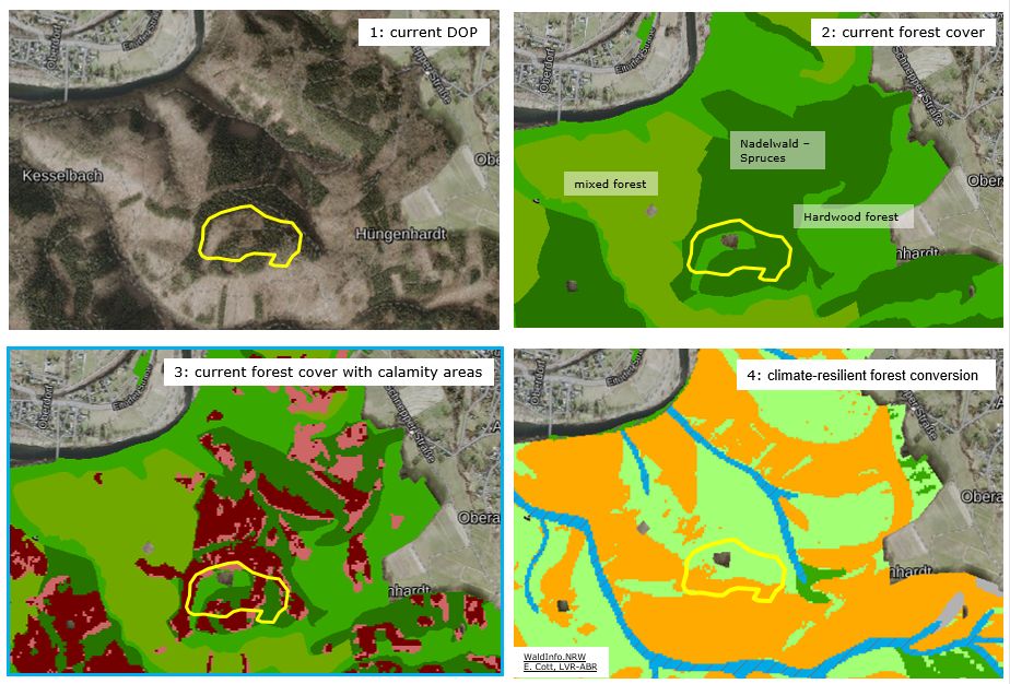
Currently, and with regard to climate change and in particular spruce die-off, Eva Cott and Alexander Kisslinger, both from the LVR-ABR, are working on archaeological management strategies for climate-resilient forest conversion, a cooperation between the state forest and the LVR office. One example of the forest conversion of an Iron-Age hilltop fortification in the Leuscheid Forest (Figure 15) has been analysed by them. It is intended to develop the monument area into an archaeotope in close coordination with forestry and nature conservation. This will ensure the future good cooperation and continued team-work by linking the different protection requirements.
It would be desirable and advisable for future large-scale nature conservation projects (especially those cultural landscapes steeped in history, having been used and shaped by humans over thousands of years) not merely to regard flora and fauna, but also to consider historico-cultural correlations.
The results of this project clearly illustrate the manner in which the use and anthropogenic interference with the landscape is linked to the spread of certain animal and plant species (biodiversity). Therefore, opinions from both nature conservation and archaeo-historical experts should be sought at an early stage and linked to each other when planning new procedures. These combined reports serve as groundwork for on-going care and protection, as well as for restoration of cultural assets.
I thank all project partners and history volunteers for their outstanding commitment. I am grateful to Maria Heitkamp (Leverkusen) for translating the text.
Internet Archaeology is an open access journal based in the Department of Archaeology, University of York. Except where otherwise noted, content from this work may be used under the terms of the Creative Commons Attribution 3.0 (CC BY) Unported licence, which permits unrestricted use, distribution, and reproduction in any medium, provided that attribution to the author(s), the title of the work, the Internet Archaeology journal and the relevant URL/DOI are given.
Terms and Conditions | Legal Statements | Privacy Policy | Cookies Policy | Citing Internet Archaeology
Internet Archaeology content is preserved for the long term with the Archaeology Data Service (ROR). Help sustain and support open access publication by donating to our Open Access Archaeology Fund.
 Home
Home