Cite this as: Davidson, L., Corns, A., Pollard, E. and Shaw, R. 2026 FAIR and Open CHERISH: data and outputs from terrestrial laser scanning and uncrewed aerial vehicle digital photogrammetry surveys of coastal heritage sites in Ireland (Data Paper), Internet Archaeology 71. https://doi.org/10.11141/ia.71.12
The Discovery Programme [Depositor]. CHERISH Project. The Discovery Programme, CHERISH Project. (2017 - 2023). Collection [Type]. Digital Repository of Ireland (2025) [Publisher]. https://doi.org/10.7486/DRI.g158r977f
The terrestrial laser scanning (TLS) and uncrewed aerial vehicle (UAV) digital photogrammetry datasets introduced in this paper form several sub-collections from the CHERISH Project collection found in the Digital Repository of Ireland (DRI). A DOI has been assigned to each sub-collection and to every digital object it contains.
Referee statement by Hannah Fluck (Senior National Archaeologist, National Trust).
To date, the Discovery Programme has published over 20,000 digital objects from the CHERISH Project in the DRI. These digital objects are from several datasets relating to 20 TLS surveys and 34 UAV digital photogrammetry surveys. These surveys were undertaken to create baseline 3D records of archaeological sites, monuments and building remains that are at risk from the impacts of climate change. Through the creation of rich metadata, the use of controlled vocabularies, deposition in a digital repository, assignment of DOIs and application of appropriate licences, these datasets are FAIR (Wilkinson et al. 2016) and open. The metadata for each digital object has been made available through a CC0 licence while the assets (the data files) were assigned a CC BY 4.0 licence. This means that the metadata is free to reuse without any restrictions, while reuse of the assets requires appropriate attribution to be given.
To provide structure and facilitate exploration of the CHERISH Project datasets in the DRI, the collection has been organized by county (study area), followed by CHERISH site (usually the name of the townland), method from the CHERISH toolkit (Barker and Corns 2023), and finally by date of data capture for UAV digital photogrammetry datasets or by monument description/National Monuments Record (NMS) number for the TLS datasets (see Figure 1). This final level contains the digital objects (metadata and assets).
With impacts of modern climate change recognised as a significant threat to coastal heritage (Kelly and Stack 2009), the CHERISH Project set out to raise awareness and understanding of past, present and near-future impacts of climate change on vulnerable cultural heritage sites and monuments along the coasts of Ireland and Wales. CHERISH was a collaborative, interdisciplinary and transnational research project, with partners from The Discovery Programme, Geological Survey Ireland, Department of Geography and Earth Sciences at Aberystwyth University and the Royal Commission on the Ancient and Historical Monuments of Wales. The project received €4.9m from the Ireland – Wales territorial Co-operation Programme 2014 – 2020 and addressed 'Priority 2: Adaptation of the Irish Sea and Coastal Communities to Climate Change.' The project began in January 2017 and ran until June 2023.
The main aim of CHERISH was to increase capacity and knowledge of climate change adaptation for the Irish Sea and coastal communities. Several CHERISH initiatives (CI's) were defined to achieve this aim. Those relating specifically to the TLS and UAV survey data and outputs deposited and published in the DRI include:
CI 3: Enhanced historic environment data
The data captured using TLS and UAV equipment was used to enhance the historic environment record by creating detailed high resolution 2D and 3D models of coastal heritage sites and monuments at-risk. These surveys provided documentation on the condition of the site at a given point in time and were used for feature detection and enabled the quantification of geomorphic change over time (in locations where repeat surveys were undertaken). In addition, the data for four of the Irish sites informed landowner management plans.
CI 8: Shared web portal
One of the legacies of the project is the vast amount of data produced with high potential for further research and development. Therefore, openly sharing this data was key to the long-lasting impact of the project. The data created by The Discovery Programme is being deposited in the DRI. The DRI is a CoreTrustSeal-certified trustworthy digital repository who preserve humanities, cultural heritage and social sciences digital data from the island of Ireland for long-term preservation, access and discovery. As of September 2025, the Discovery Programme has deposited approximately 1TB of data which comprise the TLS and UAV datasets.
The CHERISH Project Archive from Wales has been deposited in the National Monuments Record of Wales. Coflein, the RCAHMW online database, can be used to search the collection.
The TLS sub-collections (Table 1) consist of the raw laser scans and the associated GNSS (Global Navigation Satellite System) ground control points (GCPs) as well as the registered, georeferenced and cleaned point cloud model in E57 file format. In addition, several scaled elevation and plan view orthoimages have been derived from the point cloud model for each monument recorded. These orthoimages contain a 10 m scale bar for reference. Finally, figures of the elevation orthoimages and their locations marked on the plan view have been produced. These digital objects, ranging from raw data to primary outputs through to derivatives and figures, give users a variety of entry points to data reuse from highly technical to nontechnical options.
| Monument (link to record) | Thumbnail | Sub-collection title | Dates of data capture | County | Townland |
|---|---|---|---|---|---|
| Gun battery DU023-029011 |  | Data captured on 05/04/2022, gun battery DU023-029011-, terrestrial laser scanning | 2022-04-04 2022-04-05 | Dublin | Dalkey Island |
| St Begnet's Church DU023-029003- |  | Data captured on 04/04/2022, St. Begnet's Church DU023-029003-, terrestrial laser scanning | 2022-04-04 | Dublin | Dalkey Island |
| Martello tower no. 9 DU023-029009- |  | Data captured on 04/04/2022, Martello tower no. 9 DU023-029009-, terrestrial laser scanning | 2022-04-04 | Dublin | Dalkey Island |
| MacCarthy's Castle KE097-034---- and site of a fish palace KE097-034001- | 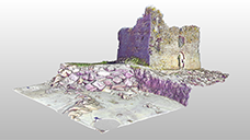 | Data captured on 29/06/2018, MacCarthy's Castle KE097-034---- and site of a fish palace KE097-034001-, terrestrial laser scanning | 2018-06-29 | Kerry | Ballinskelligs |
| MacCarthy's Castle KE097-034---- and site of a fish palace KE097-034001- | 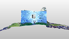 | Data captured on 10/05/2022, MacCarthy's Castle KE097-034---- and site of a fish palace KE097-034001-, terrestrial laser scanning | 2022-05-10 | Kerry | Ballinskelligs |
| Ferriter's Castle KE042-034002- | 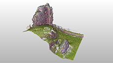 | Data captured on 25/06/2018, Ferriter's Castle KE042-034002-, terrestrial laser scanning | 2018-06-25 | Kerry | Ballyoughteragh South |
| Ecclesiastical enclosure KE0112-002001- | 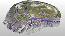 | Data captured on 19/04/2018 and 26/06/2018, Ecclesiastical enclosure KE019-002001- and associated remains, terrestrial laser scanning | 2018-04-19 2018-06-26 | Kerry | Illauntannig |
| Gatehouse KE087-046001- | 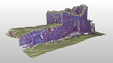 | Data captured on 28/06/2018, gatehouse KE087-046001-, terrestrial laser scanning | 2018-06-28 | Kerry | Reencaheragh |
| Bawn WX045-012002-and 16th/17th century house WX045-012004- | 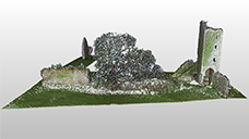 | Data captured on 18/06/2018, bawn WX045-012002-, tower and 16th/17th century house WX045-012004-, terrestrial laser scanning | 2018-06-18 | Wexford | Clonmines |
| Augustinian friary WX045-012003- and gatehouse WX045-012011- | 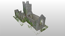 | Data captured on 14/06/2018, Augustinian friary WX045-012003- and gatehouse WX045-012011-, terrestrial laser scanning | 2018-06-14 | Wexford | Clonmines |
| Black Castle WX045-012001- | 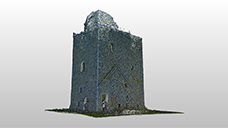 | Data captured on 04/08/2021, Black Castle WX045-012001-, terrestrial laser scanning | 2021-08-04 | Wexford | Clonmines |
| North wall of chancel from Augustinian friary WX045-012003- | 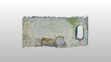 | Data captured on 04/08/2021, Augustinian friary WX045-012003- - north wall of chancel, terrestrial laser scanning | 2021-08-04 | Wexford | Clonmines |
| Old farmstead landing place | 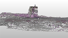 | Data captured on 06/03/2018, old farmstead landing place, terrestrial laser scanning | 2018-03-06 | Wexford | Great Saltee |
| Enclosure WX051A002002- and hut site WX051A001---- | 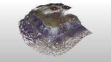 | Data captured on 07/03/2018, enclosure WX051A002002- and hut site WX051A001----, terrestrial laser scanning | 2018-03-07 | Wexford | Great Saltee |
| Enclosure WX051A002002- and hut site WX051A001---- | 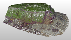 | Data captured on 15/06/2021, enclosure WX051A002002- and hut site WX051A001----, terrestrial laser scanning | 2021-06-15 | Wexford | Great Saltee |
| WWII lookout post | 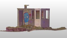 | Data captured on 08/11/2017, WWII lookout building, terrestrial laser scanning | 2017-11-08 | Wexford | Kilmichael |
| Old Coast Guard station and site of a signal tower WX007B003---- | 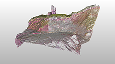 | Data captured on 08/11/2017, Old Coast Guard station and site of a signal tower WX007B003----, terrestrial laser scanning | 2017-11-08 | Wexford | Kilmichael |
| Boathouse and slipway | 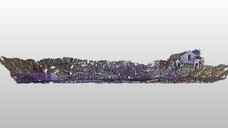 | Data captured on 08/03/2018, boathouse and slipway, terrestrial laser scanning | 2018-03-08 | Wexford | Kilmichael |
| Old Coast Guard station and site of a signal tower WX007B003---- | 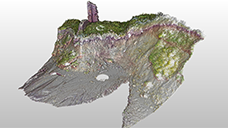 | Data captured on 14/06/2021, Old Coast Guard station and site of a signal tower WX007B003----, terrestrial laser scanning | 2021-06-14 | Wexford | Kilmichael |
| Site of an abandoned village, bastioned fort WX038-007001-, Martello tower WX038-007002-, watchtower WX038-007001- and signal tower WX038-007009- | 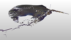 | Data captured on 08/11/2017, abandoned village, site of a bastioned fort SMR No.: WX038-007001-, a Martello tower SMR No.: WX038-007002-, a watchtower SMR No.: WX038-007001- and a signal tower SMR No.: WX038-007009-, terrestrial laser scanning | 2017-11-08 | Wexford | Wexford Harbour |
The raw data includes the unprocessed scan data in both proprietary format and converted to E57 file format. The scan data was captured mainly using either a Trimble TX8 Laser Scanner or a FARO Focus 3D S 120 Laser Scanner. In one instance a FARO Focus X330 HDR was employed. Files exported from the former scanner were in RWI and RWP file format. These are a Trimble RealWorks proprietary file format and represent the project and information files. The RWI folder contains the raw point cloud data and scanner information which is accessed by opening the RWP project file. Data captured with the FARO Focus 3D S Max Laser Scanner or the FARO Focus X330 HDR were exported from the equipment as FLS files, which are a FARO Focus proprietary file format. These can be processed in FARO SCENE, imported to Trimble RealWorks or other point cloud processing software which has FLS import capabilities.
Each survey required several station setups to scan the entire monument. Where land access and sightlines allowed, closed traverses were employed. To align the scans from each of the station setups, laser scanning reference spheres were placed in and around the monument. There was a minimum of three spheres common to consecutive station setups which enabled target-based registration of the individual scans. Three to four of these spheres were also used as GCPs providing georeferencing information. These were selected to ensure good control geometry, i.e. the sphere's used as GCPs were well-spaced near the perimeter of the survey area.
For each GCP, rebar target supports were hammered vertically into the ground, and the spheres were placed on top. Once the scanning was completed, the spheres were removed. The position of the supports was then recorded using a Trimble R10 GNSS receiver in conjunction with Trimble VRSNow real-time kinematic (RTK) correction service. The point of the survey pole with attached GNSS receiver was positioned on top of the rebar and levelled using a surveying bipod. The GNSS receiver was connected to the correction service and collected data for three minutes resulting in 180 epochs which were then averaged providing highly accurate x, y, z positions in the Irish Transverse Mercator (ITM, EPSG: 2157) coordinate referencing system (CRS). According to Trimble Geospatial, the horizontal accuracy achieved using the VRSNow network was circa 2 cm while the vertical accuracy was circa 3 cm. Offset equivalent to the radius of the sphere (0.055m, 0.075m or 0.080m depending on sphere's used) were added giving the position of the sphere centre.
Target based registration and georeferencing of the scan was completed in either Trimble RealWorks or Faro SCENE depending on the equipment used to capture the scan data. For information regarding registration error please refer to the metadata found in the DRI. Trimble RealWorks was also used to clean all point cloud models and to generate the elevation and plan view orthoimages. A 10 m scale bar was added to each of the orthoimages using Adobe Photoshop. The figures were created using Adobe Illustrator and exported as high-resolution TIFF files.
The UAV digital photogrammetry sub-collections (Table 2) contain aerial images captured by drone technology, GCPs, primary processing outputs (orthomosaic images and digital elevation models (DEMs)) and derivatives (topographic relief visualisations) as well as figures of the outputs and derivatives.
| Main monument (link to record) | Site name | Thumbnail | Sub-collection title | Date of data capture | County | Townland |
|---|---|---|---|---|---|---|
| Shipwreck W01131 | North Bull Island | 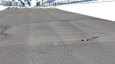 | Data captured on 20/01/2020, North Bull Island, UAV digital photogrammetry survey (CHERISH Project) | 2020-01-20 | Dublin | North Bull Island |
| McCarthy's Castle KE097-034----, Abbey KE097-036---- | Ballinskelligs | 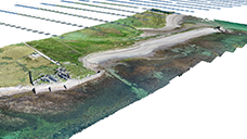 | Data captured on 29/06/2018 - UAV digital photogrammetry survey, Ballinskelligs, Co. Kerry (CHERISH Project) | 2018-06-29 | Kerry | Ballinskelligs |
| McCarthy's Castle KE097-034----, Abbey KE097-036---- | Ballinskelligs | 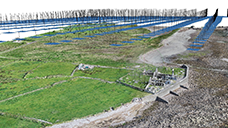 | Data captured on 27/05/2022 - UAV digital photogrammetry survey, Ballinskelligs, Co. Kerry (CHERISH Project) | 2022-05-27 | Kerry | Ballinskelligs |
| Ecclesiastical enclosure KE097-044001- | Cill Rialaigh (Kildreelig) | 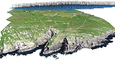 | Data captured on 27/06/2018 - UAV digital photogrammetry survey, Cill Rialaigh (Kildreelig), Co. Kerry | 2018-06-27 | Kerry | Cill Rialaigh (Kildreelig) |
| Dún an Óir promontory fort KE042-002001- | Dún an Óir | 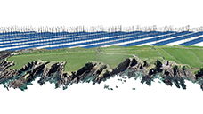 | Data captured on 05/04/2019 - UAV digital photogrammetry survey, Dún an Óir, Smerwick, Co. Kerry (CHERISH Project) | 2019-04-05 | Kerry | Smerwick |
| Dunbeg promontory fort KE052-270001- | Dunbeg | 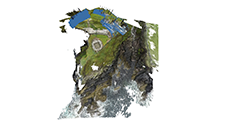 | Data captured on 08/06/2017 - UAV digital photogrammetry, Dunbeg, Fahan, Co. Kerry | 2017-06-08 | Kerry | Fahan |
| Dunbeg promontory fort KE052-270001- | Dunbeg | 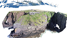 | Data captured on 20/04/2018 - UAV digital photogrammetry survey, Dunbeg, Fahan, Co. Kerry | 2018-04-20 | Kerry | Fahan |
| Dunbeg promontory fort KE052-270001- | Dunbeg | 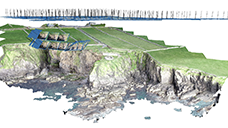 | Data captured on 04/04/2019 - UAV digital photogrammetry survey, Dunbeg, Fahan, Co. Kerry | 2019-04-04 | Kerry | Fahan |
| Dunbeg promontory fort KE052-270001- | Dunbeg | 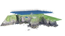 | Data captured on 12/05/2023 - UAV digital photogrammetry survey, Dunbeg, Fahan, Co. Kerry | 2023-05-12 | Kerry | Fahan |
| Promontory fort KE0042-034001-, Ferriters castle KE042-034002- | Ferriters (Ballyoughteragh South) | 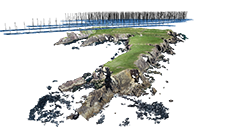 | Data captured on 25/06/2018 - UAV digital photogrammetry survey, Ferriters, Doon Point, Ballyoughteragh South, Co. Kerry | 2018-06-25 | Kerry | Ballyoughteragh South |
| Promontory fort KE0042-034001-, Ferriters castle KE042-034002- | Ferriters (Ballyoughteragh South) | 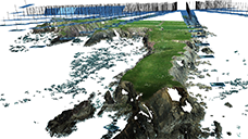 | Data captured on 16/05/2021 - UAV digital photogrammetry survey, Ferriters, Doon Point, Ballyoughteragh South, Co. Kerry | 2021-05-16 | Kerry | Ballyoughteragh South |
| Ecclesiastical enclosure, hut site: KE019-001001- KE019-002001- | Illauntannig | 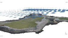 | Data captured on 19/04/2018 - UAV digital photogrammetry survey, Illauntannig, Magharee Islands, Co. Kerry | 2018-04-19 | Kerry | Magharee Islands (Illauntannig, Illaunboe and Reenafardarrig) |
| Submerged ancient forest remains | Inny Strand/Reenroe Beach |  | Ancient forest, data captured on 26/05/2022 - UAV digital photogrammetry survey - Inny Strand/Reenroe Beach, near Emlaghmore West, Co. Kerry | 2022-05-26 | Kerry | near Emlaghmore West |
| Possible field boundary remains | Inny Strand/Reenroe Beach |  | Stone alignment, data captured on 26/05/2022 - UAV digital photogrammetry survey, Inny Strand/Reenroe Beach, near Emlachnamuck, Co. Kerry | 2022-05-26 | Kerry | near Emlachnamuck |
| Promontory fort KE087-046----, Gatehouse KE087-046001- | Reencaheragh | 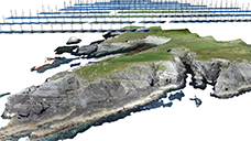 | Data captured on 28/06/2018 - UAV digital photogrammetry, Reencaheragh, Co. Kerry | 2018-06-28 | Kerry | Reencaheragh |
| Promontory fort KE087-046----, Gatehouse KE087-046001- | Reencaheragh |  | Data captured on 27/05/2022 - UAV digital photogrammetry, Reencaheragh, Co. Kerry | 2022-05-27 | Kerry | Reencaheragh |
| Promontory forts WA032-015----, WA032-048---- | Ballynarrid | 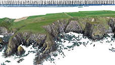 | Data captured on 24/07/2019 - UAV digital photogrammetry, Ballynarrid, Co. Waterford | 2019-07-24 | Waterford | Ballynarrid |
| Promontory forts WA032-015----, WA032-048----, WA032-043----, WA032-044---- | Ballynarrid |  | Data captured on 22/06/2021 - UAV digital photogrammetry survey, Ballynarrid, Co. Waterford | 2021-06-22 | Waterford | Ballynarrid and Ballydowane East |
| Promontory forts WA025-069001-, WA025-069002- | Dunabrattin | 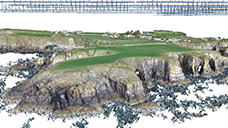 | Data captured on 14/08/2018 - UAV digital photogrammetry survey, Dunabrattin, Co. Waterford | 2018-08-14 | Waterford | Dunabrattin |
| Promontory fort WA032-028001- | Islandhubbock | 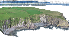 | Data captured on 14/08/2018 - UAV digital photogrammetry survey, Islandhubbock, Co. Waterford | 2018-08-14 | Waterford | Islandhubbock |
| Promontory forts WA032-028001-, WA032-046----, WA032-047---- | Islandhubbock | 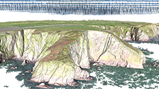 | Data captured on 02/12/2019 - UAV digital photogrammetry survey, Islandhubbock, Co. Waterford | 2019-12-02 | Waterford | Islandhubbock |
| Promontory fort WA025-072---- | Woodstown | 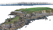 | Data captured on 23/07/2019, UAV digital photogrammetry survey, Woodstown, Co. Waterford | 2019-07-23 | Waterford | Woodstown (Middlethird By., Islandikane Par.) |
| Historic town WX045-012---- | Clonmines |  | Data captured on 12/06/2018 - UAV digital photogrammetry, Clonmines, Co. Wexford | 2018-06-12 | Wexford | Clonmines |
| Historic town WX045-012---- | Clonmines |  | Data captured on 03/08/2021 - UAV digital photogrammetry, Clonmines, Co. Wexford (CHERISH Project) | 2021-08-03 | Wexford | Clonmines |
| Burial WX051-010---- | Forlorn Point/Crossfarnoge | 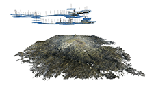 | Data captured on 17/11/2017 - UAV digital photogrammetry survey of Forlorn Point/Crossfarnoge, Ballyteige Burrow, Co. Wexford | 2017-11-17 | Wexford | Ballyteige |
| Motte and bailey WX017-008---- | Glascarrig North |  | Data captured on 07/06/2018 - UAV digital photogrammetry, Glascarrig North, Co. Wexford | 2018-06-07 | Wexford | Glascarrig North |
| Motte and bailey WX017-008---- | Glascarrig North | 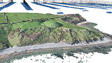 | Data captured on 27/02/2019 (1) - UAV digital photogrammetry survey of the coastal landscape (detail) containing the remains of a motte and bailey (SMR No.: WX017-008----) located in Glascarrig North, Co. Wexford | 2019-02-27 | Wexford | Glascarrig North |
| Motte and bailey WX017-008---- | Glascarrig North | 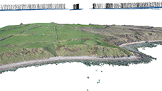 | Data captured on 27/02/2019 (2) - UAV digital photogrammetry survey of the coastal landscape (wider area) containing the remains of a motte and bailey (SMR No.: WX017-008----) located in Glascarrig North, Co. Wexford | 2019-02-27 | Wexford | Glascarrig North |
| Motte and bailey WX017-008---- | Glascarrig North | 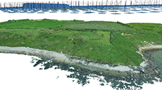 | Data captured on 16/06/2021 - UAV digital photogrammetry survey of the coastal landscape (wider area) containing the remains of a motte and bailey (SMR No.: WX017-008----) located in Glascarrig North, Co. Wexford | 2021-06-16 | Wexford | Glascarrig North |
| Ringfort WX028-005---- | Killincooly Beg | 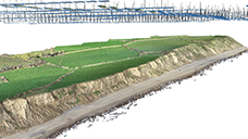 | Data captured on 08/11/2019 - UAV digital photogrammetry survey of the coastal landscape containing the remains of a ringfort - rath (WX028-055----) located in Killincooly Beg, Co. Wexford | 2019-11-08 | Wexford | Killincooly Beg |
| Ringfort WX028-005---- | Killincooly Beg | 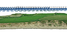 | Data captured on 16/06/2021 - UAV digital photogrammetry survey of the coastal landscape containing the earthwork and buried remains of a ringfort - rath (WX028-055----) located in Killincooly Beg, Co. Wexford | 2021-06-16 | Wexford | Killincooly Beg |
| Old coast guard station | Kilmichael Point |  | Data captured on 14/06/2021 - UAV digital photogrammetry survey of the coastal landscape that that contains a 19th century coast guard station (NIAH Reg. No. 15700741), the remains of an old coast guard station, a boathouse and a WWII lookout and the site of a signal station (SMR No: WX007B003----), located on Kilmichael Point, Kilmichael, Co. Wexford | 2021-06-14 | Wexford | Kilmichael |
| Abandoned 19th century village, Site of 16th century military remains | Rosslare Fort | 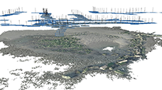 | Data captured on 17/11/2017 - UAV digital photogrammetry survey - Rosslare Fort, Wexford Harbour, Co. Wexford | 2017-11-17 | Wexford | Wexford Harbour |
| Abandoned 19th century village, Site of 16th century military remains | Rosslare Fort | 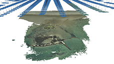 | Data captured on 21/09/2021 - UAV digital photogrammetry survey - Rosslare Fort, Co. Wexford | 2021-09-21 | Wexford | Wexford Harbour |
The aerial images were captured either by a DJI Phantom 4 UAV or a DJI Phantom 4 RTK UAV, each of which had an integrated camera. In one instance a DJI Phantom 2 equipped with a GoPro Hero 4 camera and in one instance a DJI Matrice 600 equipped with a Canon EOS-6D Mark II were used.
For UAV digital photogrammetry surveys which used a DJI Phantom 4 or a DJI Phantom 4 RTK UAV, near vertical imagery was captured along pre-programmed flight lines using the DJI Ground Station Pro app. These flightlines had a high percentage of forward (minimum of 80 percent) and side (minimum of 70 percent) overlap of between successive and lateral images. For one of the later surveys, at Dunbeg promontory fort, low oblique images were captured instead of near vertical images. In some, instances, high oblique images were also captured to provide additional details of landscape features, typically focusing on the eroding cliff face. In these instances, the UAV was flown in manual mode.
The UAV digital photogrammetry data captured using a GoPro Hero 4 mounted to a DJI Phantom 2 drone or using the DJI Matrice 600 carrying a Canon EOS-6D Mark II as a payload used a different data collection methodology. For each survey, the respective drones were flown in autonomous mode while the cameras captured low oblique video footage. Images were then extracted from the video footage, and a digital photogrammetry processing workflow was then followed.
Except for the fieldwork at Cill Rialaigh/Kildreelig, all UAV digital photogrammetry surveys were accompanied by a ground control survey. These entailed placing targets designed for digital photogrammetry on the ground surface across the area of interest. One of three types of targets were used: black and white square targets containing a cross; black and white square checkerboard targets; or cross-shaped targets. For Killincooly Beg, stable features in the landscape, such as the corner of a boulder, were used to provide ground control in addition to the traditional photogrammetry targets.
The position of each target was recorded using a Trimble R10 global navigation satellite system (GNSS) receiver in conjunction with Trimble VRSNow real-time kinematic (RTK) correction service. The point of the survey pole with attached GNSS receiver was placed on the centre of the target and levelled using a surveying bipod. The GNSS receiver connected to the correction service collected data for three minutes resulting in 180 epochs which were then averaged providing highly accurate x, y, z positions in the Irish Transverse Mercator (ITM, EPSG: 2157) coordinate referencing system (CRS). According to Trimble Geospatial, the horizontal accuracy achieved is circa 2 cm while the vertical accuracy being circa 3 cm.
A digital photogrammetry processing workflow was followed using Agisoft Metashape Professional (for information regarding software version please refer to the metadata in the DRI). Images were added to a new Metashape project. These were inspected for quality assurance and then aligned resulting in the sparse point cloud. The GCP coordinates were then imported into the project as markers. The markers were identified on the photos after which a bundle adjusted was performed updating the initial alignment. The sparse point cloud was then cleaned, removing points identified as having high Reconstruction Uncertainty, high Reprojection Error or low Projection Accuracy. Once these points were removed, the bundle adjustment was recomputed followed by the construction of the dense point cloud. In some instances, all GCPs were used as markers and in other instances some of these were used as independent check points. Finally, a digital elevation model (DEM) and an orthomosaic image were created within the project. These were exported from the software as geoTIFFs using the ITM (EPSG: 2157) CRS.
The DEMs were further processed using the Relief Visualisation Toolbox (RVT) (Kokalj and Somrak 2019) to create several topographic relief visualisations. Visualisations included hillshade, multi-directional hillshade, simple local relief model, principal component analysis, sky-view factor and slope geoTIFFs, also embedded with the ITM (EPSG2157) CRS.
Several figures were created from the orthomosaics, the DEMs and the topographic relief raster visualisations using a combination of ArcGIS for desktop and Adobe illustrator. The final figures were exported from Adobe Illustrator as high-resolution TIFF files.
The TLS and UAV digital photogrammetry surveys, deposited in the DRI, focused on vulnerable coastal sites and monuments from five Irish study areas: 1: Co. Dublin; 2 and 3: Co. Wexford; 4: Waterford's Copper Coast; and 5: the Dingle and Iveragh peninsulas of Co. Kerry. Sites documented by TLS and/or UAV digital photogrammetry were from a diverse range of topographic and bathymetric settings, stretching from the coastal hinterland through the intertidal zone and included offshore islands.
All archaeological periods from the prehistoric to the modern periods as defined by the PeriodO client for the island of Ireland (Carlin et al. 2022) were represented. This range can be narrowed to the Bronze or Iron Ages (e.g. remains of an ancient forest and stone alignment at Inny Strand/Reenroe Beach in Co. Kerry) through to the modern period (WWII lookout and 19th century coastguard station at Kilmichael Point in Co. Wexford).
CHERISH sites were also diverse in monument function and type. Although many sites were multifunctional and/or contained more than one monument type, they can be broadly grouped into the following six categories:
1. Settlement/habitation
2. Defence/military
3. Religious/sacred
4. Transport/communication
5. Industrial
6. Natural resource
The interactive web map (Figure 2) can be used to explore the CHERISH Irish sites further.
The reuse potential of the TLS and UAV datasets is vast in both reuse case scenario and in re-user type. The datasets hold value far beyond the life of the CHERISH Project and offer inputs into academic research, teaching, industry and community outreach. For example, researchers may want to answer complex questions about past societies, university students may need raw data to practice digital photogrammetry and 3D modelling skills and heritage professionals may need baseline data to support historic environment management strategies. In addition, these datasets allow the public to learn about the impacts of climate change on the archaeological record by giving digital access to sites and monuments which are otherwise inaccessible due to being located within privately owned land.
For sites where both TLS and UAV digital photogrammetry data was captured (or where airborne lidar or other terrain data is available from external sources), the outputs from both can be merged to produced intricate 3D models of the monument(s) (surveyed using TLS) within their landscape settings (from the UAV digital photogrammetry outputs). These models can be used to create virtual and augmented reality to provide immersive experiences of at-risk sites located at the lands edge or in intermittently submerged conditions found within intertidal zones. They can also be 3D printed to allow people with visual impairment or loss, for example, to explore cultural heritage landscapes through object handling of the tactile models (De-Miguel-Sánchez and Gutiérrez-Pérez 2024) – an activity The Discovery Programme has recently participated in which had positive feedback. In addition, the integrated or standalone 3D models have potential to be developed into historic buildings information models (HBIM) (Historic England 2019) to monitor and document site conditions or used to communicate climate risk and adaptation to heritage sites as exemplified by English Heritage's climate resilient house for Gainsborough Old Hall (English Heritage 2025).
As per research undertaken by Davidson (2022), Collins et al. (2012; 2009), Bailey et al. (2020), Rennie et al. (2021) Schaffrath et al. (2015) and Lague et al. (2013), the datasets, particularly the UAV digital photogrammetry datasets, can also be analysed in conjunction with information derived from historic maps, airborne lidar, aerial photographs and satellite imagery to study historic landscape change over time. For example, 2D change detection analysis of boundary data, such as of a time series of clifftops, can be undertaken to identify the direction and distance of coastline movement indicating whether the cliff experienced episodes of retreat, stability or advancement. Similarly, for sites where repeat 3D data (both UAV and TLS datasets) has been captured 2.5D and 3D change detection can be undertaken to identify surface change patterns and quantify sediment gain and loss, as demonstrated by Davidson (2022) and Rennie et al. (2021). Through the comparison of the results from 2D, 2.5D and 3D change detection analysis to the known archaeological record, the impact from coastal erosion on the historic environment can be measured and even forecasted if a trend over time has been identified. These types of change detection analysis can also be applied to building elevations where repeat TLS surveys were undertaken, as was completed for the north chancel wall of the Augustinian Friary at Clonmines, Co. Wexford (Barker and Corns 2023, 140).
The datasets can also be integrated into a geographical information system along with other historic and natural environment data to enable other kinds of spatial analysis, such as viewshed, least cost path analysis and predictive modelling. The datasets also lend themselves to more traditional archaeological outputs. The orthoimages of the point cloud models derived from the TLS surveys can be used to produced line drawings and phase plans of the elevations and floor plans. While the orthoimages, digital elevation models and topographic relief visualisations can be used to create detailed vector maps, for feature identification and to produce topographic hachure plans.
Barker, L. and Corns, A. (eds) 2023 'CHERISH: Sharing Our Practice. Investigating Heritage and Climate Change in Coastal and Maritime Environments. A Guide to the CHERISH Toolkit'. https://doi.org/10.7486/DRI.qb991h87q
Barker, L. and Corns, A. (eds) 2024 'Investigating Heritage and Climate Change in the Coastal and Maritime Environments of Wales and Ireland: A Guide to the CHERISH Toolkit', Advances in Archaeological Practice 12(3). https://doi.org/10.1017/aap.2024.11
Corns, A., Shaw, R., Shine, L., Henry, S., Pollard, E., Driver, T., Barker, L., Hunt, D., Davies, S., Robson, P., Griffiths, H., Barry, J., Craven, K. and Cullen, S. 2023 'CHERISH: Development of a Toolkit for the 3D Documentation and Analysis of the Marine and Coastal Historic Environment', 3D Imaging of the Environment: Mapping and Monitoring 1, 138-162. https://doi.org/10.1201/9780429327575-9
This work was supported by the Ireland-Wales Territorial Co-operation Programme 2014–2020 [Operation Number: 80886] and by the Heritage Council.
Cite this as: Fluck, H. 2026 'Referee statement' in Davidson, L., Corns, A., Pollard, E. and Shaw, R. 'FAIR and Open CHERISH: data and outputs from terrestrial laser scanning and uncrewed aerial vehicle digital photogrammetry surveys of coastal heritage sites in Ireland (Data Paper)', Internet Archaeology 71. https://doi.org/10.11141/ia.71.12.ref
Although there is a growing body of 3d scanned data and imagery within archaeology, the ways in which such information is archived can often make it difficult to locate and use. Such datasets are often not linked to pre-existing public records and are not readily searchable. The photogrammetry and laser scanning data collected and curated by the CHERISH project represent an extremely valuable resource, capturing scans and images of a vast number of sites around the Irish coast. What makes the data presented particularly significant is the way in which it has been archived, making access, interrogation and reuse as straightforward as possible.
This level of accessibility creates almost limitless opportunities spanning creative exploration, curiosity-driven engagement, and more formal heritage management and research applications. The CHERISH project was established to support a better understanding of climate change, and these digital assets provide an excellent baseline against which change can be assessed and monitored. They offer a powerful tool to inform present and future heritage management decisions. Moreover, they enable rapid virtual access to heritage sites that may be physically difficult to reach due to remoteness, inaccessibility, or resource constraints. The ability to examine sites in detail from a desktop will be invaluable for heritage owners and managers in making informed conservation decisions.
There are also significant benefits for teaching and training in heritage skills. This resource allows students to access levels of detail that might previously only have been available through field visits, complimenting practical fieldwork with desk-based learning. In doing so, it broadens access to experiences and information that may previously have been limited to those able to visit sites in person. The open availability of these data also enables integration into wider applications, such as modelling future climate scenarios, exploring management options and developing digital visitor experiences. Public access further expands educational and leisure opportunities, from school use to informal exploration driven by curiosity. The ability to 3d print the models extends accessibility beyond visual engagement offering additional inclusive and tactile ways of interacting with the data.
These datasets present exciting possibilities for creative reuse. Artists and creators can draw inspiration from archaeological sites they may not otherwise have encountered , supporting outputs ranging from digital media to more traditional two- and three-dimensional art forms. It will be exciting to see how this resource is used in the months and years to come.
Internet Archaeology is an open access journal based in the Department of Archaeology, University of York. Except where otherwise noted, content from this work may be used under the terms of the Creative Commons Attribution 3.0 (CC BY) Unported licence, which permits unrestricted use, distribution, and reproduction in any medium, provided that attribution to the author(s), the title of the work, the Internet Archaeology journal and the relevant URL/DOI are given.
Terms and Conditions | Legal Statements | Privacy Policy | Cookies Policy | Citing Internet Archaeology
Internet Archaeology content is preserved for the long term with the Archaeology Data Service (ROR). Help sustain and support open access publication by donating to our Open Access Archaeology Fund.
 Home
Home