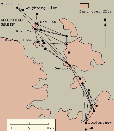
Figure 5: The pattern of intervisibility between groups of rock carvings in north Northumberland based on fieldwork by Ruth Saunders (map after Bradley 1997)
Although lacking the accuracy and perceived 'truth' of photographs, drawings allow a degree of interpretation that can emphasise important features and 'de-emphasise' or leave out less important ones. This is useful for directing the viewer to known features or to make a point, but is by its nature subjective and so denies us the opportunity to make our own interpretations, and can even be used, consciously or unconsciously, to mislead. Maps (figure 5) are for the most part accurate representations of a landscape in two dimensions and can play an important role in gaining an overview of a large area, showing the distribution of artefacts and their relation to the topography. Nevertheless, few people have the ability to visualise 3D landscapes from them so they are generally a poor means of evoking a real feeling for the space.
Figure 5: The pattern of intervisibility between groups of rock
carvings in north Northumberland based on fieldwork by Ruth Saunders
(map after Bradley 1997)
Traditionally, photography has been used to document all forms of artefact and for some artists 'becomes' the work, or at least the evidence for it. When carried out with sensitivity and understanding, the best documentary photography is an art in itself, as the work of Jerry Hardman-Jones shows (figure 16: Hardman-Jones, 1997). But for the time, movement and change-oriented work we are concerned with here, normal photography has one particular flaw - it captures just one moment of time, one view of a space. Of course a series of carefully composed photographs showing an artefact from several directions against a variety of landscapes can give an impression of the form, volume, balance, symmetry and weight; it can show colour, texture, erosion, and weathering. Nevertheless, the experience of these things is always necessarily flattened by the photographic process, lacking in those sensations that make the space around you 'active'. Furthermore, as with drawn illustrations, what you view is mediated by the eye of the photographer, which you may not trust to be accurate or truthful. Who decides what is to be shown?
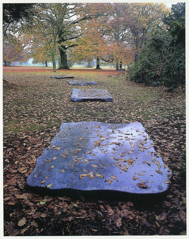
Figure 16: Stones for Meditation, Blue Brazilian Granite by Karl Prantl, photographed by Jerry Hardman-Jones
If still photography lacks the depth and movement required, video and film can provide them in full. Recordings of sites and artefacts using moving picture mediums provide excellent documents of the more obvious interrelationships but, as with photography, the viewers' experience can be controlled and channelled by the cameraman or director. However skilful and knowledgeable the producers of the film might be, the viewer is led passively through a linear experience that can only be interrogated by replaying it. To appreciate the more subtle interplay of artefact and landscape within a space, the viewer needs to gain a deeper feeling for the things that make the space 'active', its form, volume, balance, symmetry and weight. As we have seen, these are best derived from slight unconscious adjustments of viewpoint that are only possible when we are in control of the systems of navigation and interaction within the space. Film and video cannot provide these.

Figure 17: TREE- real-time still from Osmose 1995 by Char Davies/Immersence
At present, the best medium with which to gain this degree of navigation and interaction is some form of immersive virtual reality. This is not the place to undertake a detailed description of the techniques of immersive VR - they have been described exhaustively elsewhere (see Vince 1995), but a brief description is useful in the present context.
Full immersive VR is obviously as close to 'being there' as technology can currently take us. It allows complete interactivity - the use of good texture maps can create a high level of visual subtlety; it is fully three-dimensional; it allows true motion through the world. Using this technology, the distribution of any artefact and its relationship to topography at any scale could be modelled and navigated with ease. For normal day-to-day use, however, the technology suffers from two major flaws; it is unwieldy and it is costly.
Immersive VR uses computer-generated models of a scene to create the illusion that you are within the space (figure 17). The accuracy and realism of that illusion is directly related to the complexity of the model and the quality of the texture maps that clothe it. These depend on the skill of the modellers (who, much the same as illustrators and photographers, can only focus on what they know about) and the power of the computers available. To achieve the frame rates that realistic and convincing movement through a space demands, requires either very powerful (and therefore expensive) computers or low polygon (and therefore imprecise) models of the environment; often both. Almost invariably precision suffers. Ultimately to get smooth movement through a fully 3D environment a synthetic model of the space required must be used. Once again the question is - who decides what details should be included or discarded from the model?
To view these models effectively requires VR goggles with full tilt and rotation sensitivity, and for wide area landscape work, some form of navigation control along all three axes. At present this level of feedback is expensive and unwieldy but as the game arena expands its influence, much cheaper devices and software control are becoming available. In the meantime two 'desktop' technologies - VRML and QTVR - can provide much of the functionality of the fully immersive systems at a fraction of the cost.
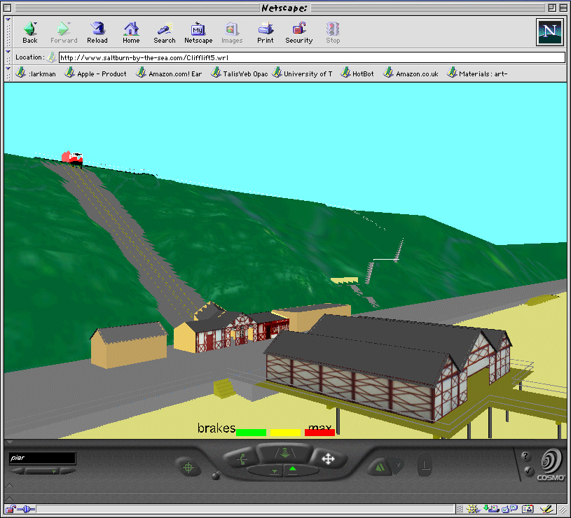
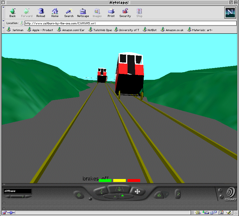
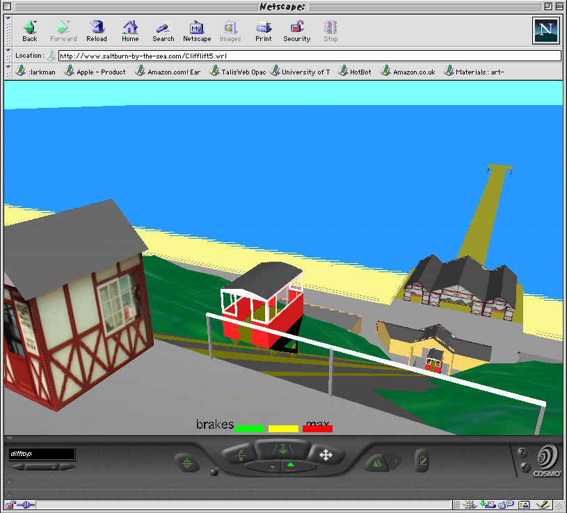
Figure 18: Stills from VRML Web site - Cliff-Lift by Clive Fencott SCM, Teesside University - a virtual landscape with contours and with buildings.
The Virtual Reality Modelling Language (VRML) is a universal standard language for describing 3D scenes on the World Wide Web (WWW). It was formulated by a group of WWW 3D developers to allow users to control realistic, fully textured animated objects interactively on normal desktop PCs and over low bandwidth networks such as the Internet. It is based on the Open Inventor file format developed by Silicon Graphics. VRML was developed for, and is primarily used on, the web but in effect it provides many of the functions of immersive VR. In time, as the power of desktop machines increases and the price of 'headsets' decreases this is the most likely medium to make VR become widespread. VRML is being used by a huge range of developers for projects as diverse as creating virtual rehearsal spaces for theatre productions (Reeve and Palmer 1998), on-line shopping malls, and - of particular interest here - virtual landscapes (figure 18). To summarise - VRML is fully 3D, a recognised standard and widely used, it allows most 3D models from other systems to be used, and it is designed for networks. Like other 3D systems, it is largely synthetic; at present it is also slow and unwieldy, low resolution, and requires relatively advanced scripting and programming skills to use it effectively.
Avoiding the 'synthetic' 3D modelling process used by most other VR systems, 'Desktop VR' systems produce navigable spaces that are photographic in nature. Users look out over the scene through a window that is much like a camera viewfinder. Dragging the input device rotates the viewpoint, allowing a full 360° panorama to be examined. Clicking on tool icons or pressing keys zooms the view in or out, and - on some systems such as Apple's QTVR - reveals hotspots, providing a means to jump to other nodes, view images, 3D objects or text, or even jump to other URLs on the web.
This technique provides the user with an excellent way to navigate an artefact-rich landscape. Nowhere near as immersive as full VR, it nevertheless provides an easy way to get a real feeling for a space and switch easily between close and distant views, allowing surface texture, colour, carvings, form and orientation of artefacts to be examined in the context of the whole panorama of a landscape. Being photographic rather than synthetic, and using 360° panoramas, it includes all of the available information, giving the user much more control.
The simple means of production of these desktop VR scenes ensure that non-programmers can produce a usable navigable space as easily as creating a presentation or a simple web site, opening the process up as a tool for professionals of other disciplines such as archaeology and art history.
With further effort, more elaborate scenes can be constructed using objects placed within the view that can be interacted with and examined - perhaps a complete rock outcrop or sculpture that can be 'picked up' and rotated freely, almost like holding it in your hands! In Apple's QTVR, these can be photographic, 'Object' VRs but in Live Picture's 'Reality Studio', 3D VRML objects can also be examined and navigated (The background to desktop VR and a more detailed description of the process of QTVR scene generation is described in a separate section).
Desktop VR is quick, simple, and cheap, requires no programming, is photo-realistic and partly interactive, produces small files that will transfer as a 'stream' over a network, and can incorporate 3D objects. It is not fully 3D, and does not allow smooth flythroughs, forcing the user to jump from node to node. The viewpoint of each node is decided by the creator removing a degree of freedom from the system's interactivity and sense of immersion.
On balance, it seems that Desktop VR fulfills the needs of the majority of those (archaeologists, art historians, geographers) wanting to examine a landscape remotely with a high degree of independent interactivity.
© Internet Archaeology
URL: http://intarch.ac.uk/journal/issue8/larkman/methods.html
Last updated: Fri Aug 25 2000