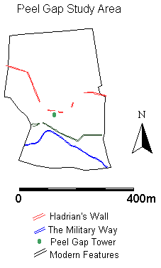
The tower at Peel Gap comprises a small, rectangular, structure added to the back face of Hadrian's Wall shortly after its construction in the early 2nd century AD. For a simple account of the feature and general locational and structural details concerning the broader context of Hadrian's Wall see Johnson (1989, 61-62). In its size and ground plan the structure resembles closely the regular series of turrets that characterise the length of the wall. These turret features have traditionally been interpreted as observation posts, functionally located to maximise the views out beyond the frontier and to either side along the line of the barrier. The location of the Peel Gap tower, however, appears directly to contradict this received notion of optimum defensive location, as it is nestled neatly at the base of a pass through the dramatic crags that characterise the central sector of the wall zone, rather than on top of the higher ground to be found at either side (Figure 10). The location of this tower feature has long provided a source of curiosity to wall scholars and the question as to its defensive utility comprises the subject of this case study, a visibility analysis based upon the location of the tower feature.
A detailed micro-topographic record of the landscape of Peel Gap was undertaken by Mr Richard Bayliss, of the department of Archaeology at the University of Newcastle upon Tyne, on behalf of the National Trust.
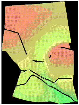
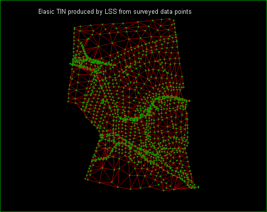
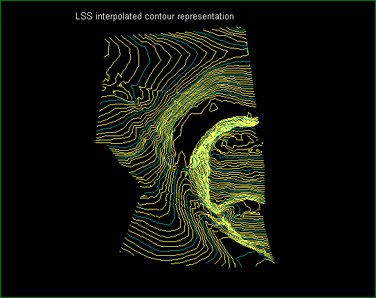
The source data was captured and processed using the Land Survey System (LSS1) package to generate a triangulated irregular network (TIN, Figure 11) from which a contour representation of the topography of the study area (Figure 12) was interpolated. In addition to capturing the surface topographic trends, a detailed record was made of the footprint of the wall and its associated features, such as the military way, as they crossed the study area.
To facilitate a study of the permissible viewshed yielded by the location of the monument, the LSS-derived contour and structural information was exported to the Arc/Info GIS system, where it was utilised to construct a 1 metre ground resolution digital elevation model (DEM) (Figure 13). Once constructed, this DEM was used to undertake a visibility analysis, modelling the height of the original tower look-out to have been of the order of 11 metres above present ground level (Figure 14).
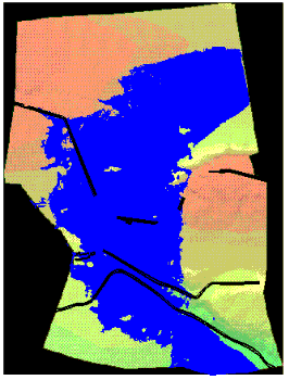
The results of the visibility analysis confirm strongly the reservations expressed by authors such as Johnson (1989, 62) as to the questionable strategic significance of siting the tower in its present position. The visible area (shaded blue in the resultant image) emphasises the heavily restricted viewsheds beyond and along the line of the Wall, with the views yielded by the tower location instead appearing to focus upon the natural pass itself, and the area to the rear of the wall zone.
As well as exporting the LSS derived topographic model and detailed plan footprint of the wall and military way to Arc/Info, the same data were also exported into a computer-aided design (CAD) package. This was in order to facilitate the construction of a VRML model of the tower in advance of a more direct and experiential appraisal of the viewshed yielded by the structure's location. Here a reconstruction of the tower was undertaken in AutoCAD, built up upon the surveyed structural footprint and located on top of the triangulated surface model provided by LSS.
On the basis of this, a simple animation sequence was generated to simulate the view an observer would get of the immediate surrounding landscape if rotated atop the observation platform. Whilst undoubtedly useful, as an interpretative device this sequence, like the mapped visibility zone identified by Arc/Info, was rather prescriptive, fixing both the height of the tower and field of view firmly in place. To overcome these restrictions the model was implemented in VRML (Figure 16, using the Fountain modelling package, to enable the viewing researcher full freedom in controlling the way in which the landscape was encountered and viewed. The height of the nominal tower reconstruction could be dynamically altered, and the effects of moving the viewing location across the top of the tower and down along the wall-top, to look at the feasibility of a manned walkway, could be investigated and compared with viewing locations on the ground surface.
Given the restricted nature of the study area, the GIS-based viewshed modelling and VRML model work together to support the idea strongly that the tower's primary function was not that of a simple watchtower, designed to fulfil an identical function to a network of similar features in an integrated frontier system. What is immediately clear is not only the fact that the views beyond and along the wall are heavily truncated by intervening terrain, as indicated by the archaeological-GIS analysis alone, but the way in which the viewshed serves to track the course of the military way clearly to the rear of the wall. This prompts questions regarding the status of less problematic turret features and offers a unique methodology for looking more broadly, and flexibly, at the functional status of Hadrian's Wall in its landscape context.
© Internet Archaeology
URL: http://intarch.ac.uk/journal/issue1/gillings/part10a.html
Last updated: Tue Sep 5 1996