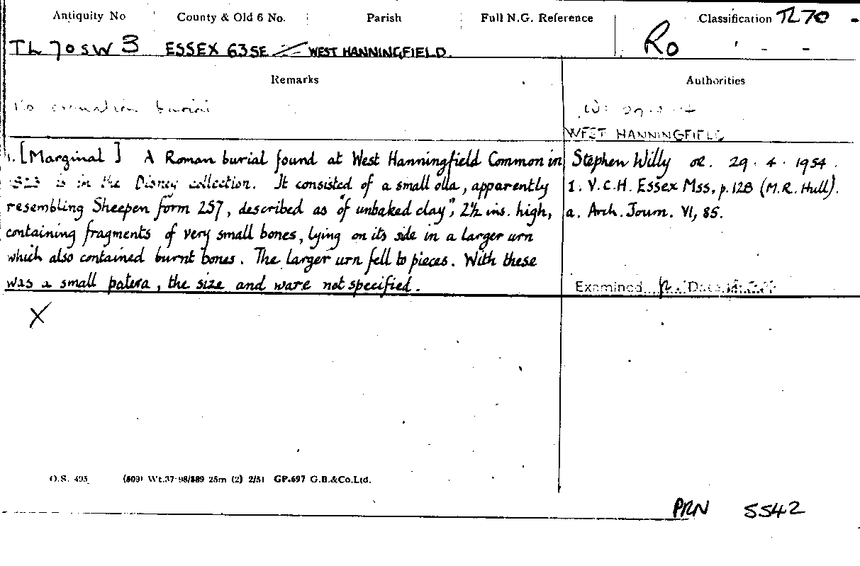
Figure 1. Ordnance Survey Record Card
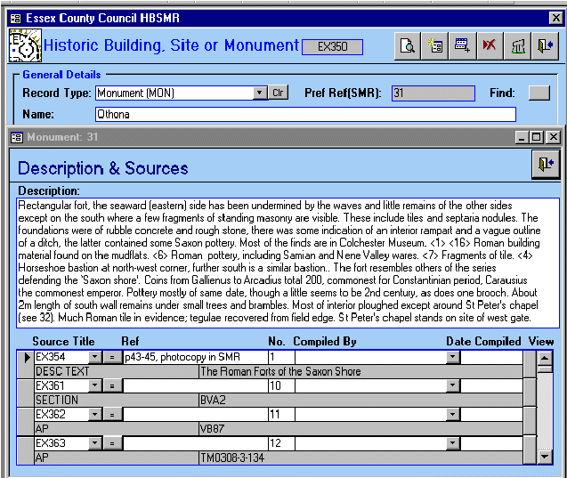
Figure 2. Sample screen from the Exegesis system
Figure 3. Panorama of Tilbury Fort, to be part of the NOF-funded East of England Sense of Place project.
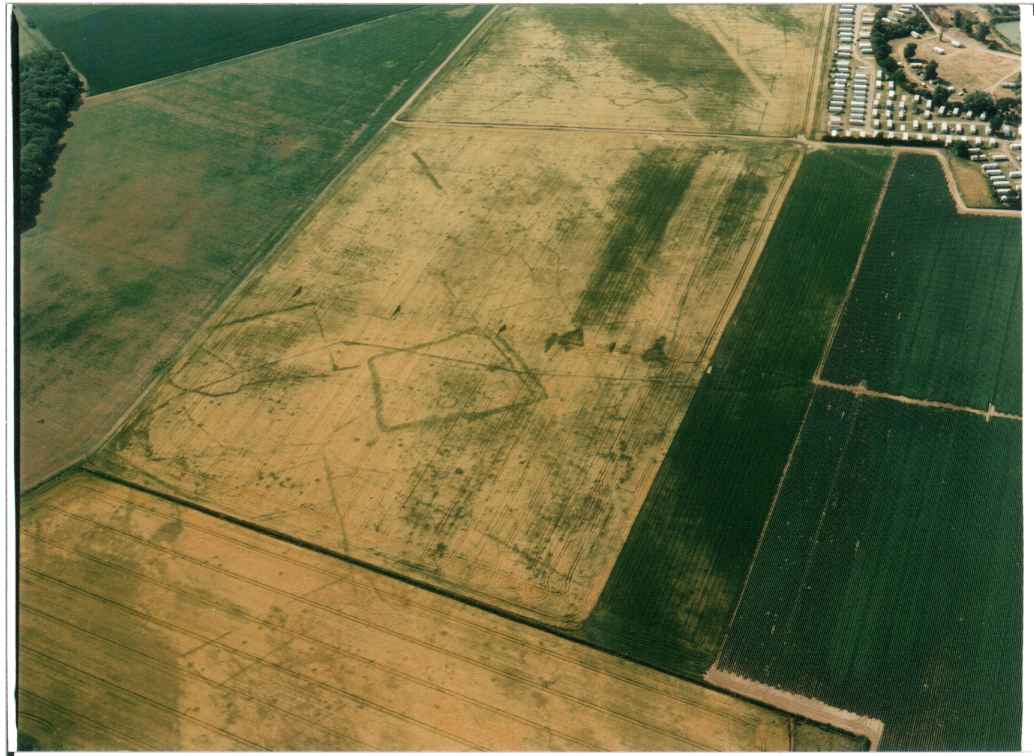
Figure 4. Scanned aerial photograph, to be part of the NOF-funded East of England Sense of Place project.
Figure 5. Castle Hedingham as first mapped on the Sites and Monuments Record © Crown copyright. Essex Council Council Licence No. 076619. 2002.
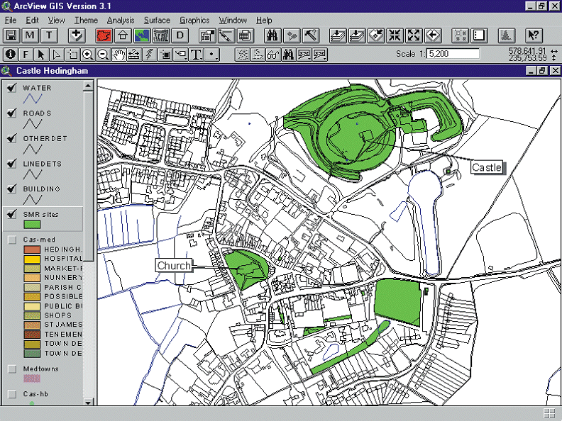
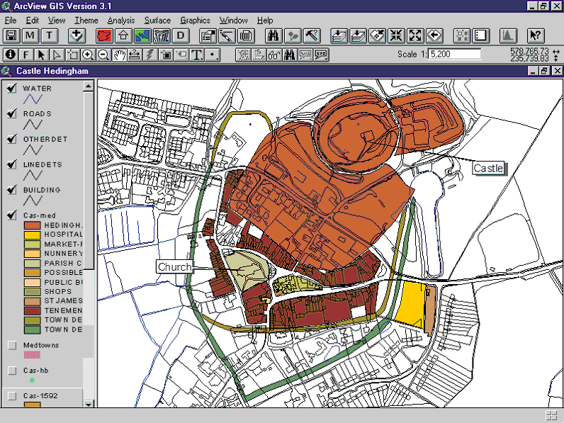
Figure 6. Castle Hedingham following GIS analysis as part of the Essex Historic Towns Project. © Crown copyright. Essex Council Council Licence No. 076619. 2002.
© Internet Archaeology
URL: http://intarch.ac.uk/journal/issue15/3/tof.html
Last updated: Wed Jan 28 2004