Figure 9: Map showing the location of the study areas and Les Bas de Fontaux (Le Carzot) in relation to Mont Beuvray, Autun and the Arroux Valley
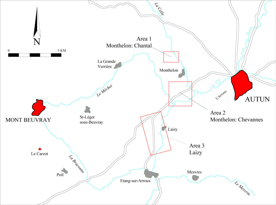
Within this study area, we selected the three micro-areas described below for more detailed investigation: two in the commune of Monthelon and the third in Laizy. In view of the evidence accumulating from major river valleys all over France for intensive exploitation of the alluvial terraces for settlement and enclosure from the later Iron Age onwards (e.g. Haselgrove 2007), it made sense to concentrate on the nearest equivalent terrain in the Arroux valley, rather than spreading our effort too thinly over the whole area between the Morvan and the granitic hills. Between them, the three micro-areas selected cover both lower lying and more elevated sections of the alluvial terraces, the confluence of the Méchet with the Arroux, and one of the side valleys, that of the Celle. Together, they held the prospect of examining potential differences in the settlement pattern both with distance from Autun along the Roman road running south-west towards Bourbon-Lancy and with distance from the river. In addition, gradiometer and resistivity surveys were carried out on a known site at Poil on the higher ground west of the river to test the efficacy of geophysical survey in detecting and characterising ditched enclosures already known from air photography (Section 5.4.1).
Figure 9: Map showing the location of the study areas and Les Bas de Fontaux (Le Carzot) in relation to Mont Beuvray, Autun and the Arroux Valley
Our objective was to sample c. 10% of each micro-area by a combination of linewalking such arable fields as existed and magnetometer survey to investigate the intervening pasture. Where new sites were located, additional resistivity and/or close interval magnetometer surveys were carried out to provide more detailed information on the remains. The total area prospected between 2000-2003 in the three micro-zones is 132 ha using one or more of the techniques, representing just under 10% of the three areas, but nearer 15% of the area available for survey. About 80 ha (60%) was covered by fieldwalking, 62 ha (47%) by gradiometry and 11 ha (8%) by resistivity.
© Internet Archaeology/Author(s)
URL: http://intarch.ac.uk/journal/issue25/3/4.html
Last updated: Wed Oct 29 2008