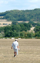
Figure 10: Geophysical prospection in progress at Chazeu
Figure 10: Geophysical prospection in progress at Chazeu
We embarked on the survey in the expectation that geophysical survey would in principle be capable of detecting both Iron Age and Gallo-Roman rural settlements in the pastures of the Arroux valley, the latter most obviously through the presence of characteristic stone building complexes of Roman date, but also features like enclosure ditches, kilns and wells if present. Equally, while next to nothing was known about Iron Age rural settlement in the immediate environs of Autun and Mont Beuvray, on the basis of evidence from more distant parts of Burgundy and the surrounding regions, we could expect many later Iron Age farmsteads to have ditched enclosures, or at least be associated with lengths of ditch, permitting their detection by geophysical survey, even if further evidence was needed to confirm their date.
North-west of the Morvan, several probable but as yet unexcavated Iron Age cropmark enclosures have been found by aerial survey (Bouthier 2002), while thanks to the pace of development-led archaeology, late Iron Age enclosed settlements or fermes indigènes have been excavated in increasing numbers on the terraces of the major rivers both to west and east. Among the first to be excavated was Chassenard, La Génerie (Allier), 50km away just beyond the confluence of the Arroux and the river Allier (Vermeulen 1999), while to the east of the study area, several sites have been investigated in the Saône valley and those of its tributaries, from south of Tournus to near Dijon (Gagnieux 2002; Barral 2005; Drouet 2005). A good example is at Chevigny-Saint-Sauveur, ZAC Excellence (Côte-d'Or) east of Dijon, where a substantial quadrangular enclosure of La Tène C2-D1 date and numerous other late Iron Age and also Gallo-Roman features were encountered over an area of 14.2 ha excavated in advance of development.
Figure 11: Iron Age enclosures in north-west Nièvre (after Bouthier 2002, 346) Figure 12: Plan of Late Iron Age enclosure at Chevigny-Saint-Sauveur (Côte-d'Or) (after Virlogeux et al. 2005, 278)In addition, gradiometry carried out in 1999-2000 at Authumes (Saône-et-Loire), at the edge of the alluvial terrace of the Doubs, 35km from Châlons-sur-Saône, successfully detected a ditched enclosure belonging to a settlement previously found from the air (Barral et al. 2001). Subsequent trial excavation indicated a La Tène D1 date for the enclosure (Barral 2005), which closely resembles the one at Chevigny-Saint-Sauveur. The gradiometer survey revealed various other concentrations of anomalies indicative of occupation, while a surface collection yielded plentiful material of La Tène finale and Augustan date, particularly around the perimeter of the enclosure (Barral et al. 2001).
Even if later Iron Age rural settlements in the immediate Mont Beuvray-Autun region differed from such sites in being unenclosed, larger examples, at least, should still in principle be detectable beneath the pasture by gradiometer survey as clusters of pits, wells and other features, similar to the concentrations of anomalies detected at Authumes. Moreover, certain locales are likely to have been favoured for habitation, so that even if Iron Age farms proved difficult to locate in their own right, we might expect some of them to exist close to or coincide with more easily visible Roman sites, as at Chevigny-Saint-Sauveur, where there is occupation of both periods (Virlogeux et al. 2005).
As a pilot for detecting Roman stone buildings under pasture on the fluvial deposits of the Arroux valley, a trial gradiometer and resistivity survey was carried out in 2000 on the known Gallo-Roman villa of Chantal in the commune of Monthelon, where the footings of one range of buildings were known to survive, partly in a small stretch of woodland, but also stretching out into adjacent pasture (e.g. Bigeard 1996). The survey found the villa, but not without difficulty (Haselgrove et al. 2000; 2001) (Section 5.1.1). We also carried out work on a second test site at Poil, where several enclosure ditches had been revealed by aerial photography, although this time the site was up in the granite foothills of the Morvan (Section 5.4.1).
The geophysical survey relied principally on gradiometry, owing to the much greater speed with which terrain can be covered than using resistivity survey. The latter method is also more likely to be sensitive to seasonal variations in groundwater, particularly in the summer months, when the main seasons of work could be undertaken. Resistivity survey was therefore only used as an additional method of investigation where follow-up seemed justified. The geophysical surveys were undertaken on a 30m grid, using a Geoscan FM36 and FM256 gradiometer and RM15 resistivity meter. Gradiometry was largely undertaken at a 0.5 x 1m resolution, with more intense 0.25 x 0.5m surveys being conducted on a number of occasions. Resistivity always took place at 1 x 1m intervals using a twin-probe array.
The local geology was not kind to gradiometry. The best results were achieved on the alluvial silts adjacent to the Arroux (e.g. the Champs d'Arroux, Fig. 53), whereas up on the river terraces the fluvial deposits provided more of a challenge. The key problem lies in the deposits originating from granite and Autunien deposits, which have among the lowest magnetic properties of all rocks. Hence a wall built out of the local stone could be invisible to gradiometry. This would be compounded if the walls were built on fluvial deposits derived from the same material.
The first trial survey at the Villa de Chantal proved these challenges correct. High-resolution survey managed to show the villa, but one suspects that lower intensity prospection might have identified noise characteristic of 'a site' but not identified walls and buildings (e.g. Chantal gradiometry, Fig. 20). Indeed, it is possible the outline of the villa shows up not because of the wall alignments, but indirectly, because of anthropogenic material accumulated within the rooms having enhanced magnetic properties, and also possibly from roof and floor tiles derived from clays with greater magnetic variance than the background fluvial sediments. Hence most of the illustrations display the gradiometry results within a very tight tolerance of ±1 nT. At this level even minor defects in walking technique will show up in the results, as proved to be the case, for example, in the survey at Les Bois de Monthelon (Fig. 25). Good field practice requires that a gradiometer is 'balanced' at the start of a survey so that it will give the same reading ±1 nT with the machine facing all directions. This is fine when features are being sought on the scale of, say, 5nT, which would not be unusual, but since here the archaeology was far more subtle, even slight swings of the instrument at the end of each traverse as the walker turned around became visible in the plotted data. Hence, the edges of the 30m survey grids are visible. As the survey progressed we ensured the machines were balanced to an even tighter tolerance at the beginning of each survey to counteract this.
Resistivity should have been a good counter to the challenges of gradiometry survey. Unfortunately, again the geology proved difficult. At the villa test-site resistivity also failed to show the walls of the building clearly. Significant variations in readings were picked up but these were from greater underlying geological variation than from the remaining building footings buried underground. What did show up clearly was a filled-in rectangular basin to the north-east of the villa. So, despite the challenges, gradiometry results were by far the better given the time-investment on site.
Higher up in the Morvan, solid granite becomes the base geology more often than derived gravels and sediments. At Poil, Le Carzot, survey took place on top of a small granitic knoll, where two square enclosures had previously been recorded by aerial photography (Fig. 74). Resistivity again produced poor results, the twin probe configuration revealing more fractures in the sub-surface geology than the near-surface enclosure boundaries. The difficulties were compounded by exceptionally dry conditions during the summers of 2001-2003. Other configurations such as a linear Wenner array might have fared better, but this option was not open to us with the equipment we had at the time. The gradiometry results were again very noisy; nonetheless some detail which is not present on the photographs was teased out of the results. By way of contrast, at Chevannes on the flanks of the granitic outcrop of Beaufort in the middle of the Arroux valley, resistivity was far more successful than the gradiometry at picking out a number of linear features (Fig. 44).
In conclusion, gradiometry was most satisfactory on the alluvial plain and rather more unforgiving on the terraces, although large-scale, low-resolution survey was still able to pick out 'noisy' areas and some enclosures, possibly resulting from the sub-surface distribution of ceramic material (pottery, brick and tile); these results could then be followed up by more intensive surveys.
The data were all processed using Geoplot software. Standard processing techniques were used, although filtering and smoothing the data has generally been avoided in presenting the results here. Each illustration includes on it the specifications of the survey.
© Internet Archaeology/Author(s)
URL: http://intarch.ac.uk/journal/issue25/3/4.1.html
Last updated: Wed Oct 29 2008