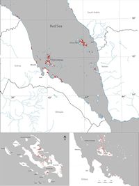
Multiple palaeoshoreline features were identified throughout the southern Red Sea, with the majority being located on islands (Figure 3). The palaeoshorelines, both on the islands and mainland, are predominantly at +2m above modern sea level and were easily identifiable. Massive Holocene sedimentation has obscured many of the palaeoshorelines on the mainland of both sides of the Red Sea. The locations where shell middens are detected on the mainland are predominantly in areas of diapirism that have shallow subtidal zones that are protected from large runoff channels. Areas of diapirism show distinctive patterns of wide bays with extensive shallow subtidal zones, which would have been favourable for extensive shell beds. It was in these locations, on palaeoshorelines, that the majority of shell midden sites were detected.
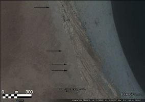
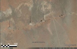
We have now identified and mapped over 4200 new shell midden sites on both sides of the southern Red Sea (Figure 3) – identified by their unique spectral signature (Figure 4). The majority of these sites (c.3000) are located on the Farasan islands, and have been ground-truthed through survey, excavation and dating (Meredith-Willliams et al. 2014). The sites elsewhere have been identified only from satellite images. In a small number of cases there is some remaining ambiguity about whether the features on the satellite images are shell middens or other sorts of natural features. This is particularly relevant to the group of mainland sites on the western side of the Red Sea located at Massawa, Eritrea, numbering 19 sites (Figure 5). The remote sensing model is, however, largely robust, as on the Farasan Islands only three false positive sites have been identified through ground-truthing out of nearly 3000 identified and visited middens (Figure 6). The nature of this ambiguity is derived from similarities in the spectral signature of shell middens to isolated parts of the local geology.
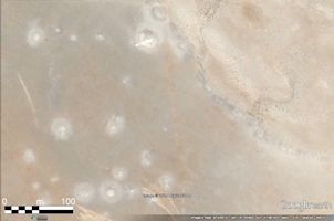
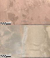
In most of the Dahlak examples, however, the features clearly represent shell mounds like those examined in the field in the Farasan Islands. Moreover the vast majority of sites recorded there are on palaeoshorelines, with spectral signatures similar or identical to those on the Farasan Islands. Some sites, particularly on the mainland, are situated on different geology to the Farasan Islands, and interpretation may be complicated by this. However, the Dhalak Islands share a very similar geology to the Farasan Islands, and shadows are visible on some high-resolution images suggesting that some of these middens are quite tall mounds (Figure 7).
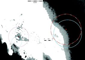
With regard to the question of mobility across the Red Sea, the viewshed analysis demonstrates that when standing on the highest part of the terrain, on a clear day, it is possible to see all of the islands (both Farasan and Dahlak) from their respective mainlands (Figure 8). It is also possible to see across the Bab-al-Mandeb from both sides, at a distance comparable to that of the Farasan Islands offshore. Voyaging to the Farasan islands or across the Bab-al-Mandeb would require open sea crossings beyond the visible horizon; however these voyages were likely carried out with a prior knowledge of the target destination. The time-depth of sites on the Farasan Islands would suggest that people were repeatedly visiting the islands, perhaps on a seasonal basis (this is currently under investigation). It is therefore a possibility that regular crossings of the Red Sea occurred during this period, resulting in the formation of similar sites on both sides.