In this article, the term 'landscape' has been defined broadly as indicating any spatially structured environment rather than just terrain and geology/soils (referred to collectively as the 'physical landscape'). This choice of definition is intentional, as it allows a more flexible approach to spatial patterning that takes into account the spatial distribution of variables such as temperature and vegetation as well as physical landscape factors. For this study, ten environmental variables were used (Table 1). These include four climatic variables that seem to be important to non-human primate spatial ecology (Dunbar 1996; Hill and Dunbar 2002), two reflecting the distribution of ecosystems and habitats and four describing different aspects of the physical landscape, specifically topography, topographic roughness (which may determine rates of access to different areas by mammals with different locomotor anatomies, Winder 2012a), geology and soils. The datasets used, and their units and sources, are given in Table 1.
A key question regarding the suitability of these maps for this sort of environmental analysis is the degree to which any visible patterns are likely to be anthropogenic. Humans modify their environments more than any other living species, and in some places – particularly in the west – have changed regional conditions beyond almost all recognition, as well as exerting potentially global influences on climate and hence related patterns.
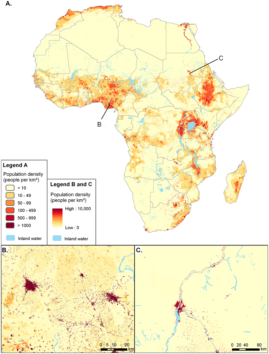
The datasets used for this article have been selected as far as possible to minimise the impact on the maps of recent anthropogenic environmental changes. The terrain variables and surface geology are in any case less likely to have been subject to such changes, as major landscaping projects that would be visible at these scales (the smallest maps here are 5x5 degrees across) are rare, particularly in countries with low GDPs. The climatic data, meanwhile, might be affected by global anthropogenic change, but these datasets – which are created from average conditions between 1960 and 1990 – pre-date the accelerated changes of the 21st century. The same is true of the vegetation map, which is based directly on White's map of 1983, and in any case also delineates separately areas of 'anthropogenic vegetation' (coloured grey on maps). This leaves the prospect of major local changes to climate, vegetation and, particularly, the ecoregion dataset from such land-use changes as deforestation etc. These effects cannot be quantified or removed from the datasets, so the best we can do is to be aware of their potential influence and location. They are particularly likely in areas of high population density (shown in Figure 1), including parts of Nigeria/Cameroon, the East African Rift Valley and Ethiopia. Of the selected regions discussed here, west and east Africa are probably most affected by anthropogenic change, south Africa somewhat less so and central Africa the least, at least if we assume that the chance of anthropogenic environmental modification increases with population density. Although all possible measures have been taken to minimise these effects – short of not selecting densely populated areas, which would prevent comparisons with key palaeoanthropological areas – it is important to bear them in mind in what follows.
Internet Archaeology is an open access journal based in the Department of Archaeology, University of York. Except where otherwise noted, content from this work may be used under the terms of the Creative Commons Attribution 3.0 (CC BY) Unported licence, which permits unrestricted use, distribution, and reproduction in any medium, provided that attribution to the author(s), the title of the work, the Internet Archaeology journal and the relevant URL/DOI are given.
Terms and Conditions | Legal Statements | Privacy Policy | Cookies Policy | Citing Internet Archaeology
Internet Archaeology content is preserved for the long term with the Archaeology Data Service. Help sustain and support open access publication by donating to our Open Access Archaeology Fund.
File last updated: Wed Mar 4 2015