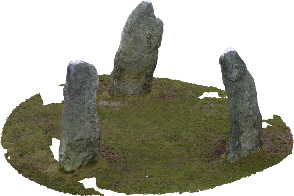
The Llanfechell Triangle (SH3639791688) is an irregular arrangement of standing stones near the village of Llanfechell, Anglesey, north Wales. The stones are roughly 2m in height, with the long axes in plan all aligned roughly north-west to south-east (Figure 1). The stones were probably erected in the late Neolithic or Early Bronze Age. Recording the monument for the HeritageTogether project emphasised several methodological issues.
When recording objects in three dimensions, it is important to try and capture all planes of an individual object. For a site with several component features, for example a group of standing stones such as the Llanfechell Triangle, it is necessary to record all planes of each individual stone; all the sides, any under-hangs or over-hangs, any details in the texture of the surface, as well as the planes on the top of a monument. For relatively tall structures or monuments (i.e. taller than the photographer), it is necessary to find some means to record from above. A lack of photographs from above may lead to a scatter of erroneous points in the model, emanating from the top of any vertical faces. Similarly, it is necessary to photograph small objects from above in order to 'flatten' any upright face. This is particularly important, for example, when recording small standing stones.
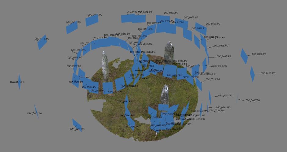
In sites composed of multiple elements, it is necessary to relate the constituent features to each other. 'Positioning' or 'contextual' images allow the program to identify how each element is spatially related. In order to tie together related monuments within an archaeological landscape, we have found that a combination of wide-angle contextual photographs that take in more than one monument and a series of linking photographs, where the photographer shoots a sequence of images moving between two monuments, can advantageously be used together. For monuments that include several elements, it is advisable to vary between portrait and landscape photographs in order to maximise both monument and background coverage. Figure 2 demonstrates the positioning of detail and contextual images taken at the Llanfechell Triangle.
In many cases it may be necessary to strike a pragmatic, time-effective, balance between levels of detail of parts of a monument and the spatial coverage required. A feasible workaround for this can be to use fewer wider area photographs for simple structural or general topographic recording, with more detailed close-up shots used in complex areas of monuments, or those with specific features that require higher precision modelling. HeritageTogether found this a useful approach, for example, when recording rock art panels in archaeological monuments or landscapes.