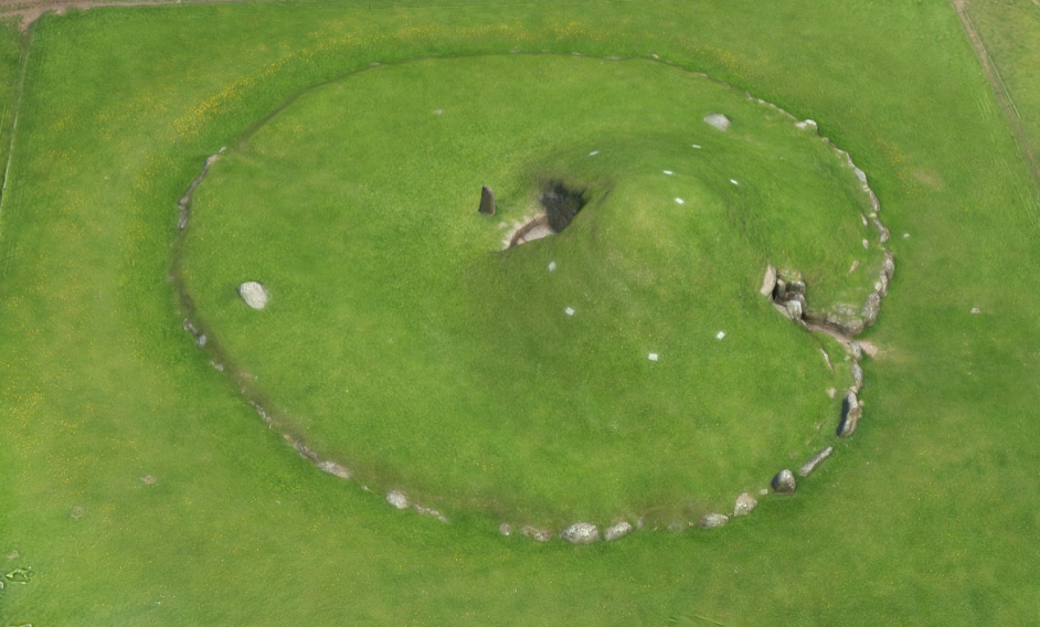
The Llanfechell Triangle and Bryn Celli Ddu passage tomb (SH5076170185) represent very different types of monument in terms of the constraints they place on digital photogrammetric recording. In its contemporary form, Bryn Celli Ddu comprises a partially denuded circular mound (Figure 3), with a semi-enclosed chamber and passage. Bryn Celli Ddu is a later Neolithic passage grave in the Atlantic tradition (Burrow 2010). While the passage and chamber are stone built, and the mound partially defined by stone kerbs, the most imposing aspect of the monument is the grass-covered mound. Modelling this monument required the team to address issues of photographing the interior of confined spaces, but also accurately producing a model of an undifferentiated grass surface. Recording the monument benefited from the crowd-sourcing approach, because the monument is so well known numerous people using different cameras (including camera phone images), shooting from different positions and providing varying degrees of coverage, contributed data to the models; these included digital photogrammetry of the site from kite platforms. Some of these images were relatively blurred, but were viable in the modelling because of the elevation from which images were taken.
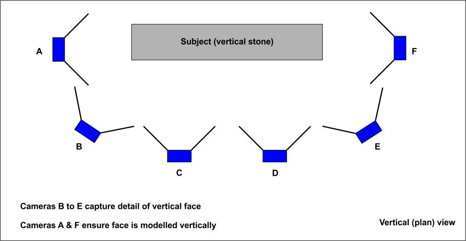
Photographing the interior of the monument includes the obvious challenges of marrying exposure with low light levels and appropriate detail. HeritageTogether found that, in confined spaces, combining photographs taken at oblique angles to the target surface with photographs that are produced perpendicular to the plane of the target surface (i.e. looking straight at the flat surface) to be a useful approach. The combination of oblique photographs and transects of perpendicular images is also especially valuable when recording any monument or structure with very tall features. In these cases it is advisable to photograph objects along a transect running parallel to the object, but adding photographs taken at oblique angles at the edges of any vertical faces. These approaches counteract the effect of barrel distortion in the lens along the vertical axis, and ensure that resultant models are undistorted (Figure 4).
A particular challenge in photographing archaeological earthworks for photogrammetric modelling is differentiating between large areas of sites or monuments that possess a very similar texture, with few unique features. In the case of the mound at Bryn Celli Ddu for example, but also for other grass-covered earthworks, photogrammetric software may not be able to identify unique targets. These can be supplied to members of the public working with a team. If unique targets are to be used these can be georeferenced in landscape models. As with any form of survey, thought needs to be given to the duration for which spatial control is required, so that allowance can be made for future use.
Alternatively, unique points in the landscape such as gateways, field boundaries, and so on, which appear in the background of the picture, can be used to locate earthworks. For topographic landscape work, photographs are required perpendicular to the plan of the landscape being recorded (Griffiths et al. in prep.). This is not usually achievable using terrestrial recording methods, and an aerial platform is required. In most instances, this limits the public accessibility of digital photogrammetry work, as individuals may not have access to aerial platforms. This said, significant work making aerial survey accessible to groups wanting to do their own digital survey work has been undertaken by John Wells and the Scottish National Aerial Photography Scheme (SNAPS).