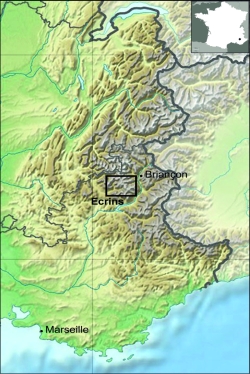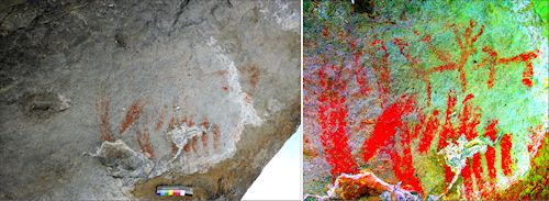

The Abri Faravel is a small rock shelter situated at 2,133m in the Parc National des Ecrins (Southern French Alps) (Figure 1). The shelter comprises the only known pre- or proto-historic paintings in the south-east Alps, and the highest altitude paintings of animal figures in Europe. The painted composition covers an area of c.3m² situated on the 'ceiling' of the shelter, and includes abstract paintings (groups of parallel lines) as well as what we interpret as two animals facing one another (Figure 2). There are also painted 'marks' on the internal wall of the shelter. This article includes two 3D models: one, a laser scan of the rock shelter and landscape, the second, a white-light scan of the actual rock art. One of the principal reasons for carrying out laser and white-light scans on such a site is that they provide media for the assessment and interpretation of a site that cannot be visited regularly owing to its location. Moreover, the models derived from the scans are effective media for communicating the nature of the paintings, and their landscape context.

The excavations and rock art analysis presented here are part of a more extensive project that investigates human activity and landscape change in the high-altitude zone (above 2000m) in the southern French Alps. This research has produced evidence for people living and working in these sub-alpine and alpine altitudes from the Mesolithic onwards (Walsh et al. 2014). The excavation of the shelter has revealed nine phases of occupation, from the Mesolithic through to the medieval period. The excavation of later prehistoric rock art sites is relatively uncommon, and such detailed research in the high-altitude zone of the Alps is unparalleled. In fact, rock shelters are rare in this part of the Alps, and the Abri Faravel is the only fully excavated shelter in the region.
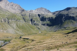
The rock shelter is the focal point of this article, and for this reason we describe the key chronological phases of activity at the shelter. For each of these phases, we assess the wider context of the Faravel plateau (Figure 3), with brief descriptions of the palaeoenvironment and the archaeological sites from the Mesolithic through to the Roman period. In some ways, the Faravel rock shelter mirrors the key periods of human activity identified across the plateau. The location of the rock shelter is important vis à vis the adjacent sites that could have been contemporary with the production, and subsequent role, of these paintings. Consequently, we assess the landscape context and the nature of activities that would have taken place across this landscape – the analysis of this context and contemporary activities adjacent to the rock shelter is essential in the interpretation of any art (Bahn 2010, ch. 5; Davidson 2012). The interpretative framework assumes that rigorous interpretations of rock art require deep contextualisation, where all forms of archaeological and landscape evidence are considered. The final discussion considers how the range of contextual information contributes to our understanding of the paintings, and considers the notion of prehistoric art and tacit knowledge.

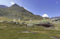
The 3D models constructed in the study take the rock shelter as the 'central' site from which other parts of the surrounding landscape can be viewed and 'visited'. The surrounding landscape, its probable environmental characteristics, and sites contemporary with the occupation phases in the rock shelter are described in the text, and some key sites flagged in the 3D laser-scan model. Readers can move to other archaeological sites in the surrounding landscape and 'discover' basic details for these sites (these details comprise a photo of each site, its chronology, and rudimentary interpretation). The white-light scan provides an accurate record of the actual paintings. This model can be viewed employing various lighting effects from different angles (the technical appendix provides the detail relating to the production of the models).
 View the model (requires WebGL compatible browser)