 View the model (requires WebGL compatible browser)
 View the model (requires WebGL compatible browser)
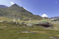
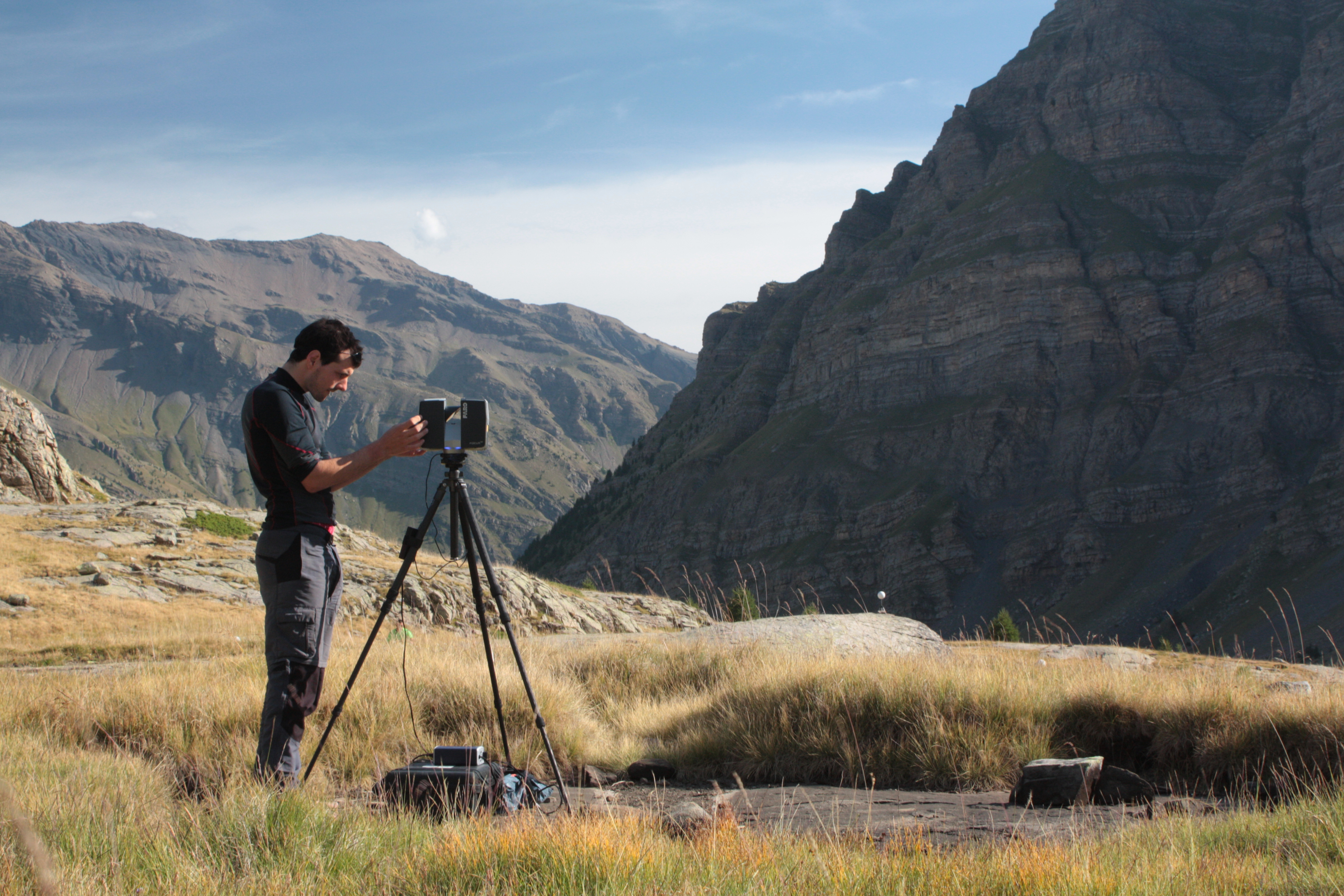
The 3D model of the surrounding landscape comprises several scans undertaken with a Faro laser scanner from different points around the rock shelter, thus allowing the creation of a complete model of the landscape context (Figure 8). While zones beyond 200m are visible, as the scan includes embedded digital images, the actual scanned area comprises a radius of c.200m in all directions originating from the rock shelter (see the technical appendix). The laser scan permits views and assessments of the position of the site vis à vis surrounding topography – for example, the mountains, and other landscape features visible from the rock shelter. Moreover, the representation of the landscape context permits the presentation of the interactive 'walk-about', where a user can click on other sites in the area and retrieve basic information. These models also demonstrate how the art might have been viewed – it seems that the intention was for this to be viewed from the exterior, as the animals are orientated thus (see Figure 6, Figure 2, as well as the white-light and laser scans). This model is designed primarily for the reader rather than as a research tool per se, hopefully giving a realistic impression of the all-important landscape context for the site and its paintings.

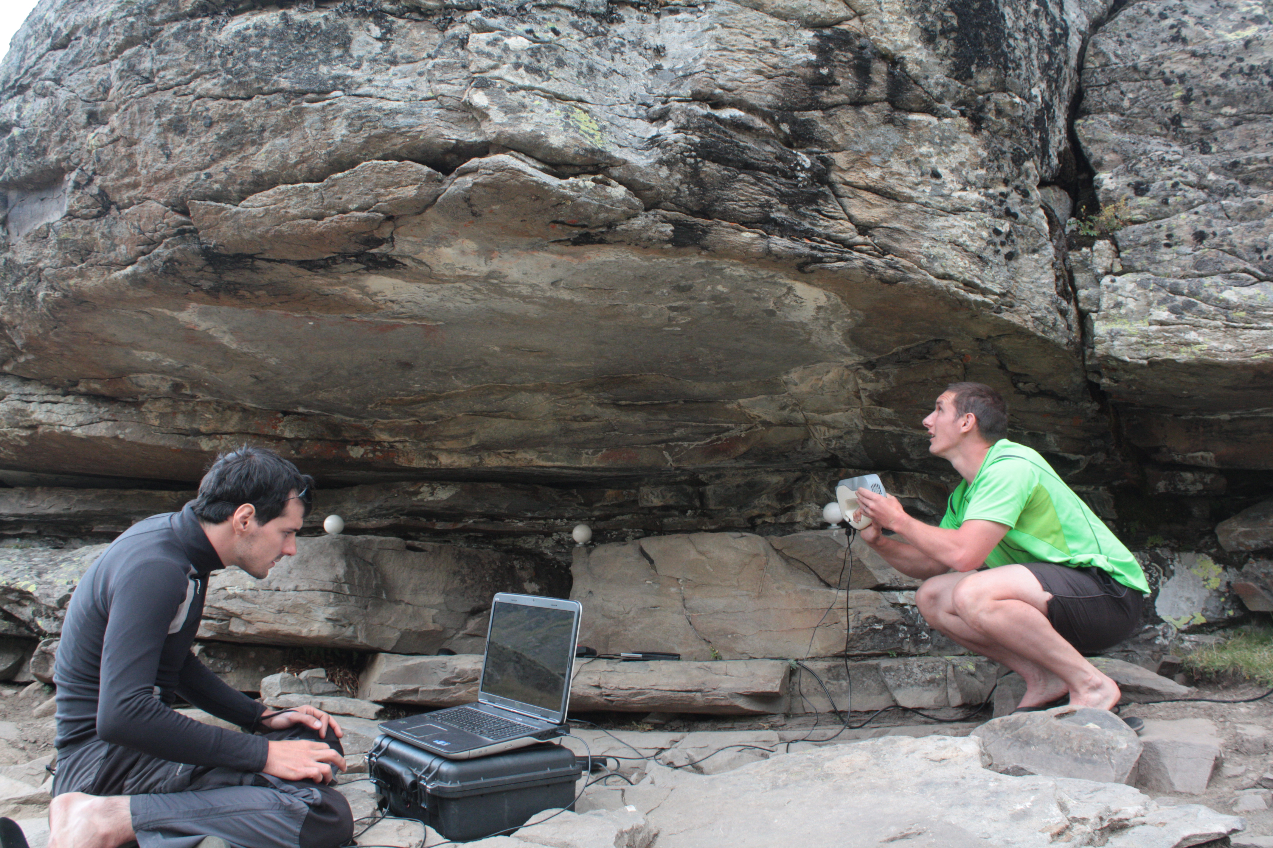
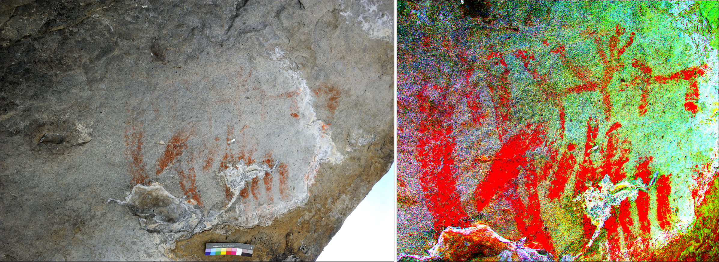
The white-light scan of the actual paintings was produced using an Artec Eva 3D scanner (Figure 7). This can capture up to 16 frames per second, with frames aligned automatically in realtime (Artec 2016). The textured model provides a high-quality record of the rock art, and while colour enhancement is not available via this model, it does provide an accurate representation of the surface of the ceiling, and permits detailed examination of the rock surface. This scan not only allows the assessment of the nature and extent of what might have been a prepared (pecked) surface but also enables a search for elements that could not be seen in the field. It also provides a reliable and accurate record of the current physical state of the artwork, and can thus inform any decisions regarding site conservation: for example, it is apparent that calcite precipitation (via streams and surface water running off the massifs to the west) and geological exfoliation threaten the integrity of the paintings. The calcite precipitation is best viewed on the Artec model employing the 'rotate light' and 'torch' functions (the 'gloss' and 'gloss intensity' functions also enhance the relief of the rock surface). This model also permits a clearer view of the texture of the 'ceiling' surface, and we see how the paintings largely fall within a zone that is a lighter grey than the surrounding area. The paintings are delimited by a curved edge between the paintings and the exterior of the rock overhang. Calcite precipitation is particularly obvious along parts of this curved edge. The curved calcite band also passes between the rear of the larger animal and the abstract form behind this animal. We can also easily identify areas where parts of the rock surfaces have been lost; particularly clear in zones between the painted abstract forms and the exterior of the rock overhang.
Both scans were undertaken in August 2012.