Remote sensing has caught the attention of artists since the invention of flight made a wider perspective of the world possible. Aerial photography in particular has been used by artists as another way in which to explore and depict landscapes (Hauser 2008). For some artists there exists a fascination with the aesthetic of landscape forms as seen from above – fields, hedges, topography and edges – but also the views onto the thick layers of human history that are strewn upon it. The seemingly flat image can reveal the multiple layers of human occupation, the constant cycles of culture and nature. For Paul Nash and John Piper the aerial image went further, becoming a 'metaphor for the resilience of the past' (Hauser 2007, 199), drawing these forms into the Neo-Romantic ideal. The aerial image explores not only the topography of landscape, but also one's own relationship with it and experience of it, such as Peter Lanyon's paintings based on his gliding (Treves and Wright 2015). Aerial photography remains a fascination with artists of differing media today. The wide availability of satellite imagery, use of drones and routine use of air travel mean that the 'earth from above' is a perspective with which the Western gaze has become familiar.
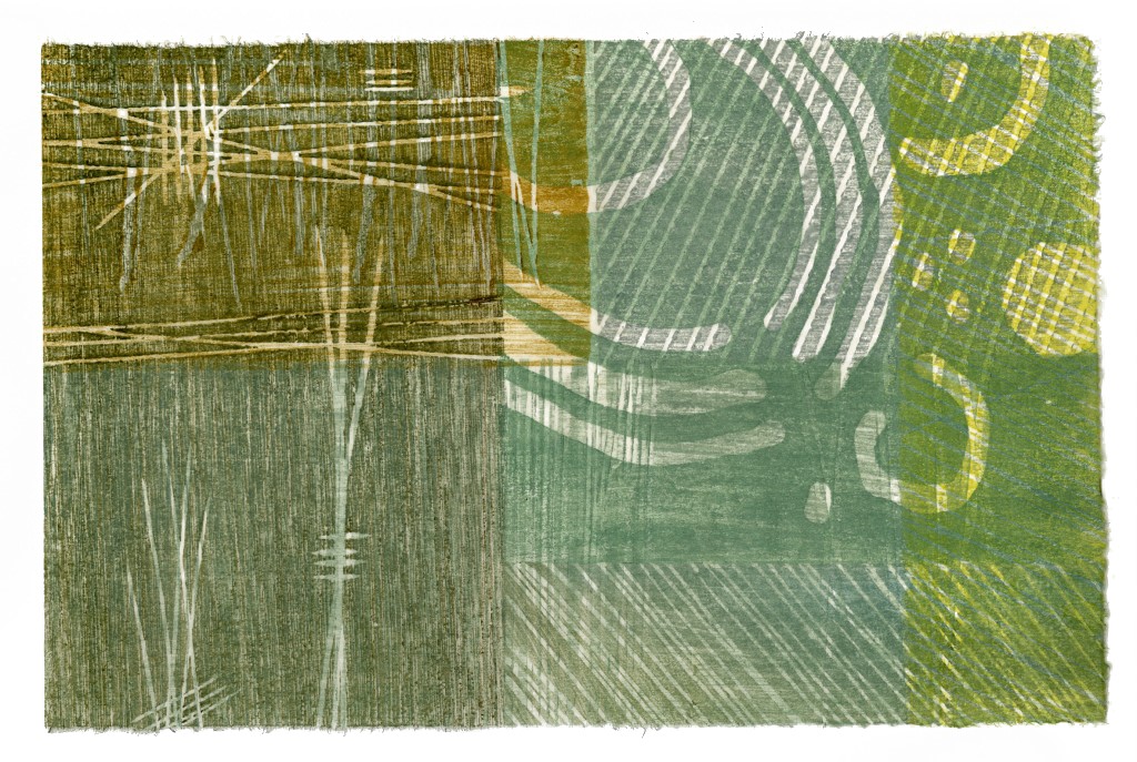
Geophysics, on the other hand, remains relatively unexplored through other artforms. This is perhaps due to the protection and availability of data and images. It may be due to the daunting complexity of the processes and software involved in its collection and processing. However, another factor may be that it is already abstracted: it is harder to read. When used by artists, it is sometimes just shifted in context rather than developed or thought through: the tones and lines of geophysical data dropped into a gallery as a piece in themselves. As well as having serious implications around ownership of the 'artwork', the re-purposing of geophysical imagery directly in the gallery can also lack feeling, depth or personality. It is only really when it is explored and a relationship developed with it that it can begin to give something more. This is evident in the work of printmaker Paul Musgrove, who worked closely with Dominic Powlesland to create prints that layered archaeological forms echoing the busy sub-surface landscape of the Vale of Pickering (Figure 3 and Figure 4). For those who can read geophysical images, there is the opportunity to push them further: 'taking a line for a walk' (Klee 1961, 105).

Section 5 shows a series of 'sketchbook' pages that explore my own artwork around geophysical imagery. Each draws out small stories, observations and new perspectives.
Internet Archaeology is an open access journal based in the Department of Archaeology, University of York. Except where otherwise noted, content from this work may be used under the terms of the Creative Commons Attribution 3.0 (CC BY) Unported licence, which permits unrestricted use, distribution, and reproduction in any medium, provided that attribution to the author(s), the title of the work, the Internet Archaeology journal and the relevant URL/DOI are given.
Terms and Conditions | Legal Statements | Privacy Policy | Cookies Policy | Citing Internet Archaeology
Internet Archaeology content is preserved for the long term with the Archaeology Data Service. Help sustain and support open access publication by donating to our Open Access Archaeology Fund.