The farm of Cwm Cilio lies at the edge of a small valley (the cwm) containing a stream, on the southern edge of a block of upland, the chief summit of which is Bwlch Mawr at a height of 504m. Its land comprises a large area of stony upland rough pasture and other, smaller fields of improved pasture. Cwm Cilio means 'Valley of retreat' but on the Tithe map of 1841 and on the OS map of 1888 was recorded as Cwm Ceiliog, meaning 'Valley of the Cockerel'. The small size of the post-medieval fields in the study area suggests enclosure for arable although at the time of the 1841 Tithe Apportionment (Llanaelhaearn) this area was all recorded as pasture.
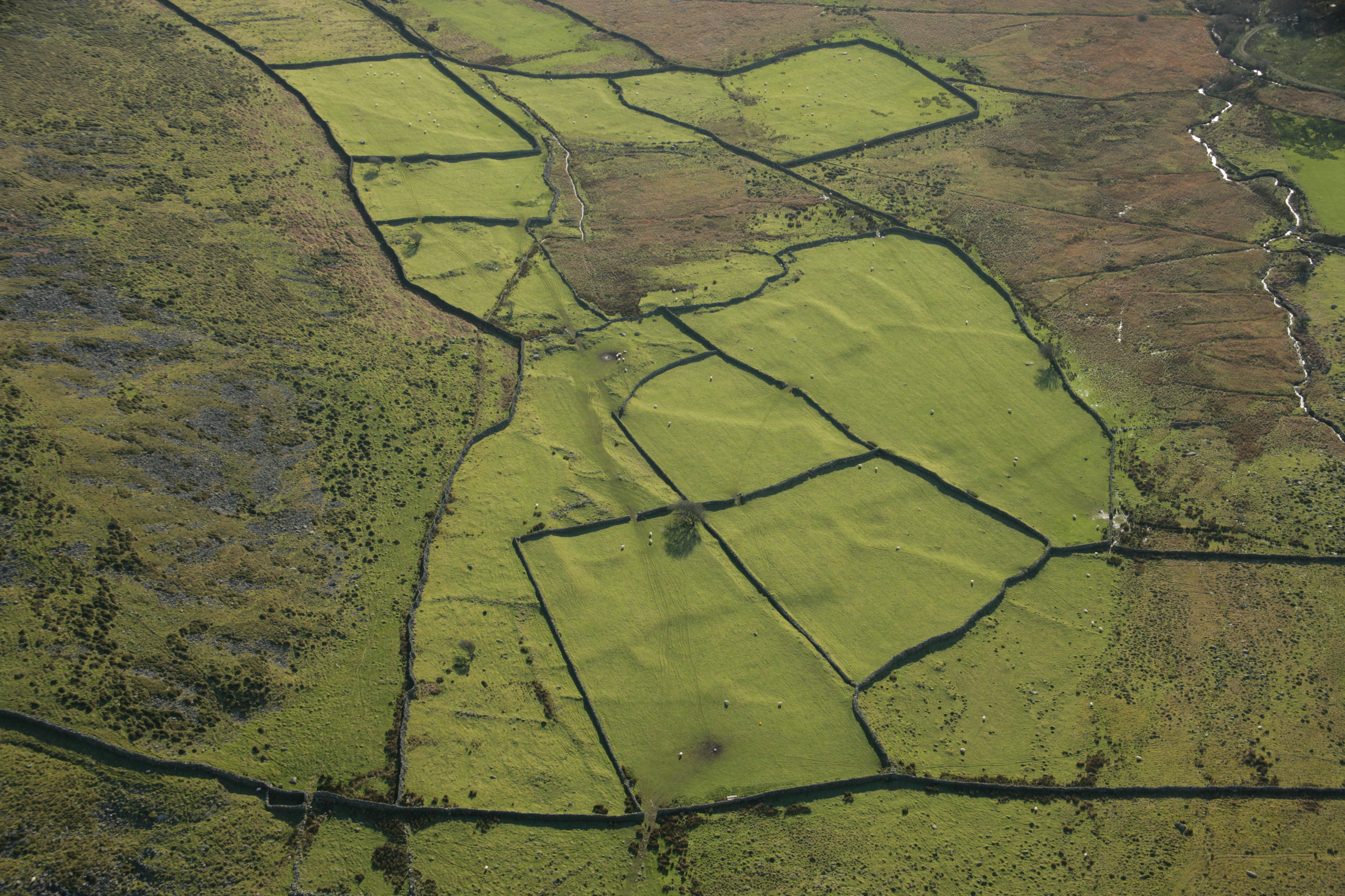
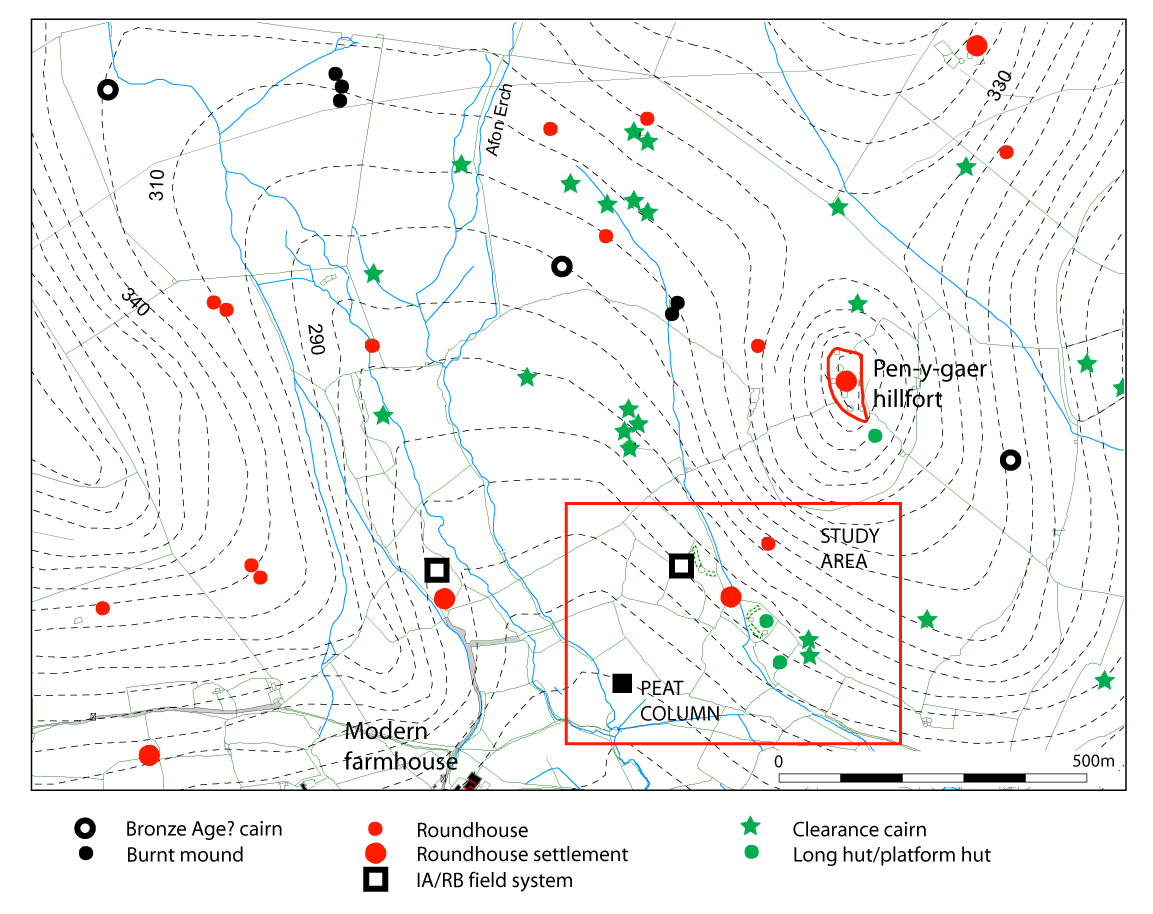
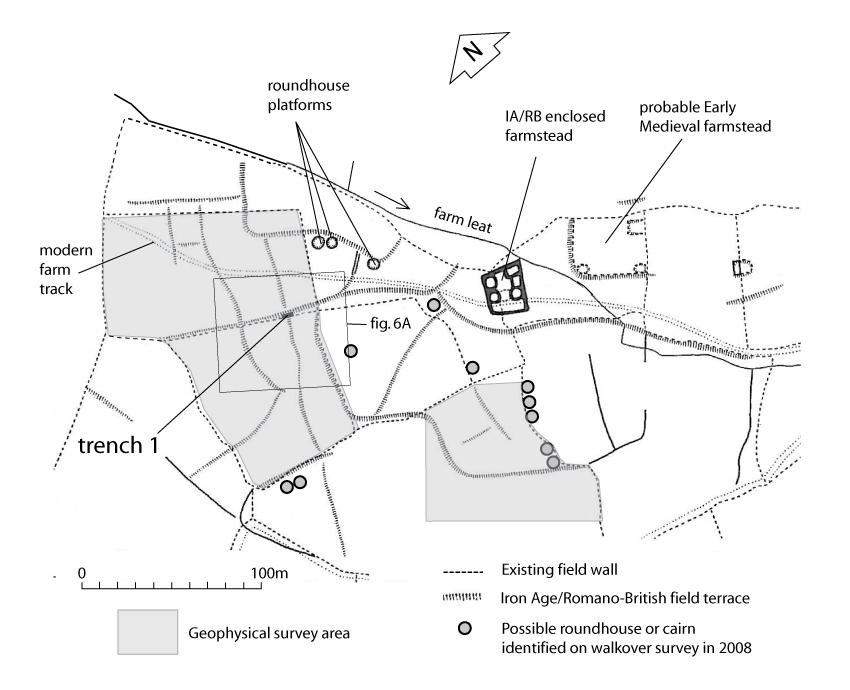
The earlier field system area is visible within the post-medieval fields as a series of low banks and terraces on a gentle south-west-facing slope between 220m and 270m OD at SH 4260 4520 (Figure 2), lying below a steep and prominent hill on which is a hillfort, Pen-y-gaer, presumed to be of Iron Age date. The field system was first recorded and surveyed by the RCAHMW (1960, 106, fig. 89). The main feature within the field system is a compact sub-rectangular enclosed roundhouse settlement of probable Iron Age and Romano-British date. It has survived well because the land has not been subject to intensive modern cultivation although there have been some post-medieval boundary changes. At the south-east side of the settlement is another, larger, sub-rectangular enclosure containing a rectangular building platform, possibly a platform house of Early Medieval date. Study of recent aerial photographs (Figure 3) and ground survey identified a number of new features, including several possible roundhouse building platforms (Figure 4). The valley immediately to the south-west has peat deposits which provided palaeoenvironmental potential.
The complexity and type of settlement features suggests occupation from some time in the Iron Age into the Roman period, then perhaps abandonment and re-occupation in the medieval period, followed by further abandonment until sometime in the post-medieval period when the farmhouse moved to its present location on the opposite side of the valley (Figure 2).
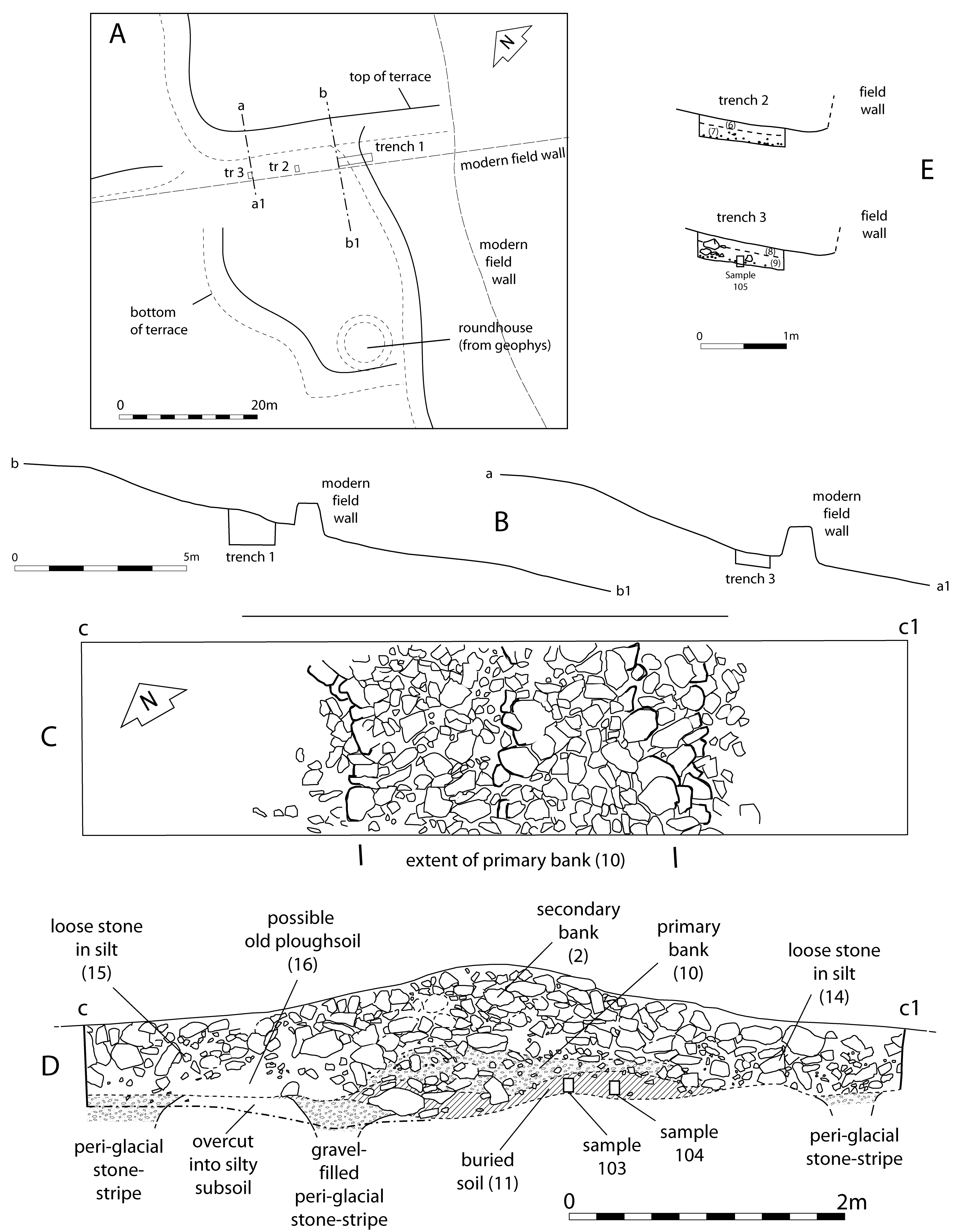
The early fields have contour and cross-contour boundaries, and are mainly of sub-rectangular outline, but in places there are some gently curving boundaries and rounded field corners. The contour boundaries take the form of terraces, in places up to 2m high, and have even formed in places where the boundaries are partly cross-contour. The cross-contour boundaries consist of grassed-over banks but in the highest upslope area are only narrow stony banks. In a few places, post-medieval boundaries overlie and therefore preserve the earlier boundaries and at these points it can be seen that the earlier boundary banks were once of greater height. One section of early cross-contour boundary preserved from post-medieval cultivation between a terrace and a post-medieval wall was chosen for a trial excavation (Figure 4 and Figure 6A).
Internet Archaeology is an open access journal based in the Department of Archaeology, University of York. Except where otherwise noted, content from this work may be used under the terms of the Creative Commons Attribution 3.0 (CC BY) Unported licence, which permits unrestricted use, distribution, and reproduction in any medium, provided that attribution to the author(s), the title of the work, the Internet Archaeology journal and the relevant URL/DOI are given.
Terms and Conditions | Legal Statements | Privacy Policy | Cookies Policy | Citing Internet Archaeology
Internet Archaeology content is preserved for the long term with the Archaeology Data Service. Help sustain and support open access publication by donating to our Open Access Archaeology Fund.