The site can be divided into three zones, as follows:
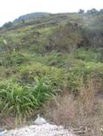
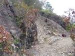
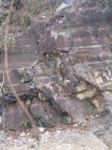
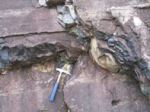
an upper zone (Zone 1) comprising a series of small, west-facing near-vertical outcrops that vary in height between 1m and 4m, outcropping generally parallel to the contours between 40 to 50m above sea level (Fig 5: top left of hill in foreground). Outcrops of tuffite and rhyolite strike north-west to south-east and dip 60 degrees to the NNE. One particular outcrop, which was excavated in 2004 and 2005 (Hong Kong Archaeological Society 2005), consists of a quarried face about 6m high and 10m long. The junction between the tuffite and the rhyolite, which is exposed further up the hillside, is not well exposed in the quarry (Figs 6-10: views of rock exposure in Neolithic quarry);
Figure 5: Top left of hill in foreground Figures 6-8: Views of rock exposure in Neolithic quarry
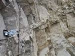
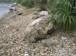
a middle zone (Zone 2) consists mainly of thick vegetation, which covers the steep hillside below the quarried outcrops of tuffite (Figs 5, 11: steep slope below Neolithic quarry site, scattered with debitage, with safety access rope). This zone appears to consist of extensive naturally weathered rock fragments and debitage from the quarry site above, and a small area of possibly burned stone. Test pits have confirmed significant concentrations of struck flakes and other forms of debitage, which spill onto the flatter beach zone below the concrete path that cuts through the site; and
Figures 9-10: Views of rock exposure in Neolithic quarry Figure 11: Steep slope below Neolithic quarry site, scattered with debitage, with safety access rope Figure 12: Beach below quarry site
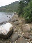
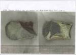
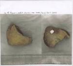
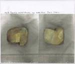
a beach zone (Zone 3) that extends for approximately 3 to 10m between high and low tide levels. The beach deposit consists mainly of sand, gravel, cobbles and boulders with a clay and silt matrix. Around 100m of beach deposits contain concentrations of archaeologically worked stone. Debitage is clearly visible below the low water mark. This does not necessarily indicate a change in sea level following the prehistoric stone tool-making period. In fact, the sea level has remained fairly constant since the Neolithic period. A better explanation is the unstable nature of the hillside. Continual land slips will have deposited natural and man-made debris on the shore for millennia. (Figs 12-13: beach below quarry site). Large blocks of tuffite that occur on the beach provided a petrological match with the tuffites which outcrop in the quarries and small cliff exposures above. They show extensive evidence of flaking technology (Figs 14-16: preform volcaniclastic and metasediment tools from beach below quarry site).
Figure 13: Beach below quarry site Figure 14-16: Preform volcaniclastic and metasediment tools from beach below quarry site