Jarlshof: the animated outcome © Kieran Baxter (CC BY-NC-ND 3.0)
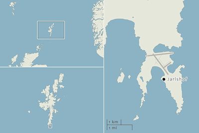
This article relates to a visualisation project conducted by the author that resulted in the animated outcome 'Jarlshof'. The project was designed around the specific aim of enhancing public engagement with the multi-period settlement site of Jarlshof (on Shetland, Scotland), using a combination of low altitude aerial photography and computer-generated imagery. The site represents a chronology spanning over four thousand years and is situated near Sumburgh airport in Shetland (Figure 1). As such, it offered a range of challenges and opportunities for the creative application of these methods.
Computer-generated visualisations are employed in a variety of ways in archaeology, from graphics-led animations that exploit archaeological data to research-based models designed to aid archaeological interpretation (Earl 2005, 204-5). While computer modelling has been explored as a means to re-assess our interpretations of the archaeological record, the project discussed here focused on the use of visualisation as a tool to communicate existing archaeological interpretations to a lay audience.
Here, computer-generated visualisation was explored as a means for visual storytelling, to communicate the structure and character of a site along with an indication of its current archaeological interpretation. While this interpretation included reconstructed elements, reconstruction was not the focus of the project. Instead the animated outcome aimed to tell the story of the site using imagery of the present-day remains as far as possible. The outcome was heavily informed by low altitude aerial photography gathered on site. Much of the animated outcome remained true to the original photographs and as such, while the outcome was computer generate, the end aesthetic was largely a photographic one. One danger inherent in the use of photography as a vehicle for storytelling is that such imagery may be mistakenly treated as a 'transparent window' (Shanks 1997, 73) onto the subject matter. Bohrer (2005, 181-2) maintains that while the photograph is still largely deemed 'objective', it is a forcefully 'interpretative' media in its own right.
During this project an attempt was made to consider the interpretative role of the camera, lighting and atmosphere and to utilise these to enhance the film's narrative and objectives. Consideration was also given to how the speculative nature of reconstructed elements, derived from photographs, could be made explicit in the visual language of the outcome. What results is neither 'transparent' nor 'objective' but a context-specific artefact of a creative and technical process. Molyneaux (1997, 5) reinforces the importance of understanding the significance of images within the context of their production. With that in mind, this article sets out to expose the process behind the visual outcome of the 'Jarlshof' project, and to offer some critical reflections on the appropriateness of the approach and methods used.
Section 2 will introduce how the initial project plan was designed around the demands of the site and the overall aims of the project. An account of the production process in Section 3 will provide a technical overview of the methods of image gathering and processing used, and the suitability of these. The animated outcome is viewable in Section 4, while Section 5 follows a reflection on the visual toolkit that was adopted to tell the story of the site. This toolkit included a consideration of how lighting, atmospheric conditions, and the role of the camera can be used as narrative mechanisms in their own right.