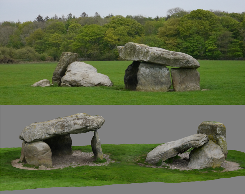
HeritageTogether is the umbrella name for a research project that uses crowd-sourced digital photographs to produce 3D models of Neolithic and Bronze Age remains from our study area of Gwynedd and Anglesey (See Griffiths et al. this issue). This is a collaborative Arts and Humanities Research Council (AHRC) project, with academic partners at Manchester Metropolitan, Bangor and Aberystwyth universities. The inspiration for the project was the prevalence of digital camera use in the UK, not least on mobile phones, to crowd-source archaeological research data. New advances in software mean that photographs produced by devices can be harnessed to create fully textured digital 3D models using structure-from-motion photogrammetry (Figure 1). The models contribute to a number of specific research aims – to produce accurate records of the sites, which can be located in GIS, and as condition surveys of the contemporary state of the sites. The images and models resulting from this work are freely available from the project website, and will be for at least ten years through the dedicated project server.
The project approach was explicitly experimental in terms of both public archaeology and computer science. There are two important interconnected themes in the archaeological approaches. Firstly, the project aimed to place working with citizen scientists at its centre, in order to produce digital archaeological research data. Secondly, emphasising tangible archaeological research outputs was central to the project design.
Since at least the mid-19th century, north Wales has been the subject of concerted research on standing stones and megalithic tombs, in part due to the concentrations of these monument types (Lynch 1969). Recently, this has included synthetic approaches to the earlier prehistoric record of north Wales (e.g. Lynch 1991; Cummings and Whittle 2004; Smith 2002; 2003), and research devoted to important individual sites (e.g. Burrow 2010). At more well-known sites, damage has been identified as a risk; in terms of lesser known sites, limited documentation exists (Smith 2002; 2003). The digital modelling and conservation status evidence produced as part of this project represents an unprecedented survey of this kind in the UK, and a significant research contribution.
The purpose of this article is not to discuss the results of the modelling, but to address some of the themes we have identified from working with members of the public to produce digital research data.