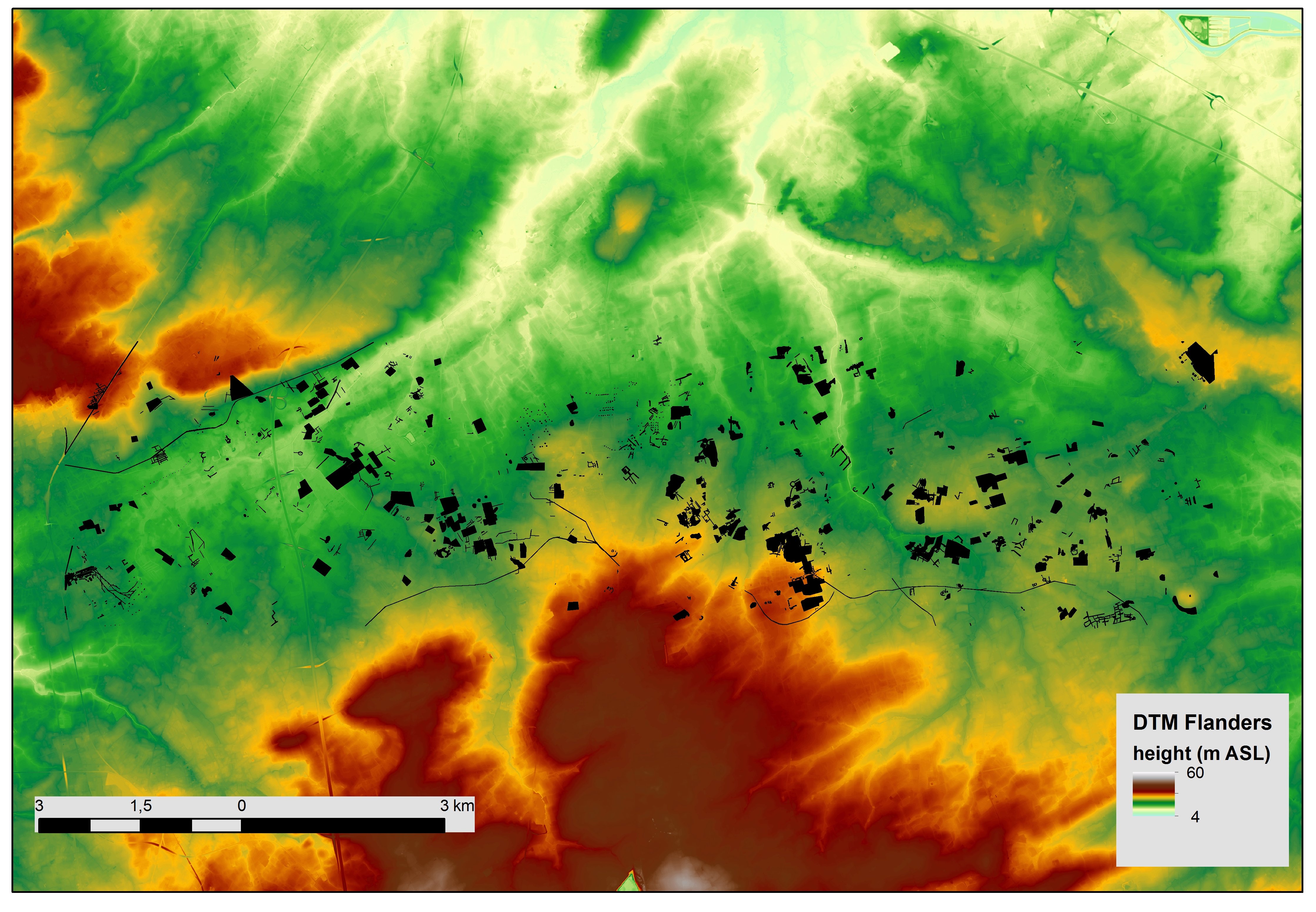
Figure 1: Archaeological traces based on a combination of remote-sensing sources (historical land archaeological aerial photographs, lidar) for a test region in the vicinity of Torhout (e.g. Stichelbaut et al. 2015)
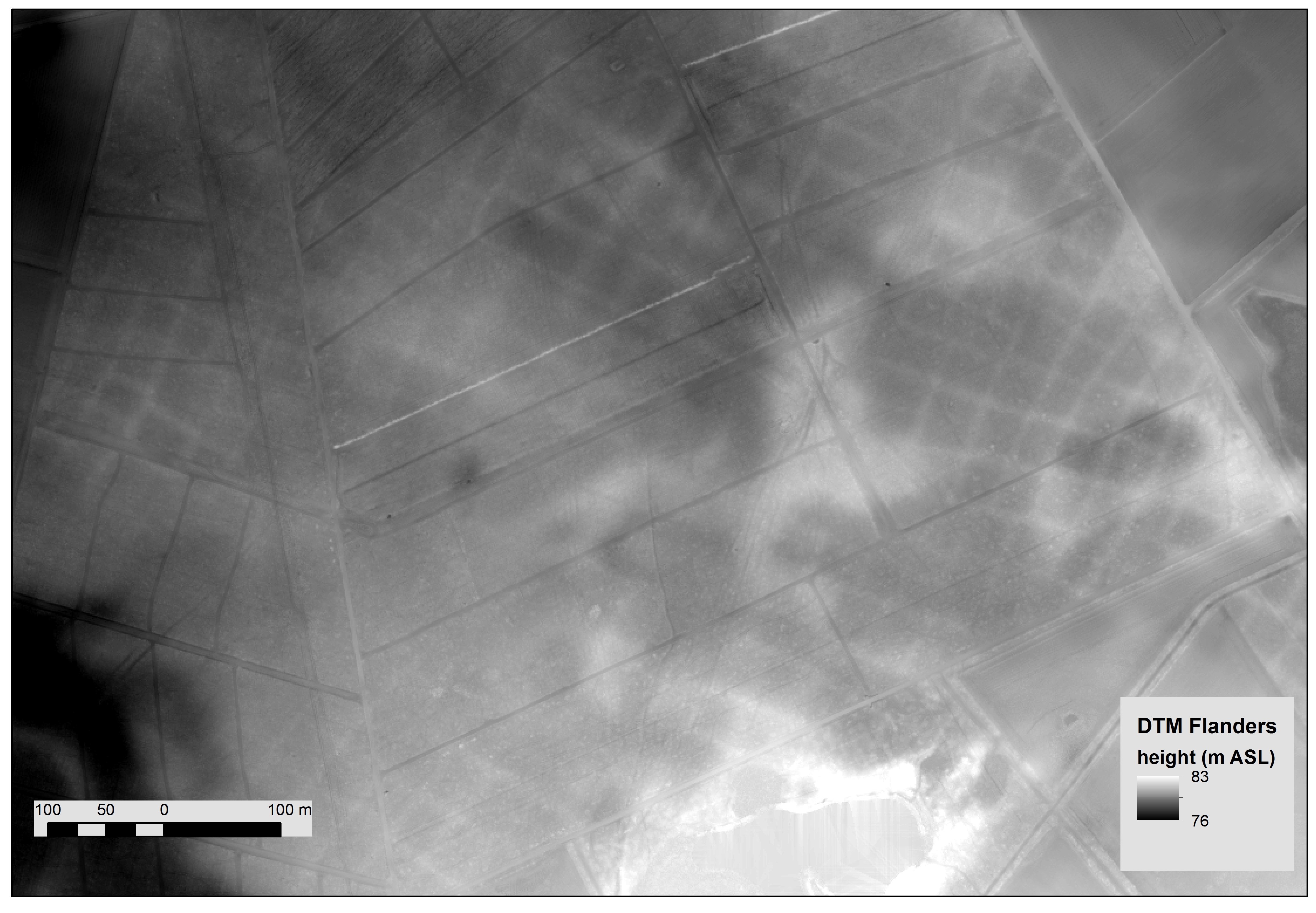
Figure 2: Greyscale colour map of lidar raster showing Celtic Field wall structures under forest
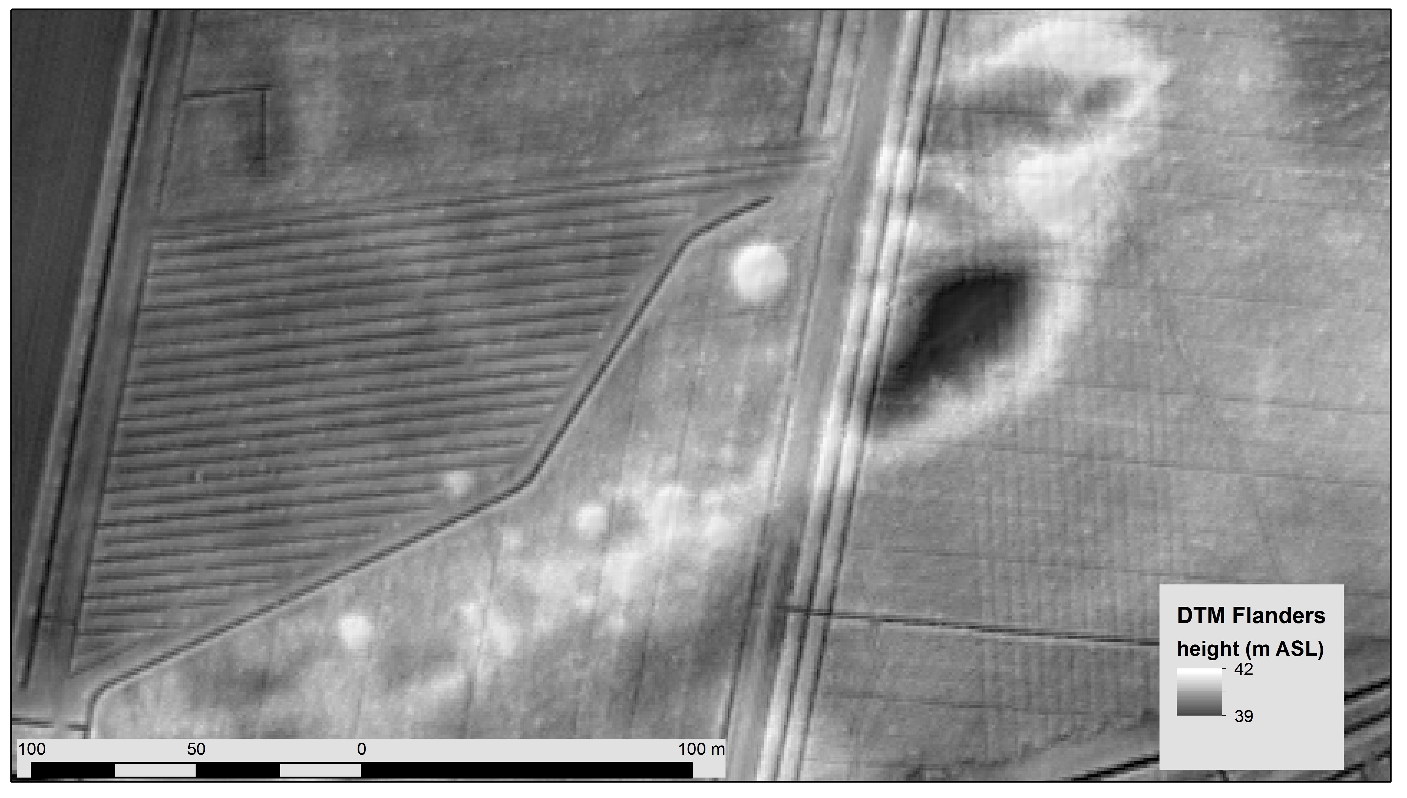
Figure 3: Combination of greyscale and hillshade of lidar raster map with several barrow structures under forest
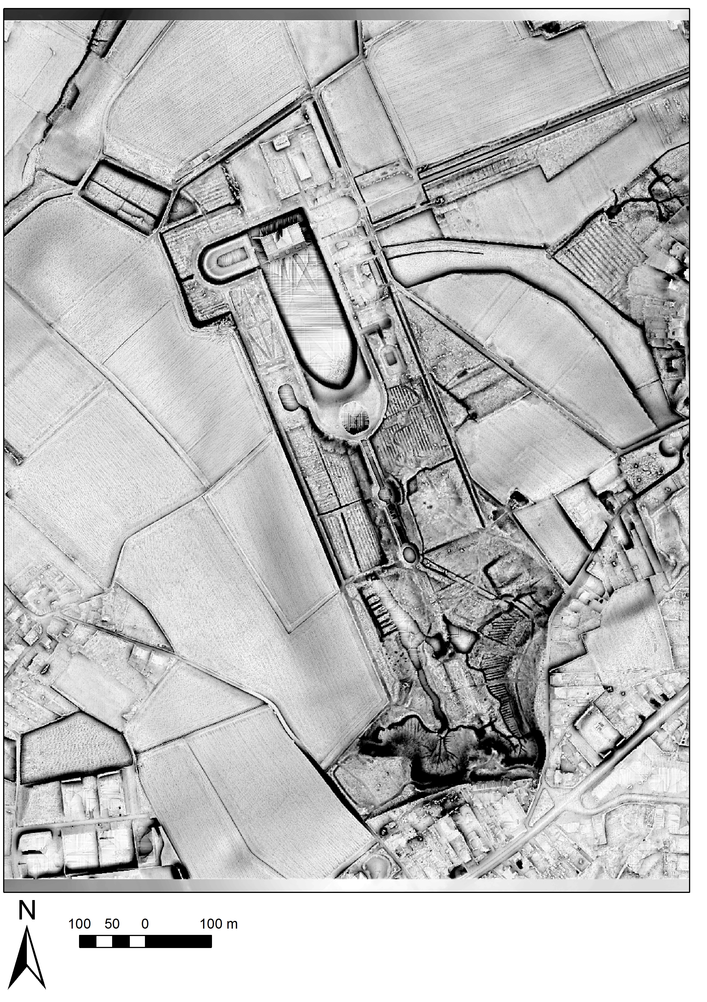
Figure 4: Skyview factor lidar raster map of a historic castle park site
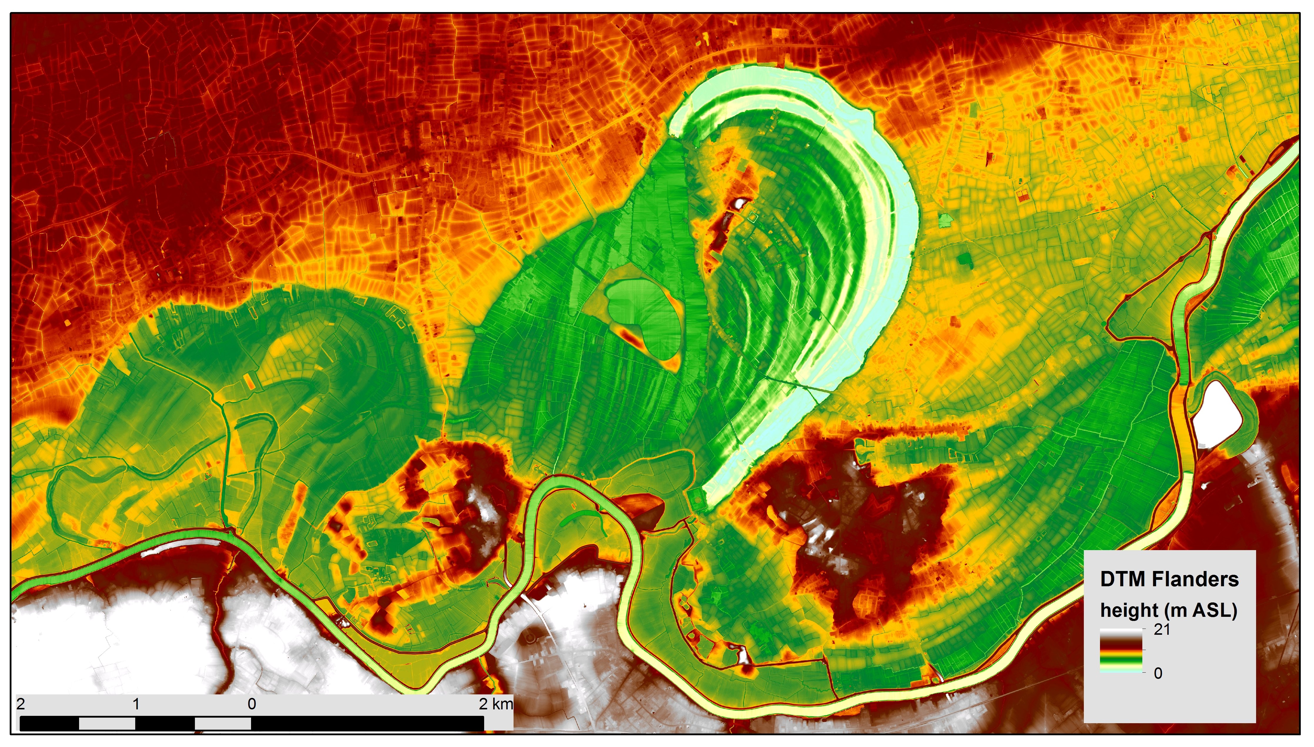
Figure 5: Colourscale lidar raster map of part of the Scheldt valley, showing fossil channels and point bar topography
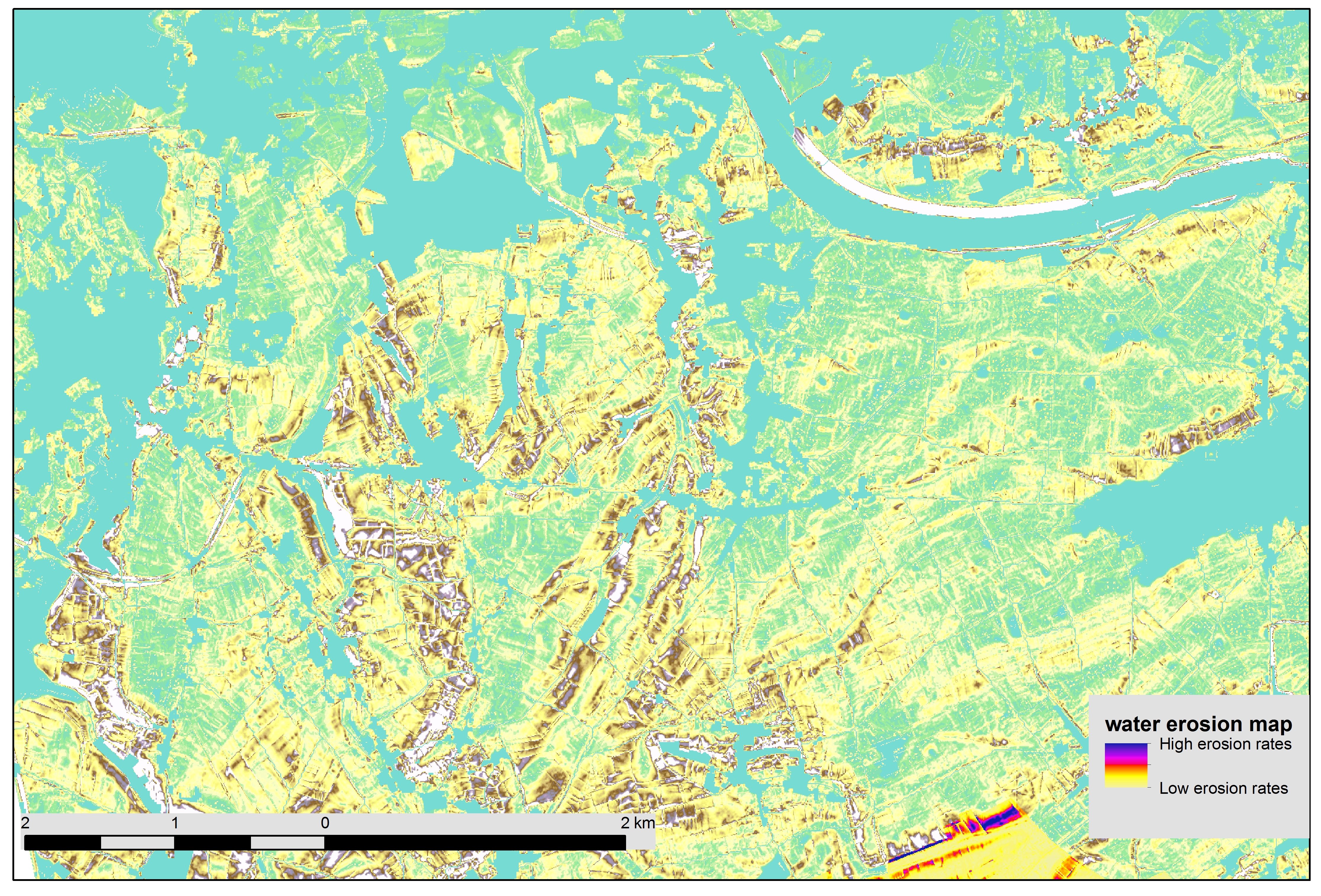
Figure 6: Example of modelled erosion rates of part of Hesbaye loam area (e.g. Notebaert et al. 2006)
Internet Archaeology is an open access journal based in the Department of Archaeology, University of York. Except where otherwise noted, content from this work may be used under the terms of the Creative Commons Attribution 3.0 (CC BY) Unported licence, which permits unrestricted use, distribution, and reproduction in any medium, provided that attribution to the author(s), the title of the work, the Internet Archaeology journal and the relevant URL/DOI are given.
Terms and Conditions | Legal Statements | Privacy Policy | Cookies Policy | Citing Internet Archaeology
Internet Archaeology content is preserved for the long term with the Archaeology Data Service (ROR). Help sustain and support open access publication by donating to our Open Access Archaeology Fund.