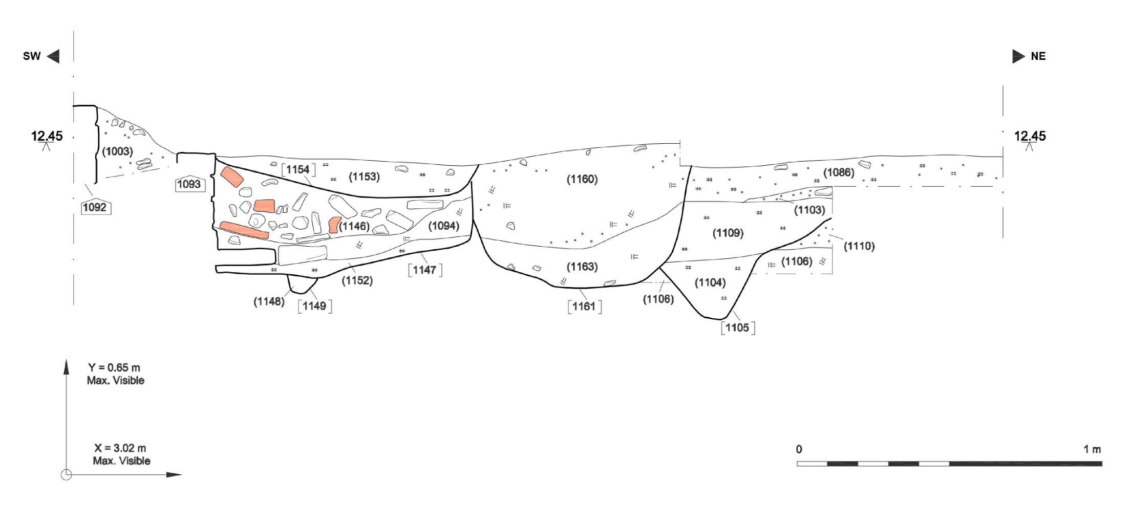
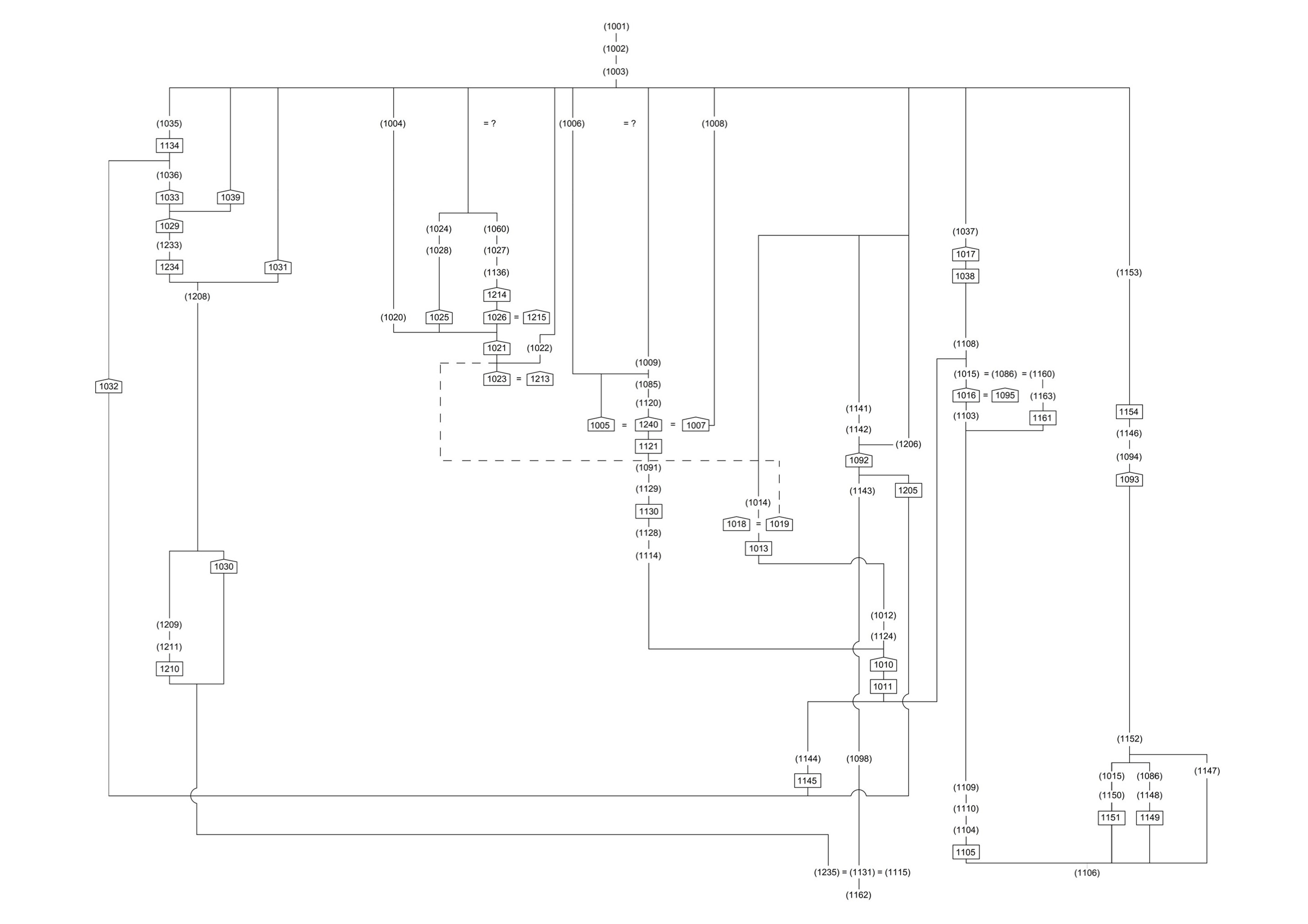
Figure 11: Detailed plan of excavation Area A [JPG]
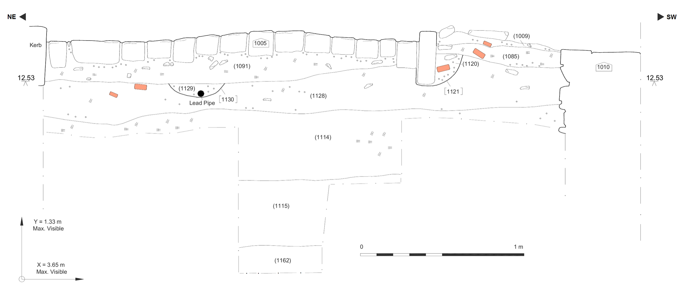
Phase 1. Unlike the other two main areas of excavation on this site, here, in Area A (Figure 11, also see Figure 12: North-west facing section, Figure 13: South-east facing section and Figure 14: Site matrix), the earliest (i.e. lowest) deposit encountered (1162), may have represented the same natural deposits that were, we think, also revealed in Areas B and C (i.e. (1239) in Area C, and (1229) and (1053) in Area B). While it is not entirely clear that this context represented an undisturbed natural deposit, it is likely that it was at least in part derived from redeposited natural river-terrace alluvial material. No finds were recovered from this layer, which was found in the base of a sondage cut through the cobble surface (1005; see Figure 12 and Figure 20). Above this, deposit (1115) contained pottery largely of 18th century date, but also included modern redwares, whose use continues into the 19th century (Appendix 2). The latter deposit (1115) seems also to have been identified in the earlier evaluation and during the watching brief, and it may represent a dumped levelling layer that was site-wide, and variously recorded as Contexts (1106), (1131) and (1235). This deposit could not be fully excavated; but it was this or one of its analogues onto which wall (1030) and possibly several other of the walls seem either to have been directly laid, or to have been constructed within construction cuts truncating the latter deposit.
Browse via image gallery (Figures 15-20)
1 / 6
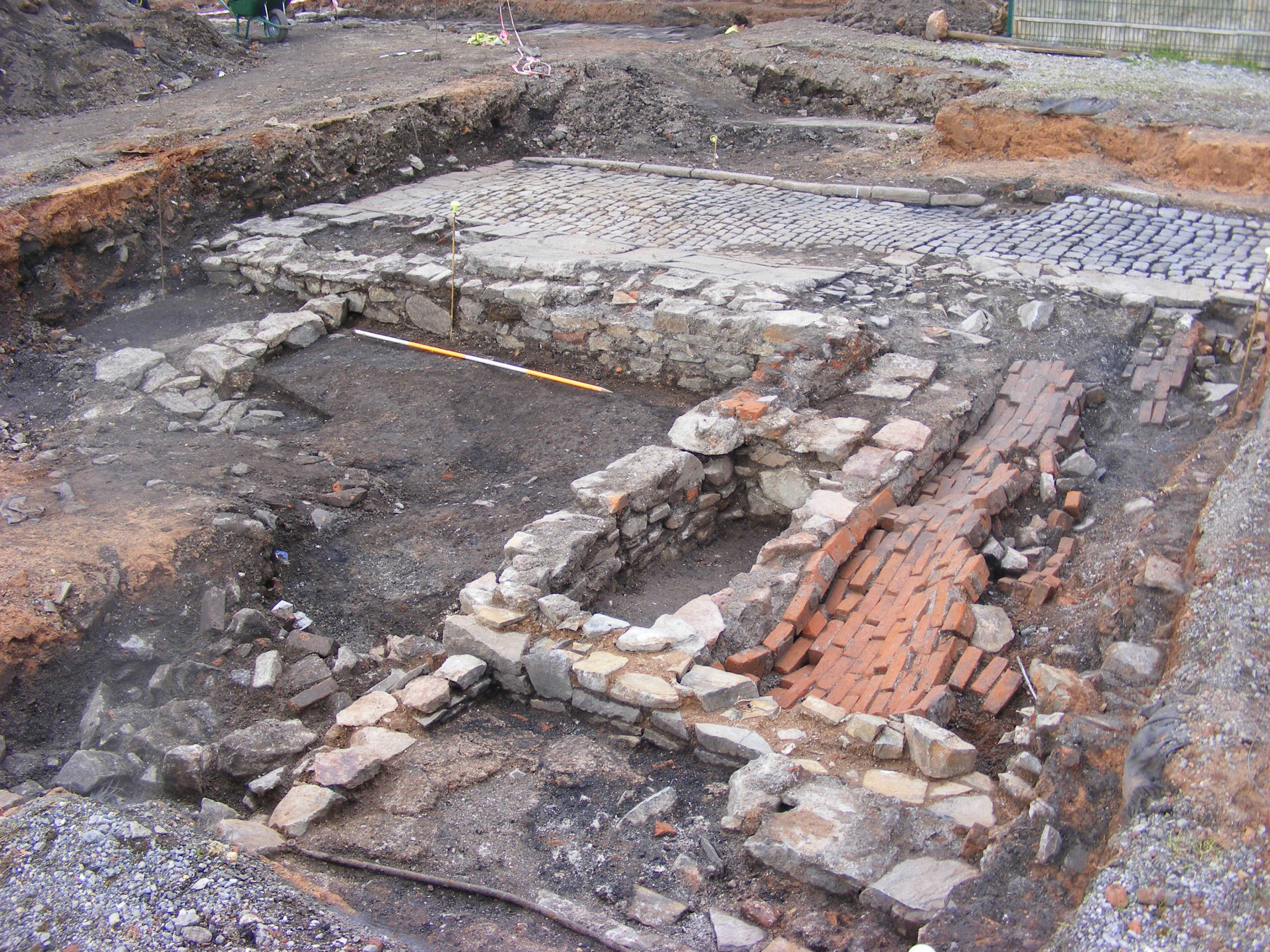
Figure 15: General view of Area A almost fully excavated, looking north. Collapsed brick vault (1026) of cellar (1021) in foreground, probably belonging to 6 Little Anne St; cobbled surface of Pratten's Court (1005) and kerbing (1240), in background. Scale: 2m
2 / 6
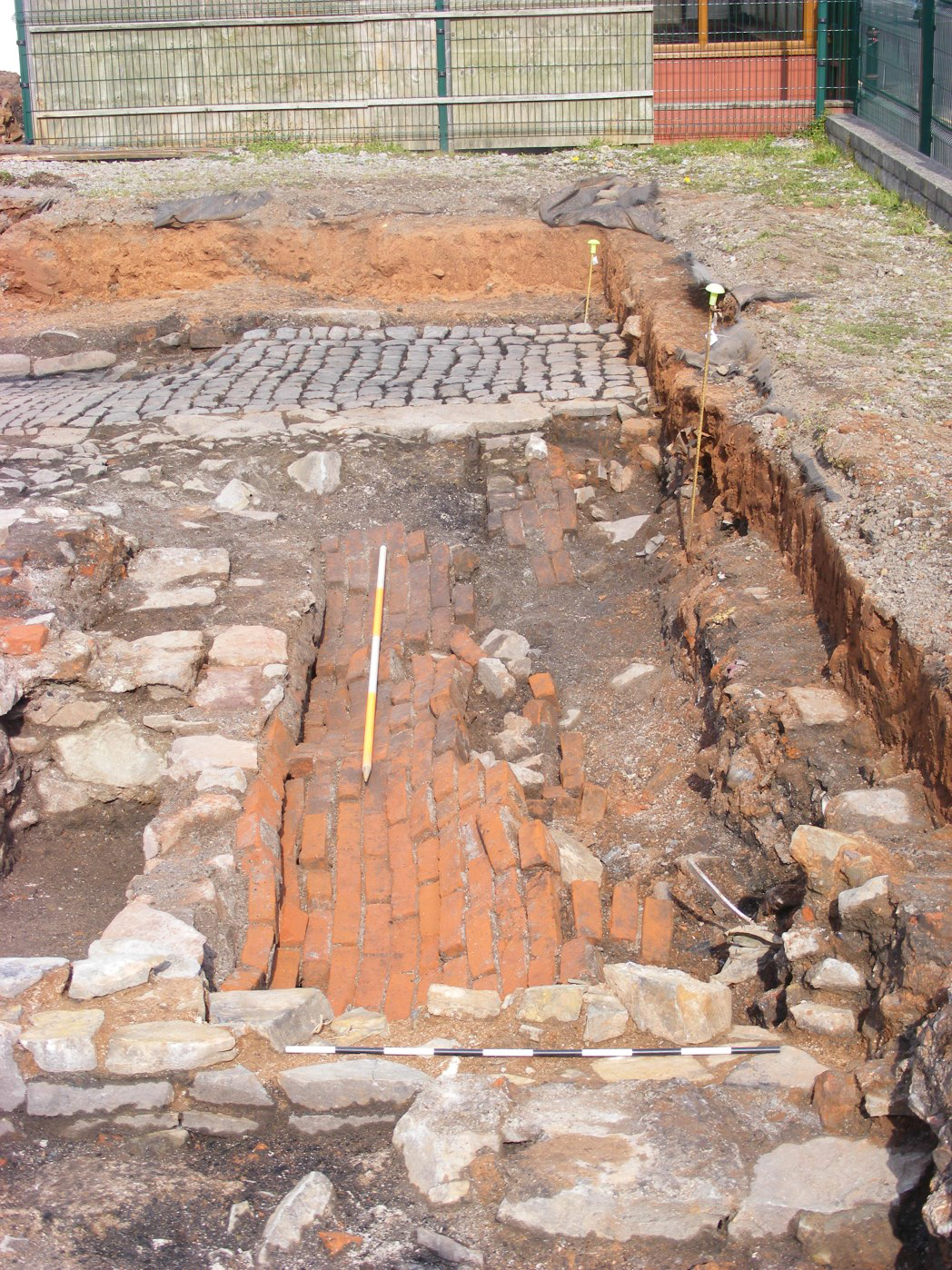
Figure 16: Detail of brick vault and cellar, looking north-east. Scales: 1m and 2m
3 / 6
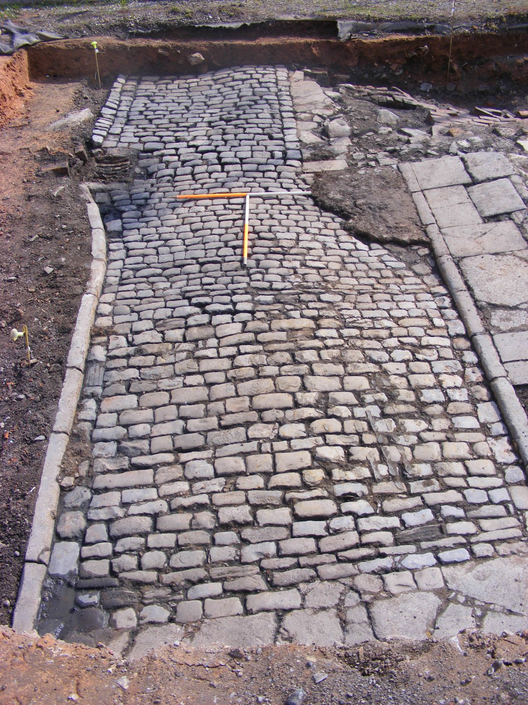
Figure 17: Cobbled surface (1005) of Pratten's Court fully exposed within Area A, looking south-east. Scales: 2×1m
4 / 6
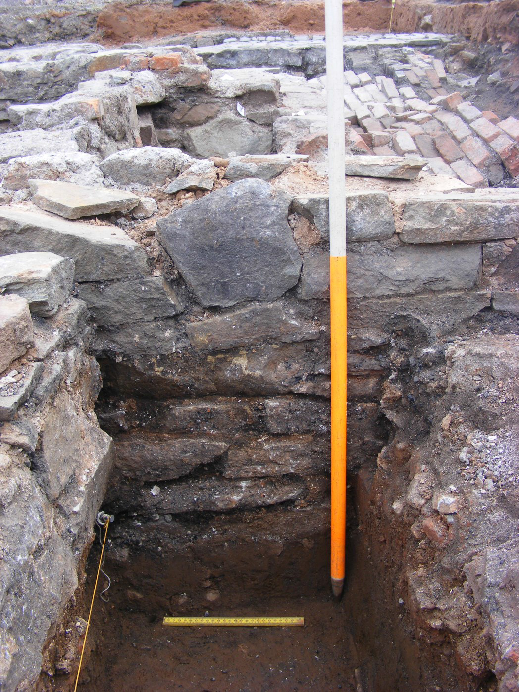
Figure 18: Section through pre-structural phase features, [1105] and associated cuts. View to south. Scales: 1×0.40m and 1×1m
5 / 6
Figure 19: Elevation of wall (1030), with wall (1029) butting against it on left-hand side of frame. Collapsed brick cellar vaulting (1026) in background. View to north-east. Scales: 1×1m and 1×0.25m
6 / 6
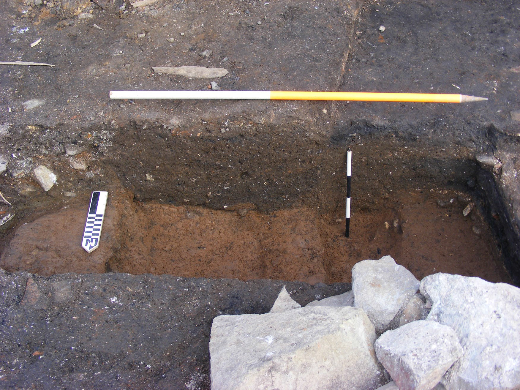
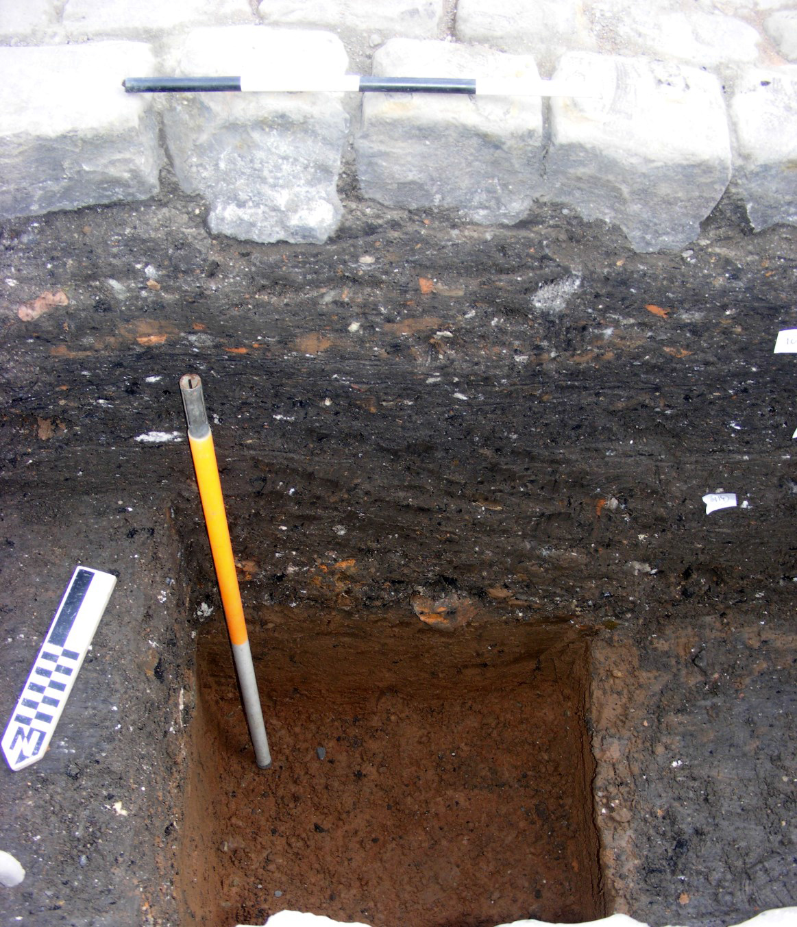
Figure 20: Section through deposits under cobbled surface of Pratten's Court (1005). Compare with Figure 12. View to south-east. Scales: 1×1m and 1×0.30m
Phase 2 in Area A is likely to be represented by a series of cuts at the western corner of the excavated area (see Figure 13 and Figure 18) and which included (1161) and (1105), both of them apparent linears, and (1149) and (1151), which had the appearance of holes for small posts or stakes; no finds were recovered from these features that might have allowed dating. In fact, the two former features were not contemporary, as the fills of (1105) were cut by (1161), but it seems at least possible that the latter was intended as a recut of the former. The lower fill of (1105) contained post-medieval ceramics, clay tobacco pipe (unfortunately not susceptible to close dating), and a glass bottle sherd. Another pre-structural feature, a cut of a possible pit or irregular linear (1145), had a fill (1144) containing a large assemblage of 18th century ceramic, into which wall (1010) had been cut.
Structural phases
Phase 3 gave rise to structure (1093) and its associated fill (1094; see Figure 13). It is probable that the latter gives a clue about the function of the former, for it seemed clearly to be a fairly typical cess deposit, and it may be that this structure was, or at least became, a primitive privy attached to a then-open yard extending behind one of the houses fronting the north-western side of Little Anne Street (perhaps specifically no. 6), prior to the construction of Pratten's Court some time before 1828.
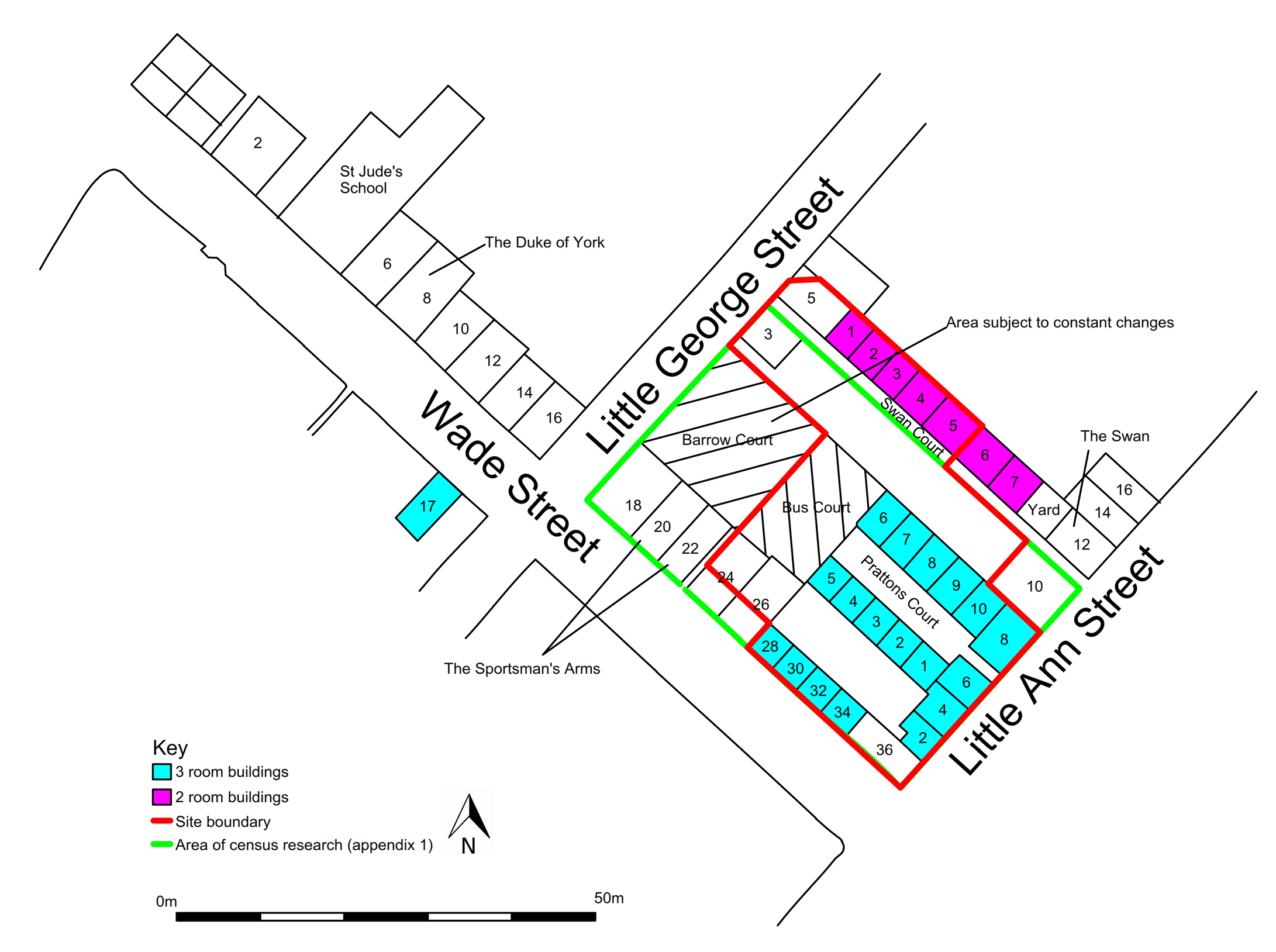
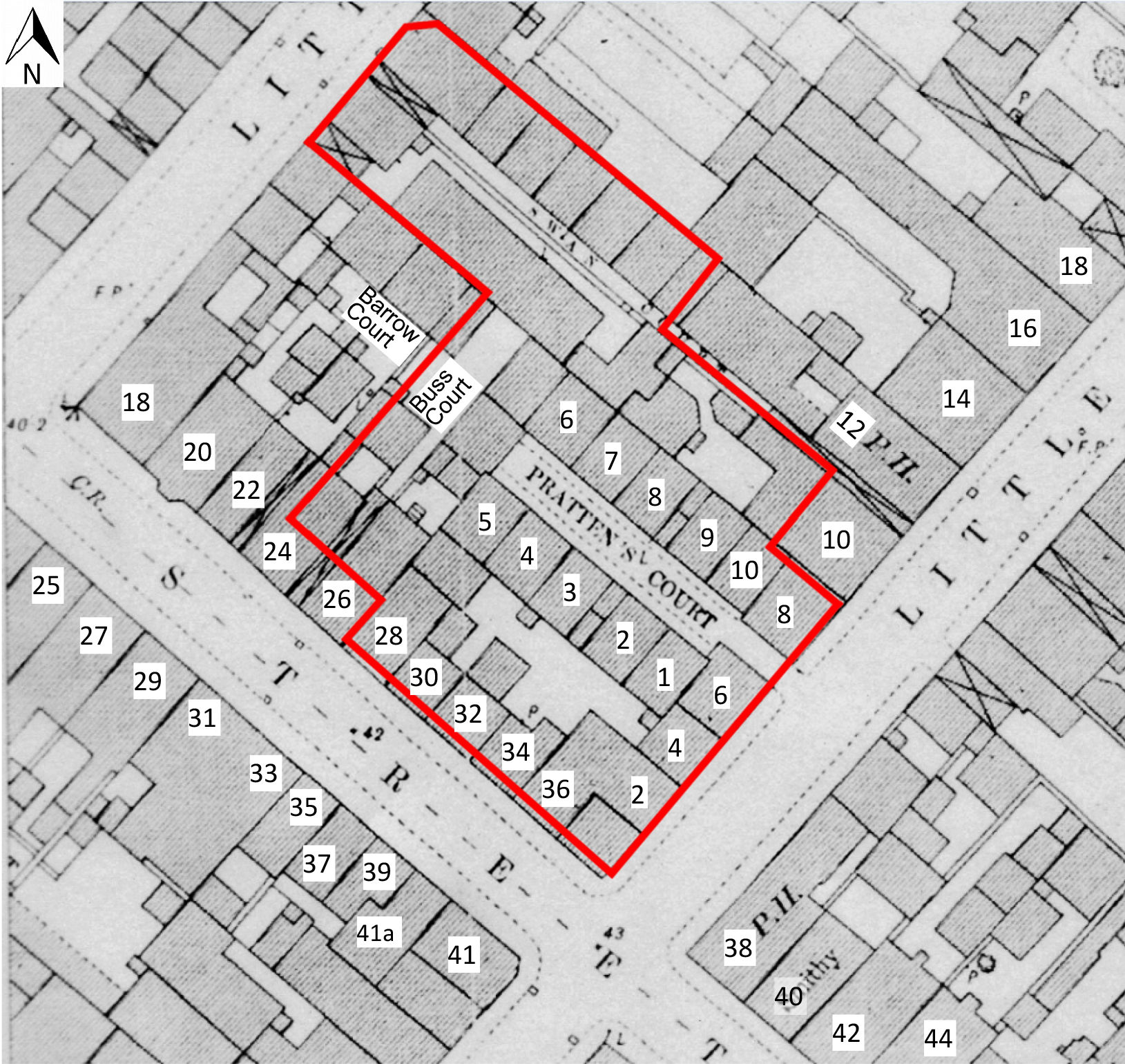
Phase 4 includes wall (1010), in a clear construction cut (1011), running north-west/south-east, and what appears to be an associated wall (1018/1019) at its south-eastern end, aligned south-west/north-east (Figure 11). This set of structures seems to coincide very well with the late 19th-century OS plan, and may represent the front and south-eastern walls of the house at the south-eastern end, and on the south-western side, of Pratten's Court (later numbered as 1 Pratten's Court, see Figure 8 and Figure 21). Wall (1018)/(1019) was not tied into wall (1010) but butted against it, and was therefore later, and it seems most likely that (1010) was constructed first, and then the party walls of the houses on the south-western side of Pratten's Court were simply butted against it and run off to the south-west.
Figure 21: Simplified scale plan showing the study site in the second half of the 19th century, with house numbers, and annotated to indicate specific features of the layout in the light of the census records
The same applies to wall (1023), butted against the north-eastern side of (1010), and clearly representing part of the side and rear wall of 6 Little Anne St (Figure 8, Figure 21, and Figure 11). In any event, wall (1010) runs exactly parallel to the main spine (1043) in Area C, and there can be little doubt that, together with its north-western continuation, wall (146), identified from the later watching brief (Figure 3), it formed the main front wall of the houses on the south-west side of Pratten's Court. However, although of the same width, its construction and bonding was rather different, and it is likely that the two walls are not contemporary. Presuming, however, that the hard surfaces to the north-east of (1010) were also established explicitly to accompany the construction of Pratten's Court (flagstone pavement (1007) and cobbled surface (1005)), then they too should be assigned to this phase, as should wall (1092), which was clearly the rear (south-western) common wall for the houses on the south-western side of Pratten's Court. Wall (1017) runs south-west/north-east off the south-western side of wall (1010), and from map evidence it appears on the face of it to be a clear candidate for a shared common wall between two houses on the south-western side, and south-eastern end, of Pratten's Court. As we have already noted of the relationship between (1018)/(1019) and (1010), the fact that (1017) butts against (1010) does not preclude the likelihood that they are of the same phase, and only separated by a relatively very short space of time.
Phase 5. Here, we should probably include walls (1029) and (1030), almost certainly, respectively, the north-eastern (i.e. rear) wall of no. 4, and the common, party wall between 4 and 6 Little Anne Street (Figure 11 and Figure 4). Wall (133), from the watching brief, is inexplicable in the context of the historic map evidence; it is difficult to see that it is a north-western continuation of (1030) as the physical builds are different, although the north-western end of the latter terminates in a truncated stub that does suggest an original continuation in that direction (Figure 3).
Phase 6 in this area seems to encompass a complex of walls and other structures that, when collated with historic map evidence, seem to resolve themselves into the later construction of the house identifiable as 6 Little Anne Street, abutting the south-eastern end of the south-western side of the pre-existing Pratten's Court (Figure 8, Figure 21 and Figure 11). Walls (1023) and (1021) can probably be assigned to this phase, and, crucially, steps (1214). As a direct corollary of this, we must suppose that the brick vault (1026) must also belong here. In fact, (1021) is the cellar wall from which the vault was made to spring. The narrow gap between the two sets of walls (1018)/(1019), and (1021), may represent a passageway giving access to this cellar, which seems clearly to have belonged to 6 Little Anne Street. As already noted, wall (1023) abuts wall (1010), and it looks as though the former may also truncate cobbled surface (1005), and its associated flagstone pavement (1007) and kerbstones (1240).
Internet Archaeology is an open access journal based in the Department of Archaeology, University of York. Except where otherwise noted, content from this work may be used under the terms of the Creative Commons Attribution 3.0 (CC BY) Unported licence, which permits unrestricted use, distribution, and reproduction in any medium, provided that attribution to the author(s), the title of the work, the Internet Archaeology journal and the relevant URL/DOI are given.
Internet Archaeology content is preserved for the long term with the Archaeology Data Service (ROR). Help sustain and support open access publication by donating to our Open Access Archaeology Fund.