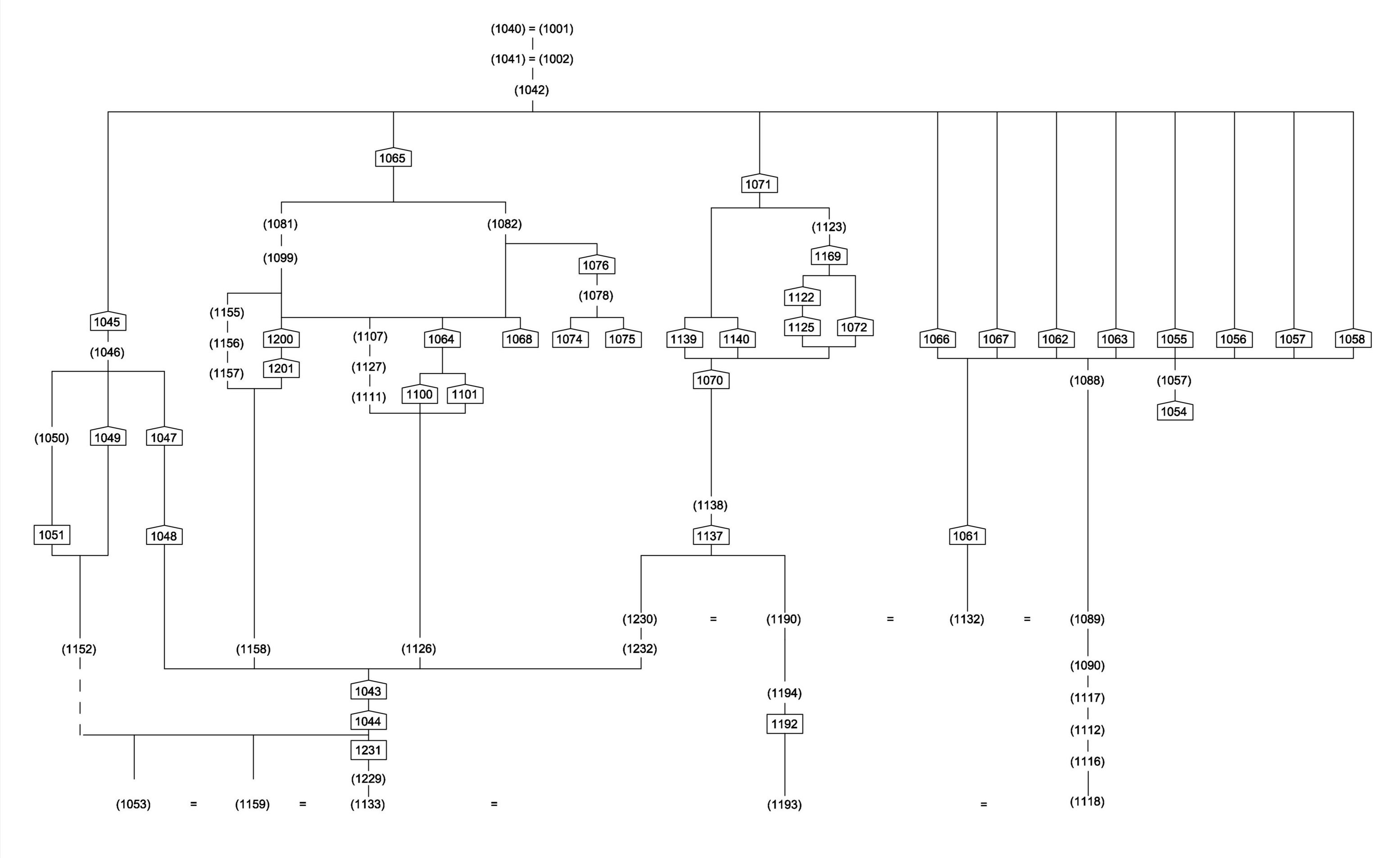
Figure 22: Detailed plan of excavation Area B [JPG]
What was taken to be the natural substrate was seen in a number of locations in this part of the excavation, most notably at the bases of the various sondages that were opened up during the course of the investigation. Deposits (1159), (1133), (1053) and (1229), appear to have been pretty typical, and like (1179) and (1196) seen in Area C, and (1162) in Area A, it is possible that the ultimate affinities of these layers are to be found in alluvial depositional processes related to the floodplain of the nearby River Frome, although perhaps having undergone some redeposition.
Phase 1. For an area of this size, Area B produced very little medieval or early modern pottery – only thirteen sherds in all. Most of that material was residual in later contexts, but two contexts very close to the bottom of the Area B stratigraphic sequence, (1193) and (1118), produced medieval and early modern ceramic only (Figure 26 and Appendix 2). Between them this only accounts for eight sherds in total, but these were the closest that the site came to producing contexts redolent of activity in the medieval period. It is possible that both of these contexts represent a form of redeposited natural river alluvium; alternatively, they may represent material that has simply sunk down into what may in the medieval and early modern periods have been a fairly dynamic, marshy floodplain environment.
Structural phases
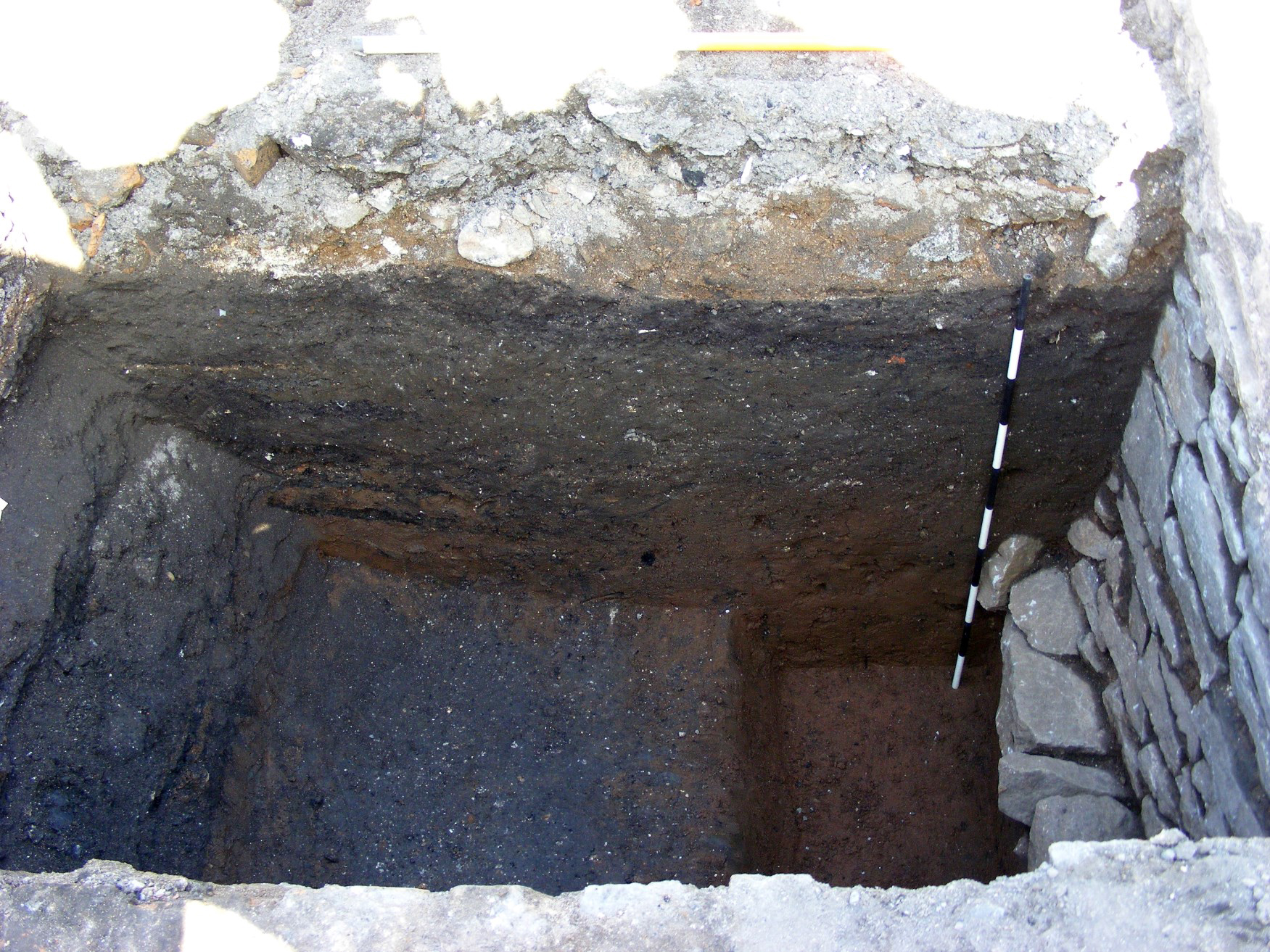
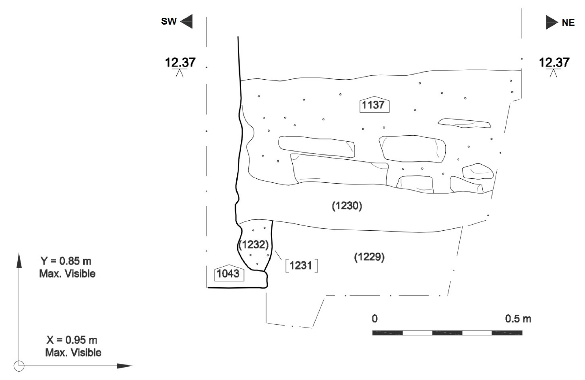
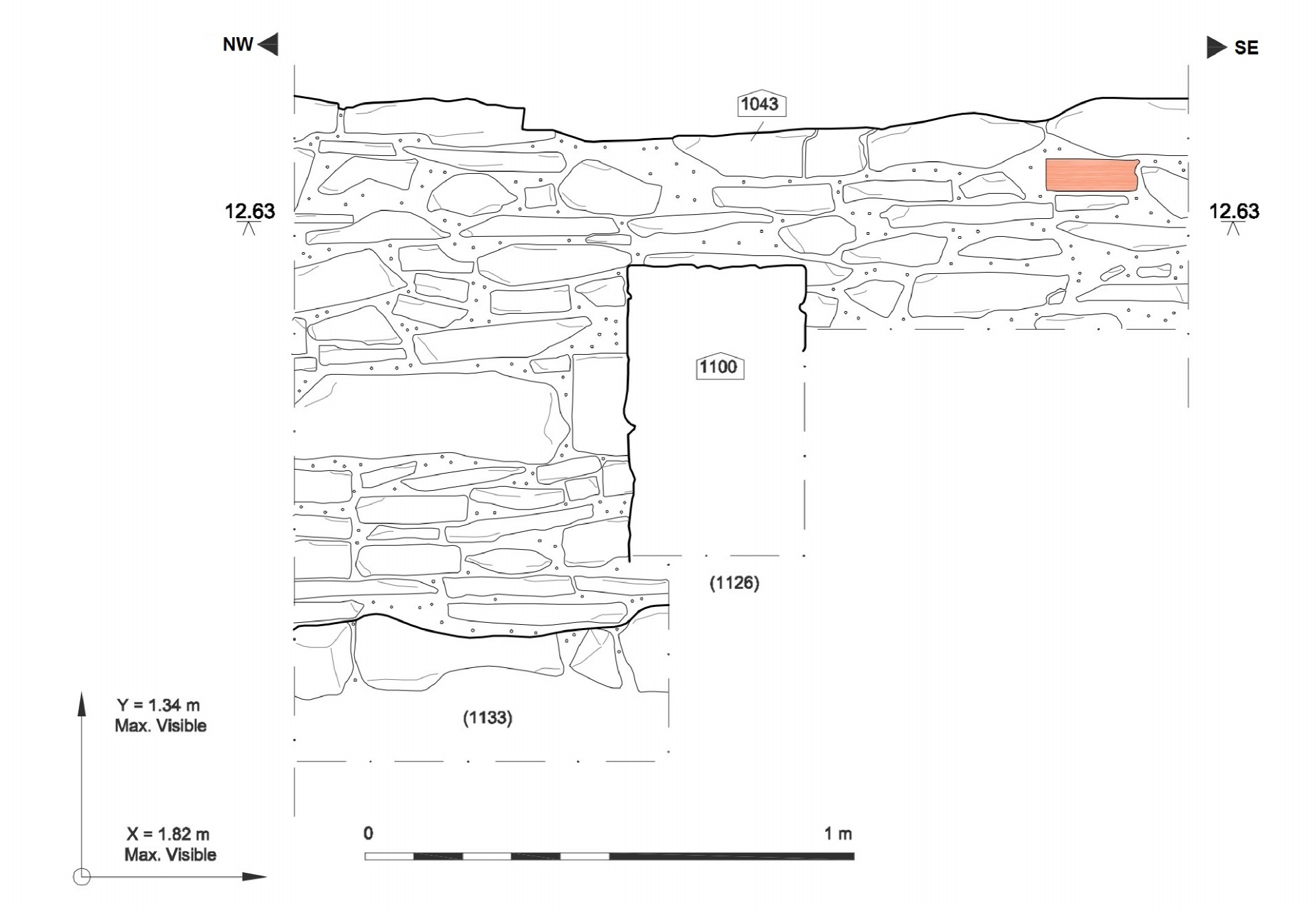
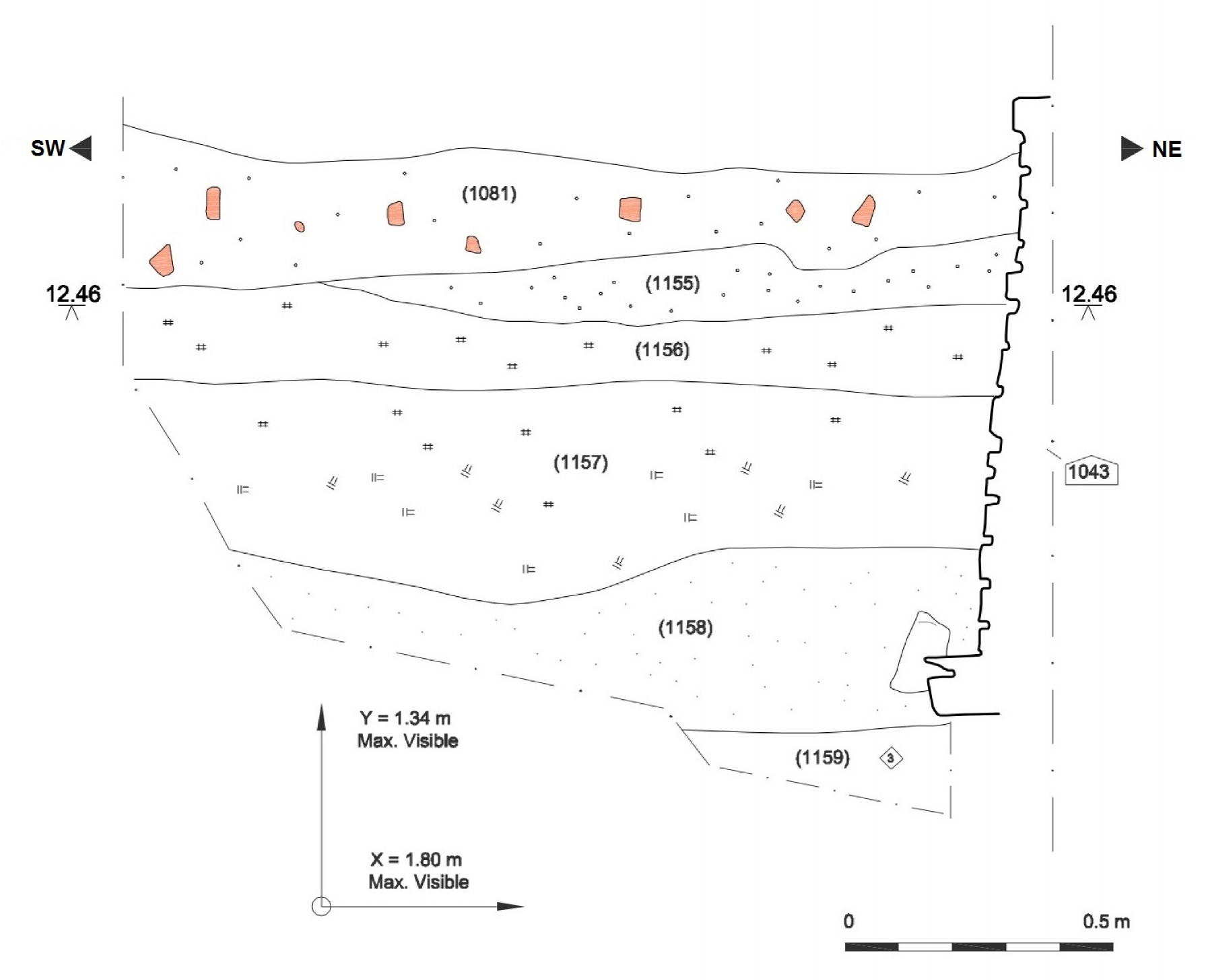
Phase 2 within this area was characterised by the erection of a very substantial stone wall (1043), displaying equally substantial, splayed footings at its base, running north-west/south-east for the entire length of the excavated area (Figure 22). The subsequent watching brief also demonstrated that this structure ran south-eastwards all the way to the Little Anne St frontage, and north-westwards at least to the limit of the site on that side (contexts (139) and (169); Figure 3). Despite its size, this wall seemed almost entirely to lack any sign of a construction cut – certainly the sondages that were excavated on its south-western side showed only that its footings appeared to be cut just centimetres into the natural substrate (such as, for example, (1159) and (1133); Figures 24 and 25); all the other associated deposits had been either dumped or had subsequently built up against it. In only a single location was it possible to discern a semblance of what might have been the very basal remnant of a construction cut, and this was at the north-western end of the excavated section of wall, in a sondage on its north-eastern side. There, a small cut (1231) was seen that looks as though it may well have been severely truncated by later activity (Figure 24).
The wall itself was of undressed, semi-coursed rubble, bonded with mortar, but the careful construction of the wall was such that it presented reasonably good, level faces on both of its elevations, with a marked outward batter towards the base on at least the south-west side (Figure 23). A variety of different types of mortar were used, presumably representing different phases of repair and/or rebuilding, as for example in the upper courses of the north-east face, at the wall's north-western end. Also, on this part of the wall, there had been crude attempts at rendering with a white lime plaster. There was also occasional brick and other ceramic building material used in the fabric of the wall, but this was always in the context of the upper exposed courses, bonded with one of the later types of mortar. Every other structure that had a relationship with this main, 'spine', wall could be seen to be butting it, and was therefore later, and indeed in no place did the foundations of these subsequent walls extend to the same depth as those of the main wall (1043). Rather, they were sitting on top of, or cut into, material that had been dumped, or had accumulated against, its elevations (see further below).
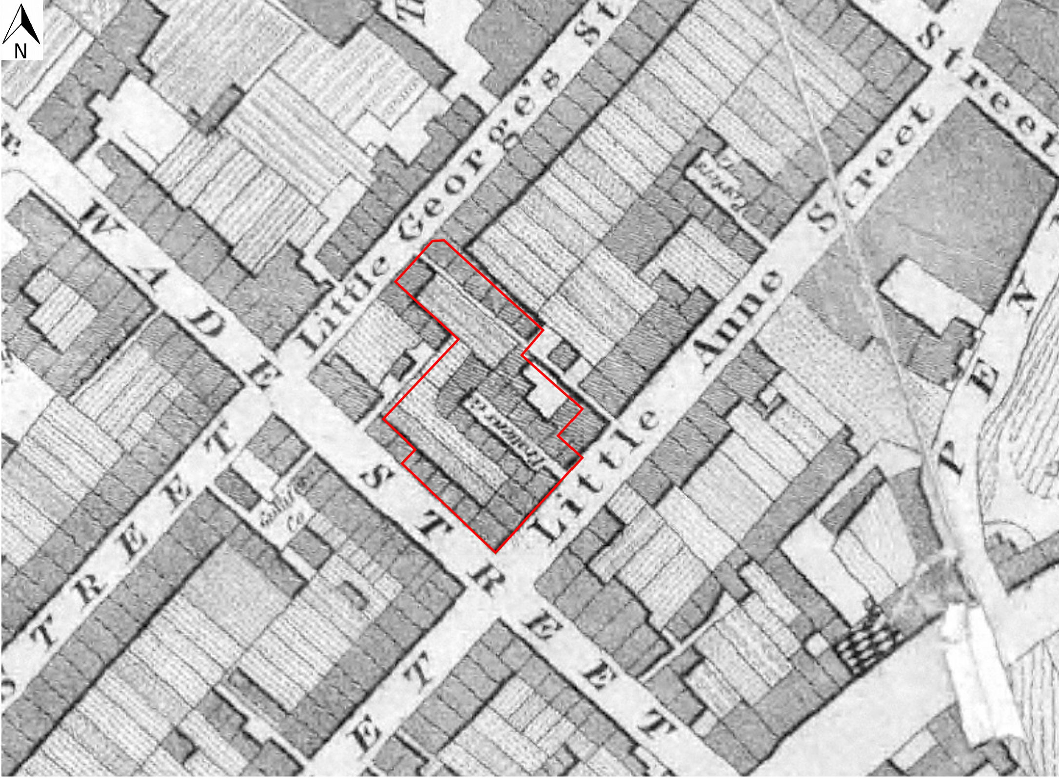
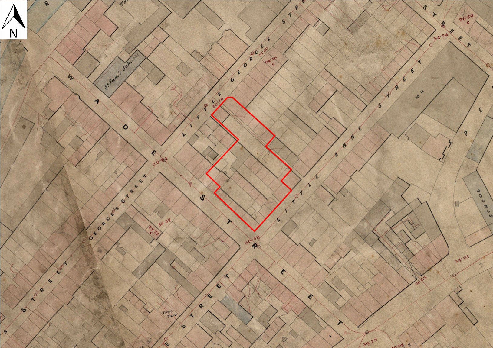
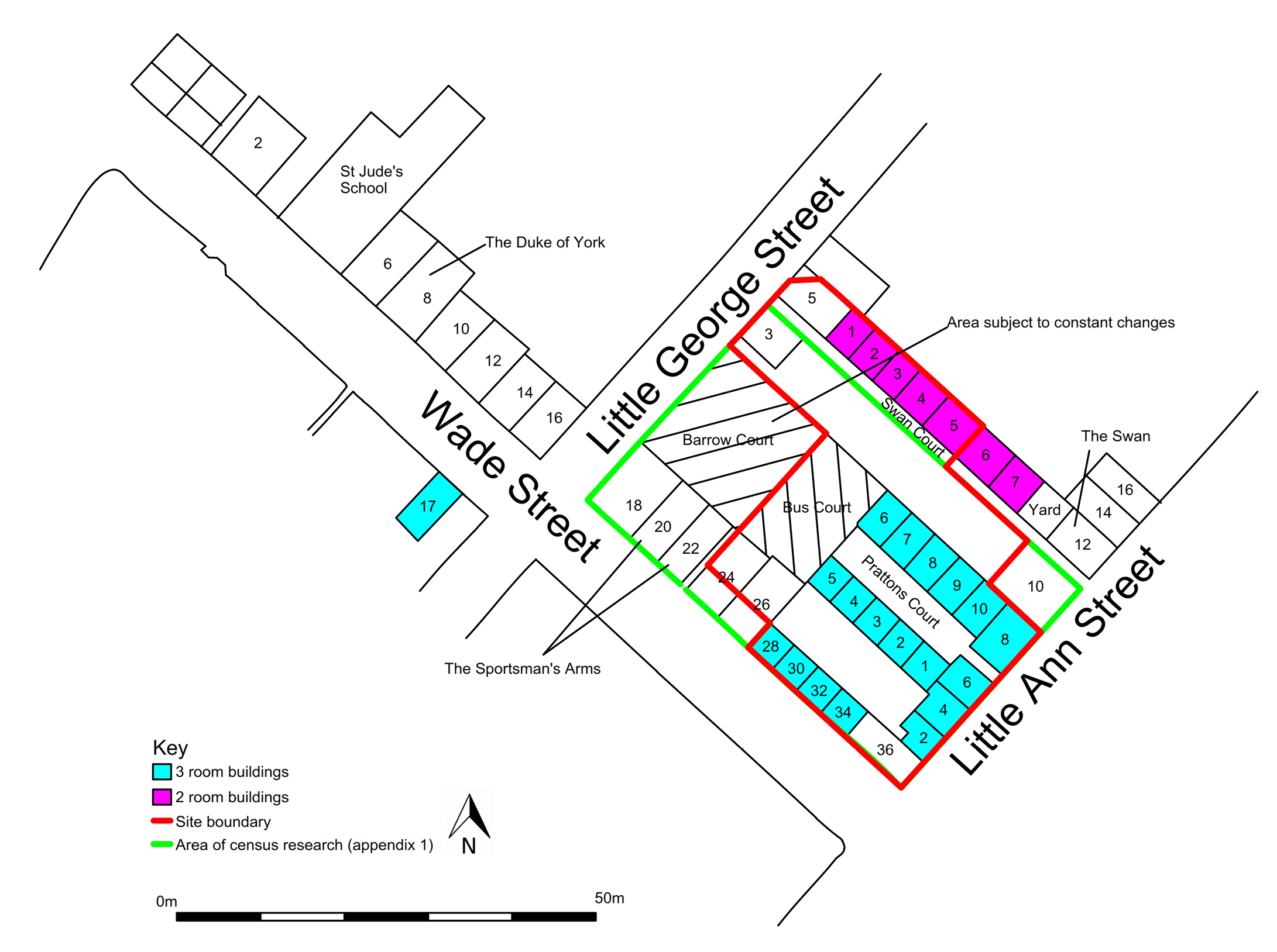
The property boundaries on historic maps indicate very strongly that to the north-west this wall is very likely to have run all the way to the Little George Street frontage, and it certainly formed the rear wall of all the properties on the north-eastern side of Pratten's Court (Smith and Erskine 2000; and see also Figure 4). It seemed clear even during the excavation that at one level or another, most of the other features identified within Area B took their cue from this primary spine wall, and it is likely to be of early 18th century date. Wall (1043) displayed numerous areas of later patching and intermittent rebuilds throughout the entire length that was exposed during the excavation, but there can be little doubt that it was both conceived and executed as a single, coherent structure. Its footings, explored in a series of sondages against both elevations, were cut slightly into the natural. There is a small possibility that wall (1043) was in existence before the advent of Wade's scheme, as a major pre-existing property boundary, and was retained, re-used, and continually repaired. The sandy, friable reddish-brown mortar, which was clearly the wall's original bonding material, may hint at a 17th century date, but this is highly problematic, and we are safer to suggest that the wall is more likely to have been a primary element of Wade's original scheme.
Phase 3, Area B, is represented by a whole series of deposits, identified in different locations, which had accumulated, or been dumped against wall (1043); see Figure 23 and Figure 24. Among these were (1158), (1126), and (1230); the finds from these respective deposits do not allow precision in terms of dating – the only finds from (1158), seen in a sondage at the south-western side of the wall, were two sherds of medieval North West Wilts ware, which were clearly residual (Appendix 2). Deposit (1126) contained a variety of late 17th/18th century ceramics. A dark, silty material (1230), revealed in a sondage on the north-eastern side of wall (1043), and butting against it, might possibly have been a remnant cultivation deposit. Although not entirely certain, it is likely that (1053), found at the base of a sondage excavated at the very south-eastern end of Area B, should probably be counted within this group, as a disturbed and redeposited natural substrate.
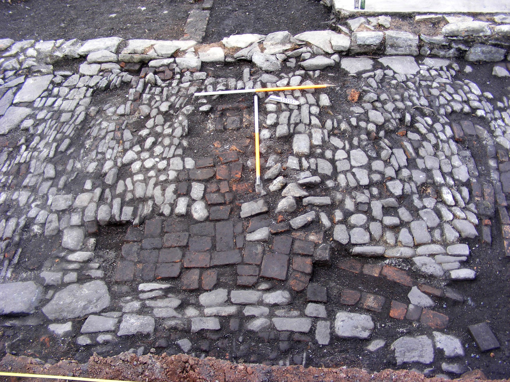
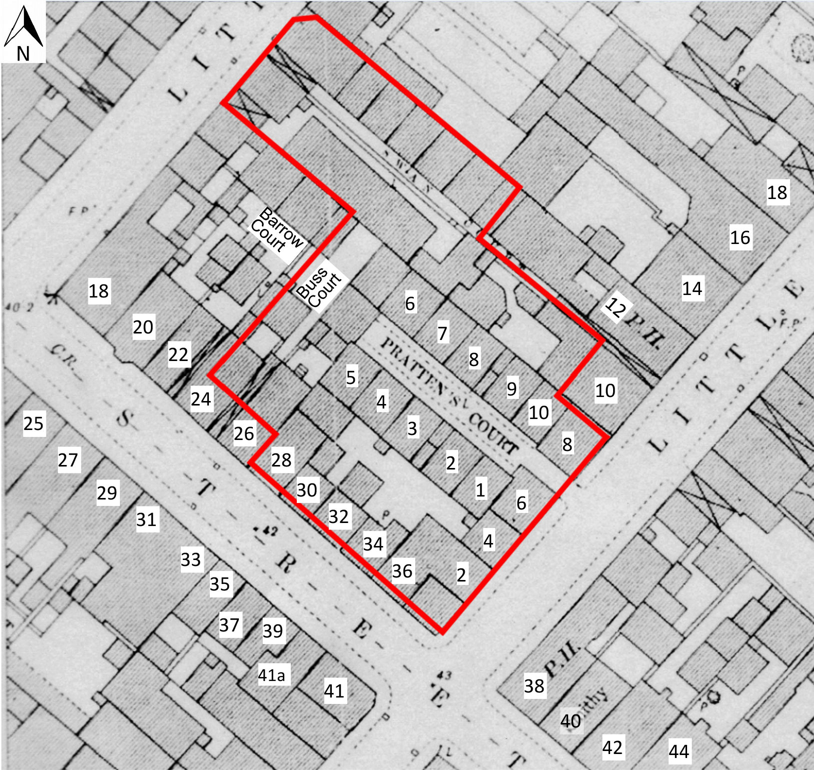
Phase 4. This included a number of features whose relationships, while sometimes not entirely clear, were likely to have been associated (see Figure 22). A single wall (1137) abutted and ran at right-angles off the north-eastern side of the main wall (1043). The low level at which this structure was found perhaps indicates an early phase of subdivision within the site; it did not appear to be matched, in terms of its structural affinities, by anything else within Area B. This phase also contained a remnant cobbled surface, (1061), which was subject to later brick repairs (1063 and 1062), and which contained at least two drains (1066 and 1067), almost certainly later insertions, possibly in Phase 5 (below). Wall (1137) may once have formed the north-western boundary to the cobbled surface. Historic map evidence appears to indicate that this surface was, at least by the late 19th century, inside a building. A substantial wall, with its own footings, seen only in the north-facing section of a sondage at the south-eastern end of this excavation area (1047/1048) butted against (1043) and at right angles to it. The nature of the mortar did not suggest that this was an especially early wall, and it is most likely to have been 19th century in date.
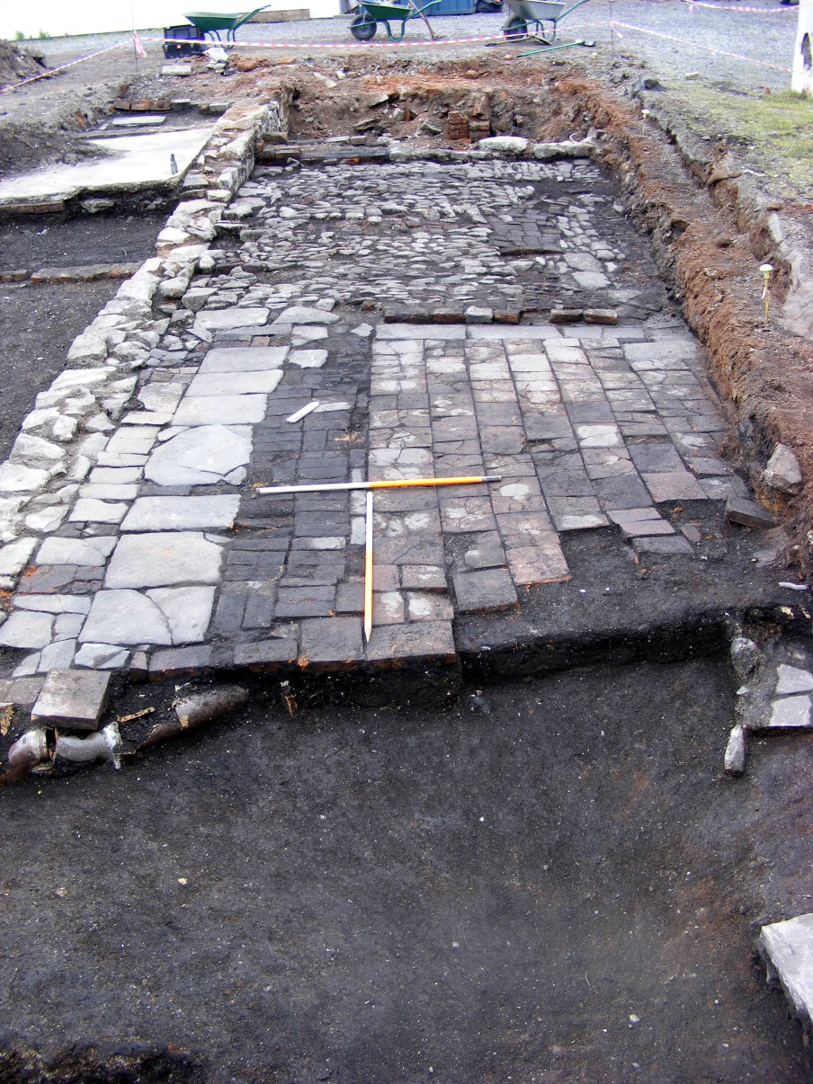
Phase 5 is marked by a hotchpotch of hard surfaces at the south-eastern end of Area B, consisting of flagstones (1058), rough ceramic tiles (1055) and bricks (1056); see Figure 22. The point of contact with main spine wall (1043) is represented by the flags in this area, which palpably respect the wall. Despite their widely varying nature, all these surfaces appear to be contemporary as they seemed to sit on the same bedding layer (1087/1088). Late 19th-century map evidence suggests very strongly that by that date these were external yard surfaces (Figures 7, 8 and 21). They are bounded on their north-western side by an insubstantial, but very distinct, angled wall (1059), which is also probably part of this phase and which can almost certainly be collated with map evidence. It is possible that these surfaces at the south-eastern end of Area B actually truncate cobbled surface (1061), the inference being that the cobbles may have originally extended much further to the south-east in this area. At the north-western end of the area, wall (1070), running south-west/north-east, and floor surfaces (1071) and (1072) which butt against its north-western side, are likely to be contemporary, and probably part of this same phase. It is possible, as at the south-eastern end, that wall (1070) had truncated cobbled surface (1061), but this could not be established with certainty. A drop of about 0.50m between (1061) and the surfaces (1071)/(1072) seems far too small to indicate a 'cellar', and may just arise from a slight drop in ground level towards the north-west. There is an indication of a return at the south-western end of wall (1070); it did not connect with the main spine wall (1043), but there was a quite deliberate gap that might possibly once have contained a doorway and short flight of steps down onto surfaces (1071) and (1072).
On the south-western side of the main spine wall (1043), there occurred a series of poorly built walls, constructed of a mixture of ill-laid rubble stone and brick, butting up to and running off at right-angles from it (Figure 22). These were (1200/1201), (1064/1100), (1074) and (1075). All appeared to be high up in the stratigraphic sequence, and two of them, (1064) and (1074) can be closely correlated with party walls of houses on the north-eastern side of Pratten's Court, as shown on the late 19th-century OS plan (Figures 8 and 21). If this is the case, then they are unlikely to be later than 1828, when Pratten's Court is identified by name, apparently in its final form, on the first edition of Ashmead and Plumley's map of Bristol (Figure 4).
Phase 6. On the north-eastern side of wall (1043), wall (1122), seems deliberately to have been intended to block the gap between walls (1070) and (1043); see Figure 22. Because there is no physical relationship between these walls and the floor surfaces on the north-western side of wall (1137), already noted ((1071) and (1072)), it is not possible to say for certain whether they are part of the same phase; they may be, or the time gap between them may be so short as to make them effectively contemporary. The fireplace (1140) in the south corner of wall (1070) was of extremely rough construction, and seems clearly to have been a later addition to that wall.
Browse via image gallery (Figures 27-30)
1 / 4
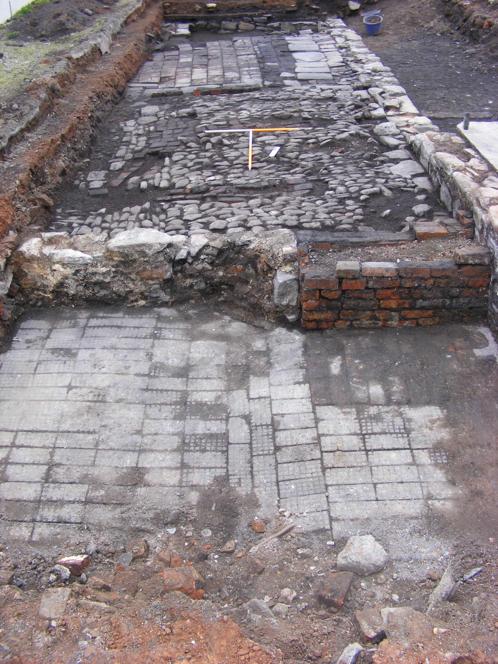
Figure 27: General view of Area B, nearing full excavation. Brick floor (1072) in foreground. The scales rest on a cobbled surface (1061) and associated brick drains. Other flagstone and brick surfaces in background. Together these features probably represent surfaces related to Swan Court. Note especially main 'spine' wall (1043) in top right of frame. View to south-east. Scales: 2×1m
2 / 4
Figure 28: General view of Area B, showing surfaces associated with Swan Court. Main 'spine' wall (1043) runs down left-hand side of frame. View to north-west. Scales: 2×1m
3 / 4
Figure 29: Detail of cobbled surface (1061), with brick drains (1067) in foreground, and (1066) on right-hand side of frame. Main 'spine' wall (1043) in background. View to south-west. Scales: 2×1m
4 / 4
Figure 30: Section through deposits on south-west side of main 'spine' wall (1043). The wall, with its footing, is seen on the right-hand side of the frame. View to north-west. Scales: 2×1m. Compare with Figure 23
Internet Archaeology is an open access journal based in the Department of Archaeology, University of York. Except where otherwise noted, content from this work may be used under the terms of the Creative Commons Attribution 3.0 (CC BY) Unported licence, which permits unrestricted use, distribution, and reproduction in any medium, provided that attribution to the author(s), the title of the work, the Internet Archaeology journal and the relevant URL/DOI are given.
Internet Archaeology content is preserved for the long term with the Archaeology Data Service (ROR). Help sustain and support open access publication by donating to our Open Access Archaeology Fund.