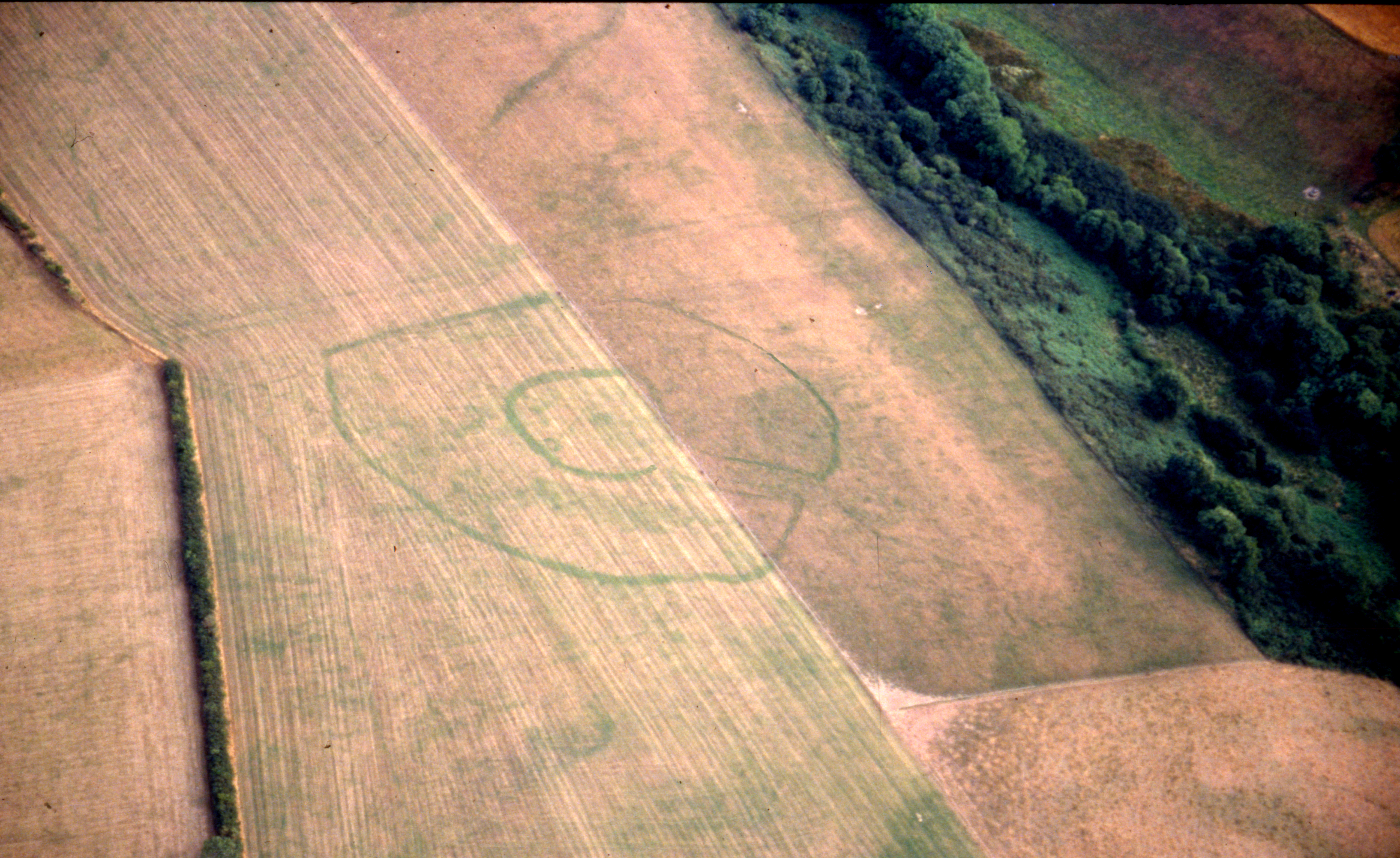
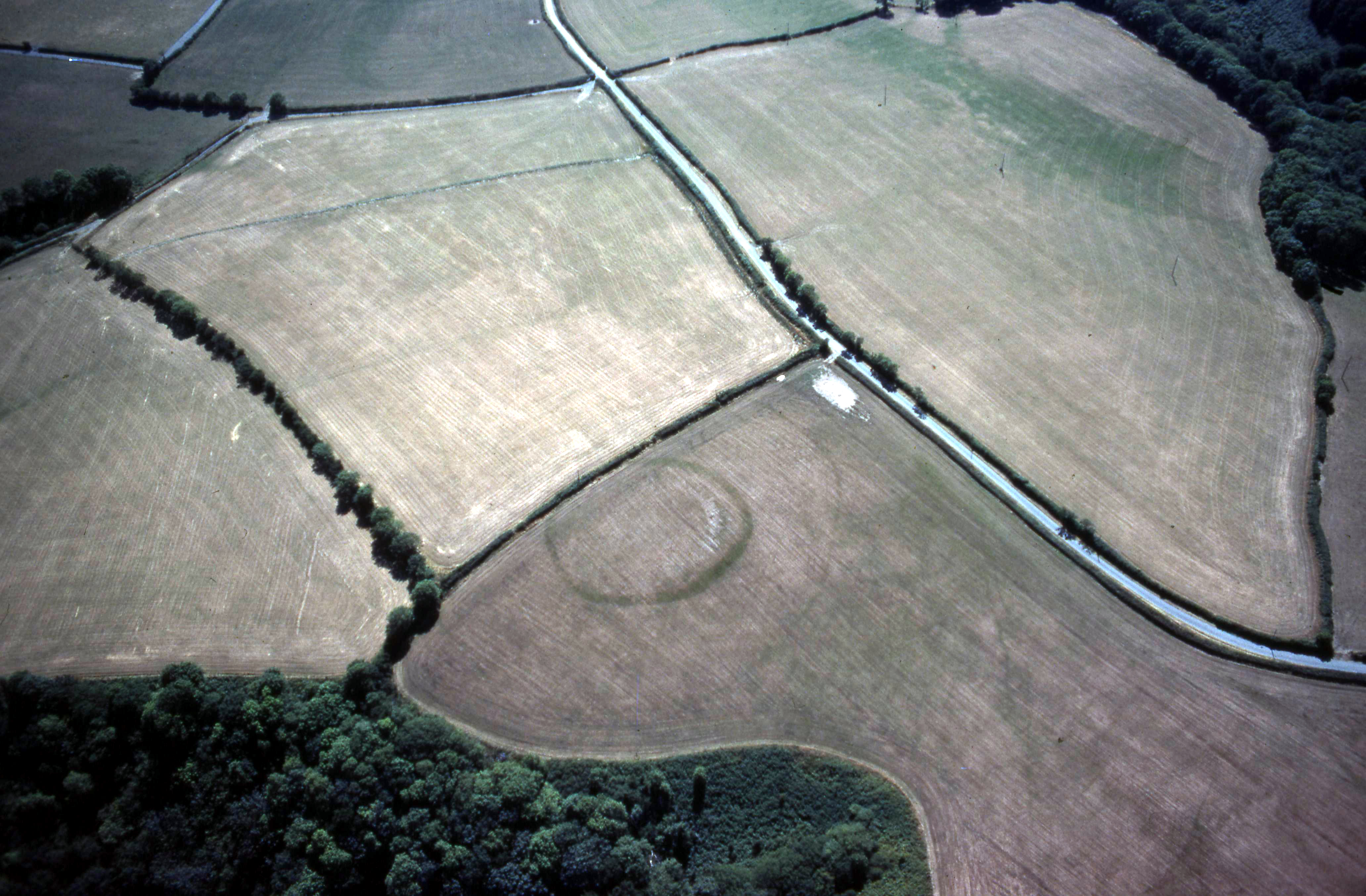
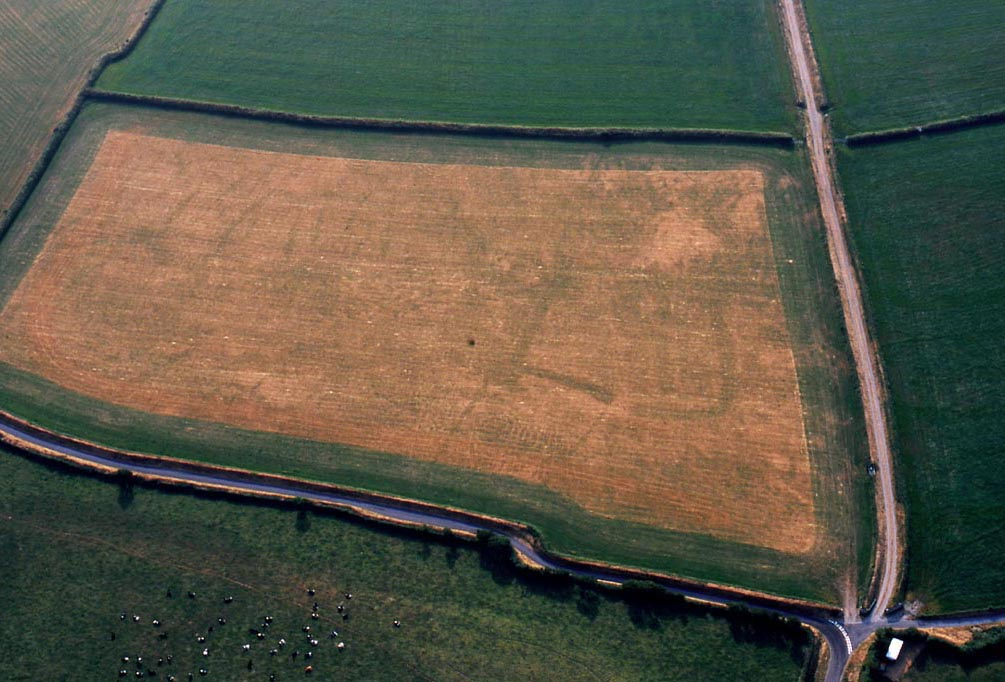
Up to about 30 years ago the late prehistoric settlement pattern of south Ceredigion (Cardiganshire) was poorly understood. Evidence was limited, consisting, as it did, of a few hillforts, coastal promontory forts and small earthwork enclosures. Aerial photography has transformed our knowledge of the late prehistoric settlement pattern of south-west Wales, and particularly of south Ceredigion. Pioneering work by St Joseph of Cambridge University during the exceptionally dry summer of 1976 identified the first cropmark sites in this area. This work was expanded during the dry summers of the mid 1980s and 1990s. Approximately 60 defended enclosures have now been identified in south Ceredigion — all appearing as cropmarks. These sites are unusual in that over half are rectangular or sub-rectangular in shape (Figure 13). This is in contrast to the rest of south-west Wales where 90 per cent of sites are oval or irregular in shape (Figures 5a and 5b). It was considered possible that these sites are older than superficially similar sites in south-west Wales, and that they are reduced to cropmarks because they have been subjected to several thousand years' more erosion than Iron Age enclosures. The large number of uncommon rectangular sites in the group supported this possible earlier date. An excavation programme by Dyfed Archaeological Trust in partnership with the University of York, initiated in 2004, to study these south Ceredigion sites, plus some in north Pembrokeshire, revealed that they are indeed Iron Age settlements (Murphy and Mytum 2011).
Since cropmark sites have experienced intensive and long-term cultivation it is reasonable to assume that only large archaeological features, such as deep ditches, are likely to survive, and that small, vulnerable features would have been destroyed; investigation proved that this is not the case. Geophysical survey of several sites rapidly revealed the likelihood that small, vulnerable features, such as pits, postholes and roundhouse gullies, did survive, all of which are characteristic of Iron Age settlements. The excavation of Troedyrhiw rectangular enclosure in 2005 followed on from a geophysical survey. The builders had gone to an enormous effort to construct the enclosure, as demonstrated by the 4m wide and 3m deep, rock-cut defensive ditch. Pottery from the upper fills of the ditch showed that the site had continued in use into the Roman period, and analysis of charcoal and other remains demonstrated that the inhabitants had been engaged in a mixed farming economy — growing cereals and raising livestock. It was not possible to identify buildings in the small area excavated at Troedyrhiw.
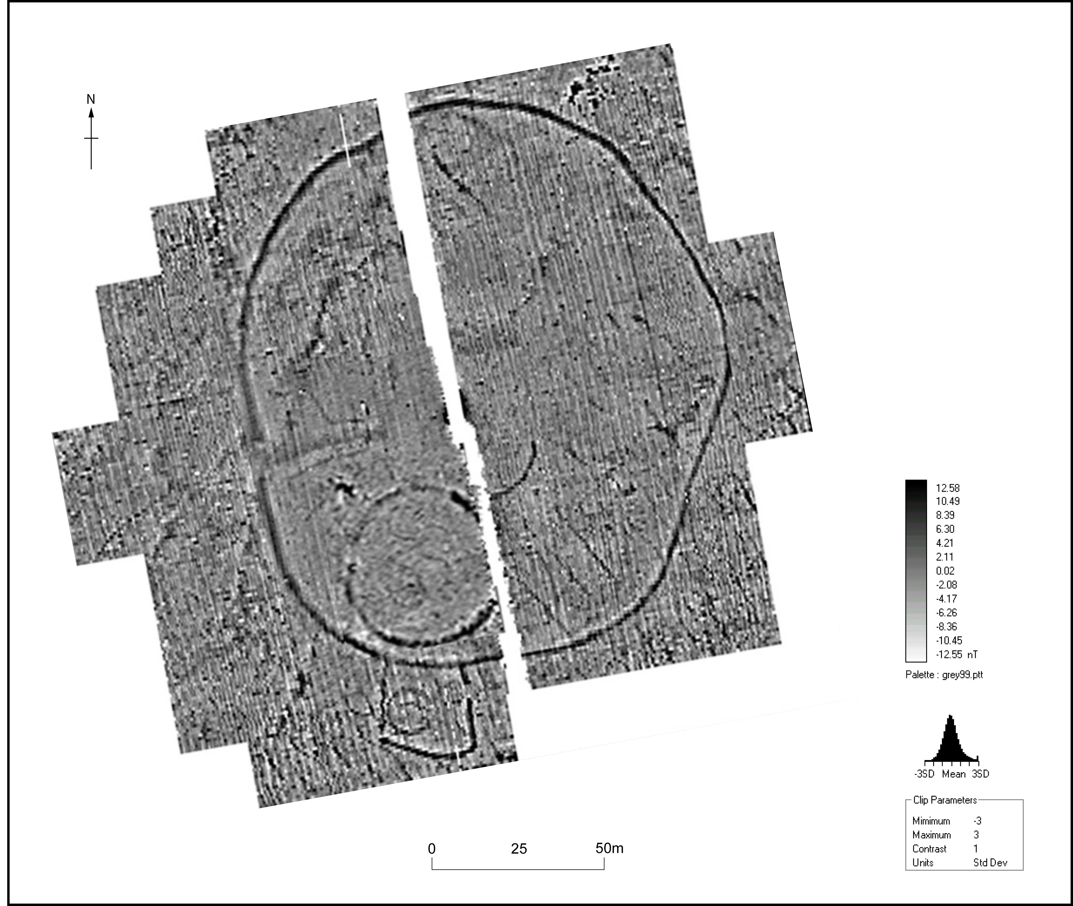
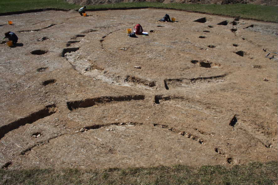
This is in contrast to the second site investigated, Ffynnonwen, in 2006 (Figures 9 and 10). Here, guided by a geophysical survey, four roundhouses and two four-post/six-post structures were discovered in the interior of a circular enclosure surrounded by a large oval enclosure. This suggests a settlement of four extended families, a total population, perhaps, of 25-40 people. In one short section the builders had not been able to dig the enclosure ditch into the very hard bedrock, leaving it just a few centimetres deep. This clearly has interpretation implications — did these large ditches have a practical defensive function or were they more symbolic. The geophysical survey detected a small rectangular annexe containing a roundhouse attached to the south side of the outer oval enclosure — an overspill settlement from the circular enclosure - but no evidence of houses within the oval enclosure itself, suggesting this area was reserved for other purposes. The Ffynnonwen excavations highlight the problem of artefacts, or rather the lack of them. All that was found was a fragment of a glass bead, and a spindlewhorl made from a piece of Roman pottery from the upper fill of the enclosure ditch.
Paucity of artefacts was also a trait highlighted at Berry Hill in 2007, the third site investigated. Prior to excavation it was considered that Berry Hill inland promontory fort, lying on the Nevern Estuary, less than a kilometre from Newport Beach in Pembrokeshire, was one of the most likely sites in west Wales to find imported prehistoric, Roman and perhaps post-Roman pottery and other artefacts. However, no dateable artefacts were found during the excavation. One explanation for this is the possibility that the fort was unfinished: the defensive ditch was incomplete, the fort entrance was of one simple and short-lived phase, and there was no evidence for buildings within the fort.
Internet Archaeology is an open access journal based in the Department of Archaeology, University of York. Except where otherwise noted, content from this work may be used under the terms of the Creative Commons Attribution 3.0 (CC BY) Unported licence, which permits unrestricted use, distribution, and reproduction in any medium, provided that attribution to the author(s), the title of the work, the Internet Archaeology journal and the relevant URL/DOI are given.
Terms and Conditions | Legal Statements | Privacy Policy | Cookies Policy | Citing Internet Archaeology
Internet Archaeology content is preserved for the long term with the Archaeology Data Service (ROR). Help sustain and support open access publication by donating to our Open Access Archaeology Fund.