Table 1: The relation of roundhouse size to altitude
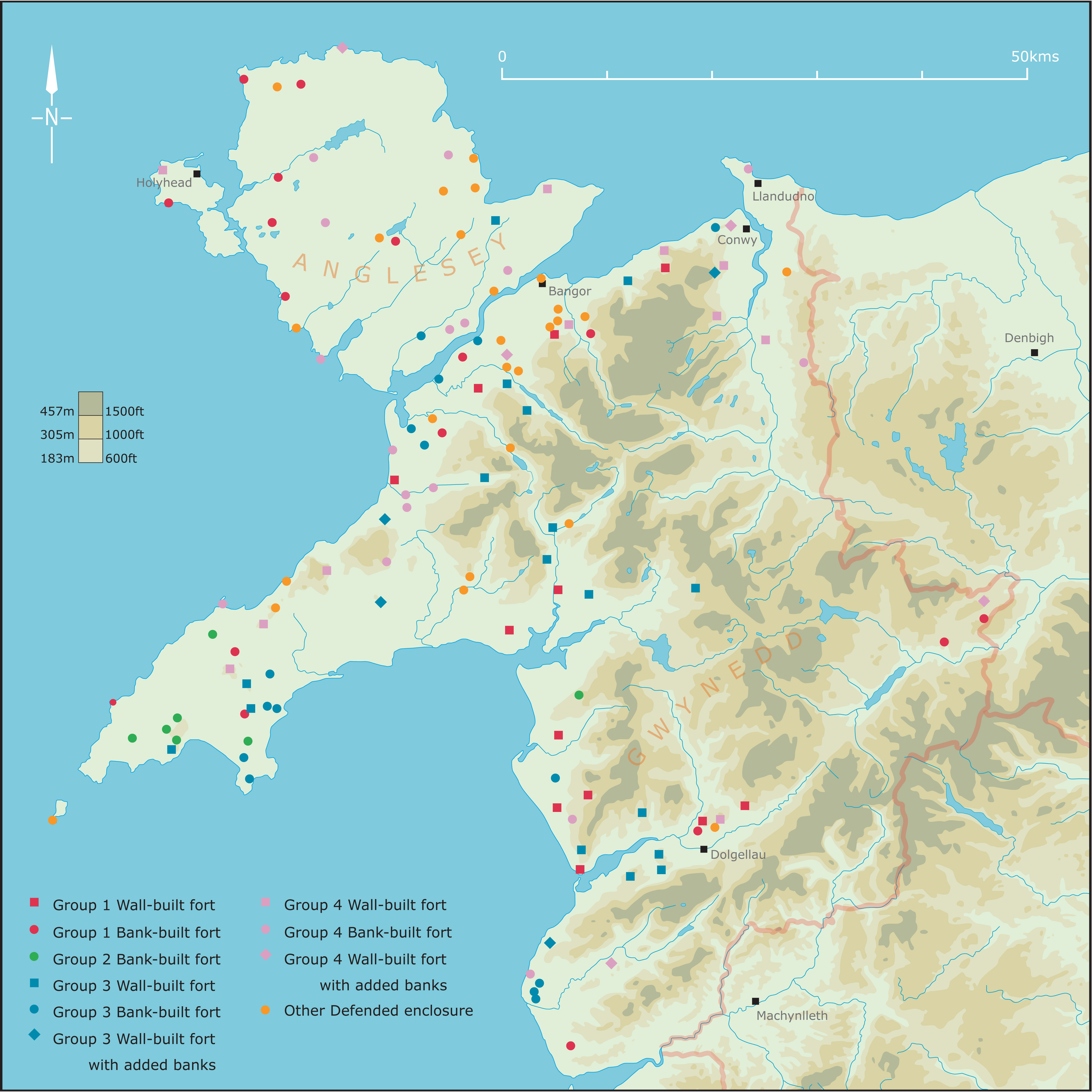
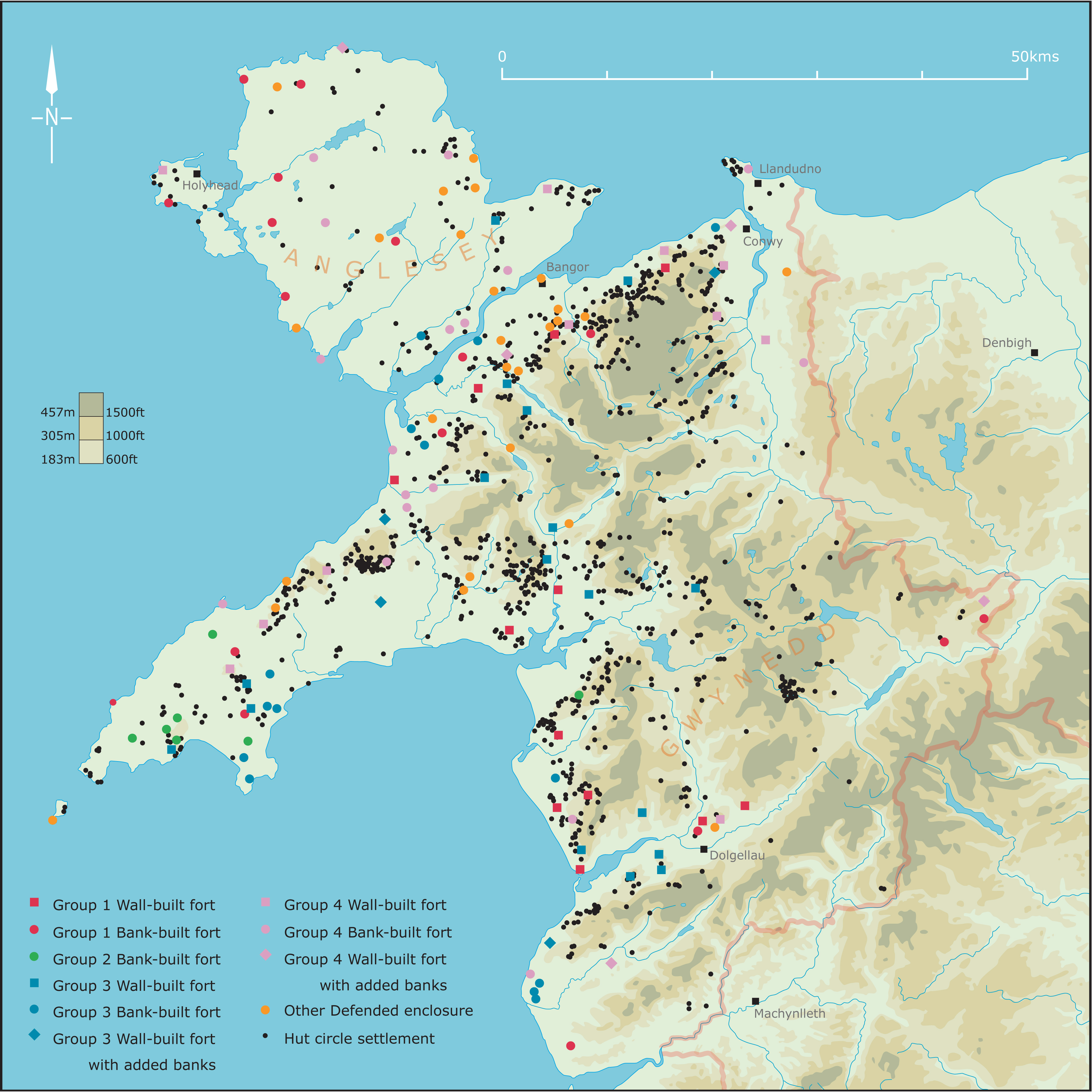
Figure 1: The distribution of all hillforts and defended enclosures in north-west Wales (Image: Gwynedd Archaeological Trust)
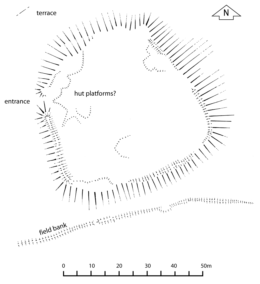
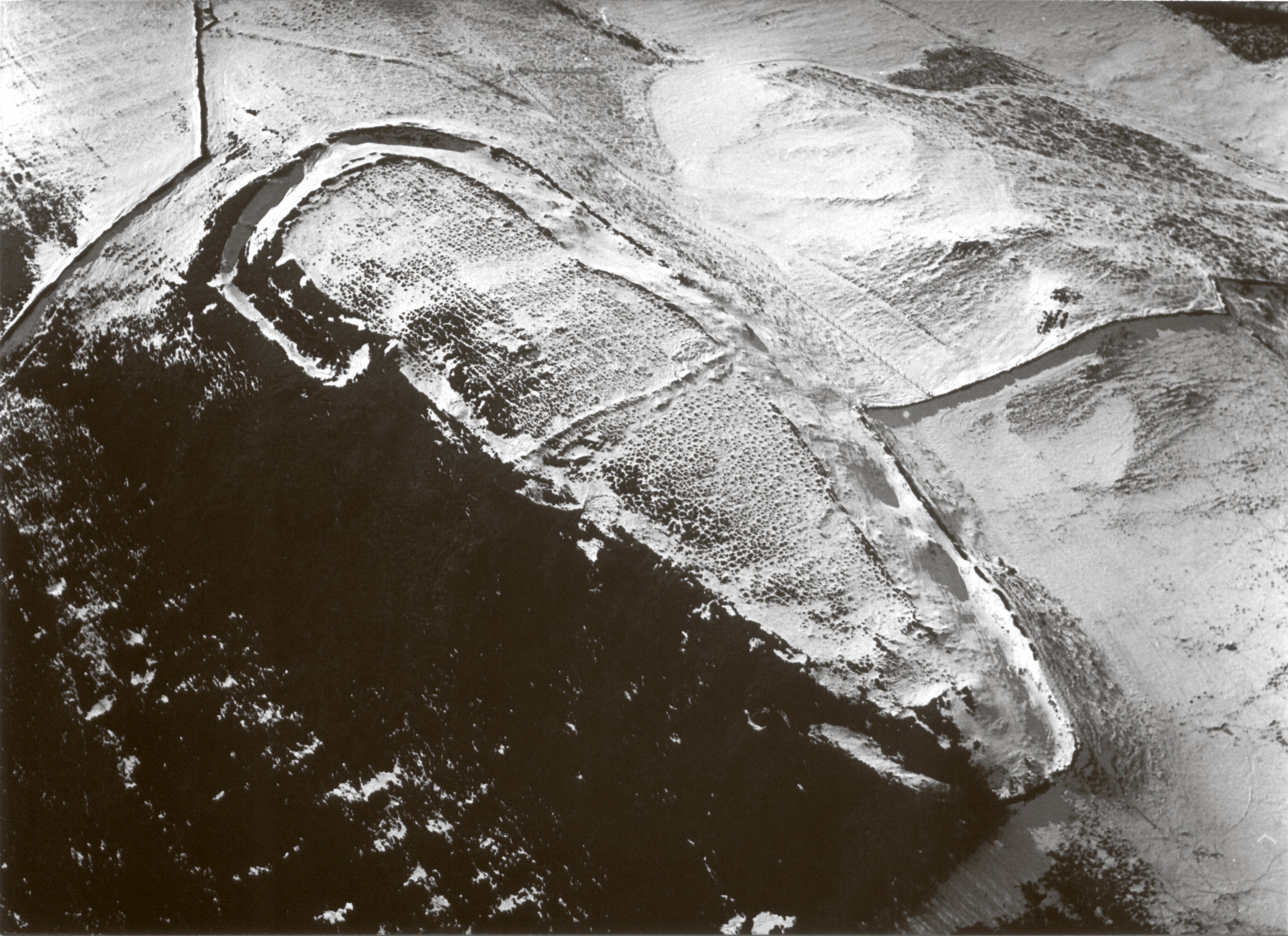
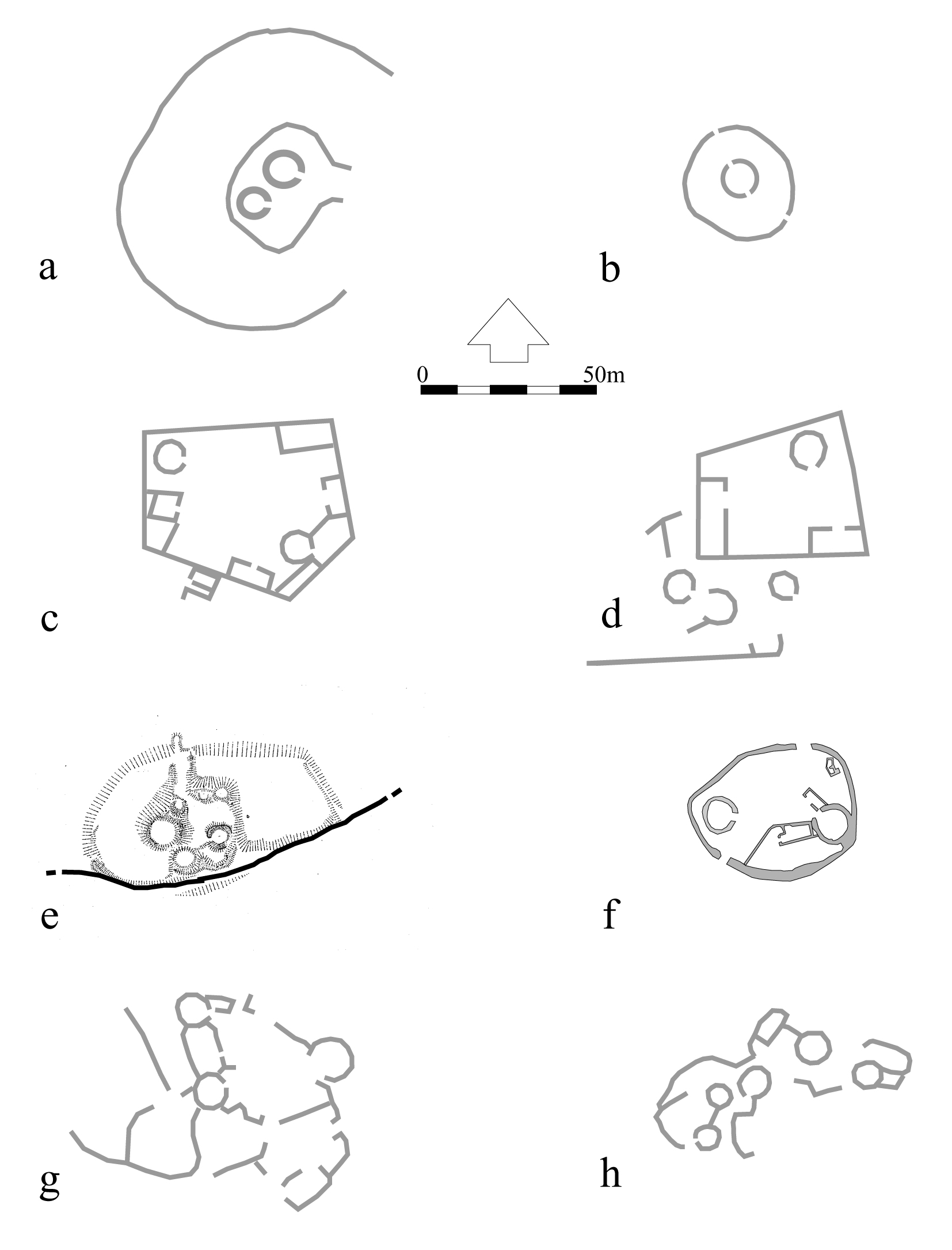
Figure 2: Foel Caethle, Meirionnydd, a small, possibly early hillfort (Image: Gwynedd Archaeological Trust)
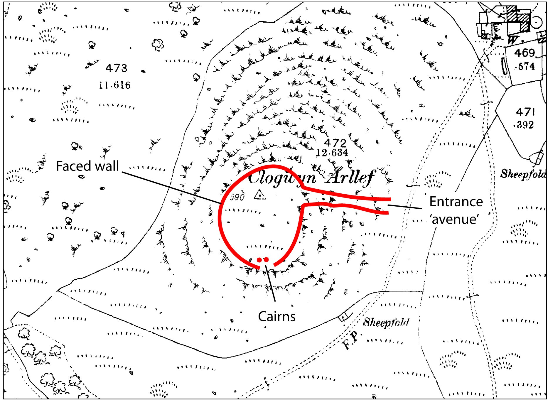
Figure 3: Clogwyn Arllef, Meirionnydd, a small, possibly early hillfort (OS with annotations)
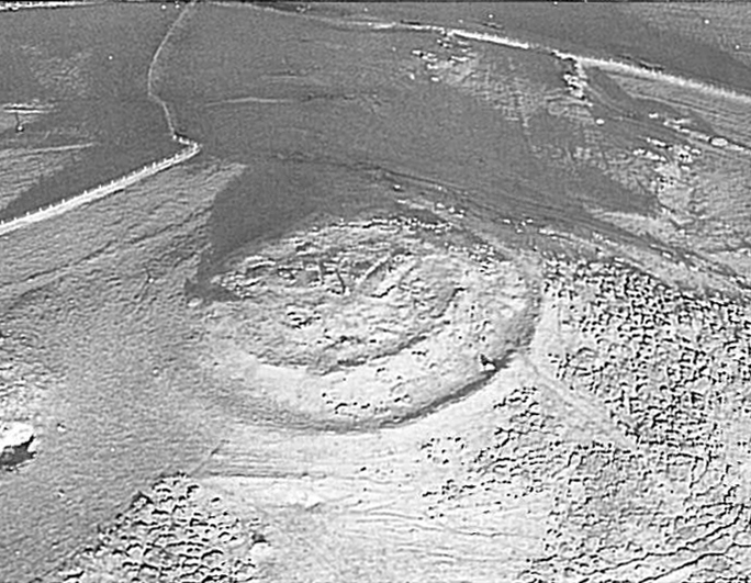
Figure 4: Castell Odo, Llŷn (Image: Gwynedd Archaeological Trust)
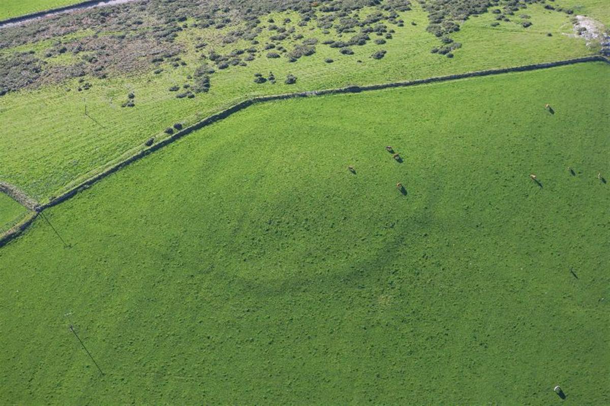
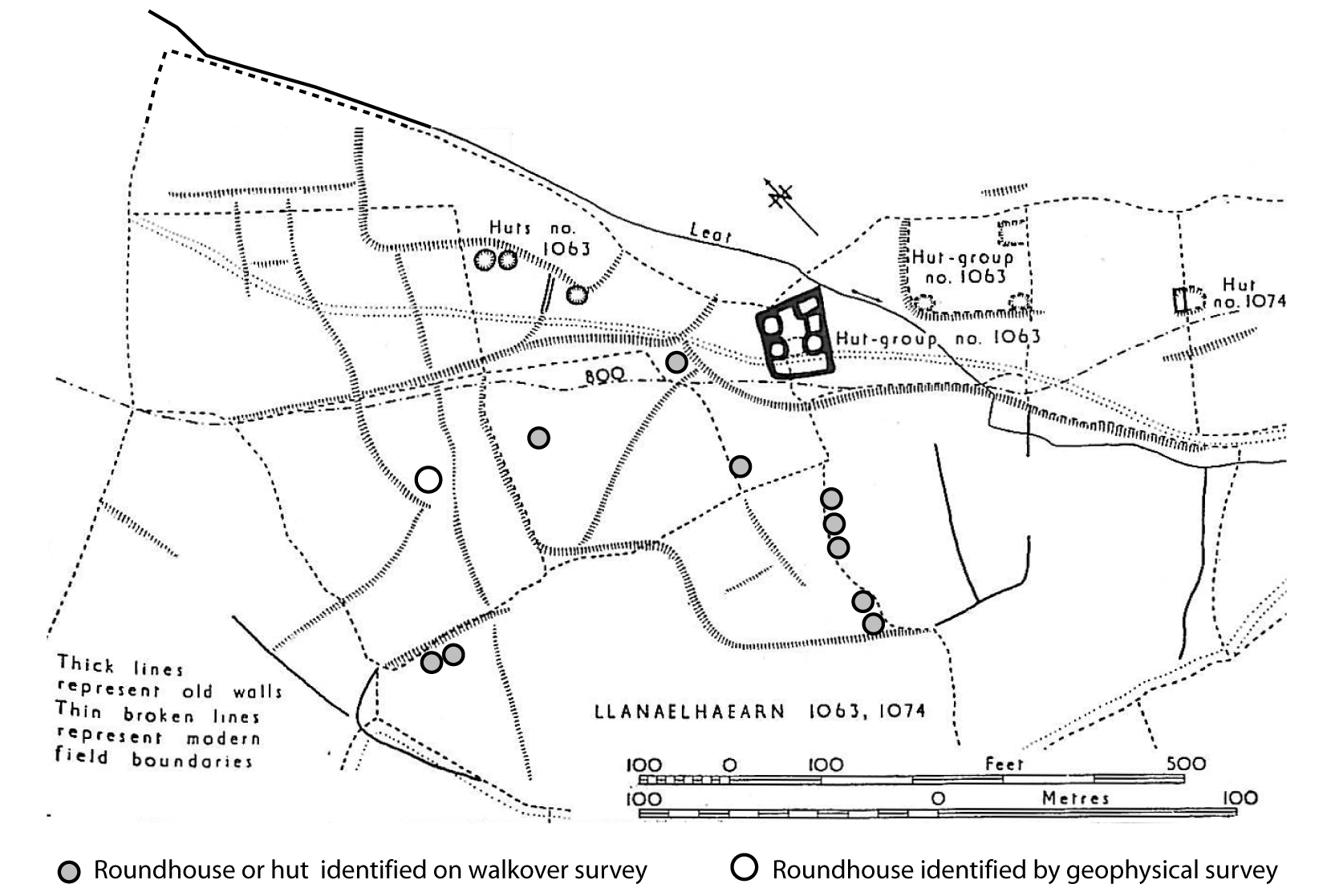
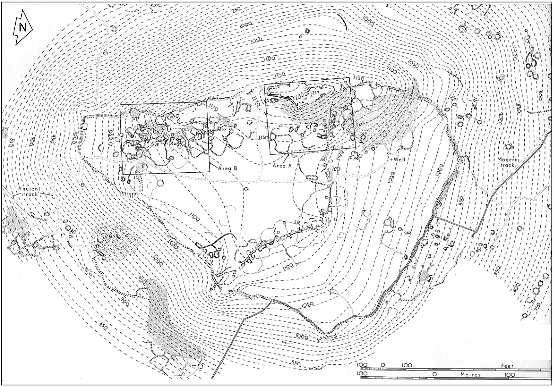
Figure 5: Meillionydd enclosure (Image: RCAHMW)
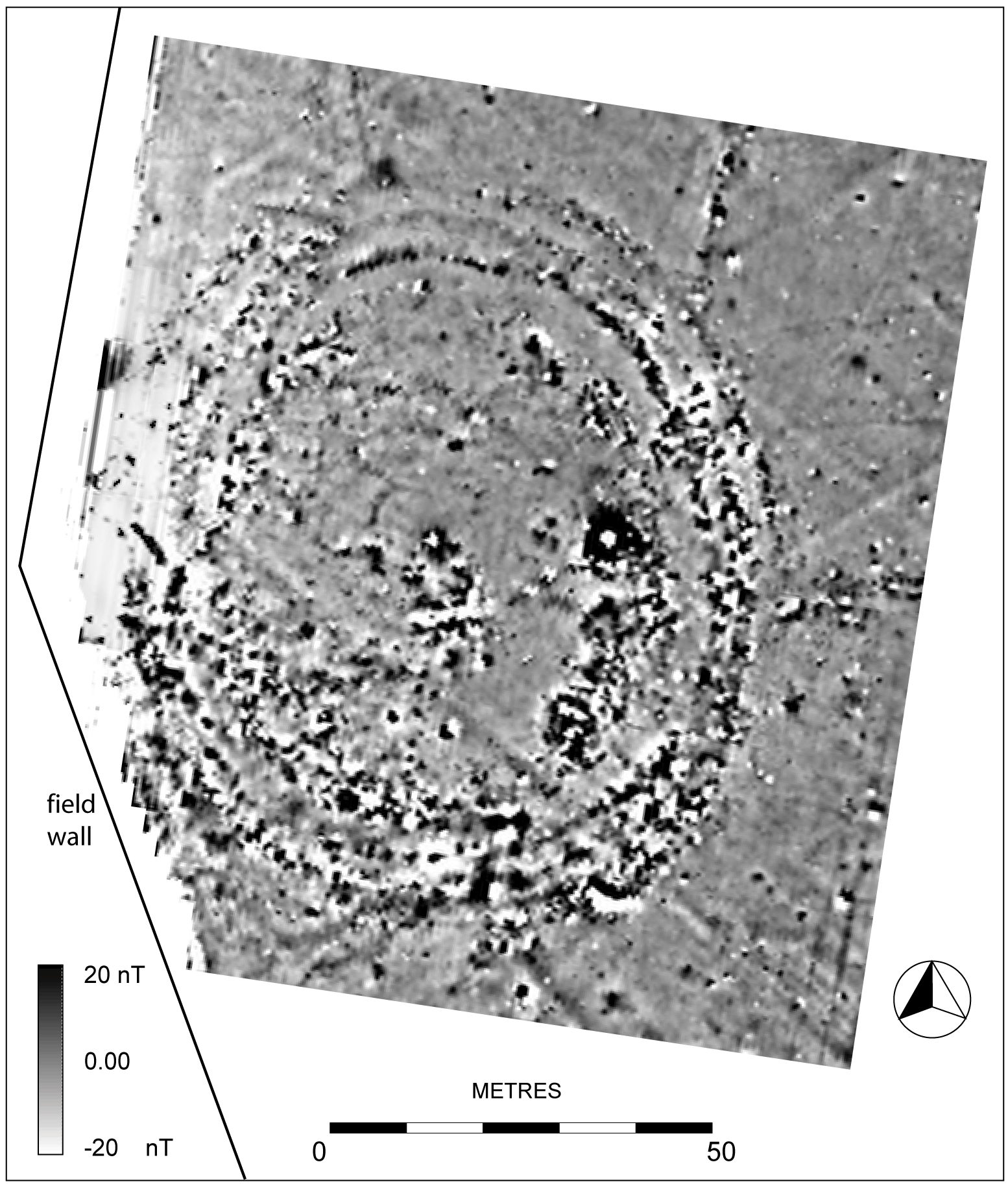
Figure 6: Meillionydd, Llŷn. Magnetometer survey (Image: Gwynedd Archaeological Trust).
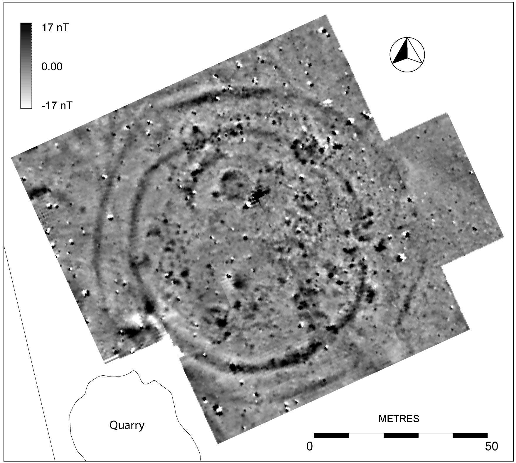
Figure 7: Bryn Rhydd, Llŷn. Magnetometer survey (Image: Gwynedd Archaeological Trust).
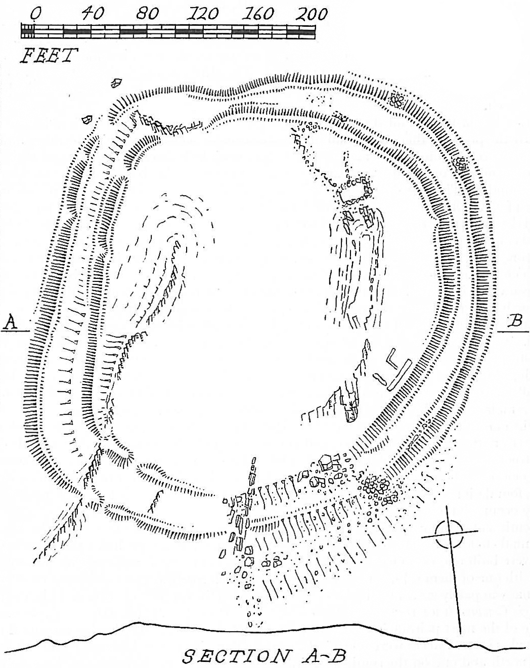
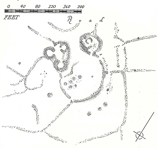
Figure 8: Moel Goedog, Meirionnydd, Llŷn (after Bowen and Gresham 1967)
Figure 9: Castell y Gaer, Llangelynin, Meirionnydd (Image: Gwynedd Archaeological Trust)
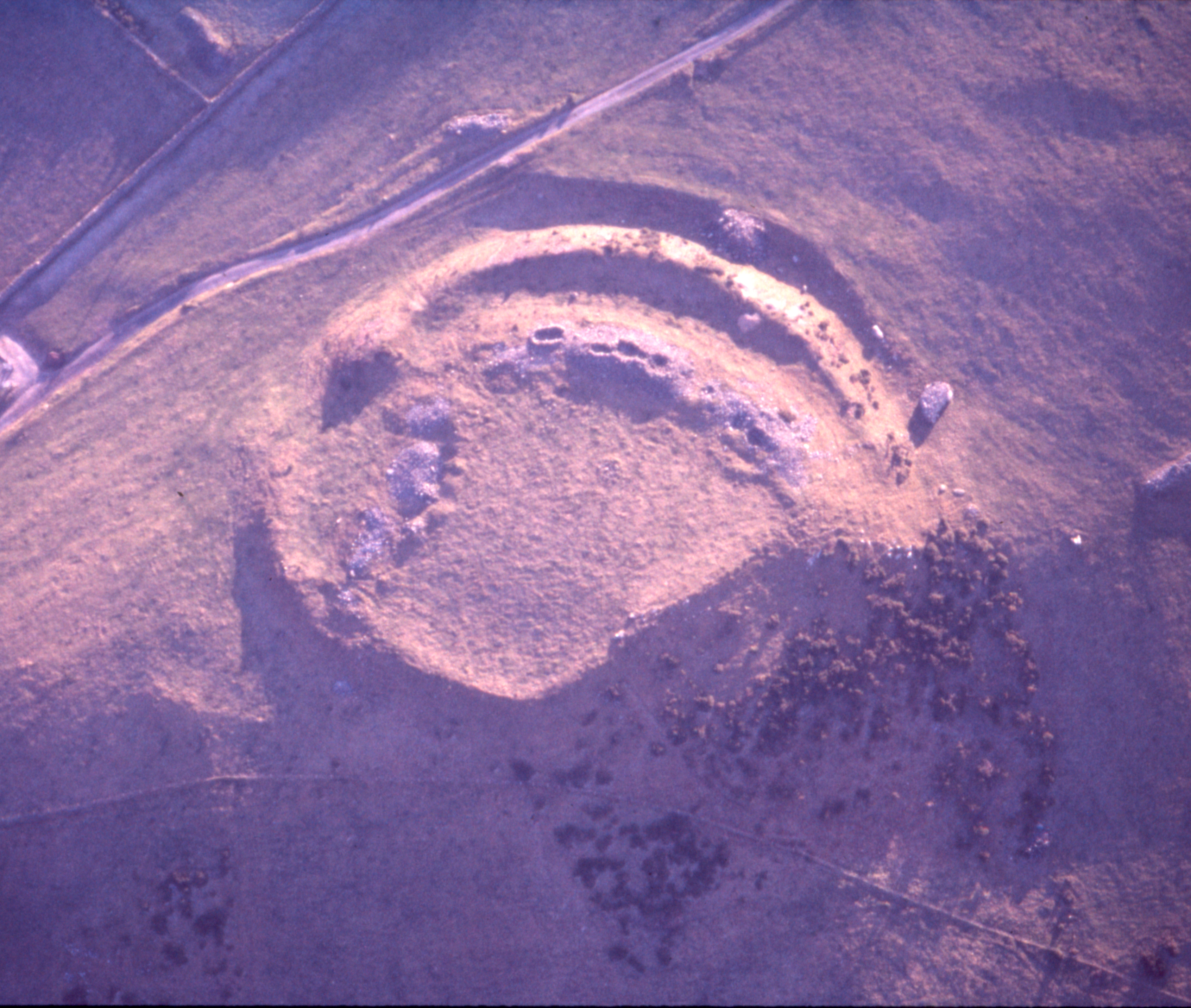
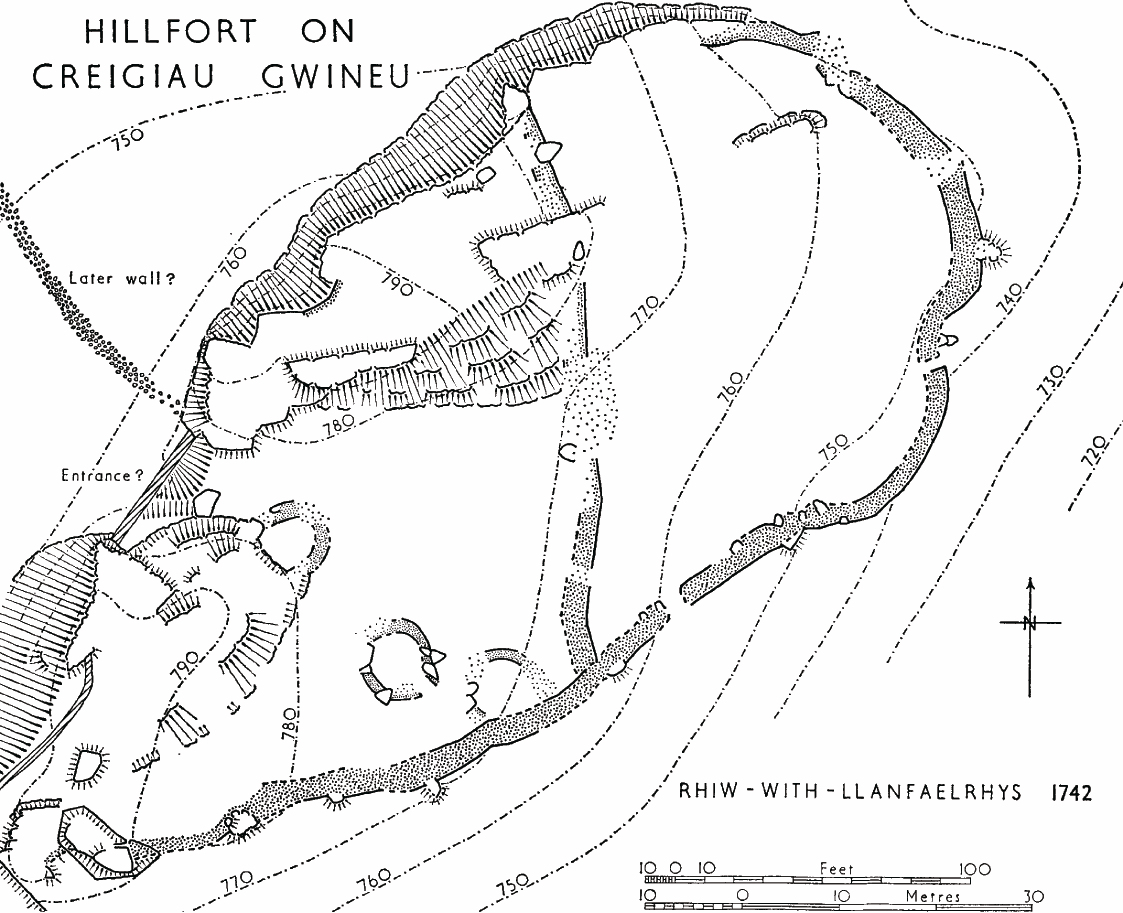
Figure 10: Creigiau Gwineu, Rhiw, Llŷn (RCAHMW 1964)
Figure 11: Caer y Twr, Holyhead, Anglesey (Image: Gwynedd Archaeological Trust)
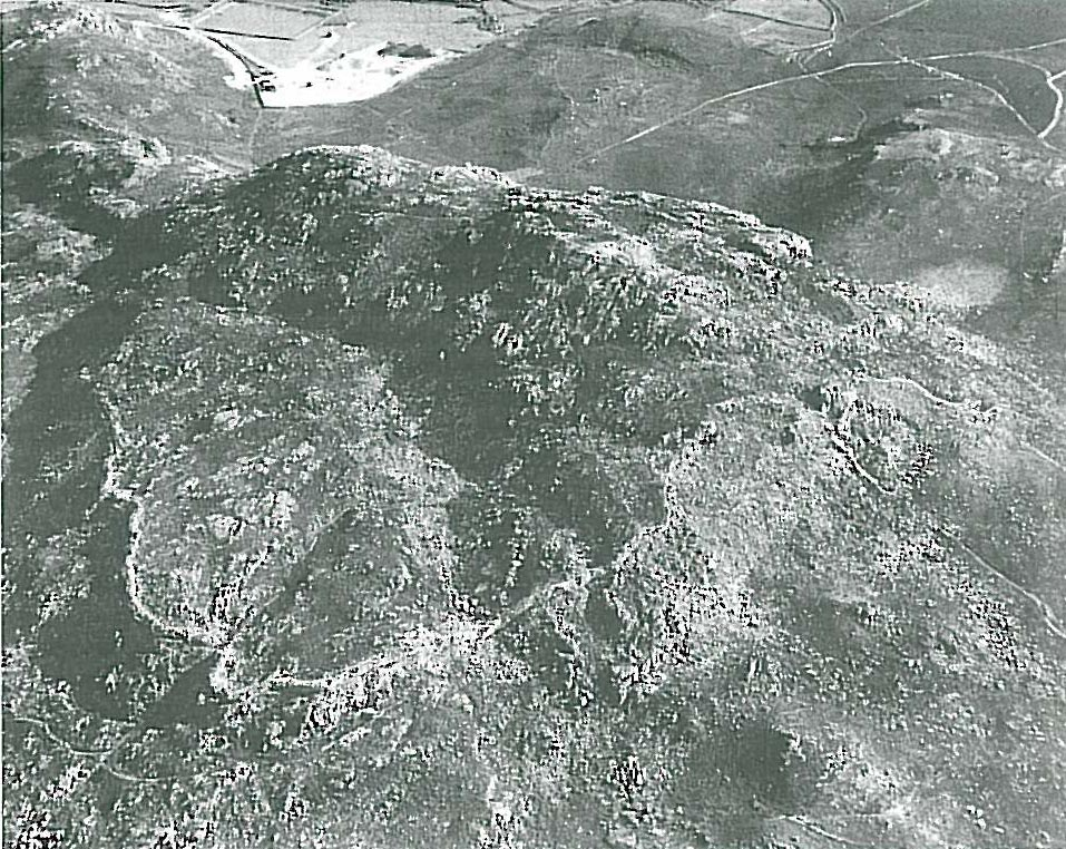
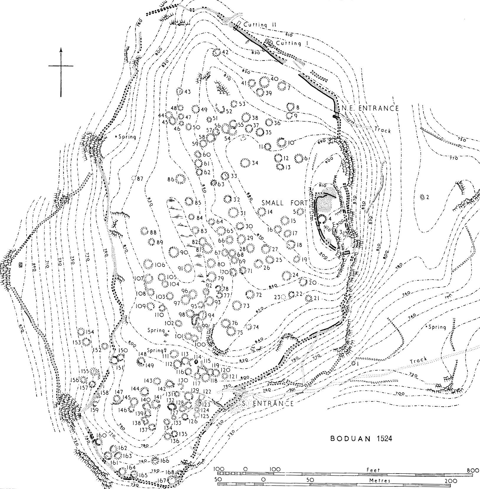
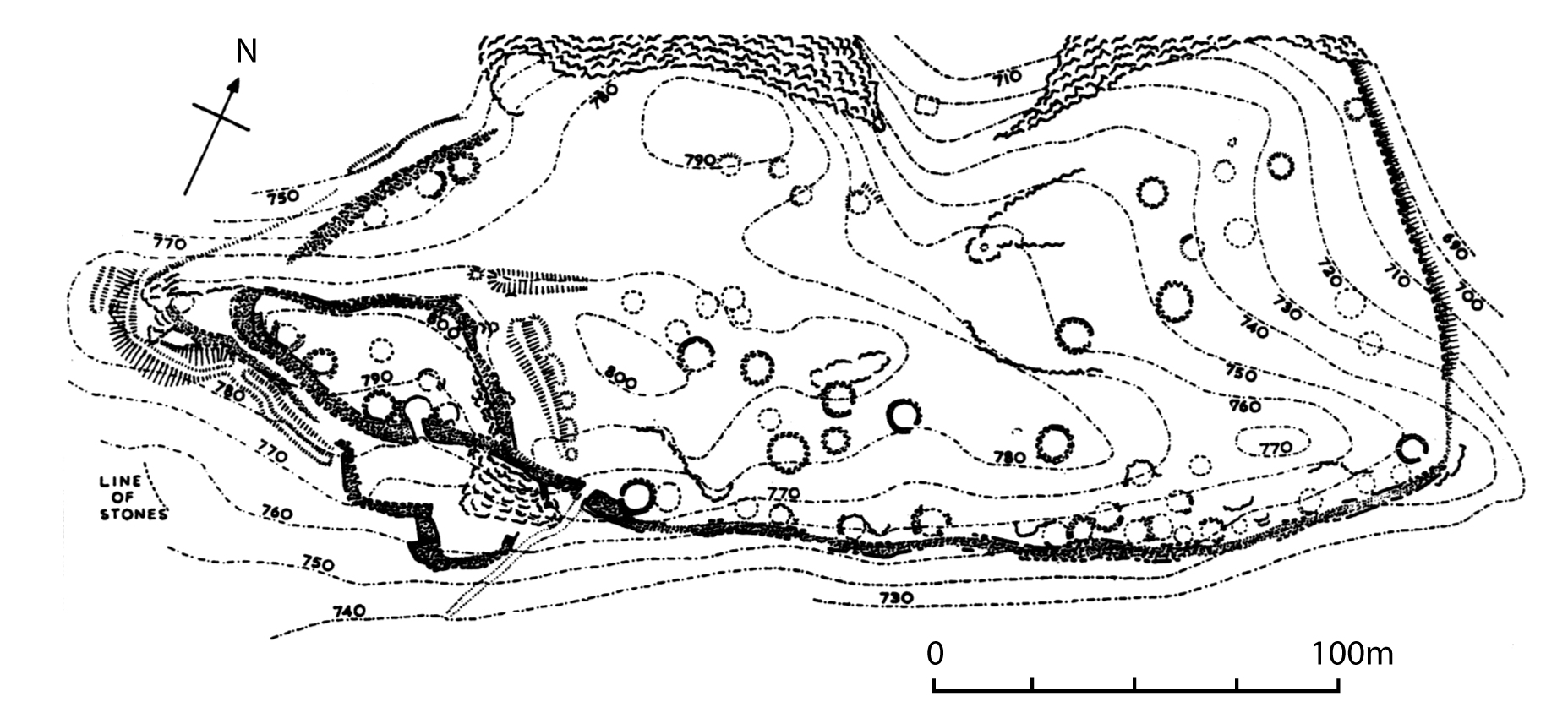
Figure 12: Garn Boduan, Nefyn, Llŷn (RCAHMW 1964)
Figure 13: Caer Euni, Meirionnydd (Image: Clwyd-Powys Archaeological Trust, 86-MB-107)
Figure 14: The distribution of all known defended enclosures compared to that of all known hut-circle settlements in north-west Wales
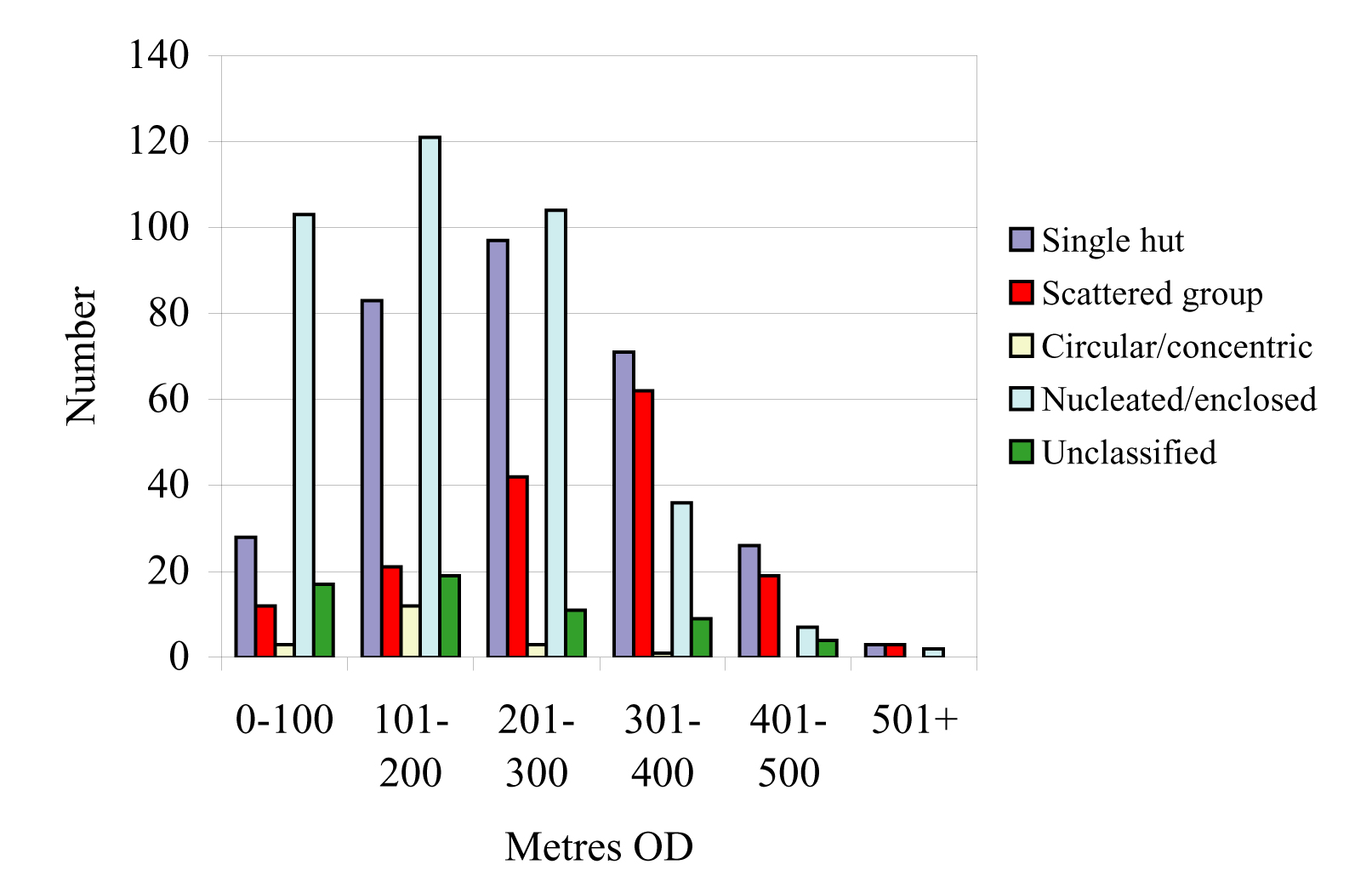
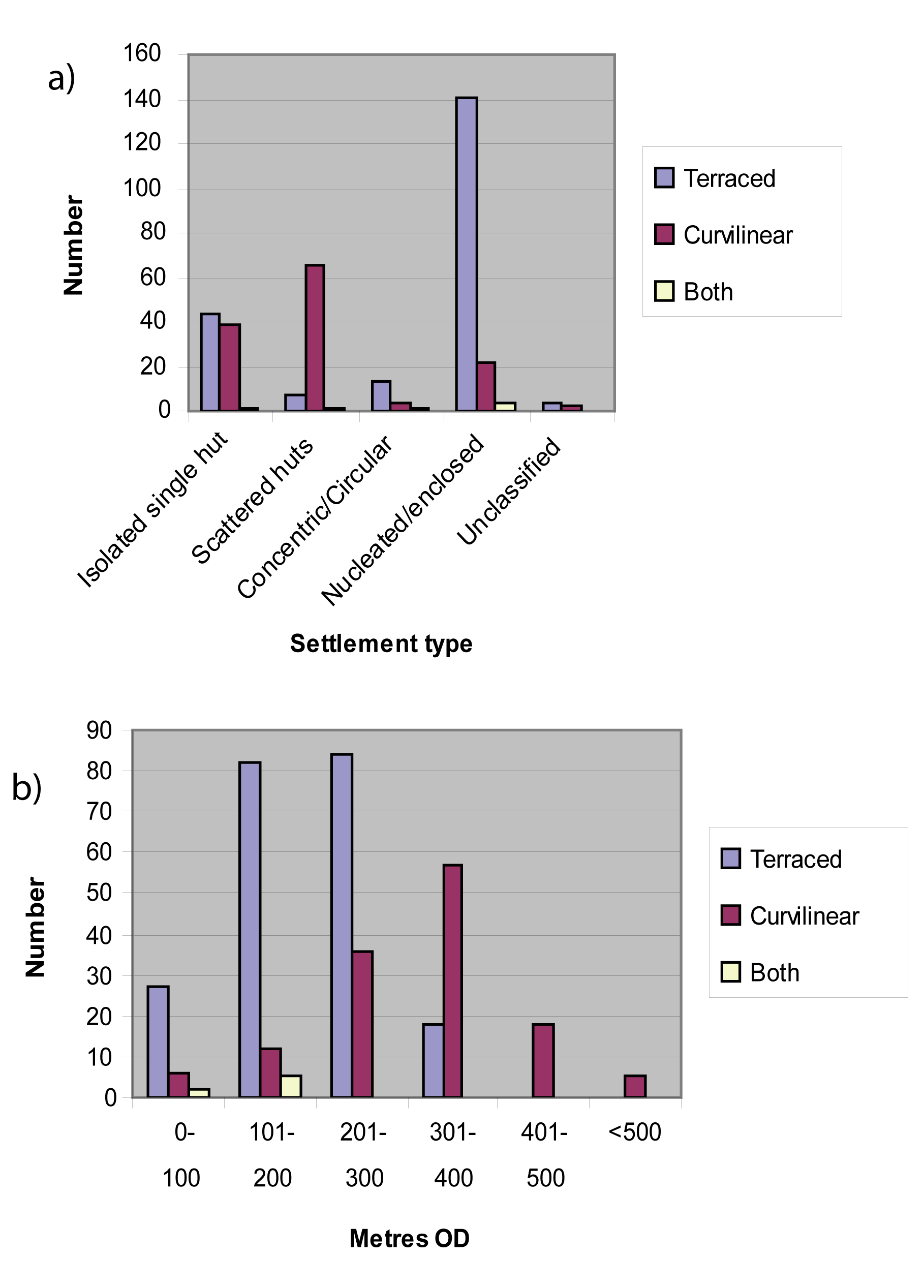
Figure 15: The distribution of all settlement types in relation to altitude
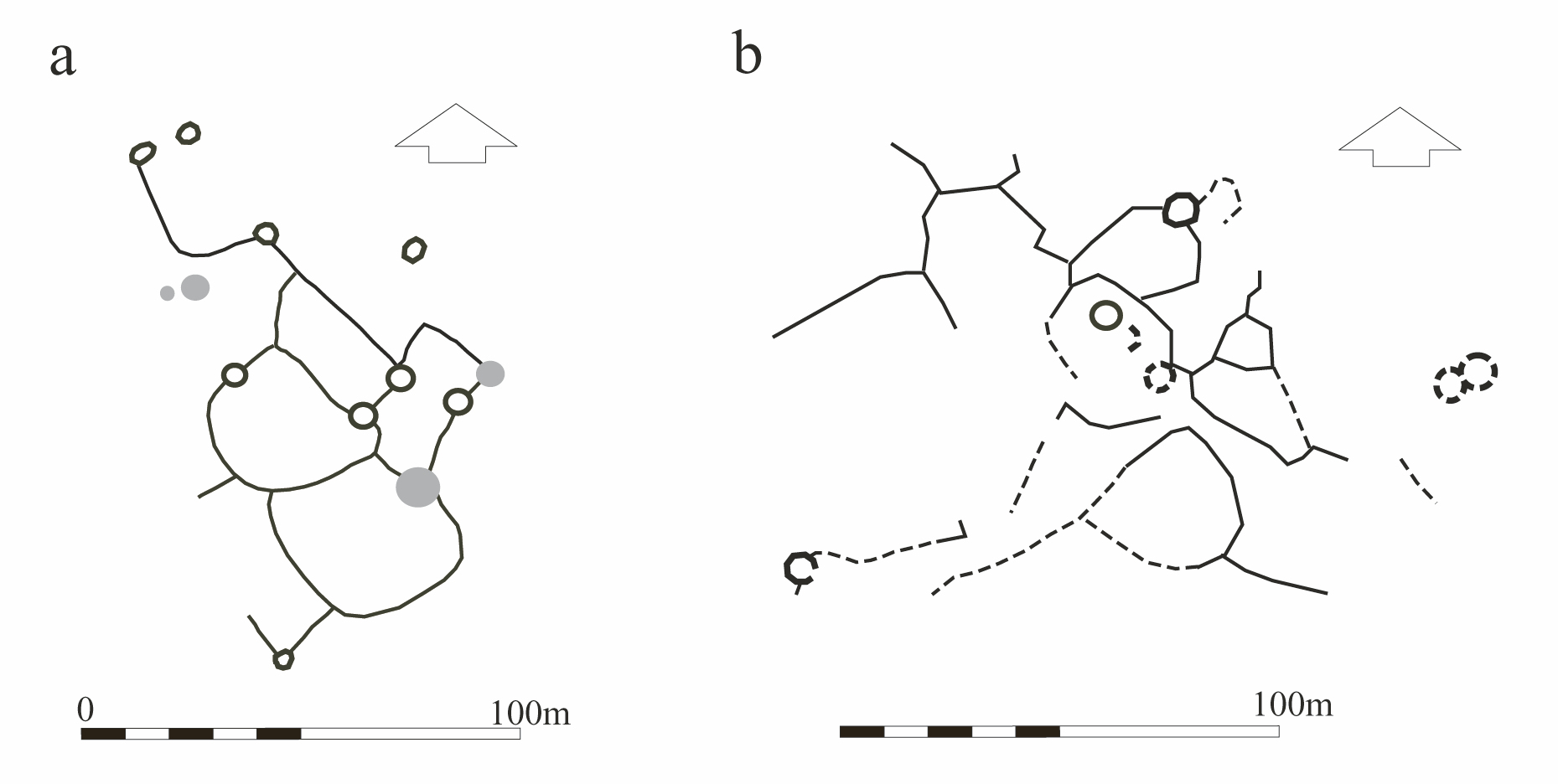
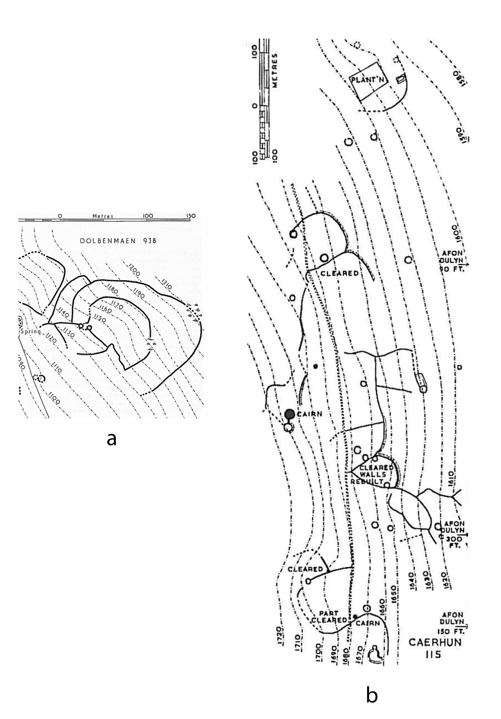
Figure 16: Examples of upland settlement plans: a Cwm Ffrydlas, Llanllechid, Gwynedd. b Ceunant y ddol, Garndolbenmaen, Gwynedd (Image: Gwynedd Archaeological Trust after RCAHMW 1960)
Figure 17: Examples of concentric and other enclosed and nucleated settlement plans (Image: Gwynedd Archaeological Trust). Concentric: a)Mellteyrn Uchaf, Llyn, b)Moel y Gerddi, Meirionnydd; Rectilinear enclosed: c)Din Lligwy, Anglesey, d)Hafoty Wernlas, Gwynedd; Curvilinear enclosed: e)Ffridd Ddu, Meironnydd, f)Pant y Saer, Anglesey; Nucleated: g)Cae Ddu, Meirionnydd, h)Cwm Dyli, Gwynedd.
Figure 18: Probable two phase settlement at Muriau Gwyddelod, Harlech, Meirionnydd (after Bowen and Gresham 1967)
Figure 19: Probable two phase settlement at Fridd Ddu, Trawsfynydd, Meirionnydd (Image: Crown Copyright RCAHMW 91-cs-170)
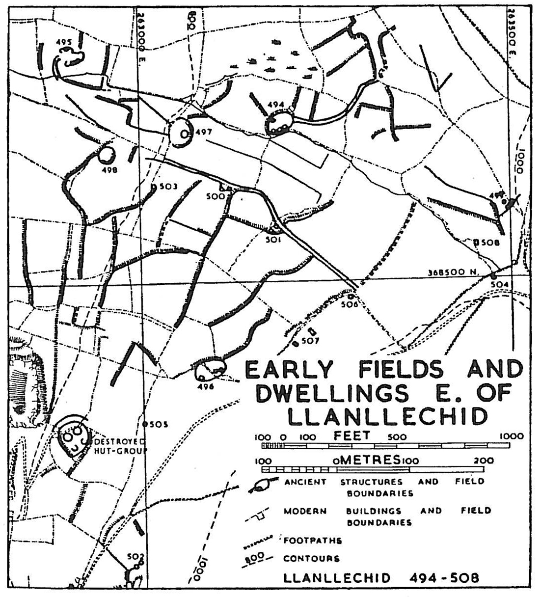
Figure 20: Relict landscape of fields and associated settlements, Llanllechid, Gwynedd (after RCAHMW 1956)
Figure 21: Fields and associated settlement below Pen-y-gaer hillfort, Llŷn (RCAHMW 1960)
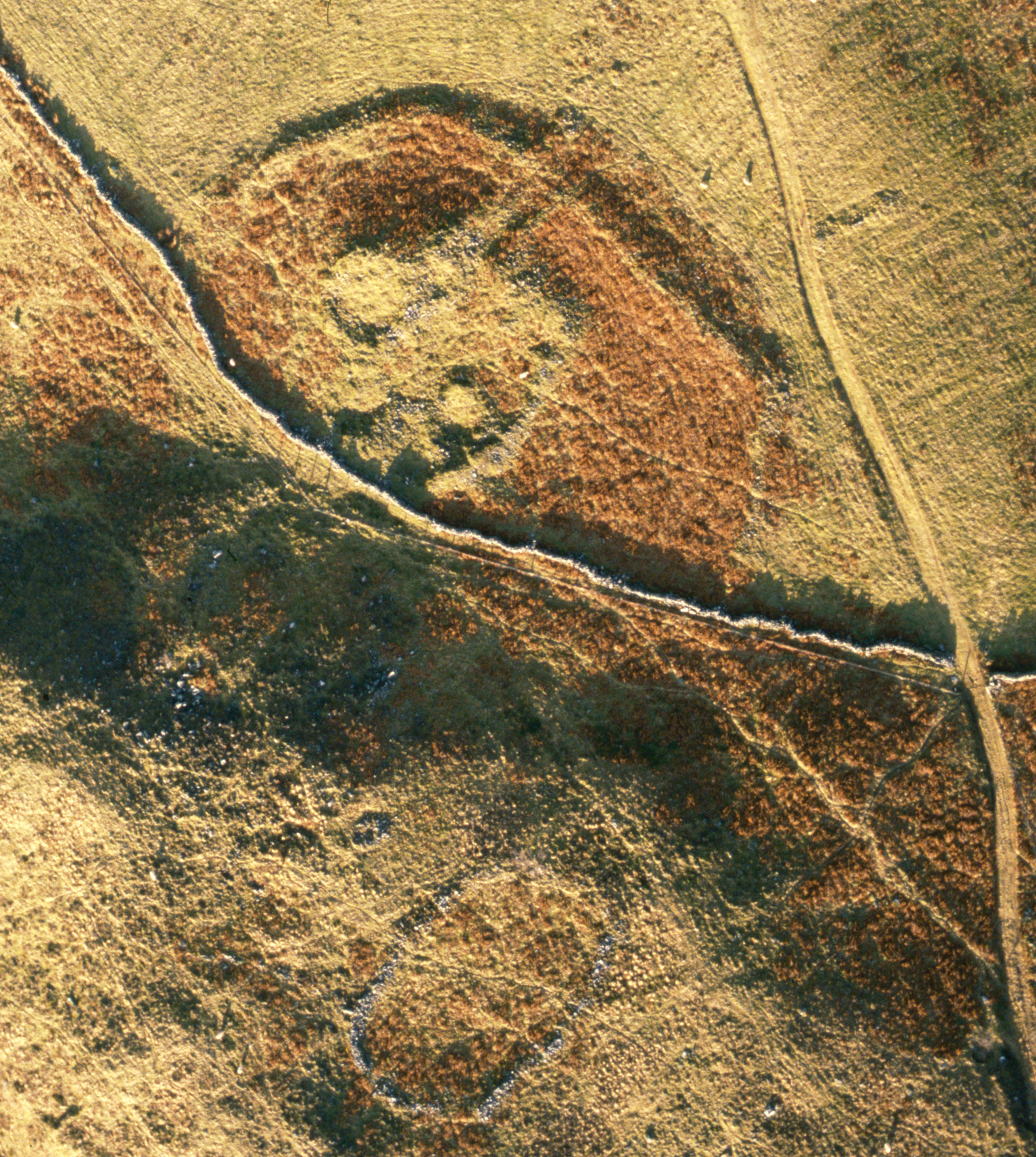
Figure 22: Fields and associated settlement below Pen-y-gaer hillfort, Llŷn (Image: Crown Copyright RCAHMW AP-2007-0240)
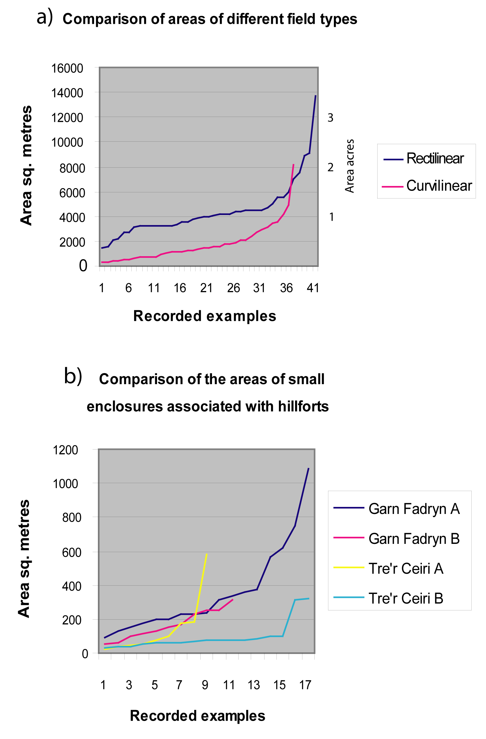
Figure 23: Comparison of areas of different types of fields/enclosures: a. Areas of terraced and curvilinear fields/enclosures. b. Areas of fields/enclosures associated with hillforts
Figure 24: Examples of upland curvilinear field systems: a. Ceunant y ddol, Garndolbenmaen, Gwynedd, b. Pant yr Griafolen, Rowen, Conwy (RCAHMW 1956 and 1960)
Figure 25: Garn Fadryn hillfort, Llŷn, showing internal enclosures/yards (RCAHMW 1964)
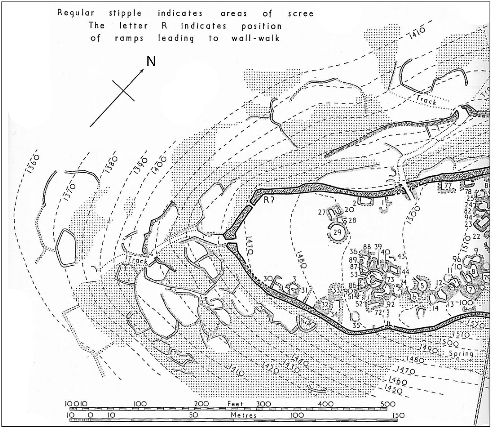
Figure 26: Tre'r Ceiri hillfort, Llŷn. Detail of enclosures on western slope (RCAHMW 1964)
Figure 27: The occurrence of field types, a. compared to settlement type, b. compared to altitude
Figure 28: Garn Bentyrch, Llŷn. Aerial photograph showing three phases of construction (Image: Gwynedd Archaeological Trust)
Figure 29: Caer Seion, Conwy, showing two phases of construction (RCAHMW 1956)
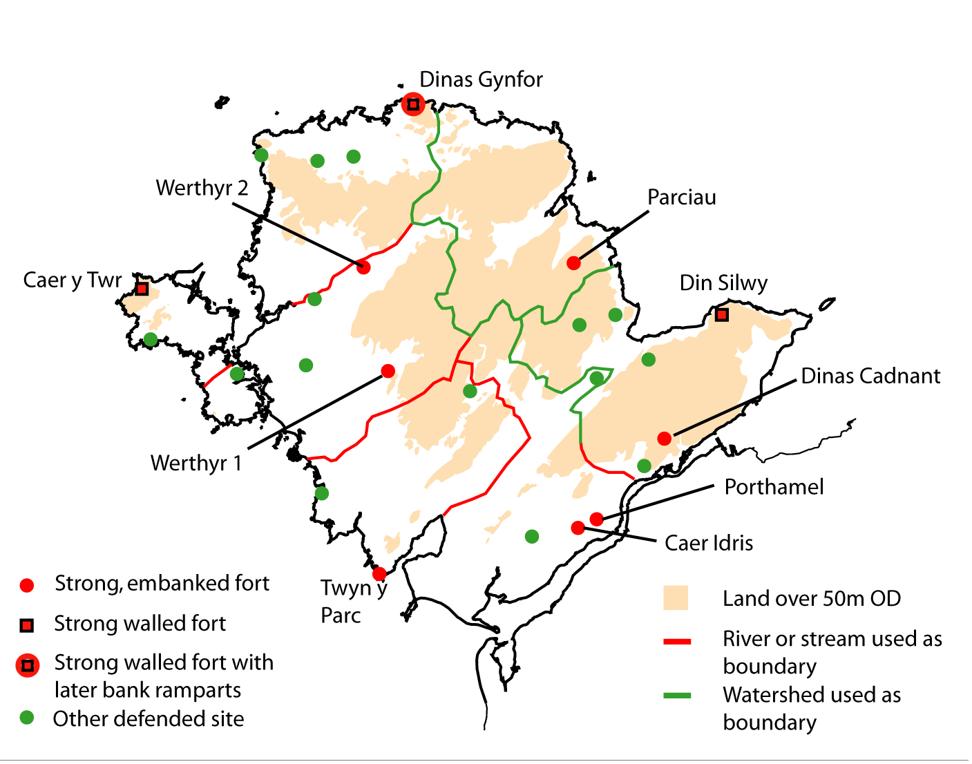
Figure 30: The distribution of forts and other defended settlements on Anglesey compared to the probable boundaries of medieval administrative areas (commotes)
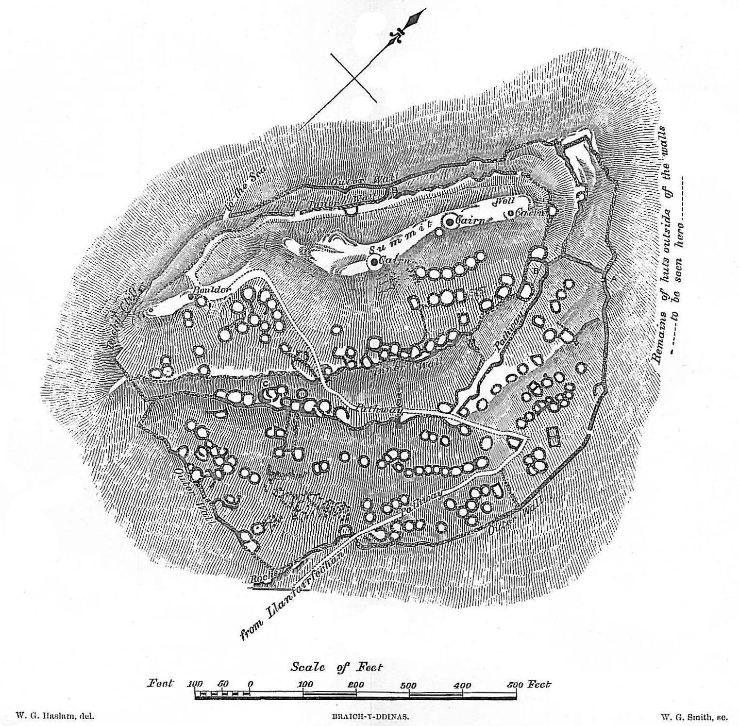
Figure A: Braich y Dinas, Conwy. 18th century. Anon.
Figure B: Braich y Dinas, Conwy, 1877 (Archaeologia Cambrensis)
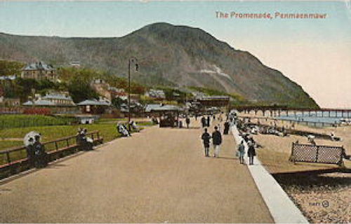
Figure C: Braich y Dinas hill, Conwy, looking west, before quarrying, 1910 (postcard)
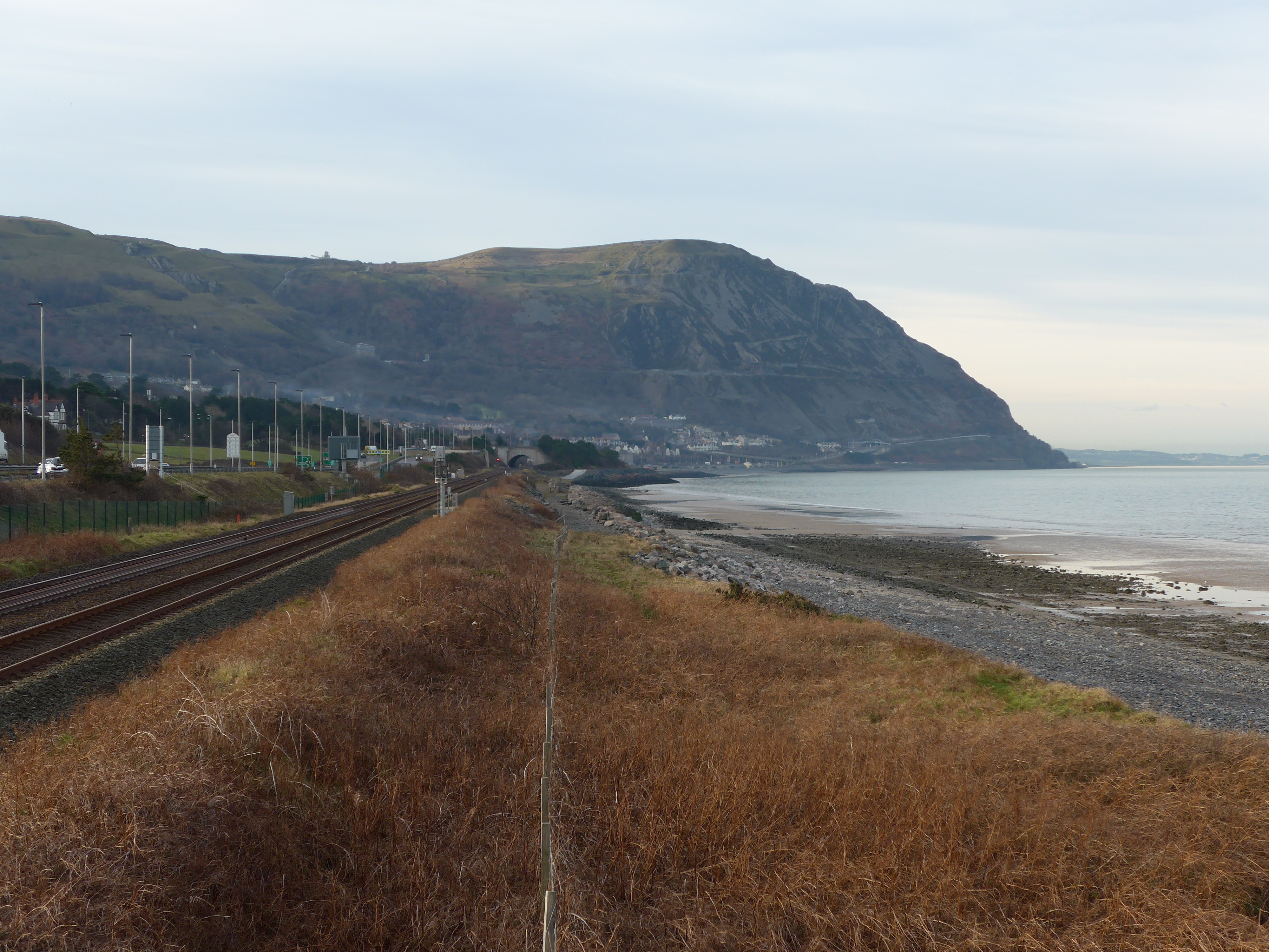
Figure D: Braich y Dinas, Conwy. Looking west. After quarrying. 2018 (Image: Gwynedd Archaeological Trust).
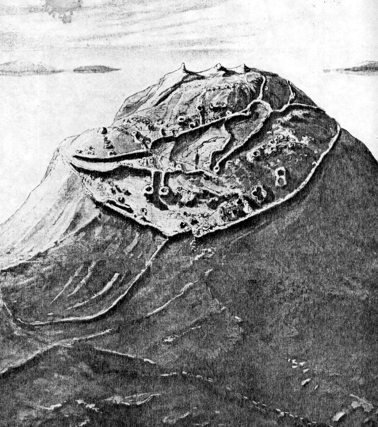
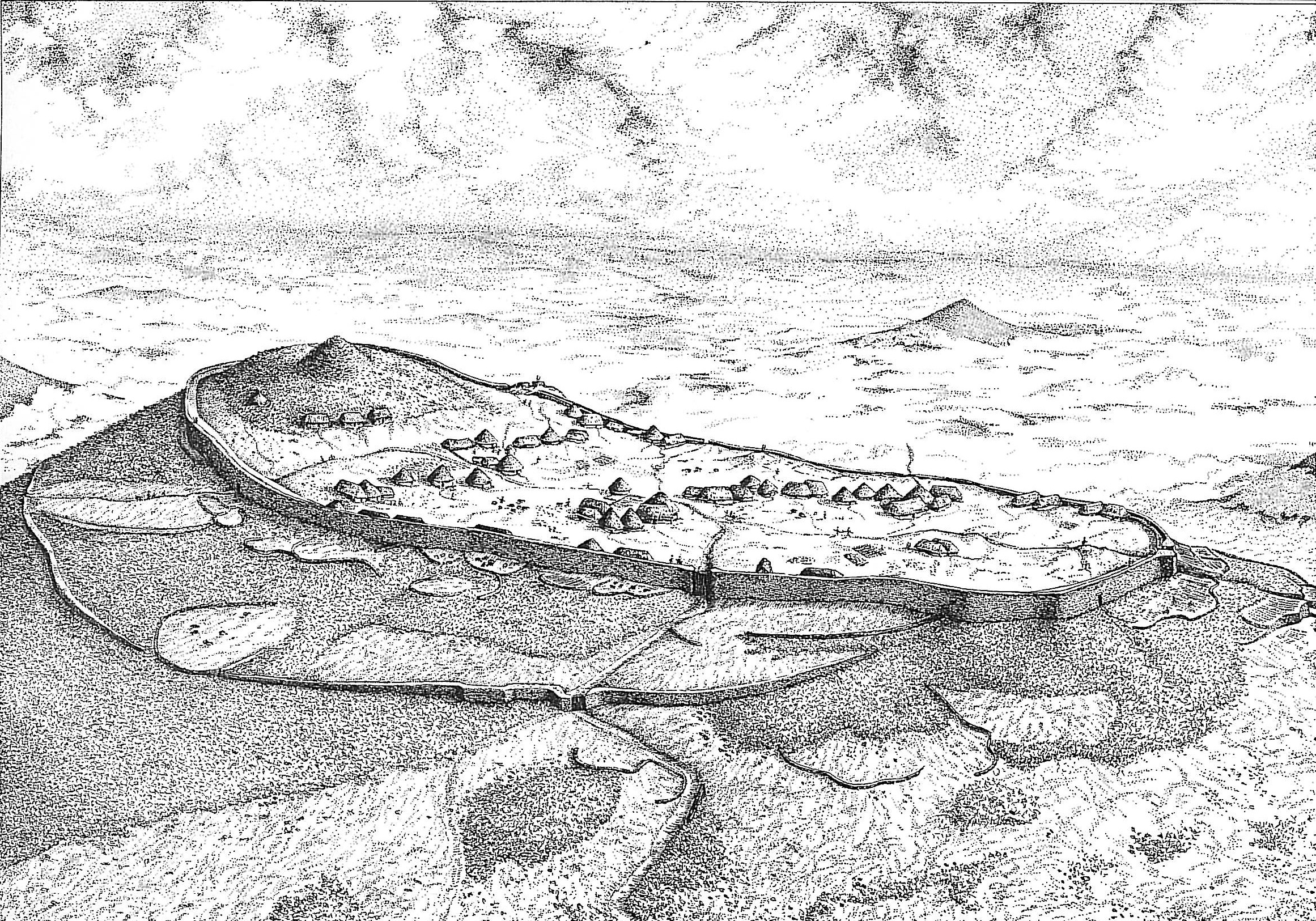
Figure E: Tre'r Ceiri hillfort. Artist's reconstruction, viewed from the north-west (A. Smith, GAT)
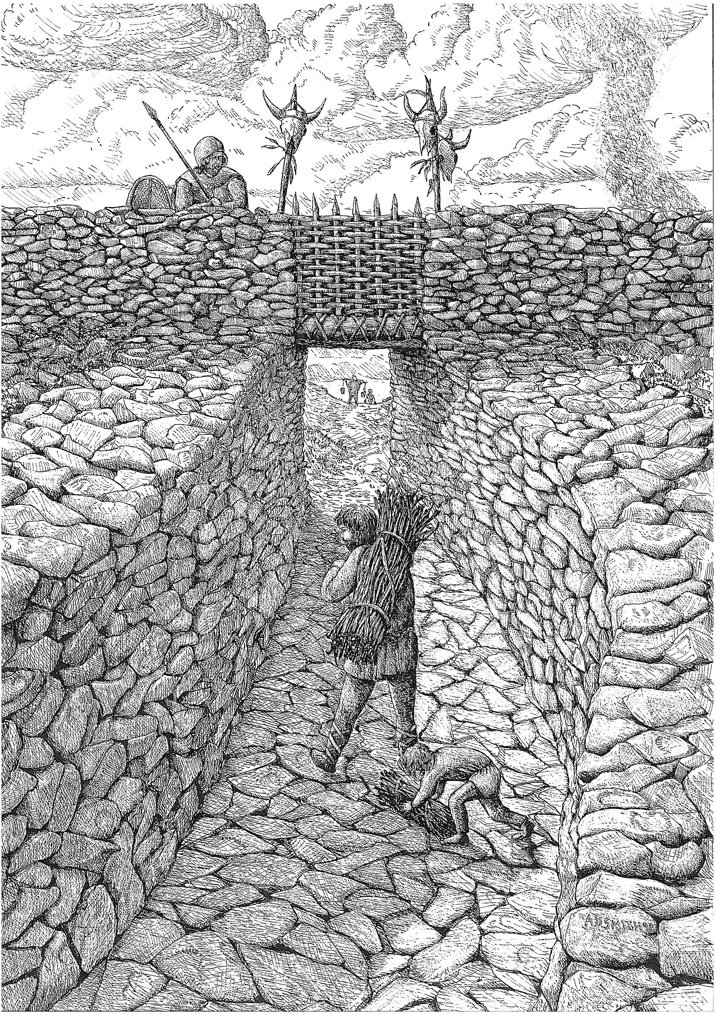
Figure F: Tre'r Ceiri hillfort. Artist's reconstruction of the main north gate approach corridor (A. Smith, GAT)
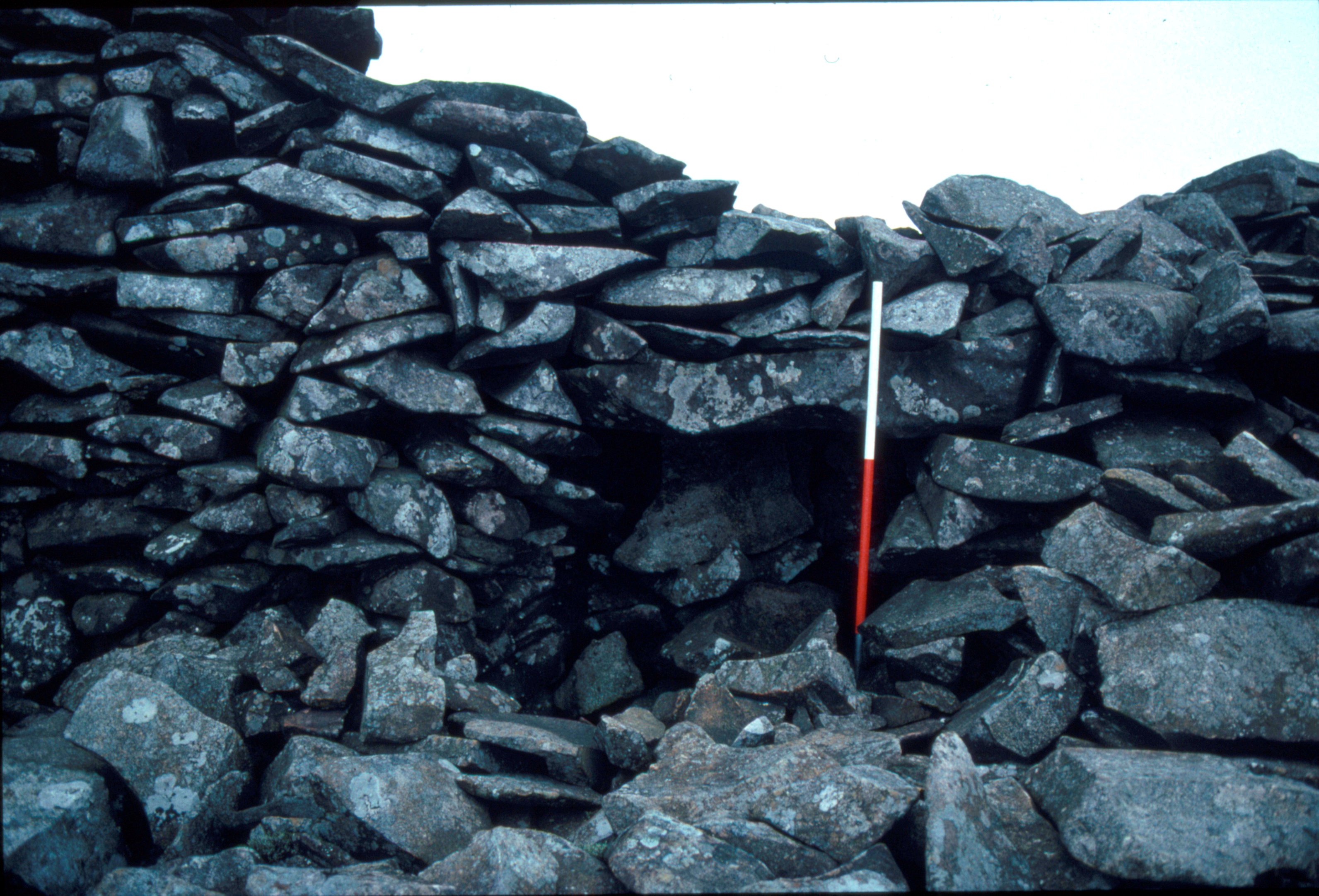
Figure G: Tre'r Ceiri hillfort. North postern gate, from the outside, showing broken lintel, before conservation (Image: Gwynedd Archaeological Trust)
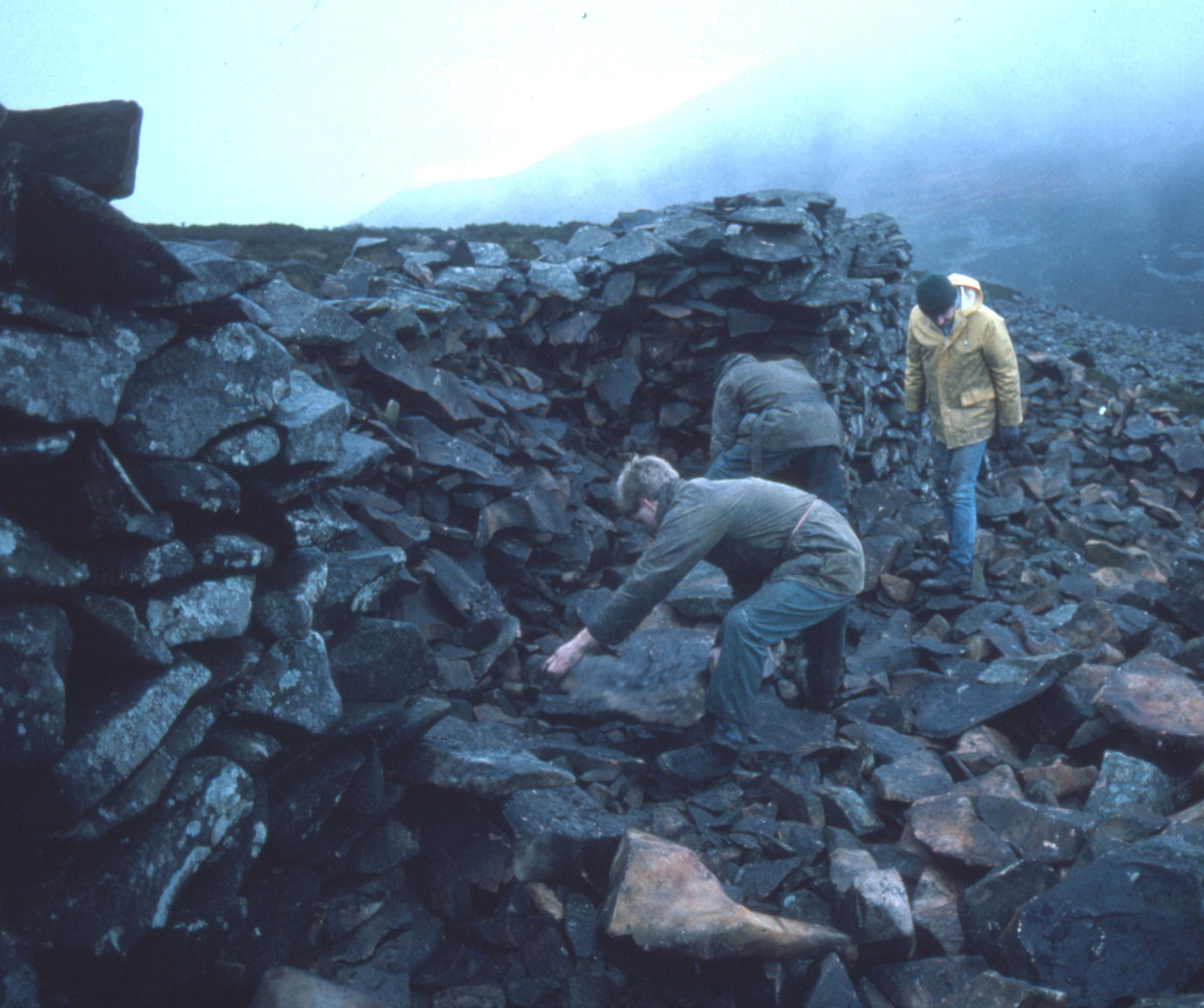
Figure H: Tre'r Ceiri hillfort. Conservation in progress on the main fort wall (Image: Gwynedd Archaeological Trust)
Figure I not used
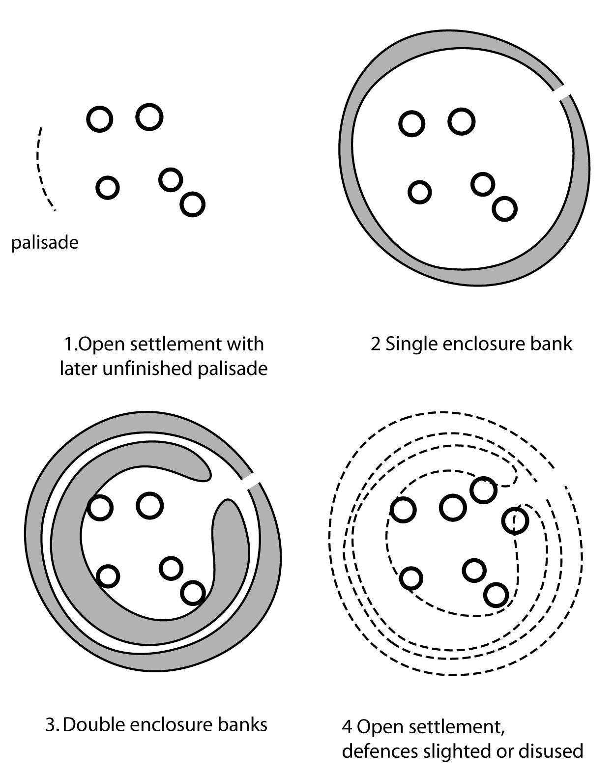
Figure J: Castell Odo. Stylised plan showing the phases of occupation. 1. Castell Odo plan, Phase 1: The open and palisaded settlement 2. Castell Odo plan, Phase 2: The single embanked fort 3. Castell Odo plan, Phase 3: The double embanked fort 4. Castell Odo plan, Phase 4: The later open settlement
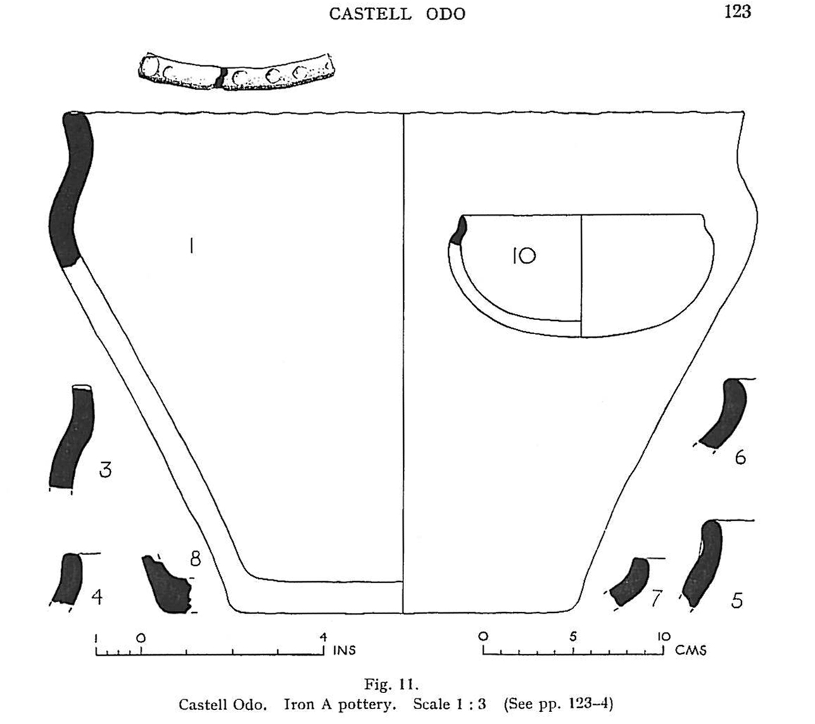
Figure K: Castell Odo. Pottery from the first settlement phase (Alcock 1960)
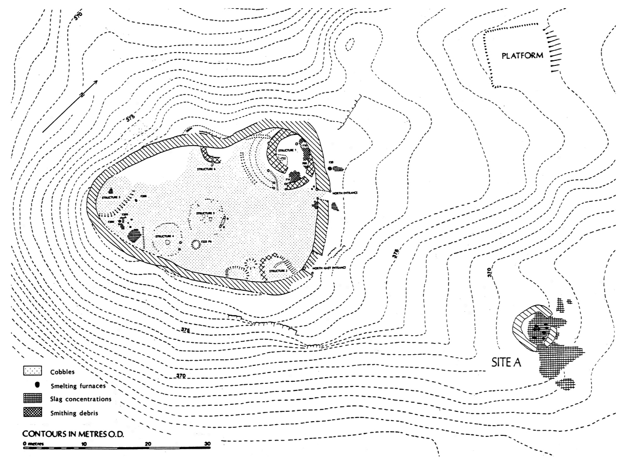
Figure L: Bryn y Castell, summary plan showing slag spreads and furnace locations (P. Crew)
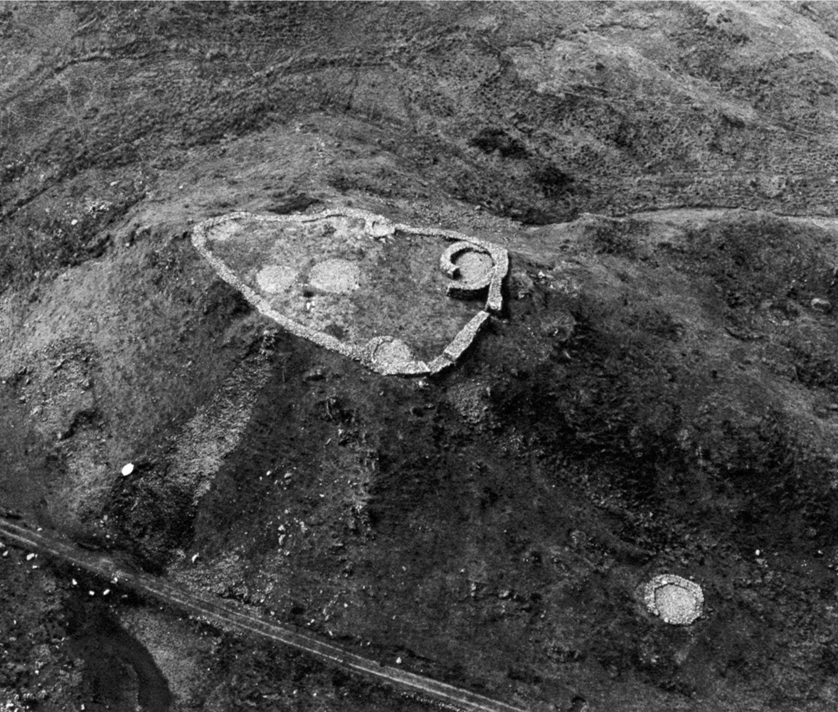
Figure M: Bryn y Castell from the air, showing the fort reconstructed after excavation (C. R. Musson)
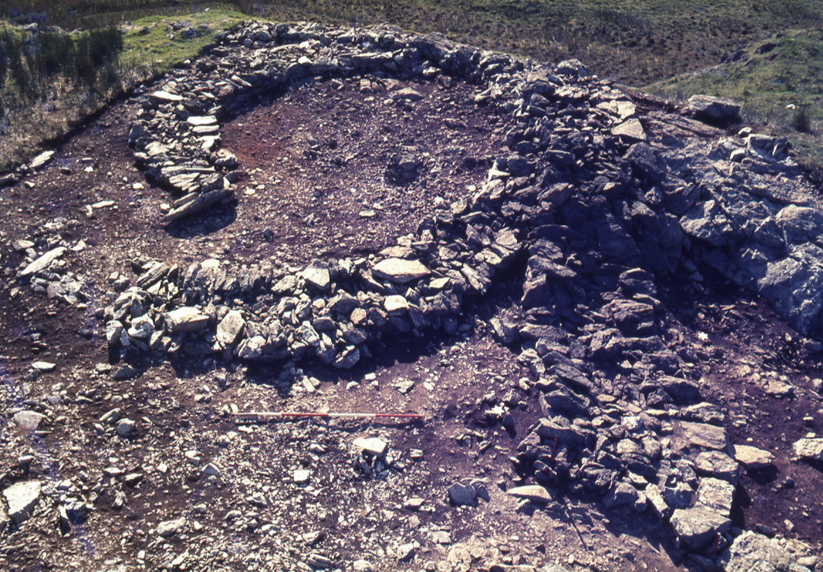
Figure N: Bryn y Castell, the snail-shaped hut
Figure O not used
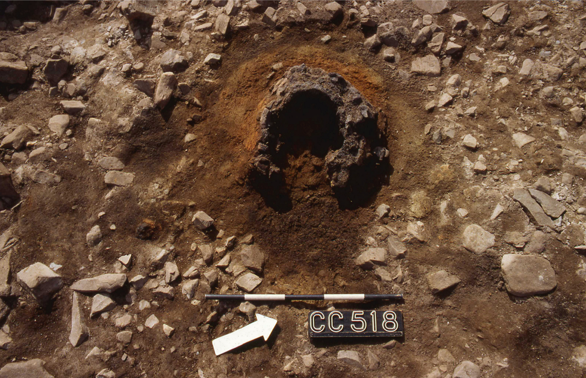
Figure P: The remains of a typical late prehistoric iron-smelting furnace (from Crawcwellt, Meirionnydd)
Internet Archaeology is an open access journal based in the Department of Archaeology, University of York. Except where otherwise noted, content from this work may be used under the terms of the Creative Commons Attribution 3.0 (CC BY) Unported licence, which permits unrestricted use, distribution, and reproduction in any medium, provided that attribution to the author(s), the title of the work, the Internet Archaeology journal and the relevant URL/DOI are given.
Terms and Conditions | Legal Statements | Privacy Policy | Cookies Policy | Citing Internet Archaeology
Internet Archaeology content is preserved for the long term with the Archaeology Data Service (ROR). Help sustain and support open access publication by donating to our Open Access Archaeology Fund.