The parcel of land on which the Carmelites constructed their friary lay to the east of the Denburn (Section 4.5), just to the north of where it met the river Dee, before the course of the Dee was altered. Previous archaeological work at 2-12 Rennie's Wynd and 67-71 Green (Murray 1982) indicates that the area appears to have been prone to flooding from an early date. New evidence from the site under discussion here confirms that. A Mesolithic flint-working area was found at 45-59 Green (Murray 1982, 89) with additional concentrations of flint artefacts at 67-71 Green (Murray 1982, 91-5).
A number of water courses were excavated in the north of the excavation area. They contained a small number of flint finds [167, 285, 286, 287, 292, 312, 324], which may indicate prehistoric activity in the area at the time the ditches were filled.
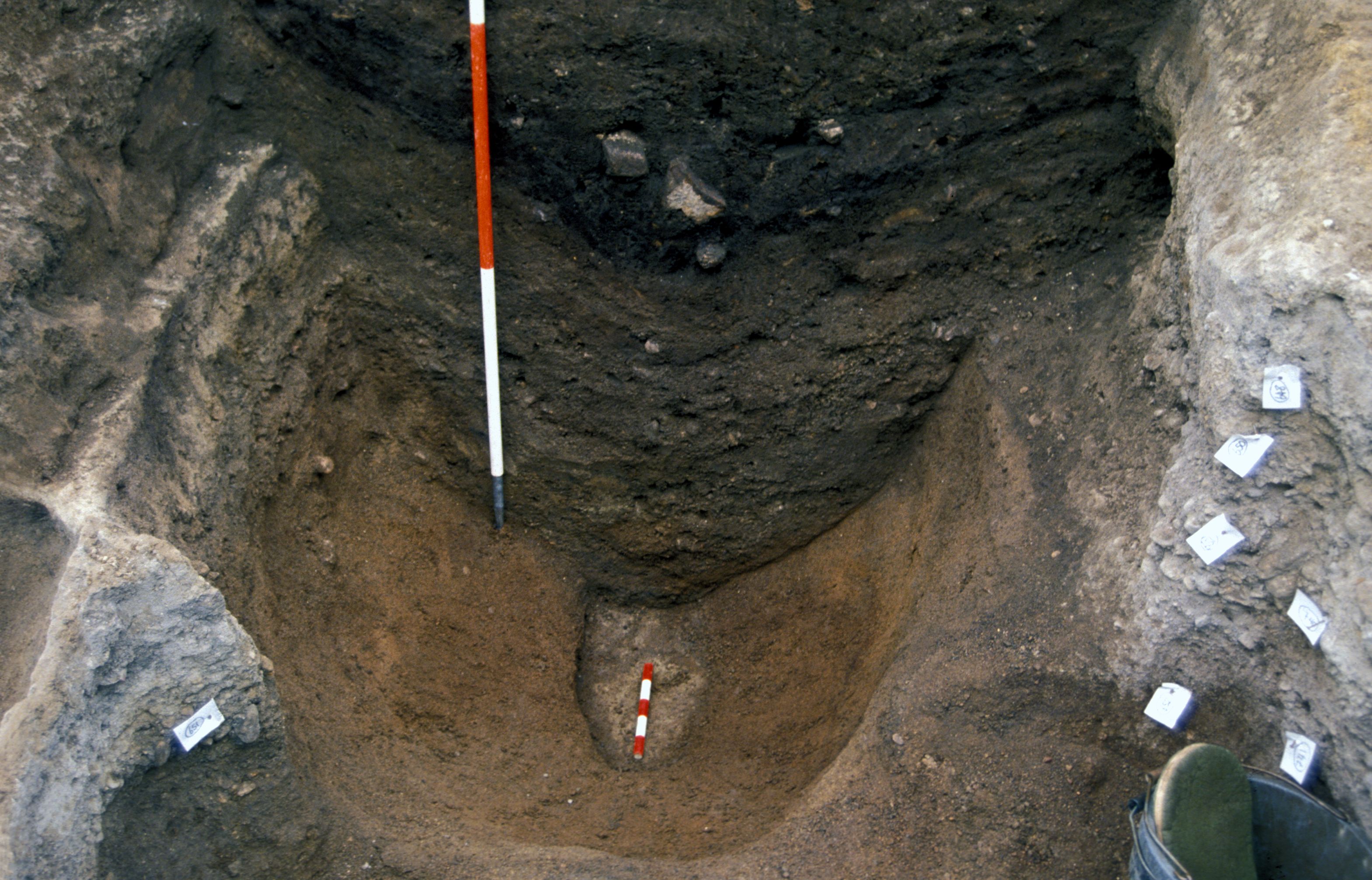
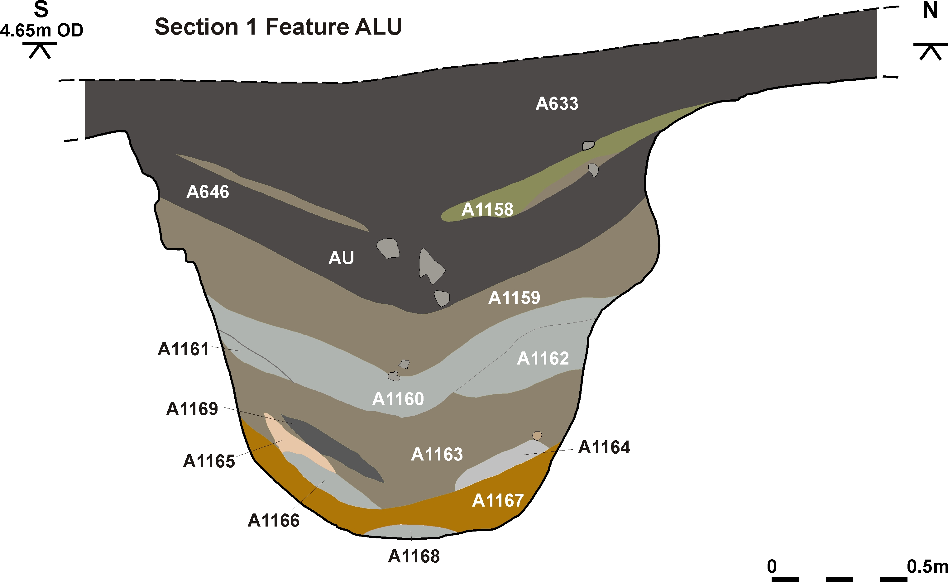
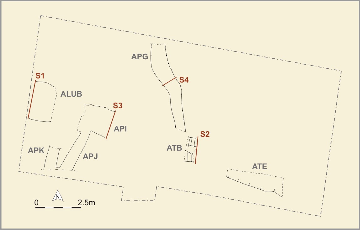
Water course ALUB [Photo 0257] was U-shaped in section; ATB; ATE; API ran west-east across the northern area of this excavation. It was a maximum of 2.2m wide and 1.5-2m deep. There were no finds in the primary infill layers of this feature, which consisted of sterile sands and gravels. The upper 1m of this feature was filled with black loam which contained pottery of 13th to 14th-century date (ALUA; Section 1 only) and appeared to be the infilling of the linear feature in Phase 3, prior to the construction of the friary buildings.
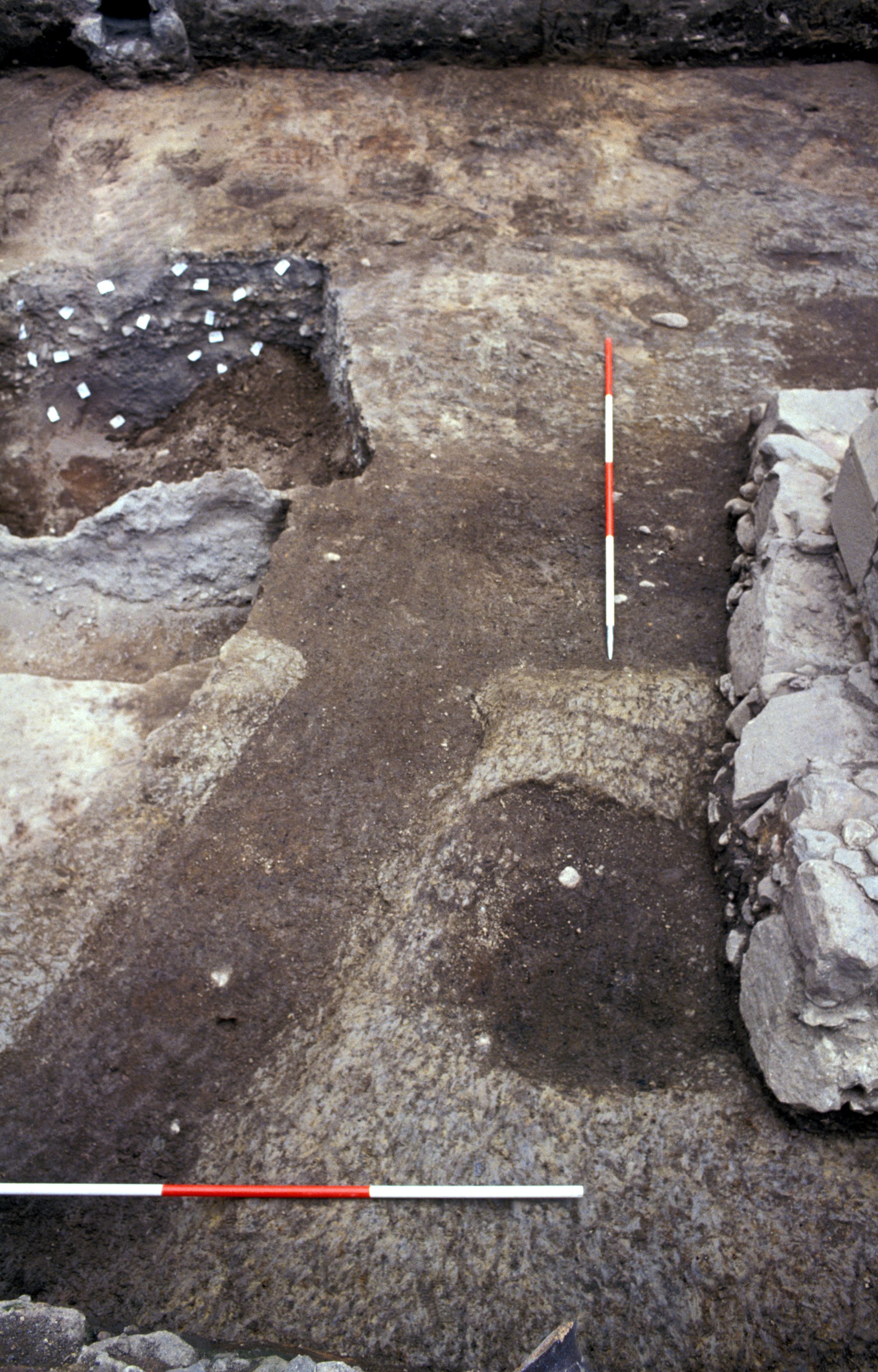
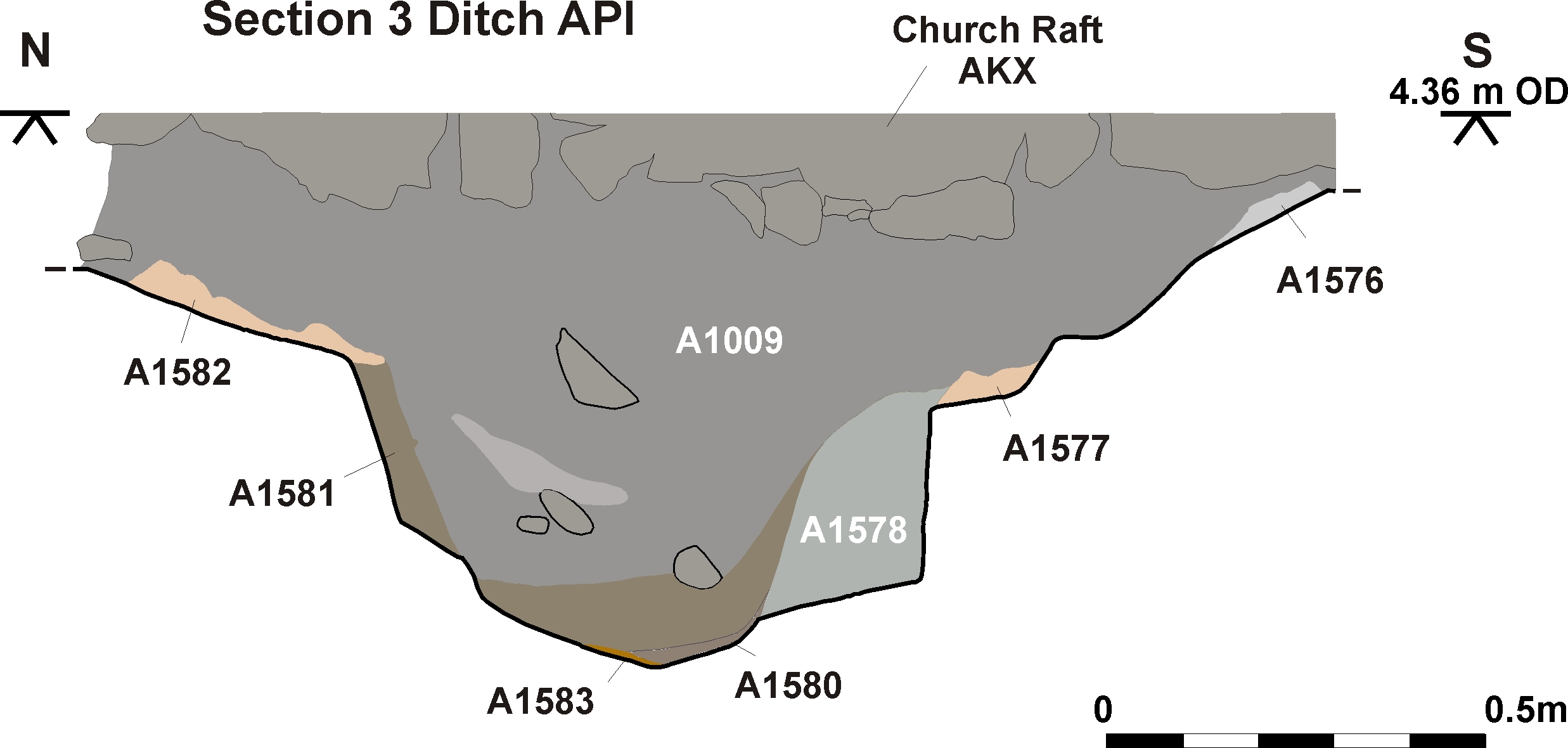
Channels APK and APJ [Photo 0513] led off this feature to the south, and a meandering channel APG [Photo 0421] probably flowed into it (although the junction of these two features was obscured by the wall of the friary church). A small number of sherds of pottery were found in ditch APG: these might have been mixed into the top of the feature as a result of the Phase 1a ploughing which took place adjacent to this feature.

Internet Archaeology is an open access journal based in the Department of Archaeology, University of York. Except where otherwise noted, content from this work may be used under the terms of the Creative Commons Attribution 3.0 (CC BY) Unported licence, which permits unrestricted use, distribution, and reproduction in any medium, provided that attribution to the author(s), the title of the work, the Internet Archaeology journal and the relevant URL/DOI are given.
Terms and Conditions | Legal Statements | Privacy Policy | Cookies Policy | Citing Internet Archaeology
Internet Archaeology content is preserved for the long term with the Archaeology Data Service (ROR). Help sustain and support open access publication by donating to our Open Access Archaeology Fund.