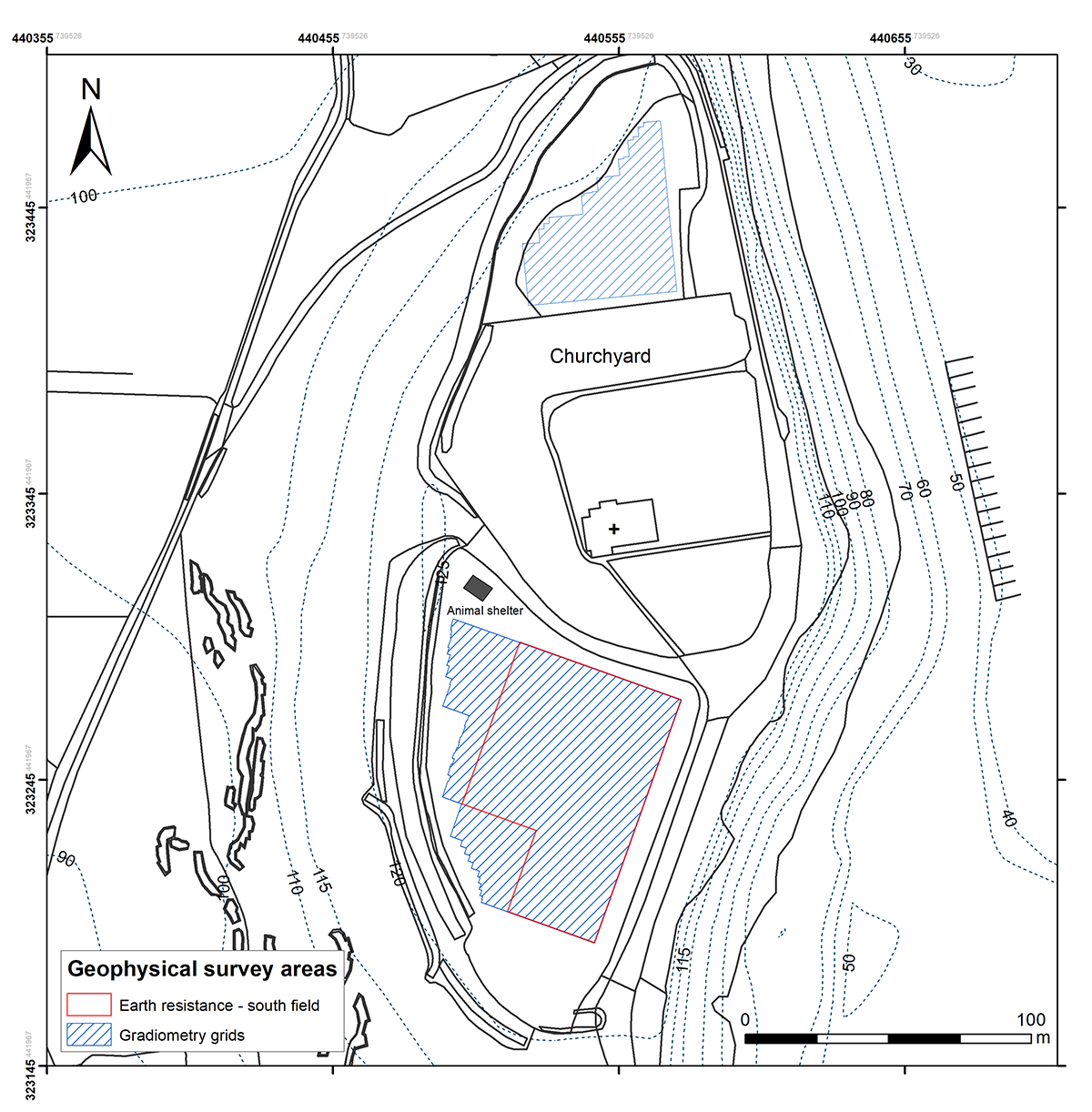
Fluxgate gradiometer and earth resistance surveys were conducted at the hilltop in February 2016, subject to the conditions set out by the Section 42 Licence issued by Historic England. Geophysical prospection was chosen in light of the site's sensitive ecology and the suitability of the bedrock geology. The surveys comprised (Figure 5):
As the quicker method, gradiometry was used for the initial survey over a wide area, which allowed for a targeted resistivity survey to focus on specific areas of possible archaeological importance (David et al. 2008, 20). The methodology was informed by previous remote sensing-led studies, which have had a significant bearing on the understanding of hillfort interiors (e.g. Payne et al. 2006). The survey metadata is listed in the project's entry deposited with the Archaeology Data Service (Whittaker 2019).
The 2014 LiDAR survey undertaken by the Environment Agency over Breedon Hill obtained high-resolution 50cm height data, covering a discrete area that included the hilltop and the full extent of the quarry site. The raw data was downloaded from the Geomatics Group (Environment Agency) as georeferenced tiles using their online database request function. The raw data was converted into a 'Raster Mosaic' using ArcGIS, allowing the total survey area to be visualised into a hillshade model, using the standard ArcGIS processing functions (Davis 2012, 12). As the DTM and hillshade visualisations hold base height data, the hillshade visualisation models were manipulated using ArcScene to create 3D surfaces (Crutchley and Crow 2010).
Cite this as: Whittaker, C. 2019 Breedon Hill, Leicestershire: new surveys and their implications, Internet Archaeology 52. https://doi.org/10.11141/ia.52.6
Internet Archaeology is an open access journal based in the Department of Archaeology, University of York. Except where otherwise noted, content from this work may be used under the terms of the Creative Commons Attribution 3.0 (CC BY) Unported licence, which permits unrestricted use, distribution, and reproduction in any medium, provided that attribution to the author(s), the title of the work, the Internet Archaeology journal and the relevant URL/DOI are given.
Terms and Conditions | Legal Statements | Privacy Policy | Cookies Policy | Citing Internet Archaeology
Internet Archaeology content is preserved for the long term with the Archaeology Data Service (ROR). Help sustain and support open access publication by donating to our Open Access Archaeology Fund.