Cite this as: Stapley, D. 2025 Towards an Archaeology of Routeways: A case study from the North York Moors National Park, Internet Archaeology 69. https://doi.org/10.11141/ia.69.7
This article presents the results of a community LiDAR survey to identify routeways in the northern part of the North York Moors National Park, which has outlined the remarkable scale and preservation of these features. The results of this survey are then used to propose a typology that classifies these previously homogenised routeway spaces. This typology is based on the physical characteristics of the routeways in question, treating them as monuments worthy of archaeological investigation. From this physical grounding, some potential avenues for future research and investigation are also discussed.
Corresponding author: David Stapley
[email protected]
University of York
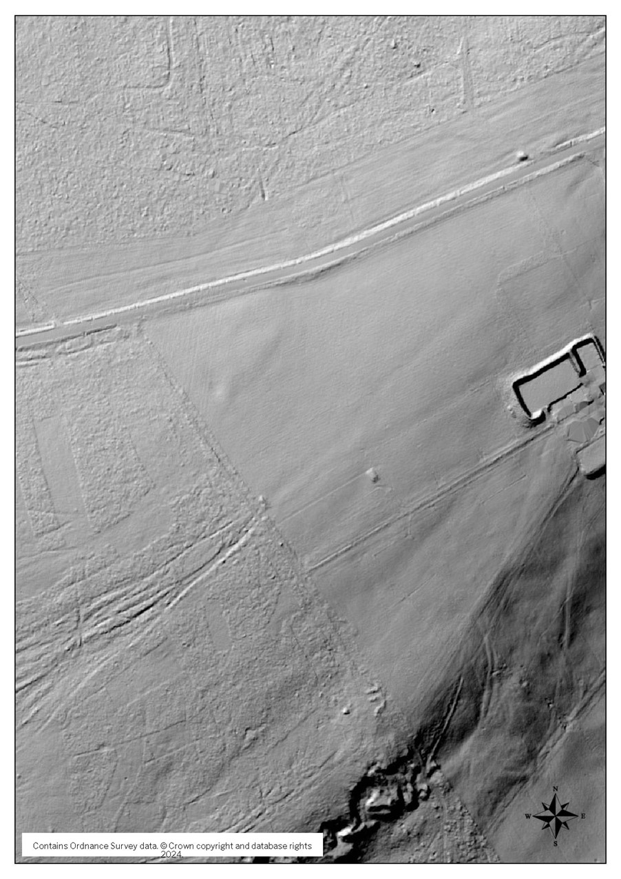
Figure 1: An example of the data pack distributed to volunteers for an individual kilometre grid square. From left to right: DTM NE, DTM NW, DTM S, OS with contour, Satellite Map and HER map (Image credit: Environment Agency © Crown Copyright and database rights 2024)
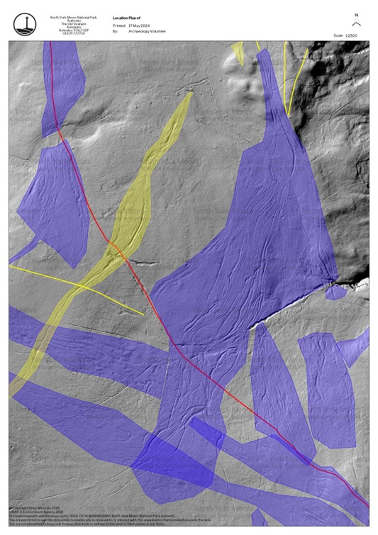
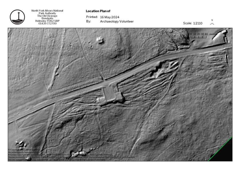
Figure 2: LiDAR image of the entire study area. Trods are mapped in red, hollow ways are mapped in yellow, complexes are mapped in blue. (Image credit: Sirius Minerals © 2018)
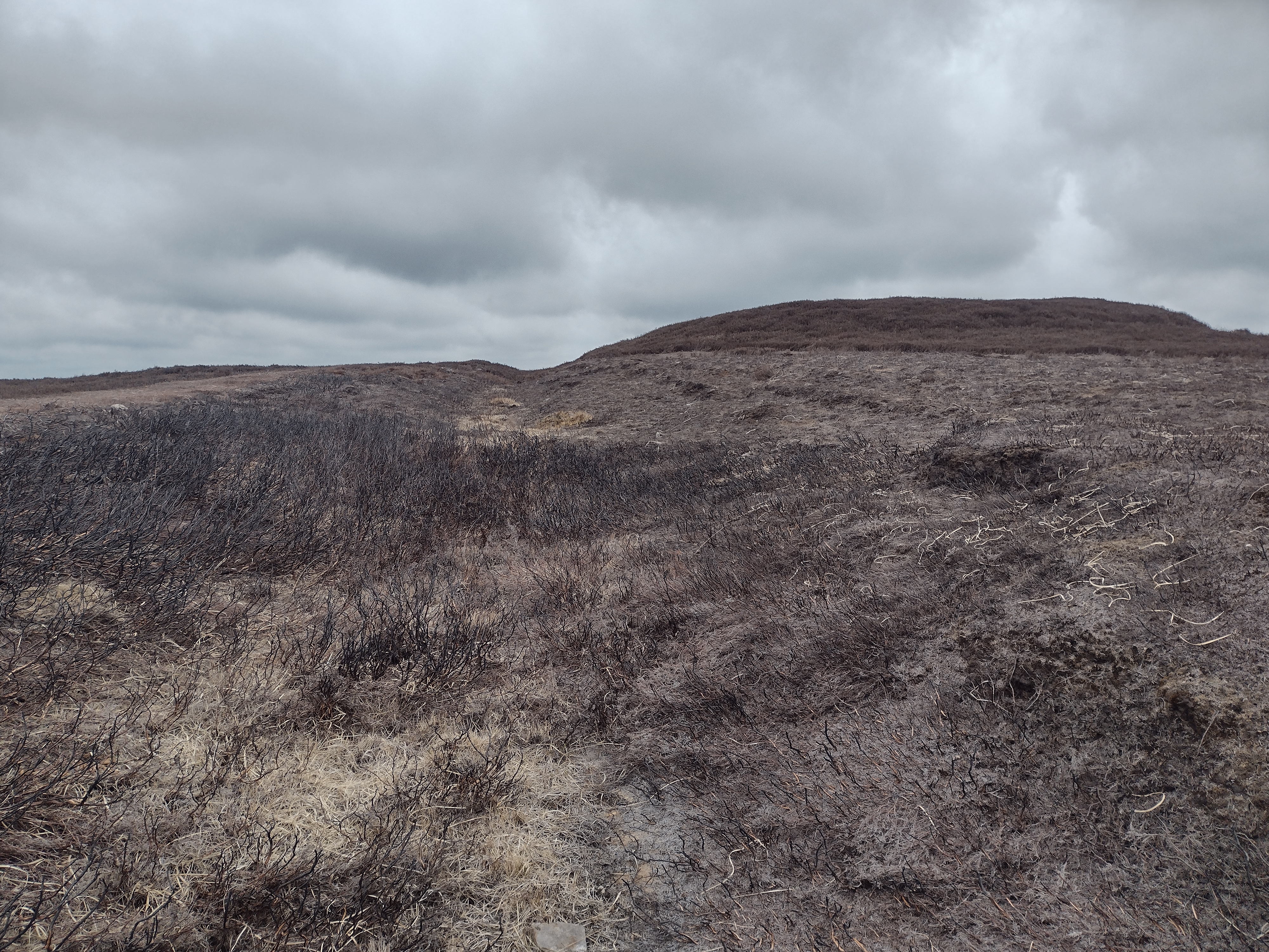
Figure 3: One part of Pannierman Pots [184] as it descends into a rill. This section remains in use as a public bridleway (Photo © Trevor Littlewood; CC-BY-SA 2.0)
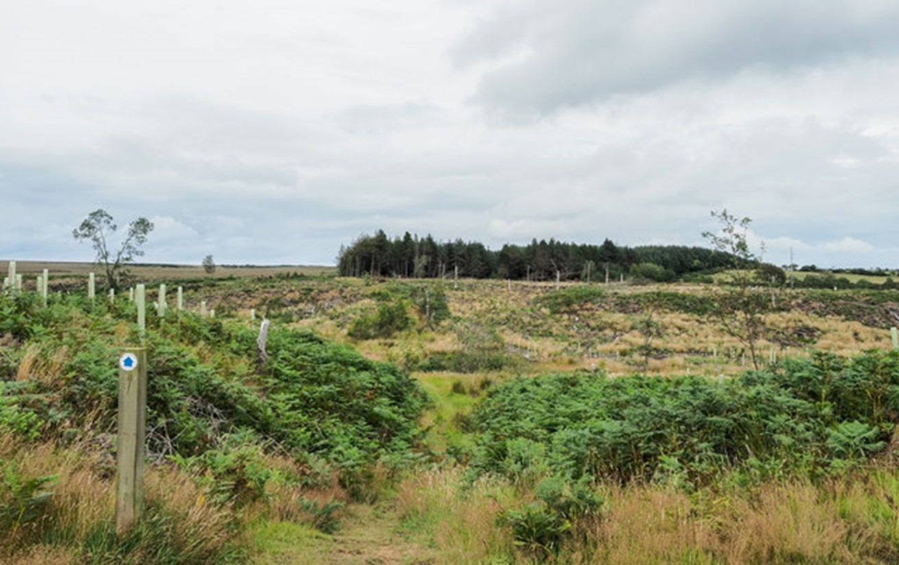
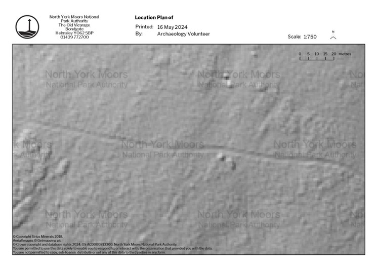
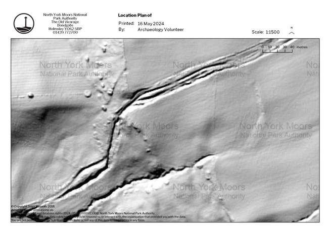
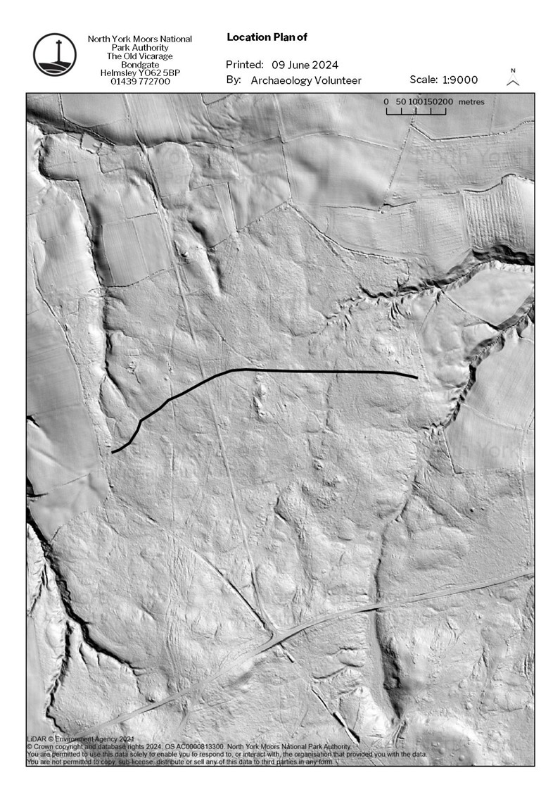
Figure 4: The central feature [143] runs SW-NE through both moorland and agricultural landscape. The modern field that it runs through is not present on the first edition OS map in 1849 but is depicted in later editions, with the public footpath rerouted to the south. Since being enclosed the field has been used as arable, forestry plantation, and pasture, processes which have degraded the way. (Image credit: Environment Agency © Crown Copyright and database rights 2024)
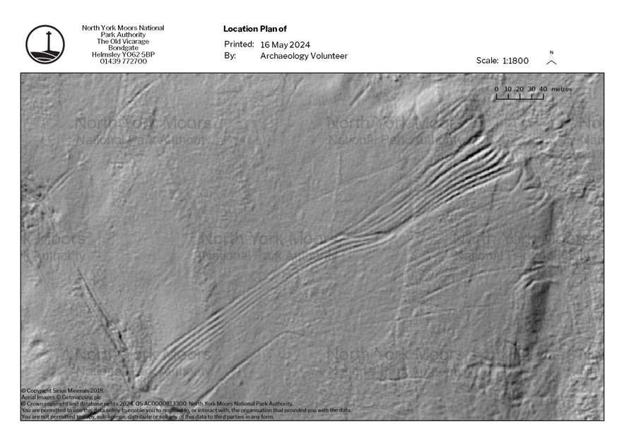
Figure 5: Path of the Quakers Causeway [392] through a complex palimpsest of other routeway features, which align, junction, and branch from the trod, covering a wide area of the landscape. The largest single feature is approximately 26 hectares in area [349]. (Image credit: © Sirius Minerals 2018)
Figure 6: A single lane hollow way, approximately 4 metres in width, crossing Newton Mulgrave Moor [205]. (Image credit: © Sirius Minerals 2018)
Figure 7: A double wide hollow way, approximately 8 metres at its widest point, north of the A171 at Liverton Moor [292] (Image credit: Environment Agency © Crown Copyright and database rights 2024)
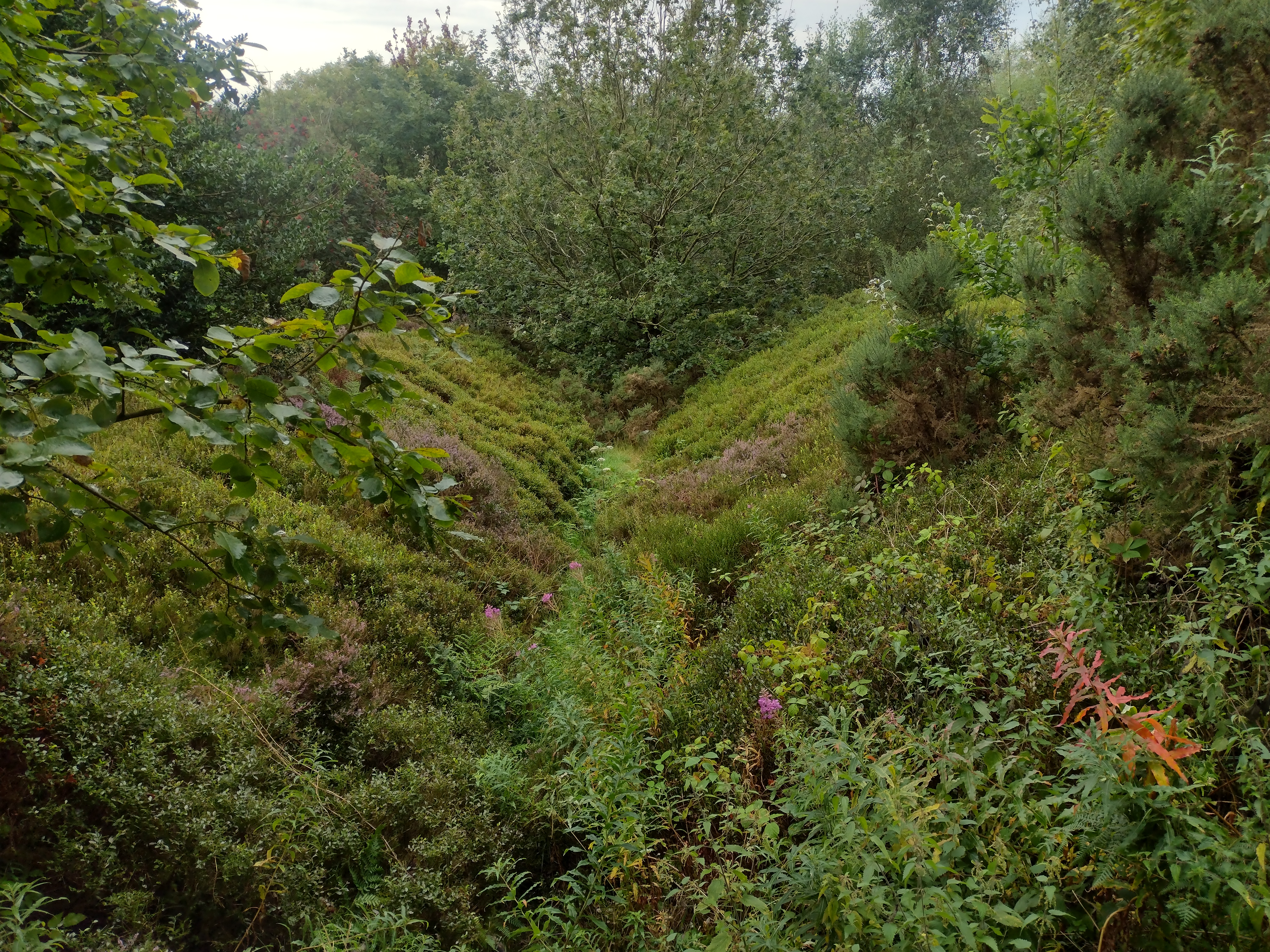
Figure 8: Hollow way known as 'Thief Lane' (out of study area) south of Roulston Scar hillfort. The feature is multiple metres in depth and is a significant barrier to access perpendicular to it. It is also heavily overgrown. (Photo © David Stapley; CC-BY-SA 2.0)
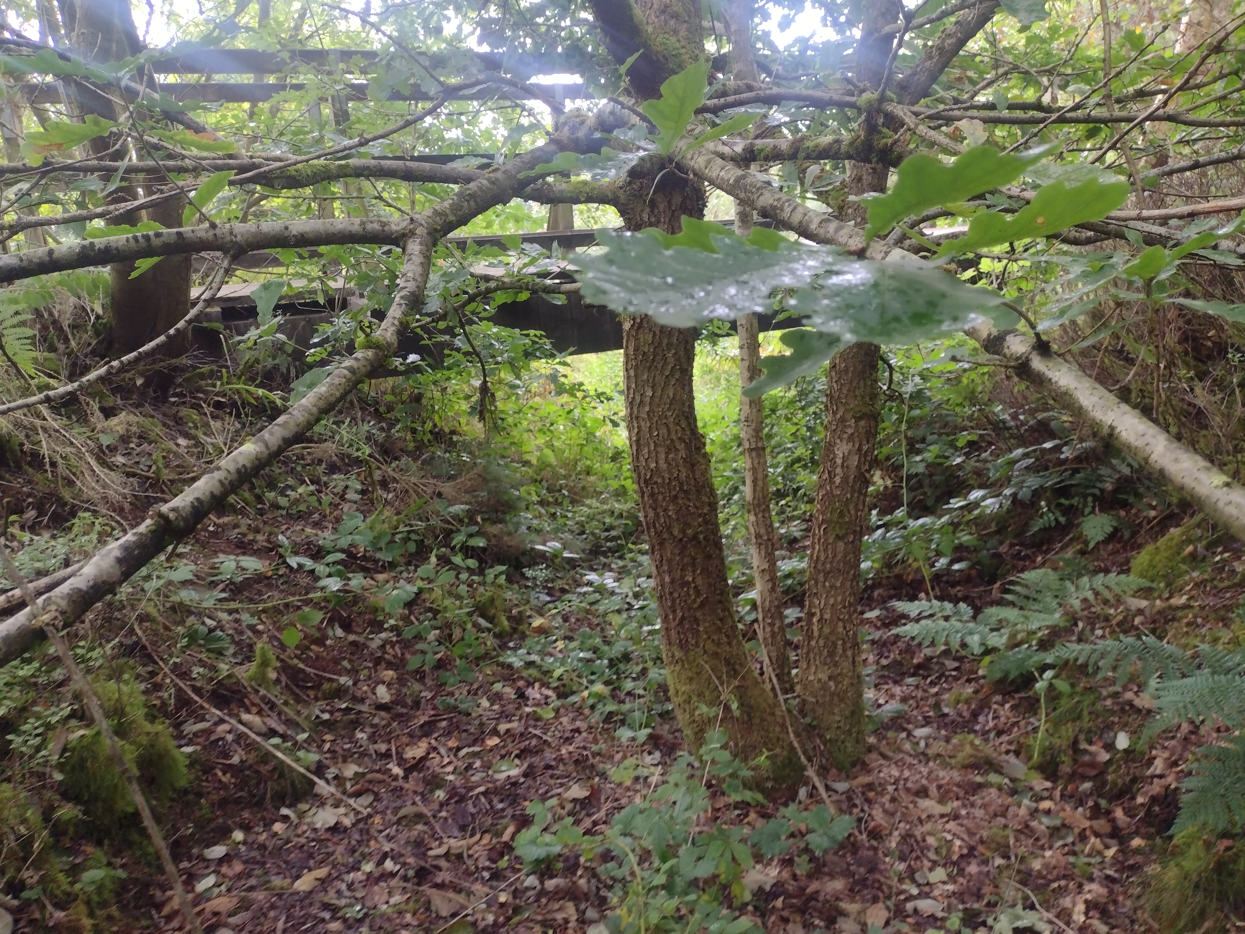
Figure 9: Thief Lane viewed from the side - a significant barrier to cross. (Photo © David Stapley; CC-BY-SA 2.0)
Figure 10: Within 'Thief Lane'. In its current state it is significantly overgrown, and is crossed by a wooden bridge which carries the modern footpath from which Figure 8 is taken. (Photo © David Stapley; CC-BY-SA 2.0)
Figure 11: Sycamore/Seggimire Lane contains both a trod and islanded hollow way. Here two hollow way paths diverge, creating an island which contains the trod, which appears to be acting as an obstacle, potentially during wet weather when it becomes slippery, inducing hollow way erosion on either side. (Image credit: © Sirius Minerals 2018)
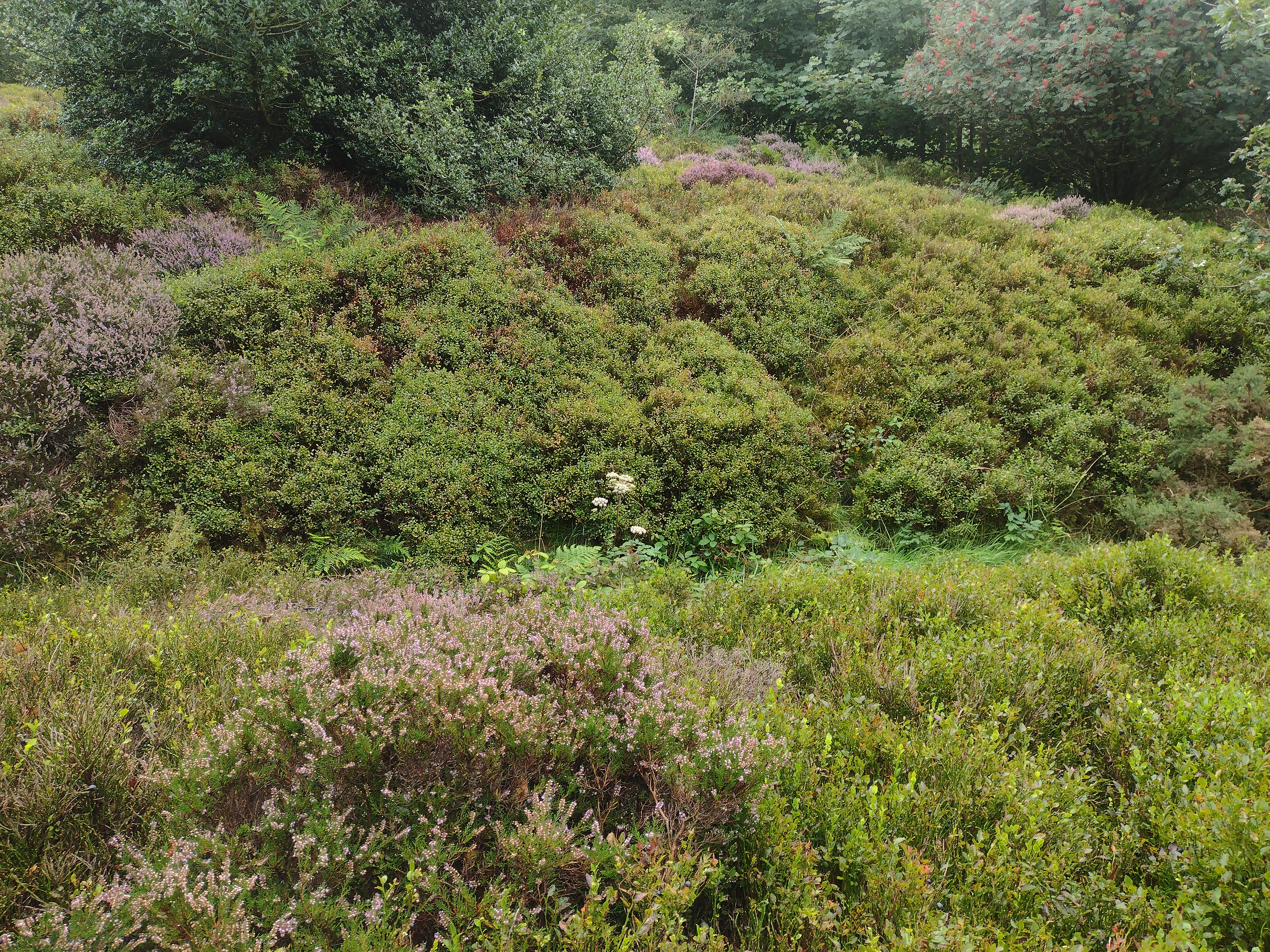
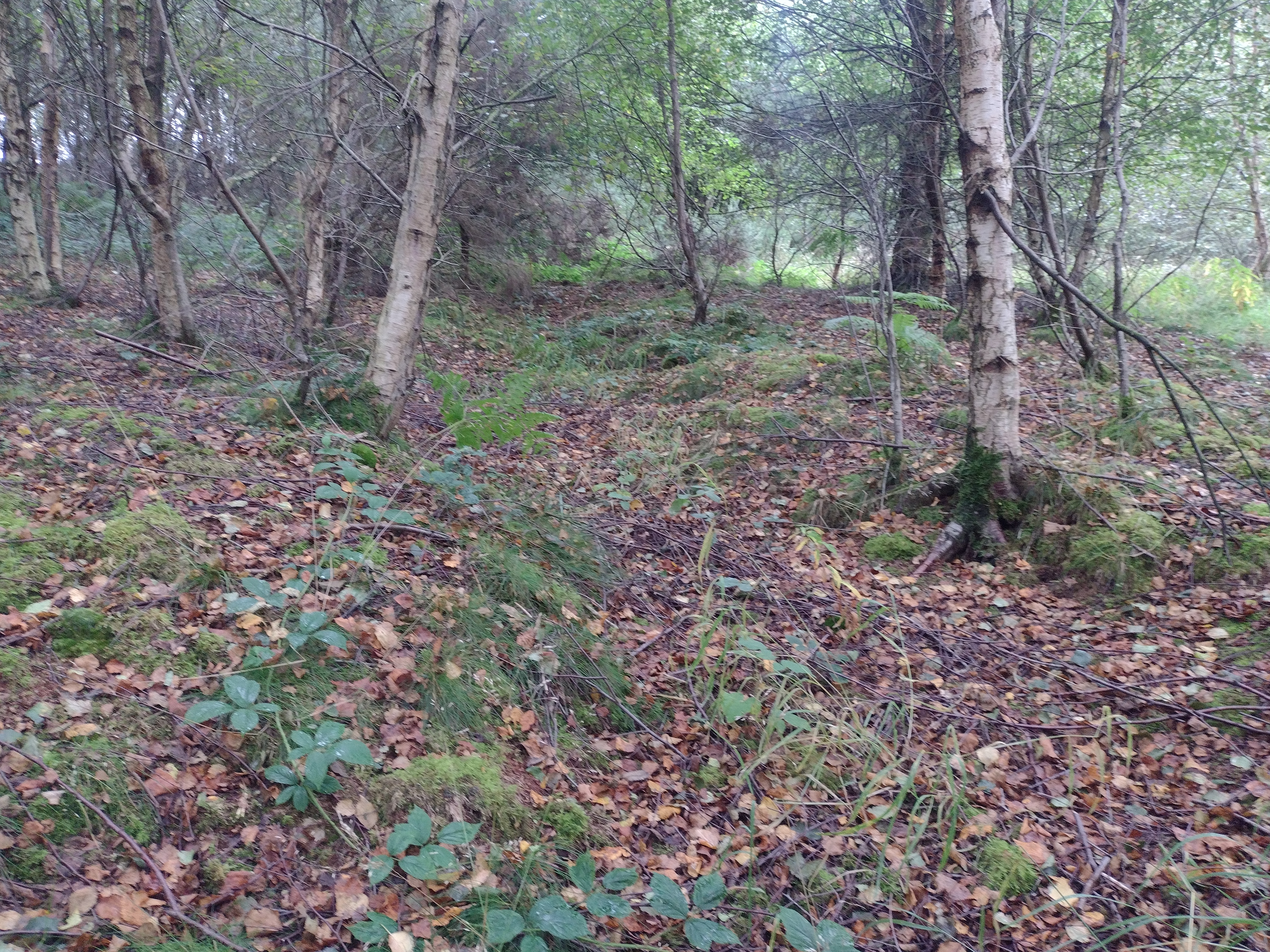
Figure 12: A faintly incised path (c.20cm depth) running parallel to 'Thief Lane'. A second path can be faintly seen on the right of the image. These two paths are separated by an 'island' with trees (Photo © David Stapley; CC-BY-SA 2.0)
Figure 13: Braided hollow way complex to the south of A171 near the village of Aislaby [125] (Image credit: © Sirius Minerals 2018)
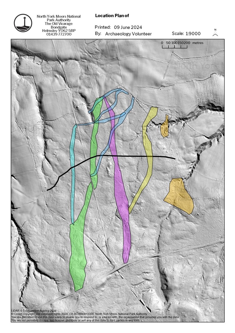
Figure 14: Two closed fan arrangements. The left [152, 153] crosses a boggy valley with a series of parallel deeply incised hollow ways. The right [176] shows two fans crossing an incline in the vicinity of a round barrow. These two fans interlock on this slope, collecting apparently different streams of traffic. (Image credit: © Sirius Minerals 2018)
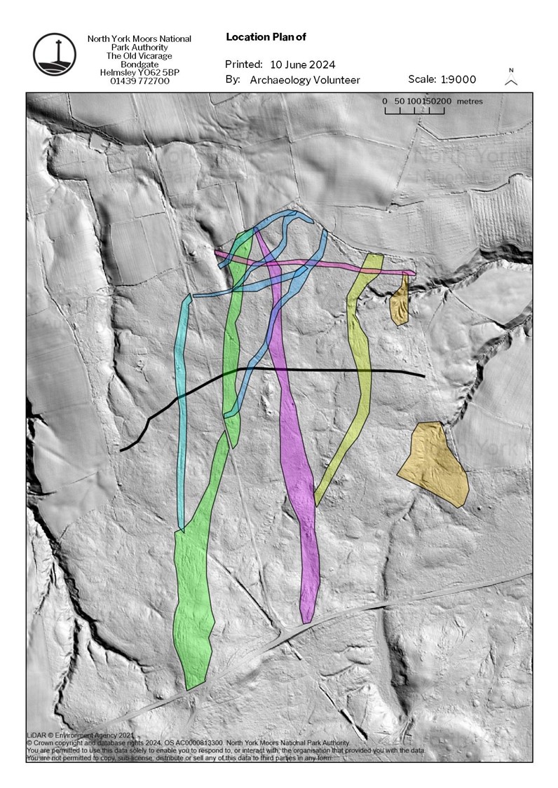
Figure 15: A closed fan hollow way [45] arrangement comprising a series of deeply incised highly parallelised ways, one of several parallel features on Fylingdales Low Moor. The feature expands as it approaches the rill, presumably to cope with greater erosion on the slopes making routes there impassable. (Image credit: © Sirius Minerals 2018)
Figure 16: Seggimire Lane Trod [116]. The trod sits within a hollow way complex [117]. Embanking of the trod is visible adjacent to a hollow way ditch, suggesting a series of phases to the relationship. (Image credit: © Sirius Minerals 2018)
Figure 17: The 'Monk's Trod' in Eskdale (Outside of survey area). Some of the stones are dished from persistent wear, and in the foreground at least one top stone is missing, revealing a secondary layer of smaller stones beneath. The lengths of stones are more irregular than their widths. It is terraced into the slope which it runs perpendicular to. Footpath erosion adjacent to the trod is undercutting and destabilising sections of it, and it is also at risk from water erosion and mass movement on the slope. (Photo © Miles Johnson; CC-BY-SA 2.0)
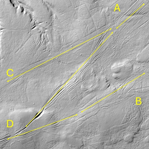
Figure 18: A four-way fork junction [371, 61, 63] on Fylingdales Low Moor. In this instance 'A' can be identified with the route to Whitby and Hawkser, whereas 'B' eventually runs to Robin Hoods Bay. 'C' and 'D' interweave with each other briefly south-west of this location, before sharply diverging, with unclear ultimate destinations. (Image credit: © Sirius Minerals 2018)
Figure 19: A disparity in the number of routeways opposing each other on a rill [45, 44] indicates potential unidirectional movement to the northeast.(Image credit: © Sirius Minerals 2018)
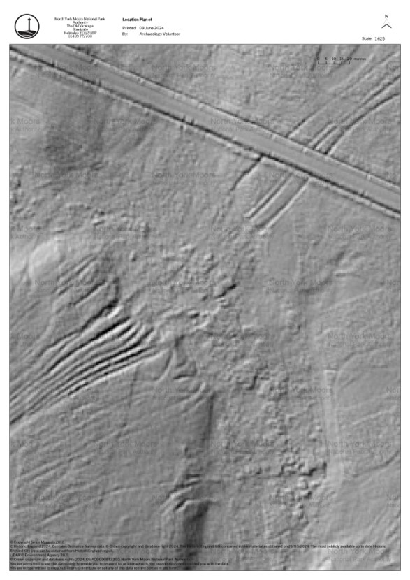
Figure 20: Liverton Moor with bank feature (HER 7076) marked (Image credit: Environment Agency © Crown Copyright and database rights 2024)
Figure 21: Liverton Moor Phase 1 [258, 259, 280] (Image credit: Environment Agency © Crown Copyright and database rights 2024)
Figure 22: Liverton Moor Phase 2 [291, 293, 282] (Image credit: Environment Agency © Crown Copyright and database rights 2024)
Figure 23: Liverton Moor Phase 3 [Phase 3: 270, 269, 273, 279 Phase 3 Putative: 274, 275, 254, 252, 250] (Image credit: Environment Agency © Crown Copyright and database rights 2024)
Figure 24: Liverton Moor Phase 4 [Phase 4: 278, 281, 279 Phase 4 Putative: 292, 300] (Image credit: Environment Agency © Crown Copyright and database rights 2024)
Figure 25: Liverton Moor Phase 5 [278] (Image credit: Environment Agency © Crown Copyright and database rights 2024)
Ageby, L., Angelucci, D.E., Brill, D., Carrer, F., Brückner, H. and Klasen, N. 2022 'Dating dry-stone walls with rock surface luminescence: A case study from the Italian Alps', Journal of Archaeological Science 144. https://doi.org/10.1016/j.jas.2022.105625
Aldred, O. 2020 The Archaeology of Movement, London: Routledge. https://doi.org/10.4324/9780429203022
Atha, M. 2007 Late Iron Age Regionality and Early Roman Trajectories (100BC-AD200): A landscape perspective from eastern Yorkshire, PhD thesis, University of York. https://etheses.whiterose.ac.uk/id/eprint/9917/
Atkinson, J.C. 1890 'Some notes on personal names obtaining in Cleveland in 1302', The Reliquary 4, 201-207. https://www.google.co.uk/books/edition/The_Reliquary/NV0_AAAAYAAJ?hl=en&gbpv=1&dq=panniermen&pg=PA201&printsec=frontcover [Last accessed: 6 January 2025]
Bell, M., Black, S., Maslin, S. and Toms, P. 2020 'Multi-method solutions to the problem of dating early trackways and associated colluvial sequences', Journal of Archaeological Science: Reports 32. https://doi.org/10.1016/j.jasrep.2020.102359
Bell, M. and Leary, J. 2020 'Pathways to past ways: a positive approach to routeways and mobility', Antiquity 94(377), 1349-1359. https://doi.org/10.15184/aqy.2020.133
Bell, T. and Lock, G. 2000 'Topographic and Cultural Influences on Walking the Ridgeway in Later Prehistoric Times' in Lock, G. (Ed) Beyond the Map. Archaeology and Spatial Technologies, Amsterdam: IOS Press. 85-100.
Boardman, J. 2013 'The hydrological role of 'sunken lanes' with respect to sediment mobilization and delivery to watercourses with particular reference to West Sussex, southern England', Journal of Soils and Sediments 13(9), 1636-1644. https://doi.org/10.1007/s11368-013-0754-7
Chadwick, A. 2016 'Foot-fall and hoof-hit. Agencies, movements, materialities, and identities; and later prehistoric and Romano-British trackways', Cambridge Archaeological Journal 26(1), 93-120. https://doi.org/10.1017/S095977431500027X
Coleman, R. 1981 'Footpath erosion in the English Lake District', Applied Geography 1(2). 121-131. https://doi.org/10.1016/0143-6228(81)90029-1
Dunn, C., Hunt, A. and Jecock, M. 2016 Medieval and Later Earthworks at Newby Hall, Newby, Penrith, Cumbria. Survey Report, English Heritage. https://historicengland.org.uk/research/results/reports/6470/MedievalandLaterEarthworksatNewbyHallNewbyPenrithCumbriaSurveyReport [Last accessed: 6 January 2025]
Edgeworth, M. and Gregory, D. 2012 Sundon Park, Lower Sundon, Bedfordshire, Archaeological Desk Based Assessment, English Heritage. https://sundon-pc.gov.uk/wp-content/uploads/2019/11/Sundon-Park-Lower-Sundon-An-Archaeological-Assessment.pdf [Last accessed: 6 January 2025]
Evans, C.P. 2008 Trods of the North York Moors, Scarborough: Scarborough Archaeological and Historical Society.
Fleming, A. 2009 'The making of a medieval road: the Monk's Trod routeway, mid Wales', Landscapes 10(1), 77-100. https://doi.org/10.1179/lan.2009.10.1.77
Fleming, A. 2011 'The crossing of Dartmoor', Landscape History 32(1), 27-45. https://doi.org/10.1080/01433768.2011.10594650
Flower, C.T. 1923 'Public Works in Mediaeval Law: Vol 2', London: Bernard Quartich. https://archive.org/details/publicworksinmed02ctfl [Last Accessed 12 March 2025]
Frodsham, P. 2021 'Ryevitalise Lidar Landscapes. Project Report', Unpublished report for the Ryevitalise Landscape Partnership and North York Moors National Park Authority. https://www.northyorkmoors.org.uk/__data/assets/pdf_file/0021/15672/Ryevitalise-Lidar-Landscapes-project-report-Dec-2021-LR.pdf
Giles, M. 2000 'Open-weave, close-knit': Archaeologies of Identity in the Later Prehistoric Landscape of East Yorkshire, PhD thesis, University of Sheffield. https://etheses.whiterose.ac.uk/id/eprint/3526/
Haken, M. 2022 'The Stainmore Road: from Late Iron Age routeway to engineered Roman road', Itinera. Journal of the Roman Roads Research Association 2, 241-302. https://romanroads.org/Itinera/Vol2_2022/haken_stainmore_ia_itinera_2022.pdf [Last accessed: 6 January 2025]
Harrison, S. 2003 'The Icknield Way: Some queries', Archaeological Journal 160(1), 1-22. https://doi.org/10.1080/00665983.2003.11078167
Hayes, R.H. 1988 Old Roads and Pannierways in North East Yorkshire, Helmsley: North York Moors National Park Authority.
Hindle, B. P. 1989 Medieval Roads, Princes Risborough: Shire Books.
Kalayci, T. 2023 'Archaeologies of Roads: An Introduction' in Kalayci, T. (ed) Archaeologies of Roads, University of North Dakota: The Digital Press. 1-31. https://doi.org/10.31356/dpb024
Leary, J. 2023 Footmarks: A Journey Into Our Restless Past, London: Icon Books.
Lewis, J. 2023 'Seeing While Moving: Direction-Dependent Visibility of Bronze Age Monuments in the Cumbrian High Fells, England' in Kalayci, T. (ed) Archaeologies of Roads, The Digital Press: University of North Dakota. 275-299. https://doi.org/10.31356/dpb024
Malim, T. and Hayes, L. 2011 'An Engineered Iron Age Road, Associated Roman Use (Margary Route 64), and Bronze Age Activity Recorded at Sharpstone Hill, 2009', Transactions of the Shropshire Archaeological and Historical Society 85, 7-81. https://shropshirearchaeologyhistory.org/wp-content/uploads/2019/09/shropshire-transactions-vol.-85_sm.pdf
Margary, I. D. 1955 Roman Roads in Britain, London: Phoenix House.
Morriss, R. K. 2005 Roads: Archaeology and Architecture, Stroud: Tempus.
Morris, S. 2024 'Ancient Welsh mountain byway threatened by resurfacing plans', The Guardian [Online], 26 March 2024. https://www.theguardian.com/uk-news/2024/mar/26/welsh-mountain-byway-threatened-by-powys-county-council-resurfacing-plans [Last accessed: 6 January 2025]
Quartermain, J. 1999 'Telford's Holyhead Road, (A5), North Wales Archaeological Survey Report', Lancaster: Lancaster University Archaeological Unit. https://eprints.oxfordarchaeology.com/6550/
Seitsonen, O. Houle, J.-L. and Broderick, L. G. 2014 'GIS Approaches to Past Mobility and Accessibility: An Example From the Bronze Age Khanuy Valley, Mongolia' in Leary J. (ed) Past Mobilities: Archaeological Approaches to Movement and Mobility, Oxford: Routledge. 79-111. https://doi.org/10.4324/9781315599632-5
Sewell, J. T. 1923 An account of some mediaeval roads crossing the moors south and south west of Whitby, Whitby: Horn.
Stables, D. 2023 'England's mysterious sunken roads', BBC [online], 14th August 2023. https://www.bbc.com/travel/article/20230813-holloways-englands-mysterious-sunken-roads [Last accessed: 6 January 2025]
Stoertz, C. 1997 Ancient Landscapes of the Yorkshire Wolds: Aerial photographic transcription and analysis, RCHME: Swindon
Vletter, W. and Spek, T. 2021 'Archaeological features and absolute dating of historical road tracks in the North-western European Sand Belt: An interdisciplinary case study of a late medieval and early modern trade route at the Hoge Veluwe National Park (Central Netherlands)', Landscape History 42(2), 23-39. https://doi.org/10.1080/01433768.2021.1999012
Wheatley, L. R. 2008 The Mercers in Medieval York 1272/3 to 1529: Social Aspirations and Commercial Enterprise, PhD Thesis, University of York. https://etheses.whiterose.ac.uk/id/eprint/9923/ [Last accessed: 6 January 2025]
White, G. 1789 The Natural History and Antiquities of Selbourne, London: S. T. Freemantle. https://ia800909.us.archive.org/6/items/naturalhistoryan01whituoft/naturalhistoryan01whituoft.pdf [Last accessed: 6 January 2025]
Zgłobicki, W., Poesen, J., De Geeter, S., Boardman, J., Gawrysiak, L., Golosov, V., Ionita, I., Niacsu, L., Rodzik, J., Stankoviansky, M. and Stolz, C. 2021 'Sunken lanes - Development and functions in landscapes', Earth-Science Reviews 221. https://doi.org/10.1016/j.earscirev.2021.103757
Internet Archaeology is an open access journal based in the Department of Archaeology, University of York. Except where otherwise noted, content from this work may be used under the terms of the Creative Commons Attribution 3.0 (CC BY) Unported licence, which permits unrestricted use, distribution, and reproduction in any medium, provided that attribution to the author(s), the title of the work, the Internet Archaeology journal and the relevant URL/DOI are given.
Terms and Conditions | Legal Statements | Privacy Policy | Cookies Policy | Citing Internet Archaeology
Internet Archaeology content is preserved for the long term with the Archaeology Data Service (ROR). Help sustain and support open access publication by donating to our Open Access Archaeology Fund.
 Home
Home