Cite this as: Dubisch, A. 2025 Lübeck's Founding Quarter: Urban Development at an Authentic Site, Internet Archaeology 70. https://doi.org/10.11141/ia.70.15
Lübeck, one of the oldest Hanse cities in Germany, harbours a rich historical heritage that is particularly evident in the so-called Founding Quarter. In the years 2009–2016, archaeological investigations were carried out in an area of more than 10,000m² in the run-up to urban restructuring measures, which not only revealed the origins of the city, but also documented the unique development of the former merchants' quarter. Based on these findings, this paper examines the challenges and opportunities for contemporary urban development using the example of Lübeck's historic city centre. The former merchants' quarter can, and should in the future, be seen as a living example of the successful integration of historical heritage and modern urban planning in a United Nations Educational, Scientific and Cultural Organization (UNESCO) World Heritage Site.
Corresponding author: André Dubisch
[email protected]
Archäologie und Denkmalpflege der Hansestadt Lübeck, Abteilung Archäologie
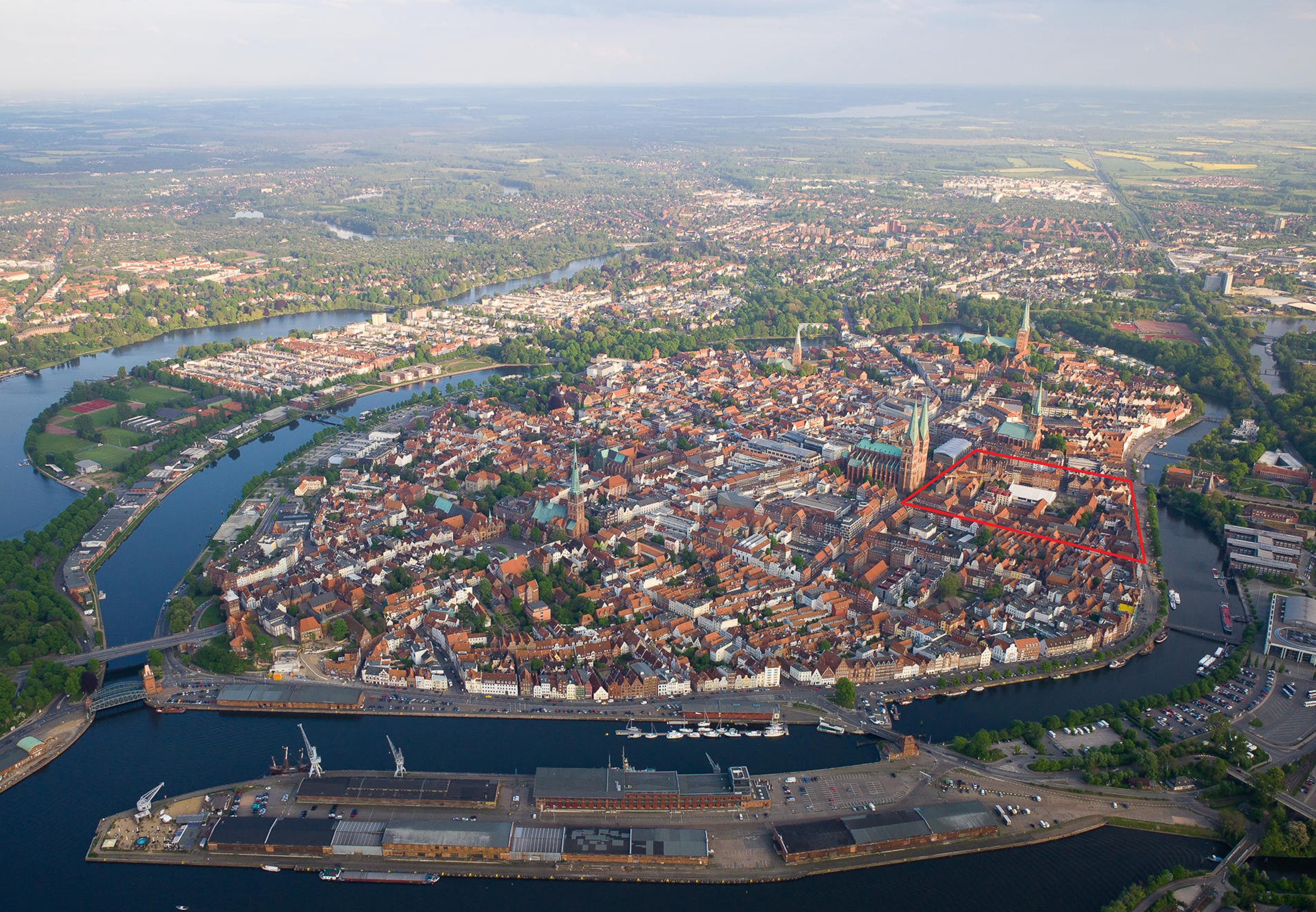
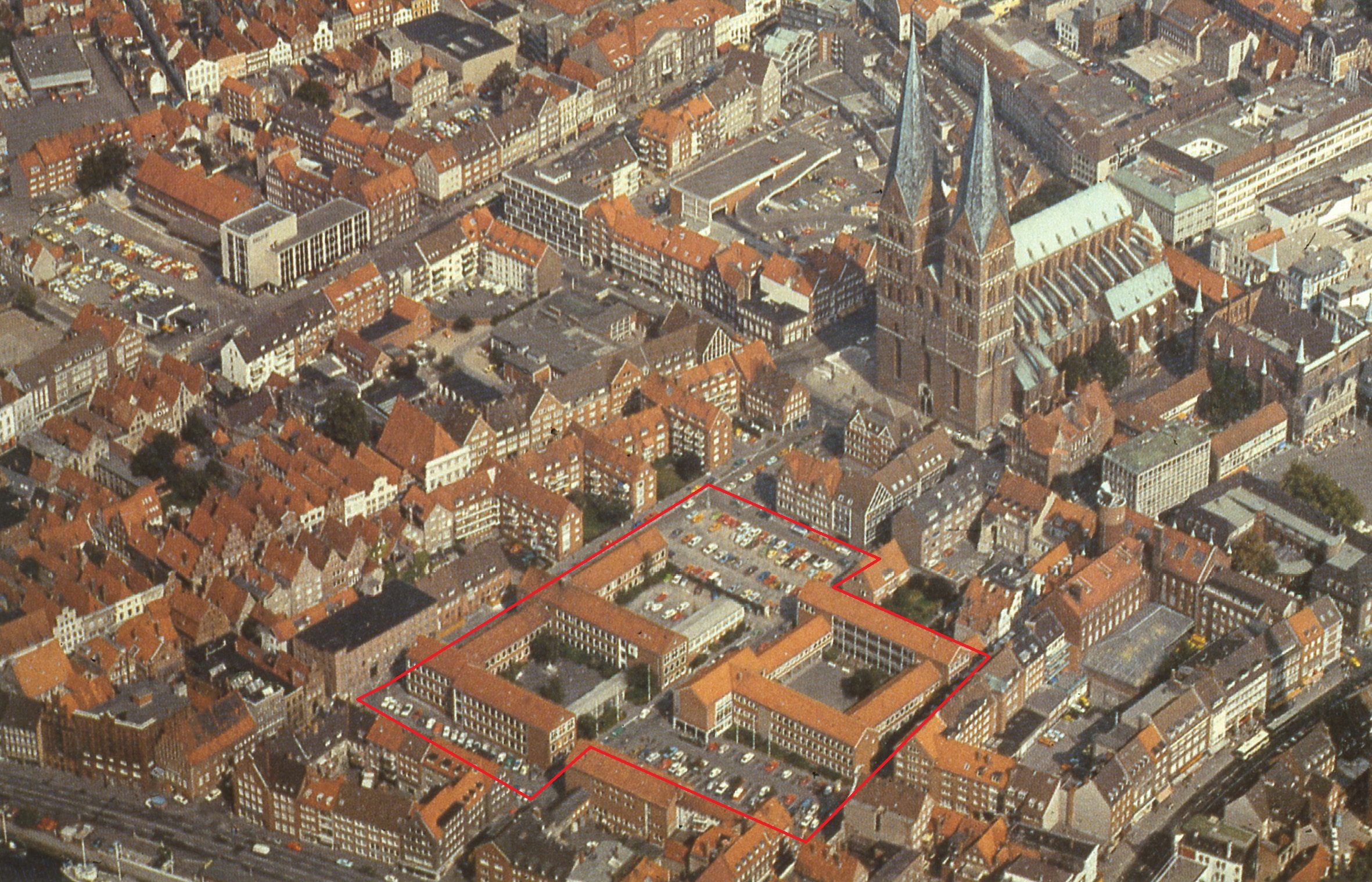
Figure 1: An aerial view of the Hanse city of Lübeck from the north-west, showcasing the island layout and the seven iconic church towers. Marked in red, below the two towers of St Mary's Church, lies the Founding Quarter, the historic area now undergoing redevelopment to blend medieval heritage with modern urban planning (© Hansestadt Lübeck, Abteilung Archäologie).
Figure 2: At the centre of the map is the Old Town Island, which is an archaeological protection area, outlined in red. The official borders according to the 1987 UNESCO Convention are marked in purple. Additionally, outside the World Heritage Site, there are also several monuments that are protected as historic landmarks (© Creative Commons).
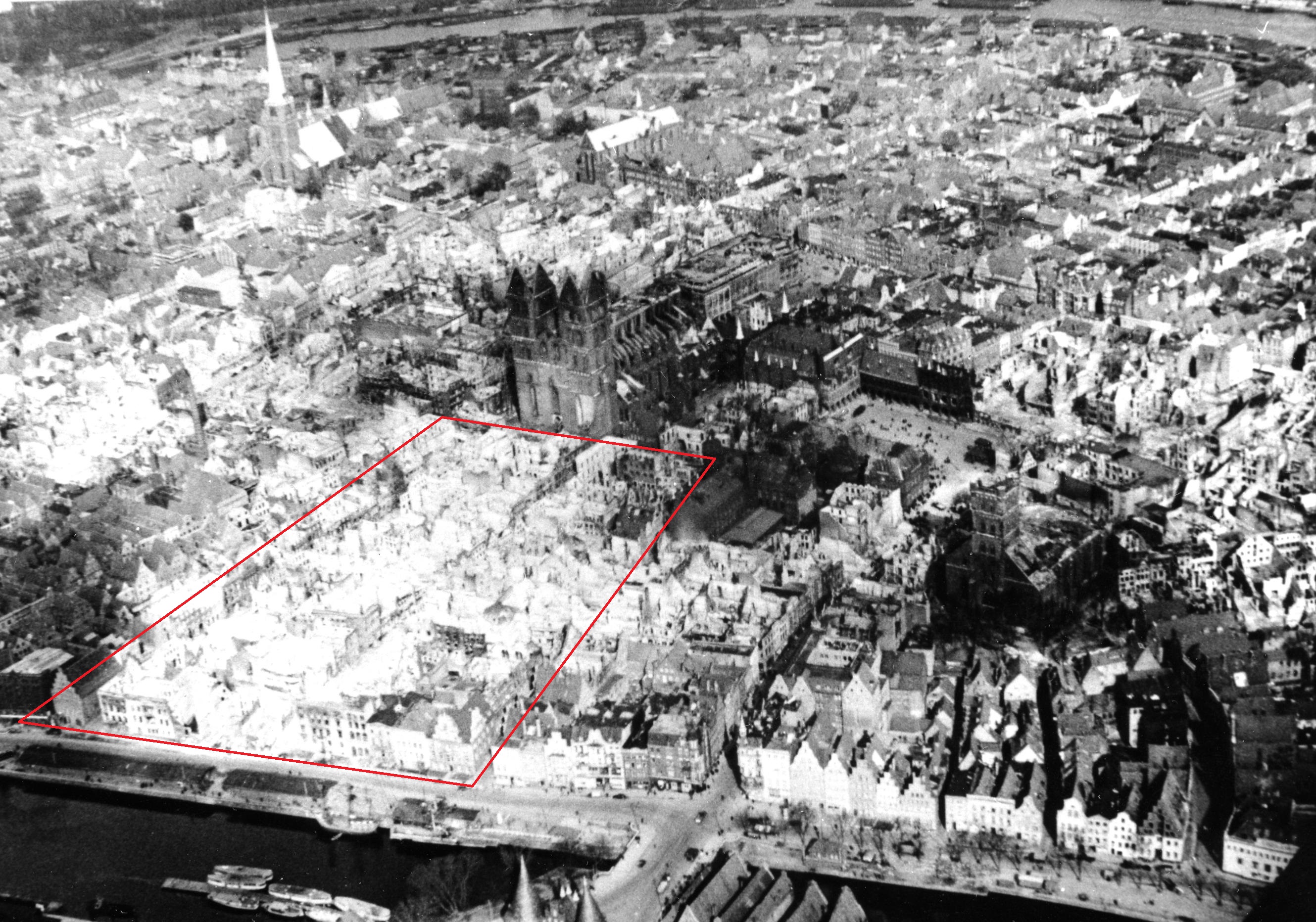
Figure 3
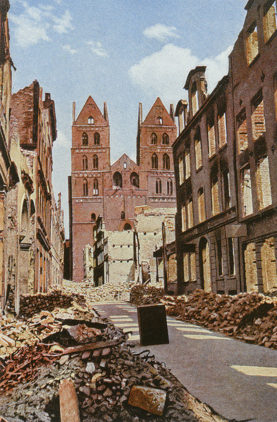
Figure 4: A colorised photo from 1942, showing the view from Alfstraße towards Marienkirche immediately after the bombing. On both sides of the street the houses were almost completely burnt down, and were soon demolished to make way for new buildings and street widening (© Hansestadt Lübeck, Abteilung Archäologie).
Figure 5: An aerial view from the west showing the Founding Quarter and Marienkirche. The two school buildings and their adjacent parking areas are highlighted in red. The existing plot structure has been completely dismantled and transformed for the new construction projects (© Hansestadt Lübeck, Abteilung Archäologie).
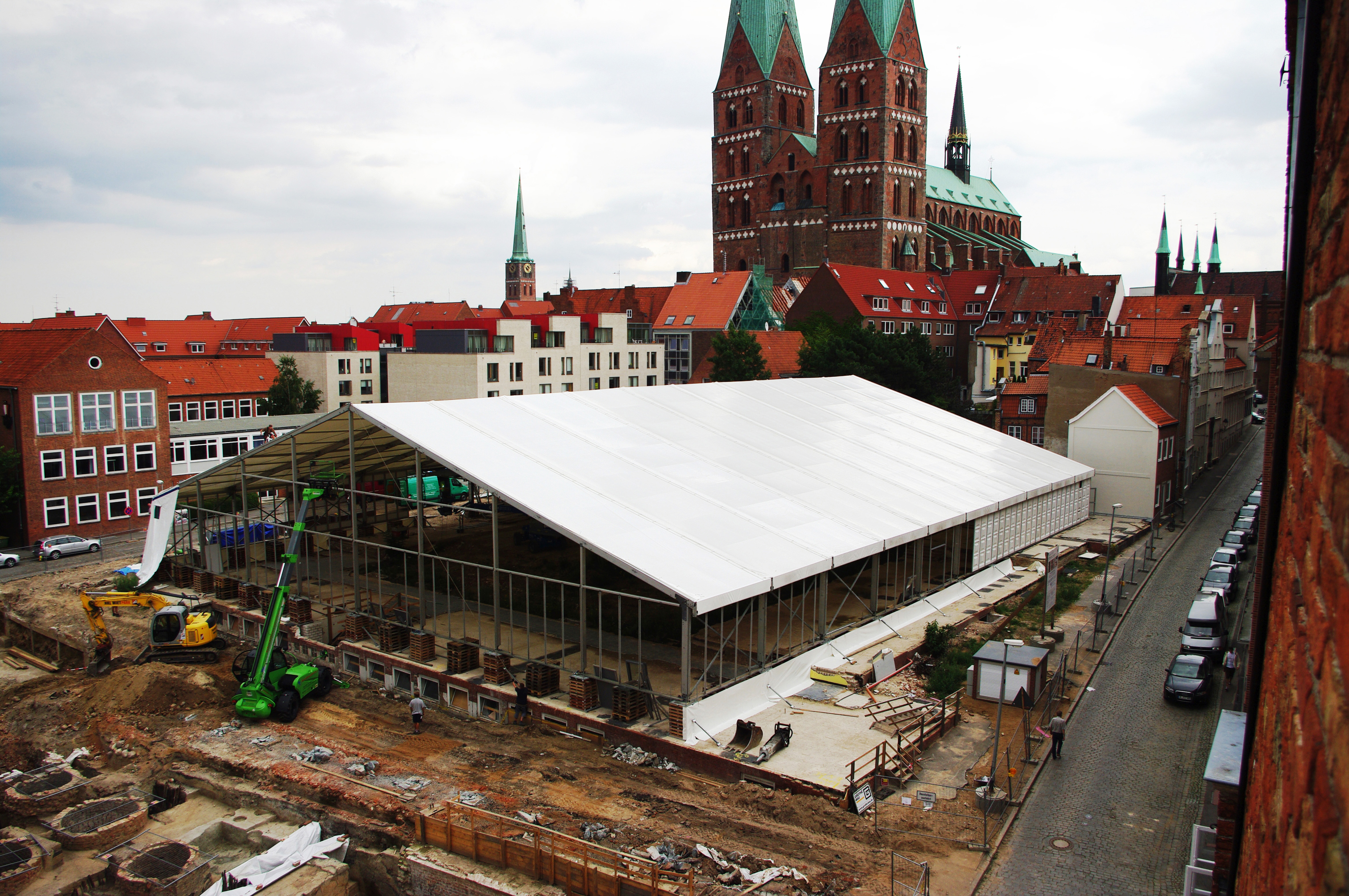
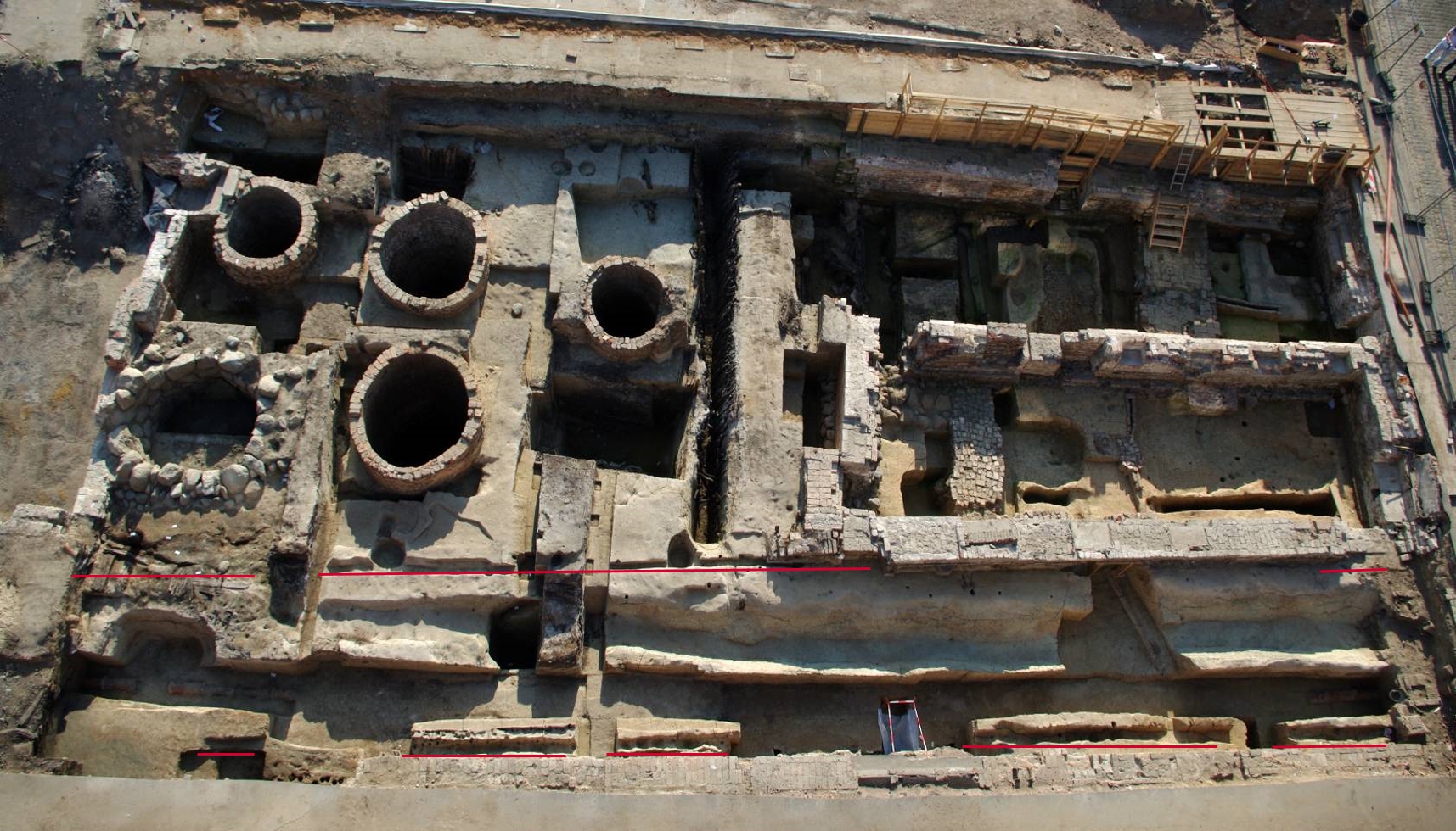
Figure 6: A large excavation tent was erected over the demolished school buildings, allowing the archaeological work to proceed regardless of the weather, temperature and season. In the lower left part of the photo, the brick cesspits in a backyard, which were uncovered directly beneath the parking lot, are clearly visible (© Hansestadt Lübeck, Abteilung Archäologie).
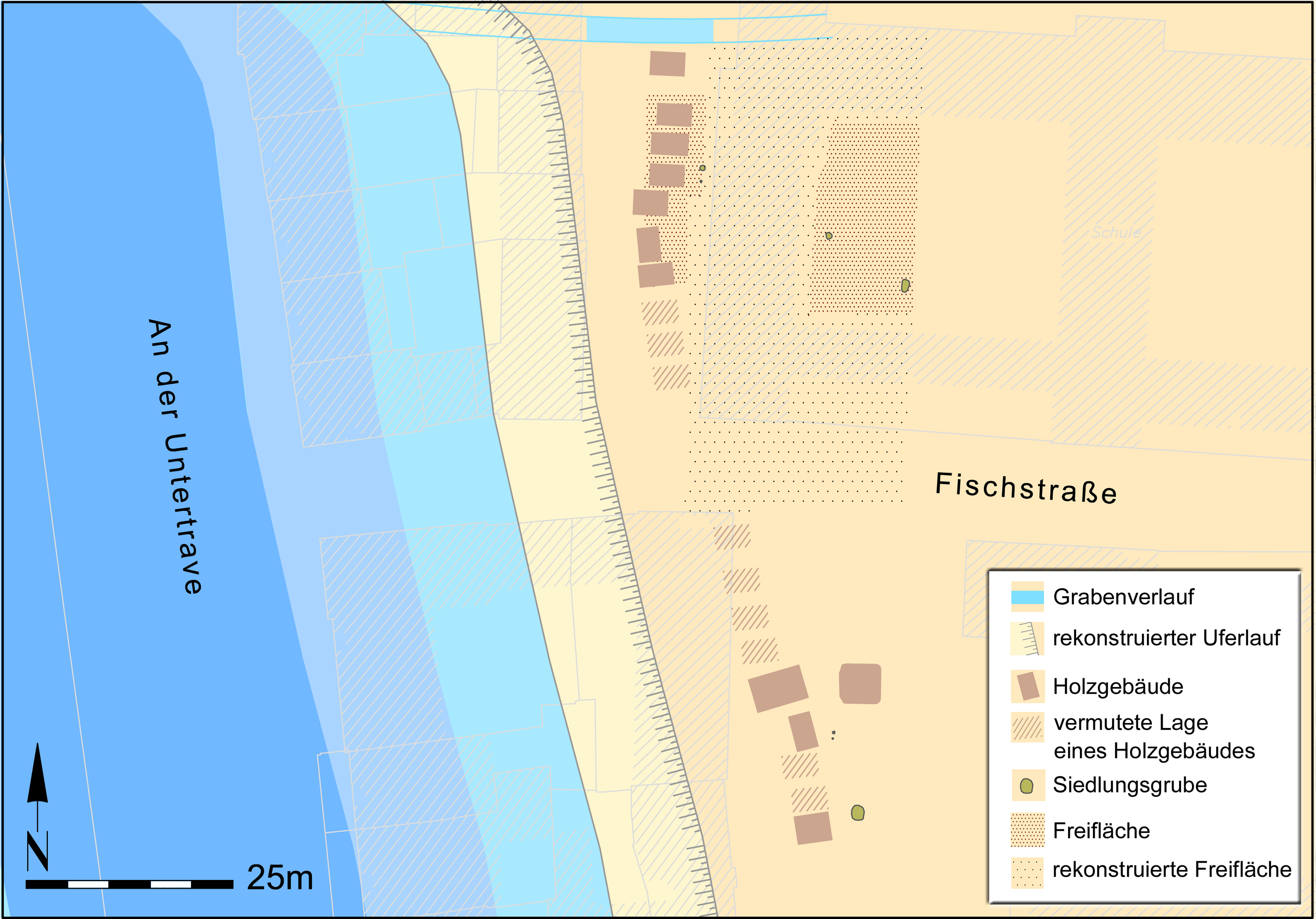
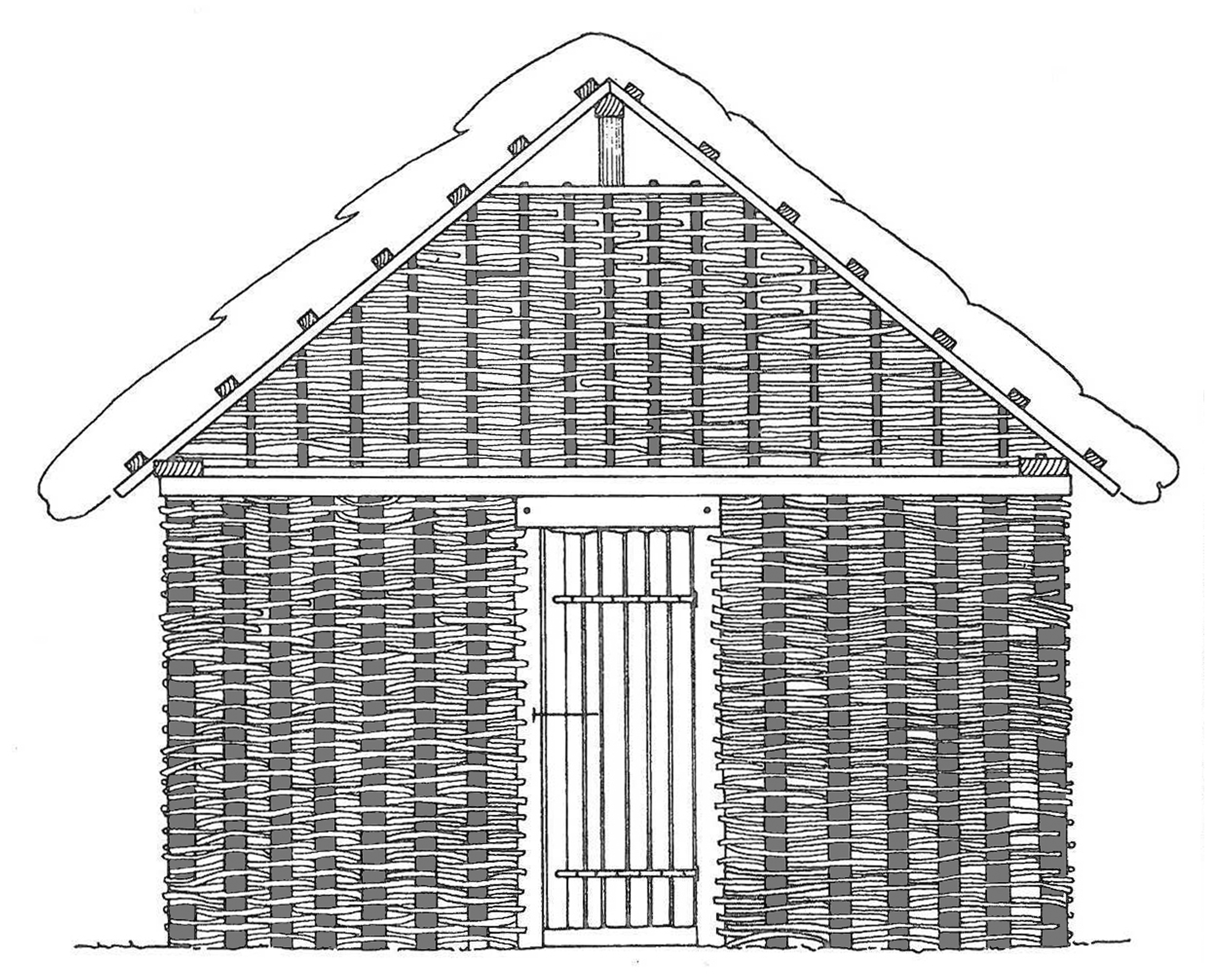
Figure 7a/Figure 7b: a) Reconstructed settlement and shoreline conditions around the year 1100, based on excavation findings. b) Reconstruction drawing of one of the wattle huts that stood along the shore (© Hansestadt Lübeck, Abteilung Archäologie).
Figure 8: In the aerial photo, the former path of Einhäuschen Querstraße is highlighted in red, showing the separation between public and private land through ditches and fences, one of the oldest urban planning features discovered in the Founding Quarter (© Hansestadt Lübeck, Abteilung Archäologie).
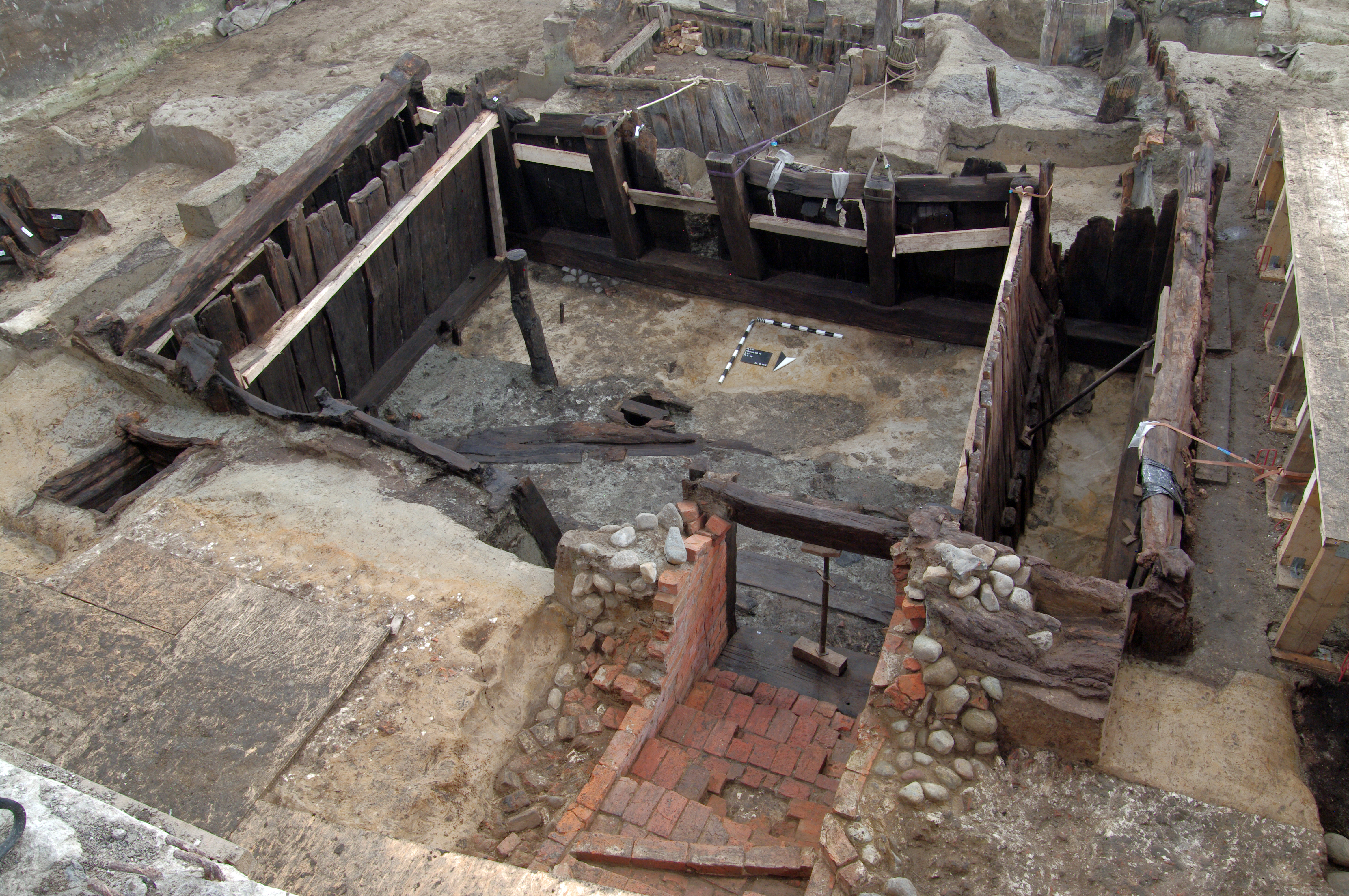
Figure 9: The large high medieval wooden cellar at Fischstraße 17 (dated to around 1180). By the late 12th century, the cellar featured a brick staircase, a sign of its special status, as not all wooden cellars had such an accessway (© Hansestadt Lübeck, Abteilung Archäologie).
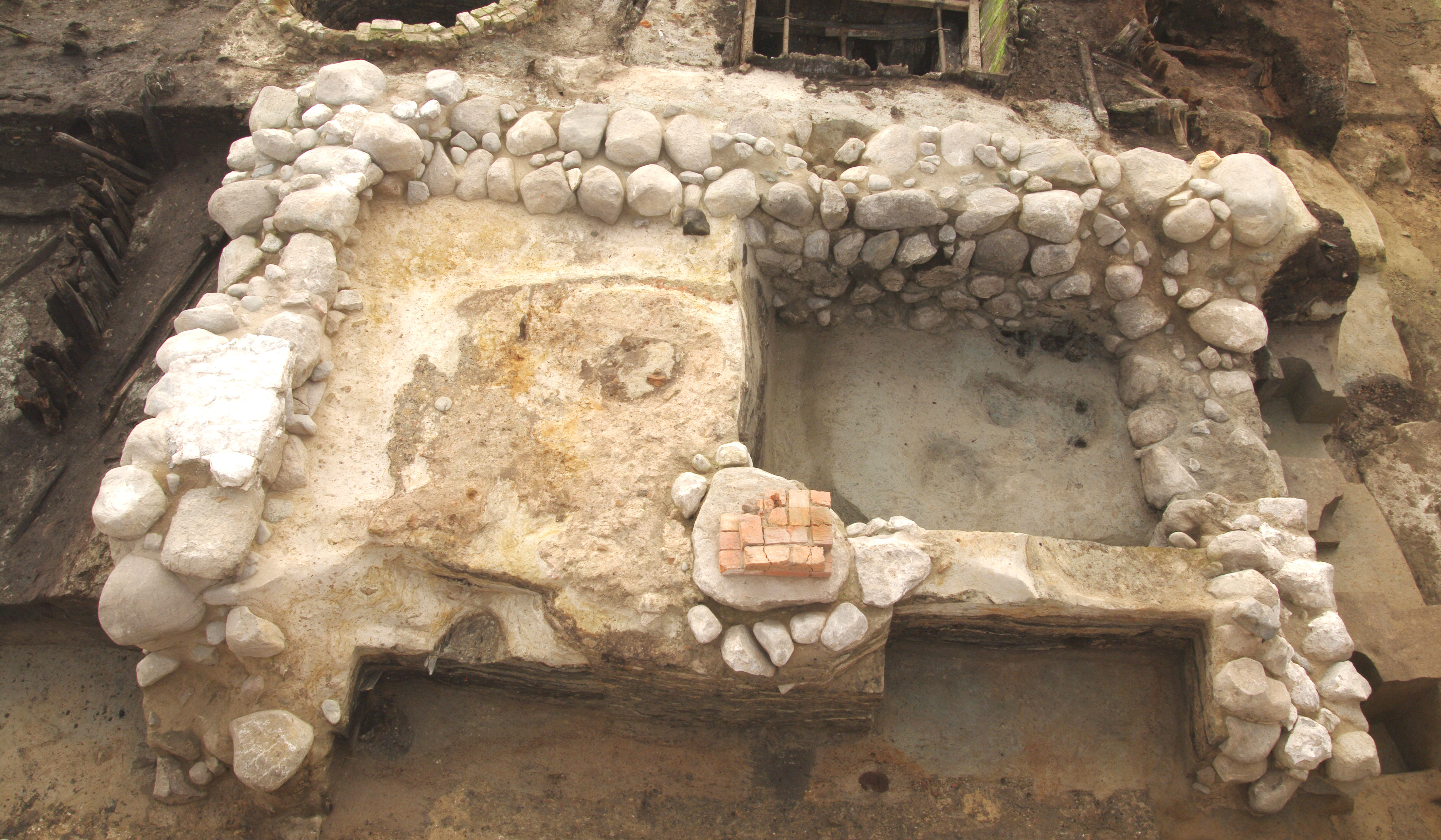
Figure 10: Remains of the 'Steinwerk' at Alfstraße 25/27. This tower-like building, measuring 10 × 10 m, was constructed on a broad fieldstone foundation. The square structure featured a vaulted ceiling supported by a central pillar, and was built between 1215 and 1240 (© Hansestadt Lübeck, Abteilung Archäologie).
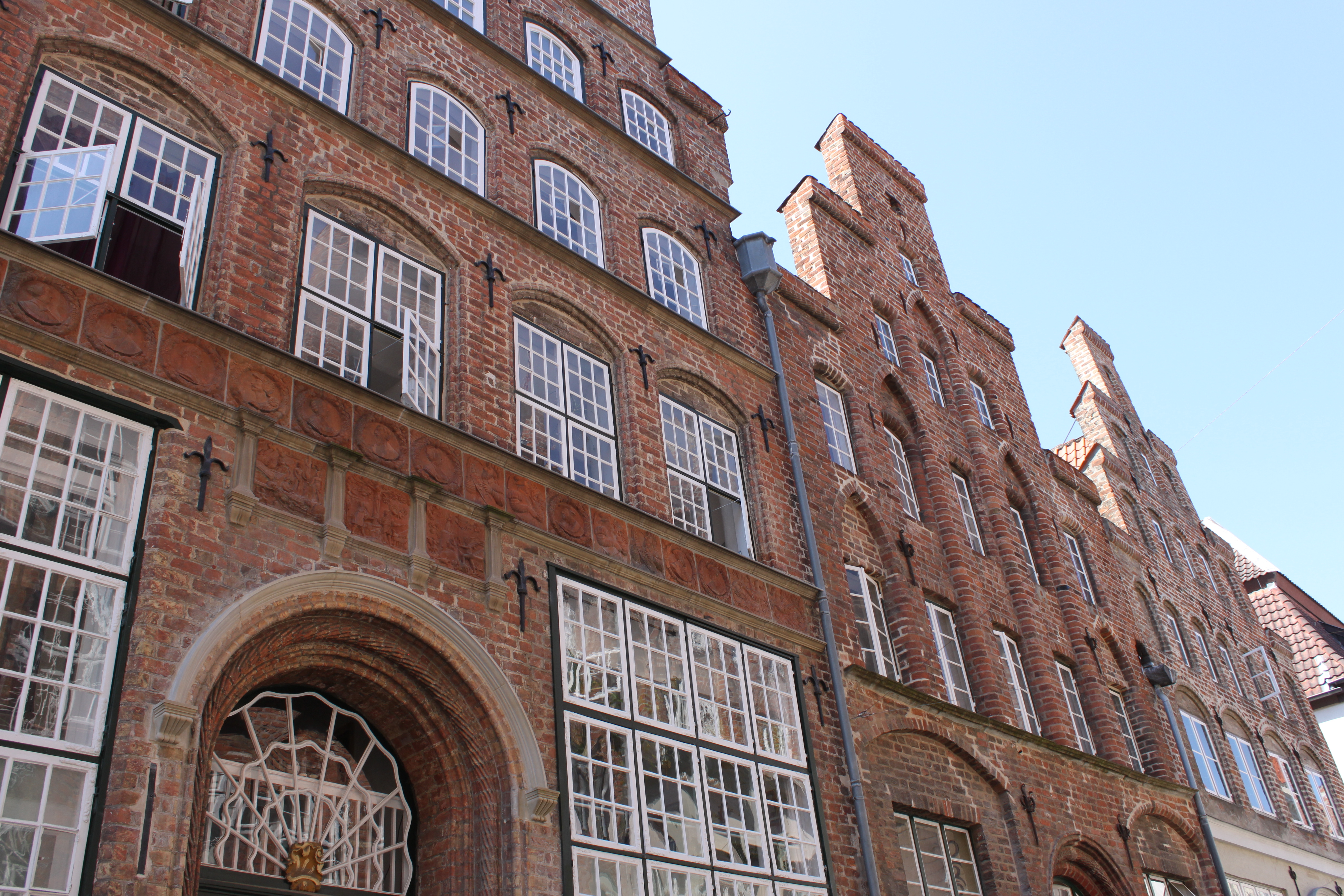
Figure 11: Typical street and gable facades from the Hanseatic period in the streets of Lübeck's Old Town that were spared during the Second World War (© Hansestadt Lübeck, Abteilung Archäologie).
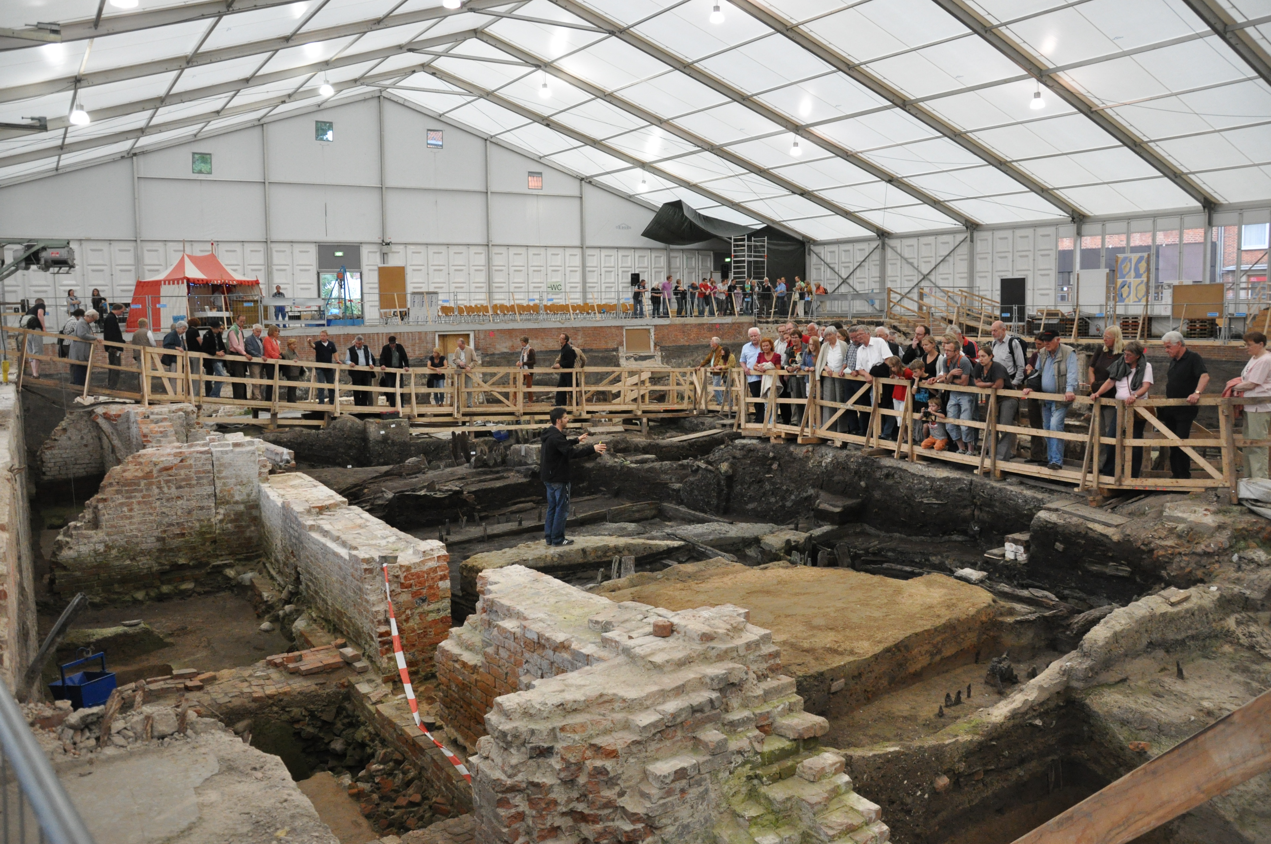
Figure 12: An essential part of the outreach efforts during the excavation was regular tours inside the excavation tent, highlighting the latest findings and offering exclusive insights into the large-scale excavation (© Hansestadt Lübeck, Abteilung Archäologie).
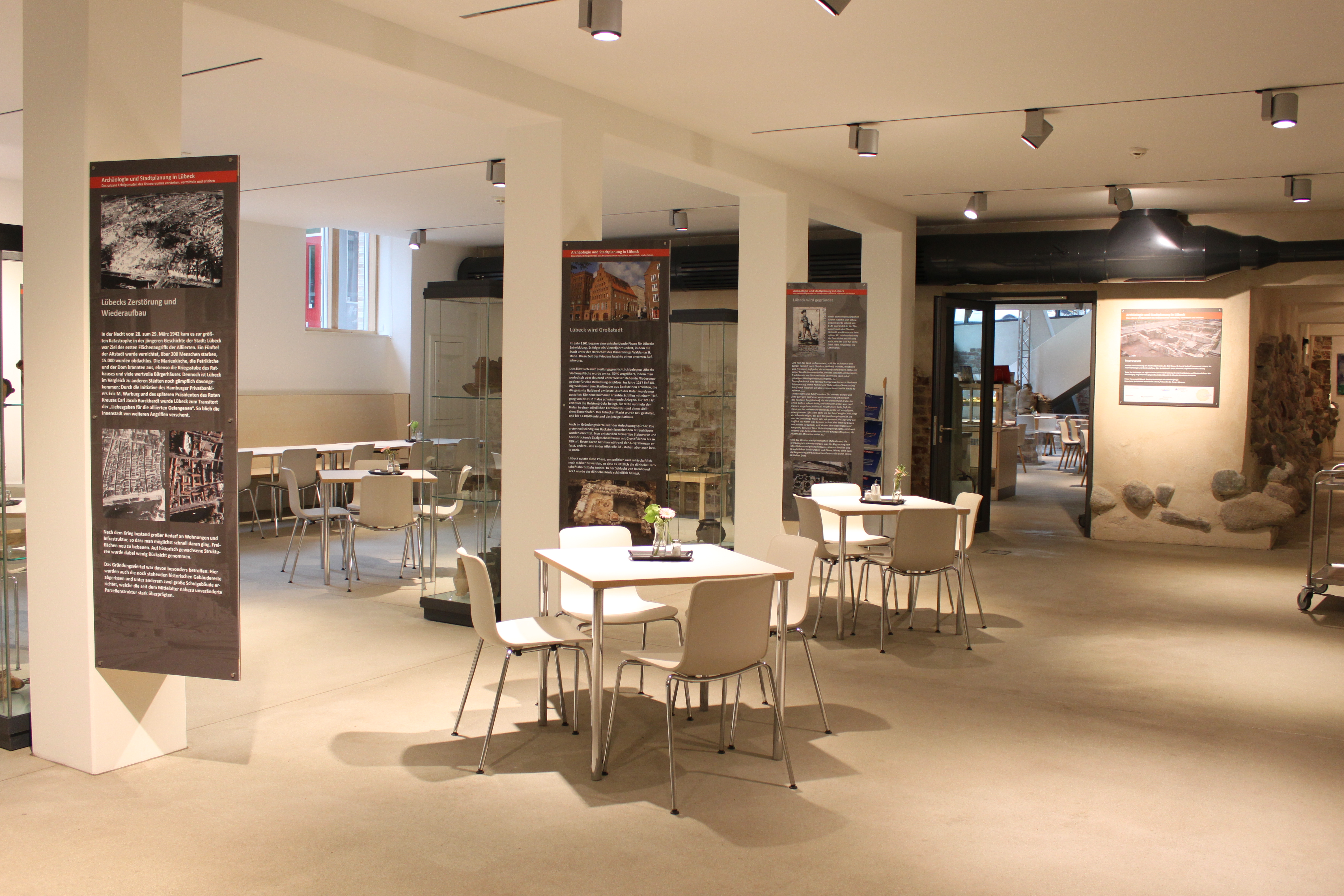
Figure 13: Café Ulrich's at Schüsselbuden 6–8. In today's café within the Ulrich-Gabler-Haus, visitors can experience the rich history of the Founding Quarter up close and gain insight into the excavation results through additional information and artefacts (© Hansestadt Lübeck, Abteilung Archäologie).
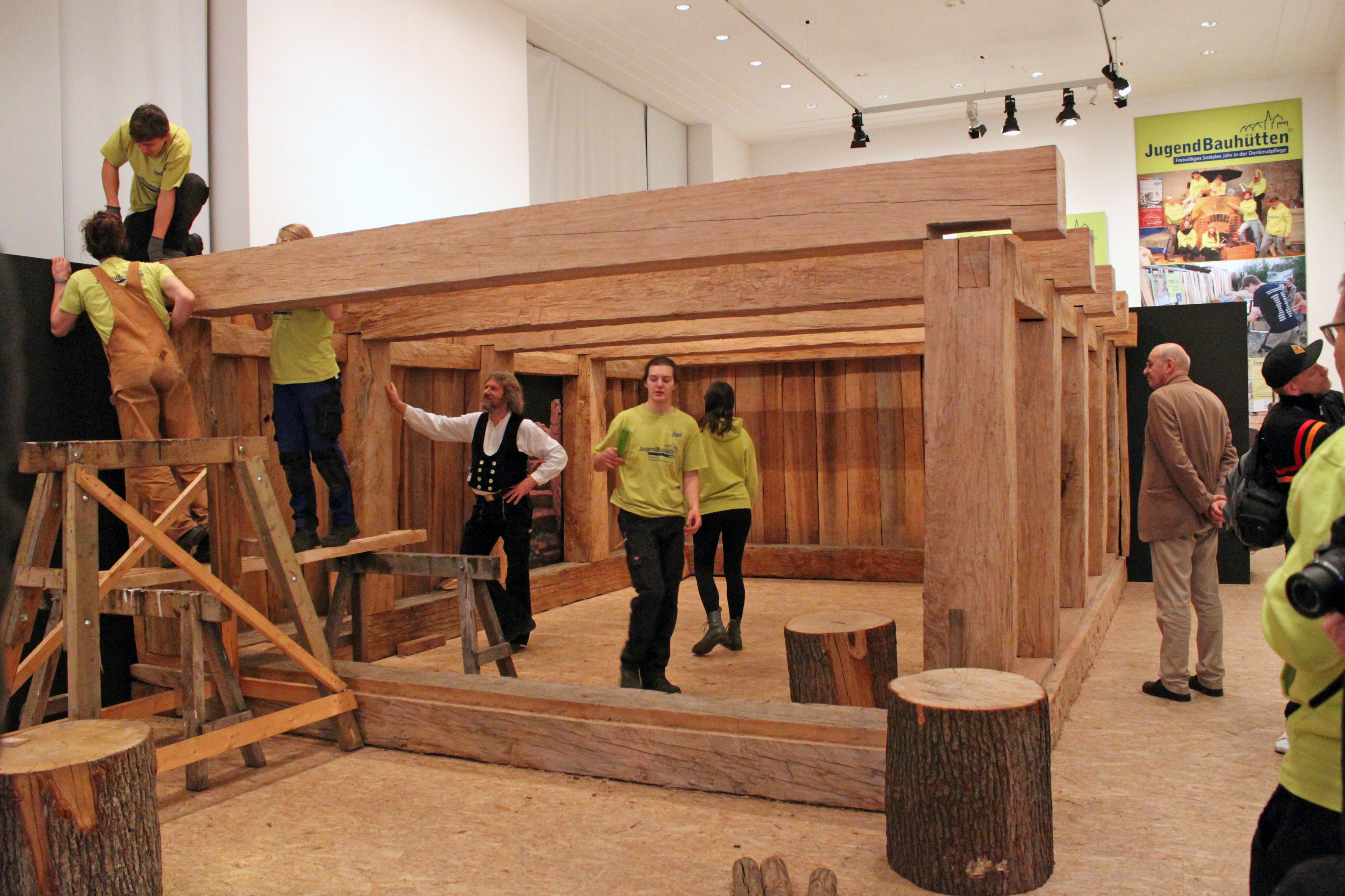
Figure 14: Erection of the wooden cellar reconstruction during the opening of the 'Restless Times' exhibition in 2018 in Berlin (© Hansestadt Lübeck, Abteilung Archäologie).
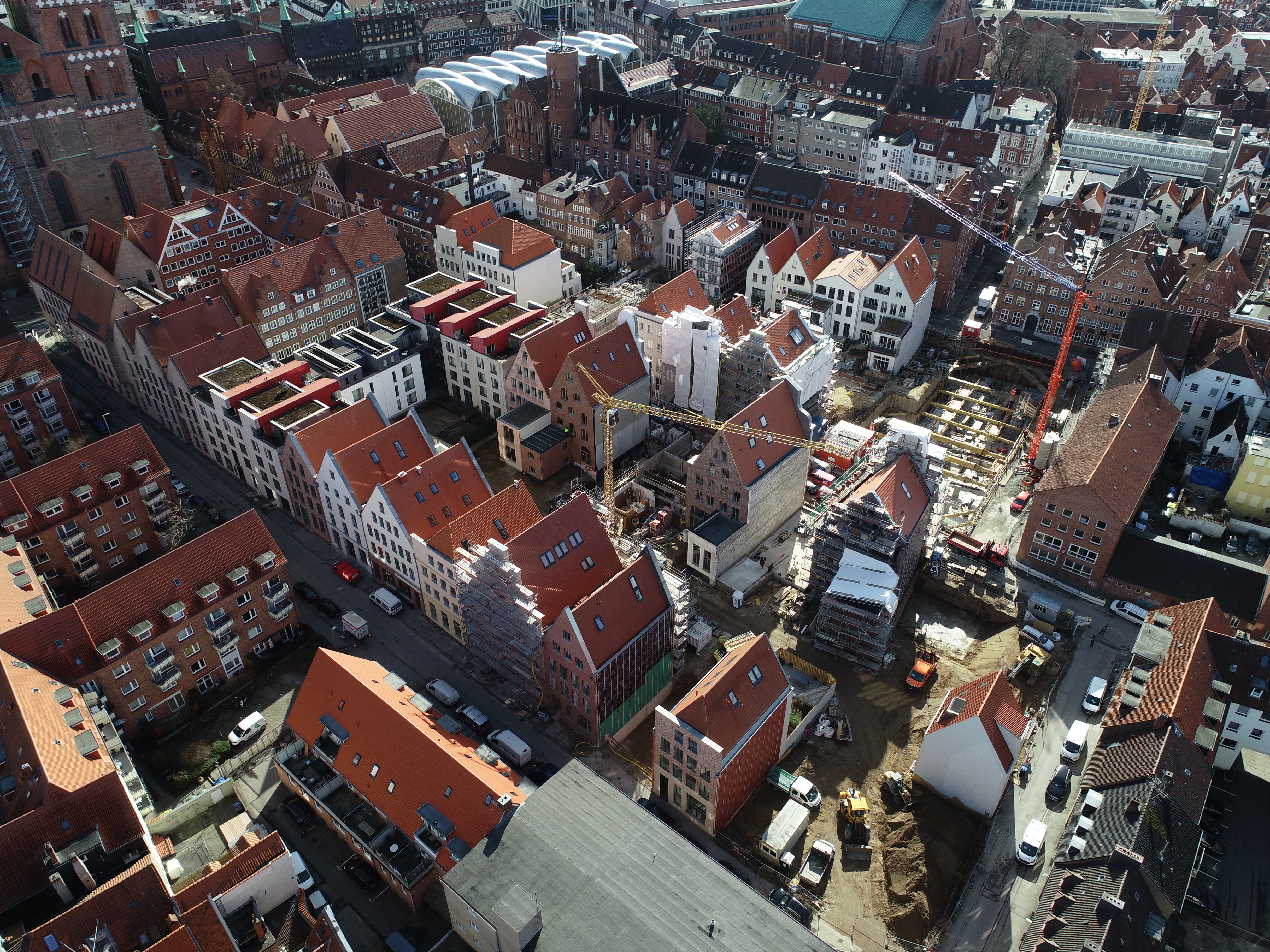
Figure 15: An aerial view of the construction site in the Founding Quarter from 2021. It is clear that the new buildings align with the historic buildings' footprints and plot structures (© Hansestadt Lübeck, Abteilung Archäologie).
Figure 16: Insight into the museum's presentation of a snapshot from the archaeological dig that took place before the museum was built. This space serves as a gentle introduction to the history of the Hanse, which is closely linked to the city's history (© Europäisches Hansemuseum).
Figure 17: A visualisation sketch of the integration of the cellars on Fischstraße into the new construction projects (© Hansestadt Lübeck, Abteilung Archäologie).
Figure 18: Using lighting technology, traces of the development and settlement structure in the Founding Quarter are successfully made visible and tangible in the cellar of Fischstraße 11 (© Hansestadt Lübeck, Abteilung Archäologie).
Figure 19 (video): A three-dimensional (3D) scan of the wooden figure found in a cesspit at the Fischstraße 24, dated to the 15th/16th centuries (© Hansestadt Lübeck, Abteilung Archäologie).
Helmolds Slavenchronik. Helmoldi presbyteri Bozoviensis Cronica Slavorum (= Monumenta Germaniae Historica, Scriptores rerum Germanicarum in usum scholarum 32), hrsg. v. B. Schmeidler, Hannover 1937. https://www.dmgh.de/mgh_ss_rer_germ_32/index.htm#page/(III)/mode/1up
LVO 1992 Landesverordnung über das Grabungsschutzgebiet “Innere Stadt“ der Hansestadt Lübeck vom 8. April 1992. https://www.gesetze-rechtsprechung.sh.juris.de/bssh/document/jlr-L%C3%BCbeckIStGrabSchGVSHV5P1
Rieger, D. 2022 Die Ausgrabungen im Lübecker Gründungsviertel II, Archäoparasitologie, Handelsgeschichte, Paläopathologie und Anthropologie, Schmidt-Römhild, Lübeck.
Rieger, D. and Jahnke, C. 2018 'Das Gründungsviertel von Lübeck. Veränderungen in den Handelsströmen und in den urbanen Strukturen' in M. Wemhoff and M. Rind (eds) Bewegte Zeiten - Archäologie in Deutschland, Michael Imhof Verlag: Berlin. 228–41.
Schneider, M. 2019 Die Ausgrabungen im Lübecker Gründungsviertel I, Die Siedlunsggeschichte, Schmidt-Römhild: Lübeck.
Schneider, M. 2021 Lübecker Kolloquium zur Stadtarchäologie im Hanseraum XI. Archäologie im Hier und Jetzt, Schmidt-Römhild: Lübeck.
World Heritage List 1987 World Heritage List. Hanseatic City of Lübeck, No. 272, Paris: UNESCO World Heritage Convention. https://whc.unesco.org/en/list/272 [Last accessed: 10 February 2025]
Internet Archaeology is an open access journal based in the Department of Archaeology, University of York. Except where otherwise noted, content from this work may be used under the terms of the Creative Commons Attribution 3.0 (CC BY) Unported licence, which permits unrestricted use, distribution, and reproduction in any medium, provided that attribution to the author(s), the title of the work, the Internet Archaeology journal and the relevant URL/DOI are given.
Terms and Conditions | Legal Statements | Privacy Policy | Cookies Policy | Citing Internet Archaeology
Internet Archaeology content is preserved for the long term with the Archaeology Data Service (ROR). Help sustain and support open access publication by donating to our Open Access Archaeology Fund.
 Home
Home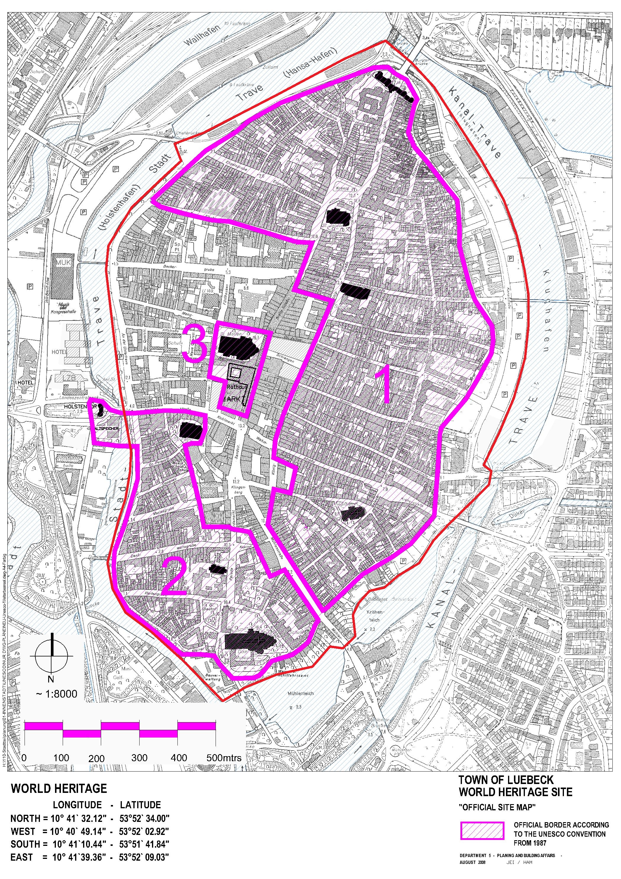