Fig. 6. Barp Frobost. Photo looking north. (Photo: Cole Henley)
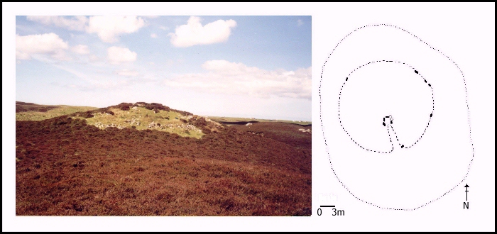
This cairn lies in the central part of the island, around 15 metres above sea level and 3 kilometres from the coast. It is situated on a rocky outcrop on the north side of a wide flat valley and a whole range of mountains are visible to the north and east.
Fig. 6. Barp Frobost. Photo looking north. (Photo: Cole Henley)
This site has been quite badly damaged and little cairn material is visible, although much of the surviving cairn is covered with grass. Six stones in the peristalith are visible and suggest a cairn of approximately 25 metres in diameter. There are no definite signs of either a forecourt or passage, but it is likely one may originally have been located to the south. On top of the cairn the tops of some orthostats can be seen which suggest that the chamber may be more or less intact. A possible capstone is also located here.
© Internet Archaeology
URL: http://intarch.ac.uk/journal/issue8/cummings/frobost1.html
Last updated: Tue Aug 8 2000