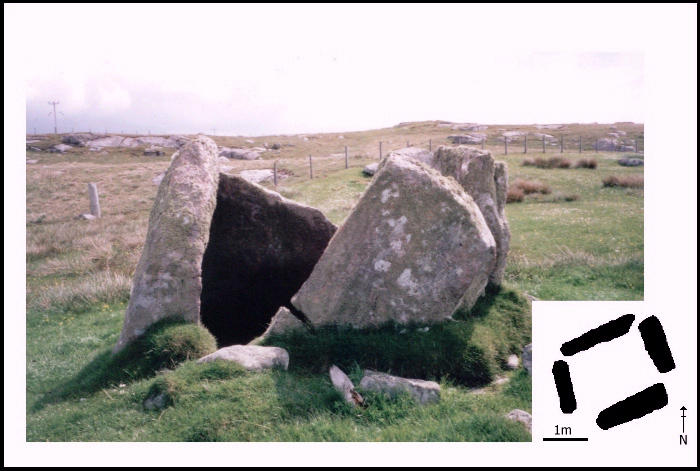
 Fig. 9. Leaval. Photo looking east.
This site is situated to the south of the island at approximately 15 metres above sea level and 1 kilometre from the coast. The cairn was built about three-quarters of the way up the north slope of a small hill which restricts views to the south, although there are wide views to the north of Loch Aisavat and the machair plain to the west.
Fig. 9. Leaval. Photo looking east.
This site has been badly damaged. Only four orthostats survive in situ which seem to define a small rectangular chamber. There is no evidence of a capstone or any kerb-stones, although Henshall (1972, 520) claims that the name of the site (leac meaning flat slab) implies that a capstone may once have been present. This site has recently seen small-scale excavation in an attempt to confirm its status as a chambered tomb (Cummings and Sharples 2000.). A core cairn was exposed around the upright slabs, but there was no sign of a passage or forecourt area.
© Internet Archaeology
URL: http://intarch.ac.uk/journal/issue8/cummings/leaval1.html
Last updated: Tue Aug 8 2000