
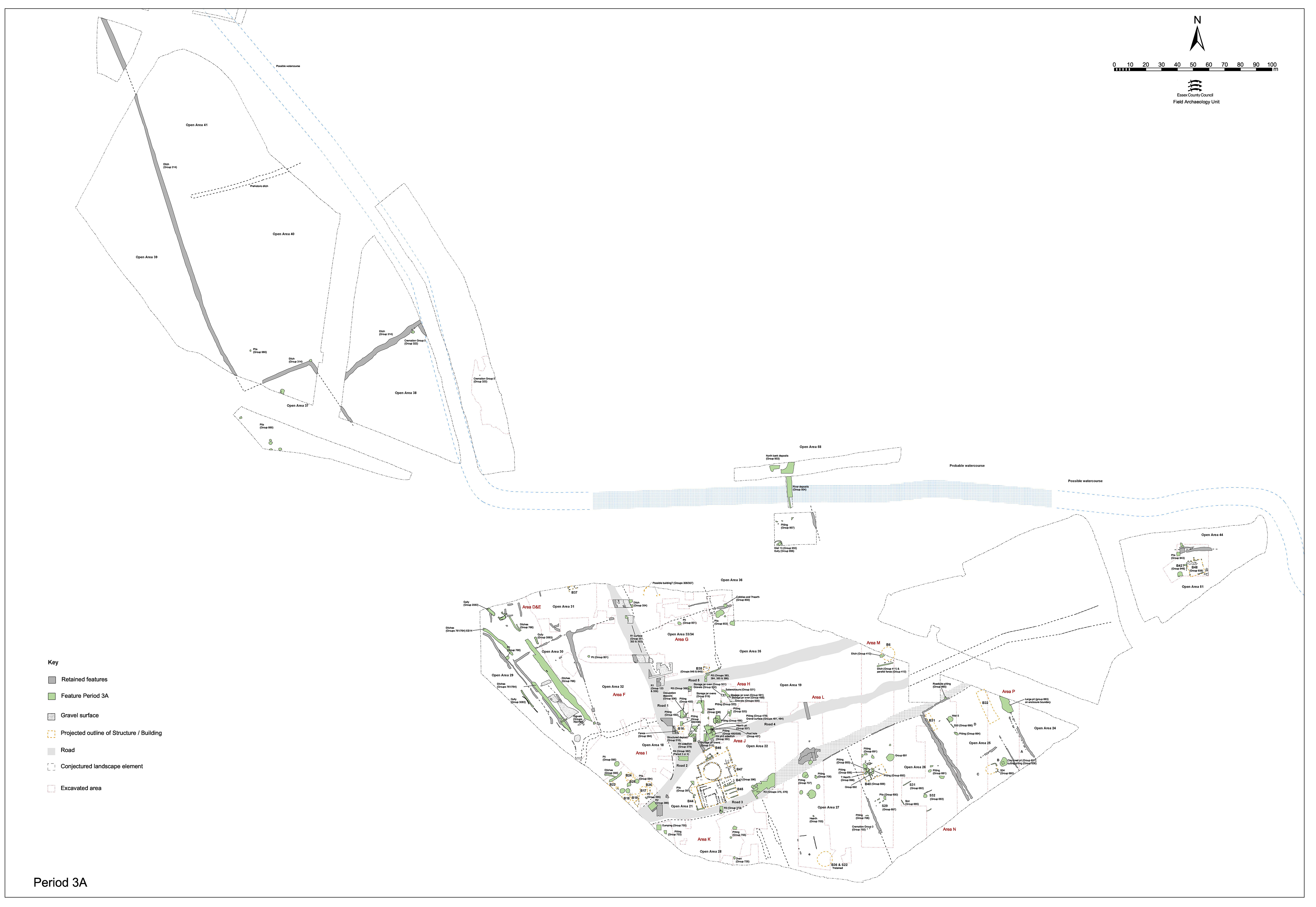
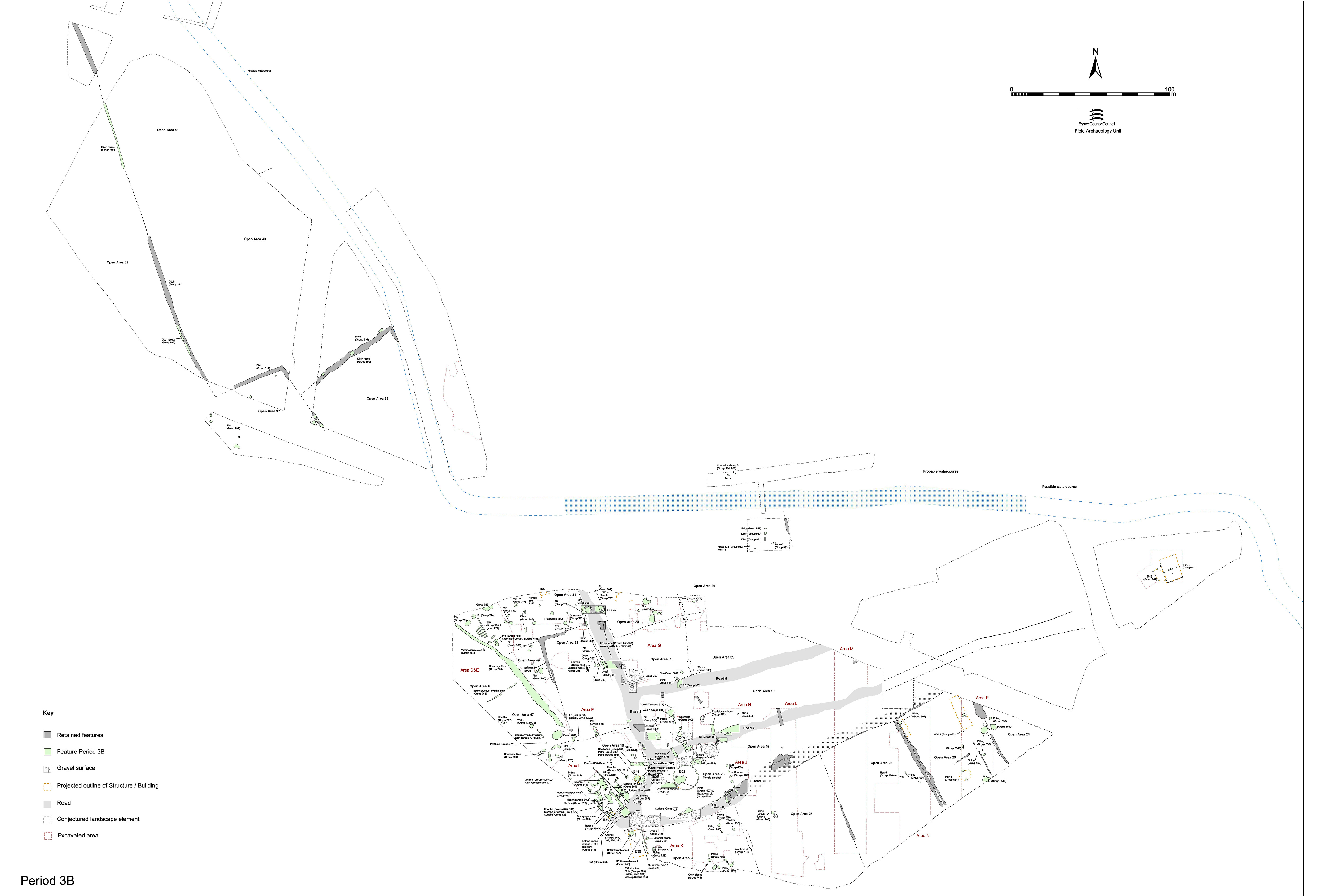
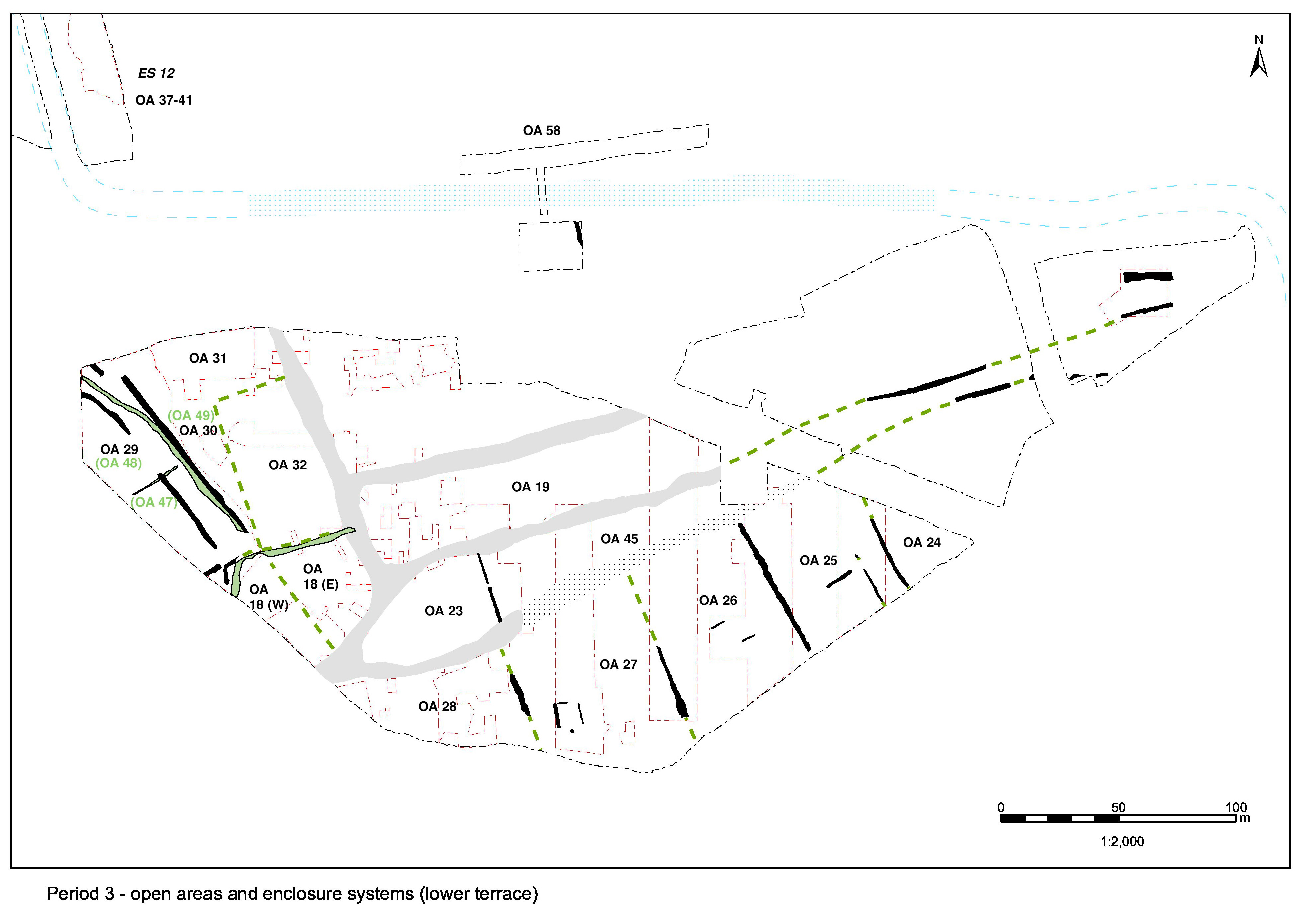
Open Area 58 is a somewhat notional entity along the north side of the watercourse (Figure 131). In the absence of identified boundaries to east and west, it encompasses the entire extent of Excavation Area R to the north of the watercourse - though in reality it is very likely subdivided. As deposition on the north bank seems to be closely associated with that within the watercourse, both locations are described here.
To the south of the watercourse, there is no evidence for a similar episode of deposition nor for consolidation and revetment of the southern riverbank.
The nature of the northern bank and channel during the Late Iron Age is unknown, remains of this date either not being present or else not being reached by excavation. The earliest recorded evidence of land-use is for Period 3. Previous investigation just to the north on the upper gravel terrace provide some additional insights into the nature and density of wider occupation activity (Wickenden 1986; Roy 2003).
A sequence of extensive early Roman layers (12037, 12047, 12065, 12066, 12068, 12071, 12088, 12119, 12123, 12127, 12136, 12139, 12172, 12173, 12373) are the earliest in a sequence of deposits that cover the area bounded by the watercourse to the south and the gravel terrace step to the north. They comprise relatively finds-free layers of yellow-brown silty sand and gravels (12065 and 12068), dark grey clays (12066 and 12071), and brown silty clays (12127) that overlie natural sands and gravels. Where these deposits extend to the edge of the watercourse (12173, 12136 and 12139), they define what is most probably a steeply sloping bank (although, owing to truncation by later pit 12175, this can only be inferred from the section). These deposits are all revealed in the sections of machine-cut trenches and very little hand excavation is undertaken of them. All are noted to contain rare tile fragments and only a single sherd of undiagnostic Roman pottery is collected from 12127, with a further three from 12037.
Deposit 12037 is reasonably well dated; it contains a jar fragment that dates from the mid-2nd to early/mid-3rd century AD. This is possibly intrusive or else attests to the long build-up of deposits here.
Although originally described as dump deposits and interpreted as the earliest phase of deliberate building up of the land surface, it is possible that 12065, 12071 and 12066 in fact constitute the remnants of the original subsoil, and possibly even topsoil, overlying natural gravel. If so, all deposits above, particularly thick silty gravel deposit 12068, may then be construed to be subsequent dumps.
A substantial deposit of yellowish-brown sandy silt-clay is present wherever excavation penetrates far enough through the sequence, and is recorded as various context numbers, chiefly 12037. It covers most of the excavated part of Excavation Area R north of the watercourse, and is presumed to extend considerably both east and westwards. This deposit clearly slopes down to the south, falling by as much as 0.5m across the 8m-wide trench. It is traced as far south as the edge of the watercourse itself, where it is recorded as deposit 12172 - although its precise relationship with the river deposits is obscured by truncating pit 12175.
Occasional, sometimes large, tile fragments are noted to occur in 12172, but not retained and only three sherds of pottery are collected. The latter offer a 2nd to mid-3rd century AD date range, the earlier end of which is in accordance with its stratigraphic position. It is likely that this 0.4m-thick deposit is a dump, or a series of dumps of broadly similar material, used to raise the height of the north bank - although it would appear that no concerted attempt was made to level the land surface at the same time.
Little evidence is recorded for the early Roman deposits within the watercourse itself (12136, 12137, 12138 and 12168). Excavation, restricted to the largely machined trench cut across it, rarely penetrates deep enough for these to be encountered. Although no dating evidence is collected from the lowest silts in the excavated sequence, it is possible that some or all are of early Roman date. All overlying deposits are 3rd century.
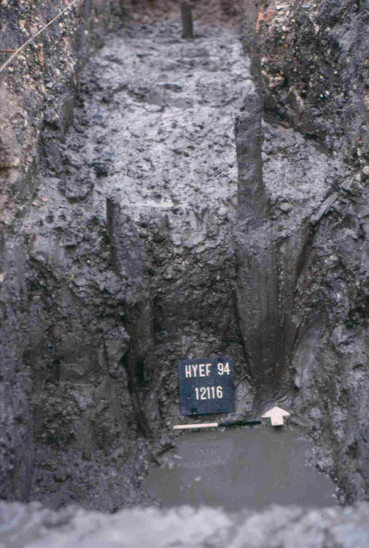
Driven into these bluish-grey silt-clays and sands are a number of wooden stakes. Four vertical stakes of approximately 0.14m diameter are recorded at, or near, the foot of the newly created north bank (see Group 953, above). Although these stakes were removed during fieldwork, the silts through which they are driven remained largely unexcavated. Three of the larger excavated stakes have been sampled for dendrochronological analysis but found to be unsuitable, having too few rings. Further stakes were encountered further into the watercourse (Figure 132), but were not satisfactorily recorded to allow meaningful interpretation.
It is conjectured that at least some of these stakes constitute the remains of a wooden revetment along the north edge of the watercourse, constructed to retain a bank created by the raising of the land surface alongside. However, bearing in mind that there seems to be other unrecorded stakes further out into the channel, a jetty or a bridge construction cannot be ruled out. During this period, the channel is likely to be in the region of 14m wide, and the tips of the revetment stakes are no more than 1.3m below the top of the bank, setting a maximum for water depth at the stream edge. It is not established if the central channel was any deeper. It seems possible that the stream is only intermittently (seasonally?) active during Period 3 and is more of a marsh than a river - perhaps becoming increasingly so over time.
Internet Archaeology is an open access journal based in the Department of Archaeology, University of York. Except where otherwise noted, content from this work may be used under the terms of the Creative Commons Attribution 3.0 (CC BY) Unported licence, which permits unrestricted use, distribution, and reproduction in any medium, provided that attribution to the author(s), the title of the work, the Internet Archaeology journal and the relevant URL/DOI are given.
Terms and Conditions | Legal Statements | Privacy Policy | Cookies Policy | Citing Internet Archaeology
Internet Archaeology content is preserved for the long term with the Archaeology Data Service. Help sustain and support open access publication by donating to our Open Access Archaeology Fund.