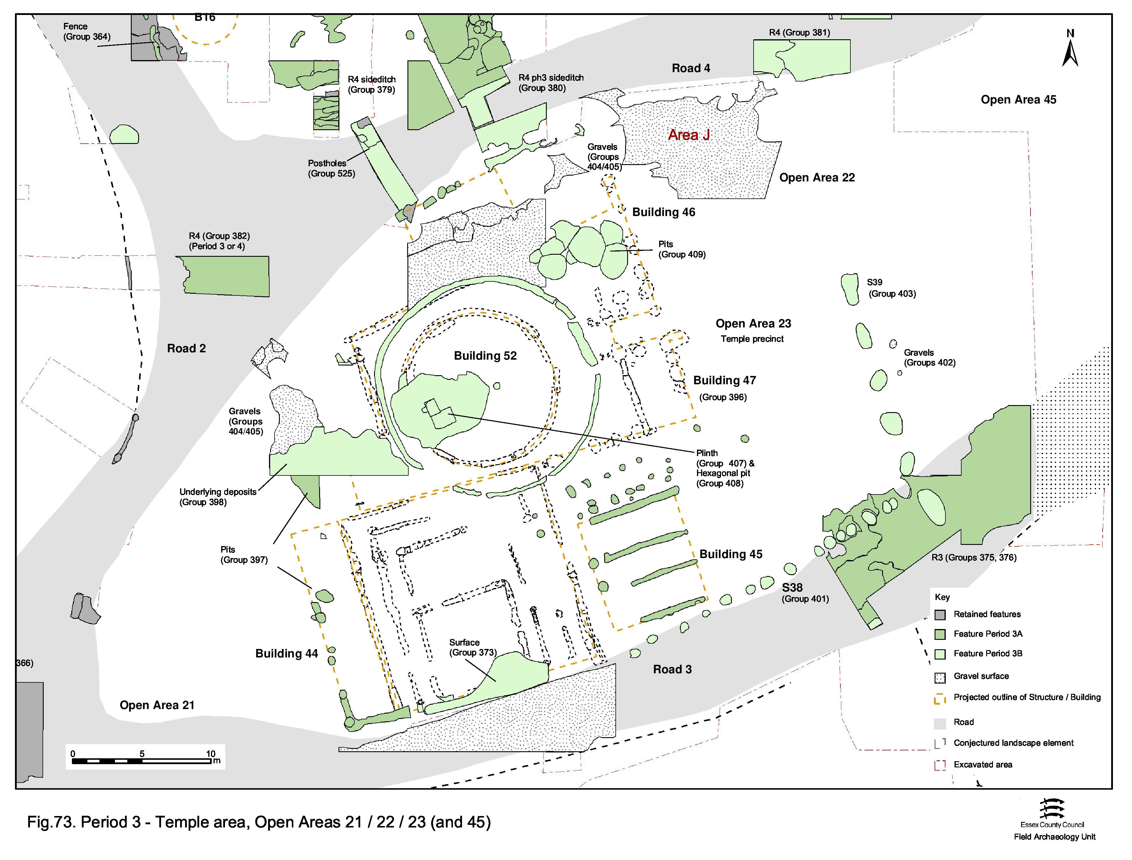
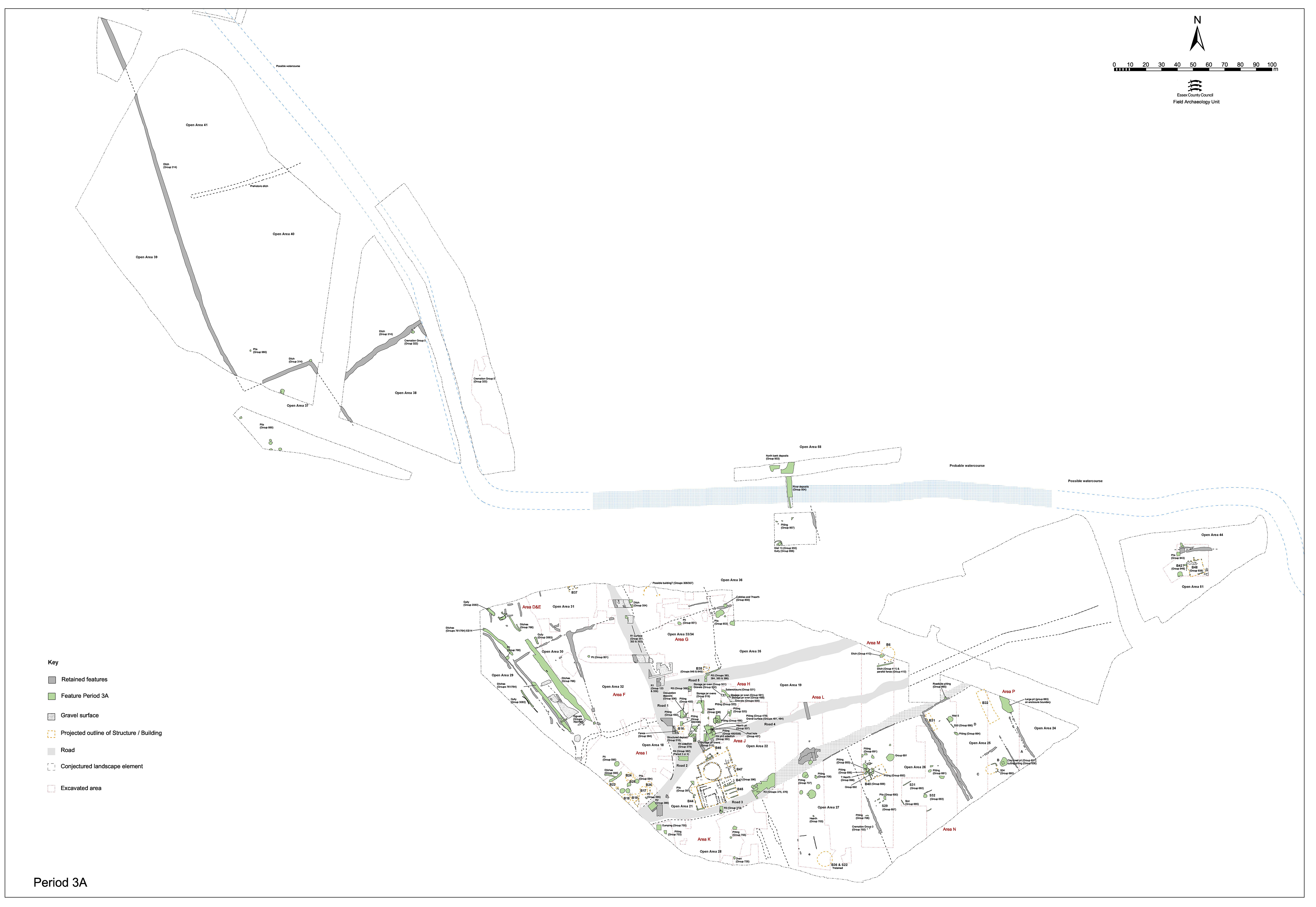
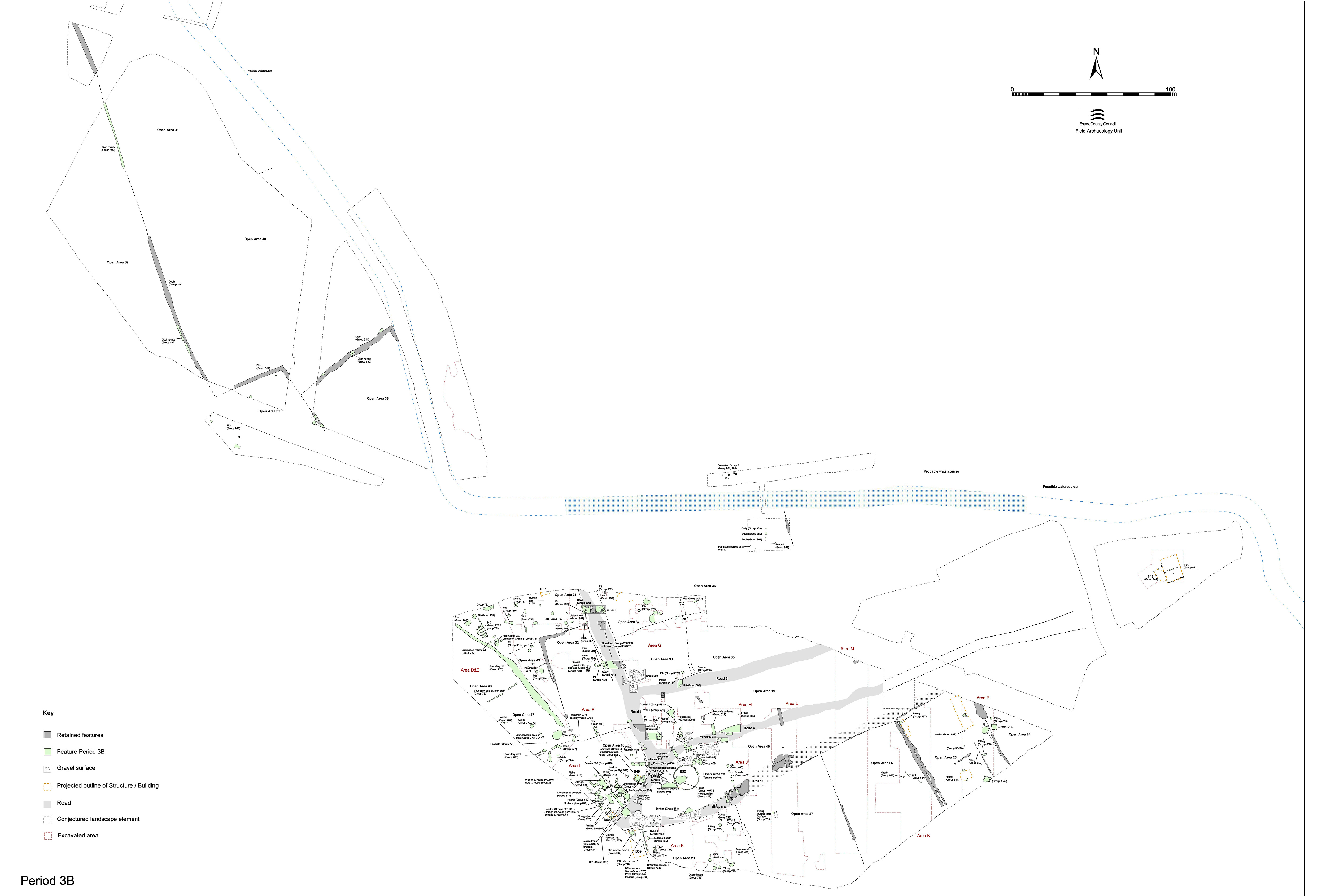
With the boundaries of the temple building complex and its surrounding open space having been firmly established by the imposition of the road infrastructure in Period 2B, Period 3 is characterised by ongoing activity within, and development of, the religious focus (Figure 73). The open space to the east, between Roads 3 and 4, is kept clear. In many respects, the division of OA21 into Late Iron Age/transition and earliest Roman phases of activity is false. The Period 2B buildings (Buildings 33, 34 and 35) are retained and the complex augmented with the addition of a number of new structures (Buildings 44, 47). These are positioned against or close to the existing buildings, mostly to either side of the temple and its enclosure; aligned on the enclosure frontage and in effect extending this frontage across the whole width of the plot. Deliberately laid out as such, the intention is clearly to create an impressive aspect from the front (east) and presumably to impose a clear and solid separation between the complex and the open space in front.
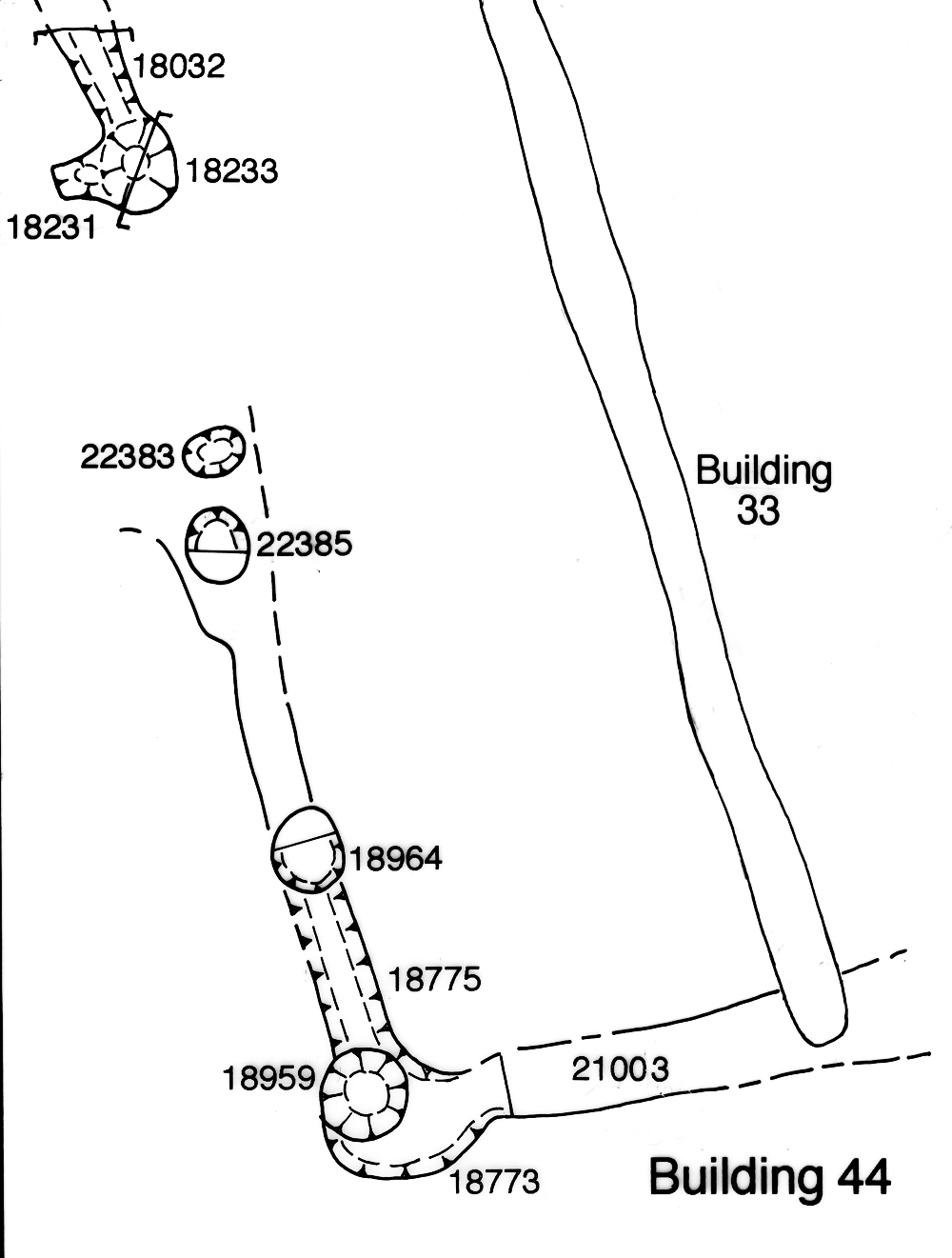
Building 44 is considered to be a westward extension of Period 2B Building 33 (Figure 74). Its remains consist of substantial wall foundation slots 18032 and 25137 (Group 391) within which are positioned a series of post-holes (18231, 18233, 18959, 18964, 22383, 22385 Group 392). Slot 25137 (segments 18773, 18775, 21003) was initially recorded as being cut by 25031 (an element of Building 33); within the interpretation presented here it is more likely that 25137 was dug around the end of 25031.
These structural features demarcate the southern part of Building 44. Its northern extent is not defined, but two post-holes (22383 and 18233) could mark the position of a 1.8m-wide doorway in its west wall and, were this entrance positioned centrally within the wall-line, Building 44 could extend the whole length of the rear of Building 33. Building 44 may therefore be estimated to measure some 14m x 3.5m in extent. The pottery fabrics present within its foundation slots indicate an early Roman construction date. No internal features are apparent and no function discernible, though some ancillary use is presumed in relation to the temple and the wider complex of its buildings.
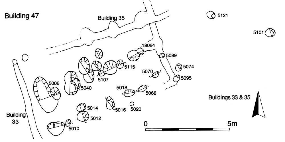
Building 47 (Group 396) is a small, rectangular, post- and slot-built structure (Figure 77) inserted into the corner formed by the east wall of Building 33 and the south wall of temple enclosure Building 35. Its south wall and interior structure are represented by a pair of parallel lines of post-holes while the east wall is slot-built. This defines a building of some 8m x 4m extent and seems to be the result of the ongoing, perhaps somewhat opportunistic, development of the temple complex. Given that Building 45 seems to be constructed soon after and immediately alongside it, it is likely that it is accessed from the east; though an entrance from the temple enclosure, through the south wall of Building 33, cannot be discounted.
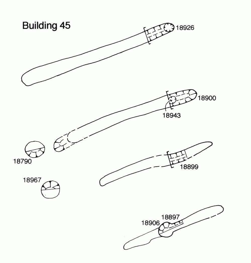
Building 45 is a further addition to the temple complex, constructed to the west of extant Building 33 and represented by four parallel foundation slots (25132 seg.18897; 25133 seg. 18899; 25134 seg. 18900; 25135 seg. 18926 Group 394) that run roughly east-west (Figure 75). The longest of these survives to 6.7m and all are regularly spaced, some 2.0-2.5m apart. Other elements of the building are defined by post-holes (18790, 18906, 18943, 18967 Group 393). Two of these (18790, 18967) probably mark the original ends of the shallow slots and presumably form the west wall of a building some 7m wide and at least 8m long. Although not particularly well aligned on the existing buildings to its north and west, it appears that Building 45 is a further attempt to utilise the space created by adjoining Buildings 33 and 35. Whether this is in addition to, or a replacement of, already inserted Building 47 is unclear; the lack of inter-cutting between structural elements of each perhaps suggests that the former is more likely.
Similar to Building 33 positioned over earlier circular 'shrine' Building 8, Building 45 overlies the site of square 'shrine' Building 7. Whether or not this is deliberate is uncertain.
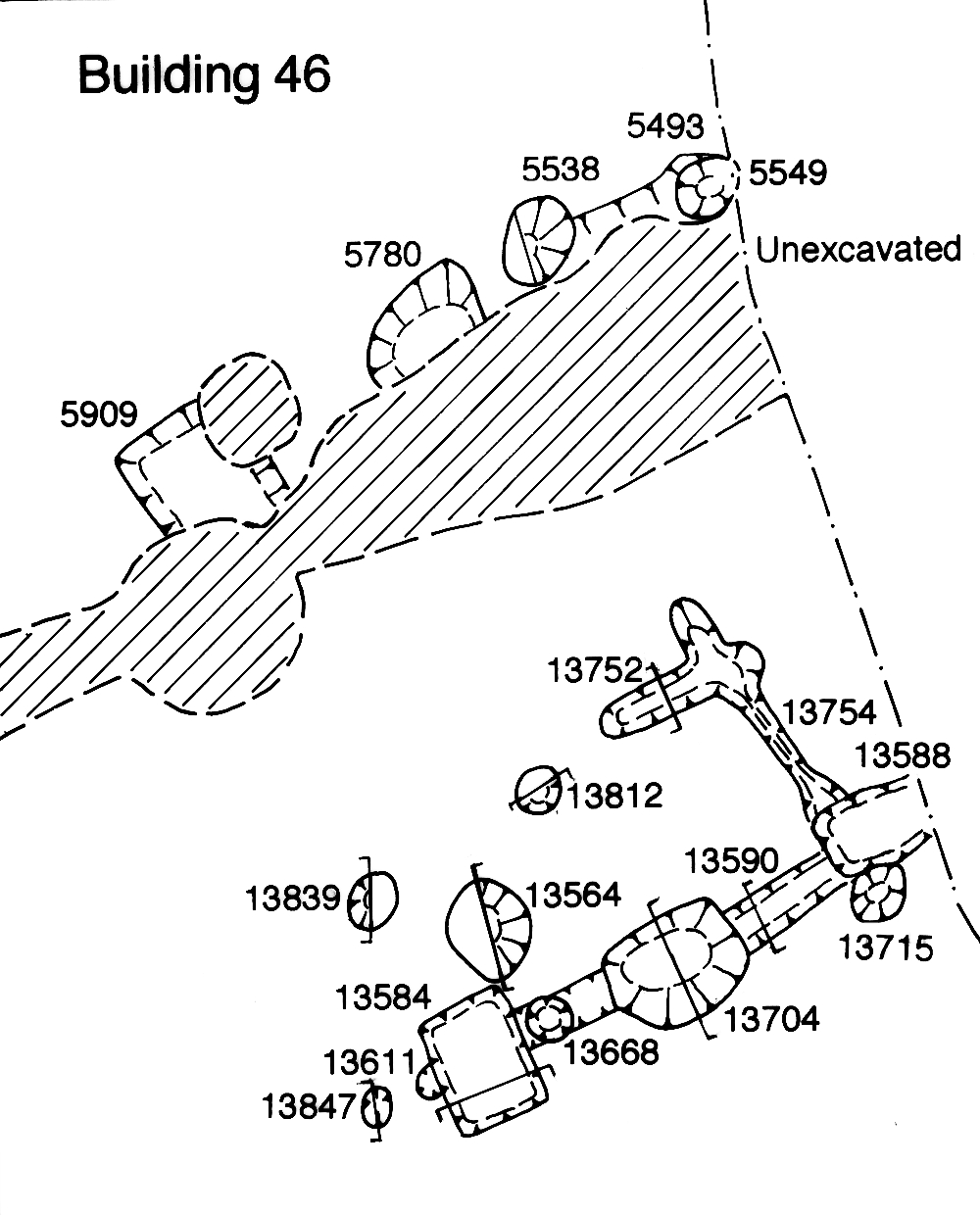
Building 46 is a rectilinear structure (Figure 76) to the north of, and seemingly aligned upon, temple enclosure Building 35. It comprises a series of sub-square post-holes, some of which are linked by shallow slots (Group 395). The pottery recovered consists mainly of undiagnostic bodysherds, but two contexts contain pottery dating to the early to mid-2nd century The date of the samian present (in 5538) is placed comfortably at the end of this range. These structural remains are sealed by the mid-2nd century resurfacing of the temple precinct. It is difficult, however, to relate this building to others in the complex, particularly because it is unclear whether elements of its south wall (i.e. post-hole 13584) cut, or co-exist alongside, Building 35. Restricted by the temple and Road 4, this building can be no more than 5m wide. Although traced for some 8m east-to-west, it is possible that it is significantly longer. Like Building 47, it may conceivably extend as far as the east wall of Building 35, just short of its portico-style frontage. If so, this would suggest that the two are contemporary and, to some extent, part of a master-plan of temple complex development. Slot 13752/13754 is probably part of an internal partition wall foundation within the building, but there are no other internal features indicative of a possible function.
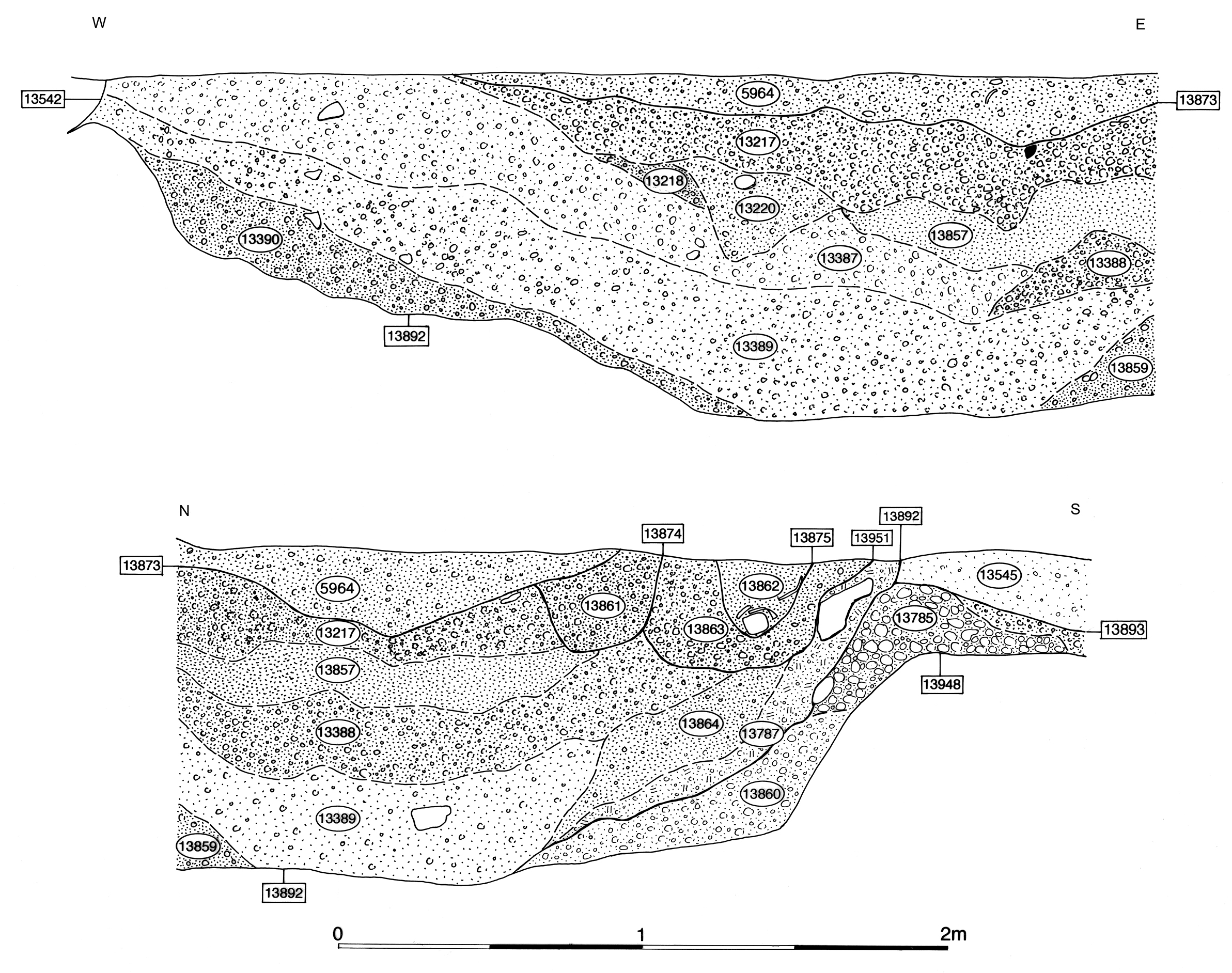
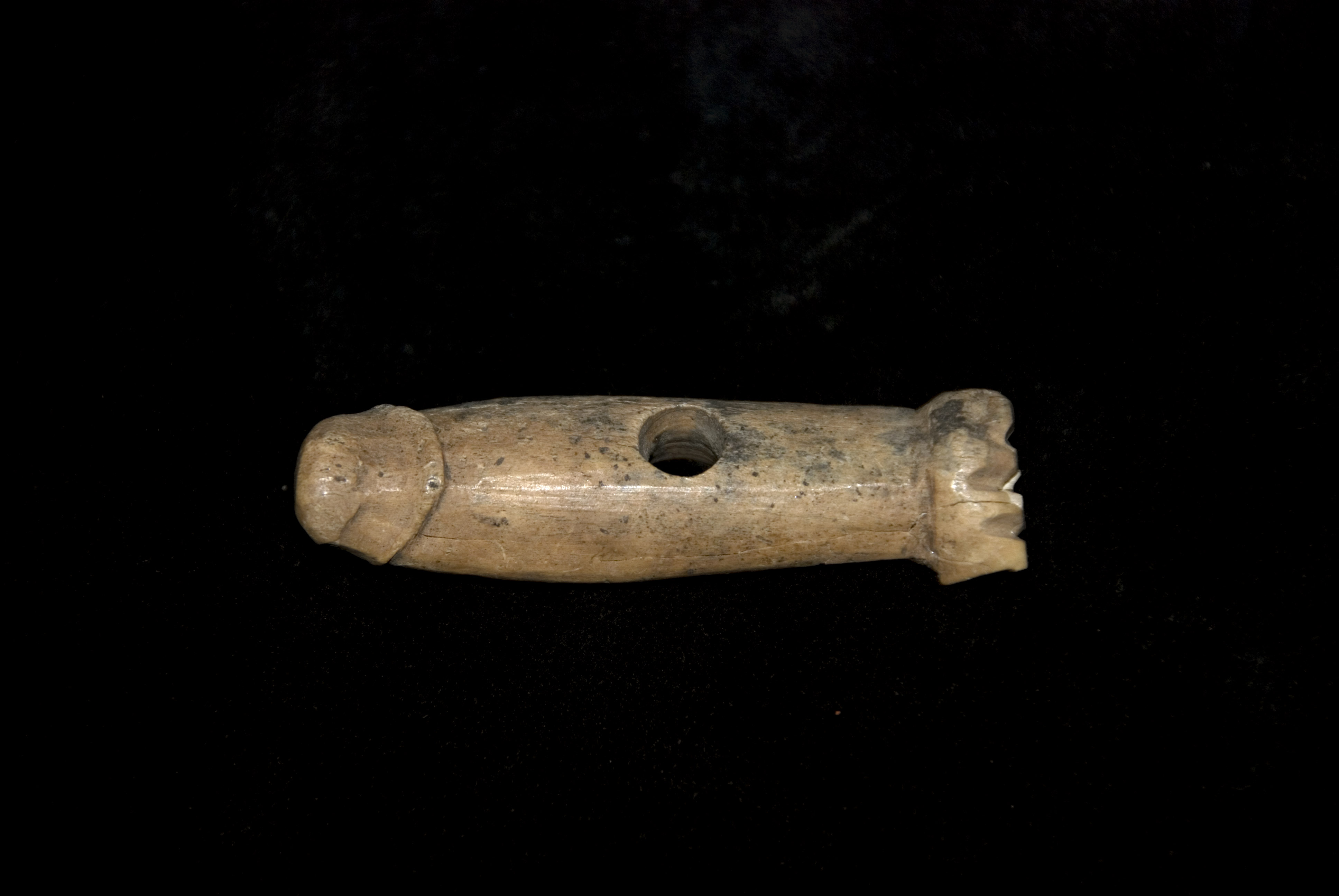
Two pits (13809, 13892 Group 397) are located to the western side of the temple precinct, 'behind' the temple complex - in continuance of practice seen in Period 2B. Pit 13892, a roughly circular cut of some 5.00m diameter and 1.10m depth, is the largest early Roman pit excavated in this vicinity of the settlement. Its complex sequence of fills (Figure 111), which attests regular re-cutting, contains mainly mid- to late 1st century pottery, but some of the forms and fabrics from contexts near the top of the sequence continue into the 2nd century. Only small quantities of other bulk materials are present, together with a bone 'fist-and-phallus' amulet (SF4742), needle and bracelet. The location of this singular pit, to the rear of the temple, is of particular significance and may hint at a specialised function which, unfortunately, is not overtly demonstrated by its finds assemblage. Whatever its function, the pit is finally infilled by the early 2nd century, as evidenced by features cut into its top. Although no relationship is recorded, it is likely that the Group 398 silty use-accumulation deposits seal infilled pit 13892.
Small pit 13809 probably pre-dates the addition of Building 44. The samian platter within it is dated AD 45-65. The majority of the pottery derives from a single large storage jar, which displays internal burning and which probably represents the redeposited remains of a storage jar hearth. However, the pit also contains an iron knife blade (SF6454) and a few other miscellaneous pieces of metal that might have significance. It is possible that it in fact represents a placed deposit of a similar nature to that in pit 4148 in OA28.
With new buildings 45, 46 and 47 infilling the available space either side of the temple, and creating a barrier that extends across the whole extent between Roads 3 and 4, that part of OA21 to their east starts to become a more distinct land entity. However, no mid- to late 1st century AD features or deposits are identified where it is investigated within Excavation Areas J, L and M. It would appear that its function as a surfaced open space is retained from Period 2B and its continued close association with the activities of the temple complex - perhaps as a place of mass congregation - is assumed.
Internet Archaeology is an open access journal based in the Department of Archaeology, University of York. Except where otherwise noted, content from this work may be used under the terms of the Creative Commons Attribution 3.0 (CC BY) Unported licence, which permits unrestricted use, distribution, and reproduction in any medium, provided that attribution to the author(s), the title of the work, the Internet Archaeology journal and the relevant URL/DOI are given.
Terms and Conditions | Legal Statements | Privacy Policy | Cookies Policy | Citing Internet Archaeology
Internet Archaeology content is preserved for the long term with the Archaeology Data Service. Help sustain and support open access publication by donating to our Open Access Archaeology Fund.