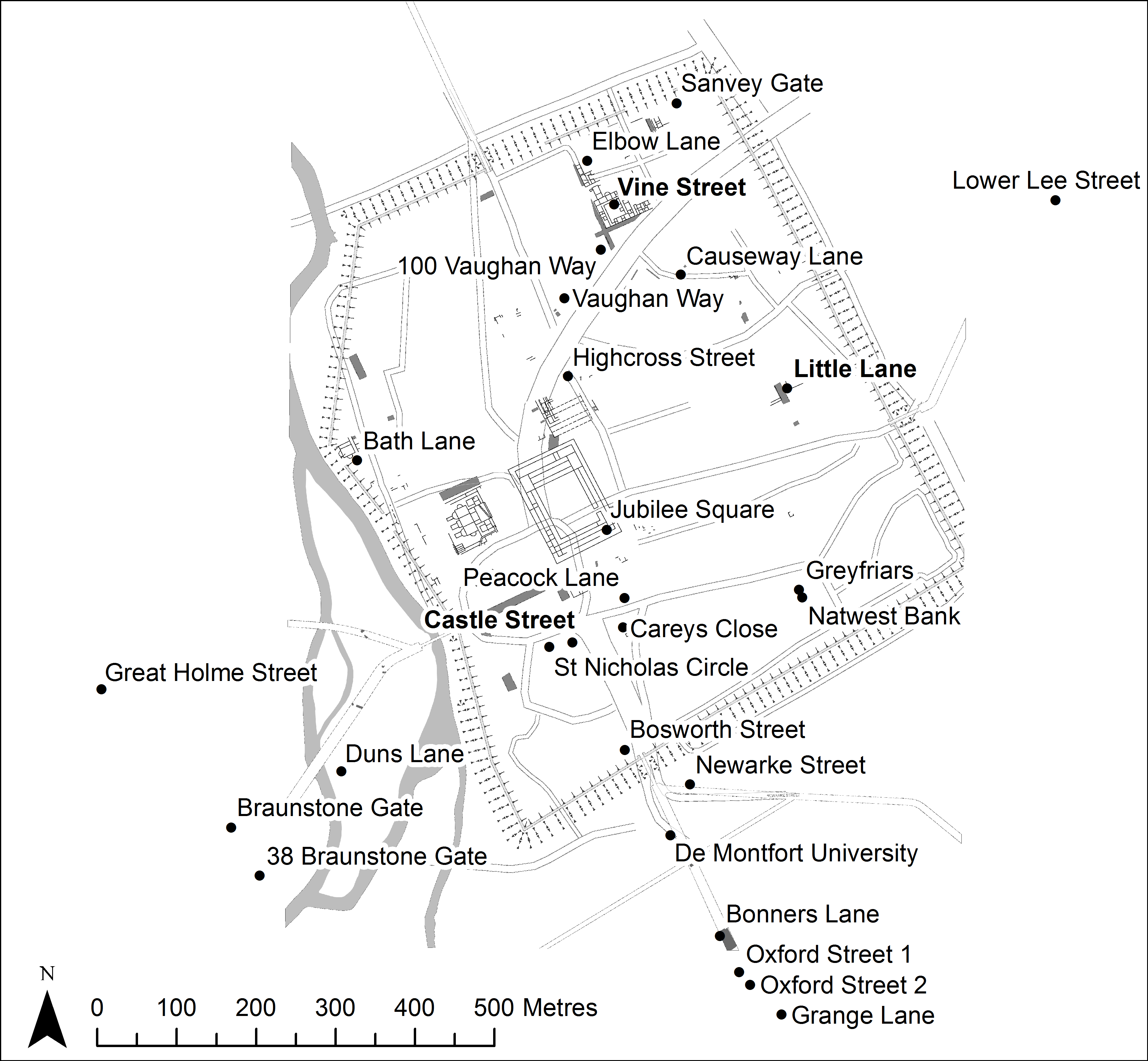
Figure 1: The Roman walled town of Leicester (Ratae Corieltavorum) showing the location of pottery assemblages mentioned in the text (dining-related groups in bold), against the remains of Roman buildings and outline of modern streets.
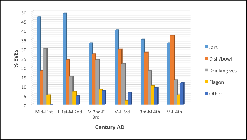
Figure 2: Graph showing the changing proportions of jars, dishes and bowls, drinking vessels, flagons and other vessels (e.g. amphorae, mortaria and lids) over time from Vine Street (measured by percentage of Estimated Vessel Equivalents (EVEs)) (Johnson 2009a, fig. 47) with mid-first century group from Bath Lane Merlin Works (Johnson 2011), and mid-to late fourth century group from Freeschool Lane (Johnson 2009b) (both measured by percentage of sherds).
Figure 3: Graph showing the changing proportions of jars, dishes and bowls, drinking vessels, flagons and other vessels (e.g. amphorae, mortaria and lids) over time from Causeway Lane (measured by percentage of Estimated Vessel Equivalents (EVEs) (Clark 1999, tables 9-28).
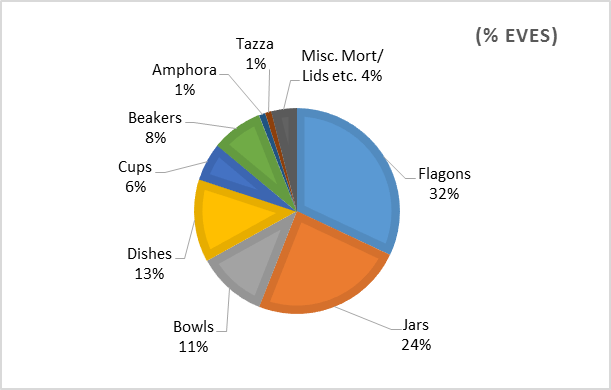
Figure 4: Pie chart showing quantified analysis by vessel form of the Little Lane cellar assemblage, expressed as percentage Estimated Vessel Equivalents (EVEs).
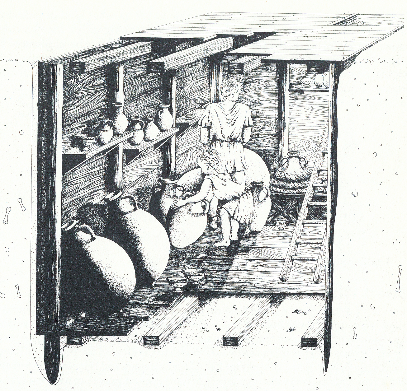
Figure 5: Artist's impression of the Little Lane Cellar showing olive oil and wine amphorae on the floor and a so-called 'tazza' and flagons on the shelf above. Drawing by Sue Moodie. Copyright Leicester City Museums (Sawday 1989, 35).
Figure 6: Selection of fine and specialist wares from cess pit 1067, showing decorated samian bowls (left), Dressel 20 olive oil amphorae (centre) and white ware flagons (right). Notice the lack of drinking vessels in the group.
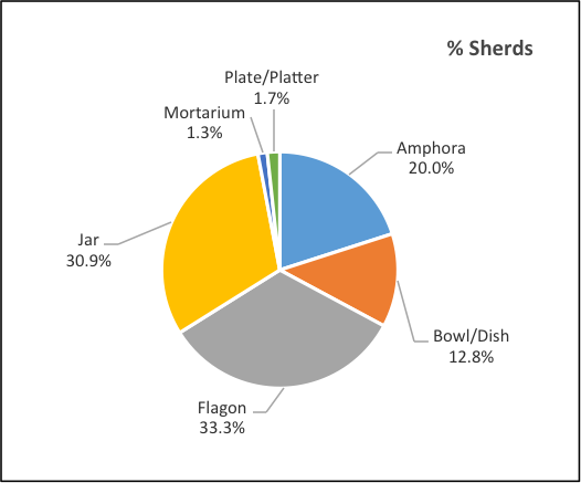
Figure 7: Pie chart showing the proportions of vessel types from Castle Street cess pit 1067 by percentage of sherd count.
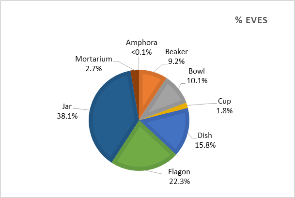
Figure 8: Pie chart showing proportions of vessel types from cess pits G526 at Vine Street, expressed as percentages of Estimated Vessel Equivalents (EVEs).
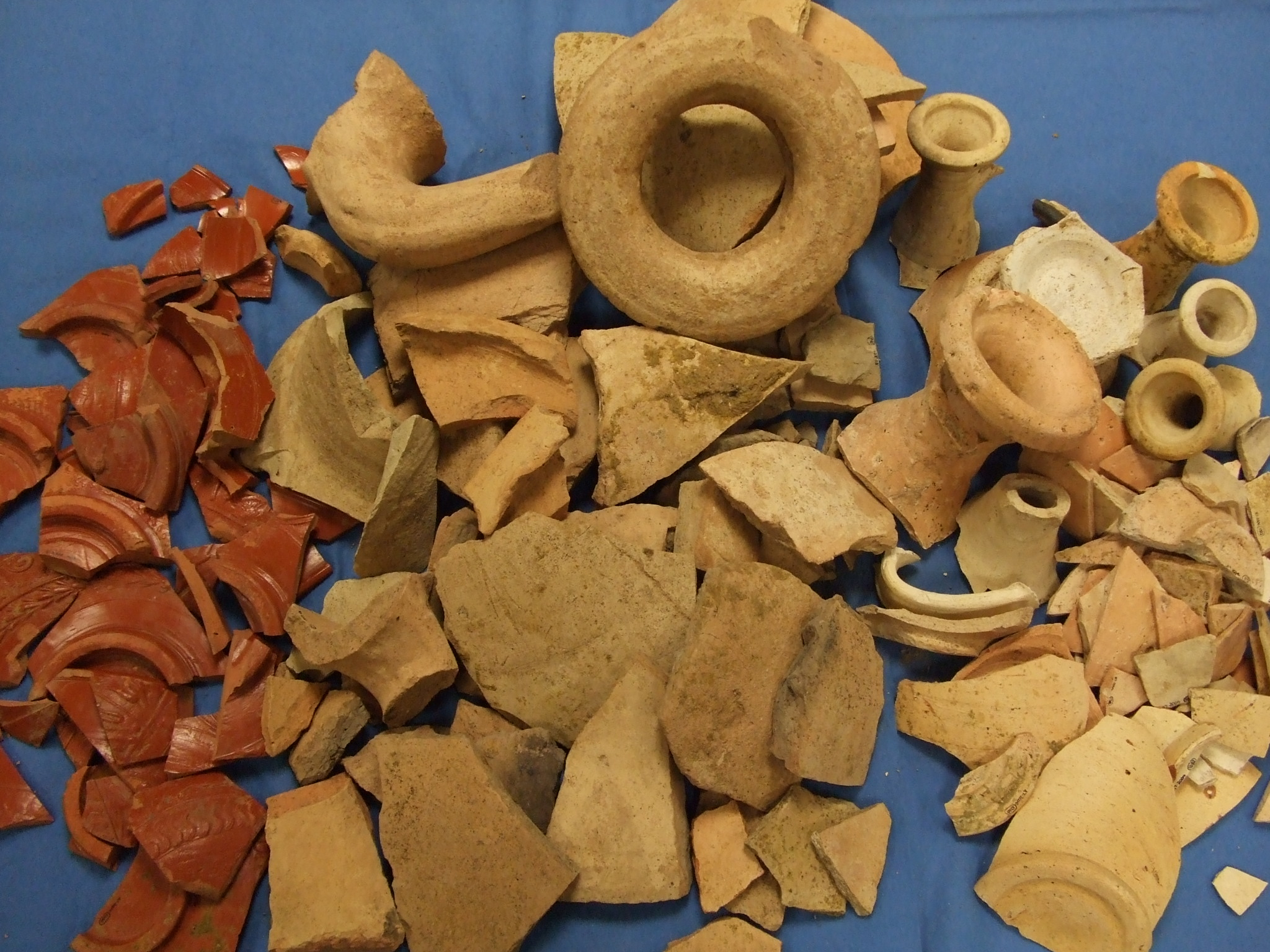
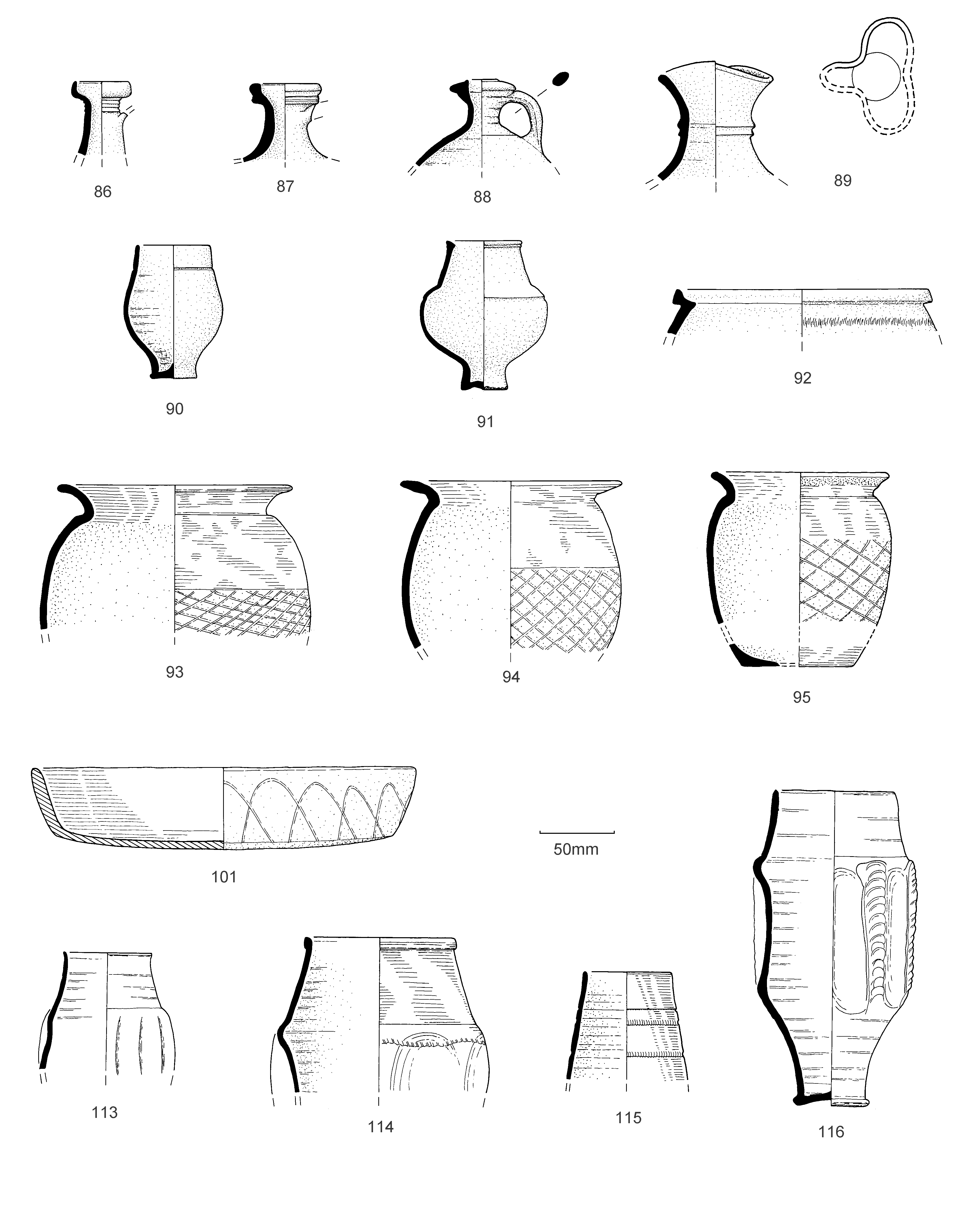
Figure 9: Selection of vessels from the cess pits from the Vine Street courtyard house, showing colour-coated ware flagons (86-89), colour-coated beakers (90-91) black burnished ware cooking pots and dish (93-95) and colour-coated indented beakers from the kitchen drain (113-116).
Figure 10a: Roman pottery assemblages from Roman Leicester and its suburbs: SCA bi-plot of first and second axes for vessel fabric/form categories. For location of assemblages see Figure 1 [SVG].
Figure 10b: Roman pottery assemblages from Roman Leicester and its suburbs: SCA bi-plot of first and second axes for site assemblages. For location of assemblages see Figure 1 [SVG].
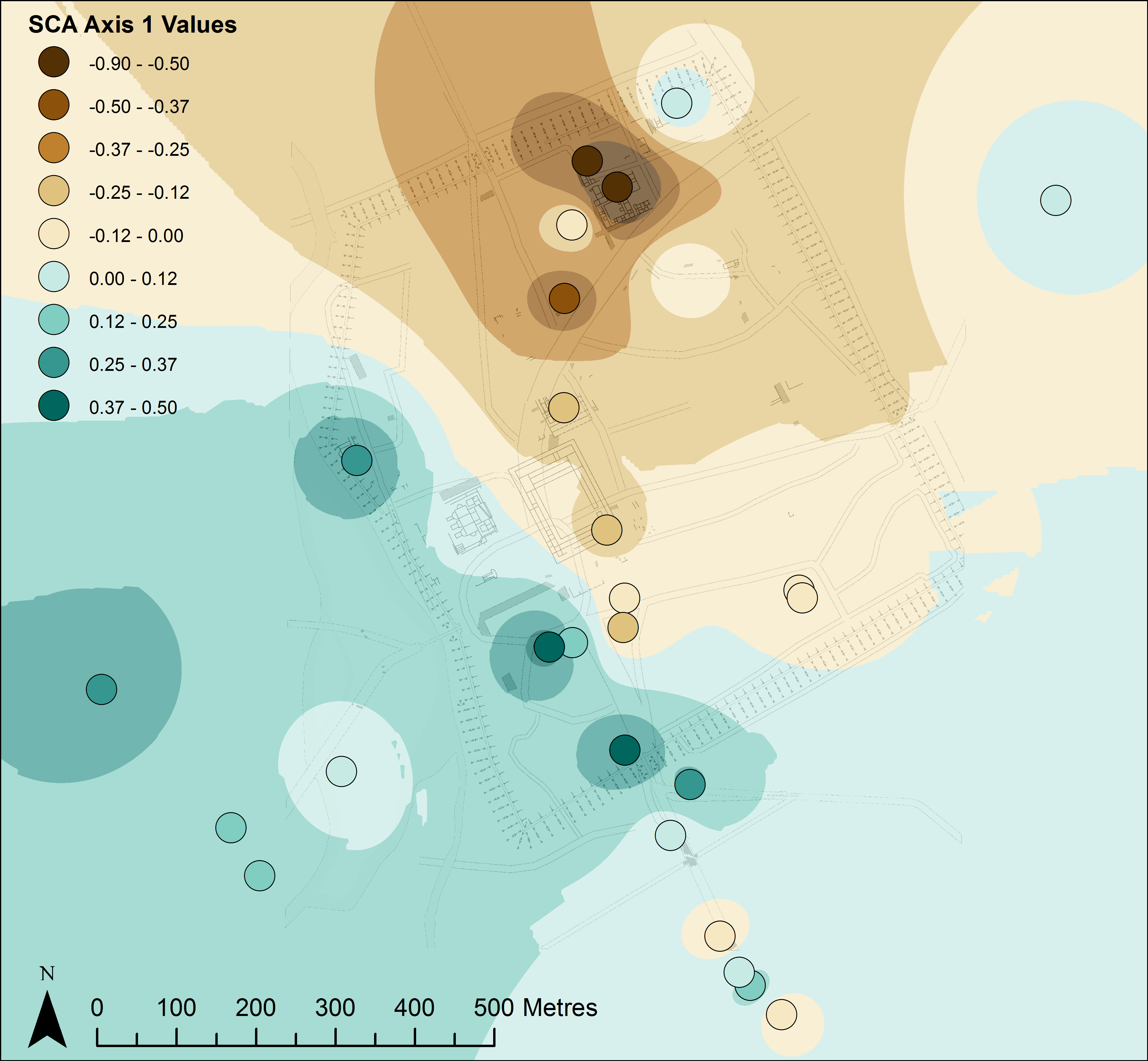
Figure 11a: Roman pottery assemblages from Roman Leicester and its suburbs: spatial visualisation of SCA axis values for site assemblages for Axis 1. For location of assemblages see Figure 1.
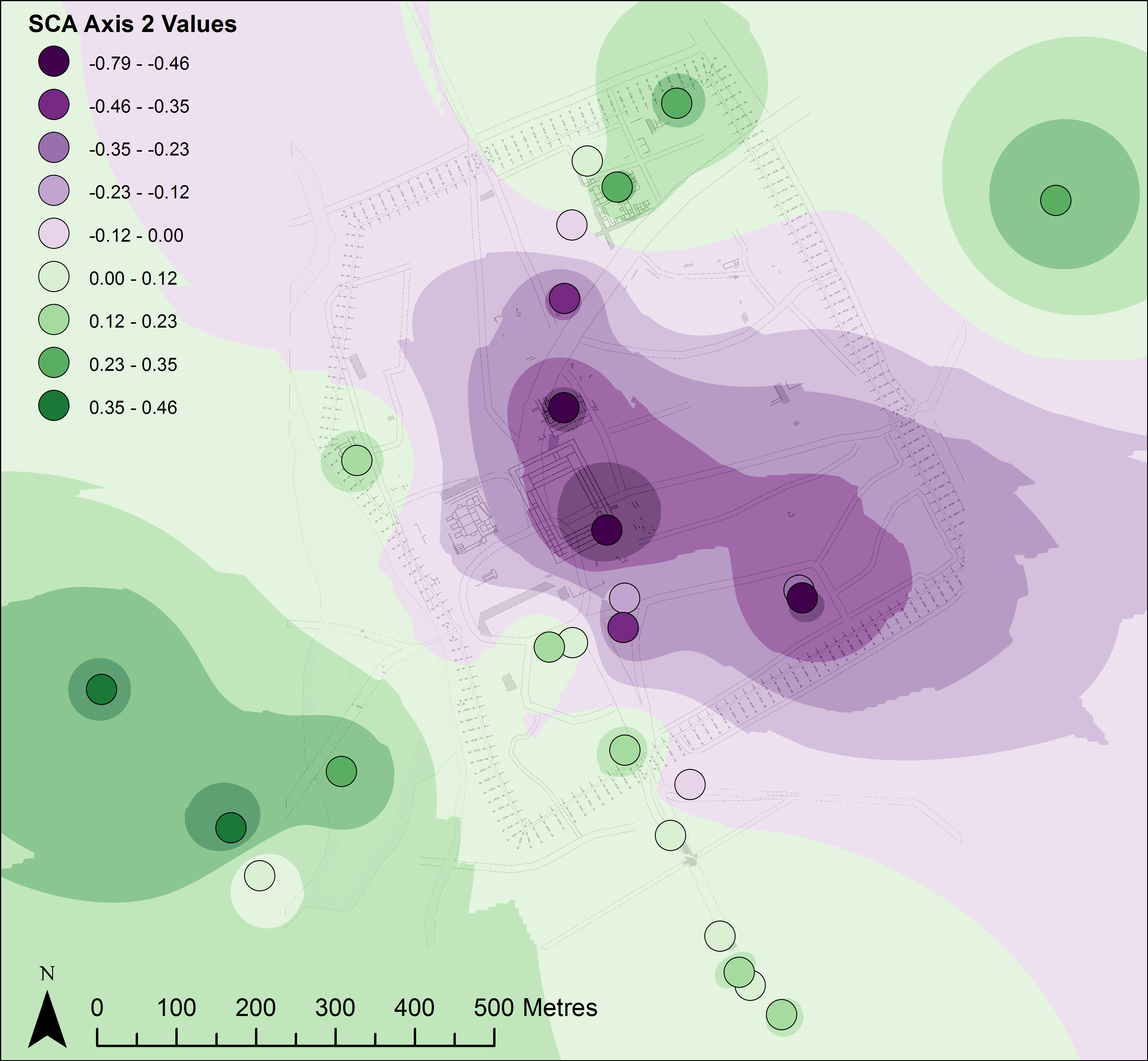
Figure 11b: Roman pottery assemblages from Roman Leicester and its suburbs: spatial visualisation of SCA axis values for site assemblages for Axis 2. For location of assemblages see Figure 1.
Figure 12: Roman pottery assemblages from Roman Leicester and its suburbs: spatial visualisation of SCA bi-plot. Colour of symbol denotes direction from origin and size denotes distance from origin. For location of assemblages see Figure 1.
Internet Archaeology is an open access journal based in the Department of Archaeology, University of York. Except where otherwise noted, content from this work may be used under the terms of the Creative Commons Attribution 3.0 (CC BY) Unported licence, which permits unrestricted use, distribution, and reproduction in any medium, provided that attribution to the author(s), the title of the work, the Internet Archaeology journal and the relevant URL/DOI are given.
Terms and Conditions | Legal Statements | Privacy Policy | Cookies Policy | Citing Internet Archaeology
Internet Archaeology content is preserved for the long term with the Archaeology Data Service. Help sustain and support open access publication by donating to our Open Access Archaeology Fund.