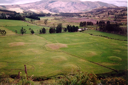
Figure 5. Hacienda Zuleta: view south-west across tolas in the valley of the Río Tahuando
The mounds at Zuleta are distributed approximately in linear form south from the Quebrada San Pedro north west to converge with the Río Tahuando at Gloria and Santa Ana (Figure 2). They consist of three main types of tola:
Some of the larger mounds retain visible evidence of circular and sub-rectangular structures surviving upon their summits, which accords with ethnohistoric descriptions of chiefs' houses as large circular buildings with walls of compacted earth and a roof supported by a large central pillar (Anónimo [1573] 1965, 226; Paz Ponce de León [1582] 1965, 240). Evidence of structures like these has also been found upon the summits of ramp mounds at Cochasquí and Socapamba (Oberem 1975; Athens 1978; 1980).
The largest recorded pyramid at Zuleta at the most westward projection of Lomo Arrayán, measures some 90m² at its base and 30m in height, with a 210m long access ramp; another in Quebrada San Pedro has measurements of 84m², a height of approximately 8m and a ramp measuring 159m in length (Athens and Osborn 1974). (See Figures 5-7).
Figure 5. Hacienda Zuleta: view south-west across tolas in the valley of the Río Tahuando
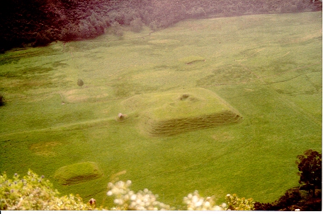
Figure 6. Aerial view of large quadrilateral ramp-mound together with smaller mounds
in the Quebrada San Pedro, Zuleta
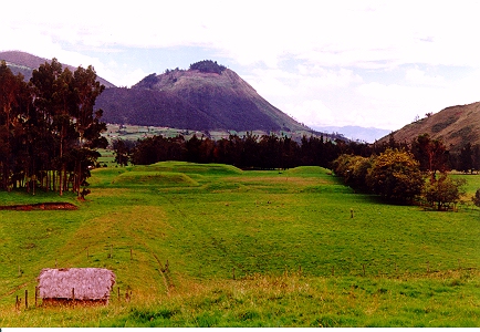
Figure 7. Hacienda Zuleta. View north-west to Loma El Cunrru with quadrilateral ramp
mounds in the Quebrada San Pedro
No formal survey has yet been undertaken of this impressive site and therefore the only plans available for it e.g. Figure 2 are those adapted from aerial photographs following Athens (1978; 1992).
© Internet Archaeology
URL: http://intarch.ac.uk/journal/issue10/currie/4sec1.html
Last updated: Thu Apr 5 2001