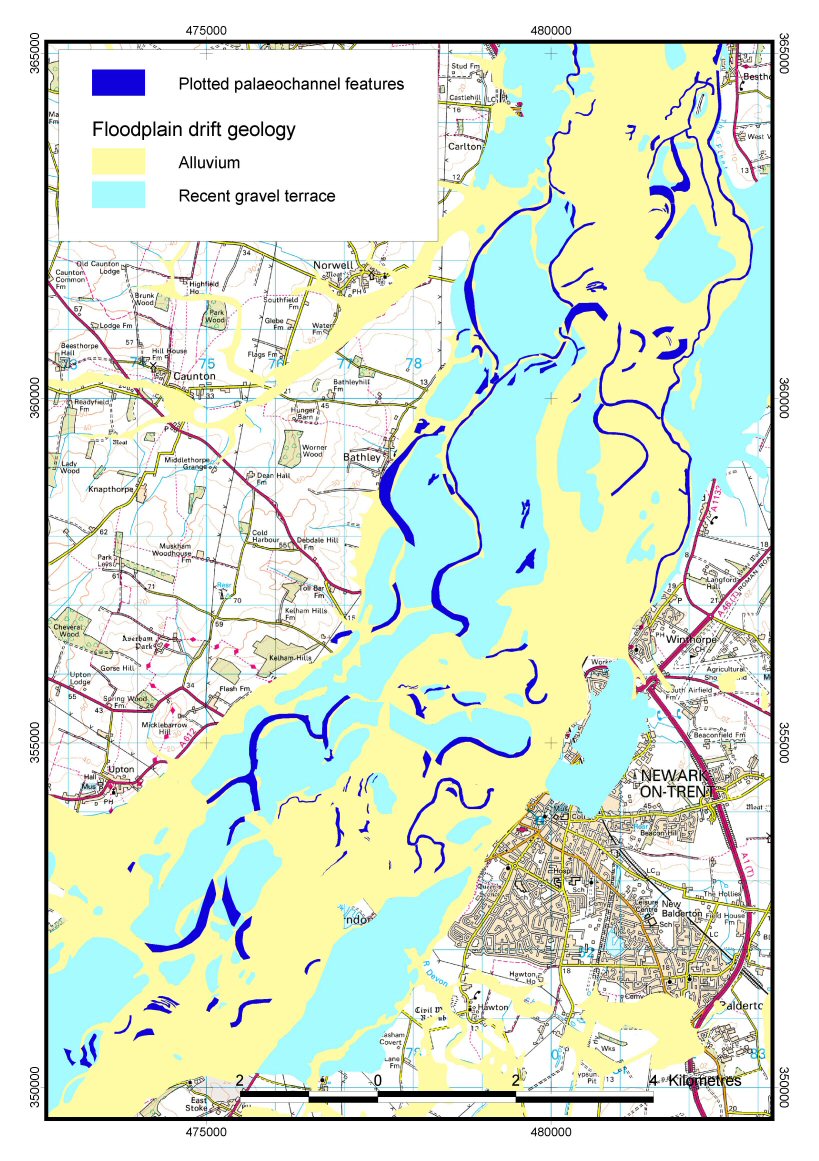
A survey area was defined using the extent of the Holocene floodplain and the Devensian gravel terraces (Figure 2). This drift geological envelope covers the full extent of the river's Holocene migration, over which relict channels may be expected (Figure 3).

Initial inspection of county photographic holdings suggested that monochrome aerial photographs at around 1:10,000 offered the sharpest definition of palaeochannel features and provided an acceptable compromise between coverage and detail. Monochrome images also afford greater potential for digital enhancements such as contrast stretching. A series of county-based surveys flown by Aerofilms, Fairey Surveys, Huntsman Surveys and Meridian Airmaps in the late 1960s and early 1970s was selected as the primary coverage source (see Archive and Photographic Sources for details). This constituted the most recent complete monochrome coverage of the survey area, and access to this material was usually available without charge or copyright implications from county archives. The unpredictable nature of cropmark formation suggested that it would be beneficial to have images taken over an extended time period, and therefore 1940s RAF coverage was acquired from English Heritage as a secondary source. In addition, this allowed changes in the record between the 1940s and the 1970s to be assessed.
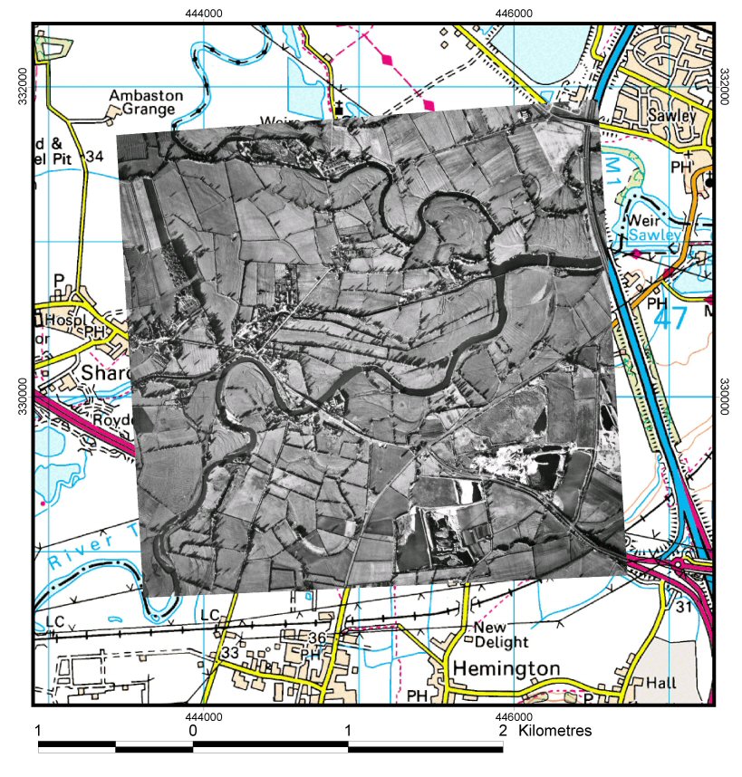
Each photograph was scanned at 150dpi to create a digital image. These were processed to remove borders and were routinely contrast-stretched to enhance the visibility of palaeochannel features. Each processed scan was digitally rectified and geo-referenced (using a second-order polynomial transformation within ERDAS Imagine) and overlaid on base layers (base map, elevation, geology) within the ArcView GIS environment (Figure 4). In this way, a GIS-based aerial photograph mosaic was created, covering the entire survey area. The photographic mosaic was interrogated for surface-visible palaeochannels, which were digitised within ArcView to create a geo-referenced digital map. This spatial plot was linked to a text database within ArcView in order to record the known attributes of mapped palaeochannels.
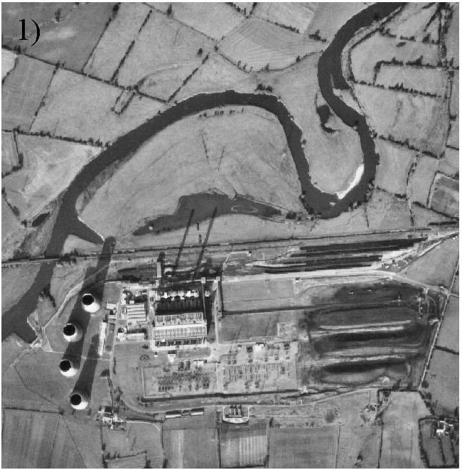
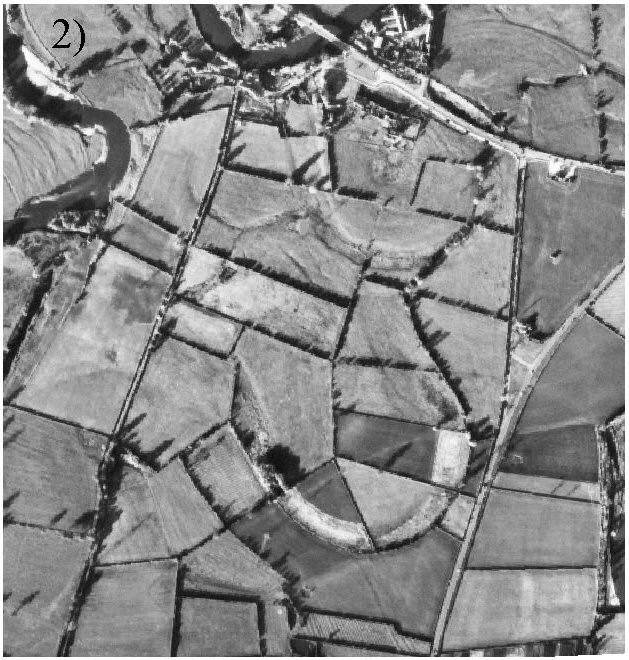
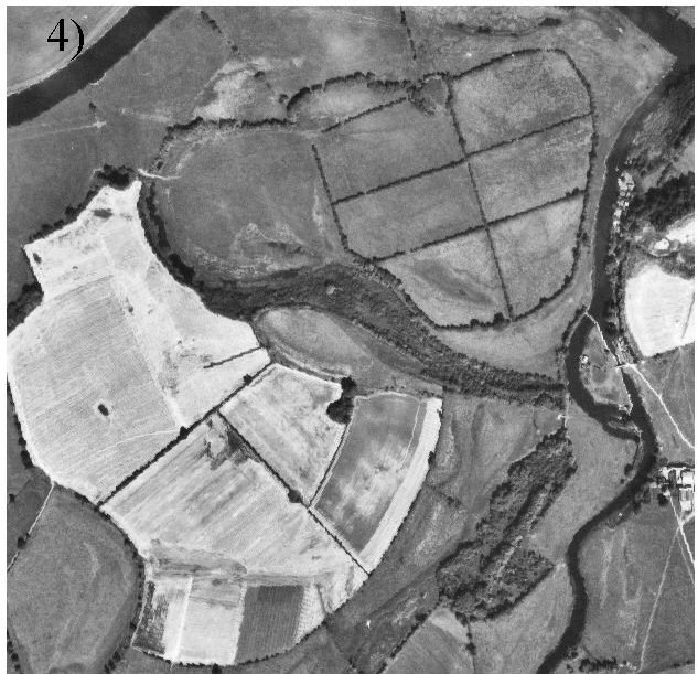
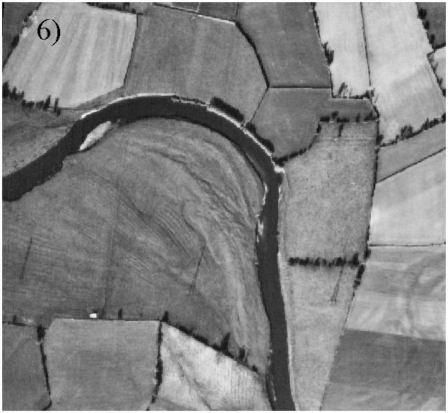
Palaeochannels were identified on the photographs in a number of different forms (Figure 5): standing water, dry depressions, bands of vegetation or trees, cropmarks, soilmarks and moisture marks, and sinuous boundaries (hedges, fences, stream-lines). Standing water (Figure 5a) may indicate a recently abandoned channel or an accumulation of floodwater within the slight depression of a former channel. Dry depressions (Figure 5b) are slight features deriving from the sequential silting of former channels, generally preserved within floodplain grassland. Cropmarks (Figure 5c) are caused by enhanced growth of arable crops or grass pasture over buried features, often surviving below the zone of disturbance caused by ploughing. The process of vegetational succession within an abandoned channel may also result in a persistent band of distinctive growth (Figure 5d). The sinuous course of hedge and fence lines may suggest that they once ran alongside a vanished channel (Figure 5e).
Select a link to pull up an image

The stage of succession reached by a palaeochannel is related to its age, although this can be complicated by land-use factors. It was considered important, therefore, to record the physical form of each mapped channel, as a rough guide to its age, and as a snapshot of changing land-use histories along the valley. The corrugated topography of ridge-and-swale (Figure 5f), resulting from successive migrations of in-channel bars during meander evolution, was also recorded. Although these features in general suggest reworking, a rich environmental record may be present in such contexts (Cooper 2003).
In addition to aerial photographs, digital parish boundary data and rectified scans of historic Ordnance Survey maps were integrated within the GIS database. These sources yielded additional information relating to the potential age of channels, and identified a small number of additional channels not visible on aerial photographs.
The text attributes appended to each mapped palaeochannel feature were as follows: the form of the channel, brief text description, NGR, photographic source(s) and map source(s). No text attribute data were recorded during the pilot project in Nottinghamshire. Additional data fields were added to allow palaeoenvironmental and dating information to be added during future programmes of investigation.