Cite this as: Caseldine, A.E. 2018 Humans and Landscape, Internet Archaeology 48. https://doi.org/10.11141/ia.48.4
Human activity has played a major role in transforming the appearance of the Welsh landscape since the end of the last Ice Age around 11,500 years ago. Although archaeological remains are often the most immediately apparent indication of former human activity in an area, palaeoenvironmental evidence is an equally valuable source of information. Biological and environmental indicators such as pollen, plant macrofossils, animal bones, insects, soils and sediments can all provide information about how humans have responded to and affected the environment and landscape. Pollen is particularly useful in elucidating wider environmental changes in the landscape. In Wales the presence of acidic peaty soils over large parts of the uplands, which favour the preservation of pollen, provides a valuable archive of evidence.
Most of the pollen work has been undertaken independently of any archaeological investigations on later prehistoric sites but there are a few, for example Moel y Gerddi and Erw-wen in (Chambers et al. 1988, Chambers and Price 1988), Cefn Graeanog (Chambers 1998) and Goldcliff (Caseldine 2000 or Bell et al. 2000), where the two have been closely integrated. Other lines of environmental evidence such as plant macrofossils and animal bones, which are particularly informative about the agricultural landscape and the exploitation of wild resources, are dependent on excavation, preservation and the implementation of sampling programmes to recover the remains. Hence there is more information available from some areas than others; for example there is more known about cereal cultivation in south-west Wales during the Iron Age than in south-east Wales.
One of the most marked effects of human activity upon the landscape that can be detected in pollen records is the clearance of woodland. This was largely a result of the demand for land because of social and economic pressures and the transformation to an increasingly agricultural landscape. A deteriorating climate in the earlier Iron Age would also have led to increased pressures to maintain harvest levels and resulted in increased clearance in some areas. In others, particularly the uplands, land was abandoned and woodland regeneration took place.
However, timber itself was a valuable resource and significant quantities of wood would have been required for building purposes such as the construction of timber roundhouses, palisades, four-posters and other structures. This might have been available as a direct consequence of woodland clearance for agriculture or might have necessitated the felling of woodland specifically for that purpose. Wood would also have been important for the manufacture of artefacts such as bowls, ladles, etc., especially in aceramic areas in Wales, while a constant supply of wood would have been required as fuel either for domestic fires or for industrial activities. In some instances it is likely the demand for wood would have resulted in deliberate attempts at management, although coppicing may have occurred adventitiously where felling had taken place and browsing by animals was restricted, thereby allowing re-growth from the tree stumps.
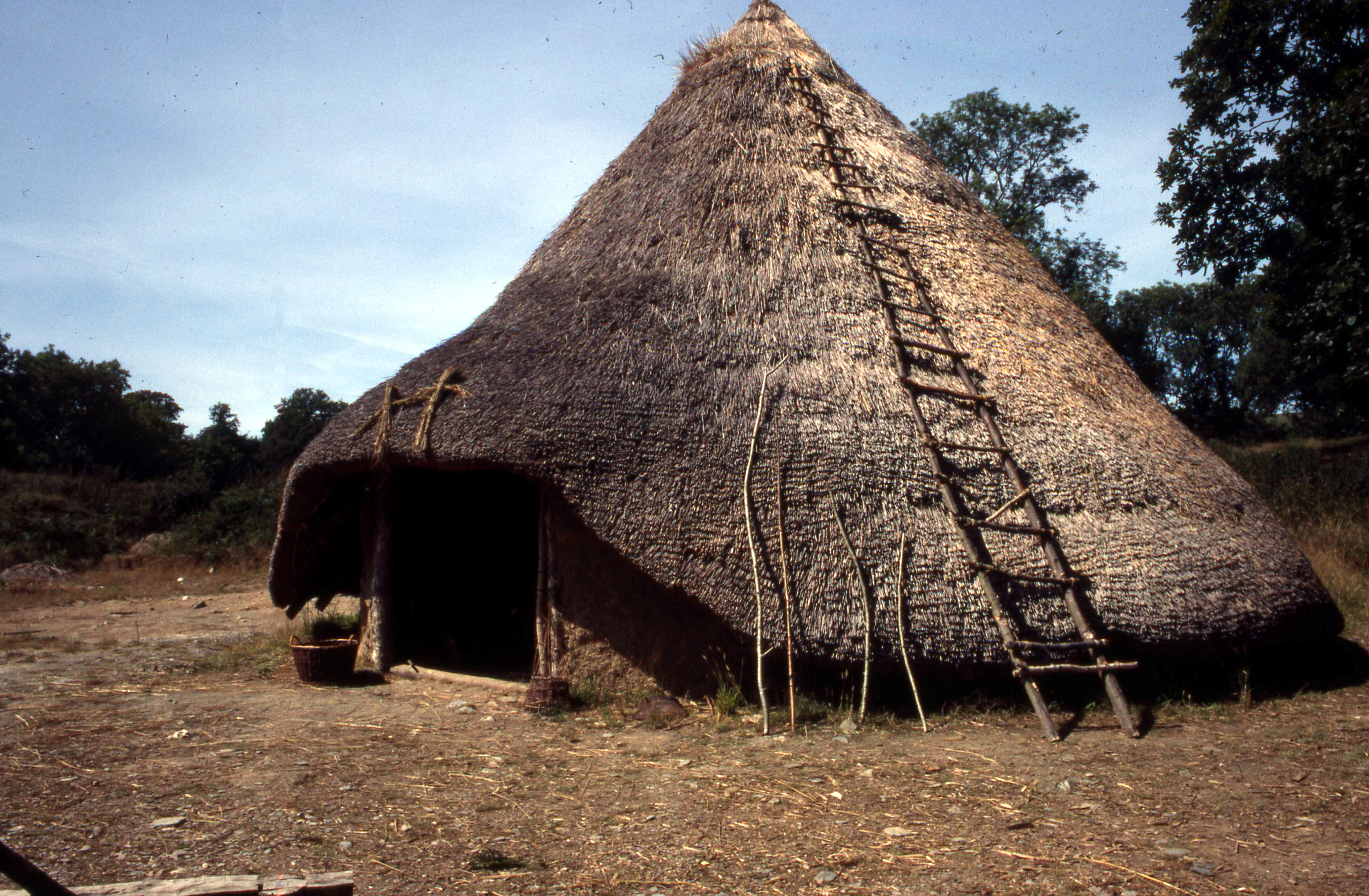
Some idea of the amount of wood required to construct a roundhouse, and therefore the impact on local woodland, has been gained from experimental work by Phil Bennett (Bennett 2001) at Castell Henllys (Figure 1), where the largest known roundhouse at the site has been reconstructed. All the wood used in the reconstruction was the result of coppicing. Around 90 hazel bushes were used in the construction of the wall and around 34 oak trees used for the rafters, wall posts and ring beams. A further indication of the possible impact on the environment was the use of two thousand bundles of water reed to thatch the roof, although wheat straw could have been used.
In Wales the pollen record indicates some variation in clearance activity across the country during later prehistory, although the general trend is towards an increasingly open landscape by the end of the Iron Age and the Romano-British period. A distinct increase in woodland clearance is observable during the middle-later Bronze Age in many areas. In some areas this appears to have persisted into the Iron Age, but in others there is evidence for woodland regeneration during the late Bronze Age/early Iron Age, before more extensive clearance that continued into the Romano-British period. There is also evidence for a recovery in woodland in certain areas during the late Iron Age. For example in the uplands of Ardudwy (Chambers et al. 1988, Chambers and Price 1988) clearance commenced during the Bronze Age and continued through the period of occupation at the later prehistoric settlements of Erw-wen and Moel y Gerddi (see Pollen evidence). There was, however, possibly some recovery in woodland following the abandonment of Moel y Gerddi, before further clearance in the Roman period (Chambers et al. 1988; Chambers and Price 1988).
Further north, the pollen record from a mire close to the Iron Age/Romano-British settlements at Cefn Graeanog indicates significant changes to the surrounding woodlands during the Bronze Age, with a further marked impact in the mid-first millennium BC. This was followed by a period of secondary birch and hazel woodland, which lasted until towards the end of the late Iron Age. Substantial deforestation accompanied by cereal cultivation suggests clearance for agriculture. This could have resulted in a decline in the availability of suitable timber for building purposes, as at Moel y Gerddi and Erw-wen, leading to the change in building layout and the use of stone observable at the hut group (Kelly 1998). Wood was, however, also used for fuel. In addition to the pollen evidence, charcoal and other charred plant remains from the site give some indication of the wood collected, including scrubby species like gorse.
Woodland clearance and agricultural activity can also lead to soil erosion in an area, and at Llyn Cororion, on the Arfon plateau, intensification of activity during the later Bronze Age/early Iron Age was accompanied by an increase in mineral input into the lake as a result of disturbance of the soils (Watkins et al. 2007). Again there is evidence for more extensive clearance and cereal cultivation during the later Iron Age, while another marked decline, particularly in oak and hazel woodland, took place slightly later during the Roman period.
Evidence of other changes in the woodland landscape of north Wales includes a marked impact at Bodandreg Bog (Chambers et al. 1998), around 1km from the later prehistoric/Romano-British settlement at Bush Farm. Here alder-birch carr gave way to open valley mire, while at the Iron Age/Romano-British farmstead of Bryn Eryr on Anglesey there is evidence for the clearance of local alder woodland. Again, as well as the clearance of woodland for agriculture and building purposes, wood would have been used as fuel for fires. Fuel would have been gathered not only for domestic but also for industrial fires and at Bryn y Castell hillfort the possible impact of ironworking on the surrounding environment has been investigated (Pollen evidence).
In the Welsh Marches evidence from the Breiddin hillfort (Smith and Green 1991; Smith 1991) suggests deforestation increased from the middle Bronze Age through to the Iron Age when, as well as evidence for continued grazing, there is also a little evidence for arable cultivation. Unfortunately, the pollen record for the later Iron Age and Romano-British occupation did not survive as a result of a gap in deposition of the sediments, perhaps of up to 1200 years, indicated by radiocarbon dating. However, charred plant remains indicate cultivation and, unusually for a dryland site, a number of wood finds recovered from an Iron Age cistern provide some information about the wood available for building purposes and to make artefacts.
Although a number of pollen sites in central Wales are undated there are an increasing number of upland sites, including Carneddau and Cefn Gwernffrwd, where there is some dating evidence. At Carneddau, clearance during the middle Bronze Age and early Iron Age is followed by extensive clearance in the late Iron Age/Romano-British period. Some woodland regeneration at the end of the Bronze Age and early Iron Age at Cefn Gwernffrwd is also followed by widespread deforestation in the Late Iron Age or Romano-British period. A detailed picture of human impact during the Iron Age, especially the Late Iron Age/Roman period, in the lowlands of west Wales is available from Tregaron bog (Cors Caron) (see Pollen evidence).
In south-west Wales there is clear evidence of increased activity during the Iron Age in the Preseli region, e.g. Dinas, and direct evidence from several lowland archaeological sites for the effects of human activity. At Castell Henllys a largely open woodland landscape with grazing is indicated in the pollen record dating from the end of the Iron Age through the Romano-British period. A mainly open pastoral landscape, though with some cultivation and woodland, is suggested in the vicinity of coastal promontory forts such as Great Castle Head, Dale, in Pembrokeshire. Elsewhere in south-west Wales the pollen sequence from below the Roman road at Pwll-y-hywaid near Whitland suggests clearance activity during the earlier Iron Age, followed by a marked expansion in activity during the later Iron Age/Romano-British period. Nevertheless some woodland and scrub persisted in the surrounding area, demonstrated by the use of wood in construction of the road. As at the late Iron Age farmstead at Penycoed, a predominantly pastoral landscape is indicated.
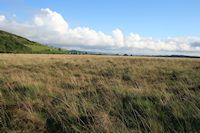
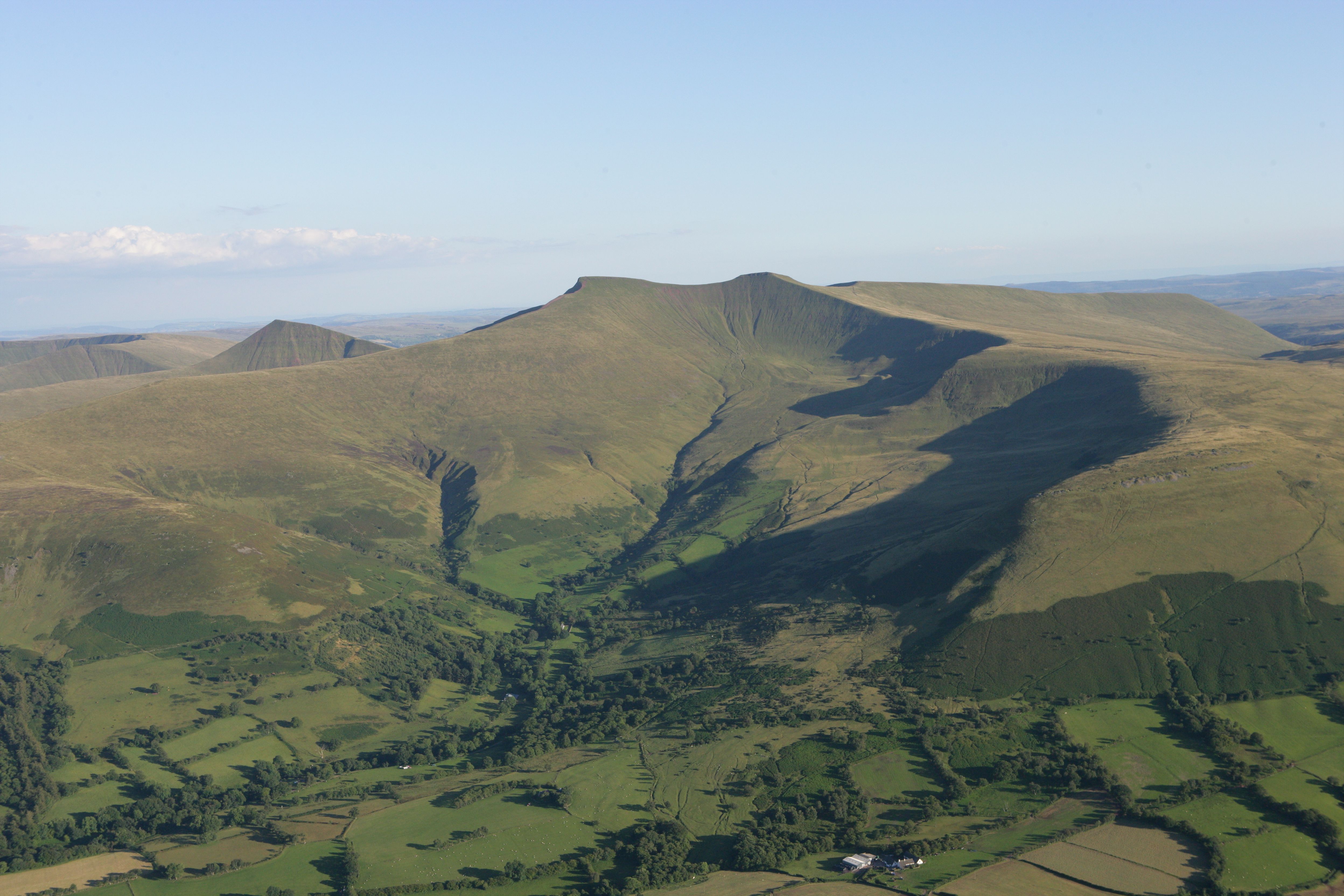
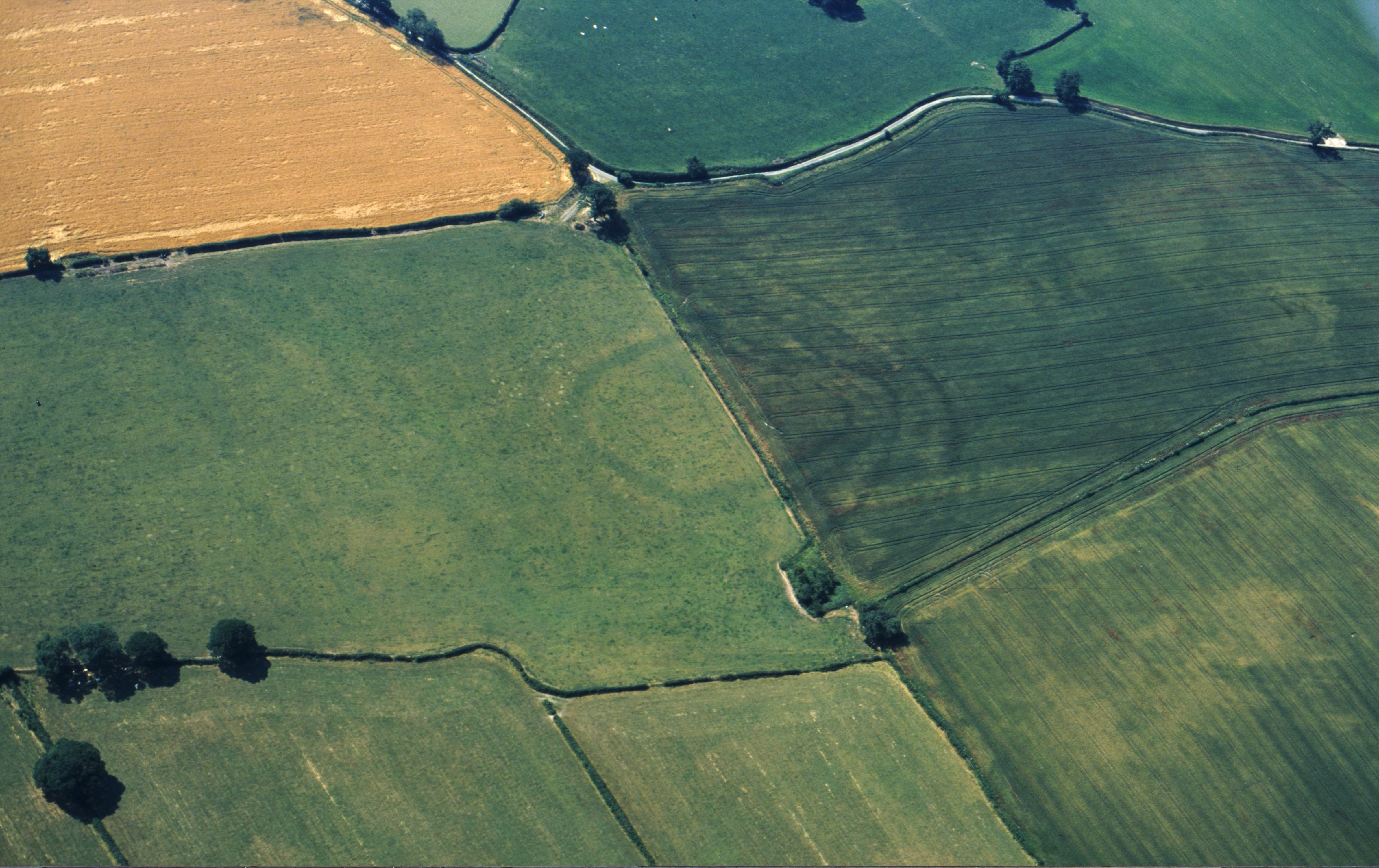
At a number of pollen sites in upland south Wales, e.g. Waun-Fignen-Felen, Brecon Beacons and Nant Helen, Mynydd y Drum, some woodland regeneration occurred in the later Bronze Age or earlier Iron Age, followed by clearance during the later Iron Age or Romano-British times (Figure 2). However, at Cefn-yr-Esgyrn, although there was clearance activity from late Bronze Age times onwards, some woodland persisted through the Iron Age. Extensive clearance leading to an open, grazed landscape occurred during the later Roman period. Further east on the Waun Fach plateau and elsewhere in the Black Mountains, there was also increased activity during the Iron Age/Romano-British period.
In lowland south-east Wales evidence from pollen sites in the Severn Estuary and the Welsh Levels has been particularly informative about the nature of the wetland landscape and environment. In addition the work of Martin Bell and colleagues at the occupation site of Goldcliff (Bell et al. 2000; see Iron Age exploitation of the wetland landscape) has greatly increased our knowledge of how people were exploiting woodland and the woodworking techniques they were using during the Iron Age. This has provided comparable evidence to that from the Lake Villages in the Somerset Levels and sites in the Fens. Furthermore, it has increased our understanding of how people were using the wetland landscape and its role in the agricultural regime.
As in Wales, clearance activity varies in other parts of Britain with differences both between and within regions. Major and extensive clearance did not take place until the later Iron Age in north central Britain, although there was widespread farming during the Bronze Age and earlier Iron Age. However, in many areas major woodland clearance occurred during the Bronze Age, for example south-east England, the uplands of Dartmoor and Bodmin and the uplands of north-west England. Similar to the situation in Wales, in some areas of south-east and south-west England there was woodland regeneration during the late Bronze Age or early Iron Age. In general, throughout much of Britain, extensive clearance occurred during the Iron Age, at least by the late Iron Age, with an accompanying increase in agriculture.
Deforestation and agricultural expansion also had an impact on river systems in Wales, as elsewhere in Britain, during the Iron Age. Clearance and agriculture contributed to making river catchments more responsive to late Holocene shifts in climate, for example in the Dyfi catchment. Mark Macklin and colleagues have investigated flood frequency and magnitude in British river systems and their relationship to climate and land-use changes during the Holocene (Macklin et al. 2005). The evidence suggests an underlying climatic control but possibly human activity and land-use changes were of greater importance c. 2500 cal BP. The adoption of iron technology and associated agricultural innovations would have contributed to increased runoff and erosion, resulting in a greater frequency of flood-related sedimentation.
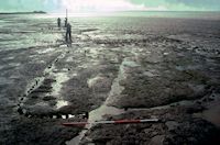
Farming played a central role in Iron Age life and much of the activity in the landscape would have been governed by the farming year. The active engagement of humans in agriculture is evident from archaeological evidence including stock enclosures, terraces, fields, ploughmarks, querns and spindle whorls. However, charred plant remains and animal bones (and occasionally animal footprints) provide a more detailed picture of farming when they survive, indicating the crops that were grown and the livestock that was kept. In Pembrokeshire charred cereal grain has been found associated with cultivation marks at Brownslade (Carruthers 2011), while ploughmarks and cattle prints were recorded at the Iron Age and Romano-British field system at Stackpole Warren (Benson et al. 1990; Figure 3). Pollen also provides information about farming in the wider landscape but is not without limitations. Cereal pollen tends to be under-represented in pollen diagrams because of its production and dispersal characteristics, and therefore its absence does not necessarily preclude arable cultivation in an area, especially if it was on a small scale and some distance from the pollen site.

Fox's (1932) division of Britain into Highland and Lowland zones led to the perception of Wales as an area occupied by pastoralists as opposed to farmers involved in cereal growing and mixed agriculture, as in southern England. In Wales, as in other parts of the Highland zone such as northern England, there is now considerable evidence for cereal cultivation. Although the pollen record generally indicates that pastoral activity dominated, evidence for cereal cultivation is evident at a number of sites. Cereal pollen has been recorded at various hillforts including the Breiddin, Caer Cadwgan and Great Castle Head, Dale, indicating either local cultivation or cereal brought in from the surrounding region. Equally, evidence of cereal growing has been found at or in the vicinity of farmsteads and enclosures including Cefn Graeanog II, Bryn Eryr, Erw-wen and Moel y Gerddi in north Wales and Penycoed and Thornwell Farm in south Wales. Other sites and areas where arable and pastoral pollen indicators suggest mixed farming include Llyn Cororion, Western Rhinogau and Tregaron (Pollen evidence) and Llangorse Lake. At the latter site a change in sedimentation, attributed to an intensification in arable agriculture and increased soil erosion, might reflect Iron Age rather than Roman activity.
Charred cereal grains confirm the pollen and archaeological evidence for cereal cultivation and give some indication of the crops that were being grown and, along with chaff and weed seeds, the crop-processing and husbandry practices that were taking place in the landscape. The main crops in Wales, as in other parts of Britain, were emmer and spelt wheats and barley. Bread wheat and rye are only occasionally or rarely recorded. Oat was probably present both as a crop and a weed.
In general there is less charred cereal evidence in Wales dating to the late Bronze Age/early Iron Age, although significant quantities of cereal have recently been found at the midden site at Llanmaes. Most of the evidence is from the late Iron Age and Romano-British period. Equally, more information is available from some parts of Wales than others. There is, for example, little evidence dating to the Iron Age from mid-west Wales and south-east Wales, although there is rather more evidence dating to the Romano-British period from the latter.
From the data that are available some variation in the crops being grown during the Iron Age is evident. This possibly gives some indication of differences in the cultivation regimes operating in the fields. At the Breiddin in the Welsh Marches emmer was the main wheat present in an occupation deposit dating from the 3rd to 2nd centuries BC, although spelt was present. Similarly, emmer predominated in Iron Age samples from the enclosure at Collfryn (Figure 4), although again spelt was present (Jones and Milles 1989). This contrasts with Romano-British samples, which comprised large quantities of bread wheat and smaller quantities of oats, rye and Bromus, albeit a sample from the Romano-British double-ditched enclosure at Ardleen yielded emmer, spelt, six-row barley and oats (Jones and Milles 1984). A negligible amount of grain was recovered from the Iron Age enclosure at Mount Pleasant, Montgomeryshire, but included spelt wheat and oat. Marijke Van der Veen (1992) has suggested that on Iron Age sites in northern England the occurrence of emmer wheat reflects an intensive cultivation regime with fertile soil conditions, while spelt wheat indicates a more extensive regime with less fertile soil conditions.
Although emmer is recorded from most Iron Age sites and clearly continues into the Romano-British period, the evidence from sites such as Cefn Graeanog II and sites on Anglesey in north-west Wales and Llawhaden (Woodside and Dan-y-Coed), Ffynnonwen and Troedyrhiw in south-west Wales suggests that spelt had replaced emmer as the main crop in much of the country, at least by the late Iron Age. At these sites emmer was probably present only as a 'contaminant' of a spelt crop. At other sites the occurrence of emmer and spelt may indicate the sowing of a mixed wheat crop rather than separate crops, perhaps as an insurance policy. This was possibly the case at Court Wood, Pembrey, where both were recorded from early Iron Age pre-rampart deposits (Hillman 1981).
Although it is generally represented only in small amounts in the charred cereal record for the Iron Age in Wales, it is apparent barley was widely grown. It is more likely to be destroyed by fire than the glume wheats and therefore may be under-represented. Experimental work by Boardman and Jones (1990) has demonstrated that some types of cereal and certain cereal components are susceptible to charring and more likely to be totally destroyed than others. Barley was possibly used as a fodder crop and therefore would have been important in an area where livestock keeping played a major role in the agricultural economy.
The increase in charred grain assemblages available for the Late Iron Age and Romano-British period is consistent with the pollen records, which suggest increased woodland clearance and an expansion in agriculture during the Iron Age and a further possible expansion during Roman times. The trend towards spelt, either because it was chosen as the main crop or because it out-competed emmer if it was sown as a mixed crop, is also consistent with more extensive farming.
In general the earlier stages of crop processing are absent from charred grain assemblages, which suggests that these activities were taking place away from the settlements. However, the presence of chaff at sites such as Llawhaden (Caseldine and Holden 1998) and Cefn Graeanog (Hillman 1984) indicates the later stages of crop processing by the settlement occupants and that wheat was brought to the site and stored in spikelet form.
Comparison of the assemblages from Wales and northern England with those from central and southern England indicates that grain-rich site assemblages (as opposed to weed-/chaff-rich assemblages) largely occur in the south of Britain and are closely associated with storage pits. In an attempt to identify specialist settlements in the landscape and determine whether cereals were transported from one site to another, Martin Jones (1985) suggested that grain-rich assemblages indicated producer or arable sites while weed-/chaff-rich assemblages indicated consumer sites. Since then this model has been criticised and alternative interpretations proposed for cereal assemblages. Van der Veen and Jones (2006; 2007) have reviewed the evidence and have argued that grain-rich assemblages are the result of accidental fires and are more likely to indicate the scale of production and consumption, i.e. large scale, rather than distinguish between the two. In Wales the evidence from Llawhaden (Caseldine and Holden 1998) and other sites such as Great Castle Head, Dale (Caseldine 1999), where chaff tends to predominate, suggests small-scale activity. In contrast, an assemblage of processed grain from Court Wood, Pembrey, may represent accidental charring while the grain was roasted. The presence of cultivation terraces nearby, considered to be contemporary, suggests local cultivation rather than the import of grain from further afield.
Although cultivation may have played a more significant role in the coastal and inland lowlands, pastoral farming was the main land use over much of the country, especially in the uplands. Enclosures are commonly attributed to stock management, while spindle whorls and pollen indicating grassland communities all point to the keeping of livestock. However the faunal evidence for animal husbandry is comparatively limited. Unfortunately, the acidic soils in Wales tend not to favour the preservation of bone. Assemblages dating to the Iron Age period are generally poor, particularly in comparison with those recovered from sites in central southern England, and compared with the Romano-British period.
The limitations of the faunal evidence is illustrated by a comparative study of animal husbandry regimes in Iron Age Britain by Ellen Hambleton (1999) in which only the assemblages from the hillforts of Coygan Camp, Castle Ditches and Dinorben in Wales produced sufficient data for analysis. These sites were grouped with those in the border counties of the Welsh Marches and south-west England. since they were considered to have shared cultural and geographical traits. It was concluded that the sites formed a clear group although there was a certain amount of intra-regional diversity. Generally the group was characterised by a higher percentage of pig compared with other areas and roughly equal proportions of cow, sheep and pig (c. 20-50%). The exception was Coygan Camp, which had higher percentages of cow and lower percentages of sheep. The high incidence of pig is in keeping with hillforts being high-status or gathering places associated with feasting, although there are other possible interpretations, including the availability of woodland in the surrounding area and dietary preference. In comparison, the faunal dataset from Wessex and central southern England tended to have higher percentages of sheep than cow and low percentages of pig. This was attributed to sheep being better suited to the chalk downland pasture. Sheep might also have aided the arable economy by grazing on stubble and manuring the fields. Dale Sergeantson (2007) has argued that communities had to work harder to obtain food from their agricultural and grazing lands in southern Britain and this resulted in intensive management of herds and flocks for meat and dairy products, while pig keeping could not be supported.
Hambleton's (1999) study only considered data from hillforts in Wales and is not necessarily representative of Wales as a whole. There is, however, evidence from a recent investigation at the midden site at Llanmaes (Gwilt et al. 2006; Madgwick and Mulville 2015) as well as evidence, if limited, from other sites that give further information about animal husbandry and the role of these sites in the landscape. At middens in southern England activity seems to have been restricted to the late Bronze Age/early Iron Age but at Llanmaes middening appears to have continued through to the late Iron Age. The animal bone assemblage is one of the largest from Wales. Pig makes up the largest proportion of identifiable bone, while cattle and sheep/goat comprise the majority of the remainder. Large quantities of pig bone have also been reported from late Bronze Age/early Iron Age midden sites in England. As already mentioned, pig may be associated with feasting. From the large bone assemblage it is possible Llanmaes may have functioned as a meeting place in the landscape.
Although limited, the assemblages from enclosures and farmsteads elsewhere give some indication of the livestock that was kept and differences in use of the pastoral landscape. Evidence from late Iron Age/Romano-British sites such as Bryn Eryr on Anglesey, Collfryn (Jones 1989; Figure 4) in mid-Wales and Biglis (Parkhouse 1988), Thornwell Farm (Pinter-Bellows 1996) and St Athan (Higbee 2006) in south Wales suggests that cattle and sheep were kept not only for their meat but also for other purposes, including milk, wool-production and draught. The lower incidence of pig, compared with the hillfort and midden sites, might reflect the status of the site and/or the demand for land for cultivation, access to woodland or dietary choice. Sheep were more numerous than cattle at Collfryn, Biglis, Thornwell and St Athan and might indicate sheep milking. Serjeantson (2007) has suggested that in southern Britain this practice continued into the later part of the first millennium BC and was, perhaps, as intensive as during the late Bronze Age. This could reflect a continued heavy dependence on dairy products for part of the food supply. The presence of neonatal and young animals at the wetland Iron Age site of Goldcliff (Hamilakis 2000) also suggests that dairying was important, but there the emphasis was on cattle rather than sheep. This contrasts with the late Bronze Age site at Caldicot, where sheep and goat significantly outnumbered cattle.
It is likely that there was some movement of stock to the uplands in the summer, at least in some areas. The animal bones from Goldcliff also indicate the seasonal movement of stock, but in this instance from the dryland to the wetland rather than from the lowlands to the uplands. From the high number of young animals, seasonal cattle herders may have occupied the site during the spring and summer, although this may not have been exclusively the case. Human and animal footprints also demonstrate the movement of herders and herded across the wetland landscape.
Apart from agriculture, the Iron Age landscape also offered wild resources. Woodland was clearly exploited for fuel and other purposes and there may have been some attempt to manage the resource. Albeit firm evidence for coppicing has not been identified in Wales, it appears that wood stems were selected according to size at Goldcliff. In addition occasional hazelnuts and blackberry seeds on Iron Age sites hint at the collection of wild plant foods from woodland or hedgerows, but this was of much less importance than in earlier times. Other plant remains such as reed may have been used for flooring, while straw, reed or heather may have been collected for use as thatch. Heather and bracken may have been gathered for bedding.
However, Iron Age communities may have perceived and responded to the 'natural' landscape and what it had to offer very differently from today. The presence of red deer antler at Goldcliff indicates hunting, but Hamilakis (2000) has suggested that hunting might have had a greater social and cosmological meaning than simply acquiring raw material to make tools. He also proposed that the absence of fish at Goldcliff may have been because fish was not considered as food. Similar conclusions have been drawn elsewhere, for example by Hill (1995) at Iron Age sites in Wessex who concluded that hunting and fishing played only a minor role in the subsistence economy and the absence of wild resources from Iron Age diets was because it was prohibited. Dobney and Ervynck (2007) have also suggested that the lack of fish remains at English sites bordering the North Sea is related to their symbolic or even unclean status, and that their capture and consumption was disallowed. There is, however, evidence for the exploitation of shellfish in Wales from Iron Age contexts, including a midden at Stackpole Warren, but again there is no evidence for the utilisation of other coastal resources such as fish.
In conclusion, the continued and increasing removal of woodland during the Iron Age and into the Romano-British period resulted in the transformation of the Welsh landscape into more of an agricultural one. Emmer and spelt wheat and barley were the main cereal crops grown, with spelt of increasing importance. Although animal bone preservation is often poor on Iron Age sites in Wales, there is some evidence for the livestock that was kept and how different parts of the pastoral landscape were used. Of note is the evidence for the use of wetland environments, such as in the Severn Estuary, in the grazing regime of domestic animals. However, although the exploitation of wild resources, whether the gathering of wild plant foodstuffs or the hunting of deer and other animals and birds, may have been of less significance than in earlier periods, it still persisted and the use of wood was clearly important. Moreover, certain elements of the landscape may have held greater meaning for the humans operating within it than simply a resource to be exploited, as demonstrated by the animal remains associated with the Llyn Cerrig Bach hoard on Anglesey (Macdonald 2000).
Internet Archaeology is an open access journal based in the Department of Archaeology, University of York. Except where otherwise noted, content from this work may be used under the terms of the Creative Commons Attribution 3.0 (CC BY) Unported licence, which permits unrestricted use, distribution, and reproduction in any medium, provided that attribution to the author(s), the title of the work, the Internet Archaeology journal and the relevant URL/DOI are given.
Terms and Conditions | Legal Statements | Privacy Policy | Cookies Policy | Citing Internet Archaeology
Internet Archaeology content is preserved for the long term with the Archaeology Data Service (ROR). Help sustain and support open access publication by donating to our Open Access Archaeology Fund.