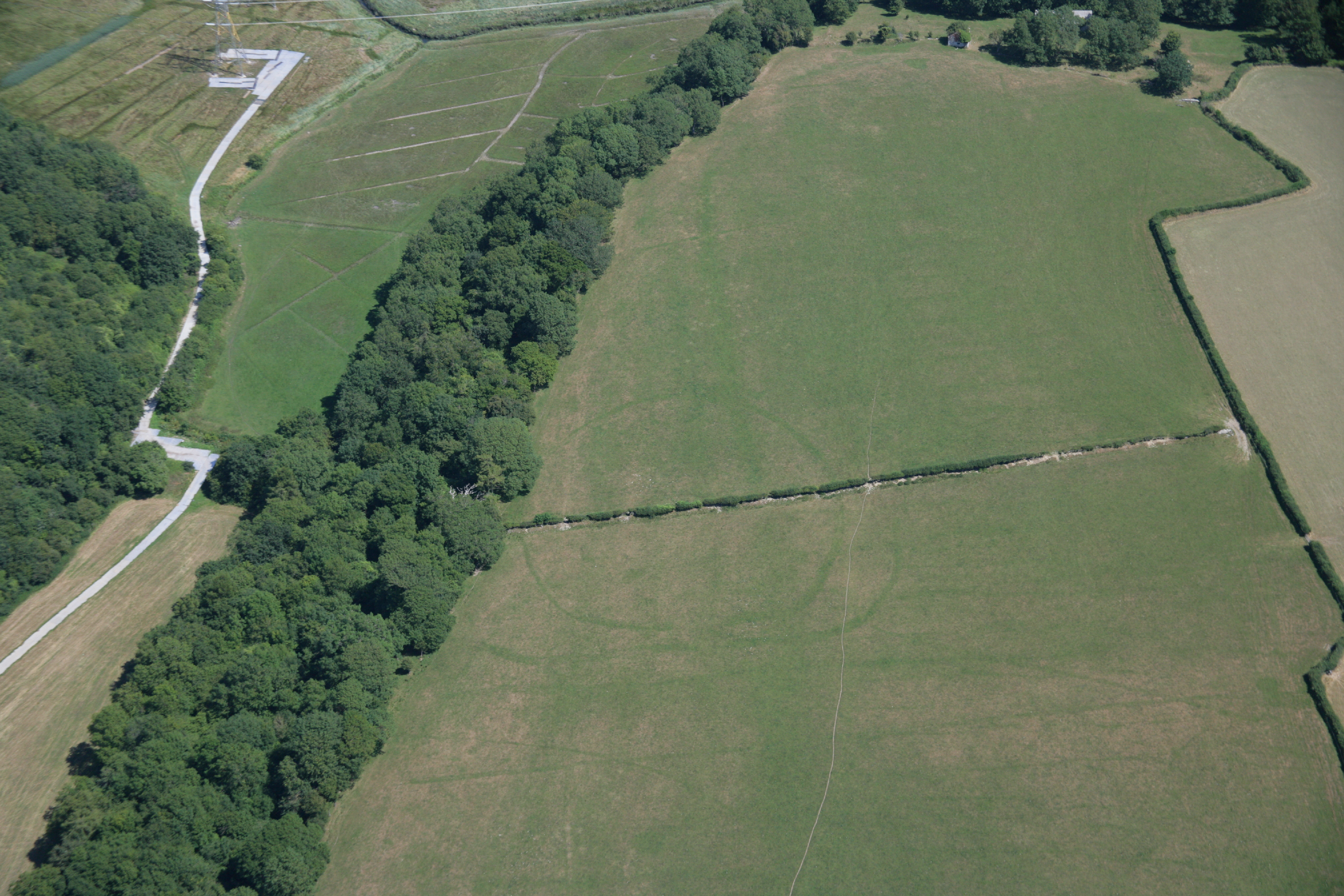
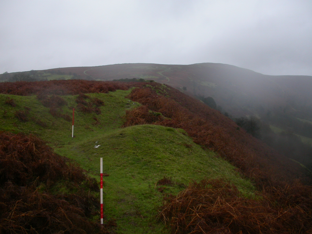
Figure 1: The escarpments overlooking the River Thaw are lined with small defended enclosures, although we do not know how many were in use at any particular time. This one, Castleton Wood, lies on the opposite side of the river from the area where the detailed survey was carried out (Image: Crown Copyright RCAHMW)
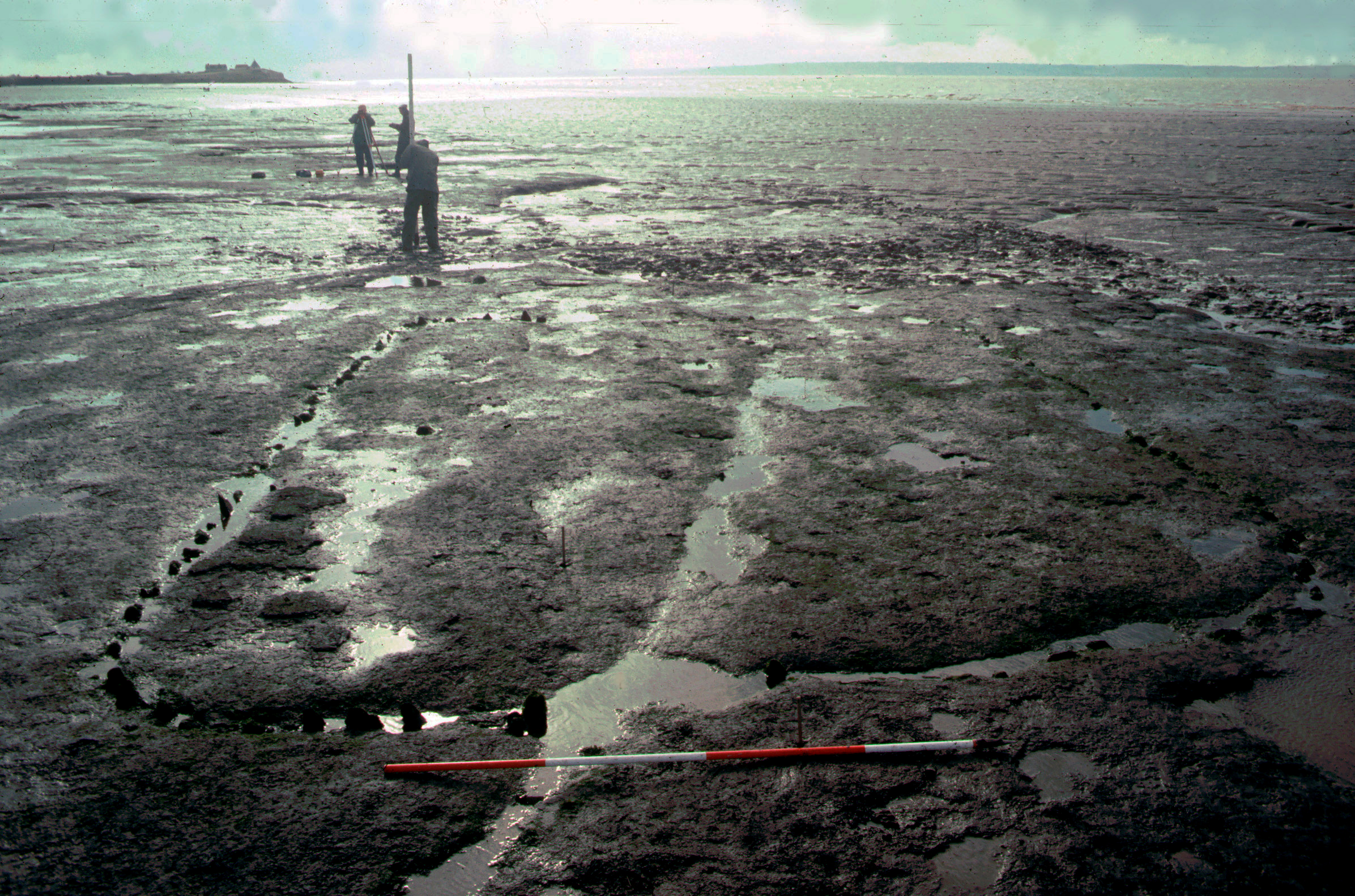
Figure 2: One of the timber buildings excavated in what is now the intertidal zone at Goldcliff. Continuous waterlogging has preserved the stumps of the posts making up the wall (Image: Martin Bell/University of Reading)
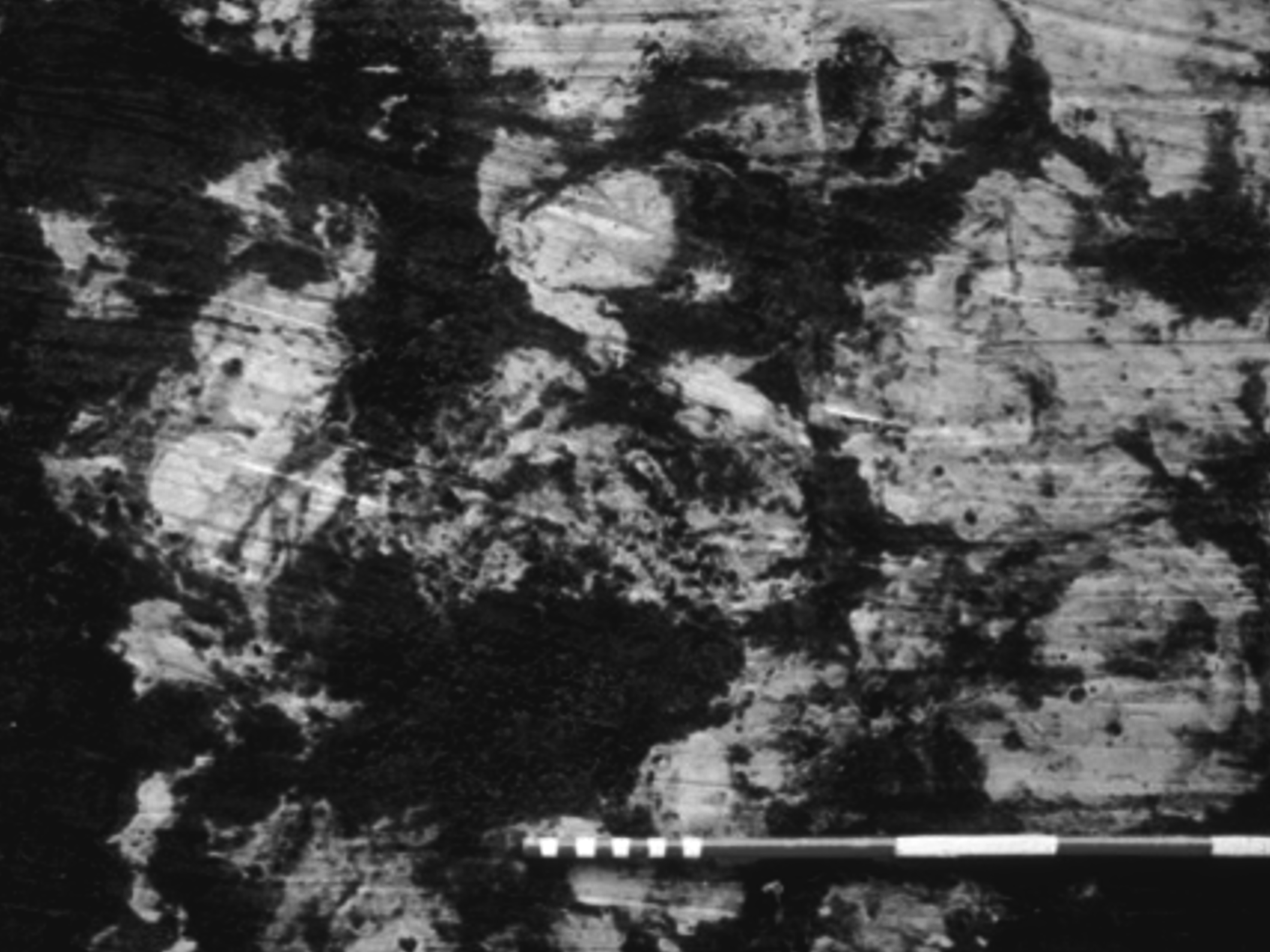
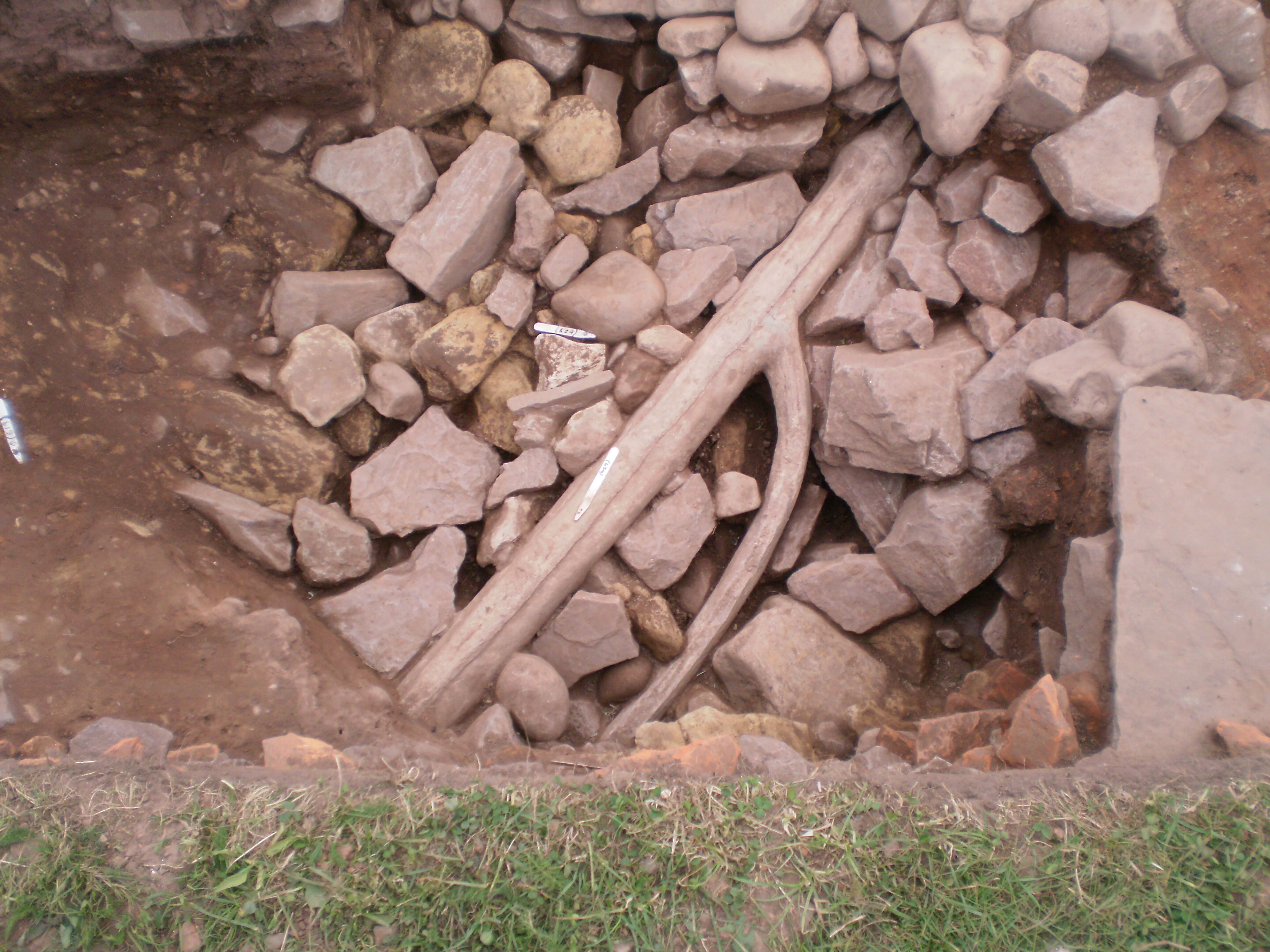
Figure 3: Hoofprints and the remains of insect parasites show that these buildings were connected with pasturing cattle (Image: Martin Bell)
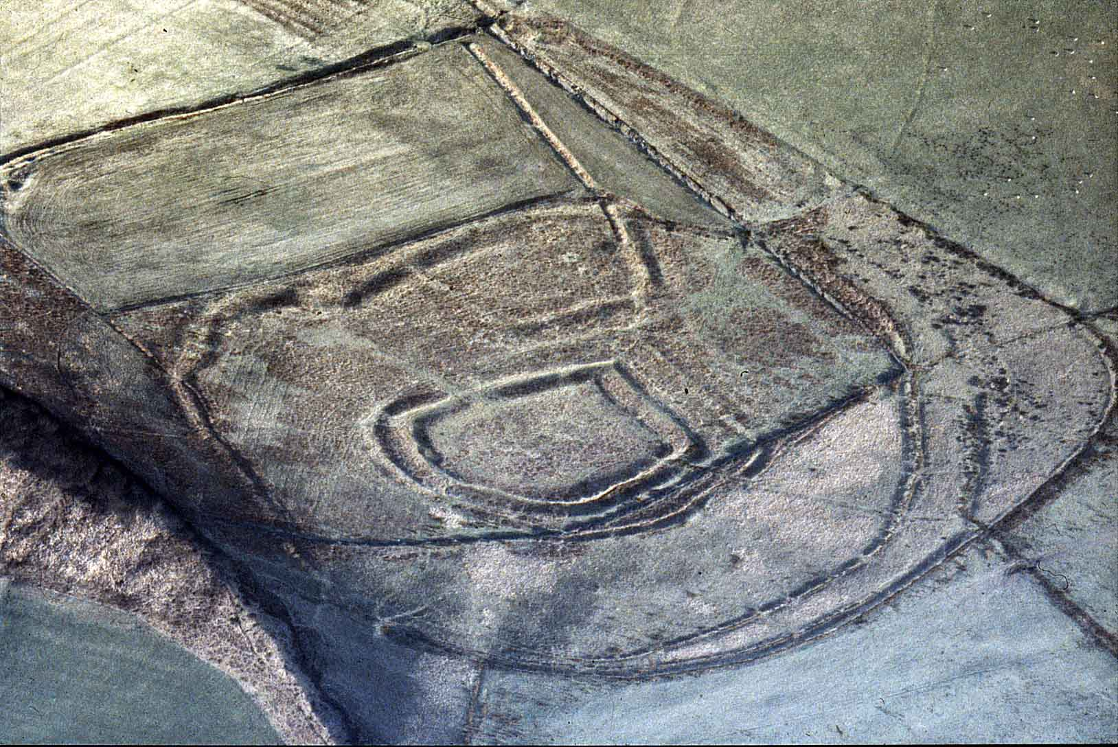
Figure 4: Y Bwlwarcau near Llangynwyd is a good example of a hillfort with a wide outer enclosure, possibly designed to house stock (Image: Glamorgan-Gwent Archaeological Trust)
Figure 5: Pen Twyn hillfort is situated in a commanding position at the south end of Hatterall Hill on a ridge with ground sloping away to the west and south, and with a natural scarp on the east giving panoramic views all round (Image: Glamorgan-Gwent Archaeological Trust)
Figure 6: Llancayo camp, a large univallate hillfort in Gwent. A wide causeway over the ditch leads to the entrance. This site has never been excavated, so we do not know whether it was occupied permanently or only sporadically, perhaps functioning as a place of refuge (Image: Glamorgan-Gwent Archaeological Trust)
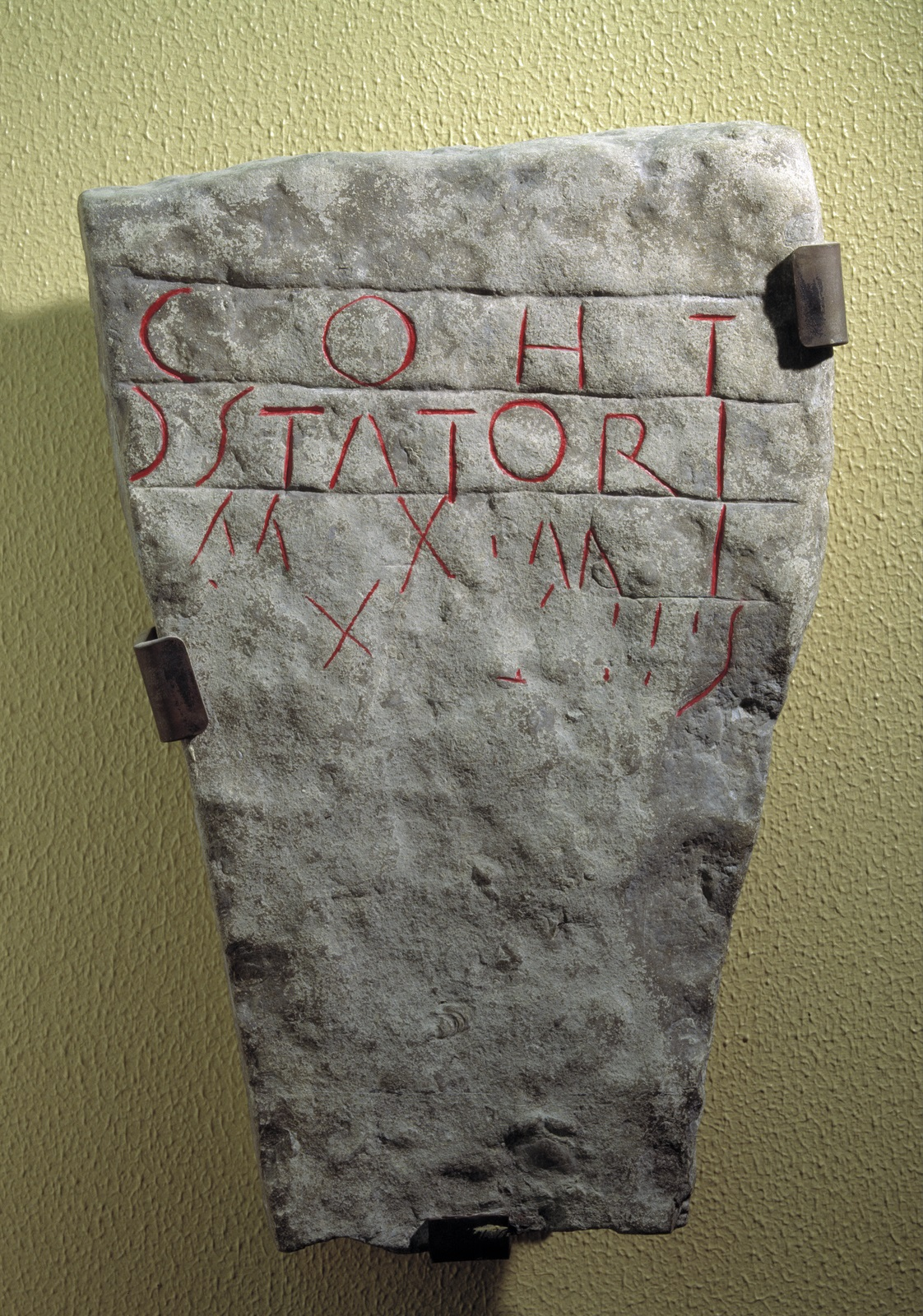
Figure 7: This stone from Goldcliff says that the Second Augustan Legion made 33½ (double) paces of some linear feature. This is usually interpreted as being the sea wall, but it might have been some other engineering project such as a major drainage ditch or a canal. The involvement of the legion does not necessarily imply that the Levels were included within the territory of the fortress — we know from other provinces that military engineers also carried out works for the civilian population (Image: Crown Copyright RCAHMW)
Figure 8: The excavations at Caerleon in the 1980s also revealed some cottage-type houses built in a more vernacular tradition on land reclaimed from the river (Image: Glamorgan-Gwent Archaeological Trust)
Figure 9: At least parts of the civil settlement at Caerleon were supplied with water that must have been drawn from the supply provided for the fortress. This lead pipe (P8290422), excavated in 2011, has a junction where the supply of water must have been drawn off for a private house in a more exclusive area of the settlement (Image: Glamorgan-Gwent Archaeological Trust)
Figure 10: The construction of a new civic centre in Caerwent in the first quarter of the 2nd century AD demonstrates that the Silures had been given the responsibility for their own local government. The paved forum may have been used as a market square while the basilica behind would have been, among other things, the local magistrates' court. The council chamber still preserved traces of the wooden seating that accommodated the decuriones (Image: Glamorgan-Gwent Archaeological Trust)
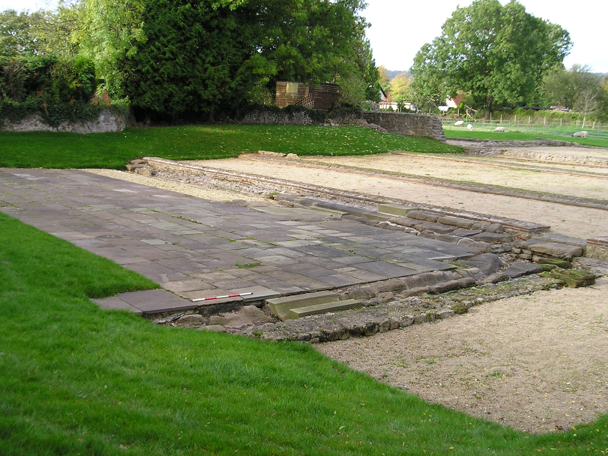
Figure 11: The baths at Cowbridge contain tile stamped by the Second Augustan legion, indicating that they must have been of official origin. They went out of use in the early part of the 2nd century because of the high water table, and we do not know whether they were replaced by baths elsewhere in the town (Image: Glamorgan-Gwent Archaeological Trust)
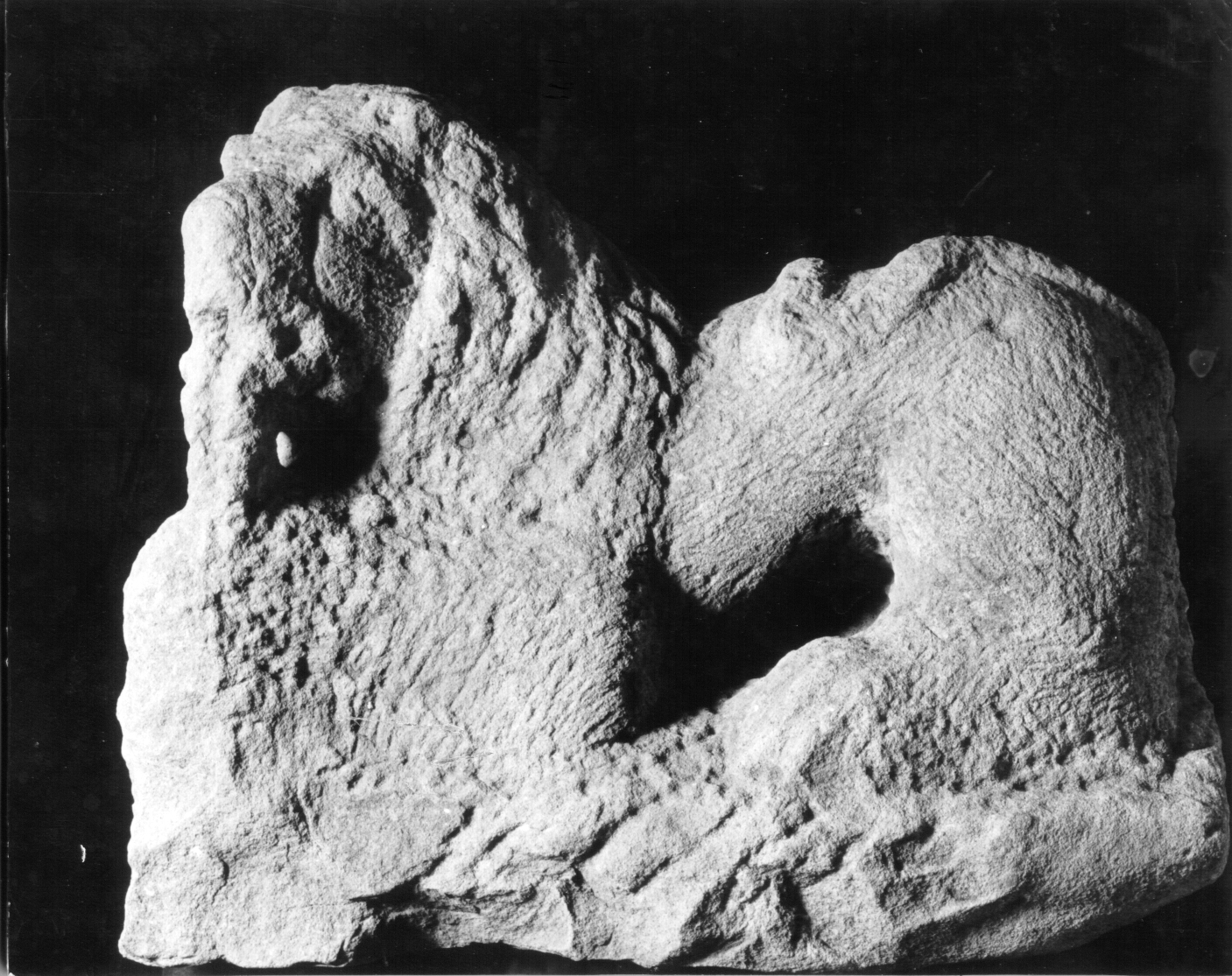
Figure 12: This sculpture of a lion must have come from the tomb of an army officer or official who died at Cowbridge (Image: Glamorgan-Gwent Archaeological Trust)
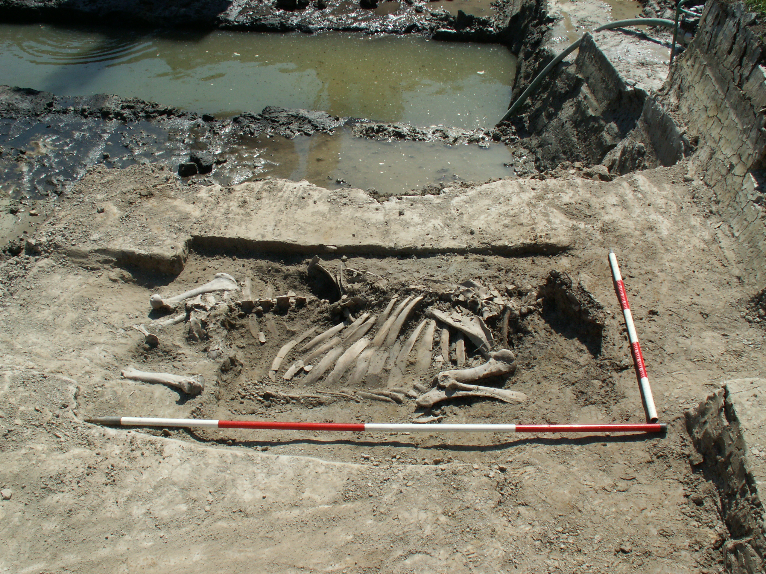
Figure 13: The skeletons of two cattle were found buried within the corner of a Roman field near Nash on the Gwent Levels, highlighting the importance of the Levels for raising stock, whether for the army or for the civilian population. We can only guess at the circumstances which led to their burial here — they might be animals that died here from disease or mischance, but we cannot rule out the possibility that they could have been sacrificial victims (Image: Glamorgan-Gwent Archaeological Trust)
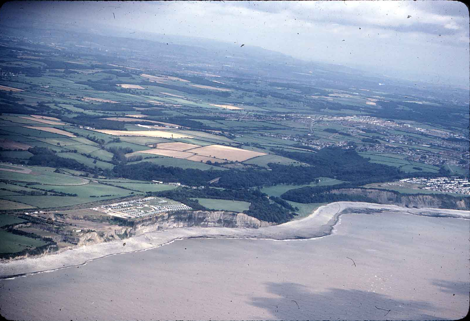
Figure 14: In the gently rolling countryside of the Vale of Glamorgan, life for the most part seems to have gone along much as it did in the Iron Age. The Bulwarks promontory fort is on the cliffs in the centre of the picture, next to the modern caravan park (Image: Glamorgan-Gwent Archaeological Trust)
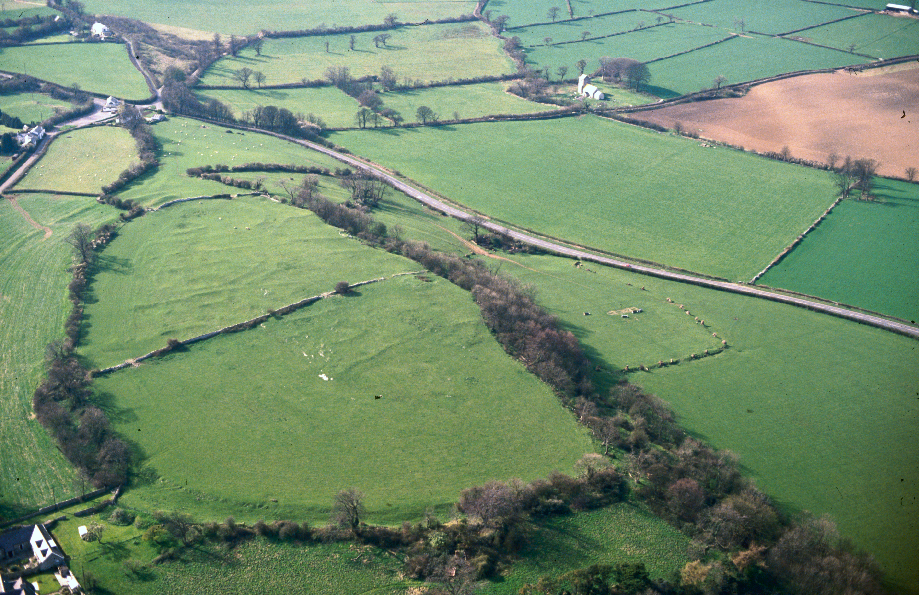
Figure 15: This farmstead on Dinas Powys Common now appears as a rectangular earthwork enclosure, containing at least two rectangular houses and surrounded by paddocks or small fields. Trial excavation showed that the central enclosure seems to have originally been marked by a timber palisade, which was later replaced by a rough drystone wall, and the pottery shows that it was occupied in the 2nd-4th centuries, though it may well have started earlier (Image: Glamorgan-Gwent Archaeological Trust)
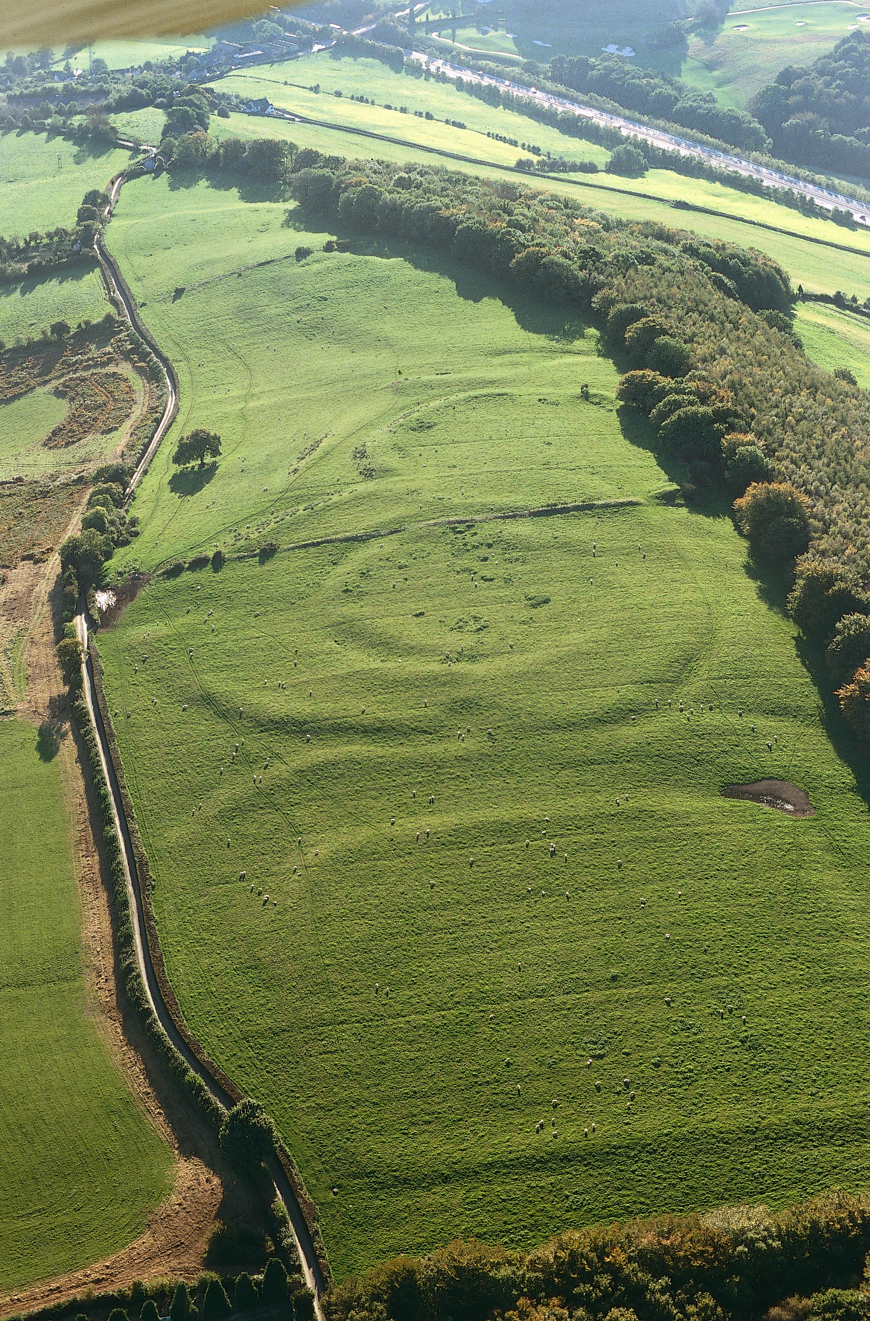
Figure 16: Within the ramparts of Caer Dynnaf are the extensive earthworks that mark the Roman settlement, which seems to have consisted of small farmsteads set in a system of small enclosures that probably include paddocks and garden (Image: Crown Copyright RCAHMW)
Figure 17: These three unexcavated earthworks at Pen-toppen-ash, overlooking the River Usk near Caerleon, probably represent three successive Iron Age/Roman enclosures. It used to be thought that the square enclosure had to be a Roman fort, but excavation of the defended enclosure at Whitton (see Whitton: from Iron Age farmstead to Roman villa) showed that such enclosures were also typical of native settlement (Image: Glamorgan-Gwent Archaeological Trust)
Figure 18: Mynydd Bychan during excavation (from SE) by the National Museum of Wales. One of the roundhouses has been half excavated, and the photograph shows how clearly its drystone walls had been marked by earthworks in the middle of the 20th century (Image: National Museum of Wales)
Figure 19: The gateway into the enclosure at Mynydd Bychan (from SE) (Image: National Museum of Wales)
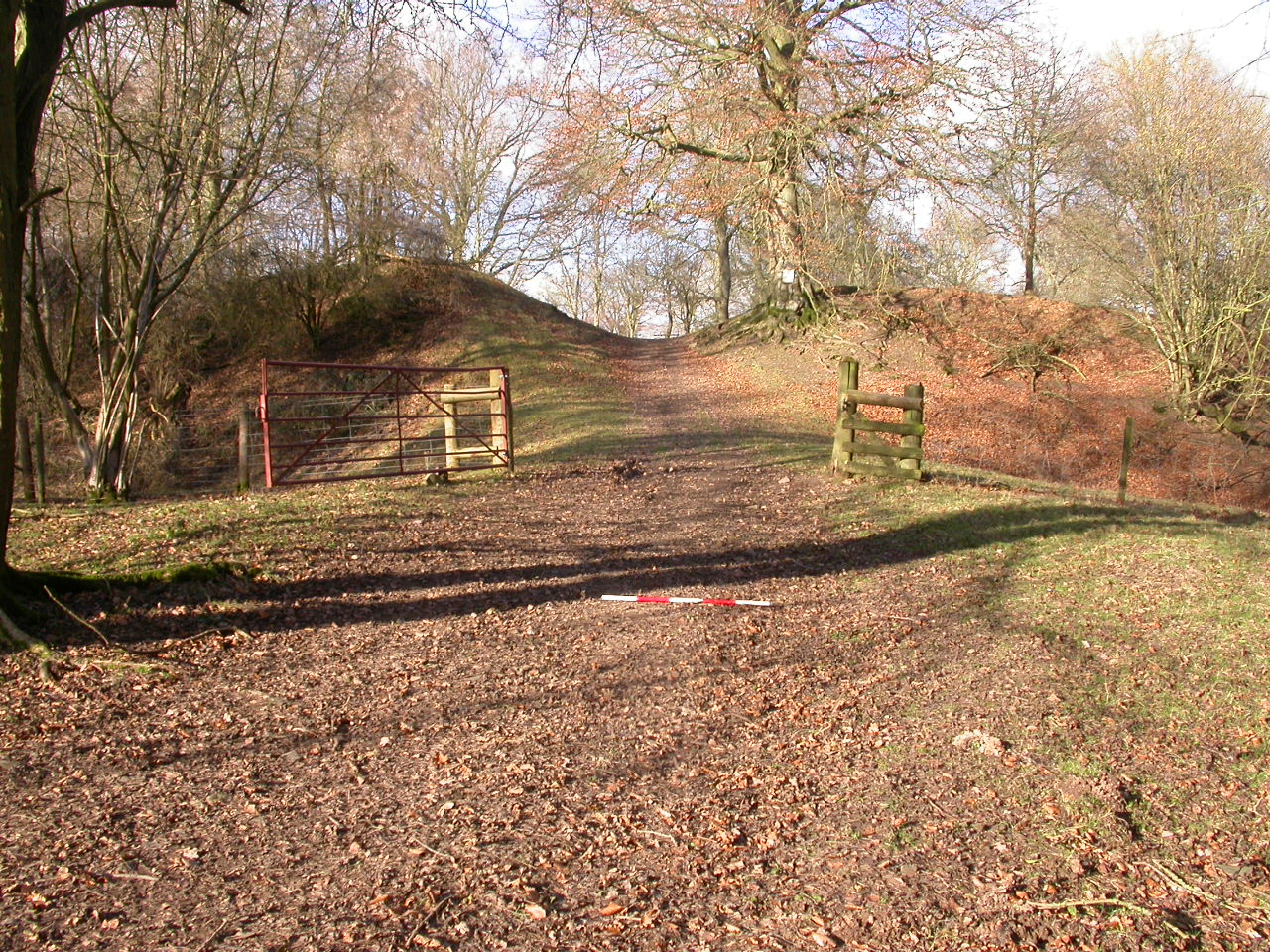
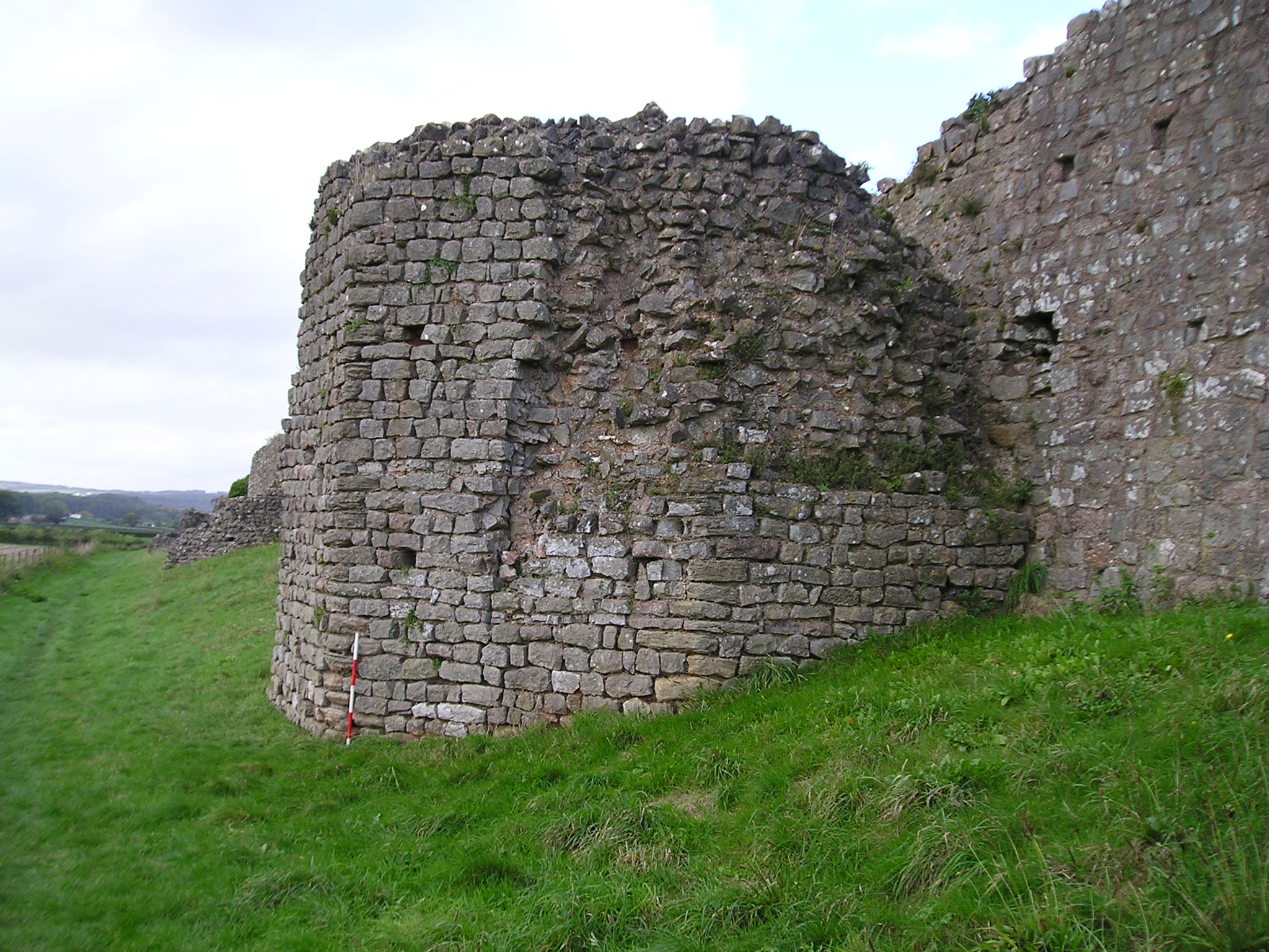
Figure 20: The massive inner rampart of Gaer Fawr, Monmouthshire. It has not been excavated archaeologically, but Roman tile has been found in the interior (Image: Glamorgan-Gwent Archaeological Trust)
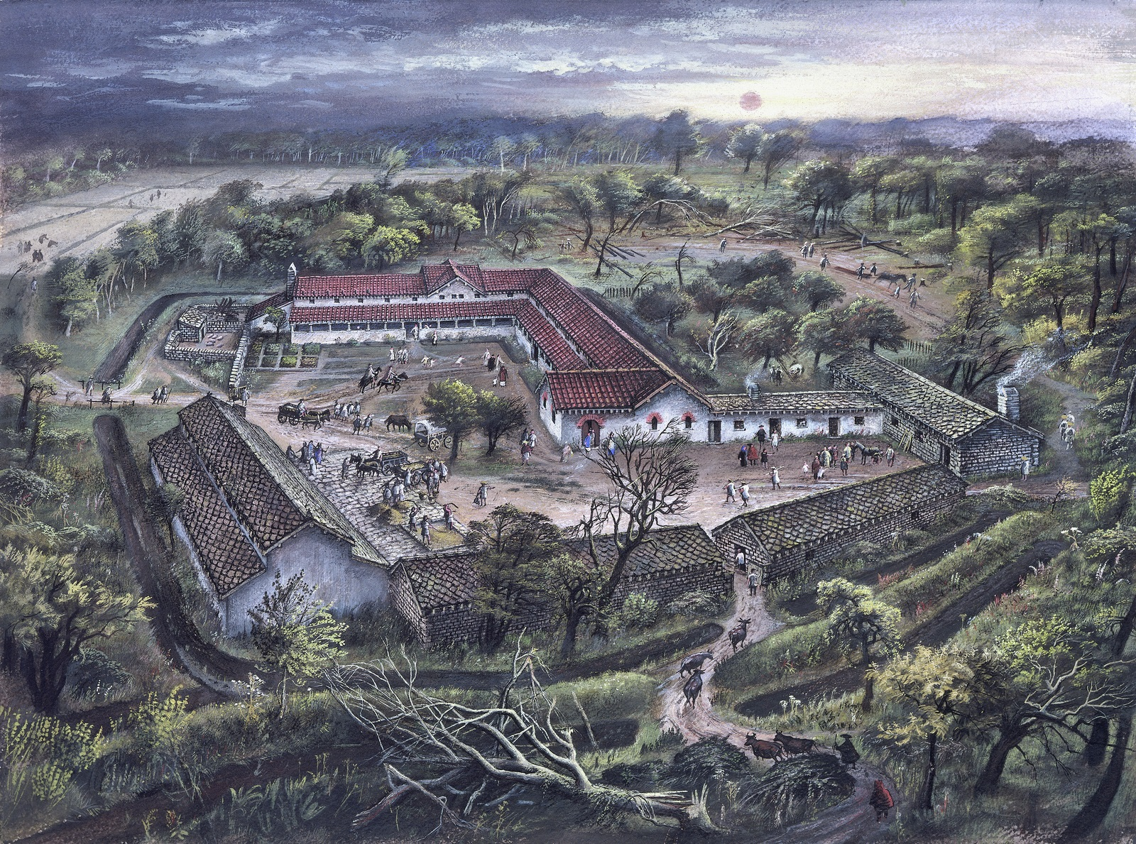
Figure 21: Llantwit Major Roman villa, The Vale of Glamorgan by Alan Sorrell, 1949. The villa, as shown, dates to the early 4th century AD. (Image: National Museum of Wales)
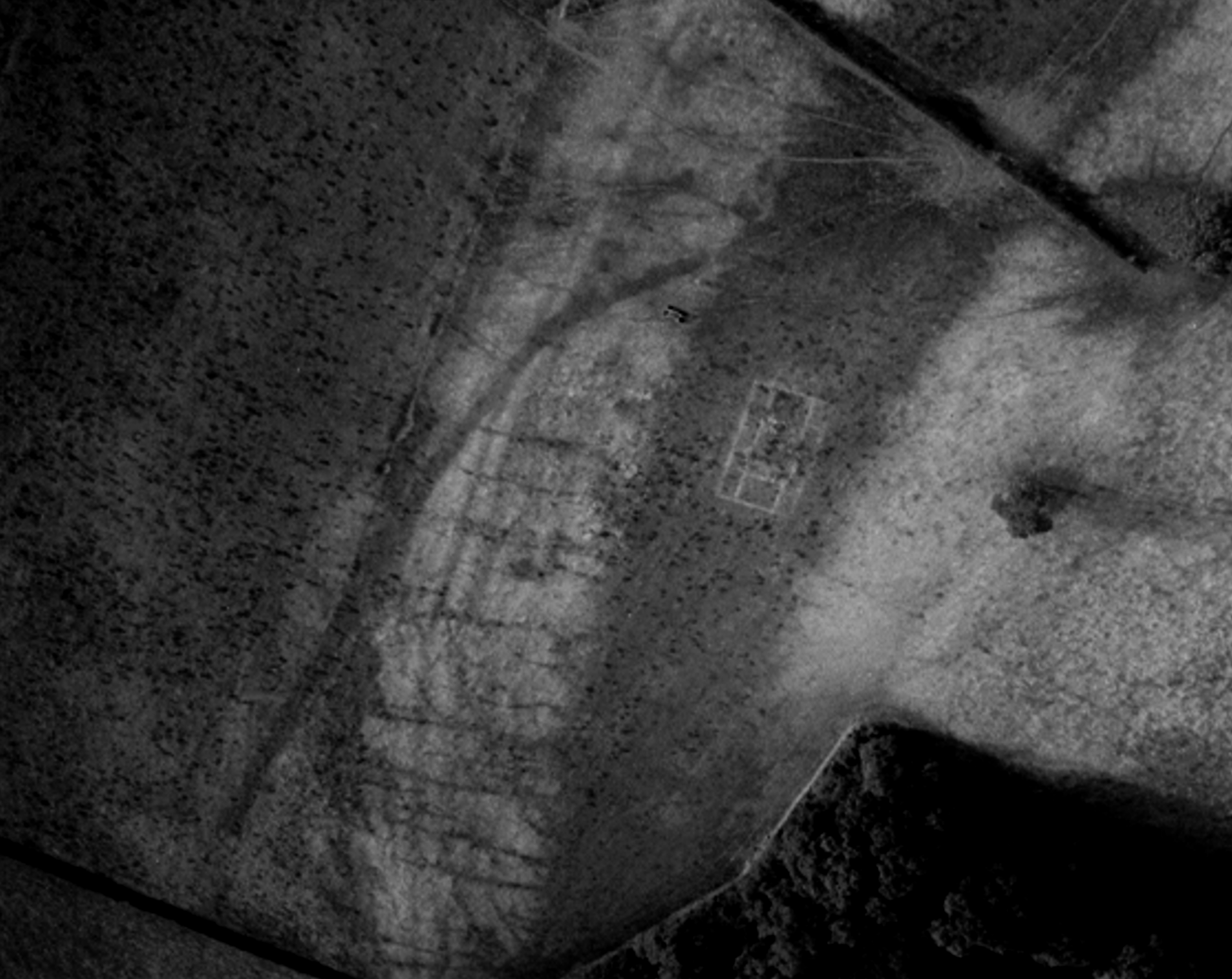
Figure 22: This typical small Roman villa building at Wyndcliff shows up as a parch mark in a deep pocket of soil in the limestone bedrock, as does the ditch of the enclosure in which it stands. Elsewhere, the shallowness of the soil cover over the bedrock has made it impossible to use air photography or geophysics to see any other buildings that might be present (Image: John Sorrell)
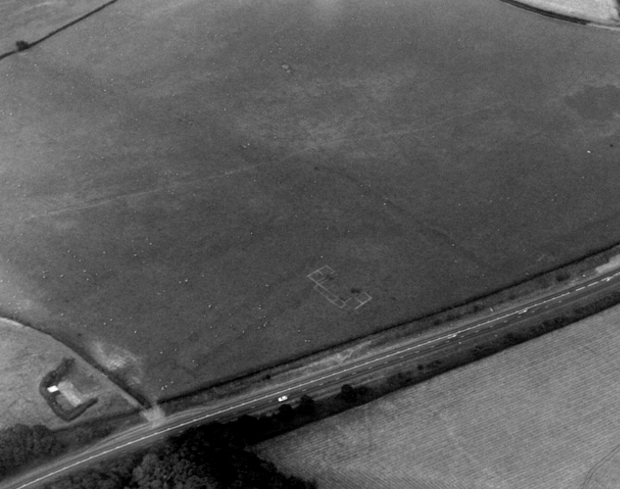
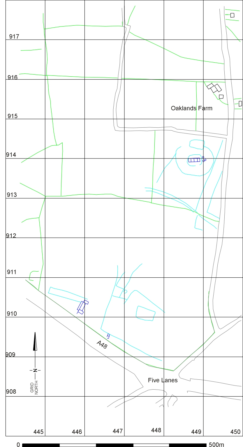
Figure 23: This villa building at Five Lanes, a few miles west of Caerwent, has been known since the 19th century, when it was discovered in what was then a cherry orchard. Air photography shows it apparently set within a contemporary fieldscape. (Image: John Sorrell)
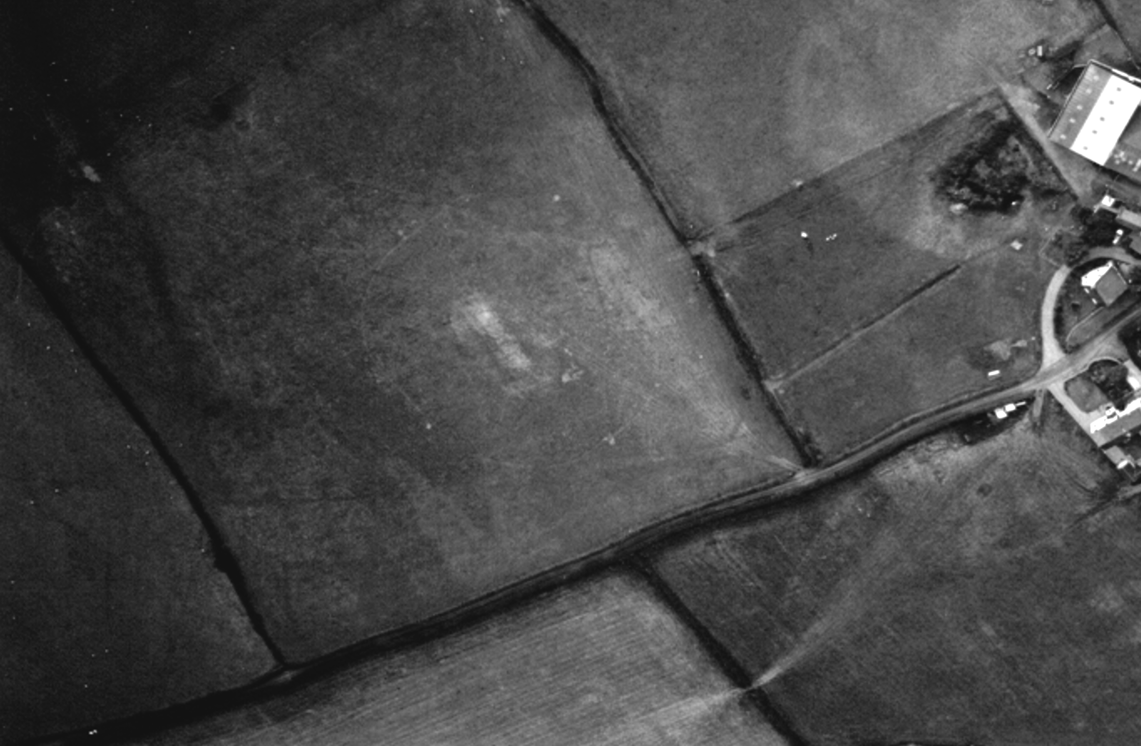
Figure 24: Also revealed at Five Lanes was this rectangular building set within a small enclosure, only a short distance away at Oaklands Farm (Image: John Sorrell)
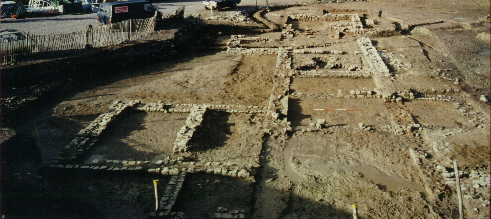
Figure 25: The whole complex of buildings and enclosures at Five Lanes (Image: Glamorgan-Gwent Archaeological Trust)
Figure A: This seal-box from the native-style settlement at Caldicot suggests that one of its inhabitants received a delivery of money sent with Roman-style security. Does this indicate some sort of link to the military? (Image: Glamorgan-Gwent Archaeological Trust)
Figure B: An iron stylus from the native farmstead at Biglis suggests that someone here knew how to write, in spite of the fact that Romanised methods of construction were never adopted by the inhabitants (Image: Glamorgan-Gwent Archaeological Trust)
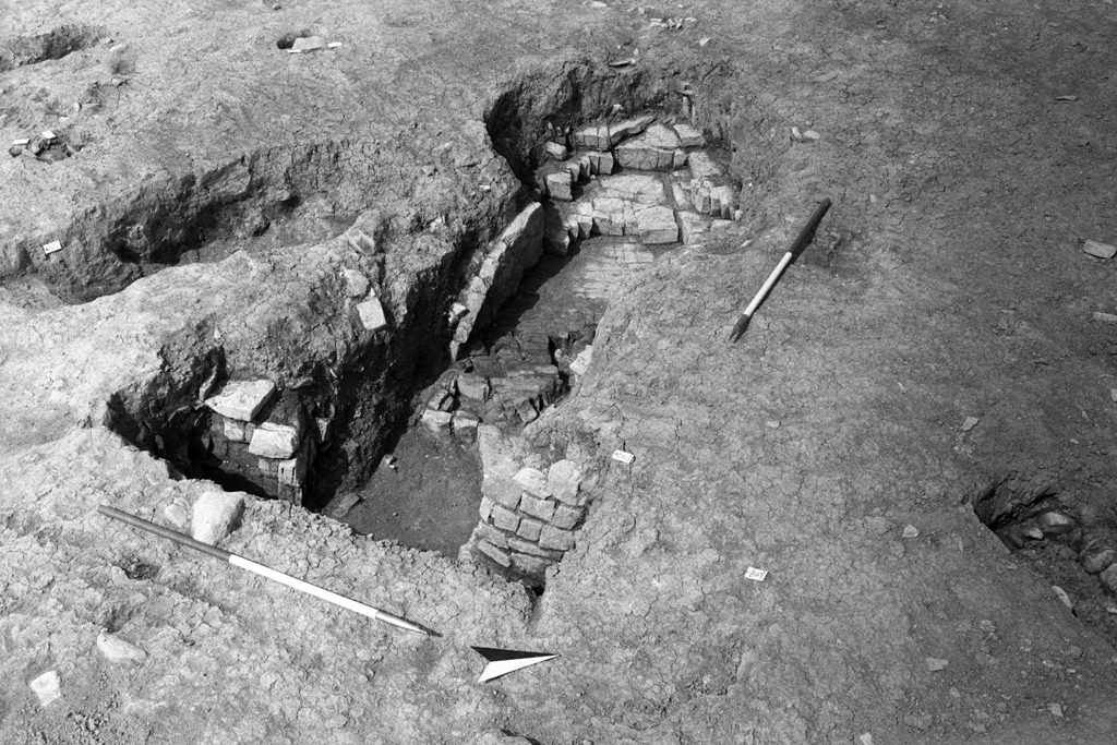
Figure C: The enclosure at RAF St Athan (Image: Cotswold Archaeology)
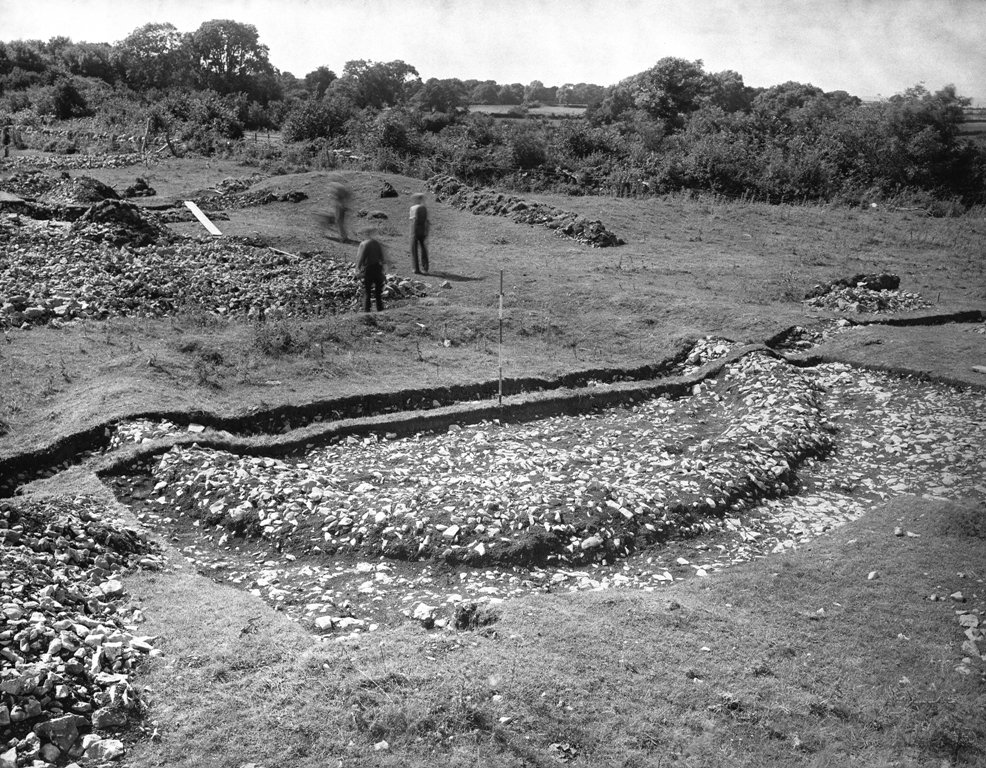
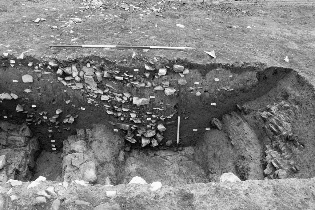
Figure D: Section through the ditch around the enclosure at RAF St Athans (Image: Crown Copyright RCAHMW)
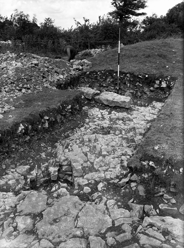
Figure E: The corndryer on the site at RAF St Athans (Image: Crown Copyright RCAHMW)
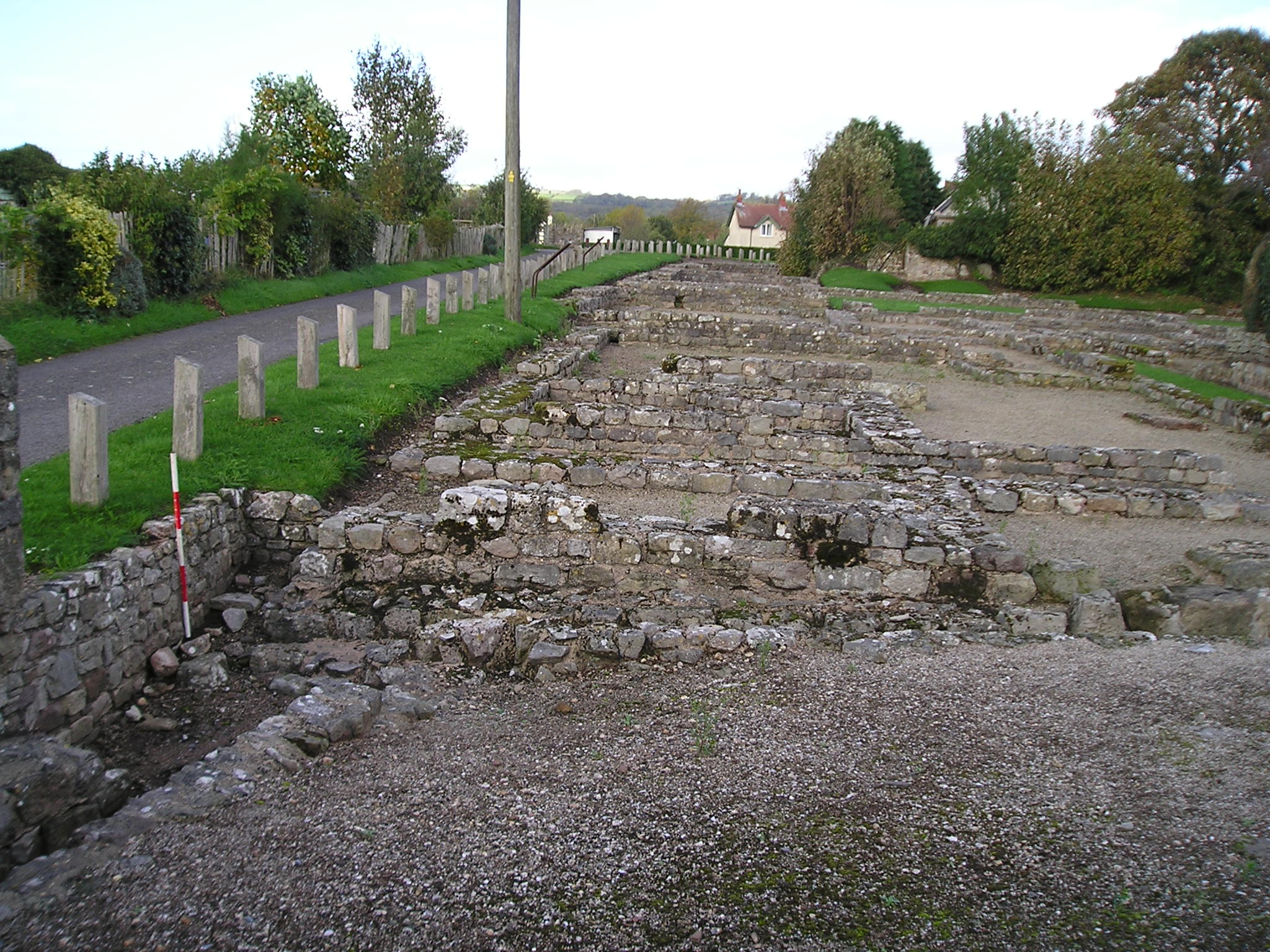
Figure F: These shops at the corner of Pound Lane in Caerwent were excavated in the 1950s and proved to have a complicated history. They opened onto the main Chepstow-Caerleon road, which can be seen in the foreground (Image: Glamorgan-Gwent Archaeological Trust)
Figure G: Caerwent flourished in particular in the 4th century, when the defences were enhanced by the construction of bastions (Image: Glamorgan-Gwent Archaeological Trust)
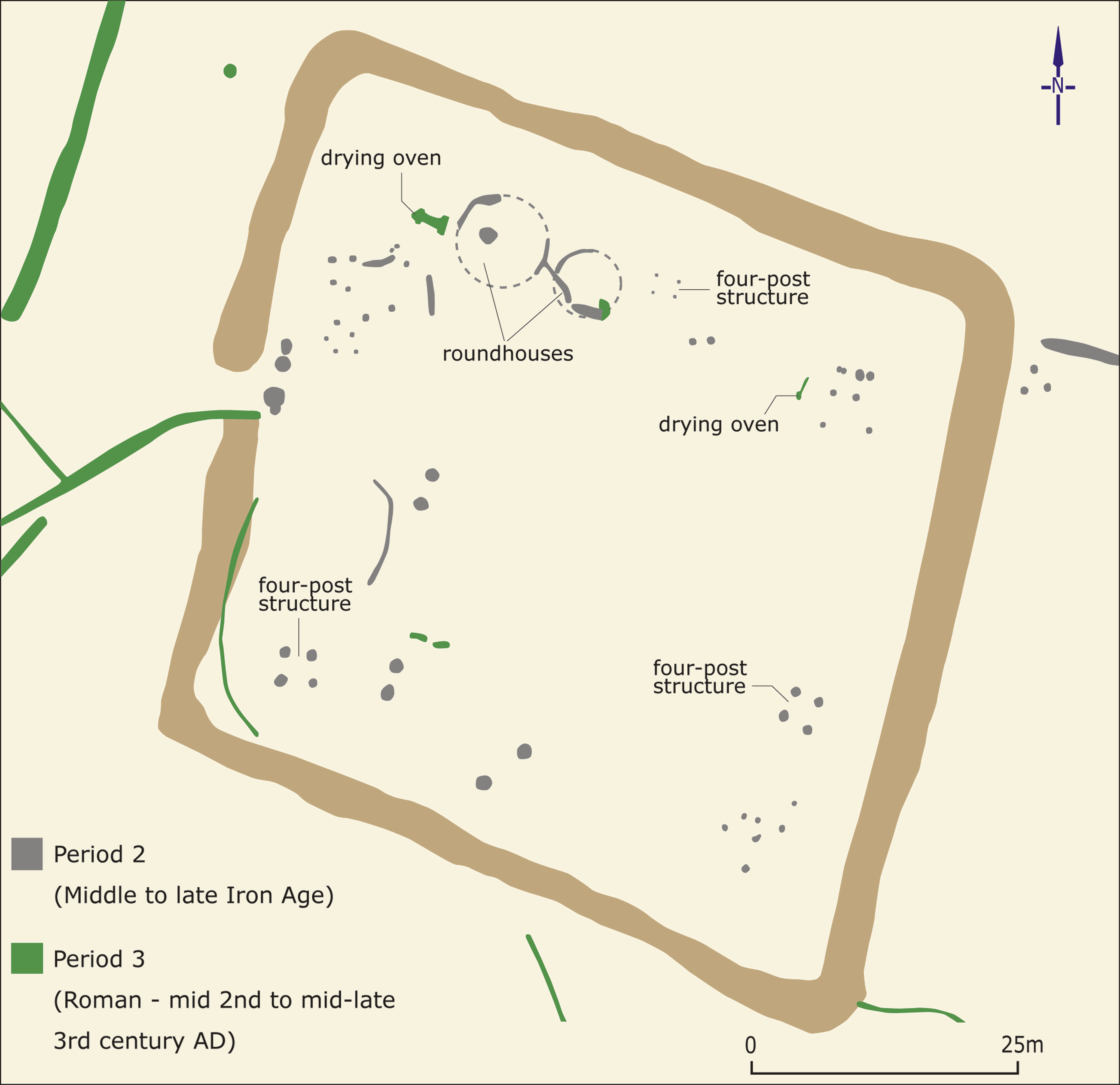
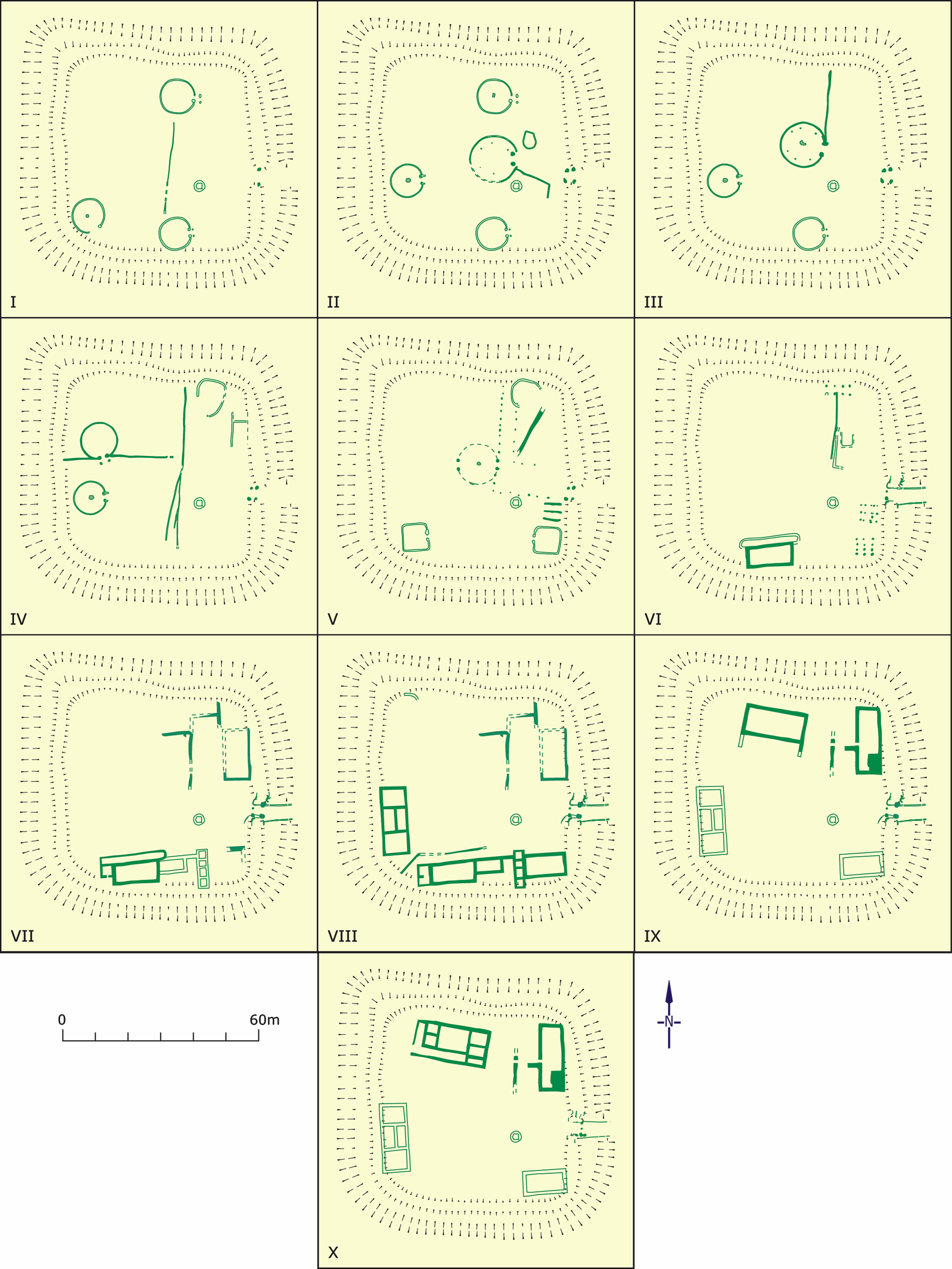
Figure H: Whitton: Phase plans after Jarret and Wrathmell 1981 (Image: Dyfed Archaeological Trust)
Figure I not used
Figure J: The settlement at Whitton began in the Iron Age with a series of timber buildings within square banks and a ditch. Roundhouses continued to be built until the end of the 1st century. Their wall lines were marked by slots cut into the bedrock, which would originally have taken timbers like the ones whose bases were found preserved at Goldcliff (Image: Glamorgan-Gwent Archaeological Trust)
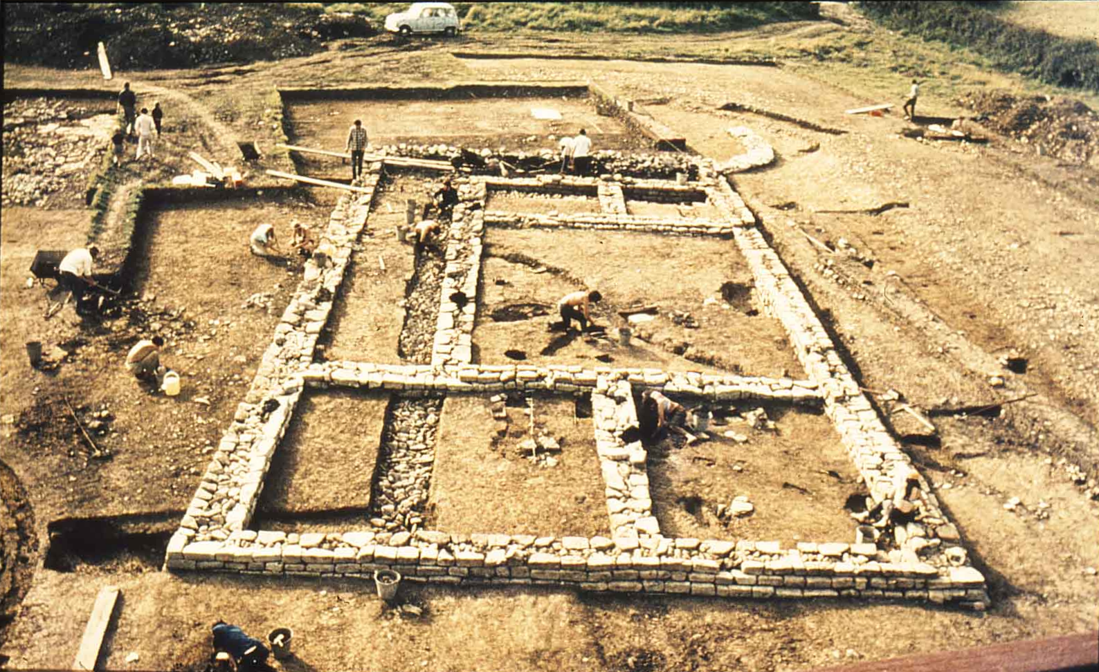
Figure K: Timber roundhouses at Whitton were replaced from the middle of the 2nd century by a series of rectangular buildings constructed in stone (Image: Glamorgan-Gwent Archaeological Trust)
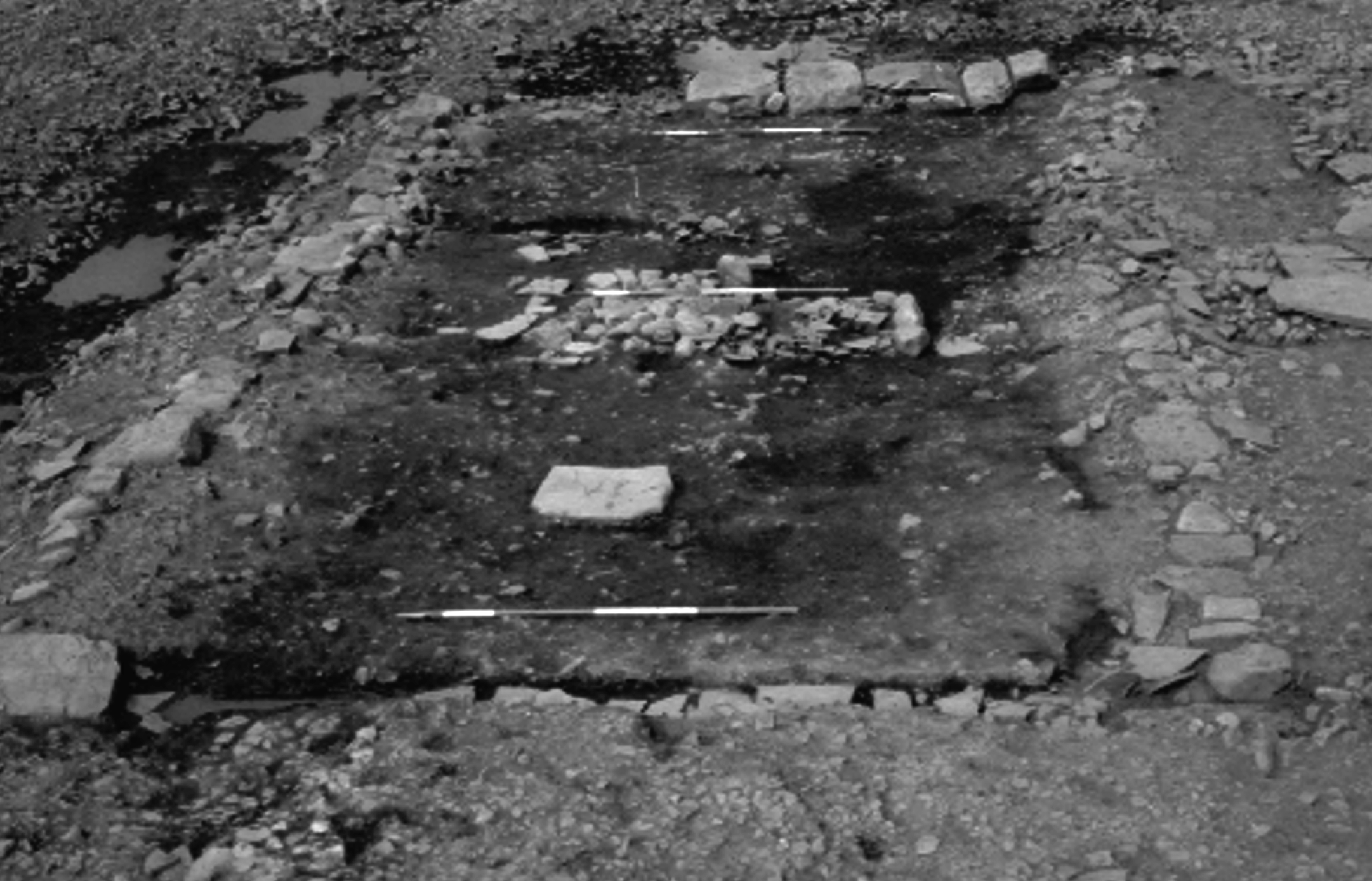
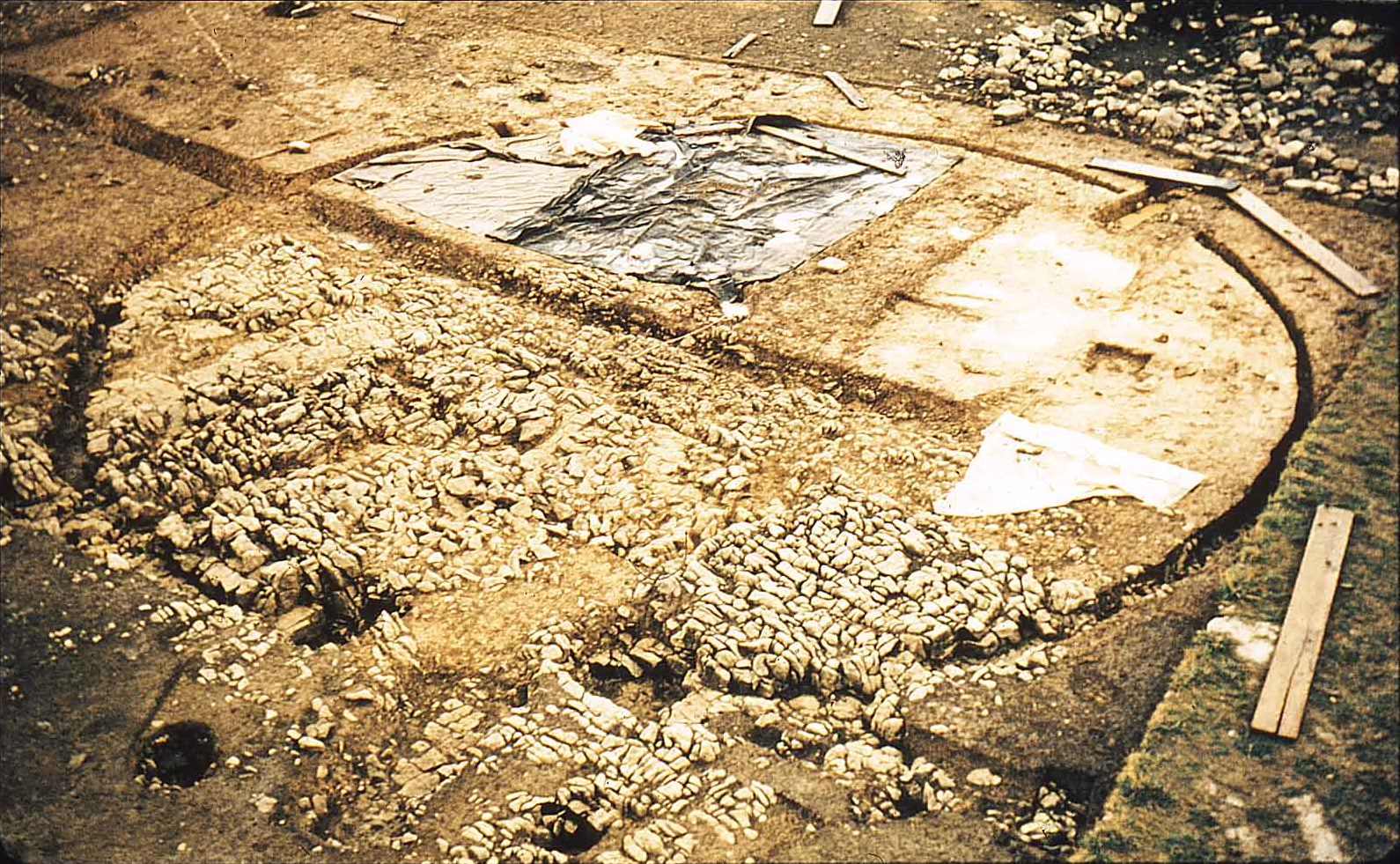
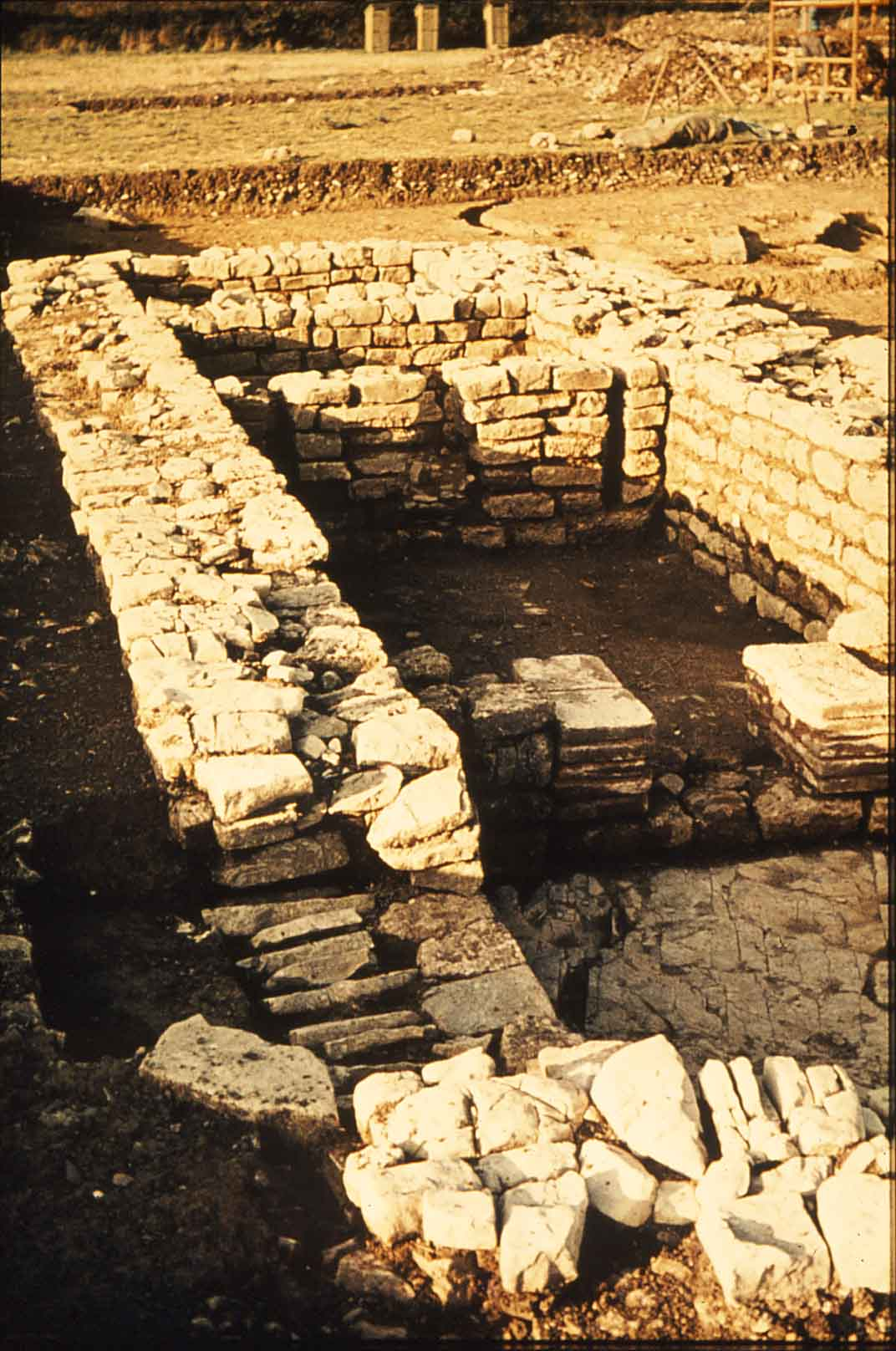
Figure L: Underground structures in one of the stone building in the south range at Whitton may originally have been intended for a hypocaust, but if so it was never completed. One of the rock-cut ditches for an earlier roundhouse can be seen in the background (Image: Glamorgan-Gwent Archaeological Trust)
Internet Archaeology is an open access journal based in the Department of Archaeology, University of York. Except where otherwise noted, content from this work may be used under the terms of the Creative Commons Attribution 3.0 (CC BY) Unported licence, which permits unrestricted use, distribution, and reproduction in any medium, provided that attribution to the author(s), the title of the work, the Internet Archaeology journal and the relevant URL/DOI are given.
Terms and Conditions | Legal Statements | Privacy Policy | Cookies Policy | Citing Internet Archaeology
Internet Archaeology content is preserved for the long term with the Archaeology Data Service (ROR). Help sustain and support open access publication by donating to our Open Access Archaeology Fund.