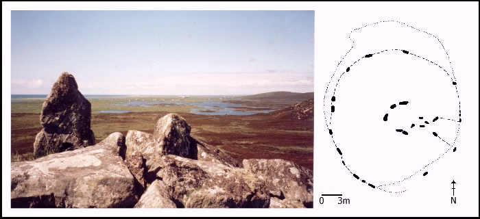
Fig. 4. Glac Hukarvat. Photo looking north-west.
This cairn is situated in the centre of the island, approximately 70 metres above sea level and just under 3 kilometres from the coast. It is located on a rocky outcrop three-quarters of the way up a relatively steep hill at the end of a small valley and has spectacular views onto the coastal plain to the west.
Fig. 4. Glac Hukarvat. Photo looking north-west.
Despite being the highest and most inaccessible cairn on South Uist, it has been severely robbed of stone. At least six buildings have been constructed on or around the cairn, particularly around the facade although cairn material survives to the north and west. A fairly substantial peristalith survives, consisting of at least 16 visible stones, most to the west. These kerb-stones define a cairn which would originally have been approximately 20 metres in diameter. Six upright stones define the characteristic funnel-shaped forecourt. A passage leads from the forecourt to a roughly circular chamber, defined by six orthostats and a prominent backstone. One large slab found in the chamber may have been the capstone, but it has been reduced in size by relatively recent activity, evidenced by three grooves on the edge of the stone.
© Internet Archaeology
URL: http://intarch.ac.uk/journal/issue8/cummings/hukarvat1.html
Last updated: Tue Aug 8 2000