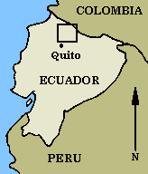
Figure 1a: Area of study
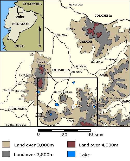
Figure 1b: The northern highlands of Ecuador
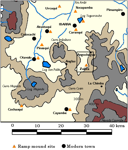
Figure 1c: The northern highlands of Ecuador - close up of region
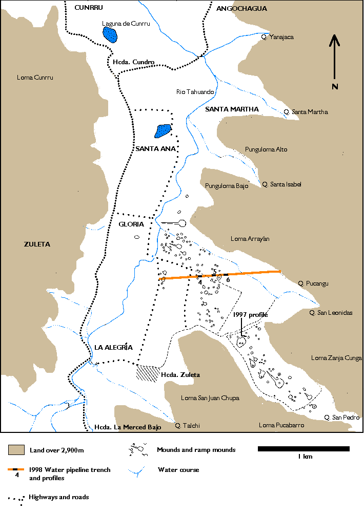
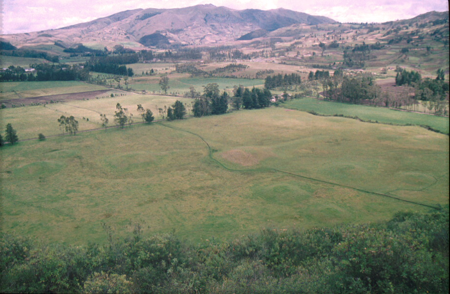
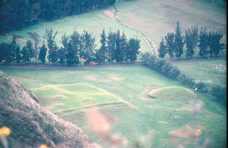
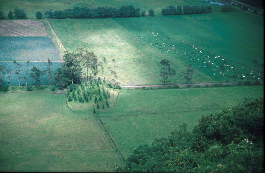
Figure 2. Hacienda Zuleta and environs: distribution of mounds
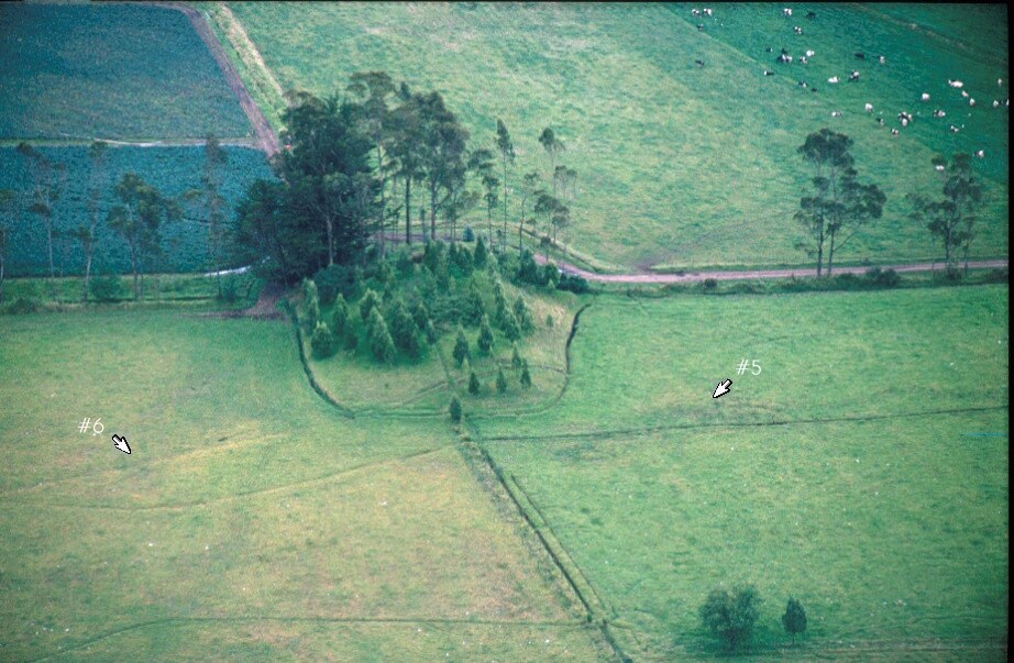
Figure 2. Hacienda Zuleta and environs with camera positions marked (clickable map)
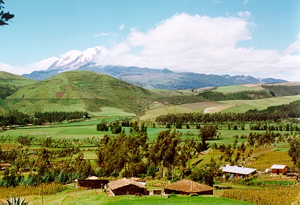
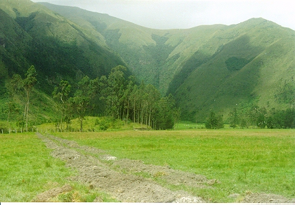
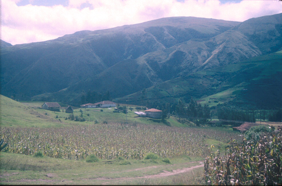
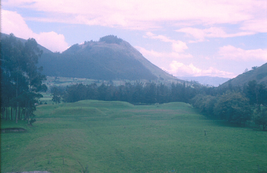
Figure 3. Zuleta, looking south-east towards Cerro Cayambe across indigenous chacras
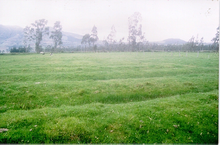
Figure 4. Camellones surviving under pasture in the Cayambe region of Ecuador's northern sierra
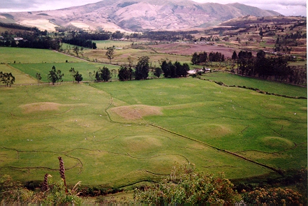
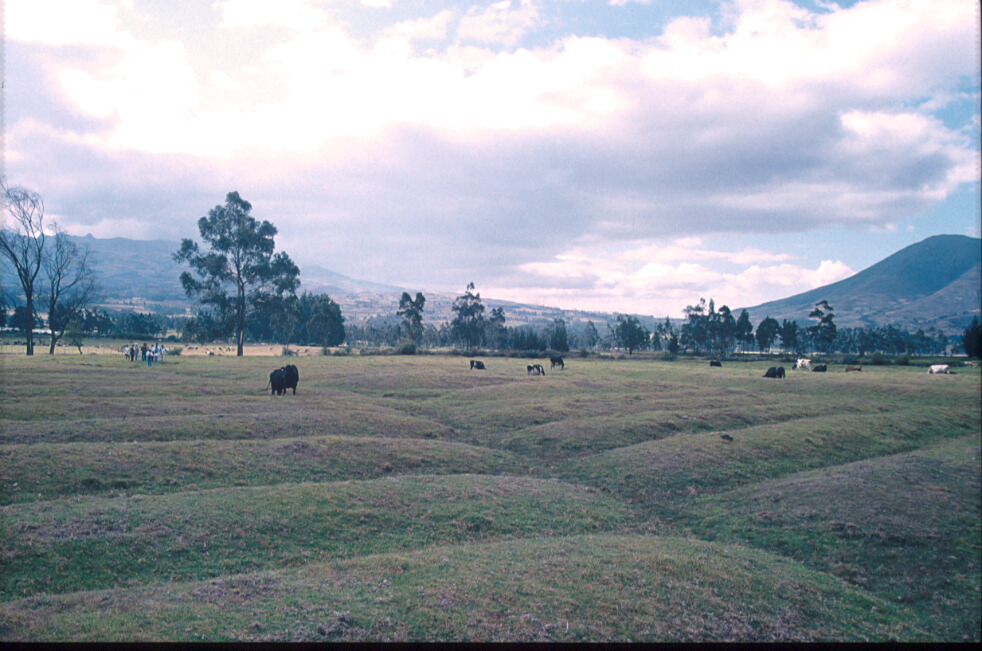
Figure 5. View south-west across tolas in the valley of the Río Tahuando
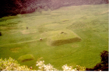
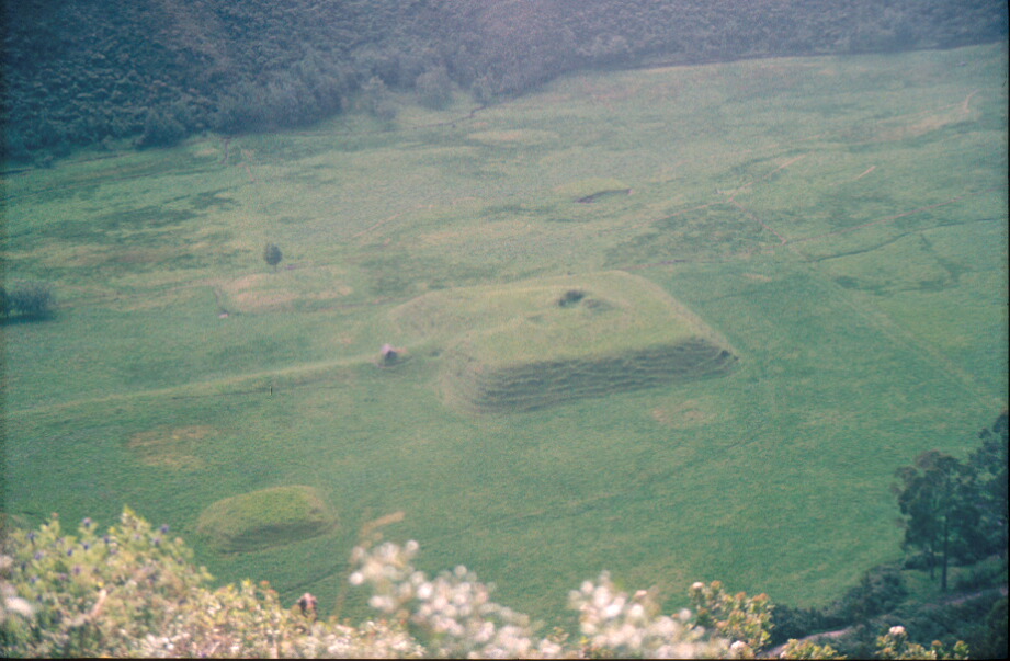
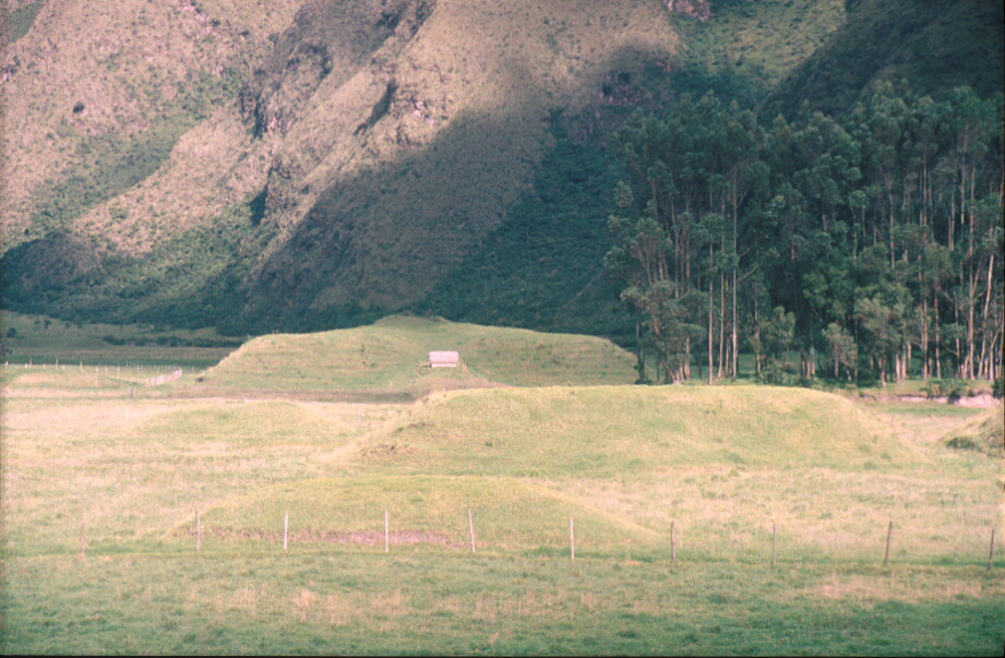
Figure 6. Aerial view of large quadrilateral ramp-mound together with smaller mounds in the Quebrada San Pedro, Zuleta
Figure 7. View north-west to Loma El Cunrru with quadrilateral ramp mounds in the Quebrada San Pedro
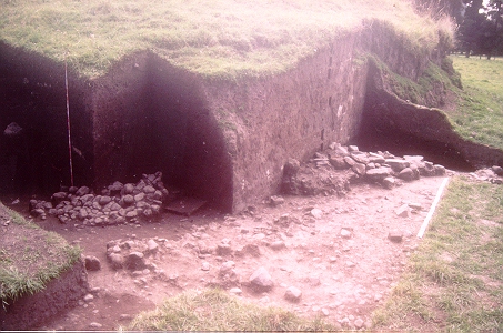
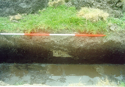
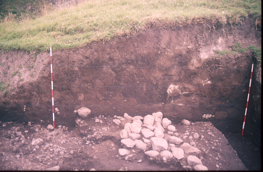
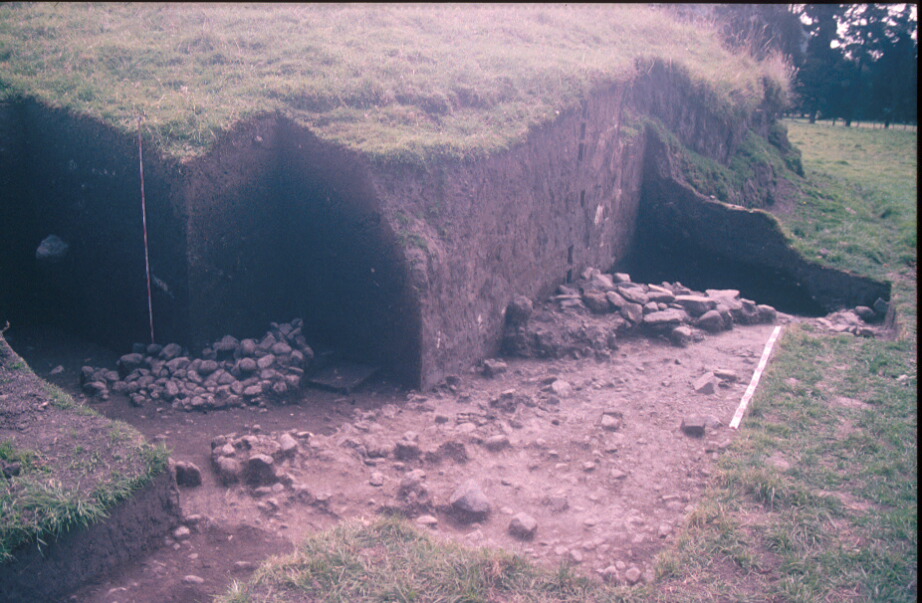
Figure 8. Excavation through mound and showing structure exposed beneath mound, 1997
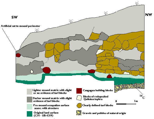
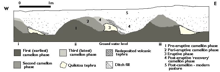
Figure 9. Profile drawing of mound excavated in 1997
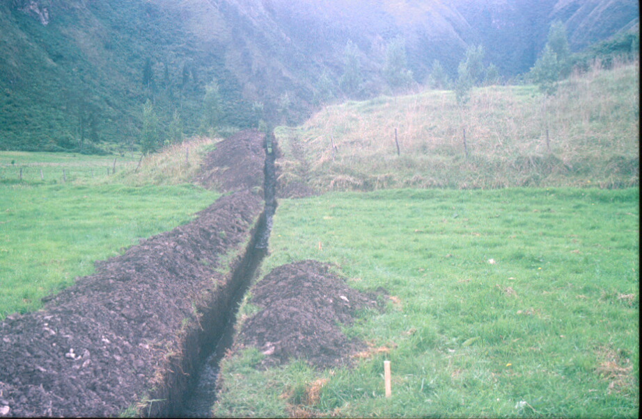
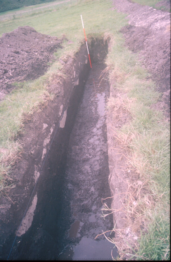
Figure 10. View east towards Quebrada Pucangu and large tola, with water pipeline trench in foreground
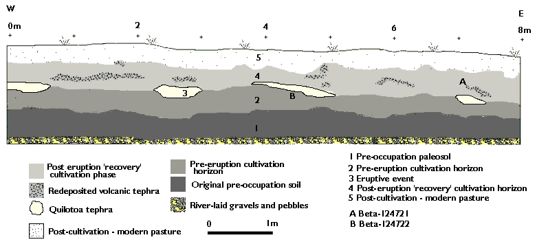
Figure 11. Profile drawing of sector 4 of the water pipeline trench cut
Figure 12. Camellón ditch infilled with Quilotoa tephra between two camellón mounds in sector 4 of the water pipeline trench cut, showing different phases of use
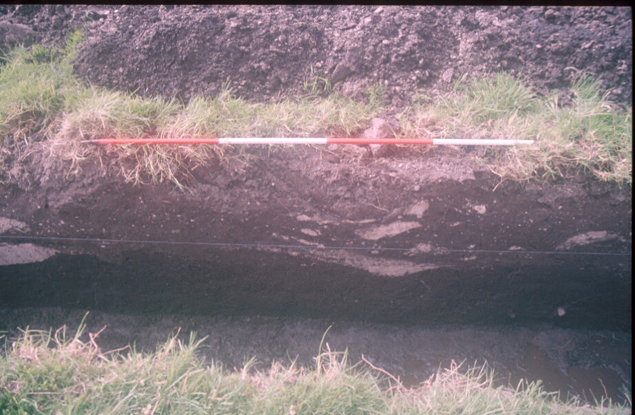
Figure 13. Profile drawing of sector 5 of the water pipeline trench cut, with phases of use
Figure 14. View of profile in sector 5 of water pipeline trench cut, showing agricultural ditches infilled by Quilotoa tephra and redeposited ash in the post-eruption phase of use
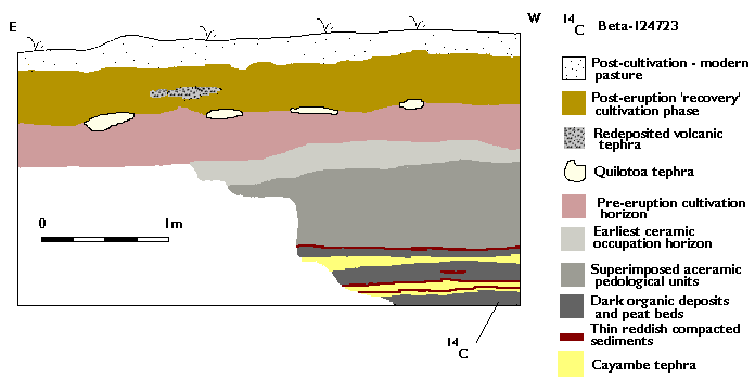
Figure 15. Profile drawing of sector 6 of the water pipeline trench cut, with superimposed layers of tephra from Cerro Cayambe towards base
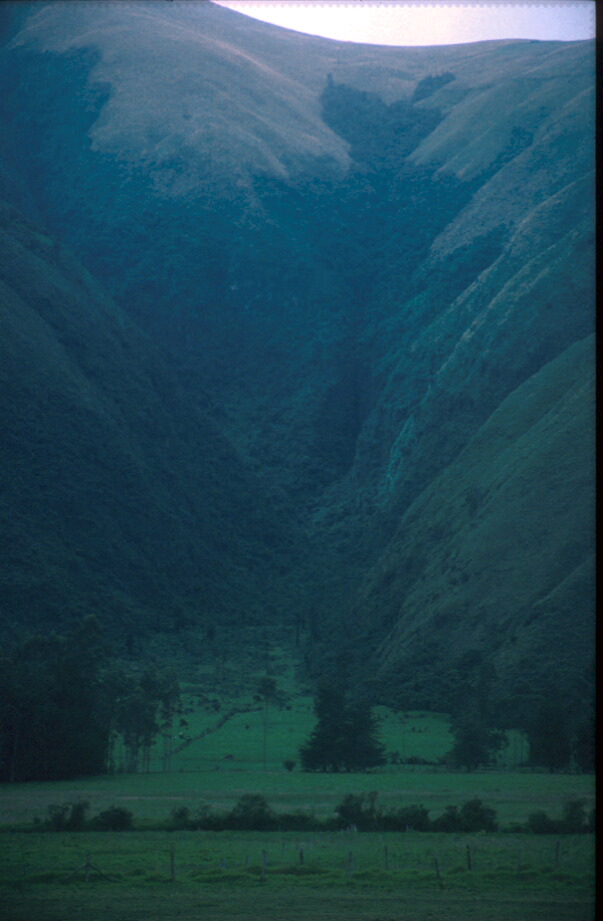
Photo 1: Andean páramo
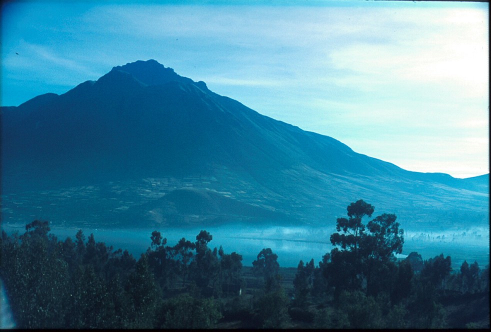
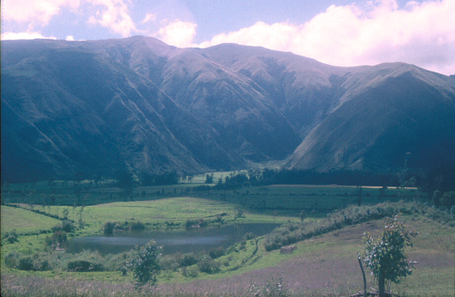
Photo 2: Cerro Imbabura and Lago San Pablo, Province Imbabura
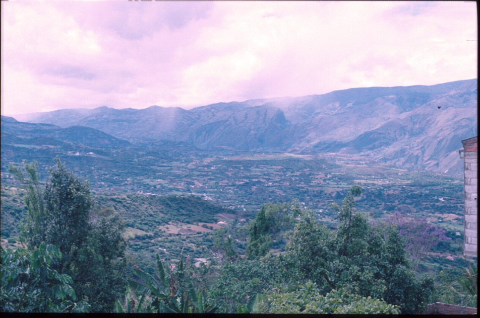
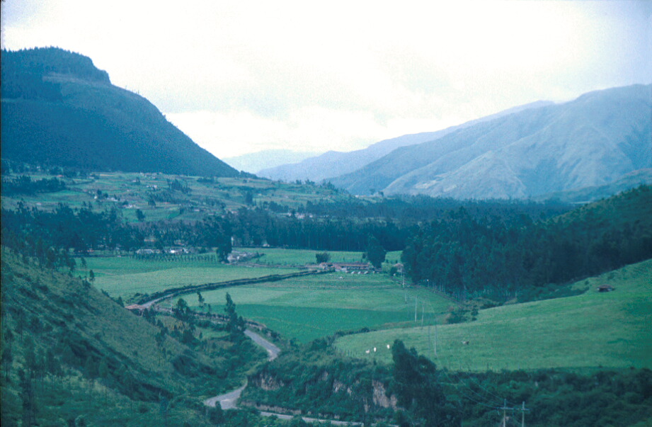
Photo 3: Ibarra Valley
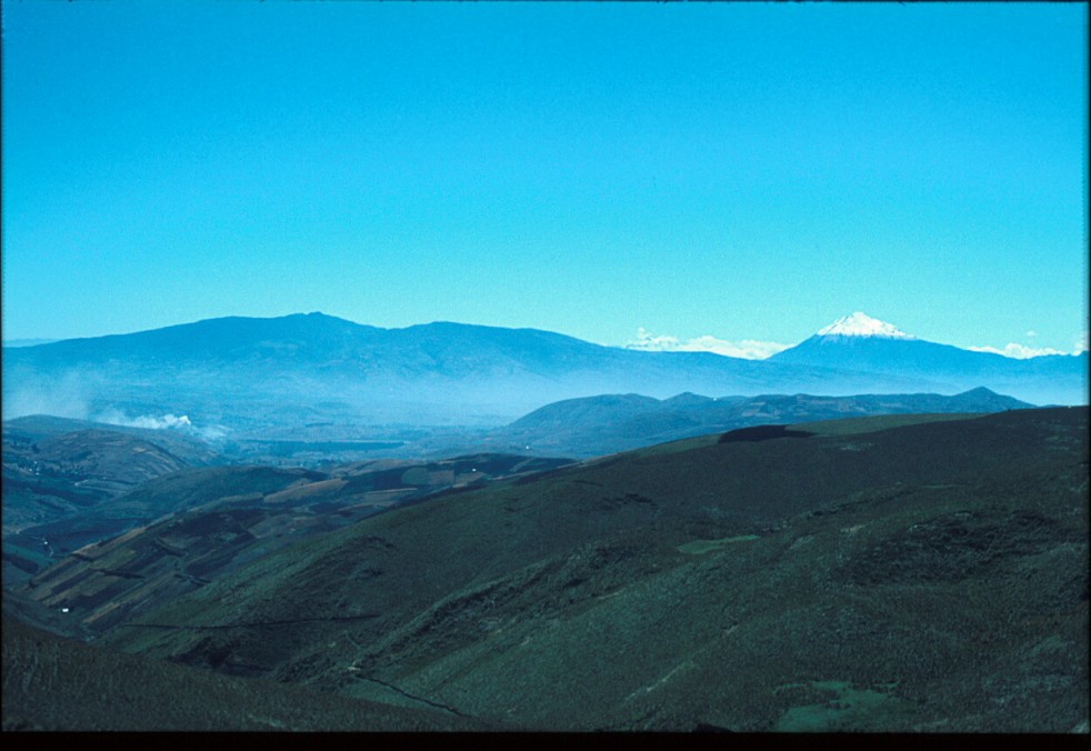
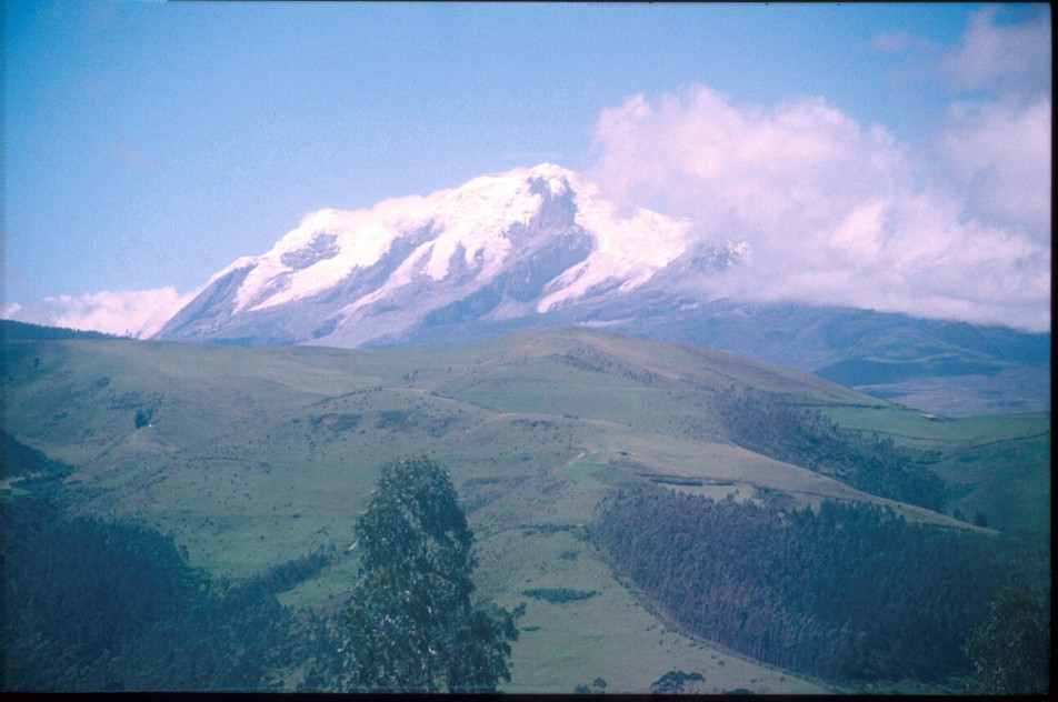
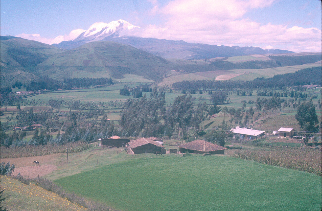
Photo 4: Cerro Cayambe
Photo 5: Campaña Pucara 15th century AD hill fort in the Pambamarca region of the northern sierra
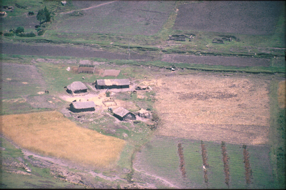
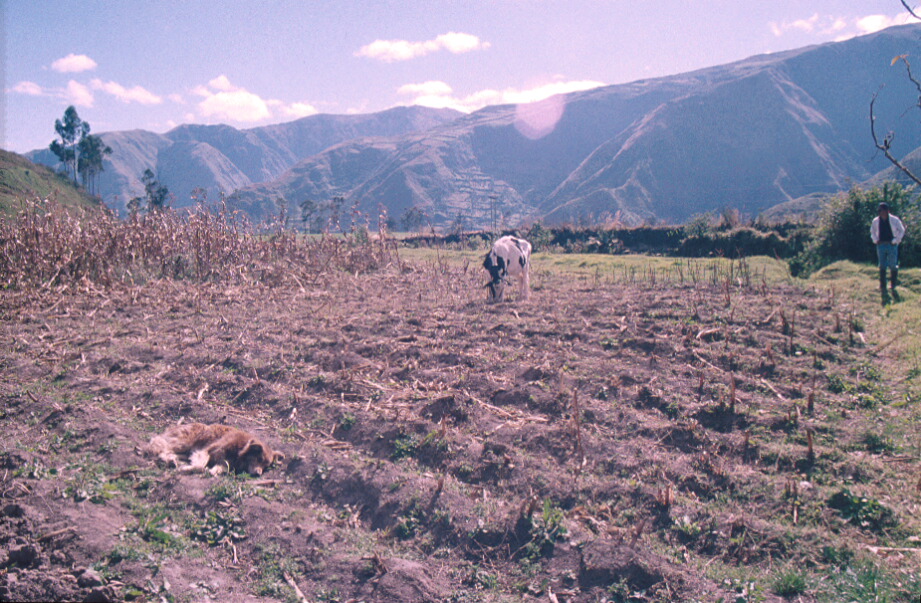
Photo 6: Modern indigenous farms in the Zuleta-Cayambe region
Photo 7: Modern indigenous farms in the Zuleta-Cayambe region
Photo 8: Modern indigenous farms in the Zuleta-Cayambe region
Photo 9: Late Period camellones near Cayambe
Photo 10: Modern indigenous traditional farm and potato plot, Zuleta region
Photo 11: Indigenous chacra with wachukuna, Zuleta region
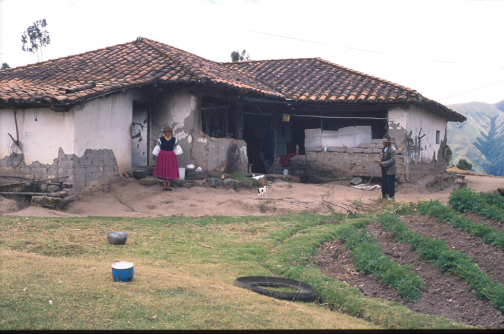
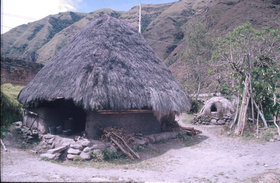
Photo 12: Traditional indigenous dwelling with Spanish-introduced Mediterranean-style clay oven to rear
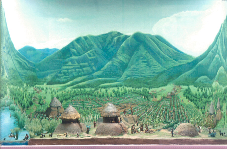
Photo 13: Diorama, Ibarra Museum of Caranqui dwellings and camellones
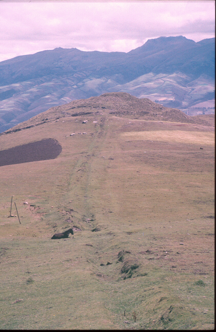
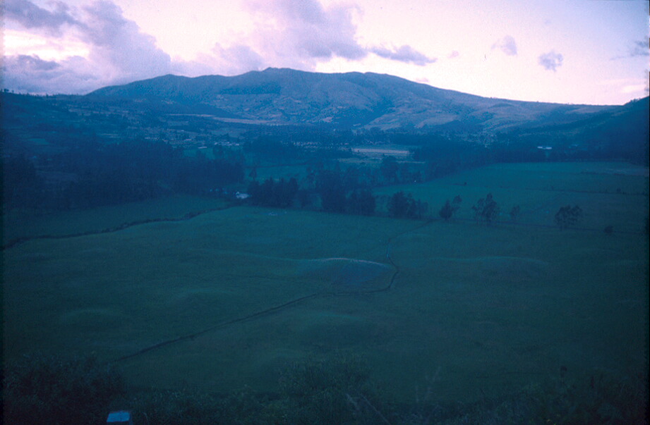
Photo 14: Hacienda Zuleta lands, looking NW towards Loma Cunrru
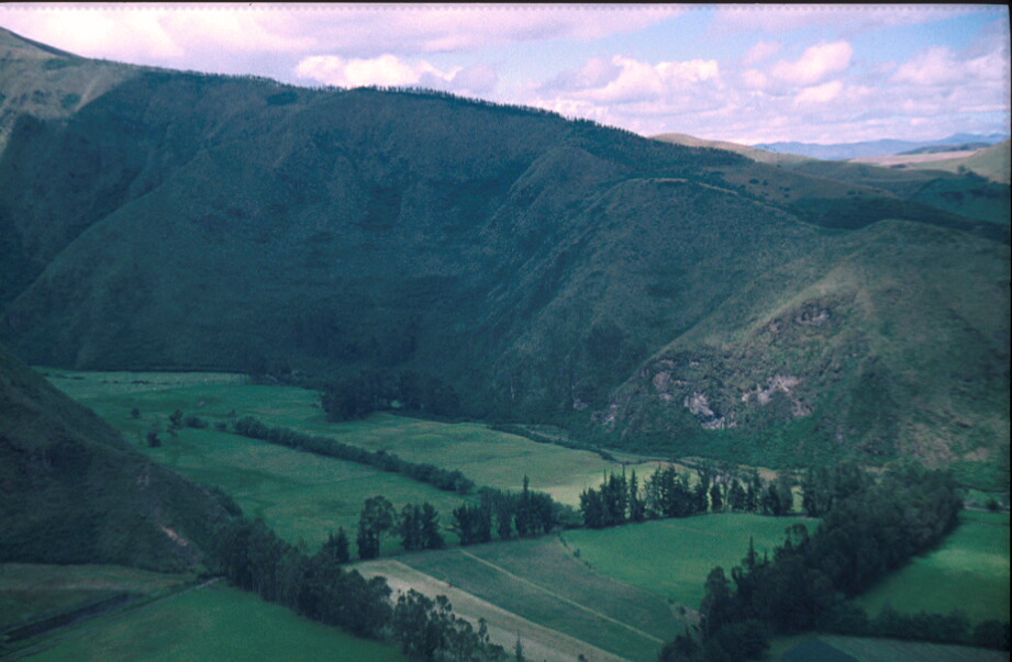
Photo 15: Hacienda Zuleta lands, looking South East towards Zanja Cunga, Pucabarro and San Juan Chupa
Photo 16: Hacienda Zuleta lands, close-up looking East into Quebradas Pucangu and San Leonidas
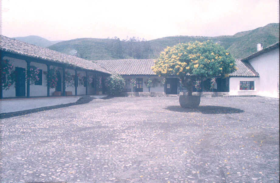
Photo 17: Hacienda Zuleta: 17th century buildings
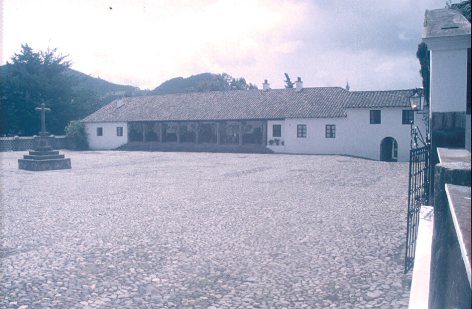
Photo 18: Hacienda Zuleta: 17th century buildings
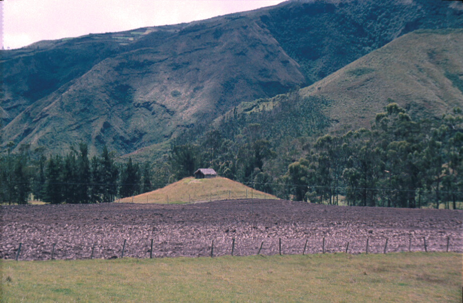
Photo 19: Hacienda Zuleta lands: tola with traditional-style indigenous structure on summit
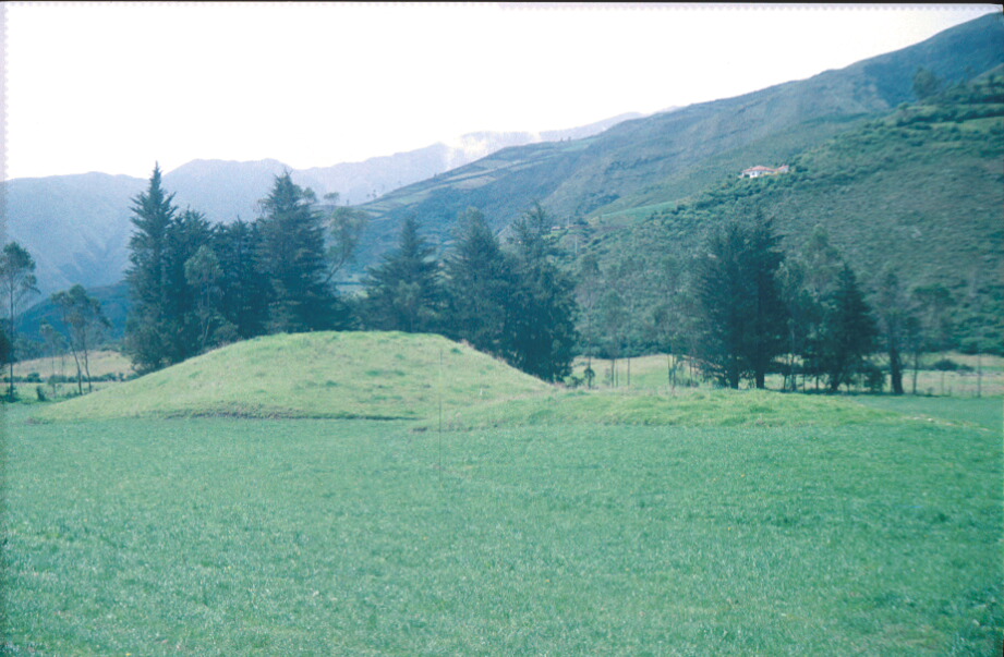
Photo 20: Tola, Hacienda Zuleta
Photo 21: Tolas at Hacienda Zulta, El Rosario, looking down SW from Loma Arrayán
Photo 22: Tolas at Hacienda Zulta, El Rosario, looking down SW from Loma Arrayán
Photo 23: Loma Pucabarrow with Quebrada San Pedro from Loma Arrayán, tolas in
distancePhoto 24: Ramp-tola in Quebrada San Pedro, from flanks of Loma Pucabarrow above
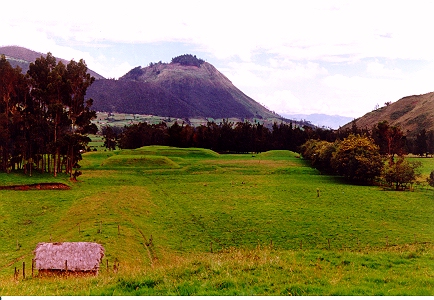
Photo 25: Quadrilateral pyramid tolas in Quebrada San Pedro, looking due S
Photo 26: Quadrilateral pyramid tolas in the Quebrada San Pedro, looking NW towards Loma Cunrru
Photo 27: Tolas in the Quebrada San Pedro, with hemispherical tola excavated in 1997 to right
Photo 28: S-N profile through hemispherical tola, excavated in 1997, showing outlines of turf and soil building blocks. White in profile are dislocated lumps of Quilotoa tephra
Photo 29: Excavation of hemispherical tola in excavated 1997, exposing stones from a structure lying on original pre-mound land surface
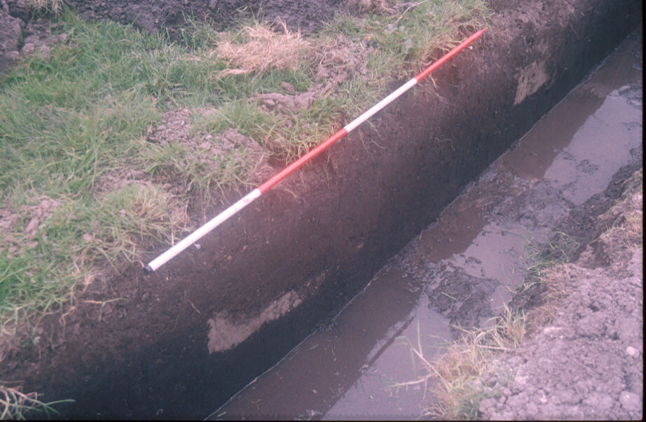
Photo 30: Location of sectors 5 and 6 of the E-W water pipeline trench (now in-filled) and large hemispherical tola in centre. From Loma Arrayán
Photo 31: Closer view of 30 with pipeline trench visible (now in-filled) showing location of sectors 5 and 6
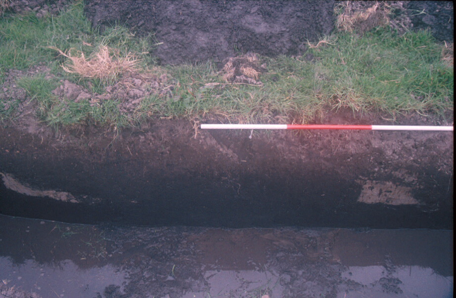
Photo 32: E-W water pipeline trench looking E, in 1998, cutting through edge of tola, prior to excavation of sector 5
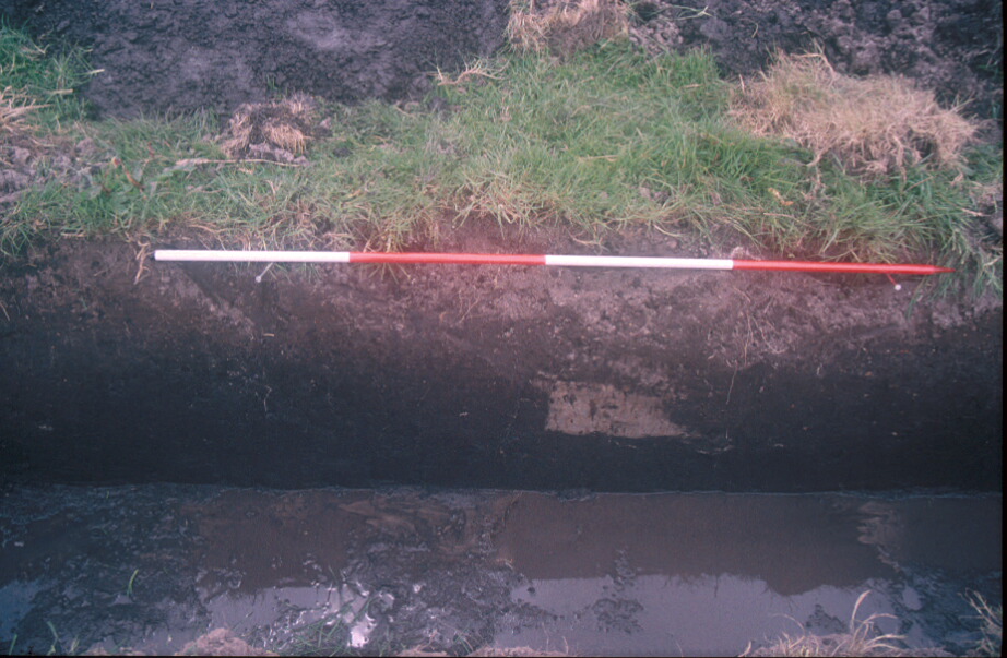
Photo 33: Sector 4 of water pipeline trench, showing volcanic tephra in-filling ditch between camellón groups II and III
Photo 34: Sector 4 of water pipeline trench, showing volcanic tephra in-filling two ditch between camellon groups I and II
Photo 35: Sector 4 of water pipeline trench, showing volcanic tephra in-filling ditch between camellón groups I and II
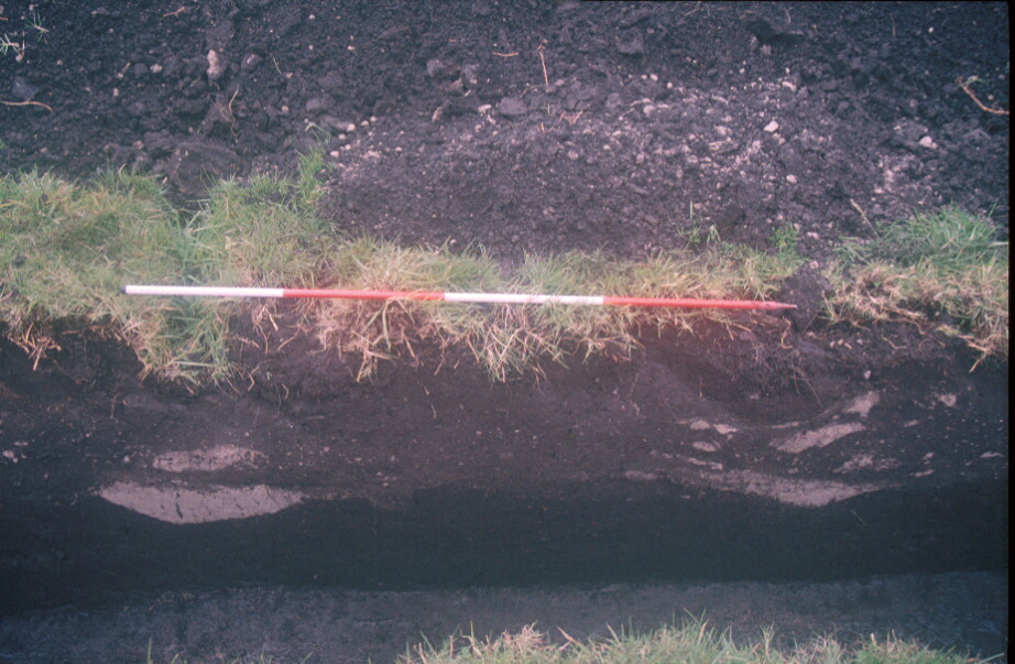
Photo 36: Sector 5 of water pipeline trench, showing volcanic tephra in ridge and furrow cultivation system, with re-cut ash lying upon the old growing surfaces
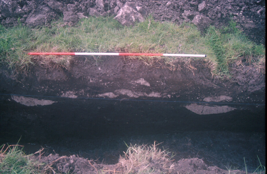
Photo 37: Sector 5 of water pipeline trench, showing volcanic tephra in ridge and furrow cultivation system, with re-cut ash lying upon the old growing surfaces
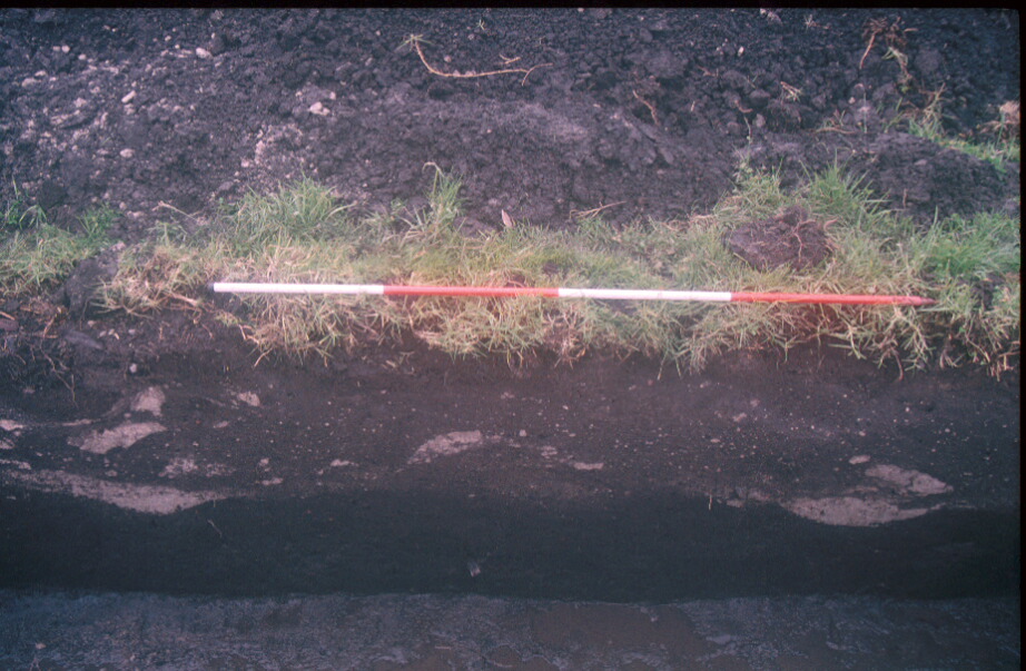
Photo 38: Sector 5 of water pipeline trench, showing volcanic tephra in ridge and furrow cultivation system, with re-cut ash lying upon the old growing surfaces
Photo 39: Sector 5 of water pipeline trench, showing volcanic tephra in ridge and furrow cultivation system, with re-cut ash lying upon the old growing surfaces
Photo 40: Sector 5 of water pipeline trench, showing volcanic tephra in ridge and furrow cultivation system, with re-cut ash lying upon the old growing surfaces
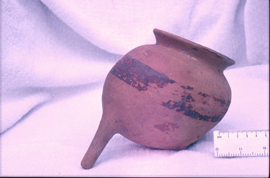
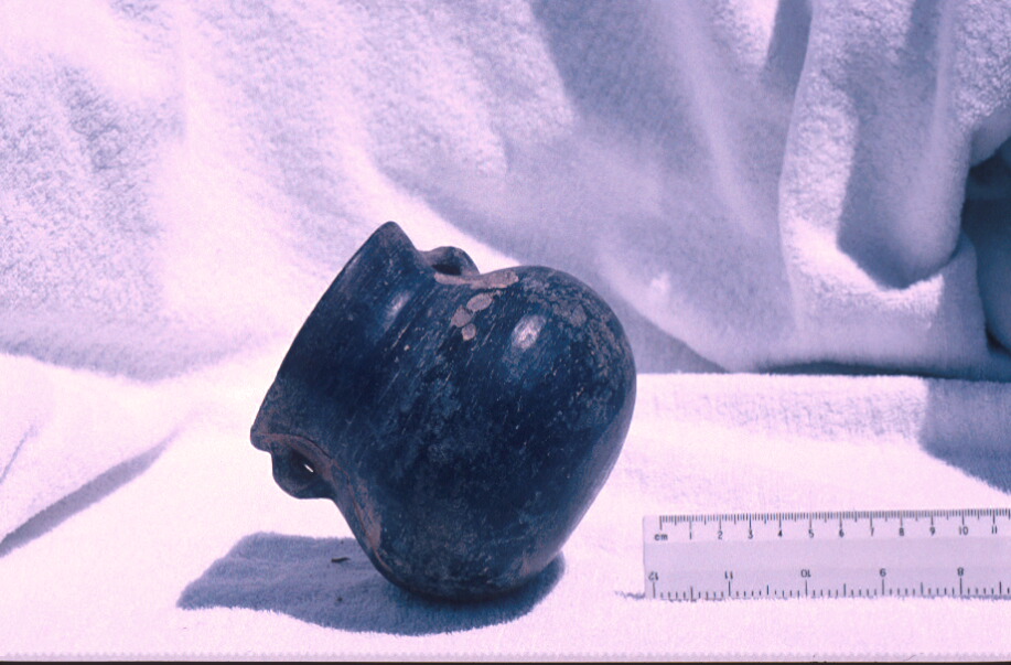
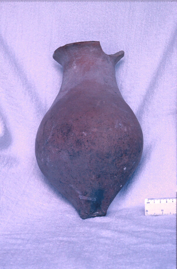
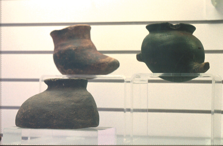
Photo 41: Late Period Caranqui pottery vessels found at Hacienda Zuleta
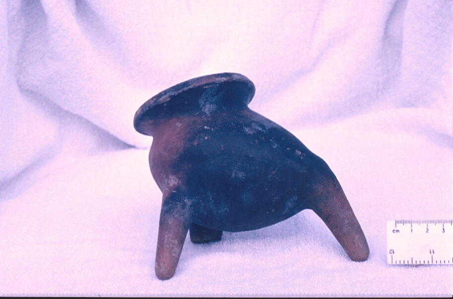
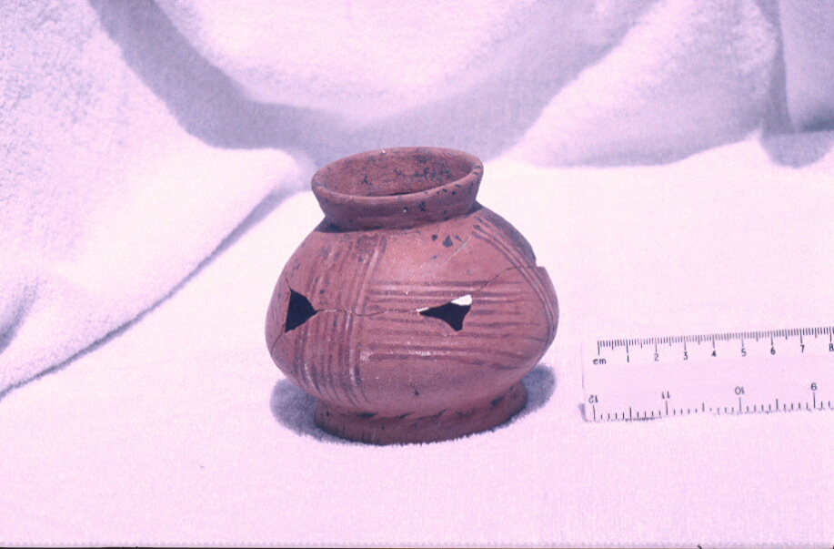
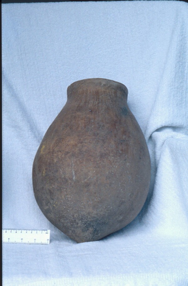
Photo 42: Late Period Caranqui pottery vessels found at Hacienda Zuleta
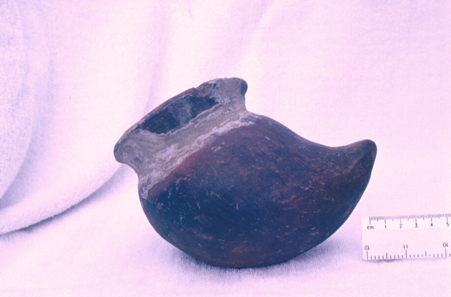
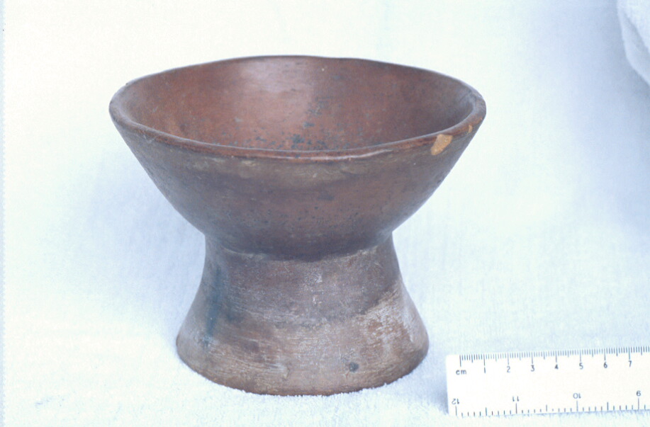
Photo 43: Late Period Caranqui pottery vessels found at Hacienda Zuleta
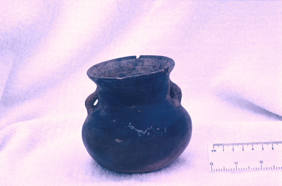
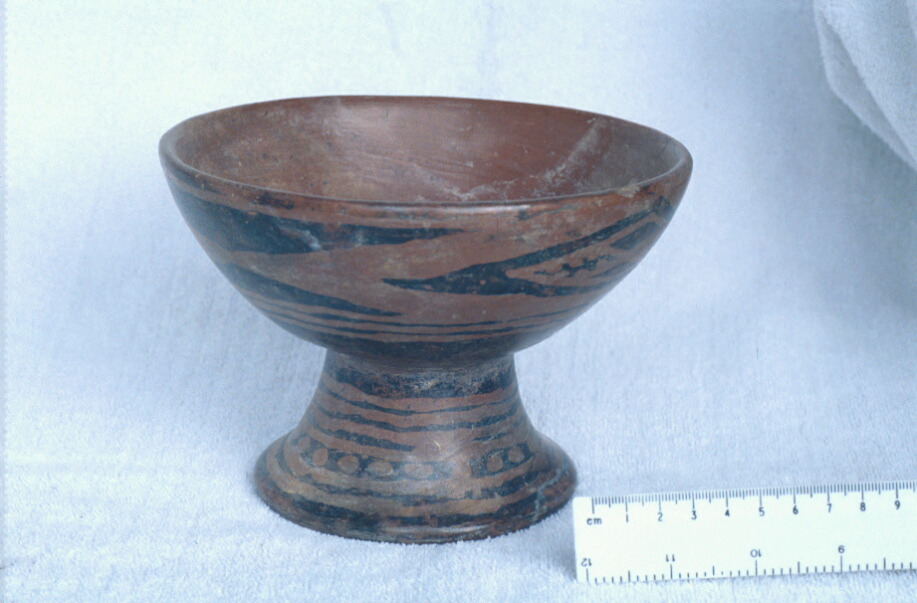
Photo 44: Late Period Caranqui pottery vessels found at Hacienda Zuleta
Photo 45: Late Period Caranqui pottery vessels found at Hacienda Zuleta
Photo 46: Late Period Caranqui pottery vessels found at Hacienda Zuleta
Photo 47: Late Period Caranqui pottery vessels found at Hacienda Zuleta
Photo 48: Late Period Caranqui pottery vessels found at Hacienda Zuleta
Photo 49: Late Period Caranqui pottery vessels found at Hacienda Zuleta
Photo 50: Late Period Caranqui pottery vessels found at Hacienda Zuleta
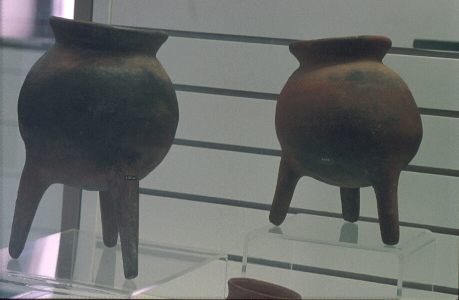
Photo 51: Typical Late Period Caranqui pottery vessels from Ibarra and Cayambe region in Ibarra Museum
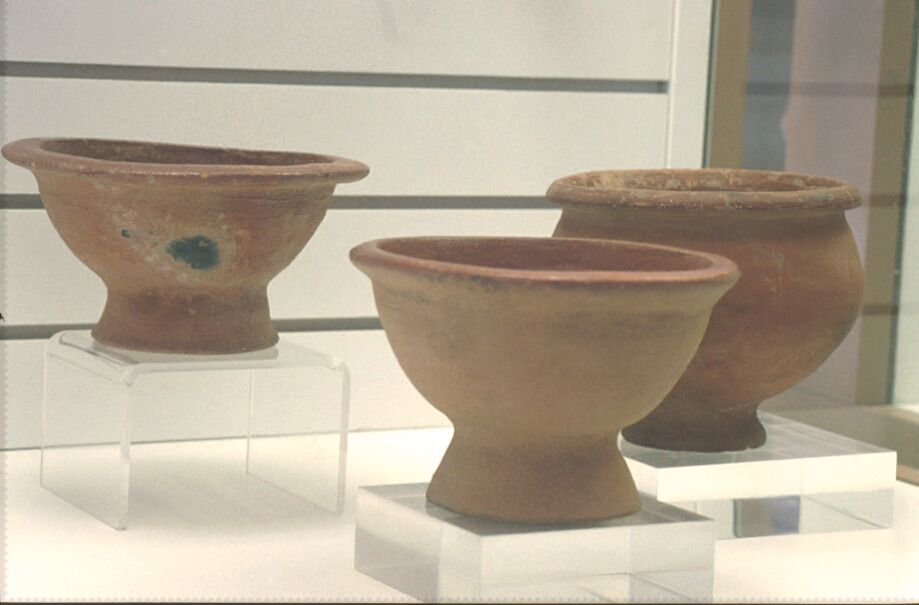
Photo 52: Typical Late Period Caranqui pottery vessels from Ibarra and Cayambe region in Ibarra Museum
Photo 53: Typical Late Period Caranqui pottery vessels from Ibarra and Cayambe region in Ibarra Museum
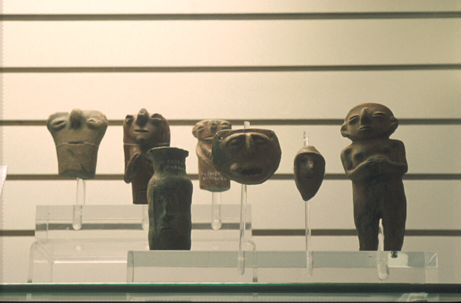
Photo 54: Caranqui figurines, Ibarra Museum
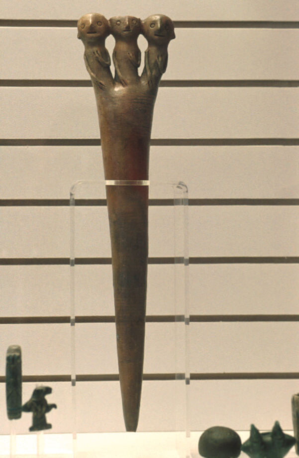
Photo 55: Ceremonial staff or baton, Caranqui culture, Ibarra Museum
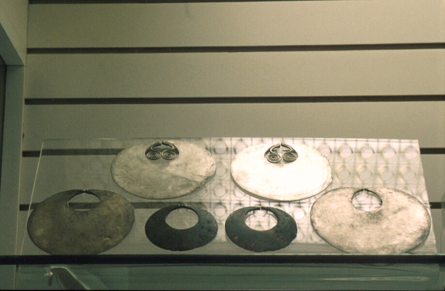
Photo 56: Silver and gold neck ornaments, Caranqui culture, Ibarra Museum
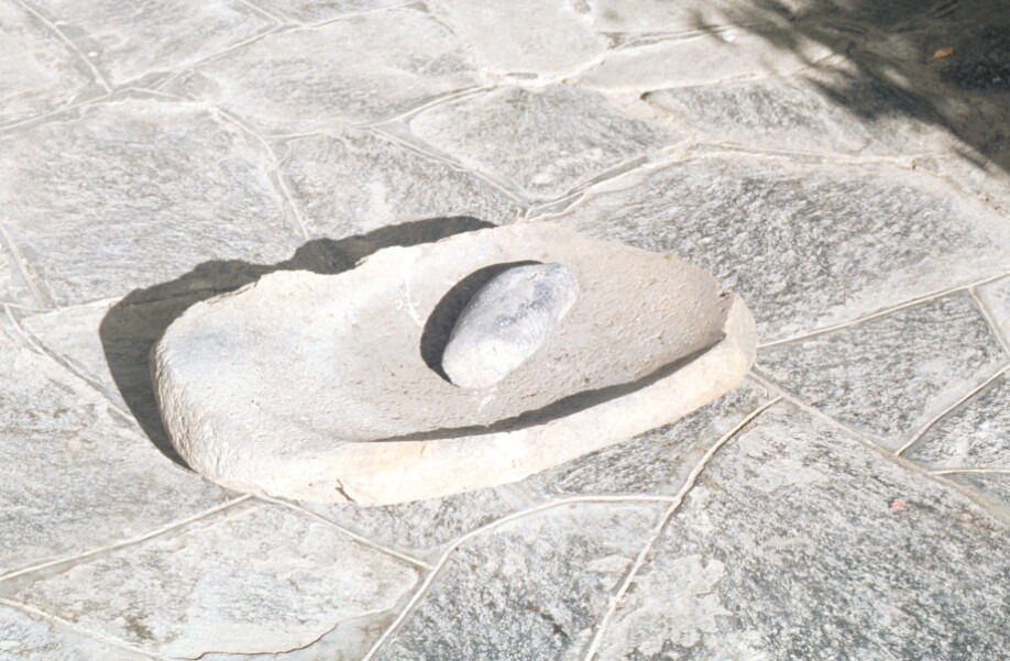
Photo 57: Mano and metate, found at Hacienda Zuleta
© Internet Archaeology
URL: http://intarch.ac.uk/journal/issue10/currie/lof.html
Last updated: Thu Apr 5 2001