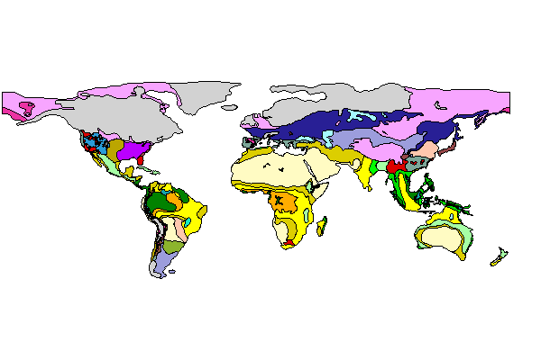
Figure 2: Global LGM vegetation map (select continent to view data for each region)

Figure 2: Global LGM vegetation map (select continent to view data for each region)
This text is divided up on a regional basis, roughly corresponding to traditional notions of 'the continents', although the detailed choice of boundaries for each region is fairly arbitrary. The legend for the maps is given in Figure 3.
The order of the regional treatment is as follows:
North and Central America: includes the USA along with Mexico and the Caribbean, Canada, Greenland, 'Beringia' and Central America;
South America: includes the South American area and the Falkland Islands;
Africa: includes Madagascar, Arabia and the Levant;
Europe: includes the area eastwards to the Urals, and also Asia Minor;
Eurasia: includes northern Eurasia, mostly Russia east of the Urals, southern and eastern Asia, the Middle East, and from the central Asian desert southwards and eastwards to Malaysia/Indonesia;
Australasia: includes Australia, New Guinea and New Zealand.
© Internet Archaeology
URL: http://intarch.ac.uk/journal/issue11/2/4.1.html
Last updated: Mon Dec 3 2001