During this phase, two lengths of lead pipe were laid to carry running water from the north of the site, presumably to buildings at the south. Three burials took place to the south of the church, in the area which probably became the cloister in Phase 5b.
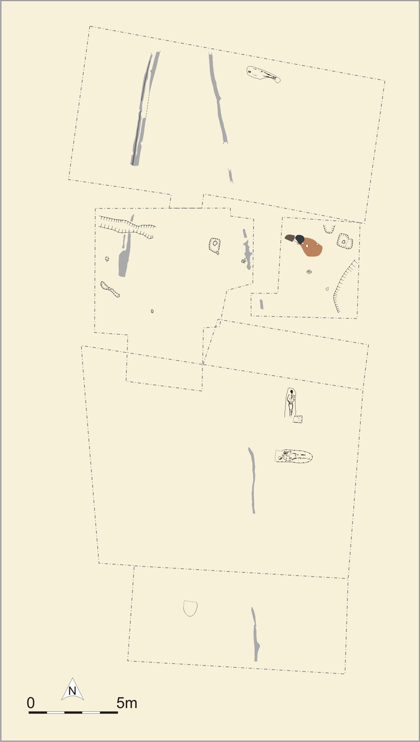
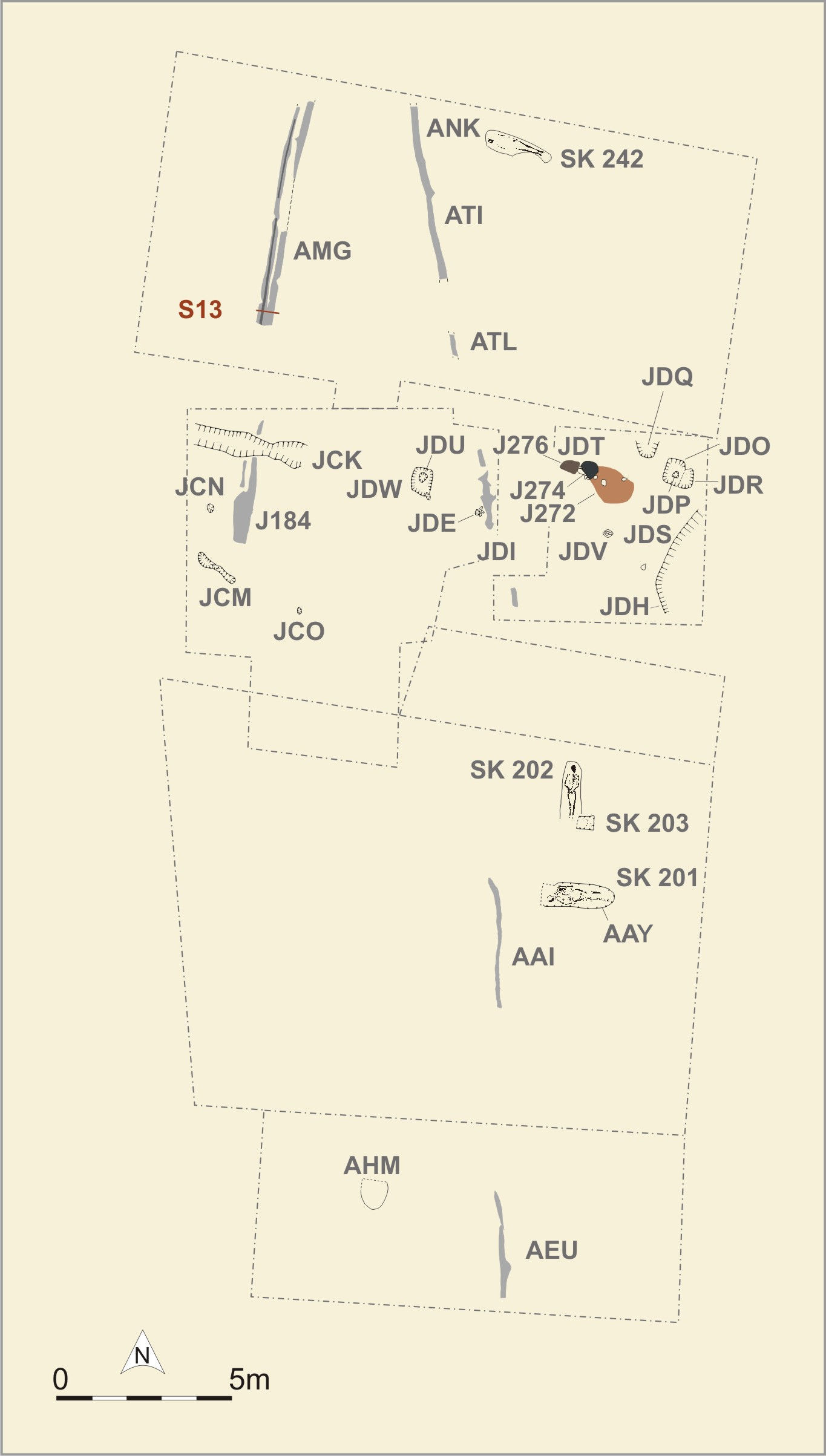
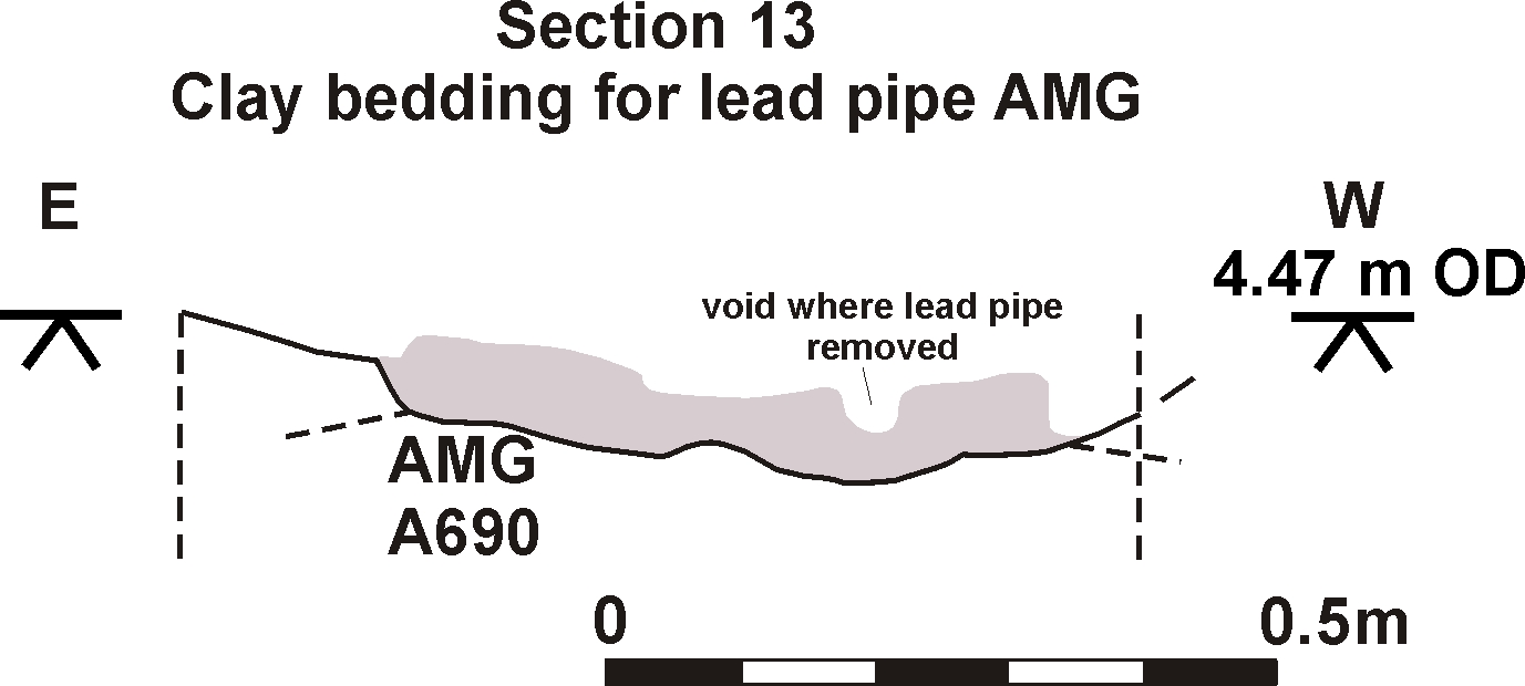
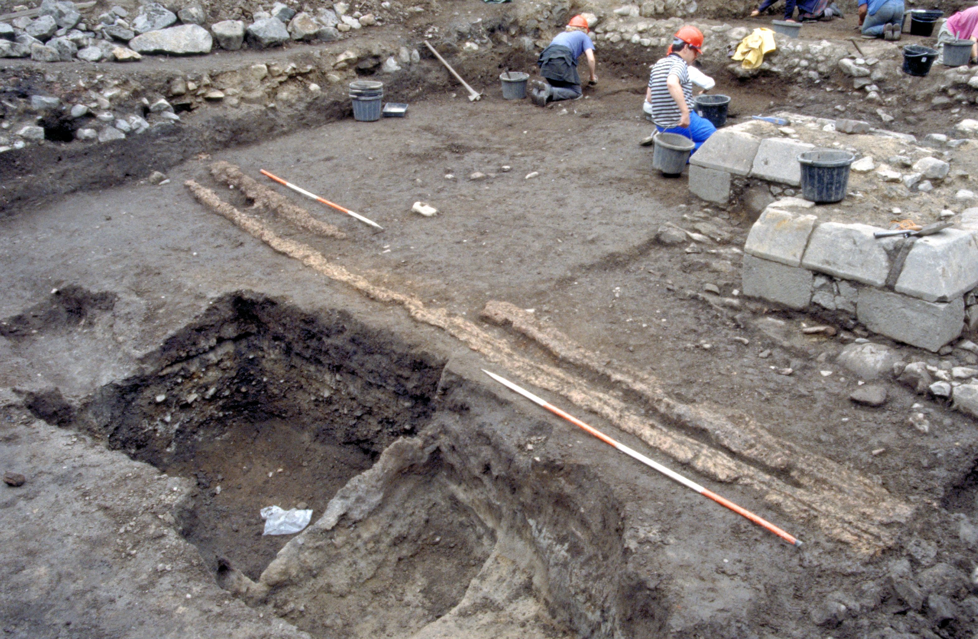
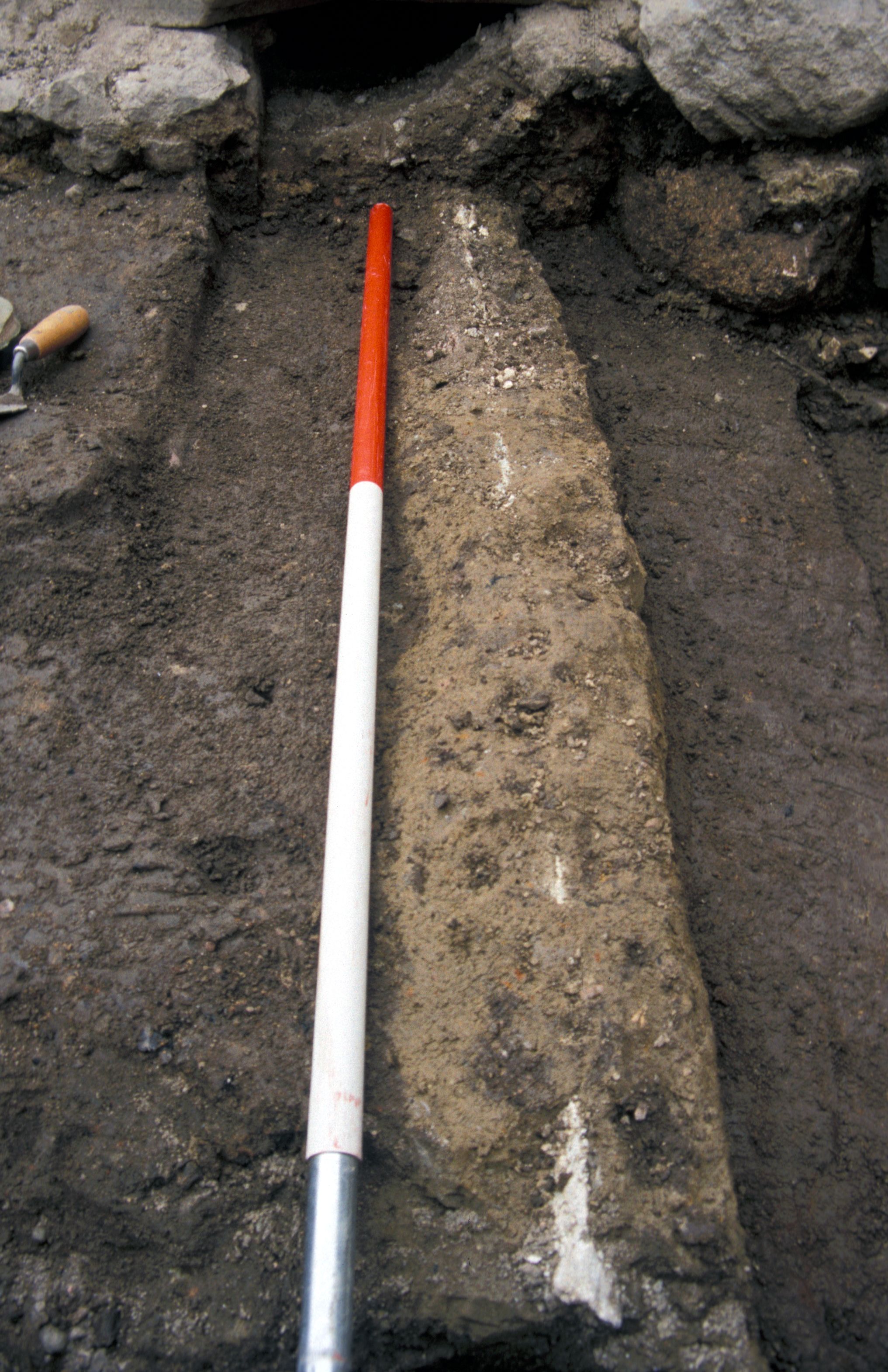
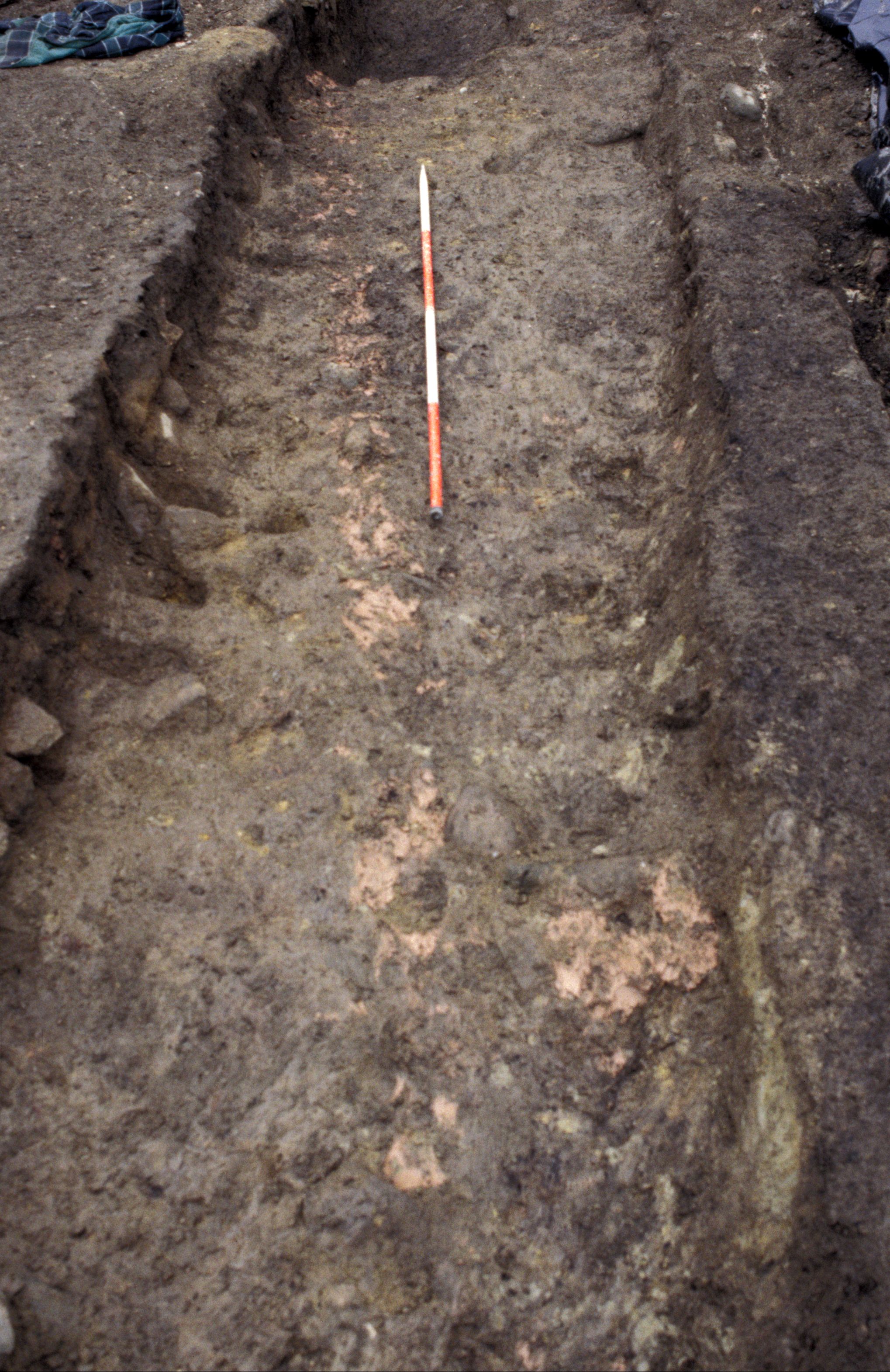
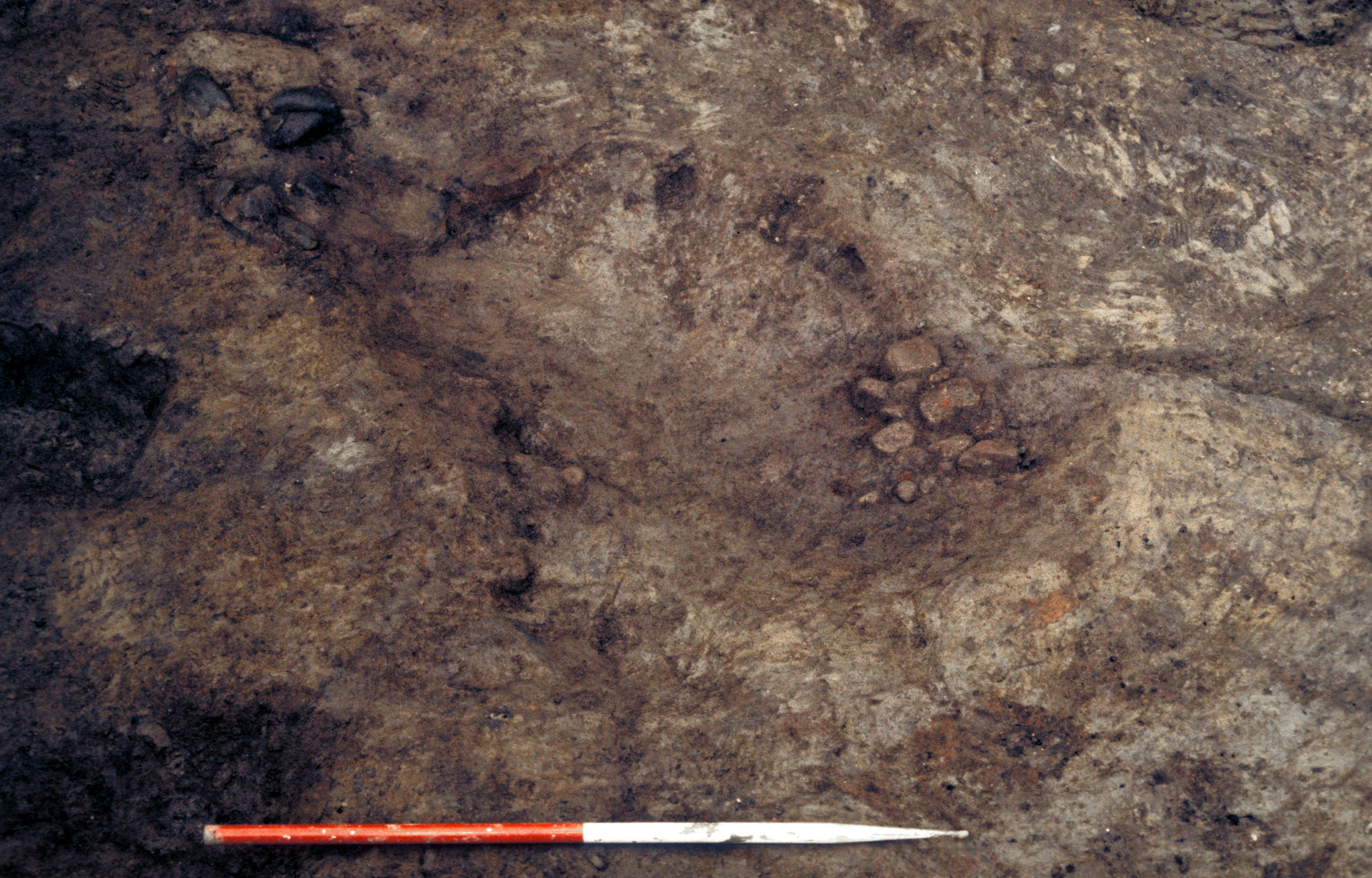
Two strips of pink clay were laid during this phase, probably as a support or foundation for lead water pipes. No lead pipe remained in either of these features, but impressions remained where the pipe had been removed [Photo 0255].
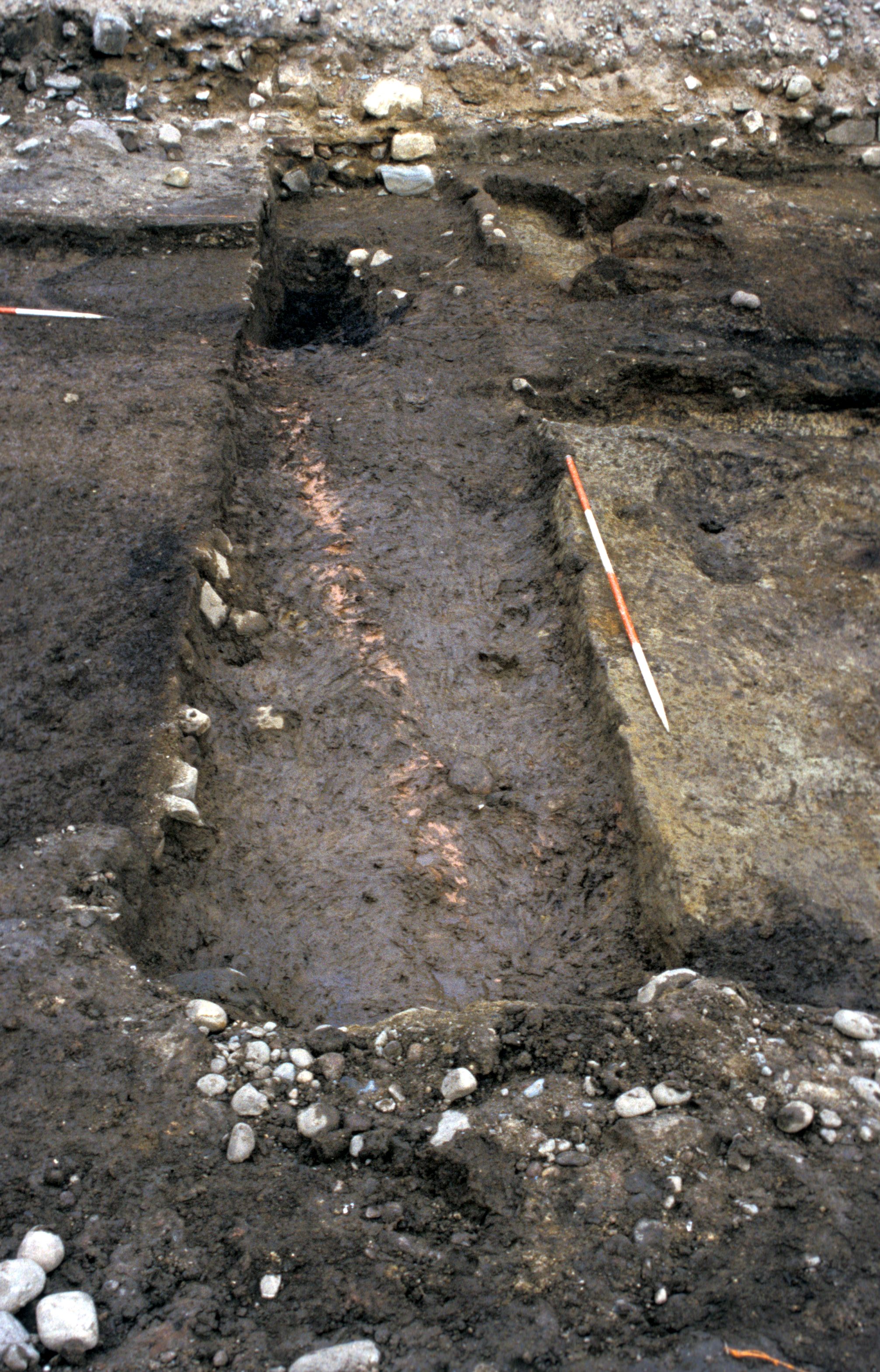
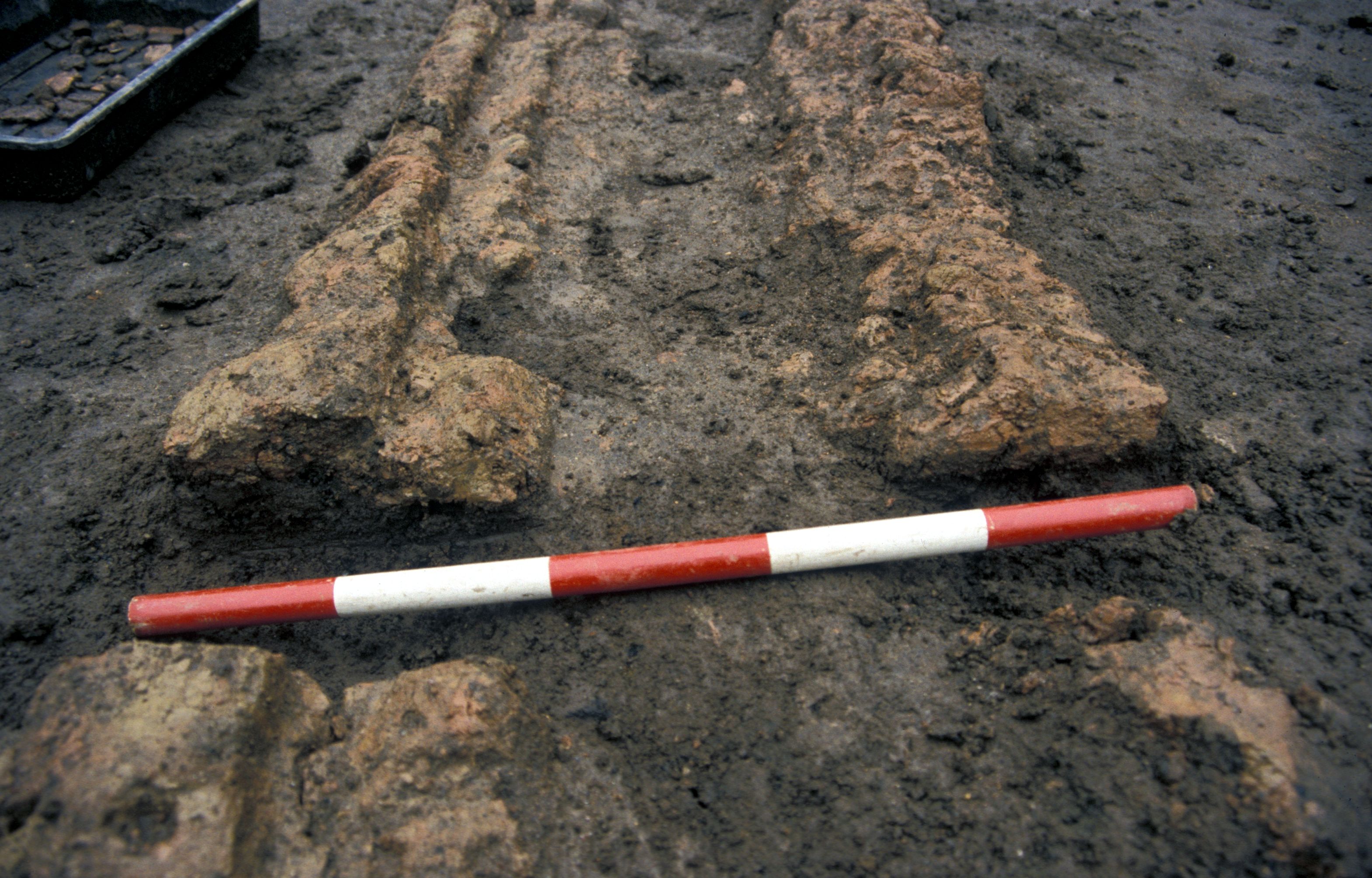
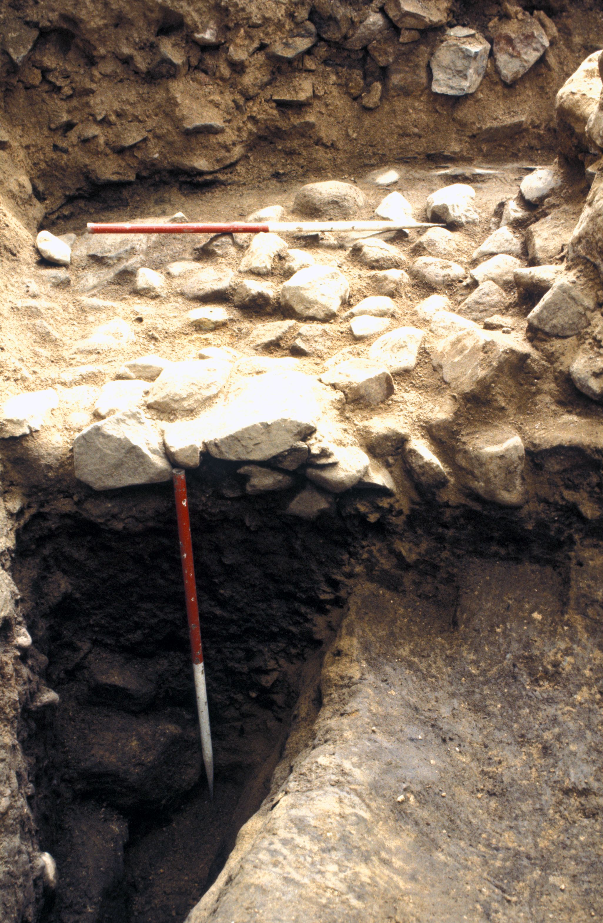
To the west of the site a length of pink clay [Photo 0197] (AMG, J184), up to 0.50m wide ran north-south. An impression of the pipe, which had subsequently been robbed, remained in the clay. The northern section of clay (AMG) had, in Phase 4, been cleanly split horizontally, the top section placed to the side [Photo 0525], and the lead pipe removed. Impressions of the pipe could be seen on both the upper and lower sections of clay. The clay was not set into a trench or cut, and it is possible that this was a temporary water supply which was never fully buried. This may have allowed the lead pipe to be easily removed and reused, possibly as the more permanent (Phase 5a) water system.

Running north west-south east, patches of pink clay, ATI, ATL [Photo 0404], AAI [Photo 0450], AEU and JDI [Photo 0336] were traced from the north of the excavated area to the south. The pink clay was, in most places, patchy and no pipe impressions were found. The northern section of clay (ATI) had been laid into the top of a Phase 1 ditch APG. This may have been an attempt to culvert a water course which ran through the area and channel the water through the lead pipe.
The water pipes presumably took water from a well or other supply to the north of the excavated area down to within or south of it. This may have been to supply a building not within the excavation area, or may have been to supply water to the construction site.
Lead pipes have been found to supply water to many friary sites including Kirkstall Abbey (Wrathmell and Moorhouse 1987). At Kirkstall the lead pipe was similar to the site under discussion here: lengths of lead pipe jointed with lead collars and sunk into a shallow trench. Clay had been used as extra support at the junction of each section of pipe although not in as large quantities as at Aberdeen, where in places the lead pipe was completely encased in clay. Other examples of medieval water management include a stone-built conduit or lade at Jedburgh Friary (Dixon et al. 2000) which carried water from Skiprunning Burn at least 40m away.
At about the same date as this water management system, three burials took place in the area which probably became the cloister area of the friary in Phase 5b. Two of the burials were unusual, as they were oriented with their heads to the north and east.
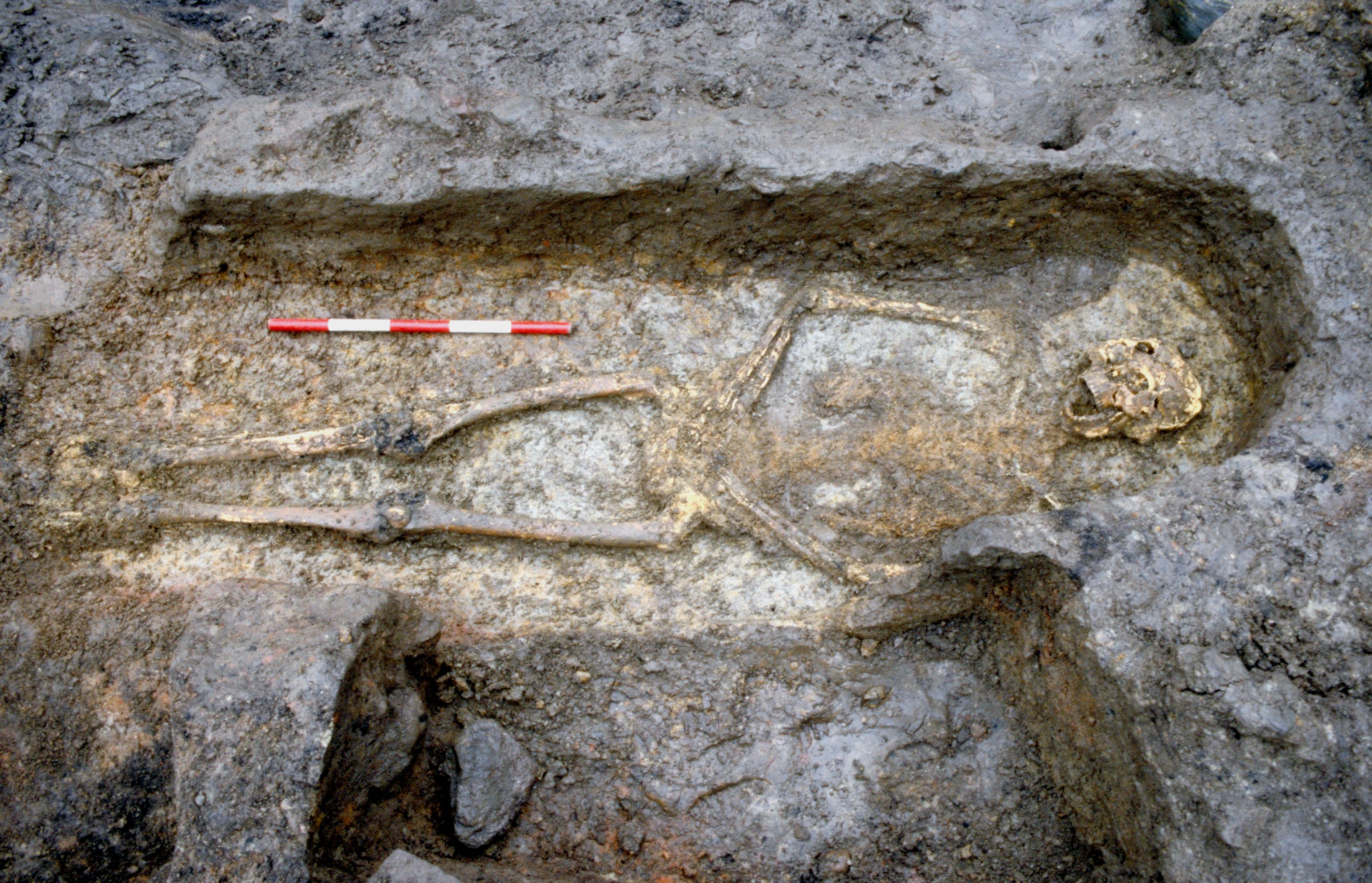
A middle-aged adult male (SK 201; AAY) had been buried within a discrete grave [Photo 0187] on a west-east alignment with the head to the west. A young adult male SK 202 (ABQ) had been buried in a north-south grave with the head to the north and a child of 18-24 months SK 203 (AAZ) was buried in a west-east grave with the head to the east. The only evidence remaining was the outline of the skull and a small number of teeth. No coffin remains were found in the burial of the infant, but both the adults had been buried in coffins.
North of the church the earliest burial in this area was SK 242 (ANK), a burial in a shallow cut on top of the natural clays. As a result the bone was in a very poor condition and very little can be said about this burial apart from that it was an adult and possibly a male. No nails were found in the fill and no other traces of a coffin.
Pit AHM was the remains of a sub-circular pit filled with orange clay and charcoal which may have been contemporary with this phase.
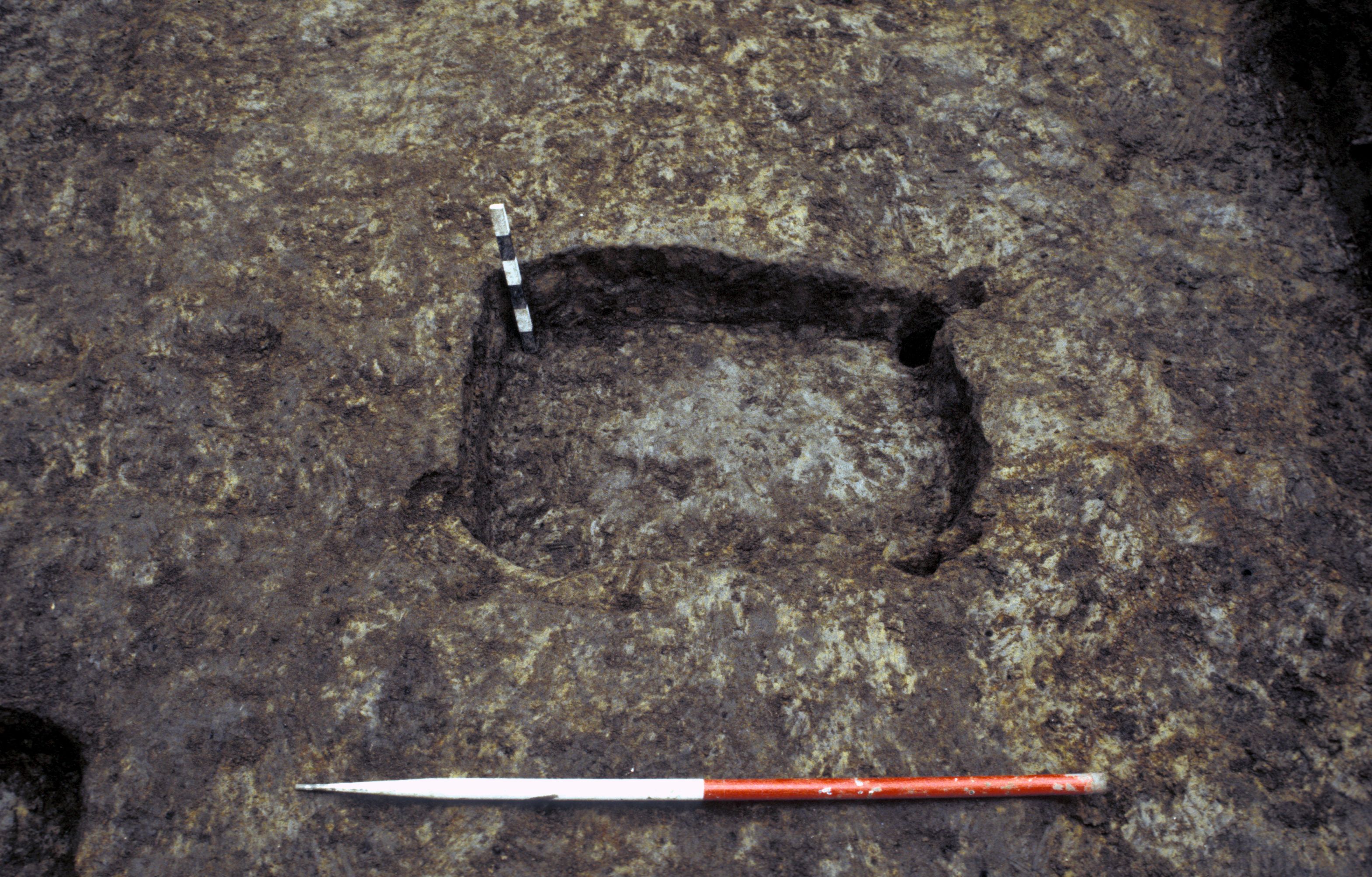
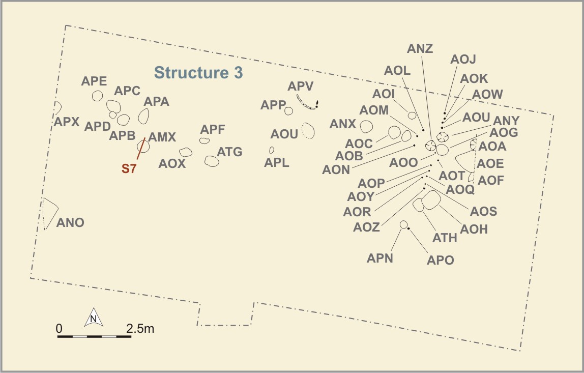
A number of pits within the area which was to become the interior of the stone church (JDO, JDQ and JDW [Photo 0461]) formed a particularly uniform group of pre-friary features. All three had been carefully cut and were straight-sided, and in the case of JDO, vertically sided. JDW [Photo 0537] and JDO were each 0.23m deep, while JDQ was 0.44m deep. Both JDW and JDO had a smaller, shallower hole in their upper levels. JDP was approximately half the depth of JDO while JDU was also 0.12m deep. JDO and JDW had similar fills (J268, J284), a redeposited natural sand mixed with clayey organic earth. JDO also had a lower fill (J269) which was much more organic. JDQ was only partially excavated because of its proximity to the baulk, but it showed similar characteristics and had a fill of JDO and JDW. The status of these features is difficult to assess except to say that they predate the stone church. JDW and JDO must have held wooden posts now seen only in shadow as JDU and JDP. The lower fill of JDO (J269) contained a small amount of charcoal and very decayed insect cuticle. JDU contained a trace of fine charcoal and a small amount of charred and uncharred peat, charred oat grains and hazel nutshell fragments (Section 9.3).
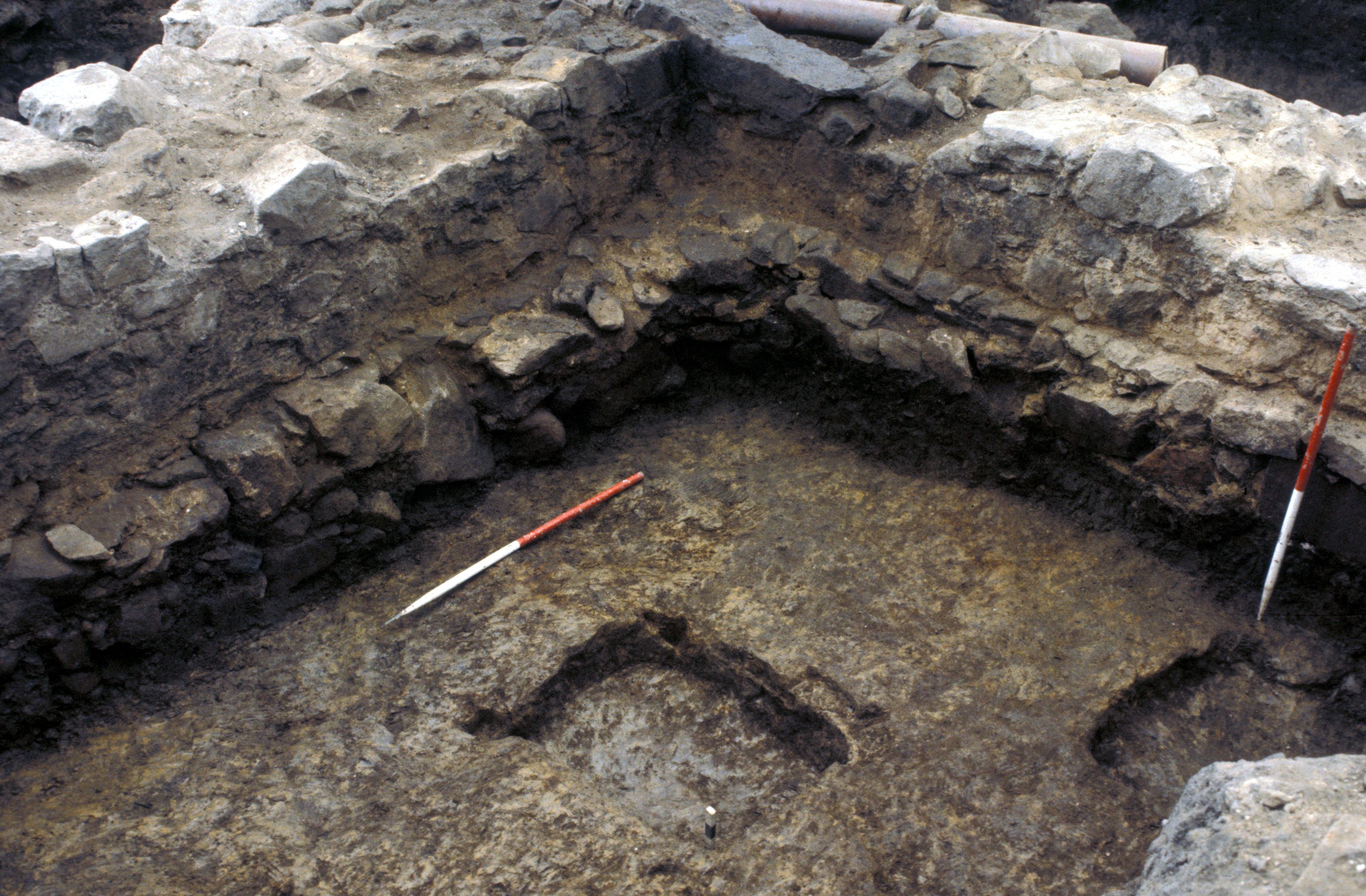
A pit, JDH [Photo 0500], at the extreme east side of the trench, could not be fully excavated, but was obviously very substantial. Stone church wall JCA had begun to collapse because of the presence of this pit below it and the wall had been repaired as a result. The lower fill of JDH (J315) contained a little fine charcoal and uncharred peat and J345 contained a large quantity of uncharred peat.
JDS was the remains of a wooden post c.0.10m square. There was little sign of a pit, but the post (c 0.06m remained in depth) was sitting on layer J285 which was probably the old soil surface prior to the construction of the stone church. JDE was a shallow post-hole cut into layer J257. JDV was a post-hole 0.15m deep and cut into the natural sand. A few stones lay in the bottom of it, but there were no wood remains. However, above the stones lay a small patch of burnt orange clay and one of charcoal. These layers were identical to layers J254 and J274 associated with feature JDT. Possibly the post which had occupied JDV had been removed before the fire was lit at JDT. JDT had severely reddened the natural sand and the remains of the soil surface above it, while some of the lower layers occupied by burials included traces of burnt material. A few stones lay scattered on the natural in the burnt area, but not really sufficient to suggest that a formalised hearth had been in use. The removal of layer J272 – a hard burnt red sand – left a distinct hollow [Photo 0535] up to 0.10m deep, but this effect was probably created merely by the fact that this was the most intensively burnt area.
Analysis of a sample of J272 revealed no organic remains but J274 contained peat ash and charred heather root/basal twig (Section 9.3). J276 contained traces of heather leaves and some other charred remains of slightly charred shrubs in the Ericeae family. The sample also contained charcoal and burnt peat together with mug (gyttja) or similar natural lacustrine deposit (probably associated with the flooding of this area) as well as charred oat grains, bracken, corn spurrey and pondweed. This layer was immediately above the subsoil and may have included part of an old land surface. It is possible that the plant remains represent vegetation growing at the time the fire was set. The presence of heather may represent thatching material in use on the site or nearby or it could have been growing in the area.
The post-pits JDO, JDQ and JDW, the post-holes JDE and JDV and the post JDS may belong to structures pre-dating the stone church, or may be associated with its construction as supports for the scaffolding which must have been necessary.
The burnt deposit JDT may represent no more than a fire lit to keep workmen warm during the construction of the stone church. At some other ecclesiastical sites, for example the friary at Hartlepool (Daniels 1983), ovens have been found within the area of the church where lead for roofs and windows was prepared. However, the finding within the burial soils inside the stone church, of a few lumps of fired glazed clay, often associated with the tilemaking process, along with the fact that a number of very crudely made floor tiles were recovered from destruction levels, might indicate that JDT was the remains of a very primitive tile kiln.
Context A879, a lens around the top of post-hole AMX , consisted of peat and ash with pollen of Ericales and fungal spores suggesting that it may have been mor humus or peat (Section 9.3).
Internet Archaeology is an open access journal based in the Department of Archaeology, University of York. Except where otherwise noted, content from this work may be used under the terms of the Creative Commons Attribution 3.0 (CC BY) Unported licence, which permits unrestricted use, distribution, and reproduction in any medium, provided that attribution to the author(s), the title of the work, the Internet Archaeology journal and the relevant URL/DOI are given.
Terms and Conditions | Legal Statements | Privacy Policy | Cookies Policy | Citing Internet Archaeology
Internet Archaeology content is preserved for the long term with the Archaeology Data Service (ROR). Help sustain and support open access publication by donating to our Open Access Archaeology Fund.